

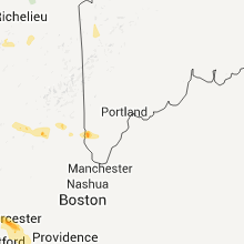
Hail Map for Tuesday, July 26, 2011

Number of Impacted Households on 7/26/2011
0
Impacted by 1" or Larger Hail
0
Impacted by 1.75" or Larger Hail
0
Impacted by 2.5" or Larger Hail
Square Miles of Populated Area Impacted on 7/26/2011
0
Impacted by 1" or Larger Hail
0
Impacted by 1.75" or Larger Hail
0
Impacted by 2.5" or Larger Hail


Cities Most Affected by Hail Storms of 7/26/2011
| Hail Size | Demographics of Zip Codes Affected | ||||||
|---|---|---|---|---|---|---|---|
| City | Count | Average | Largest | Pop Density | House Value | Income | Age |
| New Hartford, NY | 1 | 1.75 | 1.75 | 744 | $99k | $47.2k | 48.1 |
| Ludlow, MA | 1 | 1.75 | 1.75 | 740 | $127k | $47.1k | 42.6 |
| Chappell, NE | 1 | 1.75 | 1.75 | 1 | $50k | $36.1k | 47.6 |
| Chicopee, MA | 1 | 1.75 | 1.75 | 2391 | $109k | $37.3k | 43.1 |
| Rome, NY | 1 | 1.75 | 1.75 | 350 | $70k | $36.9k | 41.5 |
| Clinton, NY | 1 | 1.75 | 1.75 | 239 | $98k | $46.9k | 41.4 |
| Lyons, NY | 1 | 1.75 | 1.75 | 102 | $60k | $39.1k | 43.1 |
Hail and Wind Damage Spotted on 7/26/2011
Filter by Report Type:Hail ReportsWind Reports
States Impacted
New York, North Dakota, New Hampshire, Florida, Massachusetts, Georgia, Montana, Connecticut, Pennsylvania, Vermont, Illinois, Maine, New Jersey, Colorado, South Dakota, Indiana, Nebraska, Utah, Texas, Minnesota, IowaNew York
| Local Time | Report Details |
|---|---|
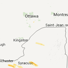
| 3:10 PM UTC | Half Dollar sized hail reported near Palmyra, NY, 54.8 miles W of Syracuse, NY |
| 3:20 PM UTC | Quarter sized hail reported near Newark, NY, 47.7 miles W of Syracuse, NY |
| 3:25 PM UTC | Quarter sized hail reported near Newark, NY, 47.7 miles W of Syracuse, NY |
| 3:30 PM UTC | Quarter sized hail reported near Clyde, NY, 36.6 miles W of Syracuse, NY |
| 3:30 PM UTC | Quarter sized hail reported near Arcadia, NY, 46.7 miles W of Syracuse, NY |
| 3:30 PM UTC | Golf Ball sized hail reported near Lyons, NY, 42.7 miles W of Syracuse, NY |
| 3:52 PM UTC | Quarter sized hail reported near Aurelius, NY, 30.7 miles WSW of Syracuse, NY |
| 3:55 PM UTC | Trees wires down on pangborn rd in oswego county NY, 22.1 miles N of Syracuse, NY |
| 3:55 PM UTC | Multiple trees down in oswego county NY, 16.4 miles NNE of Syracuse, NY |
| 3:55 PM UTC | Trees wires down cty rd 84 and 37 in oswego county NY, 16.4 miles NNE of Syracuse, NY |
| 3:55 PM UTC | Trees wires down cty rd 84 and 37 in oswego county NY, 20.2 miles N of Syracuse, NY |
| 3:55 PM UTC | Trees wires down on pangborn rd in oswego county NY, 20.1 miles N of Syracuse, NY |
| 4:00 PM UTC | Trees down in oswego county NY, 15.7 miles NNE of Syracuse, NY |
| 4:30 PM UTC | Quarter sized hail reported near Vienna, NY, 25.2 miles ENE of Syracuse, NY |
| 4:50 PM UTC | Golf Ball sized hail reported near Westmoreland, NY, 37.1 miles E of Syracuse, NY |
| 4:55 PM UTC | Two trees down on resvoir road. estimated winds of 70 to 80 mph. start of the microburst damage pat in oneida county NY, 36.8 miles E of Syracuse, NY |
| 4:57 PM UTC | Numerous trees snapped or uprooted across harding road or state route 233. winds estimated between 70 and 80 mp in oneida county NY, 37.8 miles E of Syracuse, NY |
| 4:59 PM UTC | One large tree down on pratt ave. more branches down across the town including near white stree in oneida county NY, 38.9 miles E of Syracuse, NY |
| 4:59 PM UTC | One to two dozen trees snapped or uprooted on furnance street. this included a healthy black walnut tree that was snapped just above the base. many trees on or near hou in oneida county NY, 38.4 miles E of Syracuse, NY |
| 4:59 PM UTC | Golf Ball sized hail reported near Kirkland, NY, 38.9 miles E of Syracuse, NY, report given to us while on a storm survey. |
| 5:00 PM UTC | Half Dollar sized hail reported near Kirkland, NY, 38.9 miles E of Syracuse, NY |
| 5:00 PM UTC | A large wood pole was snapped at south stree in oneida county NY, 38.9 miles E of Syracuse, NY |
| 5:04 PM UTC | A wood pole was snapped near the top. some minor shingle damage to a home and minor tree damage. damage was at the intersection of grange hill and snowden hill roads. t in oneida county NY, 41.9 miles E of Syracuse, NY |
| 5:05 PM UTC | Many large trees down just south of the sargertown square mall. car port damage in the same are in oneida county NY, 43.4 miles E of Syracuse, NY |
| 5:05 PM UTC | Half Dollar sized hail reported near , , 42 miles E of Syracuse, NY, public report near paris hill and snowden hill. |
| 5:05 PM UTC | Ping Pong Ball sized hail reported near New York Mills, NY, 43 miles E of Syracuse, NY |
| 5:05 PM UTC | Golf Ball sized hail reported near New Hartford, NY, 43.4 miles E of Syracuse, NY |
| 5:06 PM UTC | Quarter sized hail reported near New Hartford, NY, 43.4 miles E of Syracuse, NY, report relayed to us while on a storm survey. |
| 5:06 PM UTC | Trees down on harris rd.... oxford... oneida... hillside... clinton rd. damage verified by nws storm survey. mostly sporadic damage south of the mal in oneida county NY, 43.4 miles E of Syracuse, NY |
| 5:10 PM UTC | Branches and limbs dow in oneida county NY, 45.6 miles E of Syracuse, NY |
| 5:16 PM UTC | Quarter sized hail reported near New Hartford, NY, 43.4 miles E of Syracuse, NY |
| 5:17 PM UTC | Trees and wires down in chenango county NY, 33.3 miles SE of Syracuse, NY |
| 5:32 PM UTC | Trees and wires down on vosburg stree in herkimer county NY, 56.1 miles E of Syracuse, NY |
| 5:59 PM UTC | National weather service survey team verified a microburst centered at computer drive west and wolfe rd in colonie. damage was confined to downed trees...with no damage in albany county NY, 9.2 miles SE of Schenectady, NY |
| 5:59 PM UTC | National weather service survey team verified a microburst centered at computer drive west and wolf rd in colonie. damage was confined to downed trees...with no damage in albany county NY, 9.2 miles SE of Schenectady, NY |
| 6:00 PM UTC | Several trees down in morris including a tree on a hous in otsego county NY, 57.2 miles SE of Syracuse, NY |
| 6:00 PM UTC | Large branches and trees down. ponding of water on roa in albany county NY, 9.6 miles SE of Schenectady, NY |
| 6:01 PM UTC | Several trees down county road 15 and state highway 23 in chenango county NY, 52.6 miles SE of Syracuse, NY |
| 6:20 PM UTC | Trees down. minor flooding on beachwood r in schoharie county NY, 34.5 miles W of Schenectady, NY |
| 6:30 PM UTC | Trees down in schoharie county NY, 34.6 miles W of Schenectady, NY |
| 6:33 PM UTC | Many evergreen trees uprooted/snapped by wind in schoharie county NY, 25.9 miles WSW of Schenectady, NY |
| 6:34 PM UTC | Trees and powerlines dow in ulster county NY, 54 miles S of Schenectady, NY |
| 6:34 PM UTC | Tree down blocking traffic on route 37 in ulster county NY, 56.6 miles S of Schenectady, NY |
| 6:40 PM UTC | Trees and wires dow in rensselaer county NY, 23.1 miles SE of Schenectady, NY |
| 6:42 PM UTC | Quarter sized hail reported near Clifton, NY, 43.3 miles SSE of Ogdensburg, NY, quarter size hail at clifton-fine golf course |
| 6:45 PM UTC | Trees on powerline in rensselaer county NY, 26.8 miles SE of Schenectady, NY |
| 6:55 PM UTC | Trees and wires dow in rensselaer county NY, 31.3 miles SE of Schenectady, NY |
| 6:58 PM UTC | Tree fell on vehicle on route 2 in columbia county NY, 36.2 miles SE of Schenectady, NY |
| 6:58 PM UTC | Trees and wires down on route 20 and 2 in columbia county NY, 36.7 miles SE of Schenectady, NY |
| 8:06 PM UTC | Large tree down blocking southbound entrance to taconic state parkway at route 199 onram in dutchess county NY, 60.2 miles S of Schenectady, NY |
| 8:14 PM UTC | Half Dollar sized hail reported near Hancock, NY, 42.1 miles NNE of Scranton, PA |
| 8:20 PM UTC | Quarter sized hail reported near Hancock, NY, 42.8 miles NE of Scranton, PA |
| 8:25 PM UTC | Trees and powerlines down. vehicles are trapped due to impassable road on route 4 in dutchess county NY, 69.8 miles SSE of Schenectady, NY |
| 8:25 PM UTC | Trees and powerlines down. vehiles are trapped due to impassable road on route 4 in dutchess county NY, 69.8 miles SSE of Schenectady, NY |
| 8:43 PM UTC | Trees and wires down in sullivan county NY, 46 miles NE of Scranton, PA |
| 8:55 PM UTC | Trees and wires down in sullivan county NY, 45.7 miles NE of Scranton, PA |
| 9:00 PM UTC | Trees and wires down in sullivan county NY, 42.1 miles ENE of Scranton, PA |
| 9:10 PM UTC | Trees and wires down in sullivan county NY, 51.3 miles ENE of Scranton, PA |
| 9:15 PM UTC | Trees and wires down also in smallwood in sullivan county NY, 46.7 miles ENE of Scranton, PA |
| 9:25 PM UTC | Trees and wires down in sullivan county NY, 57.1 miles ENE of Scranton, PA |
| 1:02 AM UTC | Large tree limbs down on corner of west pine street and lafayette blvd in nassau county NY, 18.3 miles ESE of Brooklyn, NY |
| 2:00 AM UTC | Several trees reported down across southampton in suffolk county NY, 83 miles SW of Providence, RI |
North Dakota
| Local Time | Report Details |
|---|---|
| 3:53 PM UTC | Quarter sized hail reported near Williston, ND, 0.4 miles WNW of Williston, ND, located at the airport. |
| 12:50 AM UTC | Several tree limbs down and blocking roads. three to six inch diamete in dickey county ND, 41.8 miles NNE of Aberdeen, SD |
| 1:20 AM UTC | 4 inch diameter tree branches down across the yard in sargent county ND, 44.7 miles NE of Aberdeen, SD |
New Hampshire
| Local Time | Report Details |
|---|---|
| 6:35 PM UTC | Quarter sized hail reported near Meredith, NH, 62.3 miles W of Portland, ME, time estimated |
| 6:45 PM UTC | 8 - 10 trees down in belknap county NH, 62.3 miles W of Portland, ME |
| 7:00 PM UTC | Quarter sized hail reported near Gilford, NH, 56.7 miles W of Portland, ME |
| 7:00 PM UTC | Quarter sized hail reported near Belmont, NH, 64 miles W of Portland, ME |
| 8:45 PM UTC | Trees down on wires grafton orange line in grafton county NH, 84.7 miles W of Portland, ME |
| 9:02 PM UTC | Trees down on wires grafton orange line in grafton county NH, 84.7 miles W of Portland, ME |
| 9:05 PM UTC | Quarter sized hail reported near Danbury, NH, 81.4 miles W of Portland, ME |
| 9:30 PM UTC | Quarter sized hail reported near Alton, NH, 50.5 miles WSW of Portland, ME, photos of hail in alton |
| 9:48 PM UTC | Several trees uprooted on bridge street and pleasant street in colebrook. time is estimated in coos county NH, 89.1 miles ENE of Burlington, VT |
| 9:50 PM UTC | Trees down on wires - multiple reports in strafford county NH, 40.6 miles WSW of Portland, ME |
| 10:00 PM UTC | Tree fell on house in strafford county NH, 39.5 miles WSW of Portland, ME |
Florida
| Local Time | Report Details |
|---|---|
| 6:51 PM UTC | Barbed wire fencing blown down at the brevard correctional institut in brevard county FL, 36.2 miles E of Orlando, FL |
| 7:00 PM UTC | Thunderstorm winds knocked down trees and branches from canaveral groves boulevard in sharpes to kings highway in port saint john. lightning from these storms started a in brevard county FL, 36 miles E of Orlando, FL |
| 9:31 PM UTC | A tree was blown down along ethan allen drive in palm coast. the time of the event was based on rada in flagler county FL, 63.1 miles SSE of Jacksonville, FL |
Massachusetts
| Local Time | Report Details |
|---|---|
| 7:03 PM UTC | Tree blocking us route 20 near lebanon av in berkshire county MA, 41.2 miles SE of Schenectady, NY |
| 7:05 PM UTC | Multiple trees on homes...pecks roa in berkshire county MA, 42.8 miles SE of Schenectady, NY |
| 7:11 PM UTC | Multiple trees down...tree down on vehicl in berkshire county MA, 42.8 miles SE of Schenectady, NY |
| 7:17 PM UTC | Trees down and power outages in the are in berkshire county MA, 42.8 miles SE of Schenectady, NY |
| 7:35 PM UTC | Tree and wires down on river street in hampshire county MA, 58.2 miles ESE of Schenectady, NY |
| 7:55 PM UTC | Trees and power lines down on skyline trai in hampshire county MA, 56.8 miles SE of Schenectady, NY |
| 7:55 PM UTC | Trees and wires down on river road in hampshire county MA, 58.2 miles ESE of Schenectady, NY |
| 7:55 PM UTC | Trees down at littleville dam...as well as at allen coit...and garfield street in hampshire county MA, 67.5 miles SE of Schenectady, NY |
| 7:55 PM UTC | Trees down at littleville dam in hampshire county MA, 67.5 miles SE of Schenectady, NY |
| 8:00 PM UTC | Trees down on candy brook road. numerous power outage in hampden county MA, 61.3 miles SE of Schenectady, NY |
| 8:26 PM UTC | Trees down on pontussic and harris street in hampden county MA, 72.8 miles WNW of Providence, RI |
| 8:30 PM UTC | Golf Ball sized hail reported near Chicopee, MA, 64.5 miles WNW of Providence, RI, golf ball size hail |
| 8:34 PM UTC | Half Dollar sized hail reported near Springfield, MA, 61.6 miles WNW of Providence, RI, 1 to 1.25 inch hail |
| 8:34 PM UTC | Trees down on lyman and prospect streets. structural damage to already weakened vacant warehouse on lyman s in hampden county MA, 68.6 miles WNW of Providence, RI |
| 8:34 PM UTC | Trees down on lymon and prospect streets in hampden county MA, 68.6 miles WNW of Providence, RI |
| 8:35 PM UTC | Tree and wires down blocking middle street in hampshire county MA, 68.7 miles NW of Providence, RI |
| 8:35 PM UTC | *** 1 inj *** trees down on fuller road...the route 33 area....westover road....dolores st...james st....prospect st. home depot on route 33 has a significant amount of in hampden county MA, 64.5 miles WNW of Providence, RI |
| 8:35 PM UTC | Trees down on fuller road and the route 33 area. trees down on westover road. home depot on route 33 has a significant amount of damage to sheds and displays. no power in hampden county MA, 64.5 miles WNW of Providence, RI |
| 8:35 PM UTC | Trees down in indian orchard area on berkshire lane and several other streets. wires down on joanne road. tree down on house on brewster street. wires down on memorial in hampden county MA, 61.6 miles WNW of Providence, RI |
| 8:35 PM UTC | Ping Pong Ball sized hail reported near Springfield, MA, 61.6 miles WNW of Providence, RI, ping pong sized hail and trees down in the indian orchard section. |
| 8:36 PM UTC | Quarter sized hail reported near Springfield, MA, 61.6 miles WNW of Providence, RI |
| 8:36 PM UTC | Trees down on fuller road in hampden county MA, 64.5 miles WNW of Providence, RI |
| 8:36 PM UTC | Trees down on locust street. tree down on house on paramount street with person trapped. trees down on stuart st... and wellfleet r in hampden county MA, 61.6 miles WNW of Providence, RI |
| 8:36 PM UTC | Trees down on locust street. tree down on house on paramount street with person trapped. trees down on stuart stree in hampden county MA, 61.6 miles WNW of Providence, RI |
| 8:37 PM UTC | Boat flipped over on the connecticut river. people on boat rescued and taken to shor in hampden county MA, 68.6 miles WNW of Providence, RI |
| 8:40 PM UTC | Trees down and several road closure in hampshire county MA, 67.1 miles WNW of Providence, RI |
| 8:42 PM UTC | Trees down across wires in hampden county MA, 59.9 miles WNW of Providence, RI |
| 8:42 PM UTC | Golf Ball sized hail reported near Ludlow, MA, 59.9 miles WNW of Providence, RI |
| 8:43 PM UTC | Quarter sized hail reported near Wilbraham, MA, 57.3 miles WNW of Providence, RI |
| 8:43 PM UTC | Hundreds of trees down. 10-20 roads closed. entire town without power. several trees into building in hampden county MA, 57.3 miles WNW of Providence, RI |
| 8:43 PM UTC | Many trees down in town including near the police department. main street shut down due to downed tree in hampden county MA, 57.3 miles WNW of Providence, RI |
| 8:45 PM UTC | Trees and wires down. street floodin in hampden county MA, 61.6 miles WNW of Providence, RI |
| 8:45 PM UTC | Trees down on a building with people trapped inside in indian orchard area. also trees uprooted in the vicinit in hampden county MA, 61.6 miles WNW of Providence, RI |
| 8:55 PM UTC | Many trees down including some into houses on woburn road and main street. wires down on boston roa in hampden county MA, 50 miles WNW of Providence, RI |
| 8:55 PM UTC | Half Dollar sized hail reported near Monson, MA, 50 miles WNW of Providence, RI, quarter to half dollar sized hail |
Georgia
| Local Time | Report Details |
|---|---|
| 7:50 PM UTC | The okefenokee rural electric membership corporation reported trees and power lines were blown down along harriets bluff road. the time of the event was based on radar in camden county GA, 36.4 miles N of Jacksonville, FL |
Montana
| Local Time | Report Details |
|---|---|
| 7:57 PM UTC | Storm damage reported in valley county MT, 11.5 miles NW of Glasgow, MT |
| 8:10 PM UTC | Storm damage reported in valley county MT, 0.4 miles NNW of Glasgow, MT |
| 8:14 PM UTC | Half Dollar sized hail reported near Winnett, MT, 75.2 miles N of Billings, MT |
| 8:27 PM UTC | Storm damage reported in valley county MT, 15 miles NNE of Glasgow, MT |
| 9:45 PM UTC | Storm damage reported in roosevelt county MT, 73.1 miles WNW of Williston, ND |
| 10:20 PM UTC | Storm damage reported in sheridan county MT, 60.9 miles NW of Williston, ND |
| 12:03 AM UTC | Quarter sized hail reported near Volborg, MT, 39.3 miles SSE of Miles City, MT |
| 12:07 AM UTC | Half Dollar sized hail reported near Kinsey, MT, 13.6 miles NE of Miles City, MT, very heavy rain. hail on highway causing locally dense fog. |
| 12:10 AM UTC | Storm damage reported in powder river county MT, 64.5 miles S of Miles City, MT |
| 12:10 AM UTC | Storm damage reported in custer county MT, 9.5 miles ENE of Miles City, MT |
| 12:25 AM UTC | Quarter sized hail reported near Kinsey, MT, 12 miles N of Miles City, MT, up to quarter size hail...covering i94 and producing dense fog. |
| 1:45 AM UTC | Quarter sized hail reported near Ismay, MT, 58.9 miles ESE of Miles City, MT, estimated wind gust 60 mph |
| 1:45 AM UTC | Quarter sized hail reported near Baker, MT, 75.3 miles ESE of Miles City, MT |
| 2:00 AM UTC | Quarter sized hail reported near Baker, MT, 75.3 miles ESE of Miles City, MT |
| 5:25 AM UTC | Storm damage reported in big horn county MT, 76.9 miles ESE of Billings, MT |
| 5:43 AM UTC | Quarter sized hail reported near Worland, MT, 71.4 miles SW of Miles City, MT, very strong downpour of rain. received 1.14 inches in 15 mi |
Connecticut
| Local Time | Report Details |
|---|---|
| 8:51 PM UTC | Large branches down on spring street near the suffield line. wires down on taylor roa in hartford county CT, 60.6 miles W of Providence, RI |
| 9:05 PM UTC | Many wires down due to wind in hartford county CT, 57.3 miles W of Providence, RI |
| 9:25 PM UTC | Tree down on route 6 in tolland county CT, 46.7 miles W of Providence, RI |
| 9:30 PM UTC | Trees down especially in south windham per willimantic fire. large branch down on steps of town hall per amateur radio in windham county CT, 40.1 miles WSW of Providence, RI |
| 9:32 PM UTC | Numerous trees and wires down...a few on houses. rubber membrane roof blown off apartment house landing on bridge street. worst hit area was pleasant street per fire de in windham county CT, 42.4 miles W of Providence, RI |
| 9:36 PM UTC | Tree down which also took down cable wires on fox hill road in new haven county CT, 73.7 miles NE of Brooklyn, NY |
| 9:39 PM UTC | Two trees down in middlesex county CT, 65.6 miles WSW of Providence, RI |
| 9:43 PM UTC | Tree down blocking franklin road. time esitmated by radar in new london county CT, 40.7 miles WSW of Providence, RI |
| 9:43 PM UTC | Tree down blocking franklin road. time estimated by radar in new london county CT, 40.7 miles WSW of Providence, RI |
| 9:45 PM UTC | Multiple trees down across the city of ridgefield in fairfield county CT, 47.4 miles NNE of Brooklyn, NY |
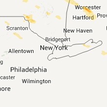
Pennsylvania
| Local Time | Report Details |
|---|---|
| 8:58 PM UTC | Storm damage reported in lackawanna county PA, 2.9 miles SSW of Scranton, PA |
| 9:20 PM UTC | Thunderstorm wind gust estimated to be between 60 and 70 mph... knocking down tree limb in monroe county PA, 20.2 miles SE of Scranton, PA |
| 9:35 PM UTC | Numerous trees down in the swiftwater area. downed tree blocking route 314 near sanofi pasteu in monroe county PA, 27.8 miles SE of Scranton, PA |
| 9:50 PM UTC | Multiple trees down on wires on brushy mountain road in smithfield townshi in monroe county PA, 37.9 miles SE of Scranton, PA |
Vermont
| Local Time | Report Details |
|---|---|
| 9:40 PM UTC | Trees and powerlines down 1 mile west of worcester in washington county VT, 32.7 miles ESE of Burlington, VT |
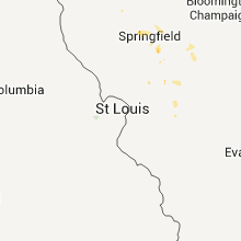
Illinois
| Local Time | Report Details |
|---|---|
| 9:45 PM UTC | Observer reported numerous oak trees downed approximately 18 to 24 inches in diameter in fayette county IL, 45.9 miles WSW of Mattoon, IL |
Maine
| Local Time | Report Details |
|---|---|
| 9:50 PM UTC | Trees down in york county ME, 35.1 miles WSW of Portland, ME |
| 9:50 PM UTC | Multiple reports of trees down in york county ME, 29.9 miles WSW of Portland, ME |
| 10:05 PM UTC | Trees down across gully oven road. time estimated from radar. delayed repor in oxford county ME, 57.7 miles NNW of Portland, ME |
| 10:05 PM UTC | Trees down across gully oven road. time estimated from radar. delayed repor in york county ME, 39.7 miles WSW of Portland, ME |
| 10:45 PM UTC | Half Dollar sized hail reported near Rangeley Plantation, ME, 89.6 miles NNW of Portland, ME, high winds and heavy rain at the time of report. time estimated from radar. delayred report. |
| 11:25 PM UTC | Numerous trees down. time estimated from radar. delayed repor in franklin county ME, 72.3 miles N of Portland, ME |
| 11:30 PM UTC | Time estimated from radar. delayed repor in franklin county ME, 67.2 miles N of Portland, ME |
New Jersey
| Local Time | Report Details |
|---|---|
| 10:10 PM UTC | Trees dow in warren county NJ, 47.1 miles SE of Scranton, PA |
Colorado
| Local Time | Report Details |
|---|---|
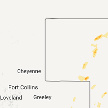
| 10:33 PM UTC | Storm damage reported in yuma county CO, 0.9 miles W of Yuma, CO |
| 12:00 AM UTC | Storm damage reported in arapahoe county CO, 6.4 miles SSW of Denver, CO |
| 12:05 AM UTC | Tree blown down in denver county CO, 1.8 miles ESE of Denver, CO |
South Dakota
| Local Time | Report Details |
|---|---|
| 10:40 PM UTC | Half Dollar sized hail reported near Agar, SD, 31.9 miles NNE of Pierre, SD, also estimated 60 mph winds. |
| 11:32 PM UTC | Quarter sized hail reported near Blunt, SD, 26.8 miles ENE of Pierre, SD |
| 11:40 PM UTC | Storm damage reported in hughes county SD, 31.9 miles ENE of Pierre, SD |
| 11:50 PM UTC | Storm damage reported in todd county SD, 35.9 miles NNE of Valentine, NE |
| 12:06 AM UTC | Storm damage reported in potter county SD, 65.6 miles NNE of Pierre, SD |
| 12:10 AM UTC | Storm damage reported in todd county SD, 26 miles N of Valentine, NE |
| 12:10 AM UTC | Branches down in highmor in hyde county SD, 46.2 miles ENE of Pierre, SD |
| 12:30 AM UTC | 30-year-old cottonwood trees blown over in hand county SD, 57.1 miles E of Pierre, SD |
| 1:00 AM UTC | Storm damage reported in bennett county SD, 49.6 miles NW of Valentine, NE |
| 1:05 AM UTC | Large trees upr in edmunds county SD, 13.3 miles W of Aberdeen, SD |
| 1:10 AM UTC | Time estimated based on radar. 1 airplane damaged and an estimated 20 to 30 trees toppled or damaged at mina lak in edmunds county SD, 13.3 miles W of Aberdeen, SD |
| 1:11 AM UTC | Winds in excess of 60 mph. highway signs blown ove in edmunds county SD, 16.2 miles W of Aberdeen, SD |
| 1:15 AM UTC | Storm damage reported in beadle county SD, 58.5 miles S of Aberdeen, SD |
| 1:30 AM UTC | Trees down in britto in marshall county SD, 42.4 miles ENE of Aberdeen, SD |
| 1:43 AM UTC | Storm damage reported in beadle county SD, 74.6 miles S of Aberdeen, SD |
| 1:45 AM UTC | Winds estimated at 60 mph knocked some small branches down from trees in spotters yar in beadle county SD, 72.4 miles S of Aberdeen, SD |
| 1:45 AM UTC | 20 year old tree b in marshall county SD, 52.4 miles ENE of Aberdeen, SD |
| 1:45 AM UTC | Tree limbs downe in marshall county SD, 62.3 miles ENE of Aberdeen, SD |
| 1:52 AM UTC | Storm damage reported in beadle county SD, 77 miles S of Aberdeen, SD |
| 2:00 AM UTC | 4 evergreens uprooted...several branches down. neighbors have lost 1 shed...another has been damage in marshall county SD, 46.5 miles ENE of Aberdeen, SD |
| 2:00 AM UTC | Several trees down...hay bales moved...shingle damage to home in marshall county SD, 46.2 miles ENE of Aberdeen, SD |
| 2:06 AM UTC | Storm damage reported in day county SD, 48.5 miles E of Aberdeen, SD |
| 2:12 AM UTC | Storm damage reported in beadle county SD, 75.1 miles SSE of Aberdeen, SD |
| 2:15 AM UTC | Many large trees down. highway 25 impassible due to trees down on highwa in day county SD, 48.5 miles E of Aberdeen, SD |
| 2:15 AM UTC | Storm damage reported in marshall county SD, 55.5 miles ENE of Aberdeen, SD |
| 2:15 AM UTC | Numerous trees and large branches are down. cars and homes are damaged. an elevator is leaning over. semi truck was tipped over. power lines are in day county SD, 48.5 miles E of Aberdeen, SD |
| 2:25 AM UTC | 60-70 mph winds. large trees dow in roberts county SD, 73 miles NW of Montevideo, MN |
| 2:30 AM UTC | Trees down. winds estimated 60-70 mph. jet ski blown up onto beach. canoes overturned. 2.85 inches of rain and flooding in low lying areas. time estimate in day county SD, 58.7 miles E of Aberdeen, SD |
| 2:30 AM UTC | Large branch from mature tree in day county SD, 33.6 miles E of Aberdeen, SD |
| 2:40 AM UTC | Several 20-foot linden trees blew over and broke at the bases in roberts county SD, 70.9 miles E of Aberdeen, SD |
| 2:47 AM UTC | Signs blown over in sisseto in roberts county SD, 71.1 miles ENE of Aberdeen, SD |
| 3:10 AM UTC | Storm damage reported in jerauld county SD, 84.4 miles ESE of Pierre, SD |
| 3:10 AM UTC | 20-25 ft linden tree broken 10 ft from g in day county SD, 48.5 miles E of Aberdeen, SD |
| 3:25 AM UTC | Storm damage reported in jerauld county SD, 89.3 miles WNW of Sioux Falls, SD |
| 4:05 AM UTC | Thunderstorm wind gusts estimated at 60 mph with heavy rain and frequent lightnin in miner county SD, 63.9 miles NW of Sioux Falls, SD |
| 4:05 AM UTC | Thunderstorm wind gusts estimated at 60 mph with heavy in miner county SD, 63.9 miles NW of Sioux Falls, SD |
| 5:05 AM UTC | Storm damage reported in mccook county SD, 37.3 miles WNW of Sioux Falls, SD |
| 5:35 AM UTC | Thunderstorm wind gusts estimated at 60 mph knocked down 2 to 3 inch diameter tree branches. heavy rain accompanied the stor in minnehaha county SD, 18.5 miles NW of Sioux Falls, SD |
Indiana
| Local Time | Report Details |
|---|---|
| 10:50 PM UTC | Several reports of trees down and power outage in vigo county IN, 53.4 miles E of Mattoon, IL |
Nebraska
| Local Time | Report Details |
|---|---|
| 11:20 PM UTC | Semi truck blown off interstate 80 near mile marker 95. law enforcement estimated wind speeds at least 80 mp in deuel county NE, 69.2 miles NNE of Yuma, CO |
| 11:20 PM UTC | Golf Ball sized hail reported near Chappell, NE, 69.2 miles NNE of Yuma, CO |
| 11:35 PM UTC | Quarter sized hail reported near Oshkosh, NE, 74.4 miles ESE of Scottsbluff, NE |
| 11:54 PM UTC | Quarter sized hail reported near , , 78.9 miles NW of North Platte, NE, wind was estimated at 60 mph with numerous branches ripped from trees. |
| 2:30 AM UTC | Tree limbs down...size unknow in lincoln county NE, 21.4 miles WSW of North Platte, NE |
| 3:06 AM UTC | Storm damage reported in lincoln county NE, 21.1 miles ESE of North Platte, NE |
Utah
| Local Time | Report Details |
|---|---|
| 6:10 PM MDT | Baccus/sr111 sensor in salt lake county UT, 12.7 miles SW of Salt Lake City, UT |
| 1:30 AM UTC | Soldier summit sensor in utah county UT, 26.8 miles NNW of Price, UT |
Texas
| Local Time | Report Details |
|---|---|
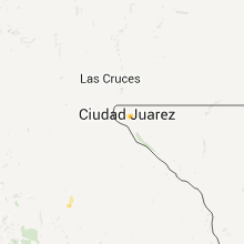
| 2:48 AM UTC | Probable wet microburst in el paso county TX, 5.8 miles ENE of El Paso, TX |
| 2:54 AM UTC | Probable wet micro burst at the el paso international airport in el paso county TX, 5.8 miles ENE of El Paso, TX |
| 3:35 AM UTC | A gate entrance into fort bliss near the el paso air port is closed due to collapsed canopy over the gate in el paso county TX, 8.4 miles NE of El Paso, TX |
Minnesota
| Local Time | Report Details |
|---|---|
| 3:20 AM UTC | Large trees blown over and telephone poles leaning in big stone county MN, 46.9 miles NW of Montevideo, MN |
| 3:25 AM UTC | Large cottonwood tree uprooted. estimated tree height 50 foot with 8 foot hole in ground where root ball resided. tree was laying from ne to sw. no structural damage se in big stone county MN, 48.3 miles NW of Montevideo, MN |
| 3:28 AM UTC | Numerous large trees down and snapped at farm location. no structural damage seen. trees were laying from wsw to ese in directio in big stone county MN, 47.8 miles NW of Montevideo, MN |
| 3:31 AM UTC | Widespread tree and structural damage to farmstead. corn on west side of place was laying north to south. trees and outbuildings on farmplace showed winds from south to in big stone county MN, 46.9 miles NW of Montevideo, MN |
| 3:40 AM UTC | Numerous large 3 to 5 inch tree branches blown down by stor in grant county MN, 61 miles NNW of Montevideo, MN |
Iowa
| Local Time | Report Details |
|---|---|
| 7:00 AM UTC | Kcrg relayed several reports of tree damage on the west and south sides of swisher as well as in rural areas. one tree fell onto a house and into the living room at 144 in johnson county IA, 9.5 miles S of Cedar Rapids, IA |
| 7:00 AM UTC | Wind gusts estimated to be over 70 mph topped off and uprooted some large trees on the south side of swisher around 2 am cdt. very heavy rain also observed around 210 a in johnson county IA, 9.5 miles S of Cedar Rapids, IA |
Connect with Interactive Hail Maps