

Hail Map for Tuesday, July 26, 2016

Number of Impacted Households on 7/26/2016
0
Impacted by 1" or Larger Hail
0
Impacted by 1.75" or Larger Hail
0
Impacted by 2.5" or Larger Hail
Square Miles of Populated Area Impacted on 7/26/2016
0
Impacted by 1" or Larger Hail
0
Impacted by 1.75" or Larger Hail
0
Impacted by 2.5" or Larger Hail


Cities Most Affected by Hail Storms of 7/26/2016
| Hail Size | Demographics of Zip Codes Affected | ||||||
|---|---|---|---|---|---|---|---|
| City | Count | Average | Largest | Pop Density | House Value | Income | Age |
| Hay Springs, NE | 3 | 1.75 | 1.75 | 1 | $36k | $31.1k | 52.3 |
| Custer, SD | 1 | 2.00 | 2.00 | 8 | $92k | $36.7k | 51.5 |
| Oelrichs, SD | 1 | 2.00 | 2.00 | 0 | $25k | $29.5k | 50.6 |
| Mission, SD | 1 | 1.75 | 1.75 | 1 | $37k | $22.7k | 24.5 |
| Presho, SD | 1 | 1.75 | 1.75 | 0 | $38k | $30.3k | 47.6 |
| Chadron, NE | 1 | 1.75 | 1.75 | 8 | $62k | $37.4k | 28.6 |
| Flasher, ND | 1 | 1.75 | 1.75 | 2 | $38k | $24.7k | 45.8 |
Hail and Wind Damage Spotted on 7/26/2016
Filter by Report Type:Hail ReportsWind Reports
States Impacted
South Dakota, Kentucky, Ohio, Virginia, Idaho, Texas, Wyoming, North Carolina, North Dakota, Michigan, Nebraska, Washington, Arizona, MontanaSouth Dakota
| Local Time | Report Details |
|---|---|
| 9:55 AM CDT | Quarter sized hail reported near Long Lake, SD, 40.6 miles NW of Aberdeen, SD, lots of nickel hail with some as large as quarters. . |
| 1:40 PM CDT | Storm damage reported in brown county SD, 32.6 miles N of Aberdeen, SD |
| 5:20 PM CDT | Quarter sized hail reported near White River, SD, 48.5 miles N of Valentine, NE |
| 5:35 PM CDT | Golf Ball sized hail reported near Presho, SD, 32.3 miles SSE of Pierre, SD, . |
| 5:08 PM MDT | Quarter sized hail reported near Custer, SD, 29.7 miles SW of Rapid City, SD |
| 6:20 PM CDT | Quarter sized hail reported near Wood, SD, 39.9 miles N of Valentine, NE |
| 6:29 PM CDT | Quarter sized hail reported near Presho, SD, 31 miles SSE of Pierre, SD, . |
| 5:38 PM MDT | Hen Egg sized hail reported near Custer, SD, 37.9 miles SSW of Rapid City, SD |
| 7:00 PM CDT | Quarter sized hail reported near Draper, SD, 33.3 miles SSW of Pierre, SD, . |
| 7:13 PM CDT | Golf Ball sized hail reported near Mission, SD, 26.7 miles N of Valentine, NE |
| 6:43 PM MDT | Hen Egg sized hail reported near Oelrichs, SD, 62.3 miles S of Rapid City, SD |
| 7:56 PM CDT | Quarter sized hail reported near Colome, SD, 52.5 miles NE of Valentine, NE |
| 8:15 PM CDT | Storm damage reported in tripp county SD, 48.9 miles NE of Valentine, NE |
| 7:40 PM MDT | Quarter sized hail reported near Tuthill, SD, 42.7 miles WNW of Valentine, NE |
Kentucky
| Local Time | Report Details |
|---|---|
| 1:35 PM EDT | 2 trees down along east bend and green roads near burlingto in boone county KY, 13 miles WSW of Cincinnati, OH |
Ohio
| Local Time | Report Details |
|---|---|
| 3:54 PM EDT | Tree knocked down along blue creek rd. time estimated from rada in adams county OH, 67.2 miles ESE of Cincinnati, OH |
| 4:16 PM EDT | Tree down along dry run rd in west portsmouth. time estimated from rada in scioto county OH, 81.5 miles ESE of Cincinnati, OH |
| 4:30 PM EDT | Tree down near greenlawn cemetery in portsmouth. time estimated from rada in scioto county OH, 77.5 miles WNW of Charleston, WV |
| 4:36 PM EDT | Tree down across sr 335 near minford. time estimated from rada in scioto county OH, 74.9 miles WNW of Charleston, WV |
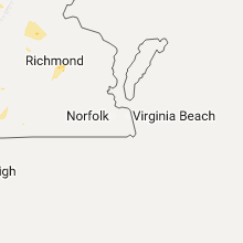
Virginia
| Local Time | Report Details |
|---|---|
| 5:27 PM EDT | Numerous trees down some uprooted and limbs down at riverside campin in page county VA, 71.5 miles ESE of Elkins, WV |
| 5:28 PM EDT | Numerous trees down - possible damage to structures in newport and stanley in page county VA, 71.3 miles ESE of Elkins, WV |
| 5:32 PM EDT | Two trees down at the intersection of us 340 and us 340 busines in page county VA, 71.6 miles ESE of Elkins, WV |
| 7:50 PM EDT | Trees down belmont rd in spotsylvania county VA, 47.4 miles NNW of Richmond, VA |
| 7:59 PM EDT | Tree down on power line at lawyers rd and stubbs bridge rd in spotsylvania county VA, 46.2 miles NNW of Richmond, VA |
| 8:15 PM EDT | Trees down lawyers rd and hayley mills rd in spotsylvania county VA, 43.8 miles N of Richmond, VA |
| 8:19 PM EDT | Trees down lawyers rd and ridge rd in spotsylvania county VA, 43.8 miles N of Richmond, VA |
| 8:48 PM EDT | Tree down across roa in henrico county VA, 15.2 miles ESE of Richmond, VA |
| 8:59 PM EDT | Tree down across roa in henrico county VA, 14.8 miles ENE of Richmond, VA |
| 8:59 PM EDT | Tree down across roa in henrico county VA, 15.2 miles ESE of Richmond, VA |
| 9:24 PM EDT | One tree down on langhorne road in city of lynchburg county VA, 43.1 miles ENE of Roanoke, VA |
| 9:26 PM EDT | One tree down on hollins mill road in city of lynchburg county VA, 44.3 miles ENE of Roanoke, VA |
| 9:26 PM EDT | One tree down at the intersection of overbrook road and hillsdale road in city of lynchburg county VA, 43.6 miles ENE of Roanoke, VA |
| 9:28 PM EDT | Tree blown down on house on spring oaks driv in campbell county VA, 42 miles E of Roanoke, VA |
| 9:34 PM EDT | Tree down on house along eastbrook roa in campbell county VA, 46.7 miles E of Roanoke, VA |
| 10:39 PM EDT | Large tree down across patterson ave blocking traffi in henrico county VA, 8.5 miles NE of Richmond, VA |
Idaho
| Local Time | Report Details |
|---|---|
| 3:50 PM MDT | 4 to 5 inch diameter tree limbs broken during high wind in caribou county ID, 70.9 miles SSE of Idaho Falls, ID |
Texas
| Local Time | Report Details |
|---|---|
| 5:44 PM CDT | Measured at k6r6 asos in terrell county TX, 87.3 miles WNW of Del Rio, TX |
| 7:05 PM CDT | 60 mph gust measured by west texas mesonet in martin county TX, 38.9 miles NNE of Odessa, TX |
Wyoming
| Local Time | Report Details |
|---|---|
| 4:45 PM MDT | Quarter sized hail reported near Buffalo, WY, 70 miles W of Gillette, WY |
| 4:50 PM MDT | Quarter sized hail reported near Buffalo, WY, 62.7 miles W of Gillette, WY |
| 5:05 PM MDT | Quarter sized hail reported near Buffalo, WY, 58.3 miles W of Gillette, WY |
| 5:20 PM MDT | Quarter sized hail reported near Buffalo, WY, 55.4 miles W of Gillette, WY |
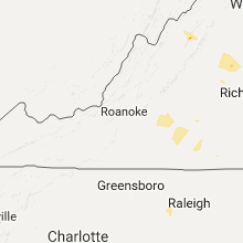
North Carolina
| Local Time | Report Details |
|---|---|
| 7:22 PM EDT | Large oak trees down on whitley and bellamy mill road in halifax county NC, 57.6 miles ENE of Raleigh, NC |
| 8:06 PM EDT | Tree down on power lin in chatham county NC, 17.5 miles WNW of Raleigh, NC |
| 8:43 PM EDT | Tree dow in wake county NC, 13.9 miles WSW of Raleigh, NC |
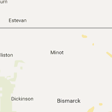
North Dakota
| Local Time | Report Details |
|---|---|
| 6:25 PM CDT | Ping Pong Ball sized hail reported near Flasher, ND, 32.1 miles SW of Bismarck, ND |
| 6:26 PM CDT | Golf Ball sized hail reported near Flasher, ND, 32.1 miles SW of Bismarck, ND, passed on via broadcast media. |
| 7:45 PM CDT | Quarter sized hail reported near Fort Yates, ND, 46.9 miles S of Bismarck, ND, winds gusting to an estimated 45 mph. |
| 9:40 PM CDT | Measured at fargo airpor in cass county ND, 4.2 miles NNW of Fargo, ND |
Michigan
| Local Time | Report Details |
|---|---|
| 7:35 PM EDT | Quarter sized hail reported near Newberry, MI, 61 miles WNW of Sault Sainte Marie, MI, trained spotter observed quarter-size hail this evening. |
| 7:45 PM EDT | Half Dollar sized hail reported near Grand Marais, MI, 69.3 miles E of Marquette, MI, observed quarter size hail with some larger hail stones greater than quarter sized. the hail lasted an estimated 5 to 10 minutes. intense downpour was observed. |
Nebraska
| Local Time | Report Details |
|---|---|
| 5:38 PM MDT | Half Dollar sized hail reported near Morrill, NE, 14 miles WNW of Scottsbluff, NE, quarter to half dollar in size. |
| 5:41 PM MDT | Quarter sized hail reported near Morrill, NE, 14.9 miles WNW of Scottsbluff, NE |
| 6:50 PM MDT | Estimates 50-60 mph in dawes county NE, 82.2 miles SSE of Rapid City, SD |
| 6:56 PM MDT | Quarter sized hail reported near Chadron, NE, 73.2 miles NNE of Scottsbluff, NE |
| 7:11 PM MDT | Quarter sized hail reported near Merriman, NE, 58.4 miles W of Valentine, NE |
| 7:13 PM MDT | Golf Ball sized hail reported near Hay Springs, NE, 81 miles NE of Scottsbluff, NE, winds were also estimated at between 50 and 60 mph. |
| 7:15 PM MDT | Golf Ball sized hail reported near Chadron, NE, 77.4 miles NNE of Scottsbluff, NE, mostly marble sized with some golf balls. winds estimated at 60+ mph. |
| 7:20 PM MDT | Golf Ball sized hail reported near Hay Springs, NE, 80.1 miles NE of Scottsbluff, NE, winds were estimated at around 50 mph. |
| 7:22 PM MDT | Sustained at 38 mp in dawes county NE, 68.9 miles NNE of Scottsbluff, NE |
| 7:27 PM MDT | Said that winds were 60+ mph. had not seen any damage ye in dawes county NE, 72.1 miles NE of Scottsbluff, NE |
| 8:35 PM CDT | Storm damage reported in cherry county NE, 8.8 miles NNW of Valentine, NE |
| 7:36 PM MDT | Golf Ball sized hail reported near Hay Springs, NE, 71.6 miles NE of Scottsbluff, NE |
| 7:45 PM MDT | Fire department reported pivots blown over and roof blown off garage from straight line winds. time estimated by rada in sheridan county NE, 84.5 miles W of Valentine, NE |
| 8:55 PM CDT | Quarter sized hail reported near Valentine, NE, 8.8 miles NNW of Valentine, NE |
| 7:55 PM MDT | Ping Pong Ball sized hail reported near Hay Springs, NE, 67.1 miles NE of Scottsbluff, NE, winds were estimated at between 40 and 50 mph. |
| 8:59 PM CDT | Storm damage reported in cherry county NE, 0.3 miles S of Valentine, NE |
| 9:00 PM CDT | Storm damage reported in cherry county NE, 1 miles WSW of Valentine, NE |
| 9:03 PM CDT | Storm damage reported in cherry county NE, 0.3 miles S of Valentine, NE |
| 9:05 PM CDT | Storm damage reported in cherry county NE, 0.3 miles S of Valentine, NE |
| 9:09 PM CDT | Storm damage reported in cherry county NE, 1.1 miles ENE of Valentine, NE |
| 9:11 PM CDT | Quarter sized hail reported near Valentine, NE, 0.3 miles S of Valentine, NE |
| 9:22 PM CDT | Storm damage reported in cherry county NE, 20.3 miles S of Valentine, NE |
| 8:24 PM MDT | Storm damage reported in cherry county NE, 74 miles W of Valentine, NE |
| 9:25 PM CDT | Trees snapped and uproote in cherry county NE, 13 miles SSE of Valentine, NE |
| 9:30 PM CDT | Storm damage reported in cherry county NE, 25.8 miles SSE of Valentine, NE |
| 8:41 PM MDT | Storm damage reported in sheridan county NE, 79.1 miles ENE of Scottsbluff, NE |
| 8:43 PM MDT | Winds were estimated at between 60 and 80 mp in cherry county NE, 79 miles WSW of Valentine, NE |
| 8:45 PM MDT | Storm damage reported in cherry county NE, 62.9 miles WSW of Valentine, NE |
| 10:00 PM CDT | Power lines down in the seneca area due to strong wind gust in thomas county NE, 59.3 miles SSW of Valentine, NE |
| 11:32 PM CDT | Winds were estimated in excess of 60 mp in blaine county NE, 72.1 miles WSW of Oneill, NE |
| 12:00 AM CDT | Storm damage reported in lincoln county NE, 3.7 miles N of North Platte, NE |
| 12:00 AM CDT | Storm damage reported in loup county NE, 60.5 miles SW of Oneill, NE |
| 12:06 AM CDT | Storm damage reported in lincoln county NE, 2.4 miles ENE of North Platte, NE |
| 12:40 AM CDT | Power is out in ord. pea sized hail reporte in valley county NE, 55.8 miles NNW of Grand Island, NE |
| 12:55 AM CDT | Awos wind gust reporte in dawson county NE, 56.7 miles ESE of North Platte, NE |
| 1:27 AM CDT | Power out. tree limbs dow in furnas county NE, 78.5 miles SE of North Platte, NE |
| 2:53 AM CDT | Storm damage reported in hall county NE, 3.3 miles NNE of Grand Island, NE |
Washington
| Local Time | Report Details |
|---|---|
| 6:00 PM PDT | Trees and powerlines down between addy and chewelah. in stevens county WA, 52.4 miles NNW of Spokane, WA |
Arizona
| Local Time | Report Details |
|---|---|
| 6:40 PM MST | Horse camp raws in pinal county AZ, 56.9 miles NNE of Tucson, AZ |
Montana
| Local Time | Report Details |
|---|---|
| 9:32 PM MDT | Storm damage reported in phillips county MT, 75 miles ESE of Havre, MT |
| 9:46 PM MDT | Storm damage reported in phillips county MT, 75 miles ESE of Havre, MT |
Connect with Interactive Hail Maps