

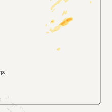
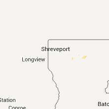
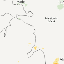
Hail Map for Tuesday, July 3, 2012

Number of Impacted Households on 7/3/2012
0
Impacted by 1" or Larger Hail
0
Impacted by 1.75" or Larger Hail
0
Impacted by 2.5" or Larger Hail
Square Miles of Populated Area Impacted on 7/3/2012
0
Impacted by 1" or Larger Hail
0
Impacted by 1.75" or Larger Hail
0
Impacted by 2.5" or Larger Hail


Cities Most Affected by Hail Storms of 7/3/2012
| Hail Size | Demographics of Zip Codes Affected | ||||||
|---|---|---|---|---|---|---|---|
| City | Count | Average | Largest | Pop Density | House Value | Income | Age |
| Tennille, GA | 2 | 1.75 | 1.75 | 30 | $64k | $28.9k | 35.9 |
| South Lyon, MI | 1 | 1.75 | 1.75 | 605 | $201k | $67.5k | 40.8 |
| Laurens, SC | 1 | 1.75 | 1.75 | 142 | $72k | $33.1k | 39.6 |
| Newland, NC | 1 | 1.75 | 1.75 | 57 | $83k | $31.3k | 45.3 |
| Columbus, ND | 1 | 1.75 | 1.75 | 1 | $15k | $17.7k | 51.6 |
| Goodrich, MI | 1 | 1.75 | 1.75 | 220 | $167k | $73.0k | 41.6 |
Hail and Wind Damage Spotted on 7/3/2012
Filter by Report Type:Hail ReportsWind Reports
States Impacted
Michigan, Ohio, North Carolina, Georgia, Virginia, Alabama, South Carolina, West Virginia, Florida, Kentucky, Tennessee, Louisiana, Mississippi, Montana, Maryland, Pennsylvania, Colorado, Nebraska, North DakotaMichigan
| Local Time | Report Details |
|---|---|
| 10:05 AM EDT | Quarter sized hail reported near Sterling Heights, MI, 48.8 miles SE of Flint, MI |
| 12:05 PM EDT | Numerous trees and branches down at m-46 and chapin r in saginaw county MI, 41.9 miles NW of Flint, MI |
| 3:34 PM EDT | Several limbs down along i96 northwest of brighton. estimated 3-4 inches in diamete in livingston county MI, 32.4 miles S of Flint, MI |
| 3:51 PM EDT | 3 inch diameter branches down at pontiac trail and milford rd in oakland county MI, 34 miles S of Flint, MI |
| 4:03 PM EDT | Quarter sized hail reported near Grand Blanc, MI, 8.1 miles SE of Flint, MI |
| 4:07 PM EDT | 4 foot diameter tree dow in ingham county MI, 45.9 miles SSW of Flint, MI |
| 4:07 PM EDT | Golf Ball sized hail reported near South Lyon, MI, 40.1 miles S of Flint, MI |
| 4:15 PM EDT | Golf Ball sized hail reported near Goodrich, MI, 12.2 miles ESE of Flint, MI |
| 4:32 PM EDT | Quarter sized hail reported near Swartz Creek, MI, 8.1 miles WSW of Flint, MI |
| 5:07 PM EDT | 4 foot diameter tree down at corner of green and shepper roads. reported by stockbridge police departmen in ingham county MI, 45.9 miles SSW of Flint, MI |
| 5:07 PM EDT | 4 foot diameter tree dow in ingham county MI, 45.9 miles SSW of Flint, MI |
| 5:15 PM EDT | Several trees and large limbs down in the rochester hills area in oakland county MI, 35.6 miles SE of Flint, MI |
| 5:17 PM EDT | Large tree limb down in washtenaw county MI, 46.5 miles SSW of Flint, MI |
| 5:18 PM EDT | Small tree limbs down...26 mile and romeo plank rd in macomb county MI, 45.5 miles ESE of Flint, MI |
| 5:21 PM EDT | 4-5 inch diameter limb down in macomb county MI, 49.2 miles ESE of Flint, MI |
| 5:25 PM EDT | Several trees and large limbs down in macomb county MI, 51.1 miles ESE of Flint, MI |
| 5:26 PM EDT | Winds uprooted a few trees and did damage to a home and automobil in macomb county MI, 49.6 miles ESE of Flint, MI |
| 5:28 PM EDT | Storm damage reported in macomb county MI, 50.8 miles ESE of Flint, MI |
| 5:29 PM EDT | Several large tree limbs down in oakland county MI, 32.7 miles SSE of Flint, MI |
| 5:53 PM EDT | 42 inch diameter tree snapped at base in macomb county MI, 42.5 miles SE of Flint, MI |
| 5:53 PM EDT | Quarter sized hail reported near Utica, MI, 42.9 miles SE of Flint, MI |
| 5:59 PM EDT | Quarter sized hail reported near Ortonville, MI, 17.6 miles SE of Flint, MI |
| 6:06 PM EDT | Storm damage reported in oakland county MI, 21.2 miles SE of Flint, MI |
| 6:10 PM EDT | 8 inch diameter tree down over ramp to us 23 at michigan av in washtenaw county MI, 53.9 miles S of Flint, MI |
| 6:10 PM EDT | Quarter sized hail reported near Ypsilanti, MI, 55.4 miles S of Flint, MI |
| 6:15 PM EDT | Tree branches down - 1/2 inch hai in macomb county MI, 40.8 miles SE of Flint, MI |
| 6:40 PM EDT | Trees and powerlines down at telegraph and carleton-rockwood rd in monroe county MI, 67.7 miles SSE of Flint, MI |
Ohio
| Local Time | Report Details |
|---|---|
| 10:30 AM EDT | Wind report occurred at state route 6 and lake breeze roa in lorain county OH, 21.3 miles W of Cleveland, OH |
| 10:35 AM EDT | A tree and a large limb dow in cuyahoga county OH, 12.5 miles W of Cleveland, OH |
| 11:15 AM EDT | Tree down indian hollow and murdon roads in carlisle township...it blocked the road. other large limbs down in the are in lorain county OH, 28.4 miles WSW of Cleveland, OH |
| 11:33 AM EDT | Tree down in york townshi in medina county OH, 28.3 miles SSW of Cleveland, OH |
| 11:40 AM EDT | Tree down vandermark and 22 in medina county OH, 34.6 miles SSW of Cleveland, OH |
| 12:05 PM EDT | Some trees down in sterlin in wayne county OH, 36.8 miles S of Cleveland, OH |
| 12:10 PM EDT | Tree down in wadsworth townshi in medina county OH, 33.5 miles S of Cleveland, OH |
| 12:13 PM EDT | Quarter sized hail reported near Smithville, OH, 45.3 miles SSW of Cleveland, OH |
| 1:24 PM EDT | Tree reported down on power line in tuscarawas county OH, 67.7 miles S of Cleveland, OH |
| 1:33 PM EDT | Tree reported down on power line in tuscarawas county OH, 71.2 miles S of Cleveland, OH |
| 3:12 PM EDT | Trees down on route 7 in jefferson county OH, 34.7 miles W of Pittsburgh, PA |
| 4:24 PM EDT | Multiple trees down in the village of vinto in gallia county OH, 57.7 miles NW of Charleston, WV |
| 7:42 PM EDT | Trees and power lines dow in ashtabula county OH, 65 miles ENE of Cleveland, OH |
| 8:30 PM EDT | Trees dow in lake county OH, 27.6 miles NE of Cleveland, OH |
| 8:40 PM EDT | Trees dow in lake county OH, 26.9 miles ENE of Cleveland, OH |
| 9:18 PM EDT | Quarter sized hail reported near Cortland, OH, 51.8 miles ESE of Cleveland, OH |
| 10:05 PM EDT | Some trees down in johnson township...vernon township and fowler townshi in trumbull county OH, 55.1 miles E of Cleveland, OH |
| 10:25 PM EDT | Some trees down across the are in trumbull county OH, 48.8 miles ESE of Cleveland, OH |
| 11:40 PM EDT | Quarter sized hail reported near East Palestine, OH, 41 miles NW of Pittsburgh, PA |
| 12:10 AM EDT | Large limb dow in portage county OH, 33.4 miles SE of Cleveland, OH |
| 12:15 AM EDT | Large limb down in rootstow in portage county OH, 36.4 miles SE of Cleveland, OH |
| 12:50 AM EDT | Quarter sized hail reported near Atwater, OH, 43.4 miles SE of Cleveland, OH |
| 1:30 AM EDT | Quarter sized hail reported near Leetonia, OH, 50.3 miles NW of Pittsburgh, PA |
North Carolina
| Local Time | Report Details |
|---|---|
| 12:55 PM EDT | Quarter sized hail reported near Millers Creek, NC, 53.3 miles ESE of Bristol, TN, water fall road |
| 12:55 PM EDT | Trees down along route 16 in wilkes county NC, 53.1 miles ESE of Bristol, TN |
| 1:10 PM EDT | Quarter sized hail reported near Newland, NC, 42.9 miles SSE of Bristol, TN, quarter sized hail on quarry road at pinola. marble sized hail was also reported on pritchard road. strong wind gusts caused some wind issues such as blown over potted |
| 1:27 PM EDT | Golf Ball sized hail reported near Newland, NC, 39.2 miles SSE of Bristol, TN |
| 2:00 PM EDT | Multiple trees blown in half. hail of unknown siz in buncombe county NC, 51.5 miles NNE of Greenville, SC |
| 2:23 PM EDT | One tree down at the intersection of beasley street and west virginia street in surry county NC, 65.2 miles SW of Roanoke, VA |
| 2:28 PM EDT | One tree down near willow street and pine street in surry county NC, 64.8 miles SW of Roanoke, VA |
| 2:28 PM EDT | One tree down on badgett avenue in surry county NC, 61.6 miles SW of Roanoke, VA |
| 2:40 PM EDT | At least a few trees and large limbs dow in mitchell county NC, 31.9 miles S of Bristol, TN |
| 2:53 PM EDT | River creek campground had a high wind gust that brought down several large limbs...split a tree and blew tents from their anchored position out into the rive in rutherford county NC, 48.6 miles NNE of Greenville, SC |
| 2:53 PM EDT | Quarter sized hail reported near Westfield, NC, 61.4 miles SSW of Roanoke, VA, near highway 89 |
| 3:05 PM EDT | Tree down near chesterfield community and another down on forest service land in northern part of count in burke county NC, 61.3 miles SSE of Bristol, TN |
| 3:30 PM EDT | Several trees down in southern caldwell county west of sawmills and granite falls...in vicinity of baton school roa in caldwell county NC, 57 miles NW of Charlotte, NC |
| 4:10 PM EDT | Tree down on winged elm way in rockingham county NC, 69.3 miles S of Roanoke, VA |
| 4:15 PM EDT | Tree down at woolen stone road in rockingham county NC, 69.3 miles S of Roanoke, VA |
| 6:10 PM EDT | Trees were blown down on hwy 740 near new london. time estimated by rada in stanly county NC, 38 miles ENE of Charlotte, NC |
| 8:10 PM EDT | Tree down on lake boone trail at i-44 in wake county NC, 3.6 miles NW of Raleigh, NC |
| 8:15 PM EDT | 4500 without power after utility lines knocked down near brentwood rd. and atlantic av in wake county NC, 4.5 miles NNE of Raleigh, NC |
| 8:19 PM EDT | Tree down at van dyke ave. and chamberlain s in wake county NC, 1.8 miles WNW of Raleigh, NC |
| 8:26 PM EDT | A couple of trees reported down on eva mae r in wake county NC, 5 miles ESE of Raleigh, NC |
| 9:07 PM EDT | Tree down on johnson pond r in wake county NC, 10.6 miles SSW of Raleigh, NC |
| 9:39 PM EDT | 3 trees down so far...one on plyler mill road...one on nesbit road and one on midwood drive. the first 2 likely fell from high wind and the tree on midwood drive which in union county NC, 24.8 miles SSE of Charlotte, NC |
Georgia
| Local Time | Report Details |
|---|---|
| 1:54 PM EDT | Sheriff dispatch reported trees down along highway 80w nar the burke county jefferson county lin in burke county GA, 28.4 miles SW of Augusta, GA |
| 2:05 PM EDT | Public reports nickel size hail and power outages from lines down along william tinley road southwest of st. clai in burke county GA, 28.8 miles SSW of Augusta, GA |
| 2:53 PM EDT | Kcsg asos reported 58mph gust...pk wnd 33050/185 in muscogee county GA, 32.6 miles E of Auburn, AL |
| 2:53 PM EDT | 911 center reported 3 to 4 trees and one traffic light down on north side of columbu in muscogee county GA, 29.1 miles E of Auburn, AL |
| 2:55 PM EDT | The public reported a tree dow in screven county GA, 53.2 miles SSE of Augusta, GA |
| 3:12 PM EDT | Jefferson county 911 relayed a report of three trees down countywide. time is estimated from rada in jefferson county GA, 41.5 miles SW of Augusta, GA |
| 3:24 PM EDT | Wrdw reported trees and powerlines down at the intersection of morgan road and green forest driv in richmond county GA, 8.2 miles SW of Augusta, GA |
| 3:49 PM EDT | Johnson county 911 reported at least ten trees down countywide from the storm in johnson county GA, 62.6 miles SSW of Augusta, GA |
| 4:00 PM EDT | 911 call center relayed a report of a couple trees down behind the call center in hamilton along with some more trees reported down across the rest of the count in harris county GA, 36.6 miles ENE of Auburn, AL |
| 4:00 PM EDT | Sheriff dispach reported trees down along river roa in burke county GA, 30.3 miles SSE of Augusta, GA |
| 4:00 PM EDT | Quarter sized hail reported near Hamilton, GA, 23.4 miles ENE of Auburn, AL, state trooper reported one inch hail near lake harding in western harris county. |
| 4:06 PM EDT | Sheriff dispatch reported trees down on vine road near girar in burke county GA, 32.7 miles SSE of Augusta, GA |
| 4:14 PM EDT | The georgia forestry commission reported a few large limbs down. limbs were greater than 6 inches in diamete in effingham county GA, 24.2 miles NW of Savannah, GA |
| 4:20 PM EDT | Golf Ball sized hail reported near Tennille, GA, 61.9 miles SW of Augusta, GA, washington county 911 relayed a report of golf ball sized hail in western washington county. |
| 4:20 PM EDT | Golf Ball sized hail reported near Tennille, GA, 62.8 miles SW of Augusta, GA, washington county 911 relayed a report of golf ball sized hail in western washington county. |
| 4:25 PM EDT | A few trees down at turnervill in habersham county GA, 50.1 miles WSW of Greenville, SC |
| 4:25 PM EDT | Ping Pong Ball sized hail reported near Clarkesville, GA, 50.1 miles WSW of Greenville, SC, silver dollar sized hail at turnerville georgia. |
| 4:31 PM EDT | Sheriff dispach reported trees down along munnerlyn alexander roa in burke county GA, 32.1 miles S of Augusta, GA |
| 4:40 PM EDT | At least 6 trees down and several powerlines down just north of carrollton near spence road. also had 1 tree down on house in the city of carrollto in carroll county GA, 40.8 miles WSW of Atlanta, GA |
| 4:50 PM EDT | *** 1 inj *** updated event from the ema director. location was near the intersection of hwy 42 and king mill road. 7 tractor trailors turned over. one individual was i in henry county GA, 27.7 miles SSE of Atlanta, GA |
| 4:50 PM EDT | Henry county ema director reports 4-5 tractor trailors turned over near the intersection of highway 42 and king mill road at around 450 pm ed in henry county GA, 27.7 miles SSE of Atlanta, GA |
| 5:00 PM EDT | Wilkinson 911 relayed a report of six trees down countywide with this stor in wilkinson county GA, 83.2 miles WSW of Augusta, GA |
| 5:00 PM EDT | Sheriff reported trees down across the count in wilkinson county GA, 78.1 miles SW of Augusta, GA |
| 5:05 PM EDT | Tree down on indian hill road. another tree down on brad dixon road east of elberto in elbert county GA, 57.8 miles SSW of Greenville, SC |
| 5:15 PM EDT | The public reported one tree and power line dow in jenkins county GA, 46.8 miles S of Augusta, GA |
| 5:19 PM EDT | 911 relayed a report of 5 to 10 trees across the roadways countywide with this thunderstor in spalding county GA, 35.2 miles SSE of Atlanta, GA |
| 5:20 PM EDT | 6 to 8 trees down along highway 49 and highway 224. also had several power lines down in these area in macon county GA, 86.5 miles E of Auburn, AL |
| 5:25 PM EDT | Quarter sized hail reported near Barnesville, GA, 46.6 miles SSE of Atlanta, GA, county sheriffs office reported 1 inch hail along highway 36 east north of barnesville. also reported several trees and power lines down across the county. |
| 5:42 PM EDT | Power lines were reported down on hood rd and hwy 8 in fayette county GA, 20.8 miles S of Atlanta, GA |
| 5:42 PM EDT | Fayette county ema relayed a report of a tree down on a barn. a donkey was caught inside and the fire department was there extricating i in fayette county GA, 21.5 miles SSW of Atlanta, GA |
| 5:43 PM EDT | Houston county 911 center reported dime size hail and 11 trees blown down due to thunderstorm winds. lightning also caused a structure fir in houston county GA, 83.6 miles NW of Douglas, GA |
| 5:50 PM EDT | 1 tree down on hopewell road in musell in crawford county GA, 68.6 miles SSE of Atlanta, GA |
| 5:56 PM EDT | Fulton county ema relayed a report of powerlines down in the lakewood park are in fulton county GA, 3.3 miles S of Atlanta, GA |
| 5:58 PM EDT | Dekalb county relayed a report of powerlines down south of decatu in dekalb county GA, 5.4 miles ESE of Atlanta, GA |
| 5:58 PM EDT | 911 relayed a report of a tree down in northern emanuel count in emanuel county GA, 59.4 miles SSW of Augusta, GA |
| 6:10 PM EDT | The bulloch county 911 center reported several trees down near nevil in bulloch county GA, 38.7 miles WNW of Savannah, GA |
| 6:13 PM EDT | Trees down along highway 19 in lee county GA, 76.9 miles WNW of Douglas, GA |
| 6:15 PM EDT | Around 10 trees down from forsyth to the southwest part of the count in monroe county GA, 57.6 miles SSE of Atlanta, GA |
| 6:18 PM EDT | Trees down along new york roa in lee county GA, 72 miles WNW of Douglas, GA |
| 6:20 PM EDT | Clayton county 911 relayed a report of a tree down across woosley roa in clayton county GA, 24.7 miles S of Atlanta, GA |
| 6:43 PM EDT | The evans county 911 center relayed a report of 1 tree down along tippins roa in evans county GA, 49.8 miles WNW of Savannah, GA |
| 6:54 PM EDT | Four mobile homes and one house damaged. several trees and powerlines down in the are in lowndes county GA, 43.5 miles SSW of Douglas, GA |
| 7:06 PM EDT | Dodge county 911 relayed a report of 5 trees and two powerlines down countywide. time estimated from rada in dodge county GA, 38.2 miles NNW of Douglas, GA |
| 7:06 PM EDT | The tattnall county 911 center relayed a report of a pecan tree down along anderson church roa in tattnall county GA, 55.2 miles W of Savannah, GA |
| 7:10 PM EDT | Telfair 911 relayed a report of 2 to 3 trees down countywide. time estimated based on rada in telfair county GA, 30.4 miles N of Douglas, GA |
| 7:10 PM EDT | Tree down on mitchell r in thomas county GA, 35.5 miles ENE of Tallahassee, FL |
| 7:19 PM EDT | Cherokee county ema relayed a report of at least 50 trees down and 4 powerlines down in the area. winds were estimated around 60 mp in cherokee county GA, 41.6 miles N of Atlanta, GA |
| 7:20 PM EDT | The tattnall county 911 center relayed a report of 2 trees down near collins georgi in tattnall county GA, 59 miles W of Savannah, GA |
| 8:05 PM EDT | Quarter sized hail reported near Axson, GA, 17.7 miles SSE of Douglas, GA, public report of hail up to quarter size...accompanied by gusty winds...at a convenience store near axson. time of event based on radar imagery. |
| 8:08 PM EDT | Trees reported down across the road in axso in atkinson county GA, 17.5 miles SSE of Douglas, GA |
| 8:10 PM EDT | Several trees down around the city of fitzgeral in ben hill county GA, 27.5 miles WNW of Douglas, GA |
| 8:25 PM EDT | Trees down along amber lane in coffee county GA, 7.8 miles NE of Douglas, GA |
| 8:25 PM EDT | Trees down along bridgetown road in coffee county GA, 11.7 miles WSW of Douglas, GA |
| 8:30 PM EDT | Tree down on barton r in cook county GA, 42.1 miles SW of Douglas, GA |
| 8:30 PM EDT | Tree down on hwy 41 in leno in cook county GA, 39.8 miles WSW of Douglas, GA |
| 8:30 PM EDT | Tree down on cool springs roa in colquitt county GA, 52.9 miles WSW of Douglas, GA |
| 8:42 PM EDT | Two power poles snapped along country circl in colquitt county GA, 57.8 miles WSW of Douglas, GA |
| 8:55 PM EDT | Trees and large limbs were blown down in willcoochee. one large limb landed on a car. the cost of damage unknown. the time of damage was estimated based on radar imager in atkinson county GA, 16 miles SW of Douglas, GA |
| 9:20 PM EDT | A tree was blown down across post road. the time of damage was based on rada in appling county GA, 32.9 miles NE of Douglas, GA |
| 10:32 PM EDT | Quarter sized hail reported near Pembroke, GA, 41.1 miles WNW of Savannah, GA, quarter sized hail reported via bryan 911 center. |
Virginia
| Local Time | Report Details |
|---|---|
| 2:10 PM EDT | One tree down along salt house branch road near the lake in franklin county VA, 32.3 miles S of Roanoke, VA |
| 2:45 PM EDT | Trees down in claudville in patrick county VA, 54 miles SSW of Roanoke, VA |
| 3:05 PM EDT | Trees down on maury river road in rockbridge county VA, 55.1 miles NNE of Roanoke, VA |
| 3:15 PM EDT | Quarter sized hail reported near Patrick Springs, VA, 45.9 miles SSW of Roanoke, VA, patrick springs post office |
| 3:30 PM EDT | Multiple trees down on salem church road in patrick county VA, 42.1 miles SSW of Roanoke, VA |
| 3:32 PM EDT | Tree down on egg farm road in patrick county VA, 38.5 miles SSW of Roanoke, VA |
| 3:47 PM EDT | Quarter sized hail reported near Dry Fork, VA, 45.7 miles SE of Roanoke, VA, white oak circle and dry fork road |
| 3:55 PM EDT | Quarter sized hail reported near Riner, VA, 28.3 miles WSW of Roanoke, VA, route 615 and 669 in riner. mostly pea size hail with some as large as a quarter. |
| 4:00 PM EDT | Power lines down on church street...third avenue...and hunting hills road in city of danville county VA, 55.4 miles SSE of Roanoke, VA |
| 4:10 PM EDT | Several trees down at 6620 plank road in rockbridge county VA, 30.1 miles NE of Roanoke, VA |
| 4:10 PM EDT | Several trees down at 6340 plank road in rockbridge county VA, 30.1 miles NE of Roanoke, VA |
| 4:10 PM EDT | Several trees down in city of lexington county VA, 43.3 miles NE of Roanoke, VA |
| 4:15 PM EDT | Tree down across 2700 fairview church roa in bedford county VA, 24.3 miles ESE of Roanoke, VA |
| 4:30 PM EDT | 2 trees down along wooding road/state rt 689 in halifax county VA, 63 miles SE of Roanoke, VA |
| 4:45 PM EDT | Tree blown dow in campbell county VA, 38.2 miles E of Roanoke, VA |
| 4:48 PM EDT | Power lines down on crestside drive in campbell county VA, 35.9 miles E of Roanoke, VA |
| 4:48 PM EDT | Ping Pong Ball sized hail reported near Thaxton, VA, 18.8 miles ENE of Roanoke, VA |
| 4:54 PM EDT | Tree blown down across intersection of brookhill and cifax road in bedford county VA, 31.8 miles ENE of Roanoke, VA |
| 5:10 PM EDT | Limbs down on power lines on doewood place in campbell county VA, 50.4 miles E of Roanoke, VA |
| 5:15 PM EDT | Trees and powerlines down along brookneal highway in southern part of county...gladys/brookneal v in campbell county VA, 54.1 miles ESE of Roanoke, VA |
| 5:24 PM EDT | Tree fell across powerlines...mollies creek roa in campbell county VA, 49.6 miles E of Roanoke, VA |
| 5:30 PM EDT | Several reports of trees and powerlines dow in charlotte county VA, 63.2 miles E of Roanoke, VA |
| 5:40 PM EDT | Power lines down on pigeon run road in campbell county VA, 50.2 miles E of Roanoke, VA |
| 5:50 PM EDT | Canopy down on car at uppy gas station in mecklenburg county VA, 65.9 miles SW of Richmond, VA |
| 6:05 PM EDT | Power lines down on monroe street in wythe county VA, 66.7 miles WSW of Roanoke, VA |
| 6:05 PM EDT | Tree down along david bruce avenu in charlotte county VA, 62.5 miles WSW of Richmond, VA |
| 6:09 PM EDT | Tree down on poiwer line and caught on fire in prince edward county VA, 54.3 miles WSW of Richmond, VA |
| 6:10 PM EDT | Tree down in prince edward county VA, 53.2 miles WSW of Richmond, VA |
| 6:10 PM EDT | Tree down on 460 in prince edward county VA, 45.5 miles WSW of Richmond, VA |
| 6:10 PM EDT | Several trees with powerlines down along mcgehee road...keysville are in charlotte county VA, 56.5 miles WSW of Richmond, VA |
| 6:15 PM EDT | Tree down along kings hwy near ontario v in charlotte county VA, 57 miles SW of Richmond, VA |
| 6:25 PM EDT | Storm damage reported in lunenburg county VA, 47.7 miles SW of Richmond, VA |
| 7:04 PM EDT | Tree down along north frederick pike near gainesboro due to strong thunderstorm wind in frederick county VA, 87.9 miles W of Baltimore, MD |
| 7:04 PM EDT | Tree down near north frederick pike and ebenezer church road due to strong thunderstorm wind in frederick county VA, 88 miles ENE of Elkins, WV |
| 7:17 PM EDT | Tree down at cedar grove rd and mountain laurel ln from strong thunderstorm wind in frederick county VA, 84.2 miles W of Baltimore, MD |
| 7:39 PM EDT | Trrees down along old charles town road in clarke county VA, 74.7 miles W of Baltimore, MD |
| 7:40 PM EDT | Trees down along withers larue rd in clarke county VA, 74.7 miles W of Baltimore, MD |
| 8:12 PM EDT | Large limb down along harry byrd hwy in loudoun county VA, 54.2 miles W of Baltimore, MD |
Alabama
| Local Time | Report Details |
|---|---|
| 1:15 PM CDT | Trees and power lines down along allen walker road. trees and power lines down at 500 archie schultz road as well a small outbuilding was destroye in clarke county AL, 34.1 miles SW of Camden, AL |
| 1:45 PM CDT | Downed tree caused damage to building and two ambulance in houston county AL, 82 miles NE of Miramar Beach, FL |
| 1:50 PM CDT | 3 trees down around cowart in houston county AL, 80.5 miles NW of Tallahassee, FL |
| 1:55 PM CDT | 5 trees down in the hodgesville are in houston county AL, 76.4 miles NE of Miramar Beach, FL |
| 1:58 PM CDT | Several trees down and powerpoles snappe in houston county AL, 75.7 miles NW of Tallahassee, FL |
| 2:03 PM CDT | Two large trees down in jackson are in clarke county AL, 48.5 miles SW of Camden, AL |
| 2:05 PM CDT | Trees and powerlines down in ja in clarke county AL, 48.5 miles SW of Camden, AL |
| 2:11 PM CDT | Strong straight line winds downing large limbs and powerline in houston county AL, 76 miles NW of Tallahassee, FL |
| 2:15 PM CDT | Trees and powerlines down at college and state streets. trees down on forrest avenue. trees blocking road and on a structure at west clinton and north portis street in clarke county AL, 48.5 miles SW of Camden, AL |
| 2:33 PM CDT | Trees down between beauregard and marvyn near state road 5 in lee county AL, 13.6 miles SSE of Auburn, AL |
| 2:36 PM CDT | A dozen trees reported snapped and power lines down on lake harding off lee road 37 in lee county AL, 19.6 miles ENE of Auburn, AL |
| 3:05 PM CDT | Multiple trees down and downed powerlines along hwy 136 east of exce in monroe county AL, 38.8 miles S of Camden, AL |
| 3:48 PM CDT | Tree was blown down across rifle range rd. cleared by f in elmore county AL, 38.5 miles WSW of Auburn, AL |
| 3:55 PM CDT | Microburst with winds est at 45 mph caused damage along cobbs ford rd. several vehicle windows were blown out and powerlines knocked down. a street sign was ben in autauga county AL, 55.7 miles W of Auburn, AL |
| 4:45 PM CDT | Several trees down in silve in baldwin county AL, 20.4 miles ESE of Mobile, AL |
| 5:20 PM CDT | Several trees down in the brantley area with reports of homes damaged. us hwy 331 blocked due to downed trees. time estimated by rada in crenshaw county AL, 67 miles ESE of Camden, AL |
South Carolina
| Local Time | Report Details |
|---|---|
| 2:30 PM EDT | Trees down near oconee state par in oconee county SC, 29.6 miles W of Greenville, SC |
| 3:23 PM EDT | A deputy reported one tree down along highway 12 in allendale county SC, 43.2 miles SE of Augusta, GA |
| 3:51 PM EDT | Highway patrol reported trees down along lanier roa in aiken county SC, 6.2 miles ESE of Augusta, GA |
| 4:15 PM EDT | Fire department reported trees and power lines down along belvedere clearwater road from duncan road to belveder in aiken county SC, 4.7 miles NE of Augusta, GA |
| 4:19 PM EDT | Law enforcement at the savannah river site reported trees dow in barnwell county SC, 26.5 miles SE of Augusta, GA |
| 4:35 PM EDT | Report of one large live limb down and one dead tree blown over at the west end of asbury roa in cherokee county SC, 51.2 miles E of Greenville, SC |
| 5:09 PM EDT | Highway patrol reported trees down along w e jeffcoat road near burns roa in lexington county SC, 50 miles ENE of Augusta, GA |
| 5:10 PM EDT | Highway patrol reported trees down on fairview road near forts pond road in lexington county SC, 46.6 miles ENE of Augusta, GA |
| 5:10 PM EDT | Quarter sized hail reported near Fountain Inn, SC, 24.8 miles ESE of Greenville, SC, quarter sized hail. |
| 5:16 PM EDT | Power company reported trees down on power lines near pelio in lexington county SC, 46.7 miles ENE of Augusta, GA |
| 5:20 PM EDT | Sheriff dispatch reported a tree down on peachtree rock roa in lexington county SC, 51.1 miles ENE of Augusta, GA |
| 5:40 PM EDT | A tree in roadway in rock springs church road at a railroad crossing...curry road at highway 49 and curry road at leeville church roa in laurens county SC, 41.8 miles ESE of Greenville, SC |
| 5:53 PM EDT | Spotter reports trees and other large limbs down around hickory tavern. also pea sized hail was reported on heavens gate lane located between boyd mill pond and princet in laurens county SC, 31.7 miles SE of Greenville, SC |
| 5:57 PM EDT | Highway patrol reported trees down on fairview road near interstate 2 in lexington county SC, 38.4 miles NE of Augusta, GA |
| 6:02 PM EDT | Interstate 385 and highway 4 in laurens county SC, 40.6 miles ESE of Greenville, SC |
| 6:02 PM EDT | Trees down at interstate 385 and highway 4 in laurens county SC, 40.6 miles ESE of Greenville, SC |
| 6:02 PM EDT | Golf Ball sized hail reported near Laurens, SC, 40.6 miles ESE of Greenville, SC, interstate 385 and highway 49. |
| 6:20 PM EDT | Trees down at us 378 and dailey creek road. report relayed from sc do in saluda county SC, 39.7 miles NNE of Augusta, GA |
| 6:20 PM EDT | Tree in roadway on wilson driv in laurens county SC, 45.1 miles ESE of Greenville, SC |
| 6:24 PM EDT | Trees down at highway sc 23 and padgett pond road in saluda county SC, 32.8 miles NE of Augusta, GA |
| 6:25 PM EDT | Tree in roadway on holmes bridge roa in laurens county SC, 45.8 miles SE of Greenville, SC |
| 6:30 PM EDT | Wis tv reported trees down one of which was a 3-foot diameter oak. unfinished barn-garage blown down on car. small hai in saluda county SC, 41.8 miles NNE of Augusta, GA |
| 6:50 PM EDT | Several trees down around greenwood and near greenwood county airpor in greenwood county SC, 47.6 miles SSE of Greenville, SC |
| 7:08 PM EDT | Tree in roadway on docheno rd at trail r in anderson county SC, 25.5 miles SSE of Greenville, SC |
| 7:30 PM EDT | Highway patrol reported trees down at sc 773 and us 176 near pomari in newberry county SC, 63.2 miles NNE of Augusta, GA |
| 7:30 PM EDT | Sheriff reported tree on house. also small hai in newberry county SC, 53.4 miles NNE of Augusta, GA |
West Virginia
| Local Time | Report Details |
|---|---|
| 2:35 PM EDT | Trees down across the road near rte 33 and ellis fork r in gilmer county WV, 53.1 miles W of Elkins, WV |
| 2:35 PM EDT | A tree down on power lines. electrical power lost to a few home in calhoun county WV, 49.3 miles NE of Charleston, WV |
| 3:05 PM EDT | Trailer blown off found in roane county WV, 34.5 miles NNE of Charleston, WV |
| 5:25 PM EDT | Several trailers in a trailer park reporting structural damag in roane county WV, 35.2 miles NNE of Charleston, WV |
| 5:25 PM EDT | Quarter sized hail reported near Tunnelton, WV, 32.5 miles N of Elkins, WV |
| 5:28 PM EDT | Small tree down in kanawha county WV, 9.6 miles ENE of Charleston, WV |
| 5:45 PM EDT | Two large trees down on the grounds of the greenbrier hotel in greenbrier county WV, 41.1 miles NNW of Roanoke, VA |
| 5:46 PM EDT | Several trees down between spencer and gandeeville along route 119. several trees down on power lines in the same are in roane county WV, 31.6 miles NNE of Charleston, WV |
| 5:50 PM EDT | Kanawha eoc reprted multiple trees down and minor roof damage at the corner of robin rd and tater creek in pinc in kanawha county WV, 9.6 miles ENE of Charleston, WV |
| 6:45 PM EDT | Trees and power lines down on south street in mercer county WV, 70.5 miles W of Roanoke, VA |
Florida
| Local Time | Report Details |
|---|---|
| 1:45 PM CDT | Tree limbs and some small pine trees down in the rolling pines community near the sunny hills golf course along highway 7 in washington county FL, 43.4 miles E of Miramar Beach, FL |
| 1:55 PM CDT | Tree down on top of powerlines causing a fir in washington county FL, 42.1 miles ENE of Miramar Beach, FL |
| 3:35 PM EDT | Several trees snapped. one power pole snapped. a couple of sheds overturne in levy county FL, 82.6 miles SW of Jacksonville, FL |
| 2:39 PM CDT | Tree down near old us rd. and hwy 16 in jackson county FL, 62.8 miles WNW of Tallahassee, FL |
| 2:49 PM CDT | The asos recorded a peak wind gust of 68 mph from 350 degrees at 249 pm cdt with a fastest two minute average wind of 54 mph at the same tim in jackson county FL, 59.9 miles WNW of Tallahassee, FL |
| 2:58 PM CDT | Power poles down on caverns rd. near marianna high schoo in jackson county FL, 60.4 miles WNW of Tallahassee, FL |
| 3:03 PM CDT | Tree down near merrits mill and flynt d in jackson county FL, 58.5 miles WNW of Tallahassee, FL |
| 4:30 PM EDT | Marion county 911 dispatch reports multiple trees downed and pea sized hail in the vicinity of ocala. time of damage based on radar imagery in marion county FL, 64 miles NW of Orlando, FL |
| 4:36 PM EDT | Tree down near blue creek rd. east of hosford causing a power outage in the are in liberty county FL, 25.3 miles W of Tallahassee, FL |
| 4:38 PM EDT | Tree down on a powerline leaning against a home along northeast dewber r in liberty county FL, 31.9 miles WSW of Tallahassee, FL |
| 4:45 PM EDT | Tree down near roberts r in liberty county FL, 31.2 miles W of Tallahassee, FL |
| 5:05 PM EDT | Tree down near homewood rd. and lang r in leon county FL, 4.2 miles NW of Tallahassee, FL |
| 5:10 PM EDT | A few trees down near le in madison county FL, 58.5 miles E of Tallahassee, FL |
| 5:35 PM EDT | Two trees and some powerlines down along boxwood lan in leon county FL, 8.9 miles NNW of Tallahassee, FL |
| 6:00 PM EDT | Tree down partially blocking road near 11427 moccasin gap roa in leon county FL, 15.8 miles NE of Tallahassee, FL |
| 8:48 PM EDT | Trees down on schank court in orange county FL, 3.7 miles WSW of Orlando, FL |
| 9:05 PM EDT | Intersection s. john young pkwy. and l.b. mcleod road. large tree in orange county FL, 2.7 miles S of Orlando, FL |
Kentucky
| Local Time | Report Details |
|---|---|
| 3:17 PM EDT | Several trees and large limbs downed in yards along route 229 south of londo in laurel county KY, 39.7 miles S of Irvine, KY |
Tennessee
| Local Time | Report Details |
|---|---|
| 4:37 PM EDT | Several trees down across nothern monroe count in monroe county TN, 39.6 miles SW of Knoxville, TN |
Louisiana
| Local Time | Report Details |
|---|---|
| 3:56 PM CDT | Measured by the acadiana regional aso in iberia county LA, 15.5 miles SSE of Lafayette, LA |
| 4:35 PM CDT | Estimated winds 65 to 70 mph caused downing of large tree limbs in and around the neighborhood intersection of johnston and doucette street in lafayette county LA, 0.8 miles W of Lafayette, LA |
| 5:20 PM CDT | Public report of a tree down on a house in southern part of lafayette. extent of damage unknown at this time. report courtesy of klfy-t in lafayette county LA, 0.8 miles W of Lafayette, LA |
| 6:44 PM CDT | Scattered tree damage in the gentilly area and around 5000 people without power in orleans paris in orleans county LA, 4 miles NNE of New Orleans, LA |
Mississippi
| Local Time | Report Details |
|---|---|
| 4:03 PM CDT | Large oak tree across the road at hwy 57 and jim ramsey. numerous limbs and debris down in the town of vancleav in jackson county MS, 38.1 miles WSW of Mobile, AL |
| 6:05 PM CDT | Trees and power lines down along highway 53 between saucier lizana rd and shaw rd. estimated time based rada in harrison county MS, 65.3 miles NE of New Orleans, LA |
Montana
| Local Time | Report Details |
|---|---|
| 3:45 PM MDT | Small tree branches down and also lost power. pea hail also reported in valley county MT, 33.6 miles NNE of Glasgow, MT |
| 4:00 PM MDT | Brief heavy rain...pea size hail...and strong winds gusting to 60 mp in valley county MT, 33.6 miles NE of Glasgow, MT |
| 4:25 PM MDT | Quarter sized hail reported near Frazer, MT, 32.1 miles ENE of Glasgow, MT, esimated quarter sized hail. |
| 4:41 PM MDT | Quarter sized hail reported near Frazer, MT, 37.4 miles ENE of Glasgow, MT, nickel to quarter size hail reported by skywarn spotter in that area. |
| 5:00 PM MDT | Quarter sized hail reported near Scobey, MT, 68.3 miles ENE of Glasgow, MT, 50 mph wind gusts also reported |
| 5:00 PM MDT | Quarter sized hail reported near Scobey, MT, 69 miles NE of Glasgow, MT |
| 5:02 PM MDT | Quarter sized hail reported near Scobey, MT, 69.4 miles NE of Glasgow, MT, mostly dime sized with some quarter size hail. heavy rain with water rushing through streets. hail duration 2 hours |
| 5:05 PM MDT | Quarter sized hail reported near Scobey, MT, 69.4 miles NE of Glasgow, MT, also reported water flowing in the streets |
| 5:20 PM MDT | Storm total 1.25 inches of rain. estimated 60 mph wind gusts...which bent television antenna in hal in roosevelt county MT, 67.9 miles ENE of Glasgow, MT |
| 5:25 PM MDT | Quarter sized hail reported near Wolf Point, MT, 46.2 miles E of Glasgow, MT, also 50 mph winds and tree branches down |
| 5:26 PM MDT | Quarter sized hail reported near Wolf Point, MT, 46.7 miles E of Glasgow, MT, hailed for 5 minutes starting at 526 pm. |
| 5:26 PM MDT | Storm damage reported in roosevelt county MT, 46.7 miles E of Glasgow, MT |
| 5:28 PM MDT | Storm damage reported in roosevelt county MT, 71.6 miles ENE of Glasgow, MT |
| 5:53 PM MDT | Quarter sized hail reported near Circle, MT, 69.4 miles NNE of Miles City, MT |
| 6:00 PM MDT | Quarter sized hail reported near Circle, MT, 68.8 miles NNE of Miles City, MT |
| 6:06 PM MDT | Reported by spotter 7733. wind estimated between 60 mph and 65 mp in roosevelt county MT, 65.1 miles WNW of Williston, ND |
| 6:10 PM MDT | Storm damage reported in roosevelt county MT, 60.6 miles WNW of Williston, ND |
| 6:10 PM MDT | Quarter sized hail reported near Brockton, MT, 60.6 miles WNW of Williston, ND |
| 6:19 PM MDT | Estimated 60 mph - 65 mph in dawson county MT, 80 miles NNE of Miles City, MT |
| 6:35 PM MDT | Also reported shingles being ripped off of the roof in sheridan county MT, 47.6 miles WNW of Williston, ND |
| 6:35 PM MDT | Reported at least 60 mph gusts and a 2.5 inch diameter branch was broken off a tree on the propert in sheridan county MT, 47.2 miles WNW of Williston, ND |
| 6:45 PM MDT | Storm damage reported in roosevelt county MT, 41.8 miles WNW of Williston, ND |
| 7:35 PM MDT | 6 inch diameter limb broken off of a tree in roosevelt county MT, 36.4 miles WNW of Williston, ND |
| 7:45 PM MDT | 6 inch diameter limb broken off of a tree in roosevelt county MT, 36.4 miles WNW of Williston, ND |
Maryland
| Local Time | Report Details |
|---|---|
| 6:13 PM EDT | Trees down along fairview church road in washington county MD, 72.6 miles WNW of Baltimore, MD |
| 6:15 PM EDT | Measured wind gust of 55 mph. branches 2-3 inches in diameter broken off in strong wind gust in allegany county MD, 78.2 miles NE of Elkins, WV |
| 6:55 PM EDT | Limb down in washington county MD, 62.2 miles W of Baltimore, MD |
Pennsylvania
| Local Time | Report Details |
|---|---|
| 6:22 PM EDT | Trees down...tree on wire in franklin county PA, 69.1 miles WNW of Baltimore, MD |
| 7:44 PM EDT | Trees and power lines dow in erie county PA, 73.4 miles ENE of Cleveland, OH |
| 8:01 PM EDT | Quarter sized hail reported near Edinboro, PA, 85.1 miles ENE of Cleveland, OH |
| 8:05 PM EDT | Roads closed due to trees dow in crawford county PA, 69.9 miles ENE of Cleveland, OH |
| 8:14 PM EDT | Trees dow in crawford county PA, 86.8 miles ENE of Cleveland, OH |
| 8:15 PM EDT | Storm damage reported in crawford county PA, 84.7 miles ENE of Cleveland, OH |
| 8:15 PM EDT | 6-8 inch diameter trees down and widespread power outag in crawford county PA, 86.8 miles ENE of Cleveland, OH |
| 8:25 PM EDT | 6 inch diameter trees dow in crawford county PA, 80.5 miles E of Cleveland, OH |
| 9:00 PM EDT | Tree and wire down in venango county PA, 70.2 miles NNE of Pittsburgh, PA |
| 9:20 PM EDT | Trees down in venango county PA, 68 miles N of Pittsburgh, PA |
| 9:30 PM EDT | Trees and power lines down in mercer county PA, 63.1 miles N of Pittsburgh, PA |
| 9:30 PM EDT | Trees down in mercer county PA, 60.3 miles NNW of Pittsburgh, PA |
| 10:12 PM EDT | Trees and power lines down in mercer county PA, 57.9 miles N of Pittsburgh, PA |
| 10:15 PM EDT | Trees and power lines down in mercer county PA, 59.3 miles NNW of Pittsburgh, PA |
| 10:17 PM EDT | Structural damage in mercer county PA, 60.6 miles NNW of Pittsburgh, PA |
| 11:28 PM EDT | Trees down in lawrence county PA, 33.2 miles NNW of Pittsburgh, PA |
| 12:35 AM EDT | Trees down in beaver county PA, 16.1 miles NW of Pittsburgh, PA |
Colorado
| Local Time | Report Details |
|---|---|
| 6:05 PM MDT | Storm damage reported in logan county CO, 61.7 miles NNW of Yuma, CO |
Nebraska
| Local Time | Report Details |
|---|---|
| 6:25 PM MDT | Storm damage reported in cheyenne county NE, 56.2 miles SSE of Scottsbluff, NE |
North Dakota
| Local Time | Report Details |
|---|---|
| 7:50 PM CDT | Spotter reported that she received a call from a neighbor who reported a tree down on top of a powerline. occurred approximately 12 miles southwest of grenora at 7...50 in williams county ND, 29 miles NW of Williston, ND |
| 8:02 PM CDT | Estimated 70 mph winds. 20ft elm tree knocked down. power is ou in williams county ND, 35.8 miles NNW of Williston, ND |
| 8:02 PM CDT | A 70 foot wall wind break 8 ft high for cattle was flattened... a wooden calf shelter 10x20 ft and 4 feet high was blown into piece in williams county ND, 34.9 miles NNW of Williston, ND |
| 10:10 PM CDT | Quarter sized hail reported near Tioga, ND, 26.7 miles NNE of Williston, ND, lots of pea sized hail with a few larger stones to 1 inch. |
| 10:53 PM CDT | Quarter sized hail reported near Grenora, ND, 38.3 miles NNW of Williston, ND |
| 10:57 PM CDT | Quarter sized hail reported near Grenora, ND, 35.8 miles NNW of Williston, ND, wind gusts up to 50 mph. |
| 12:15 AM CDT | Ping Pong Ball sized hail reported near Crosby, ND, 54.8 miles NNE of Williston, ND, public report. |
| 12:31 AM CDT | Golf Ball sized hail reported near Columbus, ND, 69.9 miles NNE of Williston, ND, report from trained spotter at campground just south of international border. hail ongoing at time of report. |
| 6:05 AM CDT | Crops layed flat in the sarles area. objects blown over at construction site. time approximat in cavalier county ND, 61 miles N of Devils Lake, ND |
Connect with Interactive Hail Maps