

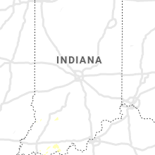
Hail Map for Sunday, June 23, 2019

Number of Impacted Households on 6/23/2019
0
Impacted by 1" or Larger Hail
0
Impacted by 1.75" or Larger Hail
0
Impacted by 2.5" or Larger Hail
Square Miles of Populated Area Impacted on 6/23/2019
0
Impacted by 1" or Larger Hail
0
Impacted by 1.75" or Larger Hail
0
Impacted by 2.5" or Larger Hail


Cities Most Affected by Hail Storms of 6/23/2019
| Hail Size | Demographics of Zip Codes Affected | ||||||
|---|---|---|---|---|---|---|---|
| City | Count | Average | Largest | Pop Density | House Value | Income | Age |
| Ellsworth, KS | 2 | 1.88 | 2.00 | 13 | $48k | $37.4k | 39.8 |
| Seymour, TX | 1 | 2.50 | 2.50 | 4 | $34k | $24.5k | 47.1 |
| Stamford, TX | 1 | 1.75 | 1.75 | 20 | $32k | $25.6k | 45.2 |
| May, TX | 1 | 1.75 | 1.75 | 13 | $38k | $32.2k | 52.7 |
| Lindsborg, KS | 1 | 1.75 | 1.75 | 29 | $84k | $40.9k | 40.5 |
Hail and Wind Damage Spotted on 6/23/2019
Filter by Report Type:Hail ReportsWind Reports
States Impacted
Louisiana, Kansas, Oklahoma, Arkansas, Georgia, Missouri, Indiana, Illinois, Kentucky, South Carolina, Texas, Ohio, Mississippi, Tennessee, FloridaLouisiana
| Local Time | Report Details |
|---|---|
| 7:09 AM CDT | Trees down at the intersection of la hwy 146 and singleton roa in lincoln county LA, 51.2 miles W of Bastrop, LA |
| 5:24 PM CDT | Telephone pole fallen in roadway at corner of rice rd. & greenwood r in caddo county LA, 11 miles WSW of Shreveport, LA |
| 5:25 PM CDT | Tree down at intersection of s lakeshore dr and hwy 16 in caddo county LA, 13 miles W of Shreveport, LA |
| 5:41 PM CDT | Utility line reported down on missouri avenue... between mrytle st. & logan s in caddo county LA, 1.9 miles W of Shreveport, LA |
| 5:42 PM CDT | Utility line down at the intersection of corbitt st. and fairfax av in caddo county LA, 4.2 miles SSW of Shreveport, LA |
| 5:49 PM CDT | Trees down in the east bank district of bossier cit in bossier county LA, 1.1 miles ENE of Shreveport, LA |
| 5:57 PM CDT | Tree down on a power line near the intersection of old brownlee road and wemple roa in bossier county LA, 5.4 miles NNE of Shreveport, LA |
| 6:05 PM CDT | Trees down on hwy 162 east of bento in bossier county LA, 15.5 miles NNE of Shreveport, LA |
| 6:29 PM CDT | Trees down on hwy 371 near golf cours in webster county LA, 35 miles NNE of Shreveport, LA |
| 6:37 PM CDT | Trees down at the intersection of dorcheat rd & hwy 16 in webster county LA, 33.6 miles NE of Shreveport, LA |
| 6:40 PM CDT | Trees down in dixie inn area along doc steed r in webster county LA, 24.5 miles ENE of Shreveport, LA |
| 6:47 PM CDT | Corrected date and time. trees down on hwy 147 just inside lincoln paris in lincoln county LA, 51.4 miles E of Shreveport, LA |
| 6:52 PM CDT | Tree down on mira scotts slough rd. between gilliam scotts slough rd and hwy 7 in caddo county LA, 30.8 miles NNW of Shreveport, LA |
| 6:53 PM CDT | Trees down at the intersection of la hwy 507 and 81 in lincoln county LA, 54.8 miles E of Shreveport, LA |
| 7:00 PM CDT | Trees down at the intersection of 2nd st. and woodland dr. in simsbor in lincoln county LA, 53.8 miles WSW of Bastrop, LA |
| 7:02 PM CDT | Trees down at the intersection of la hwy 544 and 56 in lincoln county LA, 51.1 miles WSW of Bastrop, LA |
| 7:09 PM CDT | Corrected time. trees down at the intersection of la hwy 146 and singleton roa in lincoln county LA, 51.2 miles W of Bastrop, LA |
| 12:12 AM CDT | Trees down on hwy 147 just inside lincoln paris in lincoln county LA, 51.4 miles E of Shreveport, LA |
| 1:55 AM CDT | One lane of us 425 was blocked by a downed tre in morehouse county LA, 11.7 miles SE of Bastrop, LA |
| 2:12 AM CDT | Tree downed across la 585 west of oak grov in west carroll county LA, 23.1 miles ENE of Bastrop, LA |
| 2:13 AM CDT | Several trees and powerlines downed in the baskin are in franklin county LA, 37 miles SSE of Bastrop, LA |
| 2:18 AM CDT | Tree across the road at la 17 at mitchiner r in west carroll county LA, 28.3 miles ESE of Bastrop, LA |
| 7:27 AM UTC | Trees and powerlines downed in the turkey creek park area. a tree limb fell through the side of a campe in franklin county LA, 59.8 miles S of Bastrop, LA |
Kansas
| Local Time | Report Details |
|---|---|
| 7:17 AM CDT | Large trees downe in neosho county KS, 1 miles SSW of Chanute, KS |
| 7:22 AM CDT | Tree damage in tow in allen county KS, 17.3 miles N of Chanute, KS |
| 7:22 AM CDT | 60 to 70 mph wind in allen county KS, 7.8 miles NNE of Chanute, KS |
| 2:42 PM CDT | Ping Pong Ball sized hail reported near Winona, KS, 25.5 miles SSW of Colby, KS, storm chaser reported quarter to ping pong size hail in winona. |
| 2:42 PM CDT | Quarter sized hail reported near Winona, KS, 25.5 miles SSW of Colby, KS, trained spotter in winona reported hail up to quarter size. |
| 2:45 PM CDT | Quarter sized hail reported near Winona, KS, 25.5 miles SSW of Colby, KS, public reported via facebook quarter size hail in winona. also reported 35 mph winds and a little over an inch of rain from the passing storm. |
| 2:48 PM CDT | Quarter sized hail reported near Winona, KS, 25.5 miles SSW of Colby, KS, em reported roughly quarter size hail in winona. |
| 3:30 PM CDT | Quarter sized hail reported near Oakley, KS, 33.2 miles SSE of Colby, KS, up to quarter sized hail reported. wind gusts up to 43 mph. via facebook. |
| 3:55 PM CDT | Quarter sized hail reported near Grinnell, KS, 40.2 miles SE of Colby, KS, public reported drifts of hail from dime to quarter size as well as strong winds. |
| 7:03 PM CDT | Ping Pong Ball sized hail reported near Ellsworth, KS, 60.2 miles E of Hays, KS |
| 7:11 PM CDT | Ping Pong Ball sized hail reported near Ellsworth, KS, 60.2 miles E of Hays, KS |
| 7:14 PM CDT | Hen Egg sized hail reported near Ellsworth, KS, 64.1 miles ESE of Hays, KS |
| 7:17 PM CDT | Golf Ball sized hail reported near Ellsworth, KS, 64.2 miles E of Hays, KS, hail covering ground... numerous reports of broken glass |
| 7:37 PM CDT | Quarter sized hail reported near Brookville, KS, 75.9 miles NNW of Wichita, KS |
| 8:02 PM CDT | Golf Ball sized hail reported near Lindsborg, KS, 63.6 miles NNW of Wichita, KS, nickel to golfball |
Oklahoma
| Local Time | Report Details |
|---|---|
| 7:28 AM CDT | Measured 50kt/58mph gust at tulsa asos in tulsa county OK, 4.3 miles ESE of Tulsa, OK |
| 7:30 AM CDT | Tree damage reported by a media storm tracker at woodward park in tuls in tulsa county OK, 4.3 miles ESE of Tulsa, OK |
| 7:30 AM CDT | Trees down near 24th and marion in tulsa. a portion of one tree fell on a car. relayed by broadcast medi in tulsa county OK, 4.3 miles ESE of Tulsa, OK |
| 7:30 AM CDT | Photos of large tree limbs downed near 78th street north and 129th east avenue in owasso. relayed via emergency management social media account in tulsa county OK, 12.8 miles NE of Tulsa, OK |
| 7:45 AM CDT | Tree damage relayed by media storm tracker. time estimate in creek county OK, 33.2 miles W of Tulsa, OK |
| 7:50 AM CDT | Significant damage to the metal stands at the football field in mannford. pics relayed via spotter twitter accoun in creek county OK, 20 miles W of Tulsa, OK |
| 9:45 AM CDT | A veranda roof was damaged... wind was measured at 61 mph in okmulgee county OK, 44.1 miles S of Tulsa, OK |
| 4:19 PM CDT | Quarter sized hail reported near Duncan, OK, 51.8 miles NE of Wichita Falls, TX, relayed from kswo tv. |
| 4:31 PM CDT | 3-inch tree limbs and utility poles broke in garvin county OK, 53.3 miles SSE of Oklahoma City, OK |
| 6:57 PM CDT | Trees down near lukfata baptist church just west of broken bo in mccurtain county OK, 53.2 miles W of Nashville, AR |
| 7:45 PM CDT | Several trees downed in and around broken bow... oklahom in mccurtain county OK, 50.3 miles W of Nashville, AR |
| 9:20 PM CDT | Storm damage reported in ellis county OK, 36.2 miles SW of Woodward, OK |
Arkansas
| Local Time | Report Details |
|---|---|
| 9:25 AM CDT | Tree damage noted southeast of siloam springs. one tree is blocking highway 16. relayed via twitte in benton county AR, 55.2 miles N of Fort Smith, AR |
| 9:55 AM CDT | Tree damage noted southeast of siloam springs. one tree is blocking highway 16. relayed via twitte in benton county AR, 55.2 miles N of Fort Smith, AR |
| 10:10 AM CDT | Numerous trees and power lines downed. pics relayed via broadcast media twitte in washington county AR, 55.9 miles N of Fort Smith, AR |
| 10:15 AM CDT | Tree damage in rogers. pics relayed by broadcast media twitter accoun in benton county AR, 67.3 miles NNE of Fort Smith, AR |
| 10:15 AM CDT | Tree damage noted at intersection of don tyson and gene george south of arvest ballpark. relayed via storm chaser twitter accoun in washington county AR, 54.3 miles NNE of Fort Smith, AR |
| 10:20 AM CDT | Significant tree damage noted in the bethel heights area. a portable basketball goal with its base weighted down with water was blown over. pics and additional info rel in benton county AR, 59.9 miles NNE of Fort Smith, AR |
| 10:25 AM CDT | Shingles removed from a roof near shady grove road and highway 71b in springdal in washington county AR, 55.7 miles NNE of Fort Smith, AR |
| 12:24 PM CDT | Trained storm spotter reported several large trees uprooted near and just east of clarkridge. damage to power lines and power poles as wel in baxter county AR, 73.7 miles SE of Springfield, MO |
| 12:24 PM CDT | Reports of numerous trees down near mountain home in the buffalo ridge area. many trees were blocking roads... but there was no structural damage reported at this tim in baxter county AR, 78.2 miles SE of Springfield, MO |
| 12:34 PM CDT | Johnson county emergency management reports trees and power lines downed in the hunt community... harmony community... and the oak grove/batson areas of johnson count in johnson county AR, 49.9 miles ENE of Fort Smith, AR |
| 12:58 PM CDT | A tree was blown down on a vehicle. another tree was blown down causing damage to property. trees were blown down in various locations around calico roc in izard county AR, 95.6 miles N of Little Rock, AR |
| 1:18 PM CDT | A tree was blown down on a house causing significant structual damag in izard county AR, 92.8 miles NNE of Little Rock, AR |
| 1:33 PM CDT | Power lines were blown down in evening shade... relayed by lawrence county oe in scott county AR, 33.9 miles SSE of Fort Smith, AR |
| 1:33 PM CDT | Power lines were blown down in evening shade... relayed by lawrence county oe in sharp county AR, 98.3 miles NNE of Little Rock, AR |
| 2:00 PM CDT | Several trees were blown down... and the roof of a home had damage to its shingle in lawrence county AR, 93.4 miles NW of Memphis, TN |
| 2:21 PM CDT | Several large limbs were blown dow in lawrence county AR, 89.2 miles NW of Memphis, TN |
| 2:21 PM CDT | Trees were blown down... and large limbs were taken down as well. estimated 60 mph wind gus in jackson county AR, 76.5 miles NW of Memphis, TN |
| 2:23 PM CDT | Trees and power lines were blown down. a tree was blown down onto a truc in randolph county AR, 92.4 miles NNW of Memphis, TN |
| 2:27 PM CDT | The awos at walnut ridge municipal airport measured a wind gust of 61 mph (53 knots in lawrence county AR, 81.6 miles NW of Memphis, TN |
| 2:29 PM CDT | Trees and power lines were blown dow in perry county AR, 28 miles NW of Little Rock, AR |
| 2:35 PM CDT | A tree was blown dow in perry county AR, 36.3 miles NW of Little Rock, AR |
| 2:40 PM CDT | Storm damage reported in white county AR, 65.4 miles NE of Little Rock, AR |
| 2:40 PM CDT | Large tree down in residents yar in craighead county AR, 67.4 miles NW of Memphis, TN |
| 2:44 PM CDT | Social media report of a sign bent in the southbound lane of red wold blvd... near race r in craighead county AR, 53 miles NNW of Memphis, TN |
| 2:55 PM CDT | Bleachers down down onto brookland hs football fiel in craighead county AR, 60.4 miles NNW of Memphis, TN |
| 2:55 PM CDT | Large tree down on cr 74 in craighead county AR, 60.6 miles NNW of Memphis, TN |
| 3:00 PM CDT | Social media report of tree down in residents yar in greene county AR, 64.6 miles NNW of Memphis, TN |
| 6:43 PM CDT | Tree knocked power line down near w 4th st. and s mockingbird l in hempstead county AR, 24.4 miles SE of Nashville, AR |
| 6:52 PM CDT | A tree was blown down on south melton street. another tree was blown onto power lines along north norwood street and along south main stree in chicot county AR, 58.1 miles NNE of Bastrop, LA |
| 7:40 PM CDT | Several large trees were blown dow in drew county AR, 58.5 miles N of Bastrop, LA |
| 7:55 PM CDT | A tree was downed on hey 41 north of horatio... arkansa in sevier county AR, 27.8 miles W of Nashville, AR |
| 8:40 PM CDT | Several large trees were blown dow in drew county AR, 58.5 miles N of Bastrop, LA |
| 10:27 PM CDT | Trees down at the intersection of hwy 19 s and county road 20 in columbia county AR, 56.9 miles NNE of Shreveport, LA |
Georgia
| Local Time | Report Details |
|---|---|
| 1:19 PM EDT | A roof was knocked off a barn off the 900th block of christopher r in coweta county GA, 29.4 miles SSW of Atlanta, GA |
| 2:18 PM EDT | Trees down near the intersection of caldwell rd and quail rd sw of williamso in pike county GA, 41.6 miles S of Atlanta, GA |
| 2:37 PM EDT | Quarter sized hail reported near Culloden, GA, 63 miles SSE of Atlanta, GA, quarter sized hail reported at culloden ga w of macon. |
| 3:00 PM EDT | Tree down in midtown atlanta near the intersection of juniper st ne and 11th st. ne in fulton county GA, 2.3 miles NNE of Atlanta, GA |
| 3:04 PM EDT | Large tree down in the road near the intersection of hillside dr sw and grayson hwy sw near lawrenceville in gwinnett county GA, 26.7 miles ENE of Atlanta, GA |
| 3:05 PM EDT | Quarter sized hail reported near Juliette, GA, 64.8 miles SSE of Atlanta, GA, quarter sized hail reported in bolingbroke ga nw of macon. |
| 3:06 PM EDT | Trees down in rocky face ga near the intersection of enclave dr and mill creek rd west of dalton g in whitfield county GA, 23.9 miles SE of Chattanooga, TN |
| 3:06 PM EDT | Trees reported down along the 300th block of summers mckoy rd w of newnan g in coweta county GA, 39.3 miles SW of Atlanta, GA |
| 3:12 PM EDT | A downed powerline caused a residential fire on the 1200 block of lakeridge lane north of macon g in jones county GA, 69.9 miles SE of Atlanta, GA |
| 3:15 PM EDT | Powerlines reported down along mansfield rd sout of hawkinsville g in pulaski county GA, 64.1 miles NW of Douglas, GA |
| 3:19 PM EDT | Atl asos measured a wind gust at 50 kt in clayton county GA, 7.8 miles SSW of Atlanta, GA |
| 3:24 PM EDT | Trees down over the road near the intersection of adahi and new clinton drive ne of macon g in jones county GA, 76.6 miles SE of Atlanta, GA |
| 3:30 PM EDT | 1 tree down near airport rd and ben hill rd in whitfield county GA, 30.5 miles SE of Chattanooga, TN |
| 4:24 PM EDT | Trees and powerlines reported down along macedonia rd near the intersection of macedonia and poplar hill r in newton county GA, 38.9 miles ESE of Atlanta, GA |
| 4:30 PM EDT | A tree fell on a powerline that sparked a residential fire on the 1200 block of lakeridge ct s in gwinnett county GA, 25.6 miles ENE of Atlanta, GA |
| 4:30 PM EDT | A tree was knocked down against a powerline near the intersection of fence road ne and bailey woods rd ne in dacula g in monroe county GA, 58 miles SSE of Atlanta, GA |
| 4:31 PM EDT | A tree fell on a powerline near the intersection of house road sw and memory way s in gwinnett county GA, 26.7 miles ENE of Atlanta, GA |
| 4:33 PM EDT | Several trees down on broadnax mill rd near youth... ga in walton county GA, 31.9 miles E of Atlanta, GA |
| 4:33 PM EDT | Trees and powerlines down on sunset ct... on the ne side of lake varner in walton county GA, 34.9 miles E of Atlanta, GA |
| 4:41 PM EDT | Trees down over the roadway on the 3100 block of plantation run drive sw in loganville g in gwinnett county GA, 27.8 miles ENE of Atlanta, GA |
| 4:44 PM EDT | Trees and powerslines down on stock rd... nw of monro in walton county GA, 36 miles ENE of Atlanta, GA |
| 4:48 PM EDT | Tree down over the road near the intersection of ga-53 and e church st in jasper g in pickens county GA, 49.8 miles N of Atlanta, GA |
| 4:48 PM EDT | Emergency manager reported several trees down along highway 221 near huffer. time is estimated based on radar imager in coffee county GA, 5.1 miles NE of Douglas, GA |
| 4:48 PM EDT | Tree down over the road near the intersection of church st and brittany lane in jasper g in pickens county GA, 48.4 miles N of Atlanta, GA |
| 4:58 PM EDT | Report of trees and powerlines down on marion ivie rd just south of good hope... ga in walton county GA, 45.6 miles E of Atlanta, GA |
| 5:06 PM EDT | Powerline down near the intersection of river oak dr and hwy 129 in putnam county GA, 65.4 miles ESE of Atlanta, GA |
| 5:06 PM EDT | Trees down near the intersection of oliver bridge rd and flat rock rd south of athen in oconee county GA, 61.8 miles E of Atlanta, GA |
| 5:08 PM EDT | Tree down near ga hwy 83 and little river rd in morgan county GA, 52.4 miles ESE of Atlanta, GA |
| 5:10 PM EDT | Tree down near monticello rd and lions club rd in morgan county GA, 53.4 miles ESE of Atlanta, GA |
| 5:36 PM EDT | Trees reported down along state road 44 south of i-2 in greene county GA, 68.5 miles ESE of Atlanta, GA |
| 7:31 PM EDT | Multiple tree limbs were reported to have fallen on powerlines by the 911 center near cab dr and halcyondale rd. time is estimated by rada in screven county GA, 53.8 miles NW of Savannah, GA |
Missouri
| Local Time | Report Details |
|---|---|
| 12:34 PM CDT | Corrects previous tstm wnd dmg report from west plains to add more information. reports of tops of trees broken off many yards. power lines down. wendy time radar estim in howell county MO, 65 miles SSW of Salem, MO |
| 1:54 PM CDT | Trees down on hwy b between highway 21 and hwy 6 in carter county MO, 69.4 miles SE of Salem, MO |
| 2:19 PM CDT | Trees down on a house and cars on county road 46 in butler county MO, 69.5 miles SW of Cape Girardeau, MO |
| 2:19 PM CDT | Roof damage and trees down on county road 470. lots of trees down in that same general are in butler county MO, 65.1 miles SW of Cape Girardeau, MO |
| 3:19 PM CDT | Storm damage reported in dunklin county MO, 55.4 miles SSW of Cape Girardeau, MO |
| 3:22 PM CDT | Siding peeled back on a house and tree limbs dow in cape girardeau county MO, 12.9 miles WSW of Cape Girardeau, MO |
| 3:38 PM CDT | Corrects previous tstm wnd gst report from 4 sw cape girardeau. 60 mph winds reported at exit 93 on interstate 55 northboun in cape girardeau county MO, 3.8 miles SW of Cape Girardeau, MO |
| 3:39 PM CDT | Storm damage reported in dunklin county MO, 75.2 miles N of Memphis, TN |
| 3:43 PM CDT | Powerline down on hwy in cardwell mo... lighting grass on fir in dunklin county MO, 63.5 miles NNW of Memphis, TN |
| 3:43 PM CDT | A church steeple was blown of in dunklin county MO, 61.5 miles N of Memphis, TN |
| 4:17 PM CDT | Large tree time down. time estimate in stoddard county MO, 27.2 miles SW of Cape Girardeau, MO |
| 4:22 PM CDT | Mping report of one inch limbs down between charleston and wyat in mississippi county MO, 28.7 miles SSE of Cape Girardeau, MO |
Indiana
| Local Time | Report Details |
|---|---|
| 1:45 PM EDT | Emergency manager got report of tree down near brucevill in knox county IN, 54.7 miles N of Evansville, IN |
| 1:46 PM EDT | Delayed report. numerous trees and power lines down north of petersburg and in winslo in pike county IN, 39.3 miles NNE of Evansville, IN |
| 1:47 PM EDT | Tree fell on house in bicknel in knox county IN, 57.2 miles NNE of Evansville, IN |
| 2:10 PM EDT | Delayed report...dispatch reported a couple of trees down west of huntingburg near the county lin in dubois county IN, 35.4 miles NE of Evansville, IN |
| 2:12 PM EDT | Several large tree limbs snapped on the northside of loogootee. time estimated from rada in martin county IN, 60.1 miles NE of Evansville, IN |
| 2:13 PM EDT | Dispatch reported several trees down in coalmont. time estimated from rada in clay county IN, 64.6 miles ESE of Mattoon, IL |
| 2:25 PM EDT | Several large trees uprooted and numerous tree limbs snapped with power outages reported in clay city. time estimated from rada in clay county IN, 61.3 miles WSW of Indianapolis, IN |
| 2:27 PM EDT | Sheriffs office reports widespread tree damage across the count in greene county IN, 65.8 miles SW of Indianapolis, IN |
| 1:34 PM CDT | Delayed report. two trees down on county road 1100 north. one tree down west of county road 600 east and one tree down east of county road 600 eas in spencer county IN, 30.1 miles E of Evansville, IN |
| 2:36 PM EDT | Large tree down on state road 46 near bowling gree in clay county IN, 55.1 miles WSW of Indianapolis, IN |
| 2:38 PM EDT | Several trees uprooted around the indiana springs area. time estimated from rada in martin county IN, 72.5 miles NE of Evansville, IN |
| 2:51 PM EDT | Pole barn destroyed... dump truck tipped over... and numerous large trees snapped and uproote in monroe county IN, 50.5 miles SSW of Indianapolis, IN |
| 3:10 PM EDT | Small and decent size limbs down... power out as a result of storm in morgan county IN, 36.1 miles SW of Indianapolis, IN |
| 3:22 PM EDT | Several large tree limbs reported to have snapped along state road 46 east of nashville. power outages reported also in gnaw bon in brown county IN, 39.1 miles S of Indianapolis, IN |
| 2:25 PM CDT | Tree down on boyd road near sr 237. time estimated based on rada in perry county IN, 46.1 miles E of Evansville, IN |
| 3:27 PM EDT | 10 inch diameter live tree snapped off at bas in hendricks county IN, 17.1 miles W of Indianapolis, IN |
| 3:41 PM EDT | Storm damage reported in marion county IN, 7 miles SSW of Indianapolis, IN |
| 3:43 PM EDT | Social media report of trees down in greenwood with picture of tree limb on the road. time estimated from rada in johnson county IN, 10.6 miles SSE of Indianapolis, IN |
| 3:50 PM EDT | Delayed report of a tree down in leavenworth. time estimated based on rada in crawford county IN, 37.5 miles WNW of Louisville, KY |
| 4:00 PM EDT | Transformer blew as storms passed throug in marion county IN, 9.4 miles NE of Indianapolis, IN |
| 4:11 PM EDT | Numerous trees and power lines down across fortvill in hancock county IN, 20 miles NE of Indianapolis, IN |
| 4:14 PM EDT | Multiple trees down in corydo in harrison county IN, 27.2 miles NW of Louisville, KY |
| 8:10 PM EDT | Tree limbs down. one tree uproote in marshall county IN, 71.4 miles ESE of Chicago, IL |
Illinois
| Local Time | Report Details |
|---|---|
| 1:45 PM CDT | Power lines down at intersection of perrysville ave and griffin s in vermilion county IL, 59.9 miles NE of Mattoon, IL |
| 5:15 PM CDT | Wind damage including trees down on eddyville blacktop roa in pope county IL, 58.5 miles E of Cape Girardeau, MO |
Kentucky
| Local Time | Report Details |
|---|---|
| 1:50 PM CDT | Several trees down and power is ou in henderson county KY, 13.8 miles SE of Evansville, IN |
| 2:00 PM CDT | Delayed report. tree down near state road 949. additional report of tree down near greenvill in muhlenberg county KY, 66.7 miles SSE of Evansville, IN |
| 2:12 PM CDT | Quarter sized hail reported near Owensboro, KY, 25.6 miles ESE of Evansville, IN, nickel to quarter size hail. |
| 2:15 PM CDT | Several trees down across the county along with 4 broken power poles on wrecc line in simpson county KY, 37.9 miles N of Nashville, TN |
| 2:33 PM CDT | Delayed report...tree down on hwy 271 sout in hancock county KY, 42.1 miles E of Evansville, IN |
| 2:43 PM CDT | Three trees down on brownsville roa in butler county KY, 69.9 miles SE of Evansville, IN |
| 3:09 PM CDT | Tree down on houchin ferry roa in edmonson county KY, 62.3 miles SSW of Louisville, KY |
| 3:15 PM CDT | Reported at leitchfiel in grayson county KY, 47 miles SW of Louisville, KY |
| 3:18 PM CDT | Tree down on a power line on nolin dam roa in edmonson county KY, 56.9 miles SSW of Louisville, KY |
| 4:41 PM EDT | Reported at louisville international airpor in jefferson county KY, 15.7 miles NW of Louisville, KY |
| 3:50 PM CDT | Several trees and power lines down in northern barren count in barren county KY, 69.6 miles S of Louisville, KY |
| 4:55 PM EDT | Large tree dow in jefferson county KY, 25.6 miles NNE of Louisville, KY |
| 4:55 PM EDT | Large tree dow in jefferson county KY, 18.4 miles NNE of Louisville, KY |
| 5:00 PM EDT | Numerous trees and power lines down across the count in oldham county KY, 32.2 miles NNE of Louisville, KY |
| 5:02 PM EDT | Several trees reported down across the county...with this one the farthest west...the 5500 block of fisherville road. time estimated from rada in shelby county KY, 21.4 miles NE of Louisville, KY |
| 4:10 PM CDT | Several trees down in central metcalfe count in metcalfe county KY, 69.7 miles S of Louisville, KY |
| 4:26 PM CDT | Two trees snapped. time estimate in ballard county KY, 40.8 miles SE of Cape Girardeau, MO |
| 5:26 PM EDT | Tree down on heinzville road and hwy 1 in shelby county KY, 38.8 miles ENE of Louisville, KY |
| 4:40 PM CDT | Large tree down on home. time estimate in graves county KY, 48.4 miles NNW of Mc Kenzie, TN |
| 4:43 PM CDT | Structural damage on a farm... including sections of roofs removed... damaged grain bins... and tree damage. time estimate in mccracken county KY, 49.6 miles ESE of Cape Girardeau, MO |
| 4:45 PM CDT | Several old growth trees uprooted... several large healthy branches down... siding ripped off pole barn. time estimate in mccracken county KY, 51 miles ESE of Cape Girardeau, MO |
| 4:45 PM CDT | Several trees down in central adair count in adair county KY, 64.1 miles SSE of Louisville, KY |
| 4:45 PM CDT | Large tree through a hom in ballard county KY, 39.3 miles ESE of Cape Girardeau, MO |
| 4:45 PM CDT | Numerous tree large limbs and trees down in hickory and viol in graves county KY, 47.9 miles N of Mc Kenzie, TN |
| 4:48 PM CDT | Tree damage with a semi truck overturned near pilgrims pride. metal outbuilding with damage. time estimate in graves county KY, 47.9 miles N of Mc Kenzie, TN |
| 4:49 PM CDT | Storm damage reported in mccracken county KY, 48.8 miles ESE of Cape Girardeau, MO |
| 4:53 PM CDT | Restaurant signs blown down and windows blown out of storefront on southside of paduca in mccracken county KY, 55.2 miles ESE of Cape Girardeau, MO |
| 4:53 PM CDT | Large tree fell down onto a fence and the side of a house. time estimate in mccracken county KY, 59.5 miles ESE of Cape Girardeau, MO |
| 4:53 PM CDT | Roof damage to a former church. time estimate in mccracken county KY, 55.1 miles ESE of Cape Girardeau, MO |
| 4:53 PM CDT | Trees down. time estimate in graves county KY, 48.8 miles N of Mc Kenzie, TN |
| 4:54 PM CDT | Soffit blown off a hom in mccracken county KY, 60.5 miles N of Mc Kenzie, TN |
| 5:58 PM EDT | Facebook report of several trees down in perryville. time estimated based on rada in boyle county KY, 48 miles ESE of Louisville, KY |
| 5:04 PM CDT | Mobile home destroyed. time estimate in livingston county KY, 64.1 miles E of Cape Girardeau, MO |
| 5:05 PM CDT | Church in town has major roof damag in livingston county KY, 64.1 miles E of Cape Girardeau, MO |
| 5:07 PM CDT | Trees down. time estimate in marshall county KY, 53.9 miles N of Mc Kenzie, TN |
| 5:10 PM CDT | Trees and power lines dow in russell county KY, 71.2 miles SW of Irvine, KY |
| 5:15 PM CDT | Major damage at moors marin in marshall county KY, 58.3 miles NNE of Mc Kenzie, TN |
| 5:15 PM CDT | Large tree down. time estimate in livingston county KY, 65.4 miles E of Cape Girardeau, MO |
| 6:15 PM EDT | Large tree down over roadway in the 600 block of cane run. time estimated based on rada in scott county KY, 48.8 miles NW of Irvine, KY |
| 5:20 PM CDT | Power lines down and large trees uprooted in and near salem. windows blown out of business downtown sale in livingston county KY, 61.2 miles SW of Evansville, IN |
| 6:21 PM EDT | Trees dow in wayne county KY, 76.4 miles SW of Irvine, KY |
| 6:37 PM EDT | A tree was blown down along ky highway 19 in pulaski county KY, 60.9 miles SW of Irvine, KY |
| 6:41 PM EDT | Several areas in casey county are without power including liberty... contown... calhoun creek and maimie price roa in casey county KY, 58.7 miles WSW of Irvine, KY |
| 5:44 PM CDT | Large trees and power lines down... including trees on houses. time estimate in webster county KY, 41.9 miles SSW of Evansville, IN |
| 5:45 PM CDT | Numerous trees down in providence in the tower drive - baptist hill are in webster county KY, 41.1 miles SSW of Evansville, IN |
| 6:46 PM EDT | Branches down and trees swingin in pulaski county KY, 63.3 miles SSW of Irvine, KY |
| 5:52 PM CDT | Tree down near sixth vein road and highway 70. time estimate in hopkins county KY, 49.2 miles S of Evansville, IN |
| 6:53 PM EDT | A tree was blown down along ky highway 7 in pulaski county KY, 47.1 miles SW of Irvine, KY |
| 7:13 PM EDT | A tree was reported to have been blown dow in estill county KY, 6.6 miles NNW of Irvine, KY |
| 7:15 PM EDT | Several trees down across clark count in clark county KY, 20.9 miles NNW of Irvine, KY |
| 7:19 PM EDT | A tree was reported to have been blown dow in estill county KY, 4.6 miles NNE of Irvine, KY |
| 6:20 PM CDT | Wires down. time estimate in henderson county KY, 20.5 miles S of Evansville, IN |
| 6:23 PM CDT | Tree down on a house. roof torn off a tool shed. time estimate in mclean county KY, 40.6 miles SE of Evansville, IN |
| 6:26 PM CDT | Large tree that was 100 to 150 years old uprooted. time estimate in mclean county KY, 40.7 miles SE of Evansville, IN |
| 6:26 PM CDT | Large tree down. time estimate in muhlenberg county KY, 47.3 miles SSE of Evansville, IN |
| 7:27 PM EDT | Powerlines were blown dow in montgomery county KY, 24.3 miles N of Irvine, KY |
| 7:31 PM EDT | A tree was blown down on sidney driv in montgomery county KY, 24.9 miles N of Irvine, KY |
| 6:35 PM CDT | Trees and power lines down in central ohio count in ohio county KY, 51.8 miles SE of Evansville, IN |
| 7:36 PM EDT | Trees down near dollier miller roada nd ky highway 137 in laurel county KY, 34.5 miles SSW of Irvine, KY |
| 7:40 PM EDT | A tree was reported to have been blown down on short roa in bath county KY, 29.4 miles NNE of Irvine, KY |
| 7:40 PM EDT | Tree down on mcwhorter r in laurel county KY, 36.8 miles S of Irvine, KY |
| 6:58 PM CDT | Tree down on tick ridge roa in hancock county KY, 44.4 miles E of Evansville, IN |
| 8:08 PM EDT | A tree was reported to have been blown dow in bath county KY, 31.4 miles NE of Irvine, KY |
| 8:09 PM EDT | Trees down on leatherwood road just east of the bath county lin in menifee county KY, 32.2 miles NE of Irvine, KY |
South Carolina
| Local Time | Report Details |
|---|---|
| 4:03 PM EDT | Tree blown down on wilsontown roa in laurens county SC, 33.9 miles SE of Greenville, SC |
| 4:12 PM EDT | County official reports many trees blown down across the county. time averaged from rada in laurens county SC, 39.7 miles SE of Greenville, SC |
| 4:12 PM EDT | One tree dow in laurens county SC, 41.9 miles SE of Greenville, SC |
| 7:28 PM EDT | Schp reported a tree down at hwy 278 and rock spring road. time is estimated by rada in hampton county SC, 48.2 miles N of Savannah, GA |
| 7:46 PM EDT | The south carolina highway patrol reports a tree down on good hope road near shady pass. time estimated based on rada in hampton county SC, 44.8 miles N of Savannah, GA |
Texas
| Local Time | Report Details |
|---|---|
| 3:12 PM CDT | Quarter sized hail reported near , , 4.3 miles N of Wichita Falls, TX |
| 3:27 PM CDT | Storm damage reported in wichita county TX, 5 miles N of Wichita Falls, TX |
| 4:15 PM CDT | Trees down at the intersection of us hwy 79 and fm 179 in rusk county TX, 54.8 miles WSW of Shreveport, LA |
| 4:31 PM CDT | Tennis Ball sized hail reported near Seymour, TX, 40.8 miles WSW of Wichita Falls, TX |
| 4:32 PM CDT | Trees down at intersection of fm 1798 and fm 84 in rusk county TX, 48.9 miles N of Lufkin, TX |
| 4:33 PM CDT | Corrects previous tstm wnd dmg report from 10 sw beckville. trees down at the intersection of us hwy 79 and fm 179 in rusk county TX, 54.8 miles WSW of Shreveport, LA |
| 4:33 PM CDT | Corrected lat/lon. trees down at the intersection of us hwy 79... fm 1798... and tx hwy 4 in rusk county TX, 50.2 miles NNW of Lufkin, TX |
| 4:50 PM CDT | Trees down on fm 13 2 miles e of price on the cherokee/rusk county lin in rusk county TX, 55.1 miles NNW of Lufkin, TX |
| 4:50 PM CDT | Corrects previous tstm wnd dmg report from 8 w henderson. trees down on fm 13 2 miles e of pric in rusk county TX, 56.3 miles NNW of Lufkin, TX |
| 4:51 PM CDT | Trees down on power line in front of a residence along country road 303 in panola county TX, 40.3 miles WSW of Shreveport, LA |
| 4:53 PM CDT | Tree down along hwy 80 near longview city limit in harrison county TX, 53.9 miles W of Shreveport, LA |
| 5:00 PM CDT | Trees down on fm 13 2 miles e of pric in rusk county TX, 56.3 miles NNW of Lufkin, TX |
| 5:02 PM CDT | Quarter sized hail reported near Sweetwater, TX, 39.1 miles W of Abilene, TX, quarter size hail was reported on i-20 on the south side of sweetwater. |
| 5:16 PM CDT | Trees down at the intersection of us hwy 80 and fm 968 west of marshal in harrison county TX, 40.5 miles W of Shreveport, LA |
| 5:23 PM CDT | Half Dollar sized hail reported near Seymour, TX, 36.2 miles SW of Wichita Falls, TX |
| 5:24 PM CDT | Tree blocking road on fm 1997 about 5 miles north of tx loop 39 in harrison county TX, 39 miles WNW of Shreveport, LA |
| 5:26 PM CDT | Power lines down in woodlawn... tx area along hwy 59 in harrison county TX, 36.2 miles WNW of Shreveport, LA |
| 5:34 PM CDT | Corrects previous tstm wnd dmg report from 4 nw jefferson. strong winds knocked power lines dow in marion county TX, 43.3 miles WNW of Shreveport, LA |
| 5:34 PM CDT | Tree down by 411 s friou st in jefferson... t in marion county TX, 39 miles WNW of Shreveport, LA |
| 5:35 PM CDT | Tree reported hanging over 4-5ft over road along hwy 49 w near city limits of jefferson... t in marion county TX, 39.1 miles WNW of Shreveport, LA |
| 5:59 PM CDT | The 60 mph wind was reported at abilene christian universit in taylor county TX, 0.7 miles E of Abilene, TX |
| 6:02 PM CDT | Several large tree limbs were knocked down by damaging thunderstorm winds as seen on photo in social medi in taylor county TX, 2.7 miles S of Abilene, TX |
| 6:03 PM CDT | 1 to 3 inch tree limbs down at interstate 20 and old anson road. there were also reports of some power outages at winters freeway and north 1s in taylor county TX, 4.2 miles N of Abilene, TX |
| 6:09 PM CDT | The kabi asos recorded a 61 mph wind gust at 609 p in taylor county TX, 4.5 miles SE of Abilene, TX |
| 6:18 PM CDT | Quarter sized hail reported near Abilene, TX, 4.1 miles S of Abilene, TX, broadcast media passed along a report of quarter size hail in south abilene on social media. |
| 6:23 PM CDT | Quarter sized hail reported near Buffalo Gap, TX, 12.1 miles SSW of Abilene, TX |
| 6:28 PM CDT | Volunteer fire department in clyde estimated this wind spee in callahan county TX, 14.4 miles E of Abilene, TX |
| 6:28 PM CDT | Golf Ball sized hail reported near Stamford, TX, 34.7 miles N of Abilene, TX |
| 7:25 PM CDT | Quarter sized hail reported near Gruver, TX, 75.1 miles NNE of Amarillo, TX, mostly dime to nickel with a few quarter size hail stones just south of gruver. time estimated based on radar. |
| 7:47 PM CDT | Half Dollar sized hail reported near Spearman, TX, 72.3 miles NNE of Amarillo, TX, hail occurred at county road cc and 26. photo and information posted on twitter. |
| 7:48 PM CDT | Trees and power lines blown down along with damage to roof in callahan county TX, 20.8 miles E of Abilene, TX |
| 8:30 PM CDT | Half Dollar sized hail reported near Mineral Wells, TX, 76 miles W of Dallas, TX |
| 8:37 PM CDT | Trees down causing some power outages. report relayed via twitte in titus county TX, 84.5 miles SW of Nashville, AR |
| 8:52 PM CDT | 63 mph gust mearured at fort worth naval air station in tarrant county TX, 38.2 miles W of Dallas, TX |
| 8:54 PM CDT | Storm damage reported in parker county TX, 49.8 miles W of Dallas, TX |
| 8:55 PM CDT | Quarter sized hail reported near Canadian, TX, 56.3 miles WSW of Woodward, OK, quarter size hail lasted about 3 minutes. wind was estimated 40 to 50 mph with a few peak gusts around 60 mph. |
| 8:55 PM CDT | Quarter size hail lasted about 3 minutes. wind was estimated 40 to 50 mph with a few peak gusts around 60 mp in hemphill county TX, 56.3 miles WSW of Woodward, OK |
| 8:55 PM CDT | 69 mph wind gust at fort worth meacham in tarrant county TX, 32 miles W of Dallas, TX |
| 9:00 PM CDT | 64 mph wind gust measured at the fort worth wfo in tarrant county TX, 32.1 miles W of Dallas, TX |
| 9:02 PM CDT | Quarter sized hail reported near Canadian, TX, 65.7 miles WSW of Woodward, OK |
| 9:10 PM CDT | Trees down in hurst... bedford... and euless. one tree fell on a home. some damage to power lines. time estimate in tarrant county TX, 20.8 miles W of Dallas, TX |
| 9:29 PM CDT | Measured wind gust at dallas executive airport in dallas county TX, 6.9 miles SSW of Dallas, TX |
| 9:30 PM CDT | Damage to trees... power lines... and roofs in everman. time estimate in tarrant county TX, 30 miles WSW of Dallas, TX |
| 9:55 PM CDT | Downed trees in red oa in ellis county TX, 17.8 miles S of Dallas, TX |
| 10:58 PM CDT | Golf Ball sized hail reported near May, TX, 56.7 miles SE of Abilene, TX, golf ball size hail was reported on the north side of lake brownwood. |
Ohio
| Local Time | Report Details |
|---|---|
| 5:58 PM EDT | Several large tree branches down and one tree partially uprooted. report is from wyoming near state route in hamilton county OH, 8.6 miles N of Cincinnati, OH |
Mississippi
| Local Time | Report Details |
|---|---|
| 6:15 PM CDT | Trees down along midway road. winds were likely 40-50mp in rankin county MS, 25.2 miles ENE of Jackson, MS |
| 7:12 PM CDT | A tree was blown down on highway 49 and had to be cleared from the roadway. another large limb was blown down as wel in holmes county MS, 62.2 miles N of Jackson, MS |
| 3:17 AM CDT | Multiple reports of trees and power lines down county wid in warren county MS, 39.6 miles W of Jackson, MS |
| 3:18 AM CDT | Multiple reports of trees and power lines down county wid in adams county MS, 87.3 miles SW of Jackson, MS |
| 3:48 AM CDT | Trees down on bunkley r in franklin county MS, 81.2 miles SW of Jackson, MS |
| 4:10 AM CDT | Report of uprooted trees and several large limbs downe in wilkinson county MS, 81.3 miles NE of Lafayette, LA |
| 5:40 AM CDT | Tree down on hwy 13 in jefferson davis county MS, 49.1 miles SSE of Jackson, MS |
Tennessee
| Local Time | Report Details |
|---|---|
| 6:45 PM CDT | A tree down on the trace at hickman creek r in stewart county TN, 43 miles NE of Mc Kenzie, TN |
Florida
| Local Time | Report Details |
|---|---|
| 7:49 PM EDT | A few trees down in the area of rifle road and crump roa in leon county FL, 10.7 miles ENE of Tallahassee, FL |
| 8:30 PM EDT | 911 call center reported wire down on trees along sawpit road in northeast section of jacksonville. time is based on radar imager in duval county FL, 16.1 miles NE of Jacksonville, FL |
| 8:48 PM EDT | Broadcast media relayed public report of tree down in southside near the avenues mall area. time based on radar imager in duval county FL, 12.2 miles SSE of Jacksonville, FL |
Connect with Interactive Hail Maps