

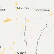
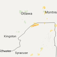
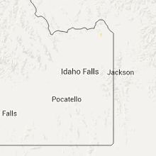
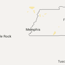
Hail Map for Tuesday, June 28, 2016

Number of Impacted Households on 6/28/2016
0
Impacted by 1" or Larger Hail
0
Impacted by 1.75" or Larger Hail
0
Impacted by 2.5" or Larger Hail
Square Miles of Populated Area Impacted on 6/28/2016
0
Impacted by 1" or Larger Hail
0
Impacted by 1.75" or Larger Hail
0
Impacted by 2.5" or Larger Hail


Cities Most Affected by Hail Storms of 6/28/2016
| Hail Size | Demographics of Zip Codes Affected | ||||||
|---|---|---|---|---|---|---|---|
| City | Count | Average | Largest | Pop Density | House Value | Income | Age |
| Coats, KS | 2 | 1.88 | 2.00 | 1 | $17k | $33.4k | 37.5 |
| Custer, SD | 2 | 1.75 | 1.75 | 8 | $92k | $36.7k | 51.5 |
| Kinsley, KS | 1 | 3.00 | 3.00 | 6 | $38k | $29.5k | 45.5 |
| New Underwood, SD | 1 | 2.00 | 2.00 | 1 | $55k | $34.9k | 41.3 |
| Wall, SD | 1 | 1.75 | 1.75 | 1 | $63k | $36.2k | 43.8 |
| Kirk, CO | 1 | 1.75 | 1.75 | 2 | $46k | $33.8k | 51.1 |
| Ashland, KS | 1 | 1.75 | 1.75 | 0 | $37k | $34.7k | 44.3 |
| Ekalaka, MT | 1 | 1.75 | 1.75 | 0 | $23k | $25.4k | 50.1 |
| Watonga, OK | 1 | 1.75 | 1.75 | 16 | $47k | $27.7k | 33.5 |
| Philip, SD | 1 | 1.75 | 1.75 | 0 | $52k | $31.7k | 49.7 |
Hail and Wind Damage Spotted on 6/28/2016
Filter by Report Type:Hail ReportsWind Reports
States Impacted
New York, Maine, Pennsylvania, West Virginia, Wyoming, Maryland, Kansas, Georgia, Tennessee, Virginia, Missouri, Texas, South Carolina, South Dakota, Oklahoma, Arizona, Idaho, Nebraska, New Jersey, Montana, ColoradoNew York
| Local Time | Report Details |
|---|---|
| 1:15 PM EDT | Quarter sized hail reported near Endicott, NY, 51.9 miles NNW of Scranton, PA |
| 1:20 PM EDT | Half Dollar sized hail reported near Peru, NY, 20.4 miles WNW of Burlington, VT |
| 1:28 PM EDT | Quarter sized hail reported near Peru, NY, 17.2 miles WNW of Burlington, VT |
| 1:30 PM EDT | Several trees down in the town of clinton in oneida county NY, 38.9 miles E of Syracuse, NY |
| 2:05 PM EDT | Trees and wires down route 5s and dyke road in oneida county NY, 47.6 miles E of Syracuse, NY |
| 2:05 PM EDT | Quarter sized hail reported near Frankfort, NY, 50 miles E of Syracuse, NY, trained spotter |
| 2:08 PM EDT | Quarter sized hail reported near Frankfort, NY, 50 miles E of Syracuse, NY, trained spotter |
| 3:14 PM EDT | Powerlines wires down in herkimer county NY, 55.7 miles E of Syracuse, NY |
| 5:05 PM EDT | Quarter sized hail reported near Fishs Eddy, NY, 46.2 miles NNE of Scranton, PA, quarter to half dollar sized hail... 1.56 inches rain past hour |
| 5:48 PM EDT | Trees down on county rt 27 near trout creek in delaware county NY, 58.1 miles NNE of Scranton, PA |
| 6:49 PM EDT | Trees and power lines dow in st. lawrence county NY, 18.3 miles NE of Ogdensburg, NY |
| 7:22 PM EDT | Quarter sized hail reported near Massena, NY, 33.7 miles ENE of Ogdensburg, NY, reported from the public. |
| 7:25 PM EDT | Quarter sized hail reported near Massena, NY, 33.7 miles ENE of Ogdensburg, NY |
| 7:38 PM EDT | Quarter sized hail reported near Brasher Falls, NY, 40.9 miles ENE of Ogdensburg, NY, nickel to quarter size hail at the helena general store |
Maine
| Local Time | Report Details |
|---|---|
| 2:02 PM EDT | 5 inch diameter tree into power lines between ashland and presque isle me on rte 16 in aroostook county ME, 24 miles SW of Caribou, ME |
Pennsylvania
| Local Time | Report Details |
|---|---|
| 3:10 PM EDT | Trees down wheatfield twp in perry county PA, 47.5 miles ESE of State College, PA |
| 3:25 PM EDT | Trees down along rt 54 in lycoming county PA, 57.6 miles ENE of State College, PA |
| 3:49 PM EDT | Damaged chicken coo in lycoming county PA, 54.5 miles WSW of Scranton, PA |
| 4:00 PM EDT | Multiple trees down via police scanner in dauphin county PA, 62.6 miles SE of State College, PA |
| 4:55 PM EDT | Quarter sized hail reported near York, PA, 50 miles N of Baltimore, MD, twitter photo emigsville/roundtown |
| 4:55 PM EDT | Trees/wires down nrn part of york/manchester twp in york county PA, 48 miles N of Baltimore, MD |
West Virginia
| Local Time | Report Details |
|---|---|
| 3:30 PM EDT | Multiple trees down on woodbrier golf course in berkeley county WV, 72.8 miles WNW of Baltimore, MD |
Wyoming
| Local Time | Report Details |
|---|---|
| 1:36 PM MDT | Ping Pong Ball sized hail reported near Gillette, WY, 5.6 miles SE of Gillette, WY |
| 1:36 PM MDT | Storm damage reported in campbell county WY, 0.3 miles SE of Gillette, WY |
| 1:47 PM MDT | Quarter sized hail reported near Gillette, WY, 5.2 miles E of Gillette, WY |
| 2:05 PM MDT | 2 se hiland /khld in natrona county WY, 52.9 miles WNW of Casper, WY |
| 2:40 PM MDT | Quarter sized hail reported near Upton, WY, 38 miles SE of Gillette, WY, 50 mph wnd gusts |
| 2:53 PM MDT | Quarter sized hail reported near Upton, WY, 48.3 miles ESE of Gillette, WY |
| 3:41 PM MDT | Sustained 47 mp in converse county WY, 27.9 miles E of Casper, WY |
| 3:43 PM MDT | Storm damage reported in converse county WY, 23.8 miles E of Casper, WY |
| 4:33 PM MDT | Quarter sized hail reported near Douglas, WY, 59.5 miles ENE of Casper, WY |
| 5:09 PM MDT | Quarter sized hail reported near Yoder, WY, 32.6 miles W of Scottsbluff, NE |
| 5:27 PM MDT | Storm damage reported in goshen county WY, 30.3 miles WNW of Scottsbluff, NE |
Maryland
| Local Time | Report Details |
|---|---|
| 3:55 PM EDT | Tree down in myersville in frederick county MD, 44.5 miles WNW of Baltimore, MD |
| 4:26 PM EDT | Tree down in new windsor in carroll county MD, 31.4 miles WNW of Baltimore, MD |
| 6:00 PM EDT | Tree down in the 5400 block of luckpenny plac in howard county MD, 12.3 miles WSW of Baltimore, MD |
| 6:05 PM EDT | Tree down near the intersection of little patuxent parkway and governor warfield parkwa in howard county MD, 14.3 miles WSW of Baltimore, MD |
| 6:21 PM EDT | Tree down in yard near gorman par in howard county MD, 16.3 miles WSW of Baltimore, MD |
| 6:23 PM EDT | Large tree down blocking roadway at intersection of glen hannah drive and delfield cour in howard county MD, 17.8 miles SW of Baltimore, MD |
| 6:23 PM EDT | Tree down behind house on nicky ct in howard county MD, 17.5 miles SW of Baltimore, MD |
| 6:52 PM EDT | Several trees down and power out in white oa in montgomery county MD, 27.6 miles SW of Baltimore, MD |
| 6:57 PM EDT | Tree down in yard in four corners section of silver sprin in montgomery county MD, 28.5 miles SW of Baltimore, MD |
| 6:59 PM EDT | 53-knot wind gust measured at francis scott key middle schoo in montgomery county MD, 27.2 miles SW of Baltimore, MD |
| 7:01 PM EDT | Roof of parking garage damaged by high wind in prince georges county MD, 27.3 miles SW of Baltimore, MD |
| 7:45 PM EDT | Numerous trees and wires down on baptist church road near nanjemo in charles county MD, 65.5 miles SSW of Baltimore, MD |
Kansas
| Local Time | Report Details |
|---|---|
| 2:56 PM CDT | Golf Ball sized hail reported near Ashland, KS, 61.8 miles NNW of Woodward, OK, . |
| 2:58 PM CDT | Quarter sized hail reported near Pratt, KS, 68.5 miles W of Wichita, KS, mostly nickels... a few quarters. |
| 3:00 PM CDT | Ping Pong Ball sized hail reported near Ashland, KS, 62.4 miles NNW of Woodward, OK, from social media. estimated from radar. |
| 3:04 PM CDT | Tea Cup sized hail reported near Kinsley, KS, 65.7 miles S of Hays, KS, measured 3.5 inches |
| 3:26 PM CDT | Quarter sized hail reported near Pratt, KS, 66.1 miles W of Wichita, KS |
| 3:49 PM CDT | Hen Egg sized hail reported near Coats, KS, 81.1 miles NNE of Woodward, OK, some damage to siding on home also reported. |
| 3:57 PM CDT | Golf Ball sized hail reported near Coats, KS, 78.9 miles NNE of Woodward, OK, . |
| 3:58 PM CDT | Storm damage reported in barber county KS, 73.7 miles WSW of Wichita, KS |
| 4:10 PM CDT | Storm damage reported in barber county KS, 73.7 miles WSW of Wichita, KS |
| 4:20 PM CDT | Storm damage reported in barber county KS, 55.5 miles NE of Woodward, OK |
| 10:41 PM CDT | 1.5 miles east of county road w and 15 intersectio in cheyenne county KS, 49.8 miles NW of Colby, KS |
| 10:47 PM CDT | Storm damage reported in cheyenne county KS, 47.8 miles WNW of Colby, KS |
| 10:51 PM CDT | Storm damage reported in cheyenne county KS, 45.3 miles ESE of Yuma, CO |
| 10:51 PM CDT | Storm damage reported in cheyenne county KS, 47.8 miles WNW of Colby, KS |
| 11:13 PM CDT | Storm damage reported in rawlins county KS, 28.5 miles N of Colby, KS |
| 11:19 PM CDT | Storm damage reported in rawlins county KS, 28.5 miles N of Colby, KS |
| 12:35 AM CDT | Storm damage reported in logan county KS, 21.2 miles SSE of Colby, KS |
| 1:31 AM CDT | Storm damage reported in lane county KS, 40 miles NNE of Garden City, KS |
| 12:55 AM MDT | Awos station syracuse /3k3 in hamilton county KS, 48 miles W of Garden City, KS |
| 2:33 AM CDT | Asos station garden city regional airport /gck in finney county KS, 8.8 miles ESE of Garden City, KS |
| 2:50 AM CDT | Mesonet station 1 nw ulysses /kuls in grant county KS, 37.3 miles SW of Garden City, KS |
Georgia
| Local Time | Report Details |
|---|---|
| 4:18 PM EDT | One tree downed across liberty church road in southern greene count in greene county GA, 66.9 miles W of Augusta, GA |
| 4:48 PM EDT | Six trees down in the southern portion of hancock county near hwy 16 west and hwy 22 eas in hancock county GA, 62.2 miles WSW of Augusta, GA |
| 9:01 PM EDT | Tree reported down near the 2300 block of new mexico st. time estimated based on rada in chatham county GA, 2.5 miles ESE of Savannah, GA |
| 9:04 PM EDT | Tree reported down at the intersection of pennsylvania ave and tennessee st. time estimated based on rada in chatham county GA, 2.8 miles SE of Savannah, GA |
| 9:06 PM EDT | Tree reported down on river dr at tuberson ave. time estimated based on rada in chatham county GA, 4.2 miles SE of Savannah, GA |
| 9:10 PM EDT | Savannah broadcast media relayed a report of a tree down on burbank boulevar in chatham county GA, 6.9 miles SSW of Savannah, GA |
| 9:22 PM EDT | Tree reported down on johnny mercer blvd near turners rock rd. time estimated based on rada in chatham county GA, 6.8 miles SE of Savannah, GA |
Tennessee
| Local Time | Report Details |
|---|---|
| 3:30 PM CDT | Large tree down in backyard of home in clarksville in montgomery county TN, 43.2 miles NW of Nashville, TN |
| 3:35 PM CDT | Power pole and tree branches down on madison street in clarksville in montgomery county TN, 40.1 miles NW of Nashville, TN |
| 4:20 PM CDT | 100 year old oak tree blown down in cumberland furnace in dickson county TN, 33.2 miles WNW of Nashville, TN |
| 4:55 PM CDT | Two trees down across bellevue road near wildwood place in bellevue. time estimate in davidson county TN, 10.4 miles SW of Nashville, TN |
| 4:59 PM CDT | Large tree down in front yard of home at 912 curdwood blvd in inglewood in davidson county TN, 4.5 miles NE of Nashville, TN |
| 5:03 PM CDT | Large tree limbs down and power outages across inglewood area in davidson county TN, 4.4 miles ENE of Nashville, TN |
| 5:05 PM CDT | Several twitter reports of trees down in inglewood area in davidson county TN, 2.8 miles ENE of Nashville, TN |
| 5:11 PM CDT | Shingles blown off the roof of a home in east nashville in davidson county TN, 1.6 miles E of Nashville, TN |
| 5:17 PM CDT | A few trees down in the antioch are in davidson county TN, 9.6 miles SE of Nashville, TN |
| 5:18 PM CDT | Large tree uprooted onto a house in the hillbrook area in davidson county TN, 7.5 miles SE of Nashville, TN |
| 5:20 PM CDT | *** 1 inj *** a large tree fell onto a car on waikiki blvd at richards road in antioch. one woman in the vehicle reportedly suffered minor injurie in davidson county TN, 8.7 miles SE of Nashville, TN |
| 5:40 PM CDT | A tree took out a power line and clipped the corner of a house on timberside driv in williamson county TN, 16.3 miles SSE of Nashville, TN |
Virginia
| Local Time | Report Details |
|---|---|
| 4:44 PM EDT | Tree down on toll gate road near lee highwa in augusta county VA, 67 miles SE of Elkins, WV |
| 4:47 PM EDT | Tree down on dam town road near river bend driv in augusta county VA, 69.4 miles SE of Elkins, WV |
| 4:51 PM EDT | Multiple trees down on route 50 in fauquier county VA, 67.7 miles WSW of Baltimore, MD |
| 5:05 PM EDT | Multiple trees down near the intersection of zulla road and muster lan in fauquier county VA, 67.4 miles WSW of Baltimore, MD |
| 5:10 PM EDT | Tree down near the intersection of buck mountain road and browntown roa in warren county VA, 87.3 miles E of Elkins, WV |
| 5:13 PM EDT | Multiple trees down near the intersection of halfway road and landmark roa in fauquier county VA, 66.2 miles WSW of Baltimore, MD |
| 5:15 PM EDT | Numerous trees down in the 5200 block of hopewell roa in fauquier county VA, 66.4 miles WSW of Baltimore, MD |
| 5:49 PM EDT | Multiple trees down on devlin roa in prince william county VA, 62.9 miles SW of Baltimore, MD |
| 6:14 PM EDT | 2 trees snapped many limbs down in city of manassas county VA, 59 miles SW of Baltimore, MD |
| 6:14 PM EDT | Tree limb down on power lines near main street and portner avenu in city of manassas county VA, 59.4 miles SW of Baltimore, MD |
| 6:17 PM EDT | 2 trees snapped many limbs down in city of manassas county VA, 59 miles SW of Baltimore, MD |
| 6:38 PM EDT | Tree down near the intersection of hedges run drive and cornice plac in prince william county VA, 56.5 miles SW of Baltimore, MD |
| 6:40 PM EDT | Tree down near the intersection of old bridge road and mohican roa in prince william county VA, 56.2 miles SW of Baltimore, MD |
| 6:47 PM EDT | Tree down on 4100 block of laurel road in nelson county VA, 63.9 miles WNW of Richmond, VA |
| 6:54 PM EDT | Tree down at the intersection of admiral drive and lighthouse lan in prince william county VA, 54.8 miles SW of Baltimore, MD |
| 7:00 PM EDT | Trees down along route 627. a few trees on roof in buckingham county VA, 54 miles WNW of Richmond, VA |
| 7:32 PM EDT | Multiple trees down near the intersection of garrisonville road and shelton shop roa in stafford county VA, 67.5 miles N of Richmond, VA |
| 7:55 PM EDT | Tree down at courthouse rd and shelton shop rd in stafford county VA, 65.9 miles N of Richmond, VA |
| 8:11 PM EDT | Tree down near the intersection of owens drive and mathias point roa in king george county VA, 67.1 miles NNE of Richmond, VA |
| 8:58 PM EDT | Tree down in the 12600 block of elk run roa in fauquier county VA, 70.8 miles N of Richmond, VA |
| 9:03 PM EDT | Tree down in the 12400 block of tower hill roa in fauquier county VA, 70.9 miles N of Richmond, VA |
| 9:13 PM EDT | Tree down on spring branch boulevard near hollyside driv in prince william county VA, 61.4 miles SW of Baltimore, MD |
| 9:31 PM EDT | Wires down near the intersection of powhatan street and college avenu in city of fredericks county VA, 56.4 miles N of Richmond, VA |
| 9:53 PM EDT | Tree down at the intersection of potomac landing drive and marineview roa in king george county VA, 61.5 miles NNE of Richmond, VA |
Missouri
| Local Time | Report Details |
|---|---|
| 3:52 PM CDT | A few trees and powerlines down in the city of clarkton. time is radar estimate in dunklin county MO, 63.3 miles SSW of Cape Girardeau, MO |
Texas
| Local Time | Report Details |
|---|---|
| 3:52 PM CDT | Estimated 4-5 inch diameter limb broken off tree in bell county TX, 0.9 miles N of Killeen, TX |
| 9:27 PM CDT | Storm damage reported in hardeman county TX, 41 miles ESE of Childress, TX |
| 9:45 PM CDT | Storm damage reported in wilbarger county TX, 37.1 miles WNW of Wichita Falls, TX |
South Carolina
| Local Time | Report Details |
|---|---|
| 5:17 PM EDT | Tree reported down across the road near the 3000 block of coolers dairy road. time estimated based on rada in colleton county SC, 36.2 miles WSW of Charleston, SC |
| 5:49 PM EDT | Tree reported down on joe miley rd at the intersection with sandy run rd. time estimated based on rada in hampton county SC, 58.5 miles N of Savannah, GA |
| 6:02 PM EDT | Tree reported down on first street east near the intersection with holly street eas in hampton county SC, 53.7 miles N of Savannah, GA |
| 8:42 PM EDT | Tree reported down on us-17 near the intersection with sc-315. time estimated based on rada in jasper county SC, 5.3 miles NNE of Savannah, GA |
South Dakota
| Local Time | Report Details |
|---|---|
| 3:18 PM MDT | Quarter sized hail reported near Custer, SD, 27.4 miles WSW of Rapid City, SD |
| 3:25 PM MDT | Golf Ball sized hail reported near Custer, SD, 27.4 miles WSW of Rapid City, SD |
| 3:48 PM MDT | Pine tree snapped in half . time approximated by rada in custer county SD, 32.5 miles SW of Rapid City, SD |
| 3:52 PM MDT | Golf Ball sized hail reported near Custer, SD, 31.3 miles SW of Rapid City, SD, at beaver lake campground |
| 3:53 PM MDT | Hen Egg sized hail reported near New Underwood, SD, 26 miles E of Rapid City, SD |
| 3:53 PM MDT | Storm damage reported in pennington county SD, 26 miles E of Rapid City, SD |
| 4:14 PM MDT | Storm damage reported in custer county SD, 38.2 miles SSW of Rapid City, SD |
| 4:19 PM MDT | Golf Ball sized hail reported near Wall, SD, 51.5 miles E of Rapid City, SD, lasted about 10 minutes |
| 4:21 PM MDT | Quarter sized hail reported near Hot Springs, SD, 53.6 miles SSW of Rapid City, SD |
| 4:24 PM MDT | Quarter sized hail reported near Hot Springs, SD, 53.5 miles S of Rapid City, SD |
| 4:24 PM MDT | Storm damage reported in fall river county SD, 46.7 miles SSW of Rapid City, SD |
| 4:30 PM MDT | Entire tree snapped in half from thunderstorm winds in pennington county SD, 2.9 miles SW of Rapid City, SD |
| 4:32 PM MDT | Quarter sized hail reported near Quinn, SD, 59.6 miles E of Rapid City, SD |
| 4:40 PM MDT | Storm damage reported in fall river county SD, 48.5 miles S of Rapid City, SD |
| 4:42 PM MDT | Ping Pong Ball sized hail reported near Scenic, SD, 41.3 miles ESE of Rapid City, SD |
| 4:48 PM MDT | Storm damage reported in fall river county SD, 62.2 miles S of Rapid City, SD |
| 4:55 PM MDT | Quarter sized hail reported near White Owl, SD, 42.8 miles NE of Rapid City, SD, hail lasted 20 minutes |
| 4:56 PM MDT | Quarter sized hail reported near Union Center, SD, 36.6 miles NE of Rapid City, SD |
| 4:59 PM MDT | Storm damage reported in fall river county SD, 62.6 miles S of Rapid City, SD |
| 5:14 PM MDT | Golf Ball sized hail reported near Philip, SD, 69 miles W of Pierre, SD |
| 5:15 PM MDT | Storm damage reported in oglala lakota county SD, 71.1 miles SSE of Rapid City, SD |
| 5:34 PM MDT | Half Dollar sized hail reported near Howes, SD, 58.6 miles ENE of Rapid City, SD |
Oklahoma
| Local Time | Report Details |
|---|---|
| 4:45 PM CDT | Quarter sized hail reported near Gate, OK, 45.4 miles NW of Woodward, OK, a few quarters observed |
| 5:05 PM CDT | Storm damage reported in woods county OK, 42.3 miles ENE of Woodward, OK |
| 5:30 PM CDT | Several large tree limbs downed by winds estimated between 60 and 70 mp in woods county OK, 49.5 miles ENE of Woodward, OK |
| 5:42 PM CDT | Spotter reports large tree limbs down... resulting in minor damage to pickup truc in woodward county OK, 23.6 miles ESE of Woodward, OK |
| 5:50 PM CDT | Several tree limbs blown dow in major county OK, 32.3 miles E of Woodward, OK |
| 5:55 PM CDT | Storm damage reported in woodward county OK, 26.1 miles SE of Woodward, OK |
| 6:00 PM CDT | Storm damage reported in woodward county OK, 26.1 miles SE of Woodward, OK |
| 6:15 PM CDT | Storm damage reported in major county OK, 51.9 miles ESE of Woodward, OK |
| 6:15 PM CDT | Multiple etrees dow in dewey county OK, 36.6 miles SE of Woodward, OK |
| 6:15 PM CDT | Multiple etrees dow in dewey county OK, 36.6 miles SE of Woodward, OK |
| 6:25 PM CDT | Storm damage reported in dewey county OK, 43.9 miles SSE of Woodward, OK |
| 6:35 PM CDT | Storm damage reported in blaine county OK, 58.4 miles WNW of Oklahoma City, OK |
| 6:42 PM CDT | Golf Ball sized hail reported near Watonga, OK, 58.4 miles WNW of Oklahoma City, OK |
| 7:00 PM CDT | Kwtv channel 9 showed damage to a marina and boats at foss reservoir. time estimated by rada in custer county OK, 60.3 miles S of Woodward, OK |
| 7:18 PM CDT | Storm damage reported in custer county OK, 66.6 miles W of Oklahoma City, OK |
| 7:18 PM CDT | Storm damage reported in custer county OK, 66.6 miles W of Oklahoma City, OK |
| 7:20 PM CDT | Storm damage reported in washita county OK, 73.2 miles SSE of Woodward, OK |
| 7:20 PM CDT | Storm damage reported in custer county OK, 70.5 miles W of Oklahoma City, OK |
| 7:20 PM CDT | Kwtv channel 9 spotter reports tractor trailer blown over on i-40 near weatherford. time estimated by rada in custer county OK, 67.2 miles W of Oklahoma City, OK |
| 7:21 PM CDT | Csm asos in washita county OK, 75.5 miles S of Woodward, OK |
| 7:35 PM CDT | Storm damage reported in custer county OK, 67.2 miles W of Oklahoma City, OK |
| 8:02 PM CDT | Storm damage reported in kiowa county OK, 76.4 miles ENE of Childress, TX |
| 8:02 PM CDT | Storm damage reported in caddo county OK, 57.2 miles WSW of Oklahoma City, OK |
| 8:13 PM CDT | Minor roof damage reported to several homes... shingles missin in caddo county OK, 66.2 miles WSW of Oklahoma City, OK |
| 8:15 PM CDT | Storm damage reported in custer county OK, 68.1 miles SSE of Woodward, OK |
| 8:43 PM CDT | Storm damage reported in jackson county OK, 54.9 miles ENE of Childress, TX |
| 8:49 PM CDT | Kaxs awos in jackson county OK, 53.4 miles ENE of Childress, TX |
| 8:55 PM CDT | Kaxs awos in jackson county OK, 53.4 miles ENE of Childress, TX |
| 9:20 PM CDT | Storm damage reported in comanche county OK, 51.1 miles NNW of Wichita Falls, TX |
| 9:33 PM CDT | Storm damage reported in tillman county OK, 44.2 miles NW of Wichita Falls, TX |
| 10:00 PM CDT | Storm damage reported in tillman county OK, 51.8 miles NW of Wichita Falls, TX |
Arizona
| Local Time | Report Details |
|---|---|
| 4:29 PM MDT | Storm damage reported in coconino county AZ, 118.7 miles E of Saint George, UT |
Idaho
| Local Time | Report Details |
|---|---|
| 4:48 PM MDT | Quarter sized hail reported near Island Park, ID, 72.3 miles NNE of Idaho Falls, ID, time estimated from radar |
Nebraska
| Local Time | Report Details |
|---|---|
| 5:00 PM MDT | Also receiving pea to dime size hail in dawes county NE, 78.2 miles S of Rapid City, SD |
| 5:07 PM MDT | 73 knot gus in dawes county NE, 75 miles NNE of Scottsbluff, NE |
| 5:14 PM MDT | 73 knot gus in dawes county NE, 75 miles NNE of Scottsbluff, NE |
| 5:16 PM MDT | Storm damage reported in dawes county NE, 75 miles NNE of Scottsbluff, NE |
| 5:16 PM MDT | Quarter sized hail reported near Gordon, NE, 86.8 miles W of Valentine, NE |
| 5:16 PM MDT | Tree branches have snapped off and fallen over. power lines are also down in the cit in dawes county NE, 73.2 miles NNE of Scottsbluff, NE |
| 5:22 PM MDT | King canyon raws in dawes county NE, 68.9 miles NNE of Scottsbluff, NE |
| 5:23 PM MDT | Storm damage reported in box butte county NE, 45.5 miles ENE of Scottsbluff, NE |
| 5:43 PM MDT | Estimated wind speeds of between 60 and 70 mph in sheridan county NE, 75.2 miles NE of Scottsbluff, NE |
| 6:05 PM MDT | Winds were estimated between 60 to 70 mp in sheridan county NE, 77.1 miles NE of Scottsbluff, NE |
| 6:13 PM MDT | Raws sit in sioux county NE, 38.3 miles N of Scottsbluff, NE |
| 6:15 PM MDT | Storm damage reported in box butte county NE, 40.5 miles NNE of Scottsbluff, NE |
| 6:23 PM MDT | 56 knot gus in scotts bluff county NE, 0.6 miles NNE of Scottsbluff, NE |
| 6:30 PM MDT | Roof damage. hay bales destroyed. tree branches down. time estimated. home owner returned home to find the damag in grant county NE, 84.7 miles NW of North Platte, NE |
| 6:34 PM MDT | Shingles torn off the roof of the resident in sheridan county NE, 56.8 miles ENE of Scottsbluff, NE |
| 6:45 PM MDT | Bridgeport upr sensor in morrill county NE, 24.7 miles ESE of Scottsbluff, NE |
| 6:50 PM MDT | Tree branches down on the road in morrill county NE, 19.1 miles ESE of Scottsbluff, NE |
| 6:50 PM MDT | Storm damage reported in chase county NE, 62.6 miles SW of North Platte, NE |
| 6:51 PM MDT | Trees dow in morrill county NE, 32 miles ESE of Scottsbluff, NE |
| 7:07 PM MDT | In addition to strong winds...hail to the size of quarters also fel in grant county NE, 83 miles NW of North Platte, NE |
| 7:07 PM MDT | Quarter sized hail reported near Hyannis, NE, 83 miles NW of North Platte, NE, 70 mph wind driven hail |
| 7:10 PM MDT | Storm damage reported in grant county NE, 82.4 miles NW of North Platte, NE |
| 7:15 PM MDT | Union pacific in garden county NE, 66.2 miles ESE of Scottsbluff, NE |
| 7:25 PM MDT | Some tree damage at residence. large hay bails blown down the fiel in garden county NE, 79 miles ESE of Scottsbluff, NE |
| 7:30 PM MDT | Storm damage reported in cheyenne county NE, 60.9 miles SE of Scottsbluff, NE |
| 7:30 PM MDT | Storm damage reported in cheyenne county NE, 62 miles SE of Scottsbluff, NE |
| 7:38 PM MDT | Quarter sized hail reported near Potter, NE, 47.9 miles SSE of Scottsbluff, NE, report via facebook. |
| 8:39 PM CDT | Quarter sized hail reported near Ainsworth, NE, 42.8 miles SE of Valentine, NE |
| 7:40 PM MDT | Winds were estimated at 75 mp in garden county NE, 72.7 miles WNW of North Platte, NE |
| 7:50 PM MDT | Power pole and lines blown down in big springs in deuel county NE, 68.4 miles W of North Platte, NE |
| 7:50 PM MDT | Semi blow over near exit 95 on interstate 80 in deuel county NE, 69.2 miles NNE of Yuma, CO |
| 7:58 PM MDT | Storm damage reported in garden county NE, 65.2 miles E of Scottsbluff, NE |
| 8:07 PM MDT | Storm damage reported in deuel county NE, 70.4 miles NNE of Yuma, CO |
| 8:09 PM MDT | Storm damage reported in keith county NE, 48.1 miles W of North Platte, NE |
| 8:10 PM MDT | Numerous 4 to 6 inch diameter limbs down in keith county NE, 49.9 miles W of North Platte, NE |
| 9:10 PM CDT | Quarter sized hail reported near Sparks, NE, 22.9 miles E of Valentine, NE, hail was soft and breaking on impact with the ground. most hail sizes were nickel... but assumed to be quarters. |
| 8:14 PM MDT | Storm damage reported in keith county NE, 45.4 miles WNW of North Platte, NE |
| 9:14 PM CDT | Raws site in cherry county NE, 27.2 miles S of Valentine, NE |
| 8:15 PM MDT | Union pacific in keith county NE, 62.6 miles W of North Platte, NE |
| 8:15 PM MDT | Union pacific in keith county NE, 46.8 miles W of North Platte, NE |
| 8:15 PM MDT | Storm damage reported in keith county NE, 49.9 miles W of North Platte, NE |
| 8:15 PM MDT | Multiple accidents on i80 across deuel county relayed via fire department from big spring in deuel county NE, 68.4 miles W of North Platte, NE |
| 9:40 PM CDT | Storm damage reported in lincoln county NE, 10.7 miles WNW of North Platte, NE |
| 9:52 PM CDT | Storm damage reported in lincoln county NE, 9.9 miles N of North Platte, NE |
| 8:54 PM MDT | Storm damage reported in perkins county NE, 38.3 miles WSW of North Platte, NE |
| 9:58 PM CDT | Storm damage reported in lincoln county NE, 17.3 miles NNE of North Platte, NE |
| 10:01 PM CDT | Storm damage reported in lincoln county NE, 9.9 miles N of North Platte, NE |
| 9:05 PM MDT | At least 60 mph winds estimate in dundy county NE, 57.4 miles ENE of Yuma, CO |
| 9:13 PM MDT | Site is near the intersection of cr 721 and avenue 33 in dundy county NE, 62.3 miles NNW of Colby, KS |
| 10:33 PM CDT | Storm damage reported in hayes county NE, 45.3 miles SSW of North Platte, NE |
| 11:03 PM CDT | Storm damage reported in red willow county NE, 59.8 miles NNE of Colby, KS |
New Jersey
| Local Time | Report Details |
|---|---|
| 7:17 PM EDT | Quarter sized hail reported near Washington, NJ, 53.7 miles W of Brooklyn, NY |
| 9:00 PM EDT | Trees down. also in bernardsvill in somerset county NJ, 33.1 miles W of Brooklyn, NY |
| 9:11 PM EDT | Large tree knocked down onto i-287 near mile marker 3 in morris county NJ, 26.6 miles WNW of Brooklyn, NY |
Montana
| Local Time | Report Details |
|---|---|
| 5:47 PM MDT | Quarter sized hail reported near Ekalaka, MT, 67.4 miles ESE of Miles City, MT, trained spotter reported quarter sized hail. |
| 5:55 PM MDT | Golf Ball sized hail reported near Ekalaka, MT, 68.5 miles ESE of Miles City, MT |
Colorado
| Local Time | Report Details |
|---|---|
| 6:18 PM MDT | Quarter sized hail reported near Denver, CO, 2.9 miles NW of Denver, CO |
| 6:31 PM MDT | Quarter sized hail reported near Denver, CO, 2.9 miles WSW of Denver, CO |
| 6:33 PM MDT | Ping Pong Ball sized hail reported near Denver, CO, 6.3 miles SSW of Denver, CO |
| 6:34 PM MDT | Quarter sized hail reported near Denver, CO, 7.2 miles E of Denver, CO |
| 7:58 PM MDT | Quarter sized hail reported near Woodrow, CO, 54.9 miles WSW of Yuma, CO |
| 8:08 PM MDT | Quarter sized hail reported near Woodrow, CO, 53.8 miles WSW of Yuma, CO |
| 8:27 PM MDT | Quarter sized hail reported near Yuma, CO, 6.9 miles ESE of Yuma, CO, up to quarter sized hail |
| 8:55 PM MDT | Storm damage reported in yuma county CO, 37.7 miles ENE of Yuma, CO |
| 9:22 PM MDT | Also nickel size hail and 3 to 5 inch diameter tree limbs dow in yuma county CO, 18.4 miles SE of Yuma, CO |
| 9:50 PM MDT | Golf Ball sized hail reported near Kirk, CO, 37.4 miles SSE of Yuma, CO, hail lasted 25 minutes. minor leaf damage... shredded leaves... car dents. |
Connect with Interactive Hail Maps