

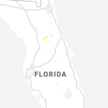
Hail Map for Sunday, June 28, 2020

Number of Impacted Households on 6/28/2020
0
Impacted by 1" or Larger Hail
0
Impacted by 1.75" or Larger Hail
0
Impacted by 2.5" or Larger Hail
Square Miles of Populated Area Impacted on 6/28/2020
0
Impacted by 1" or Larger Hail
0
Impacted by 1.75" or Larger Hail
0
Impacted by 2.5" or Larger Hail


Cities Most Affected by Hail Storms of 6/28/2020
| Hail Size | Demographics of Zip Codes Affected | ||||||
|---|---|---|---|---|---|---|---|
| City | Count | Average | Largest | Pop Density | House Value | Income | Age |
| Piedmont, SD | 3 | 1.92 | 2.25 | 23 | $88k | $41.5k | 41.4 |
| Center, ND | 2 | 1.88 | 2.00 | 2 | $60k | $38.7k | 48.1 |
| Solen, ND | 1 | 2.50 | 2.50 | 1 | $32k | $35.9k | 41.4 |
| Black Hawk, SD | 1 | 2.00 | 2.00 | 282 | $89k | $44.6k | 36.6 |
| Deadwood, SD | 1 | 2.00 | 2.00 | 18 | $78k | $32.3k | 48.5 |
| Custer, SD | 1 | 1.75 | 1.75 | 8 | $92k | $36.7k | 51.5 |
| Lyle, MN | 1 | 1.75 | 1.75 | 20 | $72k | $40.5k | 42.4 |
| Norwich, ND | 1 | 1.75 | 1.75 | 4 | $64k | $39.0k | 48.0 |
| Port Jervis, NY | 1 | 1.75 | 1.75 | 417 | $97k | $36.1k | 38.7 |
| Easthampton, MA | 1 | 1.75 | 1.75 | 443 | $125k | $45.9k | 43.4 |
| Alva, WY | 1 | 1.75 | 1.75 | 0 | $23k | $27.8k | 46.8 |
Hail and Wind Damage Spotted on 6/28/2020
Filter by Report Type:Hail ReportsWind Reports
States Impacted
Kentucky, New York, Massachusetts, Pennsylvania, Louisiana, Wyoming, Maine, South Carolina, North Carolina, Alabama, New Jersey, Connecticut, Minnesota, North Dakota, New Hampshire, Utah, Maryland, Rhode Island, South Dakota, Georgia, ColoradoKentucky
| Local Time | Report Details |
|---|---|
| 10:15 AM CDT | Tree tops snapped over a path in northern metcalfe count in metcalfe county KY, 60.7 miles S of Louisville, KY |
| 3:14 PM CDT | Tree dow in logan county KY, 58.4 miles N of Nashville, TN |
| 3:39 PM CDT | Dispatch reported one tree down near prices mil in simpson county KY, 34.7 miles N of Nashville, TN |
| 4:30 PM CDT | Kentucky mesonet site in todd county KY, 47.7 miles NNW of Nashville, TN |
New York
| Local Time | Report Details |
|---|---|
| 12:10 PM EDT | Portion of barn roof damaged. appears to be from an outflow boundary. time estimated by rada in montgomery county NY, 33 miles W of Schenectady, NY |
| 1:30 PM EDT | Golf Ball sized hail reported near Port Jervis, NY, 50.5 miles E of Scranton, PA, hail just smaller than a golf ball reported by the port jervis police on east main street at jersey avenue. |
| 1:35 PM EDT | Ping Pong Ball sized hail reported near Port Jervis, NY, 50.5 miles E of Scranton, PA, video of hail most of which were the size of quarters. some the size of ping pong balls. |
| 1:37 PM EDT | Tree down on us 6 eastbound in port jervi in orange county NY, 50.5 miles E of Scranton, PA |
| 1:38 PM EDT | Ping Pong Ball sized hail reported near Port Jervis, NY, 50.6 miles E of Scranton, PA, social media video of hail the size of ping pong balls on the ny/nj state border. time estimated from radar. |
| 1:59 PM EDT | Tree down on howell stree in orange county NY, 65.3 miles NNW of Brooklyn, NY |
| 2:20 PM EDT | Quarter sized hail reported near Fishs Eddy, NY, 46.2 miles NNE of Scranton, PA |
| 2:25 PM EDT | Downed tree on ny 207 westbound... east of ny 41 in orange county NY, 54.8 miles NNW of Brooklyn, NY |
| 2:47 PM EDT | Downed tree on ny 207 westbound... east of ny 208 in orange county NY, 54.7 miles N of Brooklyn, NY |
| 3:18 PM EDT | Trees down in sullivan county NY, 42.1 miles ENE of Scranton, PA |
| 3:48 PM EDT | Quarter sized hail reported near Spring Valley, NY, 29 miles N of Brooklyn, NY, multiple social media videos of quarter size hail. |
| 3:52 PM EDT | Quarter sized hail reported near Spring Valley, NY, 30.3 miles N of Brooklyn, NY, multiple videos on social media of quarter size hail. |
| 4:15 PM EDT | Downed trees on i87 northbound at exit 9 in westchester county NY, 26.1 miles NNE of Brooklyn, NY |
| 4:30 PM EDT | Downed tree on bronx river parkway southbound at exit 23 in westchester county NY, 25.6 miles NNE of Brooklyn, NY |
| 9:07 PM EDT | Several trees and power lines down in st. lawrence county NY, 19.8 miles SW of Ogdensburg, NY |
Massachusetts
| Local Time | Report Details |
|---|---|
| 1:29 PM EDT | Tree and powerlines down on highland av in middlesex county MA, 36.4 miles NNE of Providence, RI |
| 1:30 PM EDT | Quarter sized hail reported near Watertown, MA, 39.5 miles NNE of Providence, RI, watertown square |
| 1:40 PM EDT | Tree down blocking lewis terrace at washington street. a second tree and wires down in the same are in middlesex county MA, 36.4 miles NNE of Providence, RI |
| 1:50 PM EDT | Newton pd responding to nonantum road and charlesbank road for a tree down on the roa in middlesex county MA, 36.4 miles NNE of Providence, RI |
| 1:53 PM EDT | Trees crossing road and powerlines on carver road in middlesex county MA, 36.4 miles NNE of Providence, RI |
| 1:59 PM EDT | Tree down on a building on perry roa in norfolk county MA, 37 miles NNE of Providence, RI |
| 1:59 PM EDT | Tree down blocking the road on border stree in middlesex county MA, 36.4 miles NNE of Providence, RI |
| 2:00 PM EDT | Powerlines down at calumet street in suffolk county MA, 33.9 miles NNE of Providence, RI |
| 2:01 PM EDT | Tree down at the 200 block of walnut street in norfolk county MA, 37 miles NNE of Providence, RI |
| 2:08 PM EDT | Large tree branch down on vehicle and blocking reservoir av in suffolk county MA, 46.5 miles NNE of Providence, RI |
| 2:10 PM EDT | Pleasant street... tree down against a house with wires dow in middlesex county MA, 36.4 miles NNE of Providence, RI |
| 2:37 PM EDT | Tree fell on road near green line mbta outbound tracks near huntington av in suffolk county MA, 38.5 miles NNE of Providence, RI |
| 2:42 PM EDT | Downed tree at 288 atlantic ave by the baseball fiel in plymouth county MA, 42.1 miles NE of Providence, RI |
| 2:45 PM EDT | Large tree branch down blocking rockland road at martins lan in plymouth county MA, 39.3 miles NE of Providence, RI |
| 3:09 PM EDT | Tree down on jerusalem road... second tree down at joy place and north main stree in norfolk county MA, 42.2 miles NE of Providence, RI |
| 3:29 PM EDT | Tree down at perley place... blocking roa in norfolk county MA, 36.5 miles NE of Providence, RI |
| 3:48 PM EDT | Half Dollar sized hail reported near Florence, MA, 72.4 miles ESE of Schenectady, NY |
| 3:56 PM EDT | Ping Pong Ball sized hail reported near Easthampton, MA, 72.1 miles WNW of Providence, RI, forwarded by media. |
| 3:58 PM EDT | Golf Ball sized hail reported near Easthampton, MA, 72.1 miles WNW of Providence, RI, forwarded by media. |
| 4:01 PM EDT | Tree down on route 202 at northampton line in hampshire county MA, 72.1 miles WNW of Providence, RI |
| 4:16 PM EDT | Tree and wires down on randolf av in norfolk county MA, 33.4 miles NNE of Providence, RI |
| 4:40 PM EDT | Quarter sized hail reported near Norwood, MA, 27.5 miles NNE of Providence, RI |
| 4:50 PM EDT | Quarter sized hail reported near Franklin, MA, 18.4 miles N of Providence, RI |
| 5:10 PM EDT | Large tree and wires down on mountain roa in hampden county MA, 57.3 miles WNW of Providence, RI |
| 5:20 PM EDT | Large tree down on elm street in norfolk county MA, 26.8 miles NNE of Providence, RI |
| 5:30 PM EDT | Large tree down on oak street in norfolk county MA, 29.1 miles NNE of Providence, RI |
| 5:30 PM EDT | Trees and wires down on kingsbury roa in norfolk county MA, 21 miles NNE of Providence, RI |
| 5:35 PM EDT | Wires down on bullard street in norfolk county MA, 23.5 miles NNE of Providence, RI |
| 5:44 PM EDT | Tree down on north main street in avo in norfolk county MA, 28.4 miles NE of Providence, RI |
| 5:50 PM EDT | Tree and wires down on ridge street... spark street... and circle stree in plymouth county MA, 26.5 miles NE of Providence, RI |
| 6:00 PM EDT | Tree down on a house and car on davis street. a second tree down also on davis stree in plymouth county MA, 31 miles NE of Providence, RI |
| 6:05 PM EDT | Tree down on paine street in worcester county MA, 20.2 miles NNW of Providence, RI |
Pennsylvania
| Local Time | Report Details |
|---|---|
| 1:30 PM EDT | Half Dollar sized hail reported near Matamoras, PA, 50 miles E of Scranton, PA, cars damaged in the area. |
| 2:43 PM EDT | Trees down near route 247 and petrilak road in lackawanna county PA, 15.2 miles NNE of Scranton, PA |
| 2:46 PM EDT | Quarter sized hail reported near Pleasant Mount, PA, 25.4 miles NNE of Scranton, PA |
| 2:52 PM EDT | Quarter sized hail reported near Jermyn, PA, 10.1 miles NE of Scranton, PA |
| 3:10 PM EDT | Quarter sized hail reported near Lake Ariel, PA, 9.9 miles E of Scranton, PA |
| 3:10 PM EDT | Trees down in lackawanna county PA, 9.9 miles E of Scranton, PA |
| 3:37 PM EDT | Trees and wires down in lackawanna county PA, 10 miles ESE of Scranton, PA |
| 3:37 PM EDT | Trees and wires down in lackawanna county PA, 8.3 miles SE of Scranton, PA |
| 3:50 PM EDT | 3 trees down on spring hill road in lackawanna county PA, 8.3 miles SE of Scranton, PA |
| 5:15 PM EDT | Mping report of tree limbs down and shingles blown of in chester county PA, 66.3 miles NE of Baltimore, MD |
| 5:31 PM EDT | Downed tree blocking general weedon drive. time estimated from rada in chester county PA, 69.2 miles NE of Baltimore, MD |
| 5:35 PM EDT | Downed tree blocking westtown roa in chester county PA, 72.6 miles NE of Baltimore, MD |
Louisiana
| Local Time | Report Details |
|---|---|
| 2:06 PM CDT | Emergency manager reported trees and powerlines down in deridde in beauregard county LA, 58.6 miles NNE of Beaumont, TX |
Wyoming
| Local Time | Report Details |
|---|---|
| 1:20 PM MDT | Asos station kcpr casper airpor in natrona county WY, 8 miles WNW of Casper, WY |
| 1:41 PM MDT | Asos station krks rock springs airpor in sweetwater county WY, 8 miles E of Rock Springs, WY |
| 2:10 PM MDT | Roof blown away in campbell county WY, 24.3 miles WSW of Gillette, WY |
| 2:18 PM MDT | Asos station krks rock springs airpor in sweetwater county WY, 8 miles E of Rock Springs, WY |
| 2:22 PM MDT | Storm damage reported in campbell county WY, 16 miles WSW of Gillette, WY |
| 2:25 PM MDT | Storm damage reported in campbell county WY, 9.4 miles WSW of Gillette, WY |
| 2:30 PM MDT | Lost roof off a barn... debris thrown 150 feet in campbell county WY, 5.2 miles WSW of Gillette, WY |
| 2:35 PM MDT | Quarter sized hail reported near Gillette, WY, 4.4 miles S of Gillette, WY |
| 2:40 PM MDT | Storm damage reported in campbell county WY, 1.6 miles S of Gillette, WY |
| 2:42 PM MDT | Quarter sized hail reported near Gillette, WY, 0.3 miles SE of Gillette, WY |
| 2:50 PM MDT | Storm damage reported in campbell county WY, 5.5 miles ENE of Gillette, WY |
| 2:50 PM MDT | Quarter sized hail reported near Gillette, WY, 5.5 miles ENE of Gillette, WY |
| 3:05 PM MDT | Quarter sized hail reported near Rozet, WY, 15.2 miles E of Gillette, WY |
| 3:10 PM MDT | Quarter sized hail reported near Rozet, WY, 16.4 miles ENE of Gillette, WY, camper laid on it's side |
| 3:10 PM MDT | Camper laid on it's side in campbell county WY, 16.4 miles ENE of Gillette, WY |
| 3:14 PM MDT | A power pole was broken off... numerous houses lost siding... a roof was blown off on in campbell county WY, 15.8 miles ENE of Gillette, WY |
| 3:35 PM MDT | Awos station kemm kemmerer airpor in lincoln county WY, 70.5 miles WNW of Rock Springs, WY |
| 4:00 PM MDT | Quarter sized hail reported near Hulett, WY, 48.9 miles ENE of Gillette, WY |
| 4:05 PM MDT | Golf Ball sized hail reported near Alva, WY, 54.2 miles ENE of Gillette, WY |
| 4:26 PM MDT | Mesonet station krec atlantic city 10 ne (wydot in fremont county WY, 30.3 miles SSW of Riverton, WY |
| 4:32 PM MDT | Quarter sized hail reported near Aladdin, WY, 60.8 miles NW of Rapid City, SD |
| 4:47 PM MDT | Storm damage reported in crook county WY, 58.2 miles WNW of Rapid City, SD |
| 5:32 PM MDT | Wydot station wy62 i25 us87 - smokey ga in natrona county WY, 40.2 miles N of Casper, WY |
Maine
| Local Time | Report Details |
|---|---|
| 3:30 PM EDT | Several reports of trees down in denmar in oxford county ME, 31.4 miles NW of Portland, ME |
| 5:55 PM EDT | Trees down on wire in york county ME, 30.3 miles W of Portland, ME |
South Carolina
| Local Time | Report Details |
|---|---|
| 4:25 PM EDT | Schp reported tree down on roadway. time estimated by rada in spartanburg county SC, 39.2 miles ENE of Greenville, SC |
| 5:20 PM EDT | 911 call center reported tree down on roadway. time estimated by rada in lancaster county SC, 23.8 miles S of Charlotte, NC |
| 5:25 PM EDT | Schp reported tree down at jug factory and becky gibson road. time estimated from rada in greenville county SC, 23.2 miles ENE of Greenville, SC |
| 5:25 PM EDT | Schp reported trees down at knox rd and hwy 187. time estimated from rada in anderson county SC, 21.6 miles SSW of Greenville, SC |
| 5:25 PM EDT | Public reported tree down on house. time estimated by rada in pickens county SC, 5.8 miles WSW of Greenville, SC |
| 5:25 PM EDT | Public reported tree down on roadway. time estimated by rada in pickens county SC, 4.1 miles N of Greenville, SC |
| 5:30 PM EDT | Schp reported tree down on roadway. time estimated by rada in spartanburg county SC, 41 miles E of Greenville, SC |
| 5:40 PM EDT | Numerous reports of trees down across city of anderson and toward belton. time estimated from rada in anderson county SC, 22.8 miles S of Greenville, SC |
| 5:41 PM EDT | Trees and power lines down at intersection of martin luther king blvd and camson rd. time estimated from rada in anderson county SC, 20.6 miles SSW of Greenville, SC |
| 5:45 PM EDT | Schp reported trees down blocking right lane of sb i-85 at mm47. time estimated from rada in greenville county SC, 14.3 miles E of Greenville, SC |
| 5:48 PM EDT | Trees down on shiloh unity road. time estimated from rada in lancaster county SC, 30.8 miles SSE of Charlotte, NC |
| 5:49 PM EDT | Tree in roadway on camp creek road. time estimated from rada in lancaster county SC, 31.9 miles SSE of Charlotte, NC |
| 5:49 PM EDT | Trees down on thompson road. time estimated from rada in lancaster county SC, 33 miles SSE of Charlotte, NC |
| 5:50 PM EDT | Tree in roadway on north rocky river road. time estimated from rada in lancaster county SC, 32.7 miles SSE of Charlotte, NC |
| 5:50 PM EDT | Schp reported tree down on roadway. time estimated by rada in spartanburg county SC, 31.1 miles ENE of Greenville, SC |
| 5:51 PM EDT | Power lines down on taxahaw road. time estimated from rada in lancaster county SC, 37.6 miles SSE of Charlotte, NC |
| 5:55 PM EDT | Power poles and tree limbs down. report from mping. time estimated from rada in lancaster county SC, 34.9 miles SSE of Charlotte, NC |
| 6:04 PM EDT | Schp reported tree down on roadway. time estimated by rada in spartanburg county SC, 29 miles E of Greenville, SC |
| 6:06 PM EDT | Trees down on mctown road. time estimated from rada in lancaster county SC, 34.9 miles SSE of Charlotte, NC |
| 6:14 PM EDT | Shingles blown off and small limbs down. time estimated from rada in chesterfield county SC, 46.6 miles SSE of Charlotte, NC |
| 6:50 PM EDT | The 911 call center received numerous reports of trees down across the county. especially from jonesville... buffalo... and union cities. time estimated from rada in union county SC, 56.3 miles E of Greenville, SC |
| 7:12 PM EDT | Trees down near garys lane and us-76. time estimated from rada in newberry county SC, 59.7 miles ESE of Greenville, SC |
| 7:23 PM EDT | Trees down near the intersection of bradbury way and bush river road. time estimated from rada in newberry county SC, 59.1 miles NNE of Augusta, GA |
| 7:24 PM EDT | Power lines down near the intersection of deloach ave and keroes street. time estimated from rada in newberry county SC, 59.3 miles NNE of Augusta, GA |
| 7:40 PM EDT | Tree in roadway at the intersection of meadowlark road and mountainview circle. time estimated from rada in lexington county SC, 58 miles NE of Augusta, GA |
| 8:06 PM EDT | Tree in roadway at corley mill road and north lake drive (hwy 6 in lexington county SC, 58.2 miles NE of Augusta, GA |
| 8:18 PM EDT | Large tree down at the intersection of garners ferry and abernathy roads. time estimated from rada in richland county SC, 68.2 miles ENE of Augusta, GA |
| 8:23 PM EDT | Tree in roadway at berryhill road and fairway lan in lexington county SC, 63.1 miles NE of Augusta, GA |
| 8:37 PM EDT | Trained spotter reported 2 large pine trees downed on the side of the road south of marion near the intersection of state 41 and us hwy 50 in marion county SC, 75.2 miles NNE of Charleston, SC |
| 8:40 PM EDT | Powerlines down on country club road near edgefield. time estimated from rada in edgefield county SC, 23.3 miles NNE of Augusta, GA |
| 9:00 PM EDT | Powerlines down on columbia ave. time estimated from rada in aiken county SC, 16.5 miles ENE of Augusta, GA |
| 9:13 PM EDT | Tree in roadway near the intersection of robert rees durant road and us-301. time estimated from rada in clarendon county SC, 40.3 miles NNW of Charleston, SC |
| 9:37 PM EDT | Tree and power lines down on hampton street in eloree. time estimated from rada in orangeburg county SC, 39.6 miles NW of Charleston, SC |
North Carolina
| Local Time | Report Details |
|---|---|
| 4:27 PM EDT | Corrects previous tstm wnd dmg report from 2 nnw glen raven. tree down on house... as well as multiple trees down in burlingto in alamance county NC, 52.9 miles WNW of Raleigh, NC |
| 4:50 PM EDT | *** 1 fatal *** tree fell on mobile home. 1 fatality reporte in orange county NC, 26 miles WNW of Raleigh, NC |
| 5:30 PM EDT | 911 call center reported tree down on roadway. time estimated by rada in union county NC, 29.7 miles SSE of Charlotte, NC |
| 5:55 PM EDT | 911 call center reported tree down on roadway. time estimated by rada in union county NC, 35.4 miles SE of Charlotte, NC |
Alabama
| Local Time | Report Details |
|---|---|
| 4:20 PM CDT | Numerous trees reported down to the east of greenville... al. time estimated by rada in butler county AL, 45 miles ESE of Camden, AL |
| 4:30 PM CDT | A few trees reported down along burgamy swamp road and highway 97... approximately 5 miles northwest of highland home... al. time estimated by rada in crenshaw county AL, 54.6 miles E of Camden, AL |
| 4:30 PM CDT | A few trees downed along burgamy swamp road and highway 97 approximately 2 to 3 miles east and northeast of panola. time estimated by rada in butler county AL, 40.5 miles ESE of Camden, AL |
| 4:50 PM CDT | A few trees down near rame in montgomery county AL, 57.4 miles SW of Auburn, AL |
| 4:53 PM CDT | Numerous trees snapped and blown down from possible microburs in montgomery county AL, 58.8 miles SW of Auburn, AL |
| 5:44 PM CDT | Trees down in union springs... a few other trees down across bullock count in bullock county AL, 35.1 miles SSW of Auburn, AL |
| 6:52 PM CDT | Trees down along hwy 8 in barbour county AL, 48.4 miles SSE of Auburn, AL |
New Jersey
| Local Time | Report Details |
|---|---|
| 5:22 PM EDT | Several reports of power lines down and power outages in the vernon valley area. time estimated from rada in sussex county NJ, 45.9 miles NW of Brooklyn, NY |
| 6:07 PM EDT | Power outages in montville. time estimated from rada in morris county NJ, 25.3 miles NW of Brooklyn, NY |
| 6:11 PM EDT | Widespread power outages reported. time estimated from rada in morris county NJ, 24.2 miles WNW of Brooklyn, NY |
| 6:11 PM EDT | Several reports of downed power lines. time estimated from rada in morris county NJ, 24.1 miles NW of Brooklyn, NY |
| 6:19 PM EDT | Downed power lines reported near pequannock river park. time estimated from rada in morris county NJ, 21 miles NW of Brooklyn, NY |
| 6:23 PM EDT | Downed power lines in the area of crane road. time estimated from rada in morris county NJ, 27.4 miles WNW of Brooklyn, NY |
| 6:26 PM EDT | Corrects previous tstm wnd dmg report from lake hiawatha. widespread power outages reported. time estimated from rada in morris county NJ, 24.2 miles WNW of Brooklyn, NY |
| 6:26 PM EDT | Widespread power outages reported. time estimated from rada in morris county NJ, 23.6 miles WNW of Brooklyn, NY |
| 6:30 PM EDT | Downed tree on interstate 280 westbound ramp exit 1w. ramp closed. time estimated from rada in morris county NJ, 21.8 miles WNW of Brooklyn, NY |
Connecticut
| Local Time | Report Details |
|---|---|
| 5:53 PM EDT | Quarter sized hail reported near West Haven, CT, 66.6 miles NE of Brooklyn, NY |
Minnesota
| Local Time | Report Details |
|---|---|
| 4:55 PM CDT | 4-6 inch tree branches down. time estimated by rada in steele county MN, 57 miles N of Mason City, IA |
| 5:00 PM CDT | Golf Ball sized hail reported near Lyle, MN, 27 miles NNE of Mason City, IA, viewer report from kaal of golf ball sized hail. time estimated based on radar. |
| 5:04 PM CDT | Quarter sized hail reported near Lyle, MN, 26.4 miles NNE of Mason City, IA, relayed via social media. approximate location. |
| 6:40 PM CDT | Delayed repor in fillmore county MN, 54.9 miles W of La Crosse, WI |
| 6:40 PM CDT | Quarter sized hail reported near Stewartville, MN, 54.9 miles W of La Crosse, WI, delayed report - 1.15 inches of rain too. |
| 7:23 PM CDT | Quarter sized hail reported near Saint Charles, MN, 41.8 miles WNW of La Crosse, WI |
| 7:50 PM CDT | Quarter sized hail reported near Altura, MN, 37.5 miles WNW of La Crosse, WI, quarter size hail 3 s of altura... mn. time estimated by radar. |
| 8:10 PM CDT | Delayed report. large branches down and some shingles removed from a house in lewiston. time estimated from rada in winona county MN, 33.2 miles WNW of La Crosse, WI |
| 8:10 PM CDT | Large tree branches dow in winona county MN, 33 miles WNW of La Crosse, WI |
| 8:12 PM CDT | Quarter sized hail reported near Lewiston, MN, 32.7 miles WNW of La Crosse, WI |
North Dakota
| Local Time | Report Details |
|---|---|
| 5:00 PM CDT | Ping Pong Ball sized hail reported near Deering, ND, 16.8 miles ENE of Minot, ND |
| 5:03 PM CDT | Golf Ball sized hail reported near Norwich, ND, 14.2 miles E of Minot, ND |
| 5:25 PM CDT | Quarter sized hail reported near Norwich, ND, 9.5 miles E of Minot, ND, relayed by broadcast media. time estimated from radar. |
| 5:25 PM CDT | Quarter sized hail reported near Norwich, ND, 14.2 miles E of Minot, ND, hailed for about a half an hour. largest hail was the size of quarters. |
| 6:45 PM CDT | Quarter sized hail reported near Mohall, ND, 45.2 miles NNW of Minot, ND, time estimated from radar. |
| 6:45 PM CDT | Quarter sized hail reported near Center, ND, 32.9 miles NW of Bismarck, ND, hail up to the size of quarters occurred on an off for 15 minutes ending at 645 pm. |
| 7:08 PM CDT | Golf Ball sized hail reported near Center, ND, 27.7 miles NW of Bismarck, ND, hail up to the size of golf balls. most hail was quarter sized or smaller. very heavy rain with 0.60 inches of accumulation. |
| 7:18 PM CDT | Quarter sized hail reported near Center, ND, 28.8 miles NW of Bismarck, ND |
| 7:28 PM CDT | Hen Egg sized hail reported near Center, ND, 22.9 miles NW of Bismarck, ND |
| 6:29 PM MDT | Storm damage reported in harding county SD, 123.4 miles N of Rapid City, SD |
| 6:34 PM MDT | Storm damage reported in harding county SD, 123.4 miles N of Rapid City, SD |
| 7:40 PM CDT | Quarter sized hail reported near Lansford, ND, 25.2 miles N of Minot, ND, time estimated from radar. |
| 8:00 PM CDT | Quarter sized hail reported near Mandan, ND, 15.4 miles W of Bismarck, ND |
| 8:05 PM CDT | Quarter sized hail reported near Flasher, ND, 29.5 miles SSW of Bismarck, ND |
| 8:12 PM CDT | Quarter sized hail reported near Lansford, ND, 28.8 miles N of Minot, ND |
| 8:15 PM CDT | Quarter sized hail reported near Maxbass, ND, 28.3 miles N of Minot, ND, time estimated from radar. |
| 8:20 PM CDT | Tennis Ball sized hail reported near Solen, ND, 31.5 miles SSW of Bismarck, ND, hail began at 820 pm and lasted until 845 pm. most of the hail was quarter sized or smaller but some stones were as large as tennis balls. |
| 9:13 PM CDT | Power lines were down and a large tree was down on 101st street northeast north of the golf course. time is estimated from rada in bottineau county ND, 61.2 miles NE of Minot, ND |
New Hampshire
| Local Time | Report Details |
|---|---|
| 6:06 PM EDT | Quarter sized hail reported near Union, NH, 42.4 miles WSW of Portland, ME, corrected time estimated from radar. |
Utah
| Local Time | Report Details |
|---|---|
| 4:15 PM MDT | Mesonet station dpg02 28.0 sw dugway (dugway in tooele county UT, 85.2 miles SW of Salt Lake City, UT |
| 4:25 PM MDT | Large tree uprooted and tipped over onto front yard/street in magna... ut. tree was living and mature. estimate 2 ft diamete in salt lake county UT, 11.6 miles WSW of Salt Lake City, UT |
| 4:25 PM MDT | Simpson springs dpg2 in tooele county UT, 80.2 miles SW of Salt Lake City, UT |
| 4:30 PM MDT | Mesonet station utjps 5.4 w clover (utah dot in tooele county UT, 46.1 miles SW of Salt Lake City, UT |
| 4:55 PM MDT | Storm damage reported in tooele county UT, 71.3 miles SW of Salt Lake City, UT |
Maryland
| Local Time | Report Details |
|---|---|
| 6:41 PM EDT | Storm damage reported in kent county MD, 37.8 miles E of Baltimore, MD |
| 6:42 PM EDT | Downed power lines in the area. time estimated from rada in kent county MD, 32.2 miles E of Baltimore, MD |
| 6:57 PM EDT | Downed power lines reported in the area. time estimated from rada in queen anne's county MD, 37.1 miles E of Baltimore, MD |
| 7:02 PM EDT | Downed power lines in the area. time estimated from rada in queen anne's county MD, 35.2 miles E of Baltimore, MD |
| 7:25 PM EDT | Mping report of tree limbs down and shingles blown off. time estimated from rada in queen anne's county MD, 40.9 miles ESE of Baltimore, MD |
Rhode Island
| Local Time | Report Details |
|---|---|
| 6:42 PM EDT | Half Dollar sized hail reported near Pascoag, RI, 18.1 miles WNW of Providence, RI |
South Dakota
| Local Time | Report Details |
|---|---|
| 4:47 PM MDT | Quarter sized hail reported near Belle Fourche, SD, 55.3 miles NW of Rapid City, SD |
| 5:05 PM MDT | Storm damage reported in butte county SD, 50.9 miles NW of Rapid City, SD |
| 5:10 PM MDT | Storm damage reported in harding county SD, 107.3 miles ESE of Miles City, MT |
| 5:15 PM MDT | Storm damage reported in butte county SD, 48.3 miles NNW of Rapid City, SD |
| 5:15 PM MDT | Roof torn off shed in butte county SD, 49.2 miles NNW of Rapid City, SD |
| 5:20 PM MDT | Storm damage reported in butte county SD, 44.4 miles NNW of Rapid City, SD |
| 5:20 PM MDT | Ping Pong Ball sized hail reported near Nisland, SD, 45.6 miles NNW of Rapid City, SD |
| 5:35 PM MDT | Quarter sized hail reported near Hill City, SD, 21.4 miles W of Rapid City, SD |
| 5:42 PM MDT | Storm damage reported in harding county SD, 106 miles N of Rapid City, SD |
| 5:50 PM MDT | Hen Egg sized hail reported near Deadwood, SD, 17.5 miles WNW of Rapid City, SD |
| 6:03 PM MDT | Quarter sized hail reported near Nemo, SD, 15.3 miles WNW of Rapid City, SD |
| 6:09 PM MDT | Ping Pong Ball sized hail reported near Piedmont, SD, 14.4 miles NW of Rapid City, SD |
| 6:10 PM MDT | Golf Ball sized hail reported near Piedmont, SD, 13.8 miles NW of Rapid City, SD, lots of half dollar size hail |
| 6:10 PM MDT | Storm damage reported in harding county SD, 121.5 miles N of Rapid City, SD |
| 6:13 PM MDT | Golf Ball sized hail reported near Piedmont, SD, 13 miles NW of Rapid City, SD |
| 6:15 PM MDT | Hen Egg sized hail reported near Black Hawk, SD, 8.7 miles NW of Rapid City, SD |
| 6:15 PM MDT | Hen Egg sized hail reported near Piedmont, SD, 13 miles NW of Rapid City, SD |
| 6:18 PM MDT | Half Dollar sized hail reported near Newell, SD, 58.3 miles N of Rapid City, SD |
| 6:18 PM MDT | Storm damage reported in butte county SD, 58.3 miles N of Rapid City, SD |
| 6:35 PM MDT | Storm damage reported in meade county SD, 44.8 miles NNE of Rapid City, SD |
| 6:39 PM MDT | Storm damage reported in meade county SD, 66.7 miles NNE of Rapid City, SD |
| 7:00 PM MDT | Storm damage reported in meade county SD, 76.2 miles NNE of Rapid City, SD |
| 7:20 PM MDT | Half Dollar sized hail reported near Custer, SD, 29 miles SW of Rapid City, SD |
| 7:22 PM MDT | Storm damage reported in meade county SD, 88.7 miles NE of Rapid City, SD |
| 7:29 PM MDT | Storm damage reported in meade county SD, 88.7 miles NE of Rapid City, SD |
| 7:30 PM MDT | Half Dollar sized hail reported near Custer, SD, 25.3 miles SW of Rapid City, SD |
| 7:32 PM MDT | Storm damage reported in ziebach county SD, 88.8 miles NE of Rapid City, SD |
| 7:33 PM MDT | Golf Ball sized hail reported near Custer, SD, 28.3 miles SW of Rapid City, SD |
| 7:34 PM MDT | Storm damage reported in ziebach county SD, 85.5 miles NW of Pierre, SD |
| 7:40 PM MDT | Ping Pong Ball sized hail reported near Hill City, SD, 21.3 miles WSW of Rapid City, SD |
| 7:44 PM MDT | Storm damage reported in ziebach county SD, 85.5 miles NW of Pierre, SD |
| 8:00 PM MDT | Half Dollar sized hail reported near Keystone, SD, 16.4 miles SSW of Rapid City, SD |
| 8:02 PM MDT | Quarter sized hail reported near Rapid City, SD, 10.8 miles SSW of Rapid City, SD |
| 8:17 PM MDT | Quarter sized hail reported near Rapid City, SD, 4.2 miles S of Rapid City, SD |
| 8:17 PM MDT | Half Dollar sized hail reported near Rapid City, SD, 4.2 miles S of Rapid City, SD |
| 8:20 PM MDT | Quarter sized hail reported near Martin, SD, 66.9 miles WNW of Valentine, NE |
| 8:20 PM MDT | Storm damage reported in bennett county SD, 66.9 miles WNW of Valentine, NE |
| 9:41 PM MDT | Storm damage reported in haakon county SD, 65.9 miles WSW of Pierre, SD |
| 1:02 AM CDT | Mesonet station 157 forest city (sddot in potter county SD, 44.4 miles N of Pierre, SD |
Georgia
| Local Time | Report Details |
|---|---|
| 8:25 PM EDT | Tree reported down near the intersection of humber ave and mathis av in stewart county GA, 55.4 miles SE of Auburn, AL |
| 8:29 PM EDT | Tree reported down along firetower r in chattahoochee county GA, 49.6 miles ESE of Auburn, AL |
| 8:40 PM EDT | 2 trees reported down along cherokee av in stewart county GA, 60.7 miles SE of Auburn, AL |
Colorado
| Local Time | Report Details |
|---|---|
| 7:52 PM MDT | Mesonet station co034 076w180 julesbur in sedgwick county CO, 63.8 miles NNE of Yuma, CO |
Connect with Interactive Hail Maps