

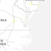
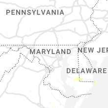
Hail Map for Thursday, June 8, 2023

Number of Impacted Households on 6/8/2023
0
Impacted by 1" or Larger Hail
0
Impacted by 1.75" or Larger Hail
0
Impacted by 2.5" or Larger Hail
Square Miles of Populated Area Impacted on 6/8/2023
0
Impacted by 1" or Larger Hail
0
Impacted by 1.75" or Larger Hail
0
Impacted by 2.5" or Larger Hail


Cities Most Affected by Hail Storms of 6/8/2023
| Hail Size | Demographics of Zip Codes Affected | ||||||
|---|---|---|---|---|---|---|---|
| City | Count | Average | Largest | Pop Density | House Value | Income | Age |
| Bulverde, TX | 1 | 1.75 | 1.75 | 127 | $171k | $66.8k | 45.7 |
Hail and Wind Damage Spotted on 6/8/2023
Filter by Report Type:Hail ReportsWind Reports
States Impacted
Texas, Virginia, Delaware, North Dakota, Mississippi, Nebraska, Georgia, Idaho, Colorado, Montana, Washington, Louisiana, South DakotaTexas
| Local Time | Report Details |
|---|---|
| 7:05 AM CDT | Nws employee reported sign damage at dunkin donuts and popeyes on boca chica blvd. time estimated by rada in cameron county TX, 1.7 miles NE of Brownsville, TX |
| 1:56 PM CDT | Quarter sized hail reported near Bulverde, TX, 23.3 miles N of San Antonio, TX, frequent dime size hail increased to quarter size in the past couple of minutes in bulverde. |
| 2:02 PM CDT | Golf Ball sized hail reported near Bulverde, TX, 22 miles N of San Antonio, TX, golf ball sized hail at 281 and 1863 per nws employee. |
| 2:21 PM CDT | Quarter sized hail reported near San Antonio, TX, 15.3 miles NE of San Antonio, TX, estimated quarter size hail at rolling meadows elementary school. |
| 2:24 PM CDT | Ping Pong Ball sized hail reported near San Antonio, TX, 17.2 miles NNE of San Antonio, TX, pictures of estimated ping pong ball size hail near tpc parkway and the golf course via social media. |
| 2:30 PM CDT | Quarter sized hail reported near Universal City, TX, 14.1 miles NE of San Antonio, TX, nws employee reports quarter size hail in universal city. time estimated from radar. |
| 2:32 PM CDT | Half Dollar sized hail reported near San Antonio, TX, 13.1 miles NE of San Antonio, TX, picture of estimated half dollar size hail at toepperwein and nagadoches. |
| 2:35 PM CDT | Half Dollar sized hail reported near Schertz, TX, 15.9 miles NE of San Antonio, TX, hail up to half dollar sized in selma per photos on social media. location marker is approximate. |
| 3:40 PM CDT | Quarter sized hail reported near College Station, TX, 74.8 miles NW of Houston, TX, trained storm spotter reported 1 inch hail near parkland dr. |
| 3:50 PM CDT | Quarter sized hail reported near Temple, TX, 21.4 miles E of Killeen, TX, report of quarters to ping-pong sized hail near loop 363 and 31st... as well as south and east of that area. estimated time given in report. |
| 4:08 PM CDT | Twitter user reported fallen tree limbs in tarkingto in liberty county TX, 45.1 miles NNE of Houston, TX |
| 5:21 PM CDT | Social media pictures of downed power lines... trees... and fences near the intersection of us 290 and barker cypress road. time is estimated based on rada in harris county TX, 22.3 miles NW of Houston, TX |
| 5:31 PM CDT | Quarter sized hail reported near Cypress, TX, 24.1 miles NW of Houston, TX, mping report of quarter sized hail just northeast of cypress. |
| 5:39 PM CDT | Twitter user reported trees snapped and blocking lanes along 249 and lakewood crossing d in harris county TX, 21.7 miles NW of Houston, TX |
| 5:42 PM CDT | Broadcast media reported a fallen tree on a hom in harris county TX, 20 miles NNW of Houston, TX |
| 5:43 PM CDT | Trained spotter reported a large tree down in jaycreek drive... nearly 4 to 6 inches in diamete in harris county TX, 20.5 miles NW of Houston, TX |
| 5:46 PM CDT | Social media video of large tree uprooted and fallen over near the intersection of interstate 45 and the north loop near fulton street. time is estimated based on radar in harris county TX, 4.1 miles N of Houston, TX |
| 6:01 PM CDT | Twitter user shared video of a downed tree along allen parkwa in harris county TX, 1.2 miles W of Houston, TX |
| 6:13 PM CDT | Quarter sized hail reported near Duncanville, TX, 12.2 miles SSW of Dallas, TX, trained spotter reports quarter sized hail 1 miles s of duncanville at 6:13 pm. |
| 6:42 PM CDT | Quarter sized hail reported near Dickinson, TX, 28.7 miles SE of Houston, TX, 1 inch hail reported along 40th east street. |
| 6:45 PM CDT | Quarter sized hail reported near League City, TX, 24 miles SE of Houston, TX, 1 inch hail reported at fm270 and fm518. |
| 7:00 PM CDT | Brigantine cay mesonet site measured 67 mph wind gus in galveston county TX, 37.2 miles SE of Houston, TX |
| 7:20 PM CDT | Kgls asos measured 61 mph wind gus in galveston county TX, 45.7 miles SE of Houston, TX |
Virginia
| Local Time | Report Details |
|---|---|
| 11:47 AM EDT | Quarter sized hail reported near Petersburg, VA, 19.9 miles SSE of Richmond, VA, quarter sized hail and large tree branches down near matoaca elementary school. |
| 12:15 PM EDT | Quarter sized hail reported near Prince George, VA, 27.3 miles SE of Richmond, VA |
| 12:17 PM EDT | Half Dollar sized hail reported near Prince George, VA, 27.8 miles SE of Richmond, VA, quarter to half dollar sized hail. over two inches in depth on the ground. |
| 1:00 PM EDT | Quarter sized hail reported near Emporia, VA, 49.4 miles S of Richmond, VA |
| 2:12 PM EDT | Quarter sized hail reported near Foster, VA, 46.2 miles NNW of Virginia Beach, VA, report of penny to quarter size hail. time estimated from radar. |
| 2:13 PM EDT | Quarter sized hail reported near Port Haywood, VA, 46.8 miles NNW of Virginia Beach, VA, hail of at least quarter size from social media video. video also shows hail covering the ground. time estimated from radar. |
Delaware
| Local Time | Report Details |
|---|---|
| 1:55 PM EDT | Quarter sized hail reported near Frankford, DE, 11.6 miles NNW of Ocean City, MD, report of video showing quarter sized hail in bayard... de covering the ground. |
North Dakota
| Local Time | Report Details |
|---|---|
| 1:47 PM CDT | Mesonet station 323369 4 nnw emmet (ndawn). 10-m measuremen in mclean county ND, 40.5 miles SSW of Minot, ND |
| 5:47 PM CDT | Half Dollar sized hail reported near Lehr, ND, 72.2 miles ESE of Bismarck, ND, heavy rain. wind gusts 40 to 50 mph. |
| 6:20 PM CDT | Ping Pong Ball sized hail reported near Fredonia, ND, 60.2 miles NNW of Aberdeen, SD, wind gusts 20 to 30 mph. |
| 6:47 PM CDT | Quarter sized hail reported near Rugby, ND, 53.4 miles WNW of Devils Lake, ND, hail from 1847 to 1853l. |
| 8:41 PM CDT | Half Dollar sized hail reported near New Town, ND, 50.8 miles ESE of Williston, ND, wind gusts 40 to 50 mph. |
Mississippi
| Local Time | Report Details |
|---|---|
| 2:58 PM CDT | Half Dollar sized hail reported near Gulfport, MS, 64.8 miles ENE of New Orleans, LA, video of hail at least half dollar in size relayed via social media. |
Nebraska
| Local Time | Report Details |
|---|---|
| 3:51 PM CDT | Mesonet/home weather statio in clay county NE, 26.5 miles SSE of Grand Island, NE |
| 5:19 PM CDT | Meso wl-davenport 0.96ss in thayer county NE, 51.6 miles SSE of Grand Island, NE |
| 5:25 PM CDT | Member of the public also called reporting several agricultural pivots blown ove in thayer county NE, 52.2 miles SSE of Grand Island, NE |
Georgia
| Local Time | Report Details |
|---|---|
| 5:31 PM EDT | Tree and powerlines down across s old perry road near hwy 12 in houston county GA, 82.1 miles NNW of Douglas, GA |
| 7:42 PM EDT | Quarter sized hail reported near Savannah, GA, 9.8 miles WSW of Savannah, GA, broadcast media relayed a video on social media showing quarter size hail in the enclave neighborhood. |
| 7:44 PM EDT | Tree down on quacco rd at laurelwood d in chatham county GA, 10 miles WSW of Savannah, GA |
| 7:55 PM EDT | Tree down on a residence on westlake av in chatham county GA, 4 miles SW of Savannah, GA |
| 8:00 PM EDT | A wind gust of 53 kt was measured at hunter army airfiel in chatham county GA, 5.4 miles SSW of Savannah, GA |
| 8:03 PM EDT | Quarter sized hail reported near Savannah, GA, 8 miles SSW of Savannah, GA, a video on social media relayed by media shows quarter size hail in the southern savannah area. |
| 8:07 PM EDT | Tree down at strachan ave and whitefield av in chatham county GA, 9.9 miles S of Savannah, GA |
Idaho
| Local Time | Report Details |
|---|---|
| 2:55 PM PDT | Corrects previous tstm wnd dmg report from 1 nne wardner. report from mping: 1-inch tree limbs broken; shingles blown of in shoshone county ID, 60.6 miles E of Spokane, WA |
| 3:22 PM PDT | Quarter sized hail reported near Cataldo, ID, 43.3 miles E of Spokane, WA |
| 3:28 PM PDT | Social media report of downed trees and limbs in farragut state park. power outages reported nearby. time estimated from rada in kootenai county ID, 42.9 miles ENE of Spokane, WA |
| 3:36 PM PDT | Several reports of power lines and tree limbs down near lane and medimont. time estimated from rada in kootenai county ID, 42 miles ESE of Spokane, WA |
| 3:41 PM PDT | Downed power lines on eddyville road. widespread power outages in the area. time estimated from rada in kootenai county ID, 31.4 miles E of Spokane, WA |
| 3:42 PM PDT | Corrects previous tstm wnd dmg report from 4 ssw fernan lake village. hwy 97 closed due to multiple trees down. photo report from social medi in kootenai county ID, 30.1 miles E of Spokane, WA |
| 3:50 PM PDT | Several reports of tree limbs and power lines down near rathdrum. time estimated from rada in kootenai county ID, 26.1 miles ENE of Spokane, WA |
| 3:53 PM PDT | Corrects previous tstm wnd dmg report from 7 s fernan lake village. power outages as of 453pm of 1700 customer in kootenai county ID, 30.5 miles E of Spokane, WA |
| 3:53 PM PDT | Downed tree has torn avista utility gas line out of the ground near lake cda. report from social medi in kootenai county ID, 30 miles E of Spokane, WA |
| 3:55 PM PDT | Report from mping: 1-inch tree limbs broken; shingles blown of in shoshone county ID, 60.6 miles E of Spokane, WA |
| 4:03 PM PDT | Social media reports of several trees and power lines down in the post falls area. time estimated from rada in kootenai county ID, 21.9 miles E of Spokane, WA |
| 4:25 PM PDT | Damaged and dislodged dock and boat from strong wind gusts. time estimated from rada in bonner county ID, 70.6 miles NNE of Spokane, WA |
| 4:42 PM PDT | Hwy 97 closed due to multiple trees down. photo report from social medi in kootenai county ID, 30.1 miles E of Spokane, WA |
| 4:53 PM PDT | Power outages as of 453pm of 1700 customer in kootenai county ID, 30.5 miles E of Spokane, WA |
| 5:44 PM PDT | Large tree hit vehicle while traveling. photo via local news medi in kootenai county ID, 28.6 miles E of Spokane, WA |
| 6:45 PM MDT | Mesonet station lof inl specific manufacturin in butte county ID, 42.8 miles NW of Idaho Falls, ID |
Colorado
| Local Time | Report Details |
|---|---|
| 4:55 PM MDT | Quarter sized hail reported near Colorado Springs, CO, 41.8 miles N of Pueblo, CO, nickle to quarter sized hail. |
| 9:01 PM MDT | Mesonet station co221 aurora i-70/airport blv in adams county CO, 11.4 miles E of Denver, CO |
Montana
| Local Time | Report Details |
|---|---|
| 5:05 PM MDT | Quarter sized hail reported near Wibaux, MT, 86.7 miles SSW of Williston, ND, hail up to the size of quarters. |
| 5:30 PM MDT | Half Dollar sized hail reported near Wibaux, MT, 83.2 miles SSW of Williston, ND, hail up to the size of half dollars lasted for 20 minutes (5:30 pm to 5:50 pm). |
| 8:20 PM MDT | Mesonet station mtgys geyser (mt dot in judith basin county MT, 42.6 miles ESE of Great Falls, MT |
Washington
| Local Time | Report Details |
|---|---|
| 4:12 PM PDT | Several reports and photos of downed trees and power lines in newman lake and near otis orchards. time estimated from rada in spokane county WA, 16.7 miles ENE of Spokane, WA |
| 4:17 PM PDT | Several reports of power outages and power lines down near newman lake. time estimated from rada in spokane county WA, 17.6 miles ENE of Spokane, WA |
| 4:21 PM PDT | Report from mping: 1-inch tree limbs broken; shingles blown of in spokane county WA, 11.4 miles E of Spokane, WA |
| 4:27 PM PDT | Downed tree limbs near mission avenue and pines road. social media report. time estimated from rada in spokane county WA, 8.1 miles E of Spokane, WA |
| 4:30 PM PDT | Downed tree limbs and power lines east of chattaroy. time estimated from rada in spokane county WA, 17.2 miles NNE of Spokane, WA |
| 4:31 PM PDT | Blown over trash cans... trees swaying... road gutter 50 0.000000ull of running w in spokane county WA, 3 miles NE of Spokane, WA |
| 4:32 PM PDT | Wind gust 23 with tree limbs broken and heavy rai in spokane county WA, 12.7 miles E of Spokane, WA |
| 4:35 PM PDT | A few public reports of trees and limbs down in spokane valley. time estimated from rada in spokane county WA, 7.6 miles E of Spokane, WA |
| 4:39 PM PDT | Social media report of downed tree limbs near mead. time estimated from rada in spokane county WA, 7.5 miles NNE of Spokane, WA |
| 4:39 PM PDT | Social media reports of damage to siding and fencing to a property on the north side of spokane. time estimated from rada in spokane county WA, 5 miles N of Spokane, WA |
| 4:44 PM PDT | Off-duty nws meteorologist reports trees down or snapped near downriver drive. time estimated from rada in spokane county WA, 2.7 miles NW of Spokane, WA |
| 4:47 PM PDT | Corrects previous tstm wnd dmg report from 1 s dishman. off duty nws employee reports 6 inch tree down. time estimated based on rada in spokane county WA, 6.7 miles E of Spokane, WA |
| 4:47 PM PDT | Corrects previous tstm wnd dmg report from 1 s dishman. off duty nws employee reports 6 inch tree down. time estimated based on rada in spokane county WA, 6.7 miles E of Spokane, WA |
| 4:48 PM PDT | Uprooted tree estimated to be 18 inches in diameter. time estimated from rada in spokane county WA, 2.1 miles SW of Spokane, WA |
| 4:52 PM PDT | Off duty nws employee reports multiple pine trees 4-8 inch diameter dow in spokane county WA, 4.3 miles WSW of Spokane, WA |
| 6:00 PM PDT | Two large trees down along orin rice road. storm spotter stevens 43. time estimated from rada in stevens county WA, 62.5 miles NNW of Spokane, WA |
| 6:02 PM PDT | Tree down on alladdin rd due to high wind gus in stevens county WA, 67.7 miles NNW of Spokane, WA |
| 6:21 PM PDT | Tree down on 842 valley westside r in stevens county WA, 64.4 miles NNW of Spokane, WA |
| 6:30 PM PDT | Time estimated from observation. large tree down measured 7.5 feet diameter. highest gust recorded was 41 mph in kettle falls at 1830ds in stevens county WA, 62.9 miles E of Omak, WA |
| 7:00 PM PDT | Gust front caused roof to blow off of airplane hangar... damaged an airplane... took out power... and started a small power line fir in okanogan county WA, 4.2 miles SW of Omak, WA |
Louisiana
| Local Time | Report Details |
|---|---|
| 7:58 PM CDT | Asos station kara new iberia measured a peak wind gust of 60 k in iberia county LA, 15.5 miles SSE of Lafayette, LA |
South Dakota
| Local Time | Report Details |
|---|---|
| 1:50 AM CDT | Pea size hai in walworth county SD, 78.8 miles N of Pierre, SD |
Connect with Interactive Hail Maps