

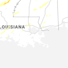
Hail Map for Sunday, April 12, 2020

Number of Impacted Households on 4/12/2020
0
Impacted by 1" or Larger Hail
0
Impacted by 1.75" or Larger Hail
0
Impacted by 2.5" or Larger Hail
Square Miles of Populated Area Impacted on 4/12/2020
0
Impacted by 1" or Larger Hail
0
Impacted by 1.75" or Larger Hail
0
Impacted by 2.5" or Larger Hail


Cities Most Affected by Hail Storms of 4/12/2020
| Hail Size | Demographics of Zip Codes Affected | ||||||
|---|---|---|---|---|---|---|---|
| City | Count | Average | Largest | Pop Density | House Value | Income | Age |
| Paris, TX | 1 | 2.00 | 2.00 | 266 | $47k | $26.2k | 36.7 |
| Milburn, OK | 1 | 1.75 | 1.75 | 10 | $39k | $27.0k | 43.9 |
| Altoona, AL | 1 | 1.75 | 1.75 | 69 | $65k | $28.7k | 39.3 |
| Tyler, TX | 1 | 1.75 | 1.75 | 2153 | $76k | $35.5k | 33.1 |
Hail and Wind Damage Spotted on 4/12/2020
Filter by Report Type:Hail ReportsWind Reports
States Impacted
Texas, Louisiana, North Carolina, Arkansas, Mississippi, Nebraska, Oklahoma, Tennessee, Alabama, Nevada, Georgia, Virginia, West Virginia, Florida, South CarolinaTexas
| Local Time | Report Details |
|---|---|
| 7:06 AM CDT | Four inch branches broken off trees in malakof in henderson county TX, 61.7 miles SE of Dallas, TX |
| 7:26 AM CDT | Golf Ball sized hail reported near Tyler, TX, 76.4 miles NNW of Lufkin, TX, golf ball size hail reported near tyler mall and at golden road and loop 323. |
| 7:35 AM CDT | Quarter sized hail reported near Tyler, TX, 77.9 miles NNW of Lufkin, TX, quarter size hail reported at nw part of loop 323 in tyler. |
| 8:15 AM CDT | Trees reported down on sabine street in south longvie in gregg county TX, 59.8 miles W of Shreveport, LA |
| 8:35 AM CDT | Quarter sized hail reported near Longview, TX, 57.8 miles W of Shreveport, LA, quarter size hail reported 2 miles south of gregg county airport. |
| 9:10 AM CDT | Trees uprooted with roof damage to a hous in harrison county TX, 28.7 miles W of Shreveport, LA |
| 9:14 AM CDT | Large limbs broke in harrison county TX, 26.7 miles WSW of Shreveport, LA |
| 9:18 AM CDT | Large tree uproote in harrison county TX, 25 miles WSW of Shreveport, LA |
| 9:37 AM CDT | Corrects previous tornado report from 2 se marshall. large trees reported down... some broken or snapped 9.2 se of marshall at fm 31 and crossroad in harrison county TX, 33.4 miles W of Shreveport, LA |
| 9:42 AM CDT | Trees down reported stricklin springs are in harrison county TX, 22.4 miles WSW of Shreveport, LA |
| 3:17 PM CDT | Quarter sized hail reported near Ivanhoe, TX, 46.6 miles S of Atoka, OK, quarter hail in ivanhoe at 3:17 pm. |
| 4:21 PM CDT | Quarter sized hail reported near Sumner, TX, 49 miles SSE of Atoka, OK, quarter size hail on cr 34520 north of sumner. |
| 4:40 PM CDT | Quarter sized hail reported near Arlington, TX, 21.7 miles WSW of Dallas, TX, social media reports of near quarter size hail at cooper/hardisty st in arlington. |
| 4:42 PM CDT | Ping Pong Ball sized hail reported near Sumner, TX, 51.4 miles SSE of Atoka, OK, lamar so relayed reports of half-dollar to ping pong ball size hail along fm1499 near fm1500. approx 5 miles w of hwy 271. |
| 4:48 PM CDT | Hen Egg sized hail reported near Paris, TX, 57.8 miles SE of Atoka, OK, trained spotter reports 2 inch hail 1 mile northeast of loop 286 on north side of town. |
| 5:10 PM CDT | Quarter sized hail reported near Mount Pleasant, TX, 79 miles SW of Nashville, AR |
| 5:38 PM CDT | Half Dollar sized hail reported near Kaufman, TX, 32.6 miles ESE of Dallas, TX, brief half-dollar hail mixed with smaller hail in oak grove. |
| 5:45 PM CDT | Half Dollar sized hail reported near Clarksville, TX, 71.7 miles WSW of Nashville, AR, half dollar sized hail reported by red river county sheriffs office. |
| 6:14 PM CDT | Numerous trees down and several county roads blocked around emor in rains county TX, 60.6 miles E of Dallas, TX |
| 6:28 PM CDT | Trees were downed on fm 16 west near hide-a-way lak in smith county TX, 80.6 miles ESE of Dallas, TX |
| 6:40 PM CDT | 60 foot pine trees down at holly lake ranch. power is out to the are in wood county TX, 85.9 miles W of Shreveport, LA |
| 6:42 PM CDT | Multiple trees down near tyler pipe in the swan communit in smith county TX, 83.9 miles NNW of Lufkin, TX |
| 6:45 PM CDT | Trees down near winon in smith county TX, 83.1 miles W of Shreveport, LA |
| 6:49 PM CDT | Large tree limbs were downed in mid town tyler. power is out to the are in smith county TX, 78 miles NNW of Lufkin, TX |
| 6:49 PM CDT | Trees down near i-20 between highway 69 and highway 14... near lavender roa in smith county TX, 84.5 miles NNW of Lufkin, TX |
| 6:52 PM CDT | A 50 ft tall oak tree with a 16 inch wide trunk was blown down across the 5000 block of east lake drive in the union grove communit in upshur county TX, 70.4 miles W of Shreveport, LA |
| 6:53 PM CDT | A 70+ ft black jack oak tree was blown down onto a shop on stallion road... damaging the roo in upshur county TX, 70.6 miles W of Shreveport, LA |
| 6:55 PM CDT | Amateur radio reports a wind gust of 70 mph in the city of hawkin in wood county TX, 84.9 miles W of Shreveport, LA |
| 6:56 PM CDT | Trees and power lines down. street signs blowing awa in upshur county TX, 71.7 miles WNW of Shreveport, LA |
| 7:12 PM CDT | Trees and power lines were downed in the new london area from a damaging gust fron in rusk county TX, 63.9 miles NNW of Lufkin, TX |
| 7:20 PM CDT | Storm damage reported in cass county TX, 48.1 miles NNW of Shreveport, LA |
Louisiana
| Local Time | Report Details |
|---|---|
| 8:20 AM CDT | Half Dollar sized hail reported near West Monroe, LA, 35.6 miles SSW of Bastrop, LA, half dollar hail in luna la. |
| 8:30 AM CDT | Quarter sized hail reported near Monroe, LA, 24.2 miles SSW of Bastrop, LA, southern sections of monroe reporting quarter size hail. |
| 9:51 AM CDT | Bay doors at fire station district 4 blown in at benton... multiple trees down... some damage to out structure in bossier county LA, 12.8 miles N of Shreveport, LA |
| 9:52 AM CDT | Report from mping: 1-inch tree limbs broken; shingles blown of in caddo county LA, 3.1 miles S of Shreveport, LA |
| 9:52 AM CDT | Large tree on home in shady grove neighborhoo in bossier county LA, 4.1 miles ESE of Shreveport, LA |
| 10:48 AM CDT | Reports of trees down south of bastrop on higginbotham r in morehouse county LA, 11.5 miles ESE of Bastrop, LA |
| 11:07 AM CDT | Trees down near the intersection of route 145 and route 821... possible tornad in lincoln county LA, 35.1 miles WSW of Bastrop, LA |
| 11:40 AM CDT | Power lines down on providence s in east carroll county LA, 43.4 miles E of Bastrop, LA |
| 11:46 AM CDT | Asos station kmlu monro in ouachita county LA, 19 miles SSW of Bastrop, LA |
| 11:46 AM CDT | Reports of large limbs down... wind estimated greater than 80 mph... roofs and structural damag in ouachita county LA, 15 miles SSW of Bastrop, LA |
| 12:01 PM CDT | Several trees reported down around the rayville are in richland county LA, 22.7 miles SSE of Bastrop, LA |
| 12:01 PM CDT | Corrects time of previous tstm wnd dmg report from 5 nne oak ridge. reports of trees down south of bastrop on higginbotham r in morehouse county LA, 11.5 miles ESE of Bastrop, LA |
| 12:27 PM CDT | Tree and several large limbs were down in tow in richland county LA, 33.1 miles SE of Bastrop, LA |
| 1:30 PM CDT | Lafayette 911 reports tree down on parklane r in lafayette county LA, 5.6 miles N of Lafayette, LA |
| 1:37 PM CDT | Lafayette 911 reported tree down at park avenue and moss s in lafayette county LA, 0.8 miles NNE of Lafayette, LA |
| 7:08 PM CDT | Power lines reported blown down across the road at intersection of louisiana highways 42 and 43 just northwest of springfield. event time estimated by rada in livingston county LA, 43.8 miles NW of New Orleans, LA |
| 7:14 PM CDT | Half Dollar sized hail reported near Hammond, LA, 45.2 miles NNW of New Orleans, LA, half dollar sized hail reported in hammond via social media. |
| 7:15 PM CDT | Half Dollar sized hail reported near Tickfaw, LA, 47.9 miles NNW of New Orleans, LA, quarter to half dollar size hail reported near natalbany. report received through social media. event time estimated by radar. |
| 7:16 PM CDT | Quarter sized hail reported near Tickfaw, LA, 49.7 miles NNW of New Orleans, LA, quarter-sized hail reported near tickfaw in tangipahoa parish. |
| 7:32 PM CDT | Half Dollar sized hail reported near Hammond, LA, 45.2 miles NNW of New Orleans, LA, half dollar sized hail reported in hammond via social media. |
| 8:10 PM CDT | A 60 mph wind gust was estimated by a nws employee in far south shrevepor in caddo county LA, 9.8 miles SSW of Shreveport, LA |
| 8:12 PM CDT | A nws employee estimated 60-70 mph winds in the university terrace subdivision in southeast shreveport. numerous large limbs were snapped and power was out in the are in caddo county LA, 5.2 miles S of Shreveport, LA |
| 8:23 PM CDT | Awos station kbad barksdale af in bossier county LA, 4.6 miles ESE of Shreveport, LA |
| 8:35 PM CDT | Quarter sized hail reported near Mer Rouge, LA, 7.3 miles E of Bastrop, LA |
| 8:40 PM CDT | Two tree were uprooted and 1 inch hail were reported along john edwards r in union county LA, 29.9 miles W of Bastrop, LA |
| 8:40 PM CDT | Public reports trees down in tall timbers neighborhoo in bossier county LA, 10.3 miles ENE of Shreveport, LA |
| 9:00 PM CDT | Several trees dow in morehouse county LA, 9.9 miles N of Bastrop, LA |
| 9:15 PM CDT | Trees and power lines dow in morehouse county LA, 2.1 miles SSE of Bastrop, LA |
| 9:30 PM CDT | Trees down in the rayville area including some across roads...reported by richland s in richland county LA, 22.5 miles SSE of Bastrop, LA |
North Carolina
| Local Time | Report Details |
|---|---|
| 10:54 AM EDT | Large tree down in the 900 block of old us highway 421. time estimated from rada in wilkes county NC, 66 miles NNW of Charlotte, NC |
| 10:30 PM EDT | Large tree down at intersection of west nc highway 268 and boomer road. time estimated from rada in wilkes county NC, 62.5 miles ESE of Bristol, TN |
| 10:54 PM EDT | Corrects previous tstm wnd dmg report from 1 sse north wilkesboro. large tree down in the 900 block of old us highway 421. time estimated from rada in wilkes county NC, 66 miles NNW of Charlotte, NC |
| 11:11 PM EDT | A strong thunderstorm with damaging winds brought a tree down in roaring rive in wilkes county NC, 68.7 miles N of Charlotte, NC |
| 12:39 AM EDT | A round of strong storms produced damaging winds that brought multiple trees down in the parsonville are in wilkes county NC, 54.8 miles ESE of Bristol, TN |
| 1:30 AM EDT | Roof blown off a structure on mount wimpey roa in cherokee county NC, 60.1 miles S of Knoxville, TN |
| 4:15 AM EDT | Trees down along the i-40 eas in catawba county NC, 38.8 miles NNW of Charlotte, NC |
| 4:45 AM EDT | Thunderstorm downed a tree near conrad drive and twin oaks lake driv in forsyth county NC, 66.4 miles NNE of Charlotte, NC |
| 4:50 AM EDT | Thunderstorm downed a tree near vienna dozier road and pine acres lan in forsyth county NC, 69.6 miles NNE of Charlotte, NC |
| 4:55 AM EDT | Thunderstorm winds downed powerlines along pine hall driv in forsyth county NC, 74.7 miles S of Roanoke, VA |
| 4:55 AM EDT | Thunderstorm winds downed a powerline along jefferson church roa in forsyth county NC, 73.2 miles SSW of Roanoke, VA |
| 4:56 AM EDT | Thunderstorm winds downed powerlines along doral driv in forsyth county NC, 74.5 miles NNE of Charlotte, NC |
| 5:04 AM EDT | Storm damage reported in mecklenburg county NC, 6.4 miles W of Charlotte, NC |
| 5:05 AM EDT | Thunderstorm winds downed a tree along tobaccoville road near moore roa in forsyth county NC, 74.5 miles SSW of Roanoke, VA |
| 5:15 AM EDT | *** 1 inj *** tree downed on home on countrymens cour in mecklenburg county NC, 7.3 miles SSW of Charlotte, NC |
| 5:19 AM EDT | Thunderstorm winds downed a tree near watkins ford road near the intersection with pine meadow driv in forsyth county NC, 71.6 miles NE of Charlotte, NC |
| 5:30 AM EDT | Broadcast media reported trees and power lines down at sides rd and upper palmer rd in rowan county NC, 33.9 miles NE of Charlotte, NC |
| 5:35 AM EDT | Tree downed across north broome s in union county NC, 21.6 miles SSE of Charlotte, NC |
| 5:35 AM EDT | Trees and powerlines down along stokes ferry roa in rowan county NC, 37.4 miles NE of Charlotte, NC |
| 6:25 AM EDT | Trees down... one through mobile hom in alamance county NC, 39.7 miles WNW of Raleigh, NC |
| 6:57 AM EDT | Thunderstorm downed a tree near old graham roa in chatham county NC, 31 miles W of Raleigh, NC |
| 7:00 AM EDT | Thunderstorm downed a tree near manns chapel roa in chatham county NC, 27.2 miles W of Raleigh, NC |
| 7:05 AM EDT | Tree on a residence on greenwod road in sanfor in lee county NC, 36.5 miles SW of Raleigh, NC |
| 7:07 AM EDT | Trees on house in sanfor in lee county NC, 36.9 miles SW of Raleigh, NC |
| 7:36 AM EDT | Gust reported at meb aso in scotland county NC, 79.7 miles SSW of Raleigh, NC |
| 7:37 AM EDT | Trees on residence near rives chapel church rd and alex watson rd. no injurie in chatham county NC, 41.1 miles W of Raleigh, NC |
Arkansas
| Local Time | Report Details |
|---|---|
| 11:05 AM CDT | Large trees reported down... large signs down and small metal building destroyed at fire station #3 in el dorad in union county AR, 52.9 miles NW of Bastrop, LA |
| 6:07 PM CDT | Storm damage reported in franklin county AR, 33.9 miles E of Fort Smith, AR |
| 6:11 PM CDT | One barn heavily damaged. several large trees dow in franklin county AR, 35.7 miles ENE of Fort Smith, AR |
| 6:23 PM CDT | Emergency manager reports tree down and power out in the goosecamp are in johnson county AR, 48.7 miles E of Fort Smith, AR |
| 6:23 PM CDT | Trees down and blocking highway 64... west of clarksvill in johnson county AR, 45.9 miles E of Fort Smith, AR |
| 6:30 PM CDT | Tree down on power lines on fuller mill roa in miller county AR, 40.5 miles S of Nashville, AR |
| 6:31 PM CDT | Emergency manager reports trees and powerlines down at intersection of highway 116 and 2 in logan county AR, 31.7 miles ESE of Fort Smith, AR |
| 6:31 PM CDT | Em reports a roof blown off of a polutry farm on highway 154 north of danvill in yell county AR, 62.6 miles ESE of Fort Smith, AR |
| 6:39 PM CDT | Mulitple large trees knocked dow in yell county AR, 64.4 miles ESE of Fort Smith, AR |
| 6:43 PM CDT | Trees knocked down... and blocking highway 21 in ozon in johnson county AR, 58 miles ENE of Fort Smith, AR |
| 6:51 PM CDT | Trees were down along with power outages. a dock was damage in pike county AR, 19.3 miles NNE of Nashville, AR |
| 6:54 PM CDT | 60 mph wind gus in lafayette county AR, 44.6 miles SSE of Nashville, AR |
| 7:00 PM CDT | Quarter sized hail reported near Waldo, AR, 49.5 miles SSE of Nashville, AR, large hail and strong winds. |
| 7:02 PM CDT | A tree was down on a mobile home near the oakhaven communit in hempstead county AR, 19.9 miles SE of Nashville, AR |
| 7:02 PM CDT | Multiple large trees down in pearcy. spotter estimates 60 mph wind gust in garland county AR, 46.1 miles NE of Nashville, AR |
| 7:06 PM CDT | Public weather station measured a 68 mph wind gus in conway county AR, 45.2 miles NW of Little Rock, AR |
| 7:07 PM CDT | Quarter sized hail reported near Doddridge, AR, 39.6 miles N of Shreveport, LA |
| 7:20 PM CDT | Fire department reports trees and powerlines down on highway 95 north of morrilton... blocking the roa in conway county AR, 40.3 miles NW of Little Rock, AR |
| 7:22 PM CDT | Public reports multiple trees down... with some trees on cars in hot spring in garland county AR, 47.7 miles WSW of Little Rock, AR |
| 7:27 PM CDT | A few trees were blown down in the are in clark county AR, 46.1 miles ENE of Nashville, AR |
| 7:31 PM CDT | Half Dollar sized hail reported near Louann, AR, 66 miles NW of Bastrop, LA |
| 7:31 PM CDT | Multiple trees down in plummervill in conway county AR, 35.1 miles NW of Little Rock, AR |
| 7:31 PM CDT | Quarter sized hail reported near Camden, AR, 63.6 miles ESE of Nashville, AR, public reports quarter size hail. |
| 7:33 PM CDT | A tree was down on highway 53 north of walker cree in lafayette county AR, 44.6 miles NNE of Shreveport, LA |
| 7:36 PM CDT | Multiple trees... powerlines... and fences down in downtown malver in hot spring county AR, 40.6 miles SW of Little Rock, AR |
| 7:40 PM CDT | Numerous trees and power lines down across the cit in nevada county AR, 28.7 miles ESE of Nashville, AR |
| 7:40 PM CDT | Smackover police department reports numerous trees and power lines down across the cit in union county AR, 62 miles NW of Bastrop, LA |
| 7:41 PM CDT | Quarter sized hail reported near Greenbrier, AR, 32.7 miles NNW of Little Rock, AR, quarter size hail reported by storm spotters. |
| 7:45 PM CDT | Portions of highway 65 were blocked by downed powerline in faulkner county AR, 33 miles N of Little Rock, AR |
| 7:49 PM CDT | Multiple large trees knocked dow in saline county AR, 18.9 miles WSW of Little Rock, AR |
| 7:52 PM CDT | Ping Pong Ball sized hail reported near Hampton, AR, 60.4 miles NNW of Bastrop, LA, social media report of ping pong ball sized hail. |
| 7:54 PM CDT | Trees knocked down in tul in grant county AR, 27.1 miles SW of Little Rock, AR |
| 7:55 PM CDT | Downed trees caused portions of highway 274 to be blocke in calhoun county AR, 64.5 miles NNW of Bastrop, LA |
| 7:56 PM CDT | Storm damage reported in grant county AR, 43.8 miles SSW of Little Rock, AR |
| 7:57 PM CDT | Quarter sized hail reported near Harrell, AR, 57.7 miles NNW of Bastrop, LA, social media report of quarter size hail in harrell. |
| 8:00 PM CDT | Trees down and blocking kanis road in west little roc in pulaski county AR, 7.2 miles W of Little Rock, AR |
| 8:00 PM CDT | Several trees were blown down with some damage noted to small outbuilding in grant county AR, 30.4 miles SSW of Little Rock, AR |
| 8:10 PM CDT | Widespread damage occurred across the county with numerous trees and powerlines down. some roads in the county were blocked due to the extent of the downed tree in cleveland county AR, 55.3 miles S of Little Rock, AR |
| 8:11 PM CDT | Trees and powerlines were reported down on east end rd. in east en in saline county AR, 13.9 miles S of Little Rock, AR |
| 8:12 PM CDT | Multiple large trees and powerlines down... blocking portions of highway 27 in jefferson county AR, 30.5 miles S of Little Rock, AR |
| 8:15 PM CDT | *** 1 fatal *** numerous trees and powerlines down in the area. one fatality occurred after a tree fell on a residenc in jefferson county AR, 33.8 miles SSE of Little Rock, AR |
| 8:16 PM CDT | Fire chief in watson chapel estimates 70 mph wind gus in jefferson county AR, 40.2 miles SSE of Little Rock, AR |
| 8:16 PM CDT | Quarter sized hail reported near Rose Bud, AR, 41.6 miles NNE of Little Rock, AR, public reports quarter size hail in rose bud. |
| 8:19 PM CDT | Storm spotter reports trees and power lines down in whitehal in jefferson county AR, 33.8 miles SSE of Little Rock, AR |
| 8:19 PM CDT | Storm damage reported in jefferson county AR, 22 miles SSE of Little Rock, AR |
| 8:24 PM CDT | Public reports multiple trees down in ry in cleveland county AR, 67.1 miles N of Bastrop, LA |
| 8:25 PM CDT | Numerous trees blown down as well as powerlines. some damage to roofs as well as small sheds occurre in lincoln county AR, 63.2 miles SSE of Little Rock, AR |
| 8:30 PM CDT | Trees and power lines dow in ashley county AR, 36 miles N of Bastrop, LA |
| 8:33 PM CDT | Multiple trees and power lines down in star cit in lincoln county AR, 61 miles SSE of Little Rock, AR |
| 8:34 PM CDT | Multiple trees and powerlines knocked down in monticell in drew county AR, 58.5 miles N of Bastrop, LA |
| 8:34 PM CDT | Observation from the raws station at university of arkansas at monticello campu in drew county AR, 56.3 miles N of Bastrop, LA |
| 8:35 PM CDT | Trees and power pole in ashley county AR, 27 miles N of Bastrop, LA |
| 8:42 PM CDT | Several trees were blown down as well as a few powerline in arkansas county AR, 39.8 miles SE of Little Rock, AR |
| 8:44 PM CDT | Quarter sized hail reported near Humphrey, AR, 39.8 miles SE of Little Rock, AR, quarter sized hail in humphrey. |
| 8:46 PM CDT | Trees and power poles damage in ashley county AR, 36 miles NNE of Bastrop, LA |
| 8:55 PM CDT | Several trees blown dow in desha county AR, 79.7 miles NNE of Bastrop, LA |
| 8:57 PM CDT | Wind gust measured from a trained spotter weather statio in arkansas county AR, 62 miles ESE of Little Rock, AR |
| 8:57 PM CDT | Wind gust measured from a trained spotter weather statio in arkansas county AR, 62 miles ESE of Little Rock, AR |
| 8:58 PM CDT | Storm damage reported in prairie county AR, 41.4 miles ESE of Little Rock, AR |
| 9:00 PM CDT | Trees damage in chicot county AR, 58.7 miles NNE of Bastrop, LA |
| 9:10 PM CDT | Damage occurred to a mobile home. roof damage occurred to a home and a small shed was blown awa in monroe county AR, 73.2 miles ESE of Little Rock, AR |
| 9:15 PM CDT | Trees and power lines dow in chicot county AR, 53 miles NE of Bastrop, LA |
| 9:22 PM CDT | Power lines damage in chicot county AR, 52.5 miles NE of Bastrop, LA |
| 9:40 PM CDT | Powerpoles and trees down across helena-west helen in phillips county AR, 53 miles SW of Memphis, TN |
| 9:40 PM CDT | Tree down along ark hwy 261 west of caldwell... arkansa in st. francis county AR, 45.6 miles W of Memphis, TN |
Mississippi
| Local Time | Report Details |
|---|---|
| 11:15 AM CDT | Tree down on road 814 in plantersvill in lee county MS, 51.9 miles N of Starkville, MS |
| 12:40 PM CDT | Report of trees uprooted/snapped and roofs blown off of structures about 3 miles south of kosciusk in attala county MS, 53 miles WSW of Starkville, MS |
| 1:20 PM CDT | Multiple trees down around renfro in leake county MS, 55.7 miles SW of Starkville, MS |
| 1:22 PM CDT | Quarter sized hail reported near Carthage, MS, 48.7 miles NE of Jackson, MS, picture of quarter size hail covering the ground in carthage. |
| 1:25 PM CDT | Trees and utility poles were blown down on old five mile road. possible tornad in humphreys county MS, 51.3 miles NNW of Jackson, MS |
| 2:21 PM CDT | Trees dow in attala county MS, 55.4 miles SW of Starkville, MS |
| 2:39 PM CDT | Report from mping: trees uprooted or snapped; roof blown of in attala county MS, 55.4 miles SW of Starkville, MS |
| 3:02 PM CDT | Several trees down along hwy 1 in madison county MS, 33.9 miles NE of Jackson, MS |
| 3:04 PM CDT | Picture of a tree down along brooksville r in winston county MS, 23.4 miles SSW of Starkville, MS |
| 3:05 PM CDT | Scattered trees down in new alban in union county MS, 71.6 miles N of Starkville, MS |
| 3:10 PM CDT | Several trees were reported down in the eastern portion of the count in winston county MS, 25.6 miles S of Starkville, MS |
| 3:16 PM CDT | Ping Pong Ball sized hail reported near Madison, MS, 12.5 miles N of Jackson, MS, social media report of ping pong ball size hail on the west side of madison. time and location estimated via radar. |
| 3:30 PM CDT | A porch was damaged and a metal roof pulled off of garag in prentiss county MS, 51.8 miles W of Florence, AL |
| 3:52 PM CDT | Report from mping: trees uprooted or snapped; roof blown of in noxubee county MS, 24.2 miles SE of Starkville, MS |
| 4:16 PM CDT | Quarter sized hail reported near Brooksville, MS, 19.7 miles SE of Starkville, MS, social media report of quarter size hail along lynn creek road on the west side of brooksville. |
| 8:11 PM CDT | Several trees reported down in runnelstow in perry county MS, 78.8 miles NW of Mobile, AL |
| 8:43 PM CDT | Several trees reported down in richto in perry county MS, 69.7 miles NW of Mobile, AL |
| 8:46 PM CDT | Trees and power lines down on dyess bridge roa in wayne county MS, 76.2 miles NNW of Mobile, AL |
| 9:10 PM CDT | Trees and power lines dow in bolivar county MS, 89.9 miles NE of Bastrop, LA |
| 9:13 PM CDT | Trees and power lines dow in bolivar county MS, 79.4 miles NE of Bastrop, LA |
| 9:22 PM CDT | Trees and power lines dow in bolivar county MS, 86 miles SSW of Memphis, TN |
| 9:23 PM CDT | 51kt gust at gl in washington county MS, 72.2 miles NE of Bastrop, LA |
| 9:25 PM CDT | Trees and power lines dow in bolivar county MS, 95.4 miles NE of Bastrop, LA |
| 9:35 PM CDT | Significant roof damage to a carwas in coahoma county MS, 72.1 miles SSW of Memphis, TN |
| 9:40 PM CDT | Several trees down...reported by sunflower s in sunflower county MS, 84.6 miles NNW of Jackson, MS |
| 9:59 PM CDT | Tunica awos reported 60mph winds at the top of the hou in tunica county MS, 36.6 miles SSW of Memphis, TN |
| 10:00 PM CDT | Numerous trees and power lines down...some trees blocking roads...reported by yazoo s in yazoo county MS, 40.1 miles NNW of Jackson, MS |
| 10:05 PM CDT | At least 15 homes across the county were damaged by falling tree in grenada county MS, 60.7 miles WNW of Starkville, MS |
| 10:05 PM CDT | Widespread trees down...many roads including major roads blocked by downed trees...reported by grenada s in grenada county MS, 61.4 miles WNW of Starkville, MS |
| 10:10 PM CDT | Numerous trees down...some blocking roads...reported by holmes s in holmes county MS, 57.1 miles N of Jackson, MS |
| 10:10 PM CDT | Numerous trees and powerlines down in the eudora communit in desoto county MS, 22.8 miles SSW of Memphis, TN |
| 10:10 PM CDT | Several trees and power lines down...tree down on a residence...reported by carroll s in carroll county MS, 64 miles W of Starkville, MS |
| 10:15 PM CDT | Multiple trees down across the entire county. ema director reports trees down on houses and structures as wel in yalobusha county MS, 61.2 miles NW of Starkville, MS |
| 10:20 PM CDT | Numerous trees down everywhere...blocking some roads...reported by montgomery s in montgomery county MS, 53 miles W of Starkville, MS |
| 10:23 PM CDT | Multiple power outages reported near looxahoma community due to downed powerline in tate county MS, 37.5 miles SSE of Memphis, TN |
| 10:26 PM CDT | Trees down all over the city of oxford and across lafayette county as wel in lafayette county MS, 61.9 miles SSE of Memphis, TN |
| 10:33 PM CDT | Relayed report from red cross. a tree is down on a house with a person trapped insid in yalobusha county MS, 74.9 miles WNW of Starkville, MS |
| 10:50 PM CDT | Numerous trees down...reported by attala s in attala county MS, 52.5 miles WSW of Starkville, MS |
| 10:50 PM CDT | Multiple trees down on 336w in pontotoc in pontotoc county MS, 55.2 miles NNW of Starkville, MS |
| 10:50 PM CDT | Tree dow in webster county MS, 18.5 miles WNW of Starkville, MS |
| 10:51 PM CDT | Multiple trees down in brunce. also... widespread power outages throughout calhoun count in calhoun county MS, 47.2 miles NW of Starkville, MS |
| 10:54 PM CDT | Multiple trees down in the community of new alpin in union county MS, 68.1 miles WSW of Florence, AL |
| 11:05 PM CDT | Several trees down...reported by oktibbeha s in oktibbeha county MS, 0.4 miles SSE of Starkville, MS |
| 11:06 PM CDT | Trees down on powerlines in guntow in lee county MS, 61.4 miles WSW of Florence, AL |
| 11:25 PM CDT | Several trees down in the area with some roads blocked including highway 15...reported by neshoba s in neshoba county MS, 51.4 miles SSW of Starkville, MS |
| 11:25 PM CDT | Social media picture of trees down at dewayne hayes campgroun in lowndes county MS, 21.8 miles ENE of Starkville, MS |
| 11:30 PM CDT | At least 20 trees reported down across the county... several of which fell on home in lowndes county MS, 22.2 miles E of Starkville, MS |
Nebraska
| Local Time | Report Details |
|---|---|
| 11:48 AM CDT | Report from mping: 1-inch tree limbs broken; shingles blown of in merrick county NE, 25.6 miles NE of Grand Island, NE |
| 1:13 PM CDT | Report from mping: 3-inch tree limbs broken; power poles broke in merrick county NE, 25.6 miles NE of Grand Island, NE |
| 1:15 PM CDT | Report from mping: 3-inch tree limbs broken; power poles broke in merrick county NE, 25.6 miles NE of Grand Island, NE |
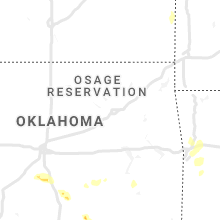
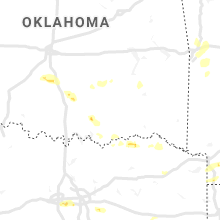
Oklahoma
| Local Time | Report Details |
|---|---|
| 2:40 PM CDT | Quarter sized hail reported near Lindsay, OK, 39.5 miles S of Oklahoma City, OK, facebook picture relayed by broadcast media. |
| 3:08 PM CDT | Quarter sized hail reported near Ada, OK, 38.2 miles NW of Atoka, OK |
| 3:50 PM CDT | Quarter sized hail reported near Sulphur, OK, 50 miles WNW of Atoka, OK, ranged from pea to quarter size hail. |
| 4:18 PM CDT | Roof shingle damage. power poles downe in sequoyah county OK, 23.1 miles WNW of Fort Smith, AR |
| 4:22 PM CDT | Quarter sized hail reported near Tishomingo, OK, 32.1 miles W of Atoka, OK |
| 4:32 PM CDT | Quarter sized hail reported near Milburn, OK, 27.2 miles WSW of Atoka, OK |
| 4:34 PM CDT | Golf Ball sized hail reported near Milburn, OK, 27.3 miles WSW of Atoka, OK |
| 5:15 PM CDT | 57.5 mph at cloudy mesonet in pushmataha county OK, 51.2 miles E of Atoka, OK |
Tennessee
| Local Time | Report Details |
|---|---|
| 3:45 PM CDT | Numerous trees down from burnt church through pyburn... counce and olivet communitie in hardin county TN, 41 miles NW of Florence, AL |
| 4:26 PM CDT | Outbuilding destroyed on piney r in lawrence county TN, 34.7 miles NNE of Florence, AL |
| 4:30 PM CDT | Several trees down near old highway 64 and red hill road in lawrence county TN, 36.9 miles NNE of Florence, AL |
| 4:31 PM CDT | Several trees down and damaged outbuilding in 780 block of ethridge red hill r in lawrence county TN, 39.4 miles NNE of Florence, AL |
| 4:49 PM CDT | Tree fell on mobile home on dawson d in maury county TN, 41.4 miles SSW of Nashville, TN |
| 4:49 PM CDT | Tree fell on home on malibu canyon d in maury county TN, 41.4 miles SSW of Nashville, TN |
| 7:30 PM CDT | Trees down near dunal in sequatchie county TN, 23.4 miles N of Chattanooga, TN |
| 11:24 PM EDT | Chattanooga airpor in hamilton county TN, 6.3 miles E of Chattanooga, TN |
| 11:51 PM EDT | Four large trees down. shed destroyed. east cleveland are in bradley county TN, 32.2 miles E of Chattanooga, TN |
| 11:53 PM EDT | Trees knocked down. power out. ham radio tower down. reported at 8612 bill reed rd ooltewa in hamilton county TN, 14.7 miles NE of Chattanooga, TN |
| 10:55 PM CDT | Multiple trees down across the count in fayette county TN, 40 miles E of Memphis, TN |
| 11:40 PM CDT | Large tree down on highway 22 near hamburg roa in hardin county TN, 45.4 miles WNW of Florence, AL |
| 2:00 AM EDT | Several trees dow in blount county TN, 20.2 miles S of Knoxville, TN |
Alabama
| Local Time | Report Details |
|---|---|
| 3:48 PM CDT | A few trees were blown down near pickensville lak in pickens county AL, 33.8 miles ESE of Starkville, MS |
| 4:10 PM CDT | Several trees and power lines were blown down west of carrollto in pickens county AL, 40.6 miles ESE of Starkville, MS |
| 4:11 PM CDT | A few trees were blown down in the zion area north of refor in pickens county AL, 47.5 miles E of Starkville, MS |
| 4:20 PM CDT | Trees uprooted or snapped; roof blown of in pickens county AL, 54.4 miles E of Starkville, MS |
| 4:23 PM CDT | Trees were blown down along highway 82 east of gord in pickens county AL, 54.4 miles E of Starkville, MS |
| 4:37 PM CDT | Pea size hail and unknown wind gusts near samanth in tuscaloosa county AL, 48.6 miles W of Birmingham, AL |
| 4:53 PM CDT | Trees blown down on oakman parrish roa in walker county AL, 34 miles WNW of Birmingham, AL |
| 5:00 PM CDT | A few trees blown down on mae vines roa in jefferson county AL, 20.8 miles W of Birmingham, AL |
| 5:04 PM CDT | A few trees blown down around allianc in jefferson county AL, 18.4 miles W of Birmingham, AL |
| 5:07 PM CDT | Trees blown down... car thrown near the gorgas steam plant. possible tornad in walker county AL, 22.3 miles WNW of Birmingham, AL |
| 5:07 PM CDT | A few trees were blown dow in jefferson county AL, 16.8 miles W of Birmingham, AL |
| 5:12 PM CDT | Multiple tree were blown down north of cordova. one garage was destroyed by fallen trees. possible tornad in walker county AL, 28.3 miles NW of Birmingham, AL |
| 5:17 PM CDT | Several business destroyed along highway 78 near sayre. possible tornad in jefferson county AL, 18.4 miles NW of Birmingham, AL |
| 5:18 PM CDT | Uah mobile mesone in jefferson county AL, 13.2 miles NW of Birmingham, AL |
| 5:18 PM CDT | Trees were blown down and a roof was blown off a home in bagel in jefferson county AL, 20.5 miles NNW of Birmingham, AL |
| 5:19 PM CDT | Numerous trees were blown down and several roadways are impassable. lawley baptist church was damaged. possible tornad in jefferson county AL, 16.1 miles NW of Birmingham, AL |
| 5:28 PM CDT | Corrects previous tstm wnd dmg report from 1 ese highland lake. several trees were blown down at straight mountai in blount county AL, 34.3 miles NE of Birmingham, AL |
| 5:40 PM CDT | Several trees were blown down along highway 79 near franklin drive and tawbush road . possible tornad in blount county AL, 27.3 miles NNE of Birmingham, AL |
| 5:50 PM CDT | Half Dollar sized hail reported near Oneonta, AL, 35.5 miles NNE of Birmingham, AL, half dollar size reported in a few places around oneonta. |
| 5:50 PM CDT | Trees were blown down and additional damage along county road 1 near dogwood lane. possible tornad in blount county AL, 32.3 miles NNE of Birmingham, AL |
| 5:53 PM CDT | Numerous trees were blown down between cr 20 and robin hill road along highway 231. road is completely blocke in blount county AL, 37.4 miles NE of Birmingham, AL |
| 5:58 PM CDT | Time estimated. trees down on sanders lane between cr 39 and hale creek roa in blount county AL, 40.7 miles NE of Birmingham, AL |
| 6:07 PM CDT | Golf Ball sized hail reported near Altoona, AL, 48.7 miles NE of Birmingham, AL |
| 6:16 PM CDT | Numerous trees down and heavy other damage. possible tornad in etowah county AL, 58.4 miles NE of Birmingham, AL |
| 6:20 PM CDT | Trees were blown down and additional damage. possible tornad in etowah county AL, 58.9 miles NE of Birmingham, AL |
| 6:21 PM CDT | Carport across the street was knocked down by wind in dekalb county AL, 63.5 miles NE of Birmingham, AL |
| 6:22 PM CDT | Debris spread across us 431 near the intersection with denson ave. possible tornado. time estimated by rada in marshall county AL, 59.8 miles NE of Birmingham, AL |
| 6:22 PM CDT | Several trees and power lines down and some structural damag in etowah county AL, 63.7 miles NE of Birmingham, AL |
| 6:30 PM CDT | Trees and power lines down on bethsaida driv in marshall county AL, 60.2 miles NE of Birmingham, AL |
| 6:31 PM CDT | Providence church had part of its roof blown of in cherokee county AL, 68 miles SSW of Chattanooga, TN |
| 6:33 PM CDT | Trees and power lines blown down and blocking the roadwa in cherokee county AL, 62 miles SSW of Chattanooga, TN |
| 6:34 PM CDT | A large tree down and completely blocking the roadway near cr 166 and highway 6 in cherokee county AL, 62.5 miles SSW of Chattanooga, TN |
| 6:40 PM CDT | Tree down and blocking the roadway near highway 68 and cr in cherokee county AL, 62.5 miles SSW of Chattanooga, TN |
| 6:42 PM CDT | A vehicle ran into a downed tree blocking the roadway along cr 36 and turtle creek loo in cherokee county AL, 63.3 miles SSW of Chattanooga, TN |
| 7:00 PM CDT | Several trees were blown down along cr 99. time estimate in cherokee county AL, 47.5 miles SSW of Chattanooga, TN |
| 7:03 PM CDT | Trees were blown down and blocking the roadwa in cherokee county AL, 51.8 miles SSW of Chattanooga, TN |
| 7:05 PM CDT | Several trees were blown down around gainesvill in sumter county AL, 58.1 miles SE of Starkville, MS |
| 7:09 PM CDT | Trees were blown down along cr 8 in cherokee county AL, 49.1 miles SSW of Chattanooga, TN |
| 8:12 PM CDT | Structural damage in carbon hill including a few fast food locations and the high school. several other structures suffered varying degrees of damage. several trees wer in walker county AL, 48.1 miles WNW of Birmingham, AL |
| 8:27 PM CDT | Trees were blown down and several landed on home in tuscaloosa county AL, 42.8 miles WSW of Birmingham, AL |
| 8:33 PM CDT | Trees were blown down and several landed on homes. several automobiles were also damaged. possible tornad in tuscaloosa county AL, 42.8 miles WSW of Birmingham, AL |
| 8:46 PM CDT | Trees down along al hwy 69 near the walker-cullman county line. time estimated from rada in cullman county AL, 31.3 miles NNW of Birmingham, AL |
| 8:48 PM CDT | Several trees were blown down around bull cit in jefferson county AL, 26.7 miles WSW of Birmingham, AL |
| 8:56 PM CDT | Tree down on car on county road 81. time estimated from rada in cullman county AL, 34.6 miles NNW of Birmingham, AL |
| 8:57 PM CDT | Collapsed house on al hwy 69 near dodge city. time estimated from rada in cullman county AL, 36 miles N of Birmingham, AL |
| 8:57 PM CDT | Power lines down on county road 223. time estimated from radar. relayed via social medi in cullman county AL, 35.3 miles N of Birmingham, AL |
| 9:00 PM CDT | Tree down in hanceville. time estimated from rada in cullman county AL, 37.3 miles N of Birmingham, AL |
| 9:00 PM CDT | Big oak trees down on county road 216... road impassable. time estimated from rada in cullman county AL, 38.7 miles N of Birmingham, AL |
| 9:05 PM CDT | Debris across the road at johnsons crossing north of hanceville. time estimated from radar. relayed via social media. possible tornad in cullman county AL, 39.3 miles N of Birmingham, AL |
| 9:07 PM CDT | Several downed trees reported around cullomburg and bladon spring in choctaw county AL, 59.5 miles WSW of Camden, AL |
| 9:08 PM CDT | Spotter reported damage and a debris field along i-65 near mile marker 302... south of good hope. possible tornad in cullman county AL, 39.4 miles N of Birmingham, AL |
| 9:12 PM CDT | Numerous trees dow in clarke county AL, 50.8 miles WSW of Camden, AL |
| 9:15 PM CDT | Trees down and power out in the walter community. time estimated from rada in cullman county AL, 43.8 miles NNE of Birmingham, AL |
| 9:17 PM CDT | Numerous trees down on hwy 69 between coffeeville and salipt in clarke county AL, 49.6 miles WSW of Camden, AL |
| 9:17 PM CDT | A barn was destroyed along black roa in blount county AL, 45.6 miles NNE of Birmingham, AL |
| 9:18 PM CDT | Tree down on county road 1699. time estimated from rada in cullman county AL, 48.7 miles NNE of Birmingham, AL |
| 9:20 PM CDT | Tree down on george adams dr. time estimated from rada in jackson county AL, 46.3 miles WSW of Chattanooga, TN |
| 9:22 PM CDT | Several trees down and many landed on homes between fultondale and gardendal in jefferson county AL, 6.9 miles N of Birmingham, AL |
| 9:23 PM CDT | Al hwy 40 blocked by fallen trees along the side of sand mountain. time estimated from rada in jackson county AL, 46.4 miles SW of Chattanooga, TN |
| 9:25 PM CDT | Trees and water across county road 33. time estimated from rada in jackson county AL, 42.7 miles WSW of Chattanooga, TN |
| 9:27 PM CDT | Trees were blown down along highway 11 in sumter county AL, 54.4 miles SE of Starkville, MS |
| 9:53 PM CDT | Roof removed and multiple trees down at shiloh church on county road 155. time estimated from radar. possible tornad in dekalb county AL, 22.7 miles SW of Chattanooga, TN |
| 9:55 PM CDT | Several trees down and many landed on homes between fultondale and gardendal in jefferson county AL, 6.9 miles N of Birmingham, AL |
| 10:00 PM CDT | Several trees were blown down and blocking the roadway in jefferson county AL, 17.8 miles NNE of Birmingham, AL |
| 10:01 PM CDT | Several trees were blown down at straight mountai in blount county AL, 34.3 miles NE of Birmingham, AL |
| 10:08 PM CDT | Several trees were blown down around trussvill in jefferson county AL, 14 miles ENE of Birmingham, AL |
| 10:12 PM CDT | *** 1 inj *** a large tree fell on a home. one man was injured and transported to the hospital. time estimate in st. clair county AL, 26.6 miles NE of Birmingham, AL |
| 10:21 PM CDT | Roof removed from home on north valley ave. time estimated from rada in dekalb county AL, 62 miles SSW of Chattanooga, TN |
| 10:31 PM CDT | Shop building destroyed along county road 853 near dog tow in dekalb county AL, 58.5 miles SSW of Chattanooga, TN |
| 10:50 PM CDT | Multiple trees down along weatherford rd. reports via social medi in monroe county AL, 49.8 miles NNE of Mobile, AL |
| 11:00 PM CDT | Reports of trees down in the tunnel springs community. reports via social medi in monroe county AL, 23.8 miles S of Camden, AL |
| 11:07 PM CDT | A large tree was blown down and blocking the eastbound lanes of vaughn road west of us 23 in montgomery county AL, 47.2 miles WSW of Auburn, AL |
| 11:12 PM CDT | A large tree was blown down and blocking the road on n opothleohola stree in elmore county AL, 42.7 miles W of Auburn, AL |
| 11:15 PM CDT | Stop light was blown down at ann street and madison avenu in montgomery county AL, 48.6 miles WSW of Auburn, AL |
| 11:30 PM CDT | Trees down on lower tuskegee rd in tallapoosa county. road reported impassable. time estimated by rada in tallapoosa county AL, 24.2 miles WSW of Auburn, AL |
| 11:42 PM CDT | Storm damage reported in macon county AL, 12 miles WSW of Auburn, AL |
| 11:43 PM CDT | Measured with home weather statio in macon county AL, 11.5 miles WSW of Auburn, AL |
| 12:00 AM CDT | Several trees down along norman and sweetwater road in crenshaw county AL, 58.7 miles E of Camden, AL |
| 12:00 AM CDT | Numerous trees down along magnolia shores r in crenshaw county AL, 58.9 miles E of Camden, AL |
| 12:10 AM CDT | Storm damage reported in lee county AL, 6.6 miles ENE of Auburn, AL |
| 12:13 AM CDT | Power lines and trees down in the communities of luverne and rutledg in crenshaw county AL, 63.5 miles ESE of Camden, AL |
| 12:17 AM CDT | Multiple trees down along petrey highwa in crenshaw county AL, 64.4 miles ESE of Camden, AL |
| 12:20 AM CDT | Four large trees down along troy highwa in crenshaw county AL, 67.2 miles ESE of Camden, AL |
| 12:20 AM CDT | Tree down along highway 23 in dale county AL, 82.8 miles S of Auburn, AL |
| 12:31 AM CDT | *** 1 inj *** trees were blown down near lee road 858. one of the trees fell through a mobile home injuring the residen in lee county AL, 24.9 miles ESE of Auburn, AL |
| 12:39 AM CDT | Tree down on county road 7 in dale county AL, 70.5 miles S of Auburn, AL |
| 12:40 AM CDT | Trees down on dale rd. near eufaula ave. time estimated by rada in barbour county AL, 54.2 miles SSE of Auburn, AL |
| 1:15 AM CDT | 911 call center reports widespread trees down county wide as well as power outage in henry county AL, 69.8 miles S of Auburn, AL |
| 1:19 AM CDT | Reports of trees down... trees on power lines... trees on multiple county roads not only around new brockton but various other parts of the county over the last hour. c in coffee county AL, 77.9 miles NNE of Miramar Beach, FL |
| 2:05 AM CDT | Trees down... power lines down... trees on power lines across enterpris in coffee county AL, 70.3 miles NNE of Miramar Beach, FL |
| 2:55 AM CDT | Multiple trees down around ashfor in houston county AL, 77 miles NW of Tallahassee, FL |
| 2:55 AM CDT | Multiple trees down around panse in houston county AL, 72.5 miles NW of Tallahassee, FL |
| 2:55 AM CDT | Multiple trees down around web in houston county AL, 81.6 miles NW of Tallahassee, FL |
Nevada
| Local Time | Report Details |
|---|---|
| 2:40 PM PDT | Quarter sized hail reported near , , 25.7 miles SSE of Las Vegas, NV, twitter video of hail up to 1 inch in diameter... about 8 miles south of the 95/93 interchange. |
Georgia
| Local Time | Report Details |
|---|---|
| 8:09 PM EDT | A tree was reported down near the intersection of oak hill road and oak hill alpine roa in chattooga county GA, 43.9 miles S of Chattanooga, TN |
| 9:00 PM EDT | Tree in road along 7000 block of ga hwy 2 in whitfield county GA, 25.3 miles ESE of Chattanooga, TN |
| 9:00 PM EDT | Tree in roadway at van buren dr and e morris s in whitfield county GA, 28.3 miles SE of Chattanooga, TN |
| 9:00 PM EDT | Tree in road at crossplains blvd and old dixie hwy in whitfield county GA, 32.1 miles SE of Chattanooga, TN |
| 9:00 PM EDT | Tree down along the 4000 block of cohutta varnell rd in whitfield county GA, 20.6 miles ESE of Chattanooga, TN |
| 9:00 PM EDT | Tree in roadway at cleveland hwy and lakeland dr. ne in whitfield county GA, 25 miles ESE of Chattanooga, TN |
| 9:31 PM EDT | Multiple structural damage reported along hwy 15 in walker county GA, 25.8 miles SSE of Chattanooga, TN |
| 9:34 PM EDT | Tree reported down on a structure on the 200th block of hewitt driv in whitfield county GA, 28.8 miles SE of Chattanooga, TN |
| 9:41 PM EDT | Multiple trees down along hwy in whitfield county GA, 25.3 miles ESE of Chattanooga, TN |
| 9:51 PM EDT | Large number of pine trees reported dow in murray county GA, 30.9 miles ESE of Chattanooga, TN |
| 10:25 PM EDT | Tree reported down on a structure just north of trio in gordon county GA, 40.8 miles SE of Chattanooga, TN |
| 11:05 PM EDT | Recieved photos of trees and powerlines down near the intersection of gulch rd and piney r in dade county GA, 16.8 miles SW of Chattanooga, TN |
| 11:15 PM EDT | Large limbs and some trees fell and damaged multiple parked vehicles in fairview... ga in walker county GA, 7.4 miles S of Chattanooga, TN |
| 11:59 PM EDT | Recieved widespread reports of tree and powerline damage county wid in polk county GA, 50.9 miles WNW of Atlanta, GA |
| 11:59 PM EDT | A tree was reported down on a structure along carson r in polk county GA, 52.1 miles WNW of Atlanta, GA |
| 11:59 PM EDT | A tree was reported down along the 100th block of ohio r in polk county GA, 54.2 miles WNW of Atlanta, GA |
| 1:20 AM EDT | *** 1 fatal... 2 inj *** a tree fell on a home on eagles driv in bartow county GA, 40.8 miles NW of Atlanta, GA |
| 1:45 AM EDT | Asos station kcsg columbus reported 58 mph wind gust as thunderstorm passed b in muscogee county GA, 31.6 miles E of Auburn, AL |
| 1:58 AM EDT | Multiple trees and powerlines reported down all along auraria r in lumpkin county GA, 54.1 miles NNE of Atlanta, GA |
| 2:12 AM EDT | Trees were reported down along mason creek r in douglas county GA, 24.3 miles W of Atlanta, GA |
| 2:15 AM EDT | Tree on power lines along us hwy 8 in quitman county GA, 55.4 miles SSE of Auburn, AL |
| 2:18 AM EDT | Powerline down near the 4500th block of maroney r in douglas county GA, 19.1 miles W of Atlanta, GA |
| 2:30 AM EDT | A tree was reported to have fallen on a house on the 6100th block of river run circl in hall county GA, 57.6 miles NE of Atlanta, GA |
| 2:36 AM EDT | Tree was reported down on a structure on the 3200th block of cardinal lake dr n in gwinnett county GA, 21.9 miles NE of Atlanta, GA |
| 2:39 AM EDT | Macedonia road closed to bear creek due to numerous trees dow in webster county GA, 70.9 miles SE of Auburn, AL |
| 2:55 AM EDT | Trees downed and building damage reporte in habersham county GA, 59 miles WSW of Greenville, SC |
| 2:57 AM EDT | Multiple trees down along huddersfield r in bibb county GA, 69.8 miles SSE of Atlanta, GA |
| 3:05 AM EDT | Trees reported down near the intersection of hwy 26 and loggins r in houston county GA, 71.9 miles NW of Douglas, GA |
| 3:15 AM EDT | A tree was reported down on a hom in houston county GA, 88.3 miles SSE of Atlanta, GA |
| 3:20 AM EDT | Trees downed around the city of toccoa... and outside of town along highways 123 and 32 in stephens county GA, 44.5 miles WSW of Greenville, SC |
| 3:20 AM EDT | Tree reported down on a house along century driv in stephens county GA, 35.8 miles WSW of Greenville, SC |
| 3:21 AM EDT | Multiple trees reported down along old glenwood springs r in putnam county GA, 64.7 miles ESE of Atlanta, GA |
| 3:35 AM EDT | A tree was reported down through a roof on the 4500th block of briarwood d in hall county GA, 44.2 miles NE of Atlanta, GA |
| 3:35 AM EDT | Trees down at the dollar general in ft gaines. time estimated by rada in clay county GA, 71.5 miles SSE of Auburn, AL |
| 3:37 AM EDT | A tree was reported down through a roof on the 6000th block of river oak in hall county GA, 41.6 miles NE of Atlanta, GA |
| 3:37 AM EDT | Multiple powerlines reported down near the intersection of 1st and williams r in wilkinson county GA, 79.5 miles NNW of Douglas, GA |
| 3:45 AM EDT | Trees down on hwy 82 heading to georgetow in randolph county GA, 64.1 miles SSE of Auburn, AL |
| 4:00 AM EDT | Call center reported a few trees down in the area of wire road and augusta roa in mcduffie county GA, 26.6 miles W of Augusta, GA |
| 4:30 AM EDT | Tree down on power lin in lee county GA, 78.8 miles WNW of Douglas, GA |
| 4:30 AM EDT | Call center reported a few trees down in the area of wire road and augusta roa in mcduffie county GA, 26.6 miles W of Augusta, GA |
| 4:30 AM EDT | Tree down at lumpkin rd and smithville road as well as another tree across the roa in lee county GA, 79.8 miles WNW of Douglas, GA |
| 4:35 AM EDT | County dispatch reported numerous trees down over the western half of the count in mcduffie county GA, 24.2 miles W of Augusta, GA |
| 4:35 AM EDT | County dispatch reported numerous trees down over the western half of the count in richmond county GA, 15.8 miles SW of Augusta, GA |
| 4:45 AM EDT | Multiple trees down on cedar springs road in cedar spring in early county GA, 68.1 miles NW of Tallahassee, FL |
| 5:00 AM EDT | One tree down on gillionville roa in dougherty county GA, 79.3 miles N of Tallahassee, FL |
| 5:00 AM EDT | Sheriff office reported trees and power lines down all over the count in burke county GA, 24.1 miles SSW of Augusta, GA |
| 5:10 AM EDT | Tree down blocking southbound lane of us 9 in seminole county GA, 54.1 miles NW of Tallahassee, FL |
| 5:14 AM EDT | Numerous trees down in the 3800 block of us-82 east of sylvester. one home with roof damage in the are in worth county GA, 64.4 miles W of Douglas, GA |
| 5:19 AM EDT | Trees were reported to be blocking the road at ga hwy 17 and north masonic street. time is estimated by rada in jenkins county GA, 46.8 miles S of Augusta, GA |
| 5:20 AM EDT | Tree blocking ga hwy 13 in worth county GA, 64.7 miles W of Douglas, GA |
| 5:23 AM EDT | A tree was reported down at old school road and rosemary church road. time is estimated by rada in candler county GA, 67.4 miles S of Augusta, GA |
| 5:24 AM EDT | Tree down on hous in worth county GA, 61.7 miles W of Douglas, GA |
| 5:25 AM EDT | Public reports trees down and blocking the road at hwy 256 and seabrook driv in worth county GA, 56.7 miles W of Douglas, GA |
| 5:25 AM EDT | Trees down blocking the road at jewel crowe road and blue springs roa in worth county GA, 61.3 miles W of Douglas, GA |
| 5:26 AM EDT | Multiple trees reported down along hwy 121 near rosemary church road. time is estimated by rada in candler county GA, 63.1 miles WNW of Savannah, GA |
| 5:30 AM EDT | Tree down at sizemore far in worth county GA, 52.8 miles W of Douglas, GA |
| 5:48 AM EDT | A tree was reported down on dover road. time is estimated by rada in screven county GA, 50 miles NW of Savannah, GA |
| 6:01 AM EDT | Several trees reported down on five bridge road south of ocilla. time estimated by radar. possible tornad in irwin county GA, 27.2 miles W of Douglas, GA |
| 6:10 AM EDT | Tree over the road on hwy 8 in berrien county GA, 19.7 miles WSW of Douglas, GA |
| 6:24 AM EDT | Emergency manager reports wind damage to a vacate mobile home near chaney road and highway 32. time estimated based on rada in coffee county GA, 5.3 miles WNW of Douglas, GA |
| 6:27 AM EDT | Numerous trees and power lines were knocked down throughout coffee county per ema and 91 in coffee county GA, 4.8 miles WNW of Douglas, GA |
| 6:30 AM EDT | Trees down along highway 93 south of the ochlockonee rive in grady county GA, 24 miles NNE of Tallahassee, FL |
| 6:32 AM EDT | Trees and power lines down across coffee county. roof on home collapsed on sleepy hallow farm roa in coffee county GA, 1.8 miles E of Douglas, GA |
| 6:32 AM EDT | Near coffee county / and atkinson county along u.s.221 numerous trees... power lines and a potential house roof were reported blown of in coffee county GA, 6.6 miles S of Douglas, GA |
| 6:35 AM EDT | A tree was reported down on kennedy bridge road. time is estimated by rada in bulloch county GA, 50.6 miles WNW of Savannah, GA |
| 7:10 AM EDT | A tree was reported down in ellabell. time is estimated by rada in bryan county GA, 23.6 miles W of Savannah, GA |
| 7:25 AM EDT | Wayne county sheriffs office reports multiple houses damaged in the vicinity of odu in wayne county GA, 49.6 miles ENE of Douglas, GA |
Virginia
| Local Time | Report Details |
|---|---|
| 9:34 PM EDT | Tree limbs broke in dickenson county VA, 39.2 miles NNW of Bristol, TN |
| 1:42 AM EDT | Tree down across both lanes of william f stone highway near the intersection with dillons fork road. time estimated from rada in henry county VA, 39.4 miles S of Roanoke, VA |
| 4:57 AM EDT | Tree down along snow creek roa in franklin county VA, 32.6 miles SSE of Roanoke, VA |
| 5:05 AM EDT | Tree and power line down across the road... near intersection of stultz road and dexter stree in henry county VA, 39.5 miles S of Roanoke, VA |
| 5:05 AM EDT | Tree down blocking both lanes of rt 220 southbound in the area of clark roa in franklin county VA, 23.1 miles S of Roanoke, VA |
| 5:07 AM EDT | Tree down at intersection of virginia avenue and oak leve roa in henry county VA, 31.1 miles S of Roanoke, VA |
| 5:11 AM EDT | Tree down near terrys mountain and barrows mill roa in henry county VA, 37 miles S of Roanoke, VA |
| 5:40 AM EDT | Trees down on w. gretna roa in pittsylvania county VA, 36.3 miles SE of Roanoke, VA |
| 5:45 AM EDT | Trees down on keeling driv in pittsylvania county VA, 51.7 miles SE of Roanoke, VA |
| 5:55 AM EDT | Power poles broke in pittsylvania county VA, 48.6 miles SE of Roanoke, VA |
| 6:34 AM EDT | Tree down on old well rd. time estimated from rada in charlotte county VA, 64.6 miles E of Roanoke, VA |
| 6:45 AM EDT | Trees down. very high wind likely 60 mph or greater reported by 911 cente in cumberland county VA, 30.2 miles W of Richmond, VA |
| 6:57 AM EDT | Trees down on courthouse rd west of louis in louisa county VA, 40.1 miles NNW of Richmond, VA |
| 7:11 AM EDT | Trees down on elk creek r in louisa county VA, 34.8 miles NNW of Richmond, VA |
West Virginia
| Local Time | Report Details |
|---|---|
| 2:11 AM EDT | Multiple trees on the road near charlton height in fayette county WV, 27.3 miles SE of Charleston, WV |
Florida
| Local Time | Report Details |
|---|---|
| 1:37 AM CDT | Kcew (asos site in crestview... fl) measured a wind gust of 61 mp in okaloosa county FL, 29.5 miles NNW of Miramar Beach, FL |
| 2:02 AM CDT | Report of tree down at county road 2 and cox roa in walton county FL, 36.2 miles N of Miramar Beach, FL |
| 2:20 AM CDT | Report of a tree down at hwy 83/ county road 1084. also quite a few reports in defuniak spring in walton county FL, 35.7 miles NNE of Miramar Beach, FL |
| 2:40 AM CDT | Widespread trees county wide including ponce de leo in holmes county FL, 35.5 miles NE of Miramar Beach, FL |
| 2:50 AM CDT | Widespread trees down in bonifa in holmes county FL, 49.6 miles NE of Miramar Beach, FL |
| 4:06 AM CDT | Tree down on power lin in jackson county FL, 55.5 miles WNW of Tallahassee, FL |
| 4:10 AM CDT | Widespread... county wide trees down everywhere and many power lines dow in jackson county FL, 60.5 miles WNW of Tallahassee, FL |
| 6:58 AM EDT | Large tree down near anniebell road and iamonia landing road. time estimated by rada in leon county FL, 15.3 miles NNE of Tallahassee, FL |
South Carolina
| Local Time | Report Details |
|---|---|
| 3:30 AM EDT | Report of tree down on lebanon rd near pendleton square blocking roadway. time estimated by rada in anderson county SC, 15.8 miles SW of Greenville, SC |
| 3:34 AM EDT | Trees downed and structural damage around senec in oconee county SC, 22.6 miles WSW of Greenville, SC |
| 3:40 AM EDT | Trees down around greater picken in pickens county SC, 7.1 miles WNW of Greenville, SC |
| 3:45 AM EDT | Trees down along boxwood lane in pickens county SC, 1.7 miles W of Greenville, SC |
| 3:55 AM EDT | Outbuilding and fence blown over along chinquapin r in greenville county SC, 21.2 miles NNE of Greenville, SC |
| 4:10 AM EDT | Trees down on a house along chenoweth d in greenville county SC, 20.8 miles E of Greenville, SC |
| 4:54 AM EDT | Schp reported trees down blocking roadway on scotts ferry road. time estimated by rada in edgefield county SC, 21.5 miles N of Augusta, GA |
| 5:05 AM EDT | Storm damage reported in york county SC, 20.9 miles SW of Charlotte, NC |
| 5:15 AM EDT | Public reported minor damage to homes... siding blown off. also tree limbs down and trash cans blown ove in richland county SC, 74.1 miles NE of Augusta, GA |
| 5:17 AM EDT | Ham radio operator reported trees blocking road at sudlow lake road and highway 1 in langle in aiken county SC, 8 miles ENE of Augusta, GA |
| 5:17 AM EDT | Corrects previous tstm wnd dmg report from jackson. schp reported power lines down on burroughs and 2nd street. time estimated by rada in aiken county SC, 14.8 miles SE of Augusta, GA |
| 5:20 AM EDT | Highway patrol reported power lines in road on burroughs st. time estimated by rada in aiken county SC, 20.2 miles SSE of Augusta, GA |
| 5:24 AM EDT | Spotter reports multiple trees and power lines down in indian land. time estimated by rada in lancaster county SC, 15.4 miles S of Charlotte, NC |
| 5:24 AM EDT | Schp reported tree down on pond branch road and davis hite place. time estimated by rada in lexington county SC, 41 miles NE of Augusta, GA |
| 5:24 AM EDT | Ham radio operator reported trees down and roadway blocked on sudlow lake road and hwy 1. time estimated by rada in aiken county SC, 8 miles ENE of Augusta, GA |
| 5:30 AM EDT | Highway patrol reported trees in roadway at highway 321 and cowhorn road. time estimated from rada in fairfield county SC, 67.7 miles SSW of Charlotte, NC |
| 5:35 AM EDT | Schp reported tree down us 321 and cowhorn rd. time estimated by rada in fairfield county SC, 67.7 miles SSW of Charlotte, NC |
| 5:36 AM EDT | Schp reported trees down on windy road. time estimated by rada in lexington county SC, 48.9 miles NE of Augusta, GA |
| 5:36 AM EDT | Highway patrol reported trees down at highway 378 and beaver creek road near jack knox bridg in lexington county SC, 50.9 miles NE of Augusta, GA |
| 5:40 AM EDT | Schpo reported trees down on sc 213 at anderson quarry rd. time estimated by rada in fairfield county SC, 65.6 miles SSW of Charlotte, NC |
| 5:48 AM EDT | Tree reported down on moving vehicle monticello rd. fire/rescue en route. time estimated by rada in richland county SC, 66.6 miles NE of Augusta, GA |
| 5:50 AM EDT | Tree down at the intersection of dutch fork rd & johnson marina rd. report submitted via social medi in richland county SC, 61.4 miles NE of Augusta, GA |
| 5:50 AM EDT | Public reported trees down on shull island near larry koon landing. video shared via social medi in lexington county SC, 52.9 miles NE of Augusta, GA |
| 5:59 AM EDT | Tree trunk snapped in the killian green subdivision near dentsville... sc. photo taken by trained spotter and shared via social medi in richland county SC, 74.6 miles NE of Augusta, GA |
| 6:30 AM EDT | Public reported strong winds and power outag in orangeburg county SC, 54.4 miles WNW of Charleston, SC |
| 6:48 AM EDT | Fire dept. reported collapsed structure... tree through house on sycamore avenu in richland county SC, 66.7 miles NE of Augusta, GA |
| 6:50 AM EDT | Fire dept reported collapsed structure... tree through house on ferrell driv in richland county SC, 69 miles NE of Augusta, GA |
| 6:52 AM EDT | Tree on a house in walterboro. also several trees down along route us 17 along the south side of the city limit in colleton county SC, 43 miles WSW of Charleston, SC |
| 6:54 AM EDT | Possible tornado. on hampton road... trees in back yard snapped off uprooted or gone. part of a roof from another residence in back yard. power lines dow in colleton county SC, 43 miles WSW of Charleston, SC |
| 6:54 AM EDT | Possible tornado. on hampton road... trees in back yard snapped off uprooted or gone. part of a roof from another residence in back yard. power lines dow in colleton county SC, 43 miles WSW of Charleston, SC |
| 6:54 AM EDT | A trained spotter reported that two individuals are trapped in a house with two trees on it. the lowcountry airport also has unknown damage. possible tornado damag in colleton county SC, 41.4 miles WSW of Charleston, SC |
| 7:00 AM EDT | Trees down and mobile home flipped over in wallace. two swaths of damage reported - one near sc-177 and other opposite side of wallace school in marlboro county SC, 66.8 miles ESE of Charlotte, NC |
| 7:45 AM EDT | Possible tormado. two homes sustained major damage on dennis blvd on the east side of monks corne in berkeley county SC, 0.3 miles NNE of Charleston, SC |
Connect with Interactive Hail Maps