

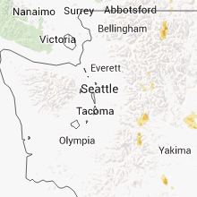
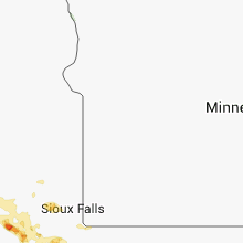
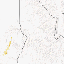
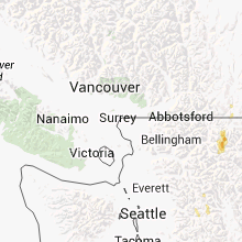
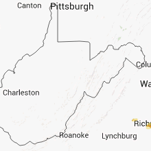
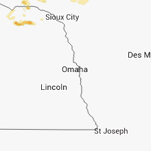
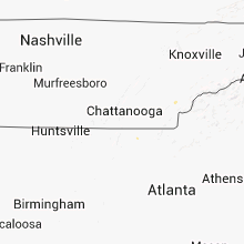
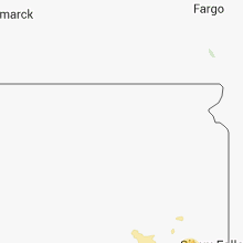
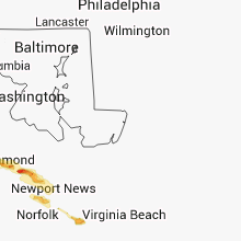
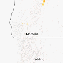
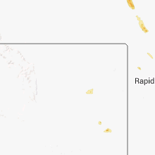
Hail Map for Saturday, August 10, 2013

Number of Impacted Households on 8/10/2013
0
Impacted by 1" or Larger Hail
0
Impacted by 1.75" or Larger Hail
0
Impacted by 2.5" or Larger Hail
Square Miles of Populated Area Impacted on 8/10/2013
0
Impacted by 1" or Larger Hail
0
Impacted by 1.75" or Larger Hail
0
Impacted by 2.5" or Larger Hail


Cities Most Affected by Hail Storms of 8/10/2013
| Hail Size | Demographics of Zip Codes Affected | ||||||
|---|---|---|---|---|---|---|---|
| City | Count | Average | Largest | Pop Density | House Value | Income | Age |
| Grants, NM | 2 | 1.75 | 1.75 | 9 | $66k | $29.7k | 37.1 |
| Parkston, SD | 1 | 2.00 | 2.00 | 6 | $54k | $31.1k | 45.8 |
| Union, OR | 1 | 1.75 | 1.75 | 5 | $80k | $30.2k | 44.9 |
| Baker, MT | 1 | 1.75 | 1.75 | 0 | $49k | $30.7k | 42.1 |
Hail and Wind Damage Spotted on 8/10/2013
Filter by Report Type:Hail ReportsWind Reports
States Impacted
Virginia, North Carolina, Louisiana, Arkansas, Colorado, New Mexico, North Dakota, Montana, Nebraska, Texas, South Carolina, Arizona, Oregon, South Dakota, WashingtonVirginia
| Local Time | Report Details |
|---|---|
| 11:49 AM EDT | Tree knocked down onto power lines along rt 20 south of charlottesville in albemarle county VA, 57.3 miles NW of Richmond, VA |
| 11:57 AM EDT | Tree down blocking rolling rd in albemarle county VA, 51.5 miles WNW of Richmond, VA |
| 2:00 PM EDT | Tree down near atlee and meadowbridge roads in hanover county VA, 18.2 miles ENE of Richmond, VA |
| 2:00 PM EDT | Quarter sized hail reported near Glen Allen, VA, 14.3 miles NE of Richmond, VA |
| 2:00 PM EDT | Quarter sized hail reported near Mechanicsville, VA, 18.2 miles ENE of Richmond, VA, several large tree limbs downed also. |
| 2:03 PM EDT | Quarter sized hail reported near Mechanicsville, VA, 18.2 miles ENE of Richmond, VA, quarter size hail vicinity rte 360 and lee davis rd |
| 2:05 PM EDT | Several large trees down in henrico county VA, 12.5 miles NE of Richmond, VA |
| 2:05 PM EDT | Structural damage to several homes from downed trees on windsor drive in mechanicsville...also a tree downed onto a vehicle in hanover county VA, 16.1 miles ENE of Richmond, VA |
| 2:10 PM EDT | Encountered tremendous downburst vicinity of pole green and meadowbridge roads... wind gust estimated 75 mph or greater... moved 3000 lb truck several fee in hanover county VA, 18.2 miles ENE of Richmond, VA |
| 2:23 PM EDT | Tree down vicinity of pole green road in hanover county VA, 18.2 miles ENE of Richmond, VA |
| 2:30 PM EDT | Quarter sized hail reported near Quinton, VA, 29.2 miles E of Richmond, VA, large tree also downed |
| 2:41 PM EDT | Large tree branches downed on i-64...near colonial downs in new kent county VA, 34.7 miles E of Richmond, VA |
| 2:44 PM EDT | Large tree downed on i-64 eastbound side. traffic partially blocke in new kent county VA, 30.3 miles E of Richmond, VA |
| 2:55 PM EDT | Trees downed near intersection of va-632 and va-10 in surry county VA, 47.8 miles WNW of Virginia Beach, VA |
| 3:20 PM EDT | Several trees down near settlers lane in james city county VA, 49.8 miles ESE of Richmond, VA |
| 4:01 PM EDT | One tree limb fell and took down a power line near the schewel furniture company along halifax road...time estimated from radar in halifax county VA, 66.9 miles NNW of Raleigh, NC |
| 4:19 PM EDT | One tree down along us route 360 north of the intersection of route 613...time estimated from radar in halifax county VA, 68.1 miles N of Raleigh, NC |
| 4:20 PM EDT | Several trees downed in northern virginia beach in city of virginia b county VA, 8.2 miles NNE of Virginia Beach, VA |
| 4:20 PM EDT | Quarter sized hail reported near Virginia Beach, VA, 11.5 miles NW of Virginia Beach, VA, 60 mph wind also measured. |
| 4:25 PM EDT | Large tree limbs down and partially blocking traffic in kirby crescent section of norfolk in city of norfolk county VA, 15.8 miles NW of Virginia Beach, VA |
| 4:57 PM EDT | Quarter sized hail reported near Virginia Beach, VA, 7 miles ESE of Virginia Beach, VA, hail varied between nickel and quarter size |
| 6:49 PM EDT | One tree fell and took a power line down on cutlett lane near the intersection of rolling hill road...time estimated from radar in charlotte county VA, 63.7 miles E of Roanoke, VA |
North Carolina
| Local Time | Report Details |
|---|---|
| 1:56 PM EDT | Two trees down along hoots road about two miles west of route 601...time estimated from radar in yadkin county NC, 61.7 miles N of Charlotte, NC |
| 2:00 PM EDT | One tree down along rome anthony road close to the intersection of lone hickory road...time estimated from radar in yadkin county NC, 59.1 miles N of Charlotte, NC |
| 2:05 PM EDT | One tree down along shacktown road near the intersection of blue dan lane...time estimated from radar in yadkin county NC, 63 miles N of Charlotte, NC |
| 2:09 PM EDT | Two trees down along courtney-huntsville road near the intersection of chris drive...time estimated from radar in yadkin county NC, 60.7 miles NNE of Charlotte, NC |
| 2:30 PM EDT | A few trees down near the southern end of harmony grove roa in mcdowell county NC, 67 miles SSE of Bristol, TN |
| 2:35 PM EDT | Tree down on bethel church rd and stigall r in guilford county NC, 75.5 miles S of Roanoke, VA |
| 2:45 PM EDT | Trees down on bunch rd near oakridge r in guilford county NC, 75.3 miles S of Roanoke, VA |
| 2:50 PM EDT | Trees down on bunch rd near northwest school r in guilford county NC, 76 miles S of Roanoke, VA |
| 3:00 PM EDT | Tree blown down near the intersection of adams farm parkway and watercrest drive. time estimated by rada in guilford county NC, 72.9 miles WNW of Raleigh, NC |
| 3:42 PM EDT | Trees down and power lines blocking roads just off springs road near kool in alexander county NC, 47.1 miles NNW of Charlotte, NC |
| 4:22 PM EDT | Multiple trees down with a few bringing down power lines on kyle lan in iredell county NC, 27.6 miles N of Charlotte, NC |
| 4:25 PM EDT | Spotter reported 62 mph wind gusts at the intersection of brawley school rd and hwy 21 just west of moores in iredell county NC, 24.7 miles N of Charlotte, NC |
| 4:25 PM EDT | A tree fell on a power line on bluefield road. the tree did not block the roa in iredell county NC, 26.7 miles N of Charlotte, NC |
| 4:57 PM EDT | 1 tree down off west c street nw of kannapoli in rowan county NC, 22.8 miles NNE of Charlotte, NC |
| 5:00 PM EDT | Trees down throughout rowan county. based on radar... core of the storm entered near mount ulla early in warning and bow like feature dissipated east of salisbury near in rowan county NC, 36.9 miles NNE of Charlotte, NC |
| 5:10 PM EDT | Tree down on the road at brighton rd and courtland dr in durham county NC, 19.7 miles NW of Raleigh, NC |
| 5:10 PM EDT | Tree down on power line... time estimated by radar in durham county NC, 11.6 miles NNW of Raleigh, NC |
| 5:15 PM EDT | Tree down on a house... time estimated by radar in wake county NC, 6.8 miles WSW of Raleigh, NC |
| 6:00 PM EDT | Tree down on williams rd...near old us hwy 6 in nash county NC, 25.3 miles ENE of Raleigh, NC |
| 6:05 PM EDT | Tree down on east jewett ave in bun in franklin county NC, 25.1 miles ENE of Raleigh, NC |
| 6:05 PM EDT | Tree down on hwy 6 in franklin county NC, 25.1 miles ENE of Raleigh, NC |
| 6:11 PM EDT | Tree down on a mobile home on black creek road... report relayed via ham radio... time estimated by radar in johnston county NC, 24.7 miles SSE of Raleigh, NC |
| 6:20 PM EDT | Tree down on railroad tracks at wal pat roa in johnston county NC, 26.4 miles SE of Raleigh, NC |
| 6:40 PM EDT | Power lines blown down near the intersection of highway 117 and great swamp loop. time estimate in wilson county NC, 39.9 miles ESE of Raleigh, NC |
| 6:50 PM EDT | One tree was reported down on a power line along watson road near highway 117 in wayne county NC, 40.4 miles ESE of Raleigh, NC |
Louisiana
| Local Time | Report Details |
|---|---|
| 1:32 PM CDT | Sheriff reported tree down on big pasture roa in cameron county LA, 33.6 miles ESE of Beaumont, TX |
Arkansas
| Local Time | Report Details |
|---|---|
| 2:50 PM CDT | Power pole and trees reported down. small shed was heavily damage in bradley county AR, 58 miles N of Bastrop, LA |
Colorado
| Local Time | Report Details |
|---|---|
| 2:01 PM MDT | Storm damage reported in montezuma county CO, 45.9 miles NNW of Farmington, NM |
| 3:13 PM MDT | Storm damage reported in la plata county CO, 39 miles NE of Farmington, NM |
| 3:25 PM MDT | Storm damage reported in la plata county CO, 39 miles NE of Farmington, NM |
| 3:45 PM MDT | Several trees down in the durango area in la plata county CO, 43 miles NNE of Farmington, NM |
New Mexico
| Local Time | Report Details |
|---|---|
| 2:05 PM MDT | Golf Ball sized hail reported near Grants, NM, 81.3 miles W of Albuquerque, NM |
| 2:55 PM MDT | Golf Ball sized hail reported near Grants, NM, 73.4 miles WSW of Albuquerque, NM |
North Dakota
| Local Time | Report Details |
|---|---|
| 3:29 PM CDT | 6 inch diameter limb blown out of the top of a tre in mckenzie county ND, 20.5 miles S of Williston, ND |
| 3:29 PM CDT | Quarter sized hail reported near Alexander, ND, 20.5 miles S of Williston, ND |
| 3:30 PM CDT | Nickel-sized hail was also reported in mckenzie county ND, 21.2 miles S of Williston, ND |
| 3:31 PM CDT | Quarter sized hail reported near Alexander, ND, 21.2 miles S of Williston, ND |
| 3:35 PM CDT | Damage to siding on homes and buildings due to a combination of large hail estimated around an inch in diameter and high winds estimated around 60 mph. tool trailer ove in mckenzie county ND, 22.9 miles S of Williston, ND |
| 4:39 PM MDT | Storm damage reported in dunn county ND, 67.3 miles SE of Williston, ND |
| 5:10 PM MDT | Storm damage reported in golden valley county ND, 71.1 miles S of Williston, ND |
| 5:15 PM MDT | 2.11 inches of rainfall in 15 minutes in golden valley county ND, 86.6 miles SSW of Williston, ND |
Montana
| Local Time | Report Details |
|---|---|
| 3:25 PM MDT | Quarter sized hail reported near Sidney, MT, 40 miles SW of Williston, ND, pea and quarter sized hail covering 25 percent of the ground...0.77 inches of rain in 15 minutes with measured 35 mph wind gust. |
| 3:38 PM MDT | Quarter sized hail reported near Sidney, MT, 33.7 miles SW of Williston, ND, pea to quarter sized hail with brief heavy rain and estimated wind gust to 40 mph. |
| 3:55 PM MDT | Half Dollar sized hail reported near Nashua, MT, 17.4 miles ESE of Glasgow, MT, quarter and half dollar sized hail. |
| 4:20 PM MDT | Quarter sized hail reported near Joliet, MT, 40.8 miles SW of Billings, MT |
| 4:30 PM MDT | Quarter sized hail reported near Babb, MT, 51.2 miles NE of Whitefish, MT |
| 4:42 PM MDT | Quarter sized hail reported near Joliet, MT, 36 miles SW of Billings, MT |
| 7:45 PM MDT | Golf Ball sized hail reported near Baker, MT, 75 miles E of Miles City, MT, hail up to golf ball size broke many windows and damaged siding on homes and dented and broke windows on cars. one family lost 6 windows on their home alone. the hail w |
| 7:50 PM MDT | Quarter sized hail reported near Baker, MT, 75.3 miles E of Miles City, MT |
| 8:00 PM MDT | Quarter sized hail reported near Baker, MT, 75.1 miles E of Miles City, MT |
| 8:15 PM MDT | Quarter sized hail reported near Heart Butte, MT, 68.9 miles E of Whitefish, MT |
| 8:21 PM MDT | Quarter sized hail reported near Heart Butte, MT, 68.9 miles E of Whitefish, MT, over one inch deep hail covering the ground |
Nebraska
| Local Time | Report Details |
|---|---|
| 5:00 PM CDT | Quarter sized hail reported near Creighton, NE, 39.3 miles E of Oneill, NE |
Texas
| Local Time | Report Details |
|---|---|
| 5:50 PM CDT | Numerous trees reported downed northeast of brenham and east of independence along fm 390 east and tappe roa in washington county TX, 66.4 miles NW of Houston, TX |
| 6:45 PM CDT | Tree down near the mall in smith county TX, 76.2 miles NNW of Lufkin, TX |
| 6:45 PM CDT | Tree down new the mall in smith county TX, 76.2 miles NNW of Lufkin, TX |
| 7:15 PM CDT | 5 to 6 inch diameter tree limbs blown down in williamson county TX, 34.2 miles SSE of Killeen, TX |
| 8:10 PM CDT | A microburst in the brady area resulted in 5 downed power lines. this caused a power outage for most of mcculloch county that lasted approximately 18 hours. power has b in mcculloch county TX, 93.5 miles SSE of Abilene, TX |
| 10:25 PM CDT | A few oak trees 12 to 15 feet in length were uprooted. numerous large limbs were also dow in kimble county TX, 94 miles NE of Del Rio, TX |
South Carolina
| Local Time | Report Details |
|---|---|
| 7:31 PM EDT | Fire department reported 2 trees down near the intersection of edwards road and talley bridge roa in greenville county SC, 16.2 miles NNE of Greenville, SC |
Arizona
| Local Time | Report Details |
|---|---|
| 4:50 PM MST | Sheriffs officials in graham county reported that numerous reports of power outages from thatcher to pima with some reports of power poles down. also some minor damage in graham county AZ, 83 miles W of Silver City, NM |
Oregon
| Local Time | Report Details |
|---|---|
| 5:00 PM PDT | Quarter sized hail reported near Welches, OR, 33.4 miles ESE of Portland, OR |
| 5:08 PM PDT | Ping Pong Ball sized hail reported near Government Camp, OR, 43.7 miles ESE of Portland, OR, 1.5 inch diameter hail observed on hwy 26 about 3 mi west of government camp |
| 5:48 PM PDT | Quarter sized hail reported near Union, OR, 63.5 miles SSE of Walla Walla, WA |
| 5:50 PM PDT | Quarter sized hail reported near Union, OR, 63.8 miles SSE of Walla Walla, WA |
| 5:55 PM PDT | Ping Pong Ball sized hail reported near Union, OR, 63.7 miles SSE of Walla Walla, WA, estimated one and one-half inch sized hail with property damage to patio roof. |
| 5:56 PM PDT | Golf Ball sized hail reported near Union, OR, 63.7 miles SSE of Walla Walla, WA |
| 6:02 PM PDT | Quarter sized hail reported near Union, OR, 63.7 miles SSE of Walla Walla, WA |
| 6:04 PM PDT | Quarter sized hail reported near Cove, OR, 59.1 miles SSE of Walla Walla, WA |
| 6:13 PM PDT | Quarter sized hail reported near Union, OR, 63.7 miles SSE of Walla Walla, WA, estimated quarter size hail causing property damage. |
South Dakota
| Local Time | Report Details |
|---|---|
| 7:03 PM CDT | Hen Egg sized hail reported near Parkston, SD, 63.9 miles W of Sioux Falls, SD |
| 7:05 PM CDT | Signs and buildings damaged at intersection of south dakota highways 37 and 44. camper also overturned and fence destroye in hutchinson county SD, 64.2 miles W of Sioux Falls, SD |
| 7:12 PM CDT | Ping Pong Ball sized hail reported near Dimock, SD, 61.6 miles W of Sioux Falls, SD, hail completely covered the ground and damaged siding of house. |
| 7:38 PM CDT | Ping Pong Ball sized hail reported near Olivet, SD, 51.6 miles WSW of Sioux Falls, SD |
| 7:43 PM CDT | Quarter sized hail reported near Mitchell, SD, 66.4 miles WNW of Sioux Falls, SD, northeast section of mitchell and very short in duration. |
| 8:07 PM CDT | Half Dollar sized hail reported near Yankton, SD, 58.2 miles SW of Sioux Falls, SD |
| 9:00 PM MDT | Quarter sized hail reported near Buffalo, SD, 102.6 miles ESE of Miles City, MT |
| 10:00 PM MDT | Storm damage reported in harding county SD, 105.7 miles NNW of Rapid City, SD |
| 10:15 PM MDT | Storm damage reported in lawrence county SD, 33.4 miles NNW of Rapid City, SD |
| 11:57 PM CDT | Quarter sized hail reported near Irene, SD, 38.7 miles SW of Sioux Falls, SD, at least quarter size hail...possibly larger...could hear hail hitting the deck over tghe phone. |
| 12:08 AM CDT | Quarter sized hail reported near Centerville, SD, 34.8 miles SSW of Sioux Falls, SD |
Washington
| Local Time | Report Details |
|---|---|
| 10:30 PM PDT | Winds uprooted a 40 foot tree with a 5 foot diameter trunk onto a car in southeastern quincy. power and phones are out in the southwestern portion of quincy. standing w in grant county WA, 53.3 miles NE of Yakima, WA |
| 11:00 PM PDT | Chelan county pud reported numerous trees on power lines and power poles broken on the southern end of lake chela in chelan county WA, 46.1 miles SSW of Omak, WA |
| 11:15 PM PDT | 2 trees down at desert canyons lodge. trees were estimated to be 2 ft in diamter at the bas in douglas county WA, 55.1 miles SSW of Omak, WA |
| 11:30 PM PDT | Trees blown down. two of the downed trees landed on houses along e poplar st. many large branches on ground throughout waterville. evidence of hail but not confirme in douglas county WA, 58.3 miles SSW of Omak, WA |
| 11:30 PM PDT | 3 large trees knocked over by winds into high voltage power lines north of orondo. diameter of trees estimated to be 2 feet and around 120ft tall. small fire started du in douglas county WA, 61 miles SSW of Omak, WA |
| 11:30 PM PDT | Approx 50 fruit trees in orondo were uprooted or broke as the result of winds. trees 1ft in diamter snappe in douglas county WA, 63.1 miles SSW of Omak, WA |
| 11:30 PM PDT | Wind blew over tree in persons front yard in orondo. diameter of tree at base was about 5 inche in douglas county WA, 63.1 miles SSW of Omak, WA |
| 11:45 PM PDT | Chelan county pud reported numerous trees on power lines and power poles broken on the southern end of lake chela in chelan county WA, 46.1 miles SSW of Omak, WA |
| 12:45 AM PDT | North cascades smokejumper base raws. gust was reported on the 106 am observation so time of the actual gust was estimated from rada in okanogan county WA, 28.2 miles W of Omak, WA |
| 1:00 AM PDT | Several trees damaged or blown down at beaver creek golf course. time estimated from rada in okanogan county WA, 28.3 miles W of Omak, WA |
Connect with Interactive Hail Maps