

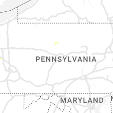
Hail Map for Monday, August 29, 2022

Number of Impacted Households on 8/29/2022
0
Impacted by 1" or Larger Hail
0
Impacted by 1.75" or Larger Hail
0
Impacted by 2.5" or Larger Hail
Square Miles of Populated Area Impacted on 8/29/2022
0
Impacted by 1" or Larger Hail
0
Impacted by 1.75" or Larger Hail
0
Impacted by 2.5" or Larger Hail


Cities Most Affected by Hail Storms of 8/29/2022
| Hail Size | Demographics of Zip Codes Affected | ||||||
|---|---|---|---|---|---|---|---|
| City | Count | Average | Largest | Pop Density | House Value | Income | Age |
Hail and Wind Damage Spotted on 8/29/2022
Filter by Report Type:Hail ReportsWind Reports
States Impacted
Iowa, Illinois, Oklahoma, Pennsylvania, New York, Indiana, Kentucky, Missouri, Michigan, Tennessee, Texas, Ohio, Arkansas, Kansas, AlabamaIowa
| Local Time | Report Details |
|---|---|
| 10:00 AM CDT | Quarter sized hail reported near Muscatine, IA, 46.3 miles SE of Cedar Rapids, IA |
Illinois
| Local Time | Report Details |
|---|---|
| 11:56 AM CDT | Delayed report and time estimated from radar. large tree knocked down in yar in putnam county IL, 40.6 miles NNE of Peoria, IL |
| 12:05 PM CDT | Multiple reports of small tree branches downed in elgin area relayed via mping. time estimated by rada in kane county IL, 35 miles WNW of Chicago, IL |
| 12:08 PM CDT | Trained spotter reports 1/2 inch to 2 inch diameter tree branches downed near butterfield road and il-59. time estimated by rada in dupage county IL, 29.6 miles W of Chicago, IL |
| 12:10 PM CDT | Tree down on hickory grove roa in marshall county IL, 22.6 miles NNE of Peoria, IL |
| 12:12 PM CDT | 6 inch diameter branch downed onto fence near north avenue and glen ellyn road. time estimated by rada in dupage county IL, 22.1 miles W of Chicago, IL |
| 12:14 PM CDT | 60 mph gust recorded by hoffman estates emergency managemen in cook county IL, 26.2 miles WNW of Chicago, IL |
| 12:15 PM CDT | Large tree limb down on kerwood st. time estimated by rada in cook county IL, 26.1 miles NW of Chicago, IL |
| 12:20 PM CDT | Public report of 6-8 inch diameter branches downed. time estimated by rada in cook county IL, 22.9 miles NW of Chicago, IL |
| 12:20 PM CDT | Multiple branches up to 6 inch diameter downed in mount prospect. relayed via social media. time estimated by rada in cook county IL, 20 miles NW of Chicago, IL |
| 12:21 PM CDT | Multiple downed branches about one to one and a half inches in diameter along euclid road. relayed via social medi in cook county IL, 21.7 miles NW of Chicago, IL |
| 12:22 PM CDT | Public report of 18 inch diameter tree snapped at base. tree appeared to be rotten. time estimated by rada in cook county IL, 14.2 miles NW of Chicago, IL |
| 12:23 PM CDT | Asos station kord reported 58 mph wind gus in cook county IL, 15.3 miles WNW of Chicago, IL |
| 12:25 PM CDT | Public report of healthy tree 12 inches in diameter snapped at the base. time estimated by rada in cook county IL, 17.5 miles NW of Chicago, IL |
| 12:26 PM CDT | Downed at rand road and golf road. relayed on social medi in cook county IL, 17.9 miles NW of Chicago, IL |
| 12:28 PM CDT | Report of a tree branch falling on a home in the 700 block of south monroe street. relayed via emergency management. time estimated from rada in la salle county IL, 49 miles NE of Peoria, IL |
| 12:28 PM CDT | Report of tree branches downed across ottawa. time estimated by rada in la salle county IL, 59.9 miles NE of Peoria, IL |
| 12:28 PM CDT | Tree down on ca in cook county IL, 5.3 miles WNW of Chicago, IL |
| 12:30 PM CDT | Us army corps of engineers weather station reported 62 mph gus in la salle county IL, 53.7 miles NE of Peoria, IL |
| 12:30 PM CDT | Report of multiple trees and power lines damaged in streator. time estimated by radar. relayed via broadcast medi in la salle county IL, 49.5 miles NE of Peoria, IL |
| 12:35 PM CDT | Public report of small tree downed in evanston. relayed via social media. time estimated by rada in cook county IL, 12.4 miles NNW of Chicago, IL |
| 12:35 PM CDT | Public report of 8 inch tree limbs downed and damage to a screen door. relayed via social media. time estimated by rada in cook county IL, 5.8 miles WNW of Chicago, IL |
| 12:35 PM CDT | Large portion of tree downed at howard and eastlake. estimated one and a half foot in diameter. relayed on social medi in cook county IL, 9.5 miles N of Chicago, IL |
| 12:39 PM CDT | Weather station at montrose harbor reported 59 mph gus in lmz741 county IL, 5.9 miles N of Chicago, IL |
| 12:40 PM CDT | 8 inch diameter limb downed near eastlake terrance and howard street. time estimated by rada in cook county IL, 9.5 miles N of Chicago, IL |
| 12:44 PM CDT | Report of a fence damaged by downed tree branches. time estimated by rada in la salle county IL, 64.3 miles SW of Chicago, IL |
| 12:45 PM CDT | Picture of tree branches down on a car in the 7000 block of washtenaw avenue. report relayed via social medi in cook county IL, 8.4 miles SSW of Chicago, IL |
| 12:51 PM CDT | 911 call center relayed a large tree branch was downed and blocked both directions of sand ridge road. time estimated by rada in grundy county IL, 48.3 miles SW of Chicago, IL |
| 1:00 PM CDT | Public report of small branches downed in dwight. relayed via mping. time estimated by rada in livingston county IL, 66.1 miles ENE of Peoria, IL |
| 1:02 PM CDT | Photo shared via social media shows semi trailer tipped over at industrial parking lot. location approximate. time estimated by rada in will county IL, 47 miles SW of Chicago, IL |
| 1:05 PM CDT | Braidwood emergency management reports multiple large tree branches downed. time estimated by rada in will county IL, 51.9 miles SW of Chicago, IL |
| 1:10 PM CDT | Emergency manager reports a few small branches downed in manhattan and a downed power line. time estimated by rada in will county IL, 36.7 miles SSW of Chicago, IL |
| 1:12 PM CDT | Multiple branches up to5-6 inch diameter downed in wilton center. time estimated by rada in will county IL, 40.6 miles SSW of Chicago, IL |
| 1:15 PM CDT | Public report of small branches downed northwest of bourbonnais. relayed via mping. time estimated by rada in kankakee county IL, 48.4 miles SSW of Chicago, IL |
| 1:17 PM CDT | Photos shared on social media of several 6-8 inch in diameter tree branches downed. time estimated by rada in kankakee county IL, 45.1 miles SSW of Chicago, IL |
| 1:18 PM CDT | Public report of 6 inch diameter tree limbs downed near county line road and us 45 us 52. time estimated by rada in will county IL, 43 miles SSW of Chicago, IL |
| 1:18 PM CDT | Large tree branches downed near i-57 and wilmington peotone road west of peotone. time estimated by rada in will county IL, 40.1 miles SSW of Chicago, IL |
| 1:20 PM CDT | Trained spotter reports widespread damage to trees on the northwest side of peotone. most trees with downed branches and limbs. time estimated by rada in will county IL, 38.5 miles SSW of Chicago, IL |
| 1:20 PM CDT | 9 inch diameter branch downed near corning avenue and conrad street in peotone. relayed via amateur radio. time estimated by rada in will county IL, 39.1 miles SSW of Chicago, IL |
| 1:24 PM CDT | Private weather station reported 74 mph gust east of peoton in will county IL, 38 miles S of Chicago, IL |
| 1:24 PM CDT | Peotone cooperative observer reports 69 mph gust near 3rd street and main street. mesonet station located 35 feet above ground level on police station. observer also re in will county IL, 39.1 miles SSW of Chicago, IL |
| 1:25 PM CDT | 2 foot diameter tree downed blocking a road. tree appears to be rotted. another 12 inch branch downed onto car. relayed via social media. time estimated by rada in kankakee county IL, 52.7 miles SSW of Chicago, IL |
| 1:30 PM CDT | Several reports of downed trees in grant park... aroma park... bradley... and kankakee. time estimated by rada in kankakee county IL, 53.1 miles S of Chicago, IL |
| 1:30 PM CDT | Trained spotter reports small branches downed north of grant park near il-1 and 10500 north road. relayed via amateur radio. time estimated by rada in kankakee county IL, 42.4 miles S of Chicago, IL |
| 1:30 PM CDT | 6-8 inch diameter branch downed in grant park near maple street and taylor street. time estimated by radar. relayed via social medi in kankakee county IL, 44.5 miles S of Chicago, IL |
| 1:30 PM CDT | Power poles downed and debris on roadways near 6000 north road and 7500 east road west of grant park. time estimated by rada in kankakee county IL, 46.8 miles S of Chicago, IL |
| 1:33 PM CDT | 20 foot tall... 6 inch diameter apple tree downed near bull creek road and il-17. east of grant park. time estimated by radar. relayed via amateur radi in kankakee county IL, 45.4 miles S of Chicago, IL |
| 1:33 PM CDT | Tree downed and several branches downed on a farm near clifton. location approximate. time estimated by radar. relayed via broadcast medi in iroquois county IL, 67.8 miles SSW of Chicago, IL |
| 6:30 PM CDT | Delayed report. tree down over rte 9 in sangamon county IL, 57.1 miles SSW of Peoria, IL |
| 7:04 PM CDT | Mesonet station dw9022 plainfiel in sangamon county IL, 62.1 miles S of Peoria, IL |
| 7:12 PM CDT | Tree and power pole down and on fire near the 100 block of grant s in vermilion county IL, 64.8 miles NNE of Mattoon, IL |
| 7:12 PM CDT | Quarter sized hail reported near Cornell, IL, 49.4 miles ENE of Peoria, IL |
| 7:15 PM CDT | Video shows a trampoline blown over a 15 ft porch roof and landed in backyard from strong thunderstorm winds. time estimated from rada in adams county IL, 38.3 miles SSE of Kahoka, MO |
| 7:22 PM CDT | Trees dow in vermilion county IL, 67.4 miles NE of Mattoon, IL |
| 7:30 PM CDT | Power poles down and transformer on fire near the 1700 block of washington r in vermilion county IL, 57.4 miles NE of Mattoon, IL |
| 7:35 PM CDT | Large limbs down on denmark rd 2 nw of danvill in vermilion county IL, 61.2 miles NE of Mattoon, IL |
| 7:35 PM CDT | Power poles down on poland rd in danvill in vermilion county IL, 62.4 miles NE of Mattoon, IL |
| 7:39 PM CDT | Downed power pole/lines blocking road in livingston county IL, 53.6 miles ENE of Peoria, IL |
| 7:39 PM CDT | Tree snappe in livingston county IL, 53.1 miles ENE of Peoria, IL |
| 7:40 PM CDT | Trees dow in vermilion county IL, 54.2 miles NE of Mattoon, IL |
| 7:40 PM CDT | Tree damage and 0.75 inch hail reported in kickapoo state par in vermilion county IL, 56.6 miles NE of Mattoon, IL |
| 7:45 PM CDT | Power lines down and tree down in argent in macon county IL, 42.3 miles NNW of Mattoon, IL |
| 7:45 PM CDT | Delayed report. tree down on power lines in tow in vermilion county IL, 62.1 miles NNE of Mattoon, IL |
| 9:32 PM CDT | Storm damage reported in moultrie county IL, 9.5 miles WNW of Mattoon, IL |
Oklahoma
| Local Time | Report Details |
|---|---|
| 12:32 PM CDT | Southbound semi-truck blown over at mile marker 172 on i-3 in payne county OK, 43.8 miles NNE of Oklahoma City, OK |
| 2:25 PM CDT | Large tree limb down. time estimated from rada in tulsa county OK, 11.6 miles ESE of Tulsa, OK |
| 3:25 PM CDT | Large tree down ... large limb down on a mobile home. several power lines down. railroad crossing gate damaged at sh 66 an 6th street. report relayed via social medi in rogers county OK, 41.4 miles NE of Tulsa, OK |
| 3:40 PM CDT | Storm damage reported in texas county OK, 96.9 miles N of Amarillo, TX |
| 3:44 PM CDT | Quarter sized hail reported near Goodwell, OK, 97.1 miles N of Amarillo, TX |
| 4:00 PM CDT | Barn destroyed. time estimated by rada in pottawatomie county OK, 30.2 miles ESE of Oklahoma City, OK |
| 4:25 PM CDT | Oklahoma mesonet observatio in grady county OK, 38.8 miles SW of Oklahoma City, OK |
Pennsylvania
| Local Time | Report Details |
|---|---|
| 1:40 PM EDT | Trees and wires down on anderson road in beaver county PA, 37.7 miles NW of Pittsburgh, PA |
| 1:50 PM EDT | Photo of trees down on roadway in beaver county PA, 21.3 miles NW of Pittsburgh, PA |
| 4:00 PM EDT | Tree down on wires in allegheny county PA, 5.8 miles ESE of Pittsburgh, PA |
| 4:15 PM EDT | Wires down on 4th av in westmoreland county PA, 15.9 miles NE of Pittsburgh, PA |
| 4:24 PM EDT | Tree down along church street in westmoreland county PA, 23 miles NE of Pittsburgh, PA |
| 4:30 PM EDT | Tree down on vandergrift lane in westmoreland county PA, 25.1 miles ENE of Pittsburgh, PA |
| 4:35 PM EDT | Tree down on edmon roa in armstrong county PA, 27.7 miles ENE of Pittsburgh, PA |
| 4:45 PM EDT | Tree down on state route 1018 in boggs township in armstrong county PA, 44.1 miles NE of Pittsburgh, PA |
| 5:02 PM EDT | Trees down around smicksburg in indiana county PA, 52.7 miles NE of Pittsburgh, PA |
| 5:23 PM EDT | A few trees down in the city of punxsutawne in jefferson county PA, 59.5 miles W of State College, PA |
| 5:28 PM EDT | Tree down in glen campbell from the outflow of the gust fron in indiana county PA, 50.9 miles W of State College, PA |
New York
| Local Time | Report Details |
|---|---|
| 2:09 PM EDT | Trees and wires down. time estimated by rada in chautauqua county NY, 62.2 miles SW of Buffalo, NY |
| 2:21 PM EDT | Trees and wires down. time estimated by rada in chautauqua county NY, 64.1 miles SSW of Buffalo, NY |
| 2:34 PM EDT | Trees and wires down. time estimated by rada in chautauqua county NY, 56.5 miles SSW of Buffalo, NY |
| 2:40 PM EDT | Multiple trees down. time estimated by rada in chautauqua county NY, 59.3 miles SSW of Buffalo, NY |
| 2:45 PM EDT | Tree down. time estimated by rada in chautauqua county NY, 56.5 miles SSW of Buffalo, NY |
| 2:45 PM EDT | Large tree limb on hous in chautauqua county NY, 58.4 miles SSW of Buffalo, NY |
| 2:45 PM EDT | *** 1 inj *** tree fell on motorcyclis in chautauqua county NY, 56.6 miles SSW of Buffalo, NY |
| 2:51 PM EDT | Trees and wires down. time estimated by rada in chautauqua county NY, 51.6 miles SSW of Buffalo, NY |
| 2:55 PM EDT | Trees and wires down. time estimated by rada in chautauqua county NY, 47.4 miles SSW of Buffalo, NY |
| 2:55 PM EDT | Trees and wires down. time estimated by rada in chautauqua county NY, 42.5 miles SSW of Buffalo, NY |
| 2:59 PM EDT | Trees and wires down. time estimated by rada in chautauqua county NY, 55.3 miles SSW of Buffalo, NY |
| 3:05 PM EDT | Trees and wires down. time estimated by rada in cattaraugus county NY, 32.5 miles S of Buffalo, NY |
| 3:07 PM EDT | Trees and wires down. time estimated by rada in cattaraugus county NY, 38.3 miles S of Buffalo, NY |
| 3:07 PM EDT | Large tree on house. time estimated by rada in cattaraugus county NY, 41.1 miles S of Buffalo, NY |
| 3:20 PM EDT | Tree down. time estimated by rada in erie county NY, 20.6 miles ESE of Buffalo, NY |
| 3:37 PM EDT | Trees and wires down. time estimated by rada in cattaraugus county NY, 31.8 miles SE of Buffalo, NY |
| 4:08 PM EDT | Multiple trees down. time estimated by rada in wyoming county NY, 39.5 miles ESE of Buffalo, NY |
| 4:23 PM EDT | Trees and wires down. time estimated by rada in allegany county NY, 66.9 miles SSE of Buffalo, NY |
| 4:30 PM EDT | Trees and wires down. time estimated by rada in livingston county NY, 56.2 miles ESE of Buffalo, NY |
| 4:38 PM EDT | Trees and wires down. time estimated by rada in allegany county NY, 81.3 miles SE of Buffalo, NY |
| 4:49 PM EDT | Trees and wires down. time estimated by rada in allegany county NY, 74.8 miles SE of Buffalo, NY |
| 4:53 PM EDT | Trees and wires down. time estimated by rada in allegany county NY, 70.3 miles SE of Buffalo, NY |
| 5:01 PM EDT | Trees and wires down. time estimated by rada in allegany county NY, 70 miles ESE of Buffalo, NY |
| 5:01 PM EDT | Trees and wires down. time estimated by rada in livingston county NY, 62.9 miles ESE of Buffalo, NY |
| 5:03 PM EDT | Trees and wires down. time estimated by rada in monroe county NY, 65 miles W of Syracuse, NY |
| 5:05 PM EDT | Trees and wires down. time estimated by rada in monroe county NY, 66.6 miles W of Syracuse, NY |
| 5:05 PM EDT | Trees and wires down. time estimated by rada in livingston county NY, 64 miles ESE of Buffalo, NY |
| 5:12 PM EDT | Trees and wires down. time estimated by rada in livingston county NY, 66.7 miles ESE of Buffalo, NY |
| 5:17 PM EDT | Trees and wires down. time estimated by rada in wayne county NY, 56.3 miles W of Syracuse, NY |
| 5:26 PM EDT | Trees and wires down. time estimated by rada in ontario county NY, 67.3 miles WSW of Syracuse, NY |
| 5:31 PM EDT | Tree down blocking roa in steuben county NY, 81 miles SW of Syracuse, NY |
| 5:32 PM EDT | Trees and wires down. time estimated by rada in ontario county NY, 70.2 miles WSW of Syracuse, NY |
| 5:33 PM EDT | Tree down blocking roa in steuben county NY, 77.2 miles SW of Syracuse, NY |
| 5:39 PM EDT | Trees and wires down. time estimated by rada in ontario county NY, 46.7 miles W of Syracuse, NY |
| 5:40 PM EDT | Large tree down blocking roa in steuben county NY, 80.4 miles SW of Syracuse, NY |
| 5:42 PM EDT | Trees down. time estimated by rada in wayne county NY, 48 miles WNW of Syracuse, NY |
| 6:07 PM EDT | Numerous trees down on hoyt road and himrod road. time estimated from rada in yates county NY, 52.6 miles WSW of Syracuse, NY |
| 6:07 PM EDT | Tree down on mcelwee road. time estimated from rada in yates county NY, 52.6 miles WSW of Syracuse, NY |
| 6:10 PM EDT | Mesonet station penn penn yan. 74 mph gust measured with sonic anemometer... 69 mph with prop anemomete in yates county NY, 50.6 miles WSW of Syracuse, NY |
| 6:15 PM EDT | Trees and wires down on david downey road. time estimated from rada in yates county NY, 48.2 miles WSW of Syracuse, NY |
| 6:21 PM EDT | Multiple trees down on the lakeshore of the suny oswego campus. time estimated by rada in oswego county NY, 34.5 miles NW of Syracuse, NY |
| 6:22 PM EDT | Trees and wires down. time estimated by rada in cayuga county NY, 32.9 miles NW of Syracuse, NY |
| 6:26 PM EDT | Trees and wires down. time estimated by rada in jefferson county NY, 57.3 miles SW of Ogdensburg, NY |
| 6:26 PM EDT | Trees and wires down. time estimated by rada in oswego county NY, 33.4 miles NNW of Syracuse, NY |
| 6:42 PM EDT | Trees and wires down. time estimated by rada in oswego county NY, 25.3 miles NW of Syracuse, NY |
| 6:48 PM EDT | Trees and wires down. time estimated by rada in jefferson county NY, 42.8 miles SW of Ogdensburg, NY |
| 7:01 PM EDT | Trees and wires down. time estimated by rada in oswego county NY, 28.6 miles N of Syracuse, NY |
| 7:12 PM EDT | Awos station kgtb fort drum airfiel in jefferson county NY, 44.6 miles SSW of Ogdensburg, NY |
| 7:18 PM EDT | Trees and wires down. time estimated by rada in jefferson county NY, 51.6 miles S of Ogdensburg, NY |
| 7:25 PM EDT | Trees and wires down. time estimated by rada in jefferson county NY, 34.7 miles S of Ogdensburg, NY |
Indiana
| Local Time | Report Details |
|---|---|
| 1:40 PM CDT | Public report of small branches downed in lowell. relayed via mping. time estimated by rada in lake county IN, 42.9 miles SSE of Chicago, IL |
| 1:42 PM CDT | Spotter reported a gust of 81 mph on a home weather station. county dispatch relayed reports of tree damage across the county including in and around lowell... dyer. in lake county IN, 41.9 miles SSE of Chicago, IL |
| 1:50 PM CDT | County dispatch relayed numerous reports of downed tree limbs across all of newton county with the most concentrated damage near roselawn. time estimated by rada in newton county IN, 53.8 miles SSE of Chicago, IL |
| 2:00 PM CDT | Trained spotter reports numerous 2-3 inch branches downed west of wheatfiel in jasper county IN, 55 miles SSE of Chicago, IL |
| 2:02 PM CDT | Trained weather spotter relayed extensive damage along state road 10 and surrounding areas from demotte to wheatfield. healthy trees were snapped at their base... and a in jasper county IN, 54.8 miles SSE of Chicago, IL |
| 2:04 PM CDT | Large oak tree downed onto shed. tree did appear partially rotten. relayed via social medi in jasper county IN, 61.5 miles SSE of Chicago, IL |
| 2:20 PM CDT | Large limbs down and some bent power poles. a limb was down in the roadway in the are in starke county IN, 64.9 miles SE of Chicago, IL |
| 3:26 PM EDT | A vehicle struck a tree on us 20 at the intersection of smilax road. there were no injuries reporte in st. joseph county IN, 62.7 miles E of Chicago, IL |
| 3:30 PM EDT | *** 1 inj *** large tree down on car. minor injury with a paramedics chec in st. joseph county IN, 68.2 miles ESE of Chicago, IL |
| 2:30 PM CDT | Large tree branch blocking the roa in starke county IN, 71.4 miles SE of Chicago, IL |
| 3:35 PM EDT | Two large trees across the roa in marshall county IN, 72.2 miles WNW of Fort Wayne, IN |
| 3:40 PM EDT | Power pole down with a powerline in the stree in st. joseph county IN, 69.5 miles WNW of Fort Wayne, IN |
| 3:45 PM EDT | 8 inch in diameter tree down in yar in fulton county IN, 68.5 miles W of Fort Wayne, IN |
| 3:45 PM EDT | Large tree down in the roa in marshall county IN, 65.5 miles WNW of Fort Wayne, IN |
| 3:45 PM EDT | Tree down on a house at ewing and balis streets. time estimated from rada in marshall county IN, 65.2 miles WNW of Fort Wayne, IN |
| 3:45 PM EDT | Large tree branch snapped... estimated to be 2 ft in diameter. time estimated from rada in marshall county IN, 61.1 miles W of Fort Wayne, IN |
| 3:45 PM EDT | Large tree dow in pulaski county IN, 77.1 miles SE of Chicago, IL |
| 3:45 PM EDT | Large tree down in this neighborhoo in miami county IN, 56 miles WSW of Fort Wayne, IN |
| 3:51 PM EDT | Picture of west facing football scoreboard bent to ground at rochester high schoo in fulton county IN, 58.5 miles W of Fort Wayne, IN |
| 3:55 PM EDT | Nws employee reports 45-50 mph wind gusts... with small branches down of 1-3 inches in diamete in kosciusko county IN, 42.3 miles WNW of Fort Wayne, IN |
| 3:55 PM EDT | Report of tree onto vehicle with at least 1 person trappe in fulton county IN, 62.8 miles W of Fort Wayne, IN |
| 4:05 PM EDT | Scanner traffic indicated tree down onto a vehicle with 2 trappe in kosciusko county IN, 40.7 miles W of Fort Wayne, IN |
| 4:05 PM EDT | Mesonet station gw0734 milfor in kosciusko county IN, 45.8 miles WNW of Fort Wayne, IN |
| 4:09 PM EDT | Corrects previous tstm wnd gst report from 1 nne winona lake. estimated 60 mph wind gust as well as tree down near gettysbutg ct and walnut s in kosciusko county IN, 38.3 miles WNW of Fort Wayne, IN |
| 4:10 PM EDT | Trees down in this neighborhood. some of them blocking street in kosciusko county IN, 37.1 miles WNW of Fort Wayne, IN |
| 4:10 PM EDT | Picture shared of tree limb down at 920 anchorage rd. time estimated by rada in kosciusko county IN, 40.7 miles WNW of Fort Wayne, IN |
| 4:15 PM EDT | Tree limbs snapped at 920 anchorage road in warsaw. estimated to be 1 to 2 ft in diamete in kosciusko county IN, 40.8 miles WNW of Fort Wayne, IN |
| 4:15 PM EDT | Tree limbs dow in kosciusko county IN, 38.5 miles NW of Fort Wayne, IN |
| 4:20 PM EDT | Storm damage reported in lagrange county IN, 42 miles NNW of Fort Wayne, IN |
| 4:20 PM EDT | Tree onto power line in whitley county IN, 28 miles WNW of Fort Wayne, IN |
| 4:20 PM EDT | Reports of trees down from law enforcement on 300 and 400 south. tree onto house in south whitley on broadstreet.. in whitley county IN, 27.7 miles W of Fort Wayne, IN |
| 4:20 PM EDT | Trees onto power line in whitley county IN, 23.5 miles WNW of Fort Wayne, IN |
| 4:25 PM EDT | Several trees and tree limbs... some onto power lines and poles were found in peru... especially in the area of state routes 19 and 24. a few structures lost roofs as w in miami county IN, 55.6 miles WSW of Fort Wayne, IN |
| 4:26 PM EDT | Tree down at 954 w dell r in whitley county IN, 21.2 miles WNW of Fort Wayne, IN |
| 4:29 PM EDT | Public reported damage to houses from thunderstorm winds just west of north manchester indiana in wabash count in wabash county IN, 41.5 miles W of Fort Wayne, IN |
| 4:30 PM EDT | Tree down onto power lines. time estimated by rada in noble county IN, 17.9 miles NW of Fort Wayne, IN |
| 4:35 PM EDT | Various trees down in the area. a few of them in the roa in whitley county IN, 27.7 miles W of Fort Wayne, IN |
| 4:35 PM EDT | Western side of the county has numerous lines limbs and branches down including this are in steuben county IN, 43.8 miles N of Fort Wayne, IN |
| 4:35 PM EDT | Several large pine trees snapped. time estimated from rada in whitley county IN, 21.2 miles WNW of Fort Wayne, IN |
| 4:40 PM EDT | Multiple reports of trees and limbs down in the city. a stop light is also down. spotters were also estimating 50 mph gusts as the line went throug in huntington county IN, 24.9 miles WSW of Fort Wayne, IN |
| 4:40 PM EDT | Large tree down laying on ca in wabash county IN, 42.7 miles WSW of Fort Wayne, IN |
| 4:43 PM EDT | Healthy 15 inch diameter tree broken at base reported by amateur radi in whitley county IN, 15.7 miles NW of Fort Wayne, IN |
| 4:43 PM EDT | Silver screen outdoor movie theater has 1/2 the screen torn out on sr 8 north of garrett indiana. time estimated via rada in de kalb county IN, 19.1 miles N of Fort Wayne, IN |
| 4:45 PM EDT | 1 foot tree branches down in south fremon in steuben county IN, 46 miles N of Fort Wayne, IN |
| 4:45 PM EDT | 3 inch branch down on power line on 1000w. time estimated via rada in steuben county IN, 35.8 miles N of Fort Wayne, IN |
| 4:45 PM EDT | Tree limbs and powerlines down. one tree was laying on a vehicle... but no injuries were reporte in steuben county IN, 39.3 miles N of Fort Wayne, IN |
| 4:47 PM EDT | 4 inch tree limb down... bass road near scott rd. time estimated via rada in allen county IN, 6.9 miles W of Fort Wayne, IN |
| 4:53 PM EDT | Trees down on road at 204 n short s in whitley county IN, 27.7 miles W of Fort Wayne, IN |
| 4:54 PM EDT | 1 to 2 inch branches down onto state road in noble county IN, 15.7 miles NNW of Fort Wayne, IN |
| 4:55 PM EDT | Awos station kgwb auburn dekalb in de kalb county IN, 15.6 miles N of Fort Wayne, IN |
| 4:55 PM EDT | Awos station kanq angol in steuben county IN, 38.3 miles N of Fort Wayne, IN |
| 4:55 PM EDT | Storm damage reported in allen county IN, 4.3 miles NNE of Fort Wayne, IN |
| 4:55 PM EDT | 4 inch tree limb down at illinois rd. at sycamore hills parkwa in allen county IN, 10 miles W of Fort Wayne, IN |
| 4:55 PM EDT | 8-10 tree inch limb down... kirkland ave. near crescent ave. time estimated via rada in allen county IN, 2.4 miles NNW of Fort Wayne, IN |
| 5:00 PM EDT | Several dispatch calls regarding tree limbs on power lines... resulting in power outages... downed power lines... and and inoperable traffic lights on the northwest sid in allen county IN, 7.8 miles NNW of Fort Wayne, IN |
| 5:05 PM EDT | 4 inch tree branches on roadway and house... canal street east of eben stree in allen county IN, 3.6 miles E of Fort Wayne, IN |
| 4:30 PM CDT | Spencer dispatch reports trees down in gentryville and richland cit in spencer county IN, 30.5 miles ENE of Evansville, IN |
| 6:10 PM EDT | Tree knocked down across us 27 in wayne county IN, 49.6 miles NNW of Cincinnati, OH |
| 6:40 PM EDT | Tree down over e st rd 15 in switzerland county IN, 25.4 miles SW of Cincinnati, OH |
Kentucky
| Local Time | Report Details |
|---|---|
| 1:46 PM CDT | Multiple trees down on house in lyon county KY, 65.8 miles NNE of Mc Kenzie, TN |
| 3:30 PM EDT | Tree reported down on crittenden-mount zion rd. time estimated from rada in grant county KY, 25.4 miles SSW of Cincinnati, OH |
| 3:50 PM EDT | Tree reported down on napoleon zion station rd. time estimated from rada in grant county KY, 27 miles SSW of Cincinnati, OH |
| 6:50 PM EDT | Report of a tree down along ky-11 in levee... ky. power outages were also reporte in montgomery county KY, 18.7 miles N of Irvine, KY |
| 7:00 PM EDT | 911 call center reported a couple of trees down... as well as power outages in the camargo are in montgomery county KY, 21.1 miles N of Irvine, KY |
| 7:55 PM EDT | A tree was blown down on town mountain road... ky 451... just into the city limits of hazard. the time of the event is radar estimate in perry county KY, 52.7 miles SE of Irvine, KY |
| 8:05 PM EDT | 2 trees were reported to have been blown down onto faulkner avenue with another tree reported to have been downed on nearby skyline drive. the time of the event is rada in perry county KY, 53.2 miles SE of Irvine, KY |
Missouri
| Local Time | Report Details |
|---|---|
| 2:01 PM CDT | Corrects previous tstm wnd dmg report from seymour. reports of power pole down in the middle of seymour. not related to power outages reporte in webster county MO, 29.1 miles E of Springfield, MO |
| 2:10 PM CDT | Tree down across sunshine and virgini in greene county MO, 0.6 miles S of Springfield, MO |
| 2:14 PM CDT | Located just 1 mile north of rogersville. location had several large trees either split in half or majority of large limbs split off. time estimate in webster county MO, 13.9 miles ESE of Springfield, MO |
| 2:30 PM CDT | Several reports of trees down. w highway 76 and in the y highway and railey creek area in stone county MO, 32 miles S of Springfield, MO |
| 2:36 PM CDT | Tree limbs down and mobile home skirting peeled of in stone county MO, 32.8 miles S of Springfield, MO |
| 2:38 PM CDT | Tree uprooted and laying on a hous in stone county MO, 22.9 miles S of Springfield, MO |
| 2:43 PM CDT | Tree down at south stewart... springfield m in greene county MO, 2.2 miles SE of Springfield, MO |
| 2:44 PM CDT | Report from mping. 1-inch tree limbs broken; shingles blown of in greene county MO, 0.9 miles SE of Springfield, MO |
| 2:45 PM CDT | Half Dollar sized hail reported near Holden, MO, 38.2 miles ESE of Kansas City, MO, off duty officer reported half dollar size hail. timing estimated by radar. |
| 2:48 PM CDT | Tree across state hwy o and mayberr in christian county MO, 20 miles S of Springfield, MO |
| 2:55 PM CDT | 4-6 inch tree limb down in north springfiel in greene county MO, 1.8 miles NW of Springfield, MO |
| 3:00 PM CDT | Delayed report: electrical damages from a downed tree near walnut lawn and campbel in greene county MO, 4.2 miles SSW of Springfield, MO |
| 3:00 PM CDT | Delayed report: tree down on national by seminole southbound lane in greene county MO, 2.8 miles SSE of Springfield, MO |
| 3:50 PM CDT | Quarter sized hail reported near New Haven, MO, 53.1 miles W of Saint Louis, MO, spotter reported quarter size hail and tree limbs down in lyon. |
| 4:26 PM CDT | County dispatch has a report of a tree down at the intersection of highways c and y in franklin county MO, 56.4 miles W of Saint Louis, MO |
| 4:47 PM CDT | Multiple tree limbs of 4 to 5 inches in diameter broken off. time estimated from rada in gasconade county MO, 56.7 miles N of Salem, MO |
| 6:06 PM CDT | Half Dollar sized hail reported near Canton, MO, 23.3 miles SSE of Kahoka, MO, spotter reported numerous 1 inch hail stones with some up to half-dollar size. |
| 7:37 PM CDT | Power lines down and power poles leaning just west of palmyra. tree down in town as well. time estimated from rada in marion county MO, 44.1 miles SSE of Kahoka, MO |
| 7:51 PM CDT | Several large tree limbs blown dow in marion county MO, 51.6 miles SSE of Kahoka, MO |
Michigan
| Local Time | Report Details |
|---|---|
| 3:06 PM EDT | Buoy station hlnm4 holland harbo in ottawa county MI, 30.1 miles WSW of Grand Rapids, MI |
| 3:15 PM EDT | Asos station kbiv w mich regional arp in allegan county MI, 26.4 miles SW of Grand Rapids, MI |
| 3:15 PM EDT | Public report of trees down near waverly and chicago driv in ottawa county MI, 23.7 miles WSW of Grand Rapids, MI |
| 3:20 PM EDT | Numerous branches down across hope college campu in ottawa county MI, 25.4 miles WSW of Grand Rapids, MI |
| 3:27 PM EDT | Photo of trees snapped in a rockford neighborhood... via social media. time estimate in kent county MI, 12 miles NNE of Grand Rapids, MI |
| 3:28 PM EDT | Tree down on coit ave between jupiter and husburger. water partially over road. traffic signal out at coit and jupiter. time estimate in kent county MI, 7 miles NNE of Grand Rapids, MI |
| 3:35 PM EDT | Lots of branches down in the city of dowagiac with power lines down in the stree in cass county MI, 71.7 miles SSW of Grand Rapids, MI |
| 3:43 PM EDT | Asos station kgrr gerald r ford int in kent county MI, 9.7 miles SE of Grand Rapids, MI |
| 3:45 PM EDT | Report of trees and power lines down throughout otsego. some trees/limbs have fallen onto homes. time estimated from rada in allegan county MI, 35 miles S of Grand Rapids, MI |
| 3:47 PM EDT | Report of metal roof ripped off buildin in kent county MI, 14.2 miles NE of Grand Rapids, MI |
| 3:50 PM EDT | Photos provided by kent county emergency mgmt showing snapped power poles... downed trees (some large)... damage to a utility trailer... and minor damage to a home exte in kent county MI, 16.5 miles ESE of Grand Rapids, MI |
| 3:52 PM EDT | Numerous trees down; road commission responding. time estimated from rada in kalamazoo county MI, 44.8 miles S of Grand Rapids, MI |
| 3:59 PM EDT | Large trees down. time estimated from rada in ionia county MI, 24.7 miles ESE of Grand Rapids, MI |
| 4:00 PM EDT | Trees down in and around the cit in st. joseph county MI, 65.7 miles NNW of Fort Wayne, IN |
| 4:02 PM EDT | Some trees and branches down in north portag in kalamazoo county MI, 51.7 miles S of Grand Rapids, MI |
| 4:15 PM EDT | Asos station kbtl battle creek executive airpor in calhoun county MI, 50 miles SSE of Grand Rapids, MI |
| 4:15 PM EDT | Report of large limb down along charlotte hwy near butler rd... via social media. time estimate in ionia county MI, 40.7 miles ESE of Grand Rapids, MI |
| 4:15 PM EDT | Photos of downed limbs on power lines... via social media. power outage at location. time estimate in calhoun county MI, 48 miles SSE of Grand Rapids, MI |
| 4:15 PM EDT | Trees and power lines down throughout calhoun count in calhoun county MI, 54 miles SSE of Grand Rapids, MI |
| 4:15 PM EDT | Tree down and blocking road at 20th st and upton ave. time estimated from rada in calhoun county MI, 49.6 miles SSE of Grand Rapids, MI |
| 4:25 PM EDT | Power pole snapped in shepherd. 14 trees down across isabella county. 3 reports of power lines down across the count in isabella county MI, 61.7 miles NW of Flint, MI |
| 4:31 PM EDT | Multiple large trees and power lines down across midland county. dispatch received numerous reports at the intersection of 9 mile rd and stewart r in midland county MI, 54.3 miles NW of Flint, MI |
| 4:35 PM EDT | Large tree dow in st. joseph county MI, 65.4 miles SSE of Grand Rapids, MI |
| 4:35 PM EDT | Quarter sized hail reported near Sanford, MI, 57.9 miles NW of Flint, MI |
| 4:40 PM EDT | Report of a 30-inch tree down. time estimate in eaton county MI, 60 miles ESE of Grand Rapids, MI |
| 4:42 PM EDT | Report of a 26-inch tree down. time estimate in eaton county MI, 58.8 miles SW of Flint, MI |
| 4:44 PM EDT | Report of 14-inch tree down on gale rd south of ferris rd. time estimated from rada in ingham county MI, 57.5 miles SW of Flint, MI |
| 4:53 PM EDT | Measured at kmbs tri-cities airpor in saginaw county MI, 41 miles NNW of Flint, MI |
| 5:00 PM EDT | 6-8 inch trees down across the road at fields rd & e dansville rd. time estimated from rada in ingham county MI, 45.9 miles SW of Flint, MI |
| 5:00 PM EDT | Trees and power lines down throughout ingham count in ingham county MI, 48.5 miles SW of Flint, MI |
| 5:00 PM EDT | Several reports of trees and wires down within the count in hillsdale county MI, 63.2 miles NNE of Fort Wayne, IN |
| 5:10 PM EDT | Spotter report of 60 mph wind gust near moscow michigan in hillsdale count in hillsdale county MI, 74.9 miles NNE of Fort Wayne, IN |
| 5:21 PM EDT | Large limbs downe in livingston county MI, 29.1 miles SSW of Flint, MI |
| 5:23 PM EDT | Social media photos of several large trees downed around pinckne in livingston county MI, 41 miles SSW of Flint, MI |
| 5:24 PM EDT | Lenawee county central dispatch reported numerous trees and power lines down throughout cambridge township. there was also a report of roof damage to a hom in lenawee county MI, 73.7 miles SSW of Flint, MI |
| 5:29 PM EDT | Tree downed and large limbs downe in genesee county MI, 14.6 miles S of Flint, MI |
| 5:35 PM EDT | Tusola county central dispatch reported numerous trees and power lines down in and around millingto in tuscola county MI, 20.2 miles NNE of Flint, MI |
| 5:44 PM EDT | Measured at nws white lak in oakland county MI, 28.1 miles SSE of Flint, MI |
| 5:45 PM EDT | Large branch downed and wires downed near walled lake dr and pontiac trai in oakland county MI, 35.5 miles SSE of Flint, MI |
| 5:45 PM EDT | Several large trees down across wardlow r in oakland county MI, 24.6 miles S of Flint, MI |
| 5:47 PM EDT | Measured gust and 130 ft pine tree snappe in lapeer county MI, 16.7 miles E of Flint, MI |
| 5:52 PM EDT | Numerous large tree branches greater than 12 inches down across city of marlett in sanilac county MI, 36.9 miles NE of Flint, MI |
| 5:54 PM EDT | Measured at kyip willow run airpor in wayne county MI, 53.9 miles S of Flint, MI |
| 6:02 PM EDT | Large tree downed - time estimated via rada in huron county MI, 64.5 miles NNE of Flint, MI |
| 6:05 PM EDT | Measured at kdtw detroit metro airpor in wayne county MI, 56.9 miles SSE of Flint, MI |
| 6:06 PM EDT | 6 to 12 inch diameter branches downe in wayne county MI, 57.9 miles SSE of Flint, MI |
| 6:08 PM EDT | Several large branches estimated 8 inches in diameter downe in oakland county MI, 35.9 miles SE of Flint, MI |
| 6:12 PM EDT | Measured at kttf monroe custer airpor in monroe county MI, 75.7 miles S of Flint, MI |
| 6:15 PM EDT | 1 foot diameter branch downed on pickup truck ca in monroe county MI, 76.8 miles SSE of Flint, MI |
| 6:15 PM EDT | Measured at kdet detroit city airpor in wayne county MI, 53.9 miles SE of Flint, MI |
| 6:20 PM EDT | Photo relayed via social media of large tree branch downed across roa in macomb county MI, 52.4 miles SE of Flint, MI |
| 6:23 PM EDT | Large trees blocking a portion of north ave. roof damage also note in macomb county MI, 42.6 miles ESE of Flint, MI |
| 6:23 PM EDT | Multiple large diameter trees along heydenreich rd south of 21 mile plus wires downed by fallen tree in macomb county MI, 46.6 miles ESE of Flint, MI |
| 6:29 PM EDT | Storm damage reported in lhz443 county MI, 61.6 miles ENE of Flint, MI |
| 6:30 PM EDT | Social media photo shows snapped tree branch at carrington golf clu in monroe county MI, 76.3 miles S of Flint, MI |
| 6:30 PM EDT | Numerous trees downed across richmond. largest was a foot in diamete in macomb county MI, 49.5 miles ESE of Flint, MI |
| 6:31 PM EDT | Storm damage reported in lcz460 county MI, 59.8 miles SE of Flint, MI |
| 6:35 PM EDT | Measured at kmtc selfridge ang in macomb county MI, 51.5 miles ESE of Flint, MI |
| 6:55 PM EDT | Dispatch reports numerous trees and power lines down in algona in st. clair county MI, 64.6 miles ESE of Flint, MI |
Tennessee
| Local Time | Report Details |
|---|---|
| 2:54 PM CDT | Tspotter report of a tree down near greer road at ivy poin in davidson county TN, 12.6 miles N of Nashville, TN |
Texas
| Local Time | Report Details |
|---|---|
| 3:25 PM CDT | Quarter sized hail reported near Amarillo, TX, 8.2 miles NE of Amarillo, TX, social media report with picture including reference quarter. |
| 3:35 PM CDT | Quarter sized hail reported near Amarillo, TX, 6.3 miles SW of Amarillo, TX, report from mping: quarter (1.00 in.). |
| 3:56 PM CDT | Three to four four inch diameter tree branches down in tangle aire subdivision. time estimated from rada in randall county TX, 10.3 miles S of Amarillo, TX |
| 4:30 PM CDT | *** 1 fatal *** nolan county sheriff confirmed 6 accidents on i-20 near roscoe... tx around 430pm... with 1 fatality caused by a tanker truck rolling over. no tornadoes in nolan county TX, 47.9 miles W of Abilene, TX |
| 3:34 PM MDT | Mesonet station 91 dell city (ttu/wtm). trained spotter also reported damage across dell city including a trampoline into powerlines and damage to the fire statio in hudspeth county TX, 76.8 miles E of El Paso, TX |
| 4:44 PM CDT | West texas mesonet in swisher county TX, 42.8 miles SSE of Amarillo, TX |
| 5:04 PM CDT | West texas mesonet in lamb county TX, 43 miles NW of Lubbock, TX |
| 5:45 PM CDT | West texas mesonet in briscoe county TX, 48.5 miles W of Childress, TX |
| 5:46 PM CDT | West texas mesonet in floyd county TX, 41.3 miles NE of Lubbock, TX |
| 5:47 PM CDT | West texas mesonet in hockley county TX, 21.5 miles WNW of Lubbock, TX |
| 5:50 PM CDT | West texas mesonet in hall county TX, 41.2 miles W of Childress, TX |
| 5:52 PM CDT | West texas mesonet in hockley county TX, 21.5 miles WNW of Lubbock, TX |
| 6:04 PM CDT | West texas mesonet in hockley county TX, 18.1 miles W of Lubbock, TX |
| 6:10 PM CDT | West texas mesonet in lubbock county TX, 11.3 miles W of Lubbock, TX |
| 6:18 PM CDT | West texas mesonet in lubbock county TX, 11.9 miles NE of Lubbock, TX |
| 6:19 PM CDT | West texas mesonet in hale county TX, 20.6 miles NNE of Lubbock, TX |
| 6:33 PM CDT | Reported by west texas mesonet meteorologist in hockley county TX, 21.1 miles SW of Lubbock, TX |
| 6:48 PM CDT | West texas mesonet in lubbock county TX, 16.4 miles SE of Lubbock, TX |
| 6:49 PM CDT | West texas mesonet in cochran county TX, 45.7 miles WSW of Lubbock, TX |
| 7:23 PM CDT | 1 sw seagraves mesonet measured wind gust of 58 mp in gaines county TX, 60.2 miles SW of Lubbock, TX |
| 7:27 PM CDT | West texas mesonet. later gust to 60 mph at 728 p in crosby county TX, 39.8 miles E of Lubbock, TX |
| 7:33 PM CDT | West texas mesonet. earlier gusts to 62 mph at 727 pm and 60 mph at 728 p in crosby county TX, 39.8 miles E of Lubbock, TX |
| 7:35 PM CDT | West texas mesonet in garza county TX, 40.3 miles SSE of Lubbock, TX |
| 7:38 PM CDT | Mesonet station 25 seminole 2 in gaines county TX, 63.3 miles NNW of Odessa, TX |
| 7:46 PM CDT | West texas mesonet in lynn county TX, 42.9 miles S of Lubbock, TX |
| 9:00 PM CDT | Off-duty nws employee estimated 60 mph wind gusts and near zero visibility due to blowing dus in ector county TX, 13.1 miles N of Odessa, TX |
| 9:09 PM CDT | Mesonet station 77 1sse lomax lomax/howard count in howard county TX, 47 miles ENE of Odessa, TX |
| 10:53 PM CDT | Kfst asos measured a wind gust of 60 mph at 10:53pm cd in pecos county TX, 58.9 miles NE of Alpine, TX |
Ohio
| Local Time | Report Details |
|---|---|
| 4:58 PM EDT | Asos station ktol toledo measured a 51 kt thunderstorm wind gus in lucas county OH, 76 miles ENE of Fort Wayne, IN |
| 5:10 PM EDT | Estimated 50 to 60 mp in williams county OH, 44.3 miles NNE of Fort Wayne, IN |
| 5:13 PM EDT | Numerous trees down in area of co rd k and co rd 10. time estimated via rada in williams county OH, 42 miles NE of Fort Wayne, IN |
| 5:15 PM EDT | Tree limbs down west of pioneer on us-2 in williams county OH, 47.1 miles NE of Fort Wayne, IN |
| 5:15 PM EDT | Corrects previous tstm wnd dmg report from 2 wsw montpelier. numerous trees down blocking the roa in williams county OH, 42 miles NE of Fort Wayne, IN |
| 5:20 PM EDT | Emergency management reports 8 power poles downed and 2 trees damaged due to straight line thunderstorm winds near cecil... ohio in paulding count in paulding county OH, 27.9 miles ENE of Fort Wayne, IN |
| 5:25 PM EDT | Large tree limb blocking a roa in fulton county OH, 57.3 miles NE of Fort Wayne, IN |
| 5:27 PM EDT | Numerous trees down blocking the roa in williams county OH, 42 miles NE of Fort Wayne, IN |
| 5:30 PM EDT | 3 to 6 inch tree limbs down across the tow in paulding county OH, 20.1 miles ENE of Fort Wayne, IN |
| 5:32 PM EDT | Several trees and tree limbs down in and around defianc in defiance county OH, 41 miles ENE of Fort Wayne, IN |
| 5:44 PM EDT | Several tree limbs down on county road 16-3 between county roads t and t in fulton county OH, 63.9 miles NE of Fort Wayne, IN |
| 5:55 PM EDT | Various instances of tree damage and power pole damage with lines in the across the county including at this locatio in henry county OH, 54.8 miles ENE of Fort Wayne, IN |
| 5:58 PM EDT | Corrects previous tstm wnd gst report from toledo express airport. asos station ktol toledo measured a 51 kt thunderstorm wind gust. corrected for tim in lucas county OH, 76 miles ENE of Fort Wayne, IN |
| 6:04 PM EDT | Power pole down on vehicle and wires near sr 64 and airport highway. time estimated via rada in lucas county OH, 72.8 miles ENE of Fort Wayne, IN |
| 6:05 PM EDT | Large tree down across roadway. time estimated via rada in lucas county OH, 81.9 miles ENE of Fort Wayne, IN |
| 6:10 PM EDT | *** 1 fatal *** a tree fell on a woman near the intersection of copland street and beverly drive resulting in a fatality. time was estimated by reports and rada in lucas county OH, 85.2 miles ENE of Fort Wayne, IN |
| 6:14 PM EDT | Multiple large trees uprooted. time estimated via rada in lucas county OH, 85 miles ENE of Fort Wayne, IN |
| 6:14 PM EDT | Large branch blocking road. time estimated via rada in wood county OH, 77 miles ENE of Fort Wayne, IN |
| 6:18 PM EDT | Tree down on county rd 53 south of us 62. time estimated via rada in holmes county OH, 64 miles ENE of Columbus, OH |
| 6:20 PM EDT | A large tree on power lines and blocking road at wasaon and segur road in lucas county OH, 89 miles ENE of Fort Wayne, IN |
| 6:45 PM EDT | Several reports of trees blown down. one tree was blocking state route 19. an outbuilding or shed was blown onto state route 19 near oak harbor. power poles and line we in ottawa county OH, 75.7 miles W of Cleveland, OH |
| 6:45 PM EDT | Multiple large limbs down and 45ft tv tower toppled over with damage to nearby residence. measured wind gust of 57 mph. time estimated via rada in sandusky county OH, 88.8 miles W of Cleveland, OH |
| 6:50 PM EDT | Corrects previous tstm wnd dmg report from 1 ssw fremont. a tree was blown down blocking a roadway near hwy 128 and hwy 65. time was estimated by radar. corrected for t in sandusky county OH, 75.1 miles W of Cleveland, OH |
| 7:04 PM EDT | Several trees down around put-in-ba in ottawa county OH, 59.9 miles W of Cleveland, OH |
| 7:08 PM EDT | Power pole was snapped near the intersection of crestview and cloverdale. power reported ou in miami county OH, 62.7 miles W of Columbus, OH |
| 7:50 PM EDT | A tree was blown down blocking a roadway near hwy 128 and hwy 65. time was estimated by rada in sandusky county OH, 75.1 miles W of Cleveland, OH |
| 8:47 PM EDT | Tree down on car. time estimated via rada in lake county OH, 25.6 miles ENE of Cleveland, OH |
Arkansas
| Local Time | Report Details |
|---|---|
| 4:55 PM CDT | Power lines down on hwy 412 west. time estimated from rada in carroll county AR, 54.5 miles S of Springfield, MO |
| 4:58 PM CDT | Power lines down along hwy 412... just west of i-4 in washington county AR, 57.9 miles NNE of Fort Smith, AR |
| 5:30 PM CDT | Couple of small trees down near hwy 412 and hwy 71. time estimated from rada in washington county AR, 57.9 miles NNE of Fort Smith, AR |
| 5:45 PM CDT | Large trree down. report relayed via social media. time estimated from rada in crawford county AR, 5.5 miles NE of Fort Smith, AR |
Kansas
| Local Time | Report Details |
|---|---|
| 6:05 PM CDT | Ping Pong Ball sized hail reported near Otis, KS, 28 miles SSE of Hays, KS, public report passed along by media. time estimate is based on radar. |
| 6:35 PM CDT | Em reported downed power poles on us 5 in ford county KS, 53.2 miles ESE of Garden City, KS |
| 7:26 PM CDT | Ping Pong Ball sized hail reported near Alma, KS, 15.7 miles SE of Manhattan, KS |
| 7:26 PM CDT | Storm damage reported in wabaunsee county KS, 15.7 miles SE of Manhattan, KS |
Alabama
| Local Time | Report Details |
|---|---|
| 7:08 PM CDT | Tree down at the corner of cr 33 and high chaparral rd. time estimated from rada in colbert county AL, 20.6 miles SW of Florence, AL |
Connect with Interactive Hail Maps