

Hail Map for Monday, August 8, 2011

Number of Impacted Households on 8/8/2011
0
Impacted by 1" or Larger Hail
0
Impacted by 1.75" or Larger Hail
0
Impacted by 2.5" or Larger Hail
Square Miles of Populated Area Impacted on 8/8/2011
0
Impacted by 1" or Larger Hail
0
Impacted by 1.75" or Larger Hail
0
Impacted by 2.5" or Larger Hail


Cities Most Affected by Hail Storms of 8/8/2011
| Hail Size | Demographics of Zip Codes Affected | ||||||
|---|---|---|---|---|---|---|---|
| City | Count | Average | Largest | Pop Density | House Value | Income | Age |
| Palisade, NE | 2 | 2.38 | 2.75 | 2 | $33k | $24.9k | 48.5 |
| Levant, KS | 2 | 2.00 | 2.00 | 2 | $43k | $34.6k | 35.5 |
| Hayes Center, NE | 1 | 2.50 | 2.50 | 1 | $34k | $26.9k | 47.0 |
| Colby, KS | 1 | 1.75 | 1.75 | 13 | $79k | $37.3k | 35.7 |
| Maxwell, NE | 1 | 1.75 | 1.75 | 1 | $52k | $32.3k | 41.6 |
| Ogallala, NE | 1 | 1.75 | 1.75 | 30 | $72k | $34.3k | 45.5 |
| Madrid, NE | 1 | 1.75 | 1.75 | 2 | $38k | $35.2k | 35.9 |
| Champion, NE | 1 | 1.75 | 1.75 | 2 | $35k | $30.3k | 45.6 |
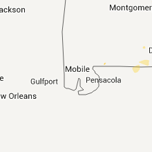
Hail and Wind Damage Spotted on 8/8/2011
Filter by Report Type:Hail ReportsWind Reports
States Impacted
Iowa, Tennessee, Kentucky, Florida, Mississippi, North Carolina, Illinois, Alabama, Massachusetts, New York, West Virginia, Arkansas, Georgia, Virginia, South Carolina, Indiana, Nebraska, South Dakota, New Jersey, Oklahoma, Minnesota, Kansas, Ohio, Missouri, Wisconsin, Colorado, WyomingIowa
| Local Time | Report Details |
|---|---|
| 5:00 PM UTC | Delayed report. maple tree uprooted and pine tree snapped off. time estimate in jones county IA, 36.9 miles ENE of Cedar Rapids, IA |
| 5:31 PM UTC | Quarter sized hail reported near Maquoketa, IA, 52.2 miles E of Cedar Rapids, IA, reported at the hurtsville interpretive center |
| 6:04 PM UTC | Quarter sized hail reported near Tipton, IA, 27 miles ESE of Cedar Rapids, IA, pea to quarter size hail and winds gusts estimated at 45 to 50 mph. |
| 6:15 PM UTC | Delayed report. broken utility pole in town. time estimate in cedar county IA, 31.5 miles ESE of Cedar Rapids, IA |
| 6:30 PM UTC | Quarter sized hail reported near Andover, IA, 73.3 miles E of Cedar Rapids, IA, delayed report. time estimated. |
| 6:55 PM UTC | Quarter sized hail reported near Wheatland, IA, 43.1 miles ESE of Cedar Rapids, IA, delayed report. time estimated. nickel to quarter size hail. |
| 6:55 PM UTC | Delated report. 4 to 5 inch diameter branches down. time estimate in clinton county IA, 43.1 miles ESE of Cedar Rapids, IA |
| 8:05 PM UTC | Quarter sized hail reported near Cedar Rapids, IA, 0.5 miles SSE of Cedar Rapids, IA, near 29th street and first avenue ne. |
| 8:05 PM UTC | Quarter sized hail reported near Cedar Rapids, IA, 3.7 miles N of Cedar Rapids, IA, heavy rain |
| 8:06 PM UTC | Quarter sized hail reported near Hiawatha, IA, 5.1 miles N of Cedar Rapids, IA |
| 8:08 PM UTC | Quarter sized hail reported near Cedar Rapids, IA, 3.3 miles NNW of Cedar Rapids, IA, lasted 3 to 4 mintues. |
| 8:10 PM UTC | Report delayed. fence blown over. estimated 12 inch diameter tree blown over with 6 inch limbs down in the vicinit in linn county IA, 4.4 miles N of Cedar Rapids, IA |
| 8:11 PM UTC | Quarter sized hail reported near Cedar Rapids, IA, 0.5 miles SSE of Cedar Rapids, IA, spotters are reporting quarter sized hail falling in cedar rapids. |
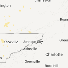
Tennessee
| Local Time | Report Details |
|---|---|
| 5:30 PM UTC | Barn dest in roane county TN, 24.1 miles WNW of Knoxville, TN |
| 5:55 PM UTC | Several trees and power lines dow in roane county TN, 24.1 miles WNW of Knoxville, TN |
| 6:05 PM UTC | Several trees and power lines dow in monroe county TN, 46 miles SSW of Knoxville, TN |
| 6:30 PM UTC | Few trees dow in blount county TN, 14.8 miles S of Knoxville, TN |
| 7:30 PM UTC | Tree and several power lines dow in jefferson county TN, 28.4 miles E of Knoxville, TN |
| 7:30 PM UTC | Few trees down in the cherokee dam area in jefferson county TN, 29.1 miles ENE of Knoxville, TN |
| 7:35 PM UTC | Few trees dow in sevier county TN, 20.8 miles ESE of Knoxville, TN |
| 8:10 PM UTC | Several trees dow in greene county TN, 50.5 miles ENE of Knoxville, TN |
| 9:40 PM UTC | Tree down on montana av in sullivan county TN, 17.7 miles W of Bristol, TN |
| 10:15 PM UTC | Tree down in johnson cit in washington county TN, 19.9 miles SSW of Bristol, TN |
| 10:40 PM UTC | Ping Pong Ball sized hail reported near Christiana, TN, 44.5 miles SE of Nashville, TN, resident on eaton hollow road reported ping pong ball size hail. |
| 11:15 PM UTC | Two trees down in seymou in blount county TN, 8.8 miles SE of Knoxville, TN |
Kentucky
| Local Time | Report Details |
|---|---|
| 5:53 PM UTC | Trees down in the willisburg area in washington county KY, 34.8 miles ESE of Louisville, KY |
| 6:30 PM UTC | Tree down at cob hil in estill county KY, 1.5 miles ESE of Irvine, KY |
| 6:39 PM UTC | Several trees down in southern areas of lawrenceburg in anderson county KY, 45.2 miles E of Louisville, KY |
| 6:44 PM UTC | 2 trees down on spencer ridge roa in lee county KY, 10.7 miles SE of Irvine, KY |
| 6:45 PM UTC | Tree down blocking new yellow rock roa in lee county KY, 16.7 miles ESE of Irvine, KY |
| 6:49 PM UTC | Tree down blocking south fork roa in lee county KY, 17.8 miles SE of Irvine, KY |
| 6:50 PM UTC | Tree down blocking highway 45 in pulaski county KY, 49.8 miles SW of Irvine, KY |
| 6:50 PM UTC | Tree down on hwy 76 in pulaski county KY, 55.2 miles SW of Irvine, KY |
| 6:50 PM UTC | Tree down blocking highway 52 eas in lee county KY, 17.7 miles ESE of Irvine, KY |
| 6:50 PM UTC | Tree down blocking proctor roa in lee county KY, 17.8 miles SE of Irvine, KY |
| 6:55 PM UTC | Tree down blocking highway 45 in pulaski county KY, 49.8 miles SW of Irvine, KY |
| 6:55 PM UTC | Tree down on hwy 76 in pulaski county KY, 55.2 miles SW of Irvine, KY |
| 7:03 PM UTC | Tree down and blocking charlie sizemore roa in clay county KY, 39.6 miles SSE of Irvine, KY |
| 7:07 PM UTC | Two trees down in annville. one down blocking ward road. the other down on pond lick roa in jackson county KY, 26.2 miles S of Irvine, KY |
| 7:26 PM UTC | Power lines down on camp creek road. also...few trees down countywid in leslie county KY, 52 miles SE of Irvine, KY |
| 7:26 PM UTC | Power lines down on highway 42 in leslie county KY, 55.8 miles SE of Irvine, KY |
| 7:42 PM UTC | 7 inch diameter tree limbs downed in laurel county KY, 39.7 miles S of Irvine, KY |
| 7:45 PM UTC | Quarter sized hail reported near London, KY, 39.7 miles S of Irvine, KY, dime to quarter size hail. |
| 7:58 PM UTC | Few trees down along ky in knox county KY, 54.1 miles S of Irvine, KY |
| 8:03 PM UTC | Tree down on ky 130 in knox county KY, 55.6 miles S of Irvine, KY |
| 8:05 PM UTC | Tree uprooted along highway 19 in laurel county KY, 44.6 miles SSW of Irvine, KY |
| 8:20 PM UTC | A tree was reported down near possum hollo in knox county KY, 58.8 miles S of Irvine, KY |
| 8:45 PM UTC | Two small trees down near steel branch in morgan county KY, 46.8 miles ENE of Irvine, KY |
| 12:30 AM UTC | Quarter sized hail reported near London, KY, 39.7 miles S of Irvine, KY, dime to quarter size hail. |
Florida
| Local Time | Report Details |
|---|---|
| 6:25 PM UTC | Emergency manager reported 6 to 7 trees down near county road 49 and 208th street. damage also to a fence. time estimated by radar imager in suwannee county FL, 75.4 miles WSW of Jacksonville, FL |
| 8:50 PM UTC | Several trees down on lake holly circle off of route 331 nort in walton county FL, 29.3 miles NNE of Miramar Beach, FL |
| 9:00 PM UTC | One tree down on county highway 108 in walton county FL, 35.7 miles NNE of Miramar Beach, FL |
| 9:06 PM UTC | One tree down on county road 6 in holmes county FL, 51.4 miles NE of Miramar Beach, FL |
Mississippi
| Local Time | Report Details |
|---|---|
| 6:35 PM UTC | Storm damage reported in tippah county MS, 66.7 miles ESE of Memphis, TN |
| 6:35 PM UTC | Steeple blown off the post office. several homes received roof damage. partial roof blown off of a church. several trees and power lines down. time estimate in tippah county MS, 66.7 miles ESE of Memphis, TN |
| 2:50 AM UTC | Trees down over power lines on spruce street in downtown clarksdal in coahoma county MS, 72.1 miles SSW of Memphis, TN |
North Carolina
| Local Time | Report Details |
|---|---|
| 6:42 PM UTC | Power lines down on hwy 12 in graham county NC, 46.6 miles S of Knoxville, TN |
| 6:49 PM UTC | 2 trees in graham county NC, 47.8 miles S of Knoxville, TN |
| 7:11 PM UTC | Power lines down on wayah road near nantahala lak in macon county NC, 55.3 miles SSE of Knoxville, TN |
| 7:20 PM UTC | Trees and power lines dow in cherokee county NC, 60.1 miles S of Knoxville, TN |
| 7:34 PM UTC | 4 large trees down as well as elongated swath of corn laid down along lazy branch r in alleghany county NC, 70.3 miles E of Bristol, TN |
| 7:47 PM UTC | Tree down on union hill rd in surry county NC, 74.9 miles E of Bristol, TN |
| 8:00 PM UTC | Tree down on dobbins mill rd in surry county NC, 78.3 miles SW of Roanoke, VA |
| 8:05 PM UTC | Tree down near highway 268 and little bend t in surry county NC, 73.7 miles N of Charlotte, NC |
| 8:06 PM UTC | Surry county dispatch reported over 20 large trees uprooted along dobbins mill rd...as well as significant roof damage to a home and a busines in surry county NC, 76.4 miles N of Charlotte, NC |
| 8:08 PM UTC | Two portions of roofs of buildings on dobson rd near joe layne mill rd. at this time not sure if from homes or outbuilding in surry county NC, 73.7 miles N of Charlotte, NC |
| 10:20 PM UTC | Large tree down on pounding mill rd near highway 19 in ashe county NC, 39.8 miles E of Bristol, TN |
| 10:30 PM UTC | Tree down on buffalo rd in ashe county NC, 38.7 miles ESE of Bristol, TN |
| 11:09 PM UTC | Tree down on biscoe road in montgomery county NC, 54.9 miles E of Charlotte, NC |
| 11:10 PM UTC | Several trees down near pekin road in montgomery county NC, 53.5 miles E of Charlotte, NC |
| 11:30 PM UTC | Multiple trees were blown down in the jackson park community of stanley...with at least one tree on a home. another tree fell on railroad tracks in the area...and a tra in gaston county NC, 16.4 miles WNW of Charlotte, NC |
| 11:55 PM UTC | Charlotte-meck fire dispatch reports power lines down in about a dozen locations throughout the city and at least one tree blown dow in mecklenburg county NC, 1.6 miles SSE of Charlotte, NC |
| 12:45 AM UTC | Union county comms reports numerous trees and powerlines down in the area east of the monroe city limits towards marshvill in union county NC, 28.6 miles SE of Charlotte, NC |
| 12:55 AM UTC | Tree down at mineral springs road and horne town road in anson county NC, 37.1 miles ESE of Charlotte, NC |
| 12:55 AM UTC | Tree down on powerlines on lower white store road in anson county NC, 37.2 miles ESE of Charlotte, NC |
| 12:57 AM UTC | Tree down near poplar hill church road in anson county NC, 40.1 miles ESE of Charlotte, NC |
Illinois
| Local Time | Report Details |
|---|---|
| 6:51 PM UTC | 6 to 7 inch diameter limbs down. time estimated in bureau county IL, 62.1 miles NNW of Peoria, IL |
| 6:51 PM UTC | Quarter sized hail reported near Tampico, IL, 62.1 miles NNW of Peoria, IL, time estimated |
| 7:23 PM UTC | Quarter sized hail reported near Morrison, IL, 78.1 miles NNW of Peoria, IL, pea to quarter size. last for 1 to 2 minutes |
| 10:23 PM UTC | Estimated wind speed. lasted aprroximately 10 minutes. power is out in kawane in henry county IL, 41.8 miles NNW of Peoria, IL |
| 10:26 PM UTC | Several 8 inches tree limbs dow in henry county IL, 41.8 miles NNW of Peoria, IL |
| 10:26 PM UTC | Several large 8 inch limbs down in henry county IL, 41.8 miles NNW of Peoria, IL |
| 10:48 PM UTC | Estimated 60 mph wind gust in marshall county IL, 29.9 miles NNE of Peoria, IL |
| 11:18 PM UTC | 12 inch tree down on stratford ave...200 block...in the knoll division. from city of peoria em in peoria county IL, 3.5 miles NNW of Peoria, IL |
| 11:20 PM UTC | Numerous reports of power lines down in city. from city of peoria em in peoria county IL, 3.5 miles NNW of Peoria, IL |
| 11:40 PM UTC | 30 foot tree...8 inches wide snapped off...5033 woodford ...close to the airport. from county em in peoria county IL, 5.4 miles W of Peoria, IL |
| 11:40 PM UTC | Tree fell on transformer...2520 south high meadow court...close to airport...from county em in peoria county IL, 5.4 miles W of Peoria, IL |
| 11:40 PM UTC | Tree fell on transformer...2527 dey cor divide...close to airport...from county em in peoria county IL, 5.4 miles W of Peoria, IL |
| 11:44 PM UTC | 12 inch tree down on house in creve coeur...from city of peoria ema in tazewell county IL, 3.7 miles S of Peoria, IL |
| 11:44 PM UTC | Spotter reported tops off trees and trees down on house and cars...entire neighborhood of the 1100 block of springfield road in east peoria. from tazewell county em in tazewell county IL, 2.5 miles SE of Peoria, IL |
| 11:44 PM UTC | 6 inch and 15 inch diameter trees down between east peoria and creve coeur. on pekin ave...south of carolyn. from city of peoria em in tazewell county IL, 4.1 miles SSE of Peoria, IL |
Alabama
| Local Time | Report Details |
|---|---|
| 7:01 PM UTC | Trees and some power lines were blown down in the zip city are in lauderdale county AL, 11 miles N of Florence, AL |
| 7:24 PM UTC | Winds blew some tin off of the roof of a she in cullman county AL, 51.8 miles NNW of Birmingham, AL |
| 7:28 PM UTC | A tree was blown down on cr 1545 in the gold ridge are in cullman county AL, 51.1 miles N of Birmingham, AL |
| 8:05 PM UTC | 1...hardridge creek...3 miles n of county road 97. several trees down 2...1 mile west of county road 93...two trees down powerline down in henry county AL, 70.7 miles S of Auburn, AL |
| 8:05 PM UTC | 1..hardridge creek area. 3 miles north of county road 97 several trees down. 2. 1 mile west of county road 93. 2 trees down...powerline dow in henry county AL, 70.7 miles S of Auburn, AL |
| 8:28 PM UTC | A tree was blown down across the road and was reported set on fire by lightning on baltimore hill roa in madison county AL, 64.6 miles E of Florence, AL |
| 8:30 PM UTC | A tree was blown down on a power line at the intersection of countess street and hudgins street. time estimated from rada in madison county AL, 63.4 miles E of Florence, AL |
| 9:20 PM UTC | Tree down on a power line on bide-a-wee dr in madison county AL, 58.2 miles E of Florence, AL |
| 11:15 PM UTC | Trees and powerlines down in the area of huntingdon colleg in montgomery county AL, 49.9 miles WSW of Auburn, AL |
| 8:38 AM UTC | Thunderstorm winds knocked trees down on nelson road and harris loop. one tree landed on a car on harris loop. gust front time estimated by rada in limestone county AL, 35.3 miles E of Florence, AL |
| 8:38 AM UTC | Thunderstorm winds knocked a tree down on tillman mill road near new cut road. gust front time estimated by rada in limestone county AL, 35.6 miles E of Florence, AL |
Massachusetts
| Local Time | Report Details |
|---|---|
| 7:05 PM UTC | Tree down fisher st and tree down birch st in bristol county MA, 17.4 miles ENE of Providence, RI |
New York
| Local Time | Report Details |
|---|---|
| 7:20 PM UTC | Trees down along route 9d and route 403 in putnam county NY, 46.8 miles N of Brooklyn, NY |
| 7:32 PM UTC | Trees down along route 9w and route 21 in orange county NY, 44.7 miles N of Brooklyn, NY |
| 7:32 PM UTC | Trees down along route 9w and route 21 in orange county NY, 46.1 miles N of Brooklyn, NY |
| 7:32 PM UTC | Trees down along route 9w and route 21 in orange county NY, 44.7 miles N of Brooklyn, NY |
| 8:35 PM UTC | Multiple trees down across town...including chamberlain street and stuyvesen avenu in westchester county NY, 24.1 miles NE of Brooklyn, NY |
West Virginia
| Local Time | Report Details |
|---|---|
| 7:30 PM UTC | Tree down along rt 74 in ritchie county WV, 59.3 miles WNW of Elkins, WV |
| 9:05 PM UTC | 15 trees down along rt 19 between falls mill and irelan in braxton county WV, 39.7 miles WSW of Elkins, WV |
| 9:05 PM UTC | 10 trees down along rt 24 in braxton county WV, 40.9 miles WSW of Elkins, WV |
| 9:05 PM UTC | 4 trees down on falls run r in braxton county WV, 38.7 miles WSW of Elkins, WV |
Arkansas
| Local Time | Report Details |
|---|---|
| 7:42 PM UTC | Quarter sized hail reported near Rogers, AR, 68.3 miles NNE of Fort Smith, AR |
| 7:44 PM UTC | 4-6 inch diameter tree limbs blown across the road. spotter estimates 70 mph win in benton county AR, 65.2 miles NNE of Fort Smith, AR |
| 8:17 PM UTC | 2 to 3 power poles snapped due to thunderstorm wind in white county AR, 31.1 miles NE of Little Rock, AR |
| 8:33 PM UTC | Numerous large tree limbs broken in area. estimated 50-60 mph gust in madison county AR, 58.7 miles NE of Fort Smith, AR |
| 8:50 PM UTC | Large trees blown down due to thunderstorm in white county AR, 44.7 miles NE of Little Rock, AR |
| 8:50 PM UTC | Large trees down due to thunderstorm wind in white county AR, 48.2 miles NE of Little Rock, AR |
| 9:32 PM UTC | Tree limbs were blown dow in newton county AR, 74.3 miles ENE of Fort Smith, AR |
| 10:50 PM UTC | Limbs were blown down at walnut grov in van buren county AR, 58.4 miles NNW of Little Rock, AR |
| 10:58 PM UTC | A large tree limb was blown dow in van buren county AR, 57.1 miles NNW of Little Rock, AR |
| 11:57 PM UTC | Quarter sized hail reported near North Little Rock, AR, 5.6 miles N of Little Rock, AR, quarter sized hail was reported near interstate 430 and crystal hill road. |
| 12:10 AM UTC | Off duty military forecaster estimated 60 mph winds and a limb dow in lonoke county AR, 21.7 miles NNE of Little Rock, AR |
| 12:50 AM UTC | Storm damage reported in lonoke county AR, 30 miles E of Little Rock, AR |
| 12:52 AM UTC | Trees were blown dow in prairie county AR, 46.4 miles E of Little Rock, AR |
| 12:52 AM UTC | Trees were blown dow in prairie county AR, 40.2 miles E of Little Rock, AR |
| 1:00 AM UTC | Trees were blown dow in prairie county AR, 46.4 miles E of Little Rock, AR |
| 1:15 AM UTC | Power lines were blown dow in monroe county AR, 55 miles E of Little Rock, AR |
| 1:30 AM UTC | Power lines were blown dow in monroe county AR, 62 miles E of Little Rock, AR |
| 1:43 AM UTC | A tree was blown down about a mile north of the highway 79/49 junctio in monroe county AR, 64.6 miles E of Little Rock, AR |
Georgia
| Local Time | Report Details |
|---|---|
| 7:45 PM UTC | Trees and power lines reported down county wid in habersham county GA, 54.5 miles WSW of Greenville, SC |
| 8:10 PM UTC | Trained spotter reported the tops of pine trees snapped off at neighbors house on n hicks rd. also reported two trees down at n hicks rd and garland r in stephens county GA, 47.5 miles WSW of Greenville, SC |
| 8:10 PM UTC | Large tree limbs blown down off barrett driv in stephens county GA, 47.2 miles WSW of Greenville, SC |
| 8:23 PM UTC | Two trees down within the 7000 block of highway 320. time determined by rada in franklin county GA, 46.3 miles SW of Greenville, SC |
| 8:27 PM UTC | Tree down on hunters creek roa in franklin county GA, 46.1 miles SW of Greenville, SC |
| 9:00 PM UTC | A spotter reported numerous trees down on highways 21 and 23 and hope valley circle road. a three side metal building was also rolled back 60 feet from the original fou in candler county GA, 60.9 miles WNW of Savannah, GA |
| 9:00 PM UTC | Spotter reported numerous trees down on highways 21 and 23 and hope valley circle road. time estimated by rada in candler county GA, 60.9 miles WNW of Savannah, GA |
| 9:32 PM UTC | Three traffic lights blown off lines at ga highway 21 north and old tusculum road. time of event estimated based on rada in effingham county GA, 24.9 miles NW of Savannah, GA |
| 9:32 PM UTC | Trees in roadway in the old dixie and keiffer hill road area. time of event estimated based on rada in effingham county GA, 25.2 miles NNW of Savannah, GA |
| 9:35 PM UTC | Spotter reported numerous trees down on highways 21 and 23 and hope valley circle roa in candler county GA, 60.9 miles WNW of Savannah, GA |
| 9:35 PM UTC | Numerous reports of large trees down and traffic lights torn of in effingham county GA, 26.2 miles NW of Savannah, GA |
| 9:36 PM UTC | Aircraft hanger roof and door blown off and aircraft damaged at 940 mock road. event time estimated based on rada in effingham county GA, 24 miles NNW of Savannah, GA |
| 9:36 PM UTC | Barn collapse and damage to two other farm structures from trees at 532 mock road. time of event estimated based on rada in effingham county GA, 23.4 miles NNW of Savannah, GA |
| 9:36 PM UTC | Trees down on roadway and powerlines at 2000 block of georgia highway 119 north. time of event estimated based on rada in effingham county GA, 24.9 miles NNW of Savannah, GA |
| 9:36 PM UTC | Trees down on roadway and on a vehicle on cedar street. time of event estimated based on rada in effingham county GA, 23.7 miles NNW of Savannah, GA |
| 9:36 PM UTC | Trees down on roadway...powerlines and bridge on stillwell road. bridge has minor damage. time estimated based on rada in effingham county GA, 23.4 miles NNW of Savannah, GA |
| 9:48 PM UTC | Trees down on the roadway and on powerlines at the 800 block of logs landing road. one tree on a house resulting in minor damage. time of event estimated based on radar in effingham county GA, 21.9 miles NNW of Savannah, GA |
| 9:52 PM UTC | Trees down on roadway and on five homes on ebenezer road in the brookstone subdivision. one home suffered moderate damage. time estimated based on rada in effingham county GA, 20.3 miles NNW of Savannah, GA |
| 9:52 PM UTC | Trees down on three homes...small trees uprooted and fences damaged on ebenezer road in the cobbleton subdivision. time estimated based on rada in effingham county GA, 20.3 miles NNW of Savannah, GA |
| 9:52 PM UTC | Damage to roof of ebenezer middle school. damage estimated at 20000 dollars. time estimated based on rada in effingham county GA, 20.5 miles NNW of Savannah, GA |
| 10:00 PM UTC | Report of trees down along highway 121 nort in candler county GA, 60.9 miles WNW of Savannah, GA |
| 10:04 PM UTC | Tree on building at methodist campground. time estimated based on rada in effingham county GA, 18.1 miles NNW of Savannah, GA |
| 10:10 PM UTC | 3-5 trees down on vineville avenu in bibb county GA, 76.8 miles SE of Atlanta, GA |
| 10:10 PM UTC | Numerous trees down...one on a home...along forest hill road between vineville and wimbush roa in bibb county GA, 76.8 miles SE of Atlanta, GA |
| 10:25 PM UTC | Spotter reported several trees down 2 miles east of richmond hil in chatham county GA, 14.3 miles SW of Savannah, GA |
| 10:28 PM UTC | Trees down on powerlines along harris trail road near richmond hill high school. reported received via twitte in bryan county GA, 17.4 miles SW of Savannah, GA |
| 10:30 PM UTC | Spotter reported several trees down 2 miles east of richmond hil in chatham county GA, 14.3 miles SW of Savannah, GA |
| 10:45 PM UTC | 6 trees reported down around jeffersonville in twiggs county GA, 85.9 miles NNW of Douglas, GA |
| 10:45 PM UTC | 7 trees down...some on power lines in a subdivision. trees in the subdivision were reported as larg in pickens county GA, 48.3 miles NNW of Atlanta, GA |
| 10:45 PM UTC | A sheriff department reported 1 tree down on mouth of the creek road and minor roof damage to a residence on brannens bridge roa in screven county GA, 54 miles SSE of Augusta, GA |
| 10:53 PM UTC | Broadcast media relayed a report of trees down in georgetown. event time estimated based on rada in chatham county GA, 10.7 miles SW of Savannah, GA |
| 11:15 PM UTC | Spotter reported a tree down across powerlines on van nuys blvd. several small branches down across the are in chatham county GA, 7.5 miles SSW of Savannah, GA |
| 11:15 PM UTC | Trained spotter reported several trees down in the wilshire estates subdivisio in chatham county GA, 7.5 miles SSW of Savannah, GA |
| 11:18 PM UTC | Tree down and blocking entrance of olde town subdivisio in chatham county GA, 9 miles SE of Savannah, GA |
| 11:22 PM UTC | Tree blocking the 1500 block of bacon park driv in chatham county GA, 4.2 miles S of Savannah, GA |
| 11:25 PM UTC | Report of a large tree down on 518 wheeler stree in chatham county GA, 4.3 miles SSW of Savannah, GA |
| 11:39 PM UTC | Tree fell on home at 108 falligant roa in chatham county GA, 7.6 miles ESE of Savannah, GA |
| 11:40 PM UTC | Tree down at the intersection of chevis road and wild herron roa in chatham county GA, 11.6 miles SW of Savannah, GA |
| 11:40 PM UTC | An emergency manager reported a 30 feet rescue platoon boat and 3 additional boats sunk near the sunbury boat ramp on fort morris road due to strong winds. heavy rain a in liberty county GA, 24.1 miles SSW of Savannah, GA |
| 11:40 PM UTC | Numerous boats sunk near the sunbury boat ramp on fort morris road due to strong winds. heavy rain also a contributing factor in liberty county GA, 24.1 miles SSW of Savannah, GA |
| 11:42 PM UTC | Large tree down on 2800 block of aimar avenu in chatham county GA, 5.2 miles SSE of Savannah, GA |
| 12:16 AM UTC | Large tree limb down on east 34th and drayton stree in chatham county GA, 1.5 miles SSW of Savannah, GA |
| 12:48 AM UTC | 911 center relayed a report from the public of trees down on brigdon roa in liberty county GA, 27.2 miles SW of Savannah, GA |
Virginia
| Local Time | Report Details |
|---|---|
| 8:50 PM UTC | Few trees dow in lee county VA, 46.4 miles WNW of Bristol, TN |
| 9:00 PM UTC | Tree down on ca in scott county VA, 33.3 miles WNW of Bristol, TN |
| 9:40 PM UTC | Trees down county wid in scott county VA, 23.9 miles WNW of Bristol, TN |
| 9:50 PM UTC | Tree down in city of bristo in city of bristol county VA, 3.1 miles ENE of Bristol, TN |
| 10:00 PM UTC | Tree down in damascu in washington county VA, 24.1 miles E of Bristol, TN |
South Carolina
| Local Time | Report Details |
|---|---|
| 9:05 PM UTC | Tree down across meadow brook lane near the highway 8 intersection. time estimated by rada in pickens county SC, 7.3 miles NNW of Greenville, SC |
| 9:13 PM UTC | Sc highway patrol reports a tree down and blocking the roadway near the intersection of hw-414 and hw-27 in greenville county SC, 13.5 miles NNE of Greenville, SC |
| 9:25 PM UTC | Sc highway patrol reports power lines down and in the roadway near the intersection of hw-291 and furman hall roa in greenville county SC, 13.4 miles ENE of Greenville, SC |
| 9:45 PM UTC | Sc highway patrol reports a tree down and blocking the roadway near the intersection of n campbell road and hw-41 in greenville county SC, 23.7 miles NE of Greenville, SC |
| 10:06 PM UTC | One large limb down on hw-29...partially blocking one east bound lan in spartanburg county SC, 34.9 miles ENE of Greenville, SC |
| 10:08 PM UTC | Sc highway patrol reports a tree down and blocking the roadway on fairforest road near the intersection with gordon stree in spartanburg county SC, 36.3 miles ENE of Greenville, SC |
| 10:08 PM UTC | Sc highway patrol reports a tree down and blocking the roadway on hw-29 near the intersection with willis roa in spartanburg county SC, 35.9 miles E of Greenville, SC |
| 10:10 PM UTC | Other large limbs down along hw-2 in spartanburg county SC, 36 miles ENE of Greenville, SC |
| 10:25 PM UTC | Sc highway patrol reports a tree down and blocking the roadway near the intersection of dogwood club road and s pine stree in spartanburg county SC, 42.5 miles E of Greenville, SC |
| 10:43 PM UTC | One large limb...approximately 12 inches in diameter...snapped off near the intersection of n main street and knitting mill stree in union county SC, 52.3 miles E of Greenville, SC |
| 10:43 PM UTC | Utility pole snapped and powerlines down across the highway at 850 gaffney highwa in union county SC, 52.9 miles E of Greenville, SC |
| 11:15 PM UTC | Sc highway patrol reports a few trees down in sharon. this include hw-97...hw-49...and york stree in york county SC, 34.1 miles WSW of Charlotte, NC |
Indiana
| Local Time | Report Details |
|---|---|
| 9:55 PM UTC | Large tree limbs down in fayette county IN, 51.1 miles NW of Cincinnati, OH |
| 12:03 AM UTC | Pea sized hail also reported. visibility near zer in cass county IN, 72.6 miles NNW of Indianapolis, IN |
| 12:15 AM UTC | Several trees and power lines down on the west and south sides of logansport. us 24 is closed due to downed trees on roadway. time estimated from rada in cass county IN, 68.9 miles N of Indianapolis, IN |
| 12:33 AM UTC | Large tree limbs down of unknown diameter...time estimated in tippecanoe county IN, 58.5 miles NW of Indianapolis, IN |
| 1:11 AM UTC | Estimated 50 to 60 mph wind gust in miami county IN, 55.8 miles SW of Fort Wayne, IN |
Nebraska
| Local Time | Report Details |
|---|---|
| 9:57 PM UTC | Golf Ball sized hail reported near Champion, NE, 54.9 miles ENE of Yuma, CO, spotter reported golf ball sized hail 4 miles west of champion. |
| 10:30 PM UTC | Ping Pong Ball sized hail reported near Ogallala, NE, 47.6 miles W of North Platte, NE, public reported ping pong ball sized hail on the south end of lake mcconaughy. |
| 10:31 PM UTC | Ping Pong Ball sized hail reported near Ogallala, NE, 47.6 miles W of North Platte, NE, public reported ping pong ball sized hail on the south side of lake mcconaughy. |
| 10:31 PM UTC | Golf Ball sized hail reported near Ogallala, NE, 47.6 miles W of North Platte, NE, spotter reported golf ball sized hail on the east end of lake mcconaughy. |
| 11:00 PM UTC | Golf Ball sized hail reported near Madrid, NE, 41.8 miles WSW of North Platte, NE |
| 11:18 PM UTC | Storm damage reported in lincoln county NE, 1.8 miles ESE of North Platte, NE |
| 11:20 PM UTC | Storm damage reported in lincoln county NE, 1.8 miles ESE of North Platte, NE |
| 11:31 PM UTC | Public reported 70 mph winds 3 miles north of maxwel in lincoln county NE, 12.2 miles E of North Platte, NE |
| 11:38 PM UTC | Telephone poles down...large tree damage and roof damag in lincoln county NE, 13.5 miles ESE of North Platte, NE |
| 11:38 PM UTC | Golf Ball sized hail reported near Maxwell, NE, 13.5 miles ESE of North Platte, NE, golfball size hail and 80 mph winds reported at exit 190 on interstate 80. |
| 11:40 PM UTC | Tennis Ball sized hail reported near Hayes Center, NE, 51 miles SW of North Platte, NE |
| 12:05 AM UTC | Storm damage reported in frontier county NE, 52.1 miles SE of North Platte, NE |
| 12:05 AM UTC | Storm damage reported in gosper county NE, 53 miles SE of North Platte, NE |
| 12:29 AM UTC | Winds of 50 to 60 mph were estimated. also had pea size hai in hitchcock county NE, 52.9 miles N of Colby, KS |
| 12:30 AM UTC | Hen Egg sized hail reported near Palisade, NE, 60.9 miles NNW of Colby, KS |
| 12:35 AM UTC | Baseball sized hail reported near Palisade, NE, 59.7 miles N of Colby, KS, windows broken out. siding to house torn up. |
| 12:39 AM UTC | 1 to 2 inch diameter tree limbs snapped along with dime to nickel sized hai in gosper county NE, 55.5 miles SE of North Platte, NE |
| 12:50 AM UTC | Estimated 60 to 70 mph winds were accompanied by nickel to quarter size hai in gosper county NE, 65 miles SE of North Platte, NE |
| 1:00 AM UTC | Storm damage reported in gosper county NE, 68 miles SE of North Platte, NE |
| 1:15 AM UTC | Quarter sized hail reported near Holdrege, NE, 62.5 miles SW of Grand Island, NE |
South Dakota
| Local Time | Report Details |
|---|---|
| 10:05 PM UTC | Half Dollar sized hail reported near Piedmont, SD, 14.1 miles NW of Rapid City, SD |
| 10:20 PM UTC | Quarter sized hail reported near Rapid City, SD, 8.1 miles NNW of Rapid City, SD |
New Jersey
| Local Time | Report Details |
|---|---|
| 10:10 PM UTC | Multiple trees down across the town...including cleveland avenue...curtis street...and bowers street. trees down on houses causing property damage as wel in union county NJ, 13.8 miles WSW of Brooklyn, NY |
Oklahoma
| Local Time | Report Details |
|---|---|
| 10:40 PM UTC | Storm damage reported in alfalfa county OK, 69.9 miles E of Woodward, OK |
| 10:40 PM UTC | Significant damage to trees was reported around the town of goltr in alfalfa county OK, 69.9 miles E of Woodward, OK |
| 10:45 PM UTC | Storm damage reported in blaine county OK, 63.3 miles NW of Oklahoma City, OK |
| 10:45 PM UTC | Several outbuildings destroyed with heavy tree damage in alfalfa county OK, 69.6 miles E of Woodward, OK |
| 10:50 PM UTC | Storm damage reported in major county OK, 70.8 miles NNW of Oklahoma City, OK |
| 11:00 PM UTC | Several 80-foot transmission poles and lines were downed. four to six homes sustained damage as the lines fel in garfield county OK, 59.6 miles NNW of Oklahoma City, OK |
| 11:01 PM UTC | Storm damage reported in garfield county OK, 63.5 miles NNW of Oklahoma City, OK |
| 11:05 PM UTC | Storm damage reported in garfield county OK, 63.5 miles NNW of Oklahoma City, OK |
| 11:05 PM UTC | Storm damage reported in noble county OK, 69.7 miles N of Oklahoma City, OK |
| 11:23 PM UTC | A large portion of the roof at the lutheran church was destroye in garfield county OK, 61.4 miles N of Oklahoma City, OK |
| 11:25 PM UTC | Several large barns were heavily damaged. several power poles and trees were snapped or blown dow in kingfisher county OK, 39.6 miles NW of Oklahoma City, OK |
| 11:35 PM UTC | The roof at the hospital sustained damage. one other home sustained major damage. numerous power poles and lines are down over a 4 to 5 block area. power was knocked ou in kingfisher county OK, 35.3 miles NW of Oklahoma City, OK |
| 11:35 PM UTC | *** 1 inj *** a mobile home was blown onto its in noble county OK, 60.1 miles NNE of Oklahoma City, OK |
| 11:35 PM UTC | Fence panels and large limbs blown down in noble county OK, 60.1 miles NNE of Oklahoma City, OK |
| 11:45 PM UTC | Storm damage reported in noble county OK, 65.3 miles WNW of Tulsa, OK |
| 11:50 PM UTC | Storm damage reported in noble county OK, 65.3 miles WNW of Tulsa, OK |
| 11:55 PM UTC | Storm damage reported in payne county OK, 48.5 miles NNE of Oklahoma City, OK |
| 12:00 AM UTC | Numerous power poles down and estimated 70 mph winds in kingfisher county OK, 35.3 miles NW of Oklahoma City, OK |
| 12:00 AM UTC | Power poles blown down. four large hail bales were rolled several feet across a stree in kay county OK, 70.8 miles S of Wichita, KS |
| 12:00 AM UTC | Power poles blown down in kay county OK, 70.8 miles S of Wichita, KS |
| 12:03 AM UTC | Storm damage reported in payne county OK, 52.5 miles NNE of Oklahoma City, OK |
| 12:05 AM UTC | Storm damage reported in payne county OK, 50.8 miles NNE of Oklahoma City, OK |
| 12:05 AM UTC | Storm damage reported in payne county OK, 43.5 miles NNE of Oklahoma City, OK |
| 12:10 AM UTC | Storm damage reported in payne county OK, 50.8 miles NNE of Oklahoma City, OK |
| 12:14 AM UTC | Storm damage reported in payne county OK, 52.5 miles NNE of Oklahoma City, OK |
| 12:15 AM UTC | A tree was knocked over and several large tree limbs were blown down on the campus of oklahoma state universit in payne county OK, 52.2 miles NNE of Oklahoma City, OK |
| 12:15 AM UTC | Several large tree limbs were blown in payne county OK, 51.1 miles NNE of Oklahoma City, OK |
| 12:15 AM UTC | 20 to 30 power poles in custer county OK, 66.5 miles W of Oklahoma City, OK |
| 12:15 AM UTC | Power poles in custer county OK, 66.5 miles W of Oklahoma City, OK |
| 12:15 AM UTC | The damage began about 5 miles west of weatherford. numerous power poles were blown down as the wind got closer to weatherford. two semi tractor trailers and two automo in custer county OK, 66.5 miles W of Oklahoma City, OK |
| 12:20 AM UTC | Storm damage reported in payne county OK, 50.8 miles NNE of Oklahoma City, OK |
| 12:20 AM UTC | Storm damage reported in payne county OK, 43.5 miles NNE of Oklahoma City, OK |
| 12:23 AM UTC | Storm damage reported in kingfisher county OK, 30.9 miles NW of Oklahoma City, OK |
| 12:25 AM UTC | A mobile home was blown over on the south side of tow in kingfisher county OK, 24.3 miles NNW of Oklahoma City, OK |
| 12:35 AM UTC | One home sustained major damage. at least 40 other buildings sustained some form of d in canadian county OK, 17.4 miles NW of Oklahoma City, OK |
| 12:43 AM UTC | A house lost 90 percent of its roof. the roof was scattered approximately 100 yards to the east. a metal barn east of the house was completely destroyed. other barns an in oklahoma county OK, 14.6 miles NNW of Oklahoma City, OK |
| 12:50 AM UTC | Off duty nws employee reported 60 to 70 mph wind gusts in oklahoma county OK, 16.5 miles NNW of Oklahoma City, OK |
| 12:55 AM UTC | The oklahoma county emergency mangement surveyed damage near rockwell avenue and memorial road. one hame sustained roof damage. a large power pole was shattered. eleven in oklahoma county OK, 7.2 miles NNW of Oklahoma City, OK |
| 1:05 AM UTC | *** 1 inj *** facade of shopping center blown down on north macarthur blvd. a person working underneath was partially tr in oklahoma county OK, 8.6 miles NW of Oklahoma City, OK |
| 1:05 AM UTC | *** 1 inj *** facade of shopping center blown down on north macarthur blvd in oklahoma county OK, 8.6 miles NW of Oklahoma City, OK |
| 8:05 PM CDT | Numerous fences and power poles blown down. time estimated based on radar in oklahoma county OK, 10 miles NW of Oklahoma City, OK |
| 1:25 AM UTC | Storm damage reported in oklahoma county OK, 5.4 miles N of Oklahoma City, OK |
| 1:30 AM UTC | Measured at the lone star school schoolne in creek county OK, 14.6 miles SSW of Tulsa, OK |
| 1:32 AM UTC | 8 to 10 power poles snapped along 221st st. women trapped in vehicle by power line in okmulgee county OK, 21.4 miles S of Tulsa, OK |
| 1:40 AM UTC | Storm damage reported in okmulgee county OK, 21.4 miles S of Tulsa, OK |
| 1:41 AM UTC | Storm damage reported in oklahoma county OK, 8.2 miles ESE of Oklahoma City, OK |
| 1:44 AM UTC | Storm damage reported in oklahoma county OK, 8.2 miles ESE of Oklahoma City, OK |
| 1:45 AM UTC | Power lines reported at the ba expressway and 145th east ave. possibly resulted in a fir in tulsa county OK, 11.9 miles ESE of Tulsa, OK |
| 1:55 AM UTC | Storm damage reported in oklahoma county OK, 8.2 miles ESE of Oklahoma City, OK |
| 1:58 AM UTC | Barn damaged...same barn was damaged by the tornado on may 24th...wind estimated 80 mp in muskogee county OK, 29.4 miles SSE of Tulsa, OK |
Minnesota
| Local Time | Report Details |
|---|---|
| 10:42 PM UTC | Quarter sized hail reported near Esko, MN, 13.5 miles WSW of Duluth, MN |
| 10:58 PM UTC | Quarter sized hail reported near Duluth, MN, 8.7 miles WSW of Duluth, MN, intersection of midway and stark rds |
| 10:59 PM UTC | Quarter sized hail reported near Duluth, MN, 8.9 miles WSW of Duluth, MN |
| 11:00 PM UTC | Ping Pong Ball sized hail reported near Duluth, MN, 8.7 miles WSW of Duluth, MN |
| 11:05 PM UTC | Quarter sized hail reported near Proctor, MN, 7 miles WSW of Duluth, MN |
| 11:14 PM UTC | 30 foot flag pole blown ove in st. louis county MN, 11.4 miles W of Duluth, MN |
| 11:40 PM UTC | 4 inch tree branch broken off at 83rd avenue and grand avenu in st. louis county MN, 1.1 miles WSW of Duluth, MN |
Kansas
| Local Time | Report Details |
|---|---|
| 10:50 PM UTC | Estimated 65 to 70 mph winds. 6 to 8 inch diameter tree limbs broke of in cheyenne county KS, 35.5 miles NW of Colby, KS |
| 11:00 PM UTC | Power lines down in bird city in cheyenne county KS, 35.5 miles NW of Colby, KS |
| 11:02 PM UTC | House lost roof in cheyenne county KS, 41.5 miles NW of Colby, KS |
| 11:06 PM UTC | Tree blown across highway 3 in rawlins county KS, 32.2 miles NNW of Colby, KS |
| 11:20 PM UTC | Storm damage reported in rawlins county KS, 29.4 miles NNW of Colby, KS |
| 11:33 PM UTC | Golf Ball sized hail reported near Colby, KS, 12.5 miles NW of Colby, KS, in addition to the hail had 60 to 70 mph winds which tore shingles off the house. |
| 11:38 PM UTC | Quarter sized hail reported near Levant, KS, 7.9 miles W of Colby, KS |
| 11:40 PM UTC | Quarter sized hail reported near Colby, KS, 4 miles W of Colby, KS |
| 11:40 PM UTC | Hen Egg sized hail reported near Levant, KS, 8.7 miles WSW of Colby, KS |
| 11:43 PM UTC | Hen Egg sized hail reported near Levant, KS, 7.9 miles W of Colby, KS |
| 11:48 PM UTC | Storm damage reported in thomas county KS, 0.6 miles SSW of Colby, KS |
| 11:50 PM UTC | Along hwy 161 a couple of trees uprooted. one of those trees was 40 feet tall and 1.5 ft in diameter. other trees had 10 inch diameter limbs torn off the top. metal roo in cheyenne county KS, 37.5 miles NW of Colby, KS |
| 11:50 PM UTC | Quarter sized hail reported near Colby, KS, 0.6 miles SSW of Colby, KS |
| 11:53 PM UTC | Storm damage reported in logan county KS, 21.2 miles SSE of Colby, KS |
| 11:53 PM UTC | Power lines down. trees blown down. windows to a couple of businesses broken ou in thomas county KS, 0.6 miles SSW of Colby, KS |
| 11:53 PM UTC | Trees blown down in town. pea to nickel size hail covering ground. also water is starting to pon in thomas county KS, 0.6 miles SSW of Colby, KS |
| 11:54 PM UTC | Storm damage reported in thomas county KS, 0.6 miles SSW of Colby, KS |
| 11:59 PM UTC | Tree branches down in town. largest hail seen was dime size. localized flooding occurrin in thomas county KS, 0.6 miles SSW of Colby, KS |
| 12:10 AM UTC | Semi-truck blown over. no injuries reported. also nickel hai in logan county KS, 20.6 miles S of Colby, KS |
| 12:23 AM UTC | Storm damage reported in wilson county KS, 15.2 miles SW of Chanute, KS |
| 12:25 AM UTC | Storm damage reported in logan county KS, 21.2 miles SSE of Colby, KS |
| 12:50 AM UTC | Storm damage reported in neosho county KS, 19.4 miles SSE of Chanute, KS |
| 12:55 AM UTC | Estimated 60 to 70 mph wind gust in labette county KS, 25.6 miles SSE of Chanute, KS |
| 1:00 AM UTC | Storm damage reported in lane county KS, 55.9 miles NNE of Garden City, KS |
| 1:02 AM UTC | 1 inch limbs dow in cherokee county KS, 45.9 miles SE of Chanute, KS |
| 1:10 AM UTC | Semi-truck blown over. no injuries reported. also nickel hai in logan county KS, 20.6 miles S of Colby, KS |
| 1:23 AM UTC | Several trees down in cit in cherokee county KS, 59.1 miles SE of Chanute, KS |
| 1:40 AM UTC | Storm damage reported in ness county KS, 52 miles SW of Hays, KS |
| 1:50 AM UTC | Several trees down in cit in cherokee county KS, 59.1 miles SE of Chanute, KS |
| 1:55 AM UTC | The spotter was southbound on highway u.s. 28 in ness county KS, 46.1 miles SW of Hays, KS |
| 2:06 AM UTC | Damage to metal outbuilding and estimated wind gusts of at least 60 mp in hodgeman county KS, 42.2 miles E of Garden City, KS |
| 2:07 AM UTC | Semi-truck blown over. also nickel hail in logan county KS, 20.6 miles S of Colby, KS |
| 2:07 AM UTC | Half Dollar sized hail reported near Edmond, KS, 58.5 miles NNW of Hays, KS |
Ohio
| Local Time | Report Details |
|---|---|
| 11:35 PM UTC | Tree limbs down. time estimated from rada in butler county OH, 28.7 miles NNE of Cincinnati, OH |
| 11:50 PM UTC | One large tree limb down in warren county OH, 27.3 miles NE of Cincinnati, OH |
| 12:05 AM UTC | 1 tree down. time estimated from rada in warren county OH, 30.7 miles NE of Cincinnati, OH |
| 12:22 AM UTC | Tree dow in warren county OH, 34.2 miles NE of Cincinnati, OH |
| 12:22 AM UTC | Tree dow in warren county OH, 32.9 miles NE of Cincinnati, OH |
| 1:15 AM UTC | Trees uprooted. structural damage to roof. also penny sized hail. time estimate in clermont county OH, 24.8 miles E of Cincinnati, OH |
Missouri
| Local Time | Report Details |
|---|---|
| 11:38 PM UTC | Utility poles down and football stadium lights were down on top of a hous in taney county MO, 37.4 miles S of Springfield, MO |
| 11:51 PM UTC | Several large trees down at hwy y and 16 in taney county MO, 37.7 miles SSE of Springfield, MO |
| 1:16 AM UTC | Joplin asos measured 60 mph wind gus in jasper county MO, 63.5 miles SE of Chanute, KS |
Wisconsin
| Local Time | Report Details |
|---|---|
| 11:40 PM UTC | Tree snapped by strong winds. unknown size of tre in bayfield county WI, 39.9 miles E of Duluth, MN |
Colorado
| Local Time | Report Details |
|---|---|
| 12:25 AM UTC | Wind gusts estimated 50 to 60 mph. many tree branches down...some 4 to 5 inches thick and 50 to 100 feet from the main sections of the trees. pea size hail and 0.40 inc in logan county CO, 47.9 miles NNW of Yuma, CO |
Wyoming
| Local Time | Report Details |
|---|---|
| 1:35 AM UTC | Storm damage reported in campbell county WY, 26.3 miles SSE of Gillette, WY |
| 2:15 AM UTC | Quarter sized hail reported near Newcastle, WY, 52.3 miles SE of Gillette, WY |
| 2:30 AM UTC | Quarter sized hail reported near Newcastle, WY, 61.6 miles SE of Gillette, WY |
Connect with Interactive Hail Maps