

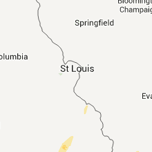
Hail Map for Sunday, January 22, 2012

Number of Impacted Households on 1/22/2012
0
Impacted by 1" or Larger Hail
0
Impacted by 1.75" or Larger Hail
0
Impacted by 2.5" or Larger Hail
Square Miles of Populated Area Impacted on 1/22/2012
0
Impacted by 1" or Larger Hail
0
Impacted by 1.75" or Larger Hail
0
Impacted by 2.5" or Larger Hail


Cities Most Affected by Hail Storms of 1/22/2012
| Hail Size | Demographics of Zip Codes Affected | ||||||
|---|---|---|---|---|---|---|---|
| City | Count | Average | Largest | Pop Density | House Value | Income | Age |
| Pine Bluff, AR | 2 | 2.25 | 2.75 | 179 | $54k | $28.9k | 34.1 |
| Louann, AR | 1 | 2.75 | 2.75 | 11 | $60k | $35.8k | 44.6 |
| Star City, AR | 1 | 2.75 | 2.75 | 26 | $53k | $31.0k | 39.1 |
| Tuckerman, AR | 1 | 2.75 | 2.75 | 25 | $41k | $27.4k | 40.9 |
| Newport, AR | 1 | 2.75 | 2.75 | 28 | $54k | $24.9k | 39.7 |
| Murray, KY | 1 | 2.00 | 2.00 | 132 | $86k | $29.6k | 31.5 |
| Southaven, MS | 1 | 1.75 | 1.75 | 1711 | $90k | $46.5k | 32.8 |
| Oil Trough, AR | 1 | 1.75 | 1.75 | 9 | $43k | $33.2k | 40.1 |
| Duncan, MS | 1 | 1.75 | 1.75 | 3 | $34k | $14.2k | 40.5 |
Hail and Wind Damage Spotted on 1/22/2012
Filter by Report Type:Hail ReportsWind Reports
Arkansas
| Local Time | Report Details |
|---|---|
| 12:19 AM UTC | Half Dollar sized hail reported near Romance, AR, 39 miles NNE of Little Rock, AR, quarter to half dollar size hail reported in gravel hill. |
| 12:29 AM UTC | Quarter sized hail reported near Searcy, AR, 52.2 miles NE of Little Rock, AR |
| 12:29 AM UTC | Ping Pong Ball sized hail reported near Malvern, AR, 40.6 miles SW of Little Rock, AR |
| 12:30 AM UTC | A few trees reported dow in howard county AR, 0.6 miles SSW of Nashville, AR |
| 12:45 AM UTC | Report of two damaged chicken houses on cr 1310 between ozan and nashvill in hempstead county AR, 9.9 miles SE of Nashville, AR |
| 12:52 AM UTC | Quarter sized hail reported near Sherwood, AR, 10.9 miles NNE of Little Rock, AR |
| 1:02 AM UTC | Trees down at white oak lake across highway 57 in ouachita county AR, 51.6 miles ESE of Nashville, AR |
| 1:03 AM UTC | Quarter sized hail reported near Jacksonville, AR, 11.7 miles NE of Little Rock, AR |
| 1:04 AM UTC | Half Dollar sized hail reported near Hampton, AR, 65.9 miles NNW of Bastrop, LA |
| 1:10 AM UTC | Quarter sized hail reported near Cabot, AR, 21 miles NE of Little Rock, AR |
| 1:10 AM UTC | Golf Ball sized hail reported near Oil Trough, AR, 76.3 miles NE of Little Rock, AR |
| 1:13 AM UTC | Several trees were blown down near highway 3 in lonoke county AR, 24.7 miles ENE of Little Rock, AR |
| 1:15 AM UTC | Quarter sized hail reported near Newport, AR, 75 miles WNW of Memphis, TN |
| 1:15 AM UTC | Quarter sized hail reported near Louann, AR, 63.9 miles NW of Bastrop, LA |
| 1:15 AM UTC | Half Dollar sized hail reported near Sheridan, AR, 29.6 miles S of Little Rock, AR, hail cracked the windshield of the amatuer radio operator. |
| 1:15 AM UTC | Baseball sized hail reported near Tuckerman, AR, 76.3 miles WNW of Memphis, TN |
| 1:26 AM UTC | Quarter sized hail reported near Black Rock, AR, 89.2 miles NW of Memphis, TN, quarter size hail reported by lawrence county sheriffs office in black rock. |
| 1:30 AM UTC | Half Dollar sized hail reported near England, AR, 24.9 miles SE of Little Rock, AR, amateuer operator reporting some hail stones the size of saoftballs. |
| 1:30 AM UTC | Ping Pong Ball sized hail reported near England, AR, 22.5 miles SE of Little Rock, AR |
| 1:38 AM UTC | Quarter sized hail reported near Cash, AR, 66.9 miles NW of Memphis, TN, quarter size hail reported by craighead county emergency management near the intersection of routes 226 and 67 near cash. |
| 1:40 AM UTC | Tree limbs and other debris reported across highway 37 in nevada county AR, 41.8 miles SE of Nashville, AR |
| 1:56 AM UTC | Golf Ball sized hail reported near Pine Bluff, AR, 47.8 miles SSE of Little Rock, AR |
| 2:00 AM UTC | Baseball sized hail reported near Newport, AR, 75 miles WNW of Memphis, TN, golf ball to baseball size hail reported in newport |
| 2:00 AM UTC | Baseball sized hail reported near Louann, AR, 63.9 miles NW of Bastrop, LA, golf ball to baseball size hail reported in newport |
| 2:00 AM UTC | Trees were blown dow in lincoln county AR, 58.6 miles SSE of Little Rock, AR |
| 2:10 AM UTC | Half Dollar sized hail reported near Pine Bluff, AR, 48.8 miles SSE of Little Rock, AR |
| 2:10 AM UTC | Baseball sized hail reported near Pine Bluff, AR, 48 miles SSE of Little Rock, AR |
| 2:15 AM UTC | Baseball sized hail reported near Star City, AR, 53.9 miles SSE of Little Rock, AR |
| 2:26 AM UTC | Golf Ball sized hail reported near Brinkley, AR, 62.3 miles E of Little Rock, AR |
| 2:29 AM UTC | Tree down blocking highway 226 spur in southwest jonesboro in craighead county AR, 58.7 miles NW of Memphis, TN |
| 2:30 AM UTC | Baseball sized hail reported near Brinkley, AR, 62.3 miles E of Little Rock, AR |
| 2:33 AM UTC | Half Dollar sized hail reported near De Valls Bluff, AR, 41.6 miles E of Little Rock, AR |
| 2:37 AM UTC | A camper and a storage building were destroye in clay county AR, 74.4 miles SSW of Cape Girardeau, MO |
| 2:40 AM UTC | Trailer house destroyed on garot road south of de wit in arkansas county AR, 64.3 miles ESE of Little Rock, AR |
| 2:52 AM UTC | Quarter sized hail reported near Colt, AR, 46.5 miles W of Memphis, TN, st. francis county office of emergency management reports quarter size hail west of colt near ar 306 and ar 193. |
| 2:55 AM UTC | Half Dollar sized hail reported near Wynne, AR, 43.1 miles W of Memphis, TN, law enforcement reports half dollar size hail 2 miles north of colt along the cross and st. francis county line. |
| 3:00 AM UTC | Grain bins damaged on state highway 39 approximately 6 miles north of turner arkansas. trees and part of a shop roof were blown off north of marvell arkansas on state h in phillips county AR, 66.7 miles SW of Memphis, TN |
| 3:33 AM UTC | Quarter sized hail reported near Tyronza, AR, 29.3 miles NW of Memphis, TN, poinsett county oem reports quarter size hail and 50 mph winds just south of tyronza at hwy 118 along the crittenden/poinsett county line. |
| 3:45 AM UTC | Tractor trailer overturned on us-49 near west helen in phillips county AR, 53.6 miles SW of Memphis, TN |
| 3:45 AM UTC | Tractor trailer overturned on us-49 near west helena. numerous storage sheds also flipped over on the south side of the road in phillips county AR, 54 miles SW of Memphis, TN |
| 4:10 AM UTC | Numerous reports of downed trees across northern ashley county. also hail of unknown siz in ashley county AR, 40.3 miles N of Bastrop, LA |
Missouri
| Local Time | Report Details |
|---|---|
| 2:34 AM UTC | Power line dow in perry county MO, 34.5 miles NNW of Cape Girardeau, MO |
| 2:48 AM UTC | Quarter sized hail reported near Dudley, MO, 46.5 miles SW of Cape Girardeau, MO, quarter size hail reported in the community. |
| 3:12 AM UTC | ...late report...camper overturned. mobile home with roof blown of in new madrid county MO, 54.1 miles S of Cape Girardeau, MO |
| 3:16 AM UTC | 60 mph winds and pea size hail reported in campbel in dunklin county MO, 63.1 miles SSW of Cape Girardeau, MO |
Illinois
| Local Time | Report Details |
|---|---|
| 3:12 AM UTC | 60 mph wind gust reported on west side of tow in jackson county IL, 34.1 miles NNE of Cape Girardeau, MO |
| 3:23 AM UTC | 60 mph wind gust reported on west side of tow in jackson county IL, 34.1 miles NNE of Cape Girardeau, MO |
| 3:38 AM UTC | Half Dollar sized hail reported near Mt Vernon, IL, 73.1 miles ESE of Saint Louis, MO, half dollar size hail reported in the community. |
| 3:47 AM UTC | Quarter sized hail reported near Mt Vernon, IL, 73.1 miles ESE of Saint Louis, MO |
| 4:05 AM UTC | Storm damage reported in massac county IL, 45.3 miles E of Cape Girardeau, MO |
| 4:05 AM UTC | Downed trees with standing water on roadways along dutchman lake roa in johnson county IL, 36.8 miles ENE of Cape Girardeau, MO |
| 4:12 AM UTC | Large tree dow in massac county IL, 47.2 miles ESE of Cape Girardeau, MO |
| 4:12 AM UTC | Storm damage reported in massac county IL, 47.2 miles ESE of Cape Girardeau, MO |
| 4:17 AM UTC | Storm damage reported in saline county IL, 56.3 miles WSW of Evansville, IN |
| 4:20 AM UTC | Delayed report. tree blown down on route 130 west of hugo blocking one lane of traffi in douglas county IL, 20.8 miles NNE of Mattoon, IL |
| 4:30 AM UTC | Late repor in gallatin county IL, 45.5 miles WSW of Evansville, IN |
Kentucky
| Local Time | Report Details |
|---|---|
| 3:53 AM UTC | Downed radio/tv antenn in graves county KY, 45.8 miles NNW of Mc Kenzie, TN |
| 3:58 AM UTC | Widespread power outages...up to 296 customers affecte in ballard county KY, 36.2 miles ESE of Cape Girardeau, MO |
| 4:20 AM UTC | Downed trees blocking rufuge roa in ballard county KY, 31.5 miles ESE of Cape Girardeau, MO |
| 4:40 AM UTC | Power outages reported. approximately 20 customers affecte in livingston county KY, 69 miles E of Cape Girardeau, MO |
| 5:05 AM UTC | Late report...damage along craig road. numerous trees down...gutters pulled off of one home which had several windows blown out. large tree fell across a truc in calloway county KY, 31.1 miles NNE of Mc Kenzie, TN |
| 5:05 AM UTC | Roof of metal barn blown off and one tree dow in calloway county KY, 29.2 miles NNE of Mc Kenzie, TN |
| 5:05 AM UTC | Quarter sized hail reported near Murray, KY, 30.5 miles NNE of Mc Kenzie, TN, quarter size hail reported. |
| 5:09 AM UTC | Hen Egg sized hail reported near Murray, KY, 33.1 miles NNE of Mc Kenzie, TN, hail the size of hen eggs reported just southwest of town. |
| 5:14 AM UTC | Marble size hail reported with this stor in calloway county KY, 36.7 miles NNE of Mc Kenzie, TN |
| 5:25 AM UTC | Power outage in hopkins county KY, 47.7 miles S of Evansville, IN |
| 5:25 AM UTC | Power outages. utility company reports nearly 1000 customers affected in hopkins and christian countie in hopkins county KY, 47.7 miles S of Evansville, IN |
| 5:25 AM UTC | Late report...large trees down or uprooted along niles roa in hopkins county KY, 52.5 miles S of Evansville, IN |
| 5:25 AM UTC | Power outages reporte in hopkins county KY, 56.1 miles S of Evansville, IN |
| 5:25 AM UTC | Power outage in hopkins county KY, 54.3 miles S of Evansville, IN |
| 5:30 AM UTC | Storm damage reported in hopkins county KY, 56.1 miles S of Evansville, IN |
| 5:30 AM UTC | 200 customers without powe in hopkins county KY, 44 miles S of Evansville, IN |
| 5:40 AM UTC | Several mobile homes destroyed and many trees blown over along a 6 to 7 mile swath across the county. one mobile home was left in the middle of brooks schoolhouse road in mclean county KY, 30.9 miles SSE of Evansville, IN |
| 5:42 AM UTC | 1 barn destroyed in north central mclean county less than 1 mile from the mclean-daviess county lin in mclean county KY, 30.3 miles SSE of Evansville, IN |
| 5:45 AM UTC | 1 mobile home destroyed on the west side of highway 81 northeast of calhou in mclean county KY, 33.5 miles SE of Evansville, IN |
| 5:55 AM UTC | Storm damage reported in christian county KY, 66.3 miles NW of Nashville, TN |
| 6:01 AM UTC | Over 1000 electrical customers without power in the communities of sebree...poole and slaughter in webster county KY, 26.1 miles S of Evansville, IN |
| 6:01 AM UTC | Over 1500 electrical customers without power in the communities of sebree...poole and slaughter in webster county KY, 26.1 miles S of Evansville, IN |
| 6:01 AM UTC | House received major damage...one or more barns destroyed. trees down along highway 8 in daviess county KY, 32.2 miles SE of Evansville, IN |
| 6:01 AM UTC | ...minor injuries to occupants...house received major damage...one or more barns destroyed. trees down along highway 8 in daviess county KY, 32.2 miles SE of Evansville, IN |
| 6:05 AM UTC | ...late report...mobile home received extensive damage along old state roa in daviess county KY, 28.5 miles ESE of Evansville, IN |
| 6:14 AM UTC | Storage building destroyed and roof damage to a few homes in hancock county KY, 36.4 miles E of Evansville, IN |
| 6:14 AM UTC | Barn blown away along hwy 334 in hancock county KY, 35.3 miles E of Evansville, IN |
| 6:19 AM UTC | Tree down across hwy 69 in ohio county KY, 48.5 miles ESE of Evansville, IN |
| 6:35 AM UTC | Roof blown off a mobile home and blown into power lines which were downe in logan county KY, 57.5 miles N of Nashville, TN |
| 6:37 AM UTC | Two trees were downed across roads in the county. one large tree fell across holt road 2 miles east of cloversport. the other fell just west of hardinsburg near the int in breckinridge county KY, 48.9 miles WSW of Louisville, KY |
| 6:40 AM UTC | Few trees reported down across count in butler county KY, 70.5 miles SE of Evansville, IN |
| 7:12 AM UTC | Two trees reported dow in grayson county KY, 48.6 miles SW of Louisville, KY |
| 7:15 AM UTC | Power outages in the city in hardin county KY, 16.8 miles SW of Louisville, KY |
| 7:23 AM UTC | Storm damage reported in simpson county KY, 35.2 miles NNE of Nashville, TN |
| 7:23 AM UTC | Power outages in simpson county KY, 40.5 miles NNE of Nashville, TN |
| 7:25 AM UTC | Vehicle damage from downed trees in bullitt county KY, 5.9 miles NNE of Louisville, KY |
| 7:25 AM UTC | Power line down and transformer blown in jefferson county KY, 10.6 miles N of Louisville, KY |
| 7:42 AM UTC | Scattered trees down around the county in allen county KY, 51.5 miles NE of Nashville, TN |
| 8:24 AM UTC | One tree down near riley in marion county KY, 42.7 miles SE of Louisville, KY |
| 8:50 AM UTC | A few trees down on cross pike near parksvill in boyle county KY, 50.6 miles W of Irvine, KY |
| 9:00 AM UTC | Casey county department of highways reported a few trees down throughout the count in casey county KY, 58.7 miles WSW of Irvine, KY |
Mississippi
| Local Time | Report Details |
|---|---|
| 3:55 AM UTC | 18 wheel semi truck turned over on bellvue rd hwy 322 just outside clarksdale city limit in coahoma county MS, 72.1 miles SSW of Memphis, TN |
| 3:55 AM UTC | Trailer home moved off slab foundation on bellvue road hwy 322 just outside clarksdale city limit in coahoma county MS, 72.1 miles SSW of Memphis, TN |
| 4:00 AM UTC | 3 grain elevator bins and farm shop heavily damaged on new africa road northeast of town of alligato in coahoma county MS, 75.7 miles SSW of Memphis, TN |
| 4:00 AM UTC | 3 grain elevator bins and farm shop heavily damaged on new africa road southeast of town of alligato in coahoma county MS, 75.7 miles SSW of Memphis, TN |
| 4:05 AM UTC | Power lines down near robinsonville in tunica county MS, 27.4 miles SW of Memphis, TN |
| 4:18 AM UTC | Debris on roadway on i-55 at mile marker 275...and northbound church road exit sign on i-55 blown dow in desoto county MS, 13.4 miles SSE of Memphis, TN |
| 4:23 AM UTC | Quarter sized hail reported near Hernando, MS, 29.1 miles S of Memphis, TN |
| 4:30 AM UTC | Golf Ball sized hail reported near Southaven, MS, 12.7 miles SSE of Memphis, TN, report of hail up to the size of golfballs on church road between getwell and pleasant hill road. |
| 4:30 AM UTC | Large limbs down...fence blown apart...some shingle damage to houses in bolivar county MS, 86 miles SSW of Memphis, TN |
| 4:35 AM UTC | Powerlines down in the area. other damage has been reported but extent is unknown at this tim in bolivar county MS, 82.5 miles SSW of Memphis, TN |
| 4:35 AM UTC | Updated info...11 mobile homes were damaged or destroyed...numerous powerlines down...possible tornado in bolivar county MS, 82.5 miles SSW of Memphis, TN |
| 4:35 AM UTC | Large limbs down...fence blown apart...some shingle damage to houses...numerous trees down in area including on magnolia hill in bolivar county MS, 86 miles SSW of Memphis, TN |
| 4:37 AM UTC | Golf Ball sized hail reported near Duncan, MS, 86.7 miles SSW of Memphis, TN, quarter to golf ball sized hail...likely driven by wind...broke some windows |
| 4:41 AM UTC | Trees down 6 miles south of byhali in marshall county MS, 32.6 miles SE of Memphis, TN |
| 5:00 AM UTC | Heavy damage to a home garage...4 to 5 homes on the same street damaged. metal roof and columns torn off of one home. power lines and power poles dow in quitman county MS, 63.3 miles SSW of Memphis, TN |
| 5:55 AM UTC | In the elizabeth community...mobile home with some damage...trees and powerlines down...carport blown away in washington county MS, 67.3 miles NE of Bastrop, LA |
| 7:03 AM UTC | Couple of trees down near morton in scott county MS, 30.6 miles E of Jackson, MS |
| 7:15 AM UTC | Awning blown off gas station near union in newton county MS, 64.3 miles SSW of Starkville, MS |
| 7:15 AM UTC | Awning blown off gas station near union in simpson county MS, 29.4 miles SSE of Jackson, MS |
| 7:22 AM UTC | Trees and powerlines down in lee county MS, 58.2 miles WSW of Florence, AL |
| 7:25 AM UTC | Tree down on house on pegg street and another tree down near gore springs community in grenada county MS, 57.7 miles WNW of Starkville, MS |
| 8:30 AM UTC | Several pine trees blown over in lauderdale county MS, 73.5 miles S of Starkville, MS |
| 8:35 AM UTC | Quarter sized hail reported near Meridian, MS, 70.1 miles S of Starkville, MS, in the bailey community |
| 8:45 AM UTC | Mobile home damaged and trees and powerlines down on sam lackey road in lauderdale county MS, 70.9 miles S of Starkville, MS |
| 8:45 AM UTC | Mobile home damaged and trees and powerlines down on sam lackey road. update from emergency manager...a few trees were snapped and uprooted and there was shingle damage in lauderdale county MS, 70.9 miles S of Starkville, MS |
| 9:25 AM UTC | Few trees down in clarke county MS, 84.4 miles E of Jackson, MS |
Tennessee
| Local Time | Report Details |
|---|---|
| 4:15 AM UTC | Storm damage reported in tipton county TN, 26 miles NE of Memphis, TN |
| 4:15 AM UTC | Carport destroyed in crockett county TN, 43.2 miles WSW of Mc Kenzie, TN |
| 4:15 AM UTC | Tree down on nailing drive in obion county TN, 35.6 miles NW of Mc Kenzie, TN |
| 4:17 AM UTC | Reported by weakley county em in weakley county TN, 23 miles WNW of Mc Kenzie, TN |
| 4:18 AM UTC | Welcome to tennessee sign blown down on i-55 near the tennessee/mississippi state line in shelby county TN, 10.6 miles SSE of Memphis, TN |
| 4:20 AM UTC | Estimated wind speed of 105 mph lifted a large roof off a building and dropped it about 200 feet away across railroad tracks. damage was just east of memphis airport ar in shelby county TN, 10.1 miles SE of Memphis, TN |
| 4:30 AM UTC | Metal detachable garage blown ove in gibson county TN, 26.7 miles W of Mc Kenzie, TN |
| 4:36 AM UTC | Estimated 65 mph wind gust at national weather service forecast offic in shelby county TN, 15.2 miles ESE of Memphis, TN |
| 4:36 AM UTC | Estimated 65 mph wind gust at national weather service forecast offic in shelby county TN, 14.2 miles E of Memphis, TN |
| 4:40 AM UTC | Storm damage reported in shelby county TN, 15.2 miles ESE of Memphis, TN |
| 5:12 AM UTC | Building damaged on hwy 18 sout in hardeman county TN, 52 miles E of Memphis, TN |
| 5:12 AM UTC | Trees on homes along hwy 18 sout in hardeman county TN, 52 miles E of Memphis, TN |
| 5:12 AM UTC | Vehicle lodged in tre in hardeman county TN, 51.5 miles E of Memphis, TN |
| 5:14 AM UTC | Trees down countywid in madison county TN, 42.9 miles SW of Mc Kenzie, TN |
| 5:15 AM UTC | Estimated wind speed of 100 mph damaged numerous trees. damage was focused in two locations. one just north of hickory valley and also near middleburg...tennesee. occur in hardeman county TN, 54.4 miles E of Memphis, TN |
| 5:15 AM UTC | Estimated wind speed of 100 mph damaged numerous trees. damage was focused in two locations. one just north of hickory valley and also near middleburg...tennesee. occur in hardeman county TN, 52 miles E of Memphis, TN |
| 5:33 AM UTC | Trees down county wid in madison county TN, 38.8 miles SSW of Mc Kenzie, TN |
| 5:45 AM UTC | Power lines were reported to have been peeled off a home in the southeastern part of the count in stewart county TN, 47.8 miles ENE of Mc Kenzie, TN |
| 5:55 AM UTC | Powerlines down along us-70 in maso in tipton county TN, 33.9 miles ENE of Memphis, TN |
| 5:56 AM UTC | Damage to structures in lexingto in henderson county TN, 34.1 miles SSE of Mc Kenzie, TN |
| 6:21 AM UTC | A few trees and power lines were downed across the count in houston county TN, 47.6 miles ENE of Mc Kenzie, TN |
| 6:30 AM UTC | Public report of car port destroyed. 950 garrettsburg road in clarks in montgomery county TN, 41.8 miles NW of Nashville, TN |
| 6:30 AM UTC | Several trees were downed across the count in perry county TN, 52.5 miles SE of Mc Kenzie, TN |
| 6:35 AM UTC | A few trees and power lines were downed across the count in montgomery county TN, 41.8 miles NW of Nashville, TN |
| 6:39 AM UTC | In a field behind a residence on east humphries county line road in dickson...one thirty foot tree snapped aloft and another thrity foot tree uprooted...along with a fe in dickson county TN, 34.2 miles W of Nashville, TN |
| 6:46 AM UTC | Amateur radio reports measured 58 mph wind gust 18 m s of clarksvill in dickson county TN, 33.2 miles WNW of Nashville, TN |
| 6:50 AM UTC | Trained spotter reported estimated 60 mph gust 1 mile north of mm 163 on i40 in dickson county TN, 28.6 miles W of Nashville, TN |
| 6:55 AM UTC | Trees and power lines were downed across portions of the count in hickman county TN, 45.8 miles SW of Nashville, TN |
| 7:08 AM UTC | Amatuer radio operator reports trees down near hwy 70 at tennessee city. hwy 48 n and steele r in dickson county TN, 41.9 miles W of Nashville, TN |
| 7:14 AM UTC | Amatuer radio reports trees fallen on ups truck. driver ok. mm 161 eastbound i4 in dickson county TN, 34.2 miles W of Nashville, TN |
| 7:16 AM UTC | Amatuer radio operator reports multiple trees down and power lines blocking the road on hwy 48 n spanning from dickson to charlott in dickson county TN, 33.7 miles W of Nashville, TN |
| 7:20 AM UTC | Trained spotter reports trees down 2 m east of whitehouse at covington and cross plains r in sumner county TN, 21.8 miles NNE of Nashville, TN |
| 7:36 AM UTC | Trees blocking hwy 25 at halltown r in sumner county TN, 24.6 miles NNE of Nashville, TN |
| 7:46 AM UTC | Tree blocking lane on new shackle road at long hollow pik in sumner county TN, 13.1 miles NE of Nashville, TN |
| 7:50 AM UTC | Power lines down at 1112 douglas place in gallati in sumner county TN, 23.5 miles NE of Nashville, TN |
| 7:55 AM UTC | Trained spotter measures 62 mph gust 4 nw gallatin in sumner county TN, 23.3 miles NE of Nashville, TN |
| 8:02 AM UTC | Trees down on hillsboro rd across dody drive near fairview in williamson county TN, 23.1 miles SW of Nashville, TN |
| 8:03 AM UTC | Tree down on hillboro rd and bobby drive in williamson county TN, 23.1 miles SW of Nashville, TN |
| 8:05 AM UTC | A couple of trees were reported downed across country road in maury county TN, 40.7 miles SSW of Nashville, TN |
| 8:08 AM UTC | Tree down across road at crow cut road and old cox pik in williamson county TN, 23.1 miles SW of Nashville, TN |
| 8:08 AM UTC | A few trees were downed in the coopertown are in robertson county TN, 21.4 miles NNW of Nashville, TN |
| 8:17 AM UTC | A few trees were reported downed across the count in cheatham county TN, 17.5 miles WNW of Nashville, TN |
| 8:30 AM UTC | A tree was reported downed on highway 64 east...coming from the i-24 wartrace are in bedford county TN, 50.7 miles SSE of Nashville, TN |
| 8:36 AM UTC | A few trees were downed across the count in davidson county TN, 0.2 miles NNW of Nashville, TN |
| 8:38 AM UTC | Trees down at switchboard rd and womack rd near the community of oak grove. road completely blocke in sumner county TN, 37 miles NE of Nashville, TN |
Indiana
| Local Time | Report Details |
|---|---|
| 4:52 AM UTC | Late repor in posey county IN, 8.6 miles W of Evansville, IN |
| 4:52 AM UTC | Storm damage reported in posey county IN, 20.1 miles NW of Evansville, IN |
| 4:56 AM UTC | Storm damage reported in posey county IN, 18.5 miles W of Evansville, IN |
| 5:04 AM UTC | Storm damage reported in posey county IN, 18.5 miles W of Evansville, IN |
| 5:15 AM UTC | Winds of 60 plus mph reported in tow in knox county IN, 37.5 miles N of Evansville, IN |
| 5:15 AM UTC | A few trees reported down throughout the communit in vanderburgh county IN, 1.3 miles E of Evansville, IN |
| 5:17 AM UTC | Tree and utility line down at state road 550 and evans road just outside of wheatland. time estimate in knox county IN, 49.1 miles NNE of Evansville, IN |
| 5:28 AM UTC | Storm damage reported in posey county IN, 8.6 miles W of Evansville, IN |
| 5:30 AM UTC | Storm damage reported in warrick county IN, 11.5 miles ENE of Evansville, IN |
| 5:30 AM UTC | Shingles were blown off a roof in daviess county IN, 67.2 miles NNE of Evansville, IN |
| 5:30 AM UTC | Shingles were blown off a roof by measured 60 mph wind in daviess county IN, 67.2 miles NNE of Evansville, IN |
| 5:43 AM UTC | Storm damage reported in warrick county IN, 11.5 miles ENE of Evansville, IN |
| 5:45 AM UTC | Unspecified and unconfirmed damage in daviess county IN, 67.6 miles NNE of Evansville, IN |
| 5:45 AM UTC | House and turkey barns destroyed at 4930 north and 350 west. one wall left standing of house. reference city and direction/distance is estimate in daviess county IN, 53.1 miles NNE of Evansville, IN |
| 5:48 AM UTC | Storm damage reported in warrick county IN, 11.5 miles ENE of Evansville, IN |
| 5:54 AM UTC | Storm damage reported in dubois county IN, 43.2 miles NE of Evansville, IN |
| 6:00 AM UTC | Trees were blown down. time estimate in putnam county IN, 38.6 miles WSW of Indianapolis, IN |
| 6:00 AM UTC | Trees were blown down. time estimate in putnam county IN, 37.8 miles WSW of Indianapolis, IN |
| 6:15 AM UTC | Garage door was blown in. time estimate in owen county IN, 40.4 miles SW of Indianapolis, IN |
| 6:17 AM UTC | Tree and utility line down at state road 550 and evans road just outside of wheatland. time estimate in knox county IN, 49.1 miles NNE of Evansville, IN |
| 6:19 AM UTC | Roof blown off building into road and several power outages in perry county IN, 43.9 miles E of Evansville, IN |
| 6:37 AM UTC | Power outages in english. dispatch reported power outages in grantsbur in crawford county IN, 46.9 miles WNW of Louisville, KY |
| 6:40 AM UTC | Part of the roof of nashville elementary school was tore off allowing water damage to some classrooms. time estimate in brown county IN, 39.4 miles S of Indianapolis, IN |
Alabama
| Local Time | Report Details |
|---|---|
| 6:34 AM UTC | Tree knocked down on hwy 172 near bear creek bridg in marion county AL, 36.7 miles S of Florence, AL |
| 7:15 AM UTC | Quarter sized hail reported near Athens, AL, 32.2 miles E of Florence, AL, brief quarter sized hail was reported. |
| 8:25 AM UTC | Trees down on highway 140 and holeman church road. time estimated from rada in tuscaloosa county AL, 58.8 miles ESE of Starkville, MS |
| 8:36 AM UTC | Significant damage to a home off of marby heights drive. possible tornad in sumter county AL, 49.7 miles SE of Starkville, MS |
| 8:40 AM UTC | Huge trees down on state highway 171 near crawford drive. possible tornad in tuscaloosa county AL, 52.3 miles WSW of Birmingham, AL |
| 8:45 AM UTC | Large trees down blocking the roadway on larry lake road...as well as a roof ripped off a home in the mount olive area of coke in tuscaloosa county AL, 47.6 miles WSW of Birmingham, AL |
| 9:09 AM UTC | Roof reported off a home on gray drive in the mount olive community. possible tornad in tuscaloosa county AL, 49.1 miles WSW of Birmingham, AL |
| 9:20 AM UTC | Several trees blown were down and a shed destroye in sumter county AL, 67.2 miles NW of Camden, AL |
| 9:23 AM UTC | Reports of trees down and possible structural damage near smithville baptist church on toadvine road near oak grove. possible tornado. time estimated from rada in jefferson county AL, 20.2 miles W of Birmingham, AL |
| 9:24 AM UTC | Multiple trees down on taylors ferry roa in jefferson county AL, 19 miles W of Birmingham, AL |
| 9:26 AM UTC | Trees down on toadvine road. possible tornad in jefferson county AL, 20 miles WSW of Birmingham, AL |
| 9:31 AM UTC | Trees down across taylors ferry road. possible tornad in jefferson county AL, 19 miles W of Birmingham, AL |
| 9:43 AM UTC | Trees down blocking camp oliver road by stringfellow hill road west of oak grov in jefferson county AL, 21.7 miles W of Birmingham, AL |
| 10:00 AM UTC | Structure damage and numerous trees down in the 8800 block of taylors ferry road. possible tornad in jefferson county AL, 19 miles W of Birmingham, AL |
| 10:00 AM UTC | Trees down across taylors ferry road. possible tornad in jefferson county AL, 19 miles W of Birmingham, AL |
| 10:05 AM UTC | Quarter sized hail reported near Birmingham, AL, 11.2 miles NE of Birmingham, AL, quarter size hail reported in center point. |
| 10:11 AM UTC | Extensive damage with multiple trees and power lines down in center point. possible tornad in jefferson county AL, 11.2 miles NE of Birmingham, AL |
| 10:36 AM UTC | Possible tornado - cr hwy 183- many trees blocking hwy sprott to sr 82 - oakmulgee damage as well in perry county AL, 47.5 miles N of Camden, AL |
| 10:37 AM UTC | Multiple trees down blocking the roadway on the intersection of alabama highway 5 and county road 16. possible tornad in perry county AL, 50.1 miles N of Camden, AL |
| 11:37 AM UTC | One home had one-fifth of its roof peeled off. a dozen pine trees were uprooted near lee road and highway 76. possible tornad in talladega county AL, 33.7 miles ESE of Birmingham, AL |
| 11:47 AM UTC | Trees and power lines down on alabama highway 76 near desoto caverns par in talladega county AL, 34 miles ESE of Birmingham, AL |
Connect with Interactive Hail Maps