

Hail Map for Sunday, July 12, 2020

Number of Impacted Households on 7/12/2020
0
Impacted by 1" or Larger Hail
0
Impacted by 1.75" or Larger Hail
0
Impacted by 2.5" or Larger Hail
Square Miles of Populated Area Impacted on 7/12/2020
0
Impacted by 1" or Larger Hail
0
Impacted by 1.75" or Larger Hail
0
Impacted by 2.5" or Larger Hail


Cities Most Affected by Hail Storms of 7/12/2020
| Hail Size | Demographics of Zip Codes Affected | ||||||
|---|---|---|---|---|---|---|---|
| City | Count | Average | Largest | Pop Density | House Value | Income | Age |
| Wray, CO | 3 | 2.25 | 2.50 | 5 | $72k | $33.4k | 39.1 |
| Wauneta, NE | 1 | 2.75 | 2.75 | 1 | $40k | $30.1k | 50.2 |
| Benkelman, NE | 1 | 2.50 | 2.50 | 3 | $33k | $26.9k | 46.8 |
| Imperial, NE | 1 | 2.50 | 2.50 | 2 | $67k | $34.4k | 41.3 |
| Enders, NE | 1 | 2.50 | 2.50 | 2 | $43k | $35.0k | 48.8 |
| Arriba, CO | 1 | 2.00 | 2.00 | 1 | $56k | $26.9k | 49.1 |
| Colorado Springs, CO | 1 | 1.75 | 1.75 | 24 | $240k | $48.6k | 45.6 |
| Vernon, CO | 1 | 1.75 | 1.75 | 1 | $12k | $31.9k | 39.3 |
| Culbertson, NE | 1 | 1.75 | 1.75 | 3 | $42k | $33.3k | 45.9 |
| Loxley, AL | 1 | 1.75 | 1.75 | 115 | $95k | $35.0k | 36.4 |
| Seneca, NE | 1 | 1.75 | 1.75 | 0 | $10k | $21.3k | 49.8 |
| Oakley, KS | 1 | 1.75 | 1.75 | 5 | $57k | $32.4k | 45.3 |
| Sheridan Lake, CO | 1 | 1.75 | 1.75 | 1 | $25k | $30.7k | 38.8 |
Hail and Wind Damage Spotted on 7/12/2020
Filter by Report Type:Hail ReportsWind Reports
States Impacted
Tennessee, Alabama, Indiana, Nebraska, South Dakota, Mississippi, Colorado, Ohio, Georgia, West Virginia, Kentucky, Pennsylvania, Florida, North Dakota, Kansas, Utah, New Mexico, OklahomaTennessee
| Local Time | Report Details |
|---|---|
| 7:02 AM CDT | Several trees and power lines down along highway 412 from little swan creek road eastward to the maury county line in lewis county TN, 54.8 miles SW of Nashville, TN |
| 7:55 AM CDT | Significant tree and powerpole damage on highway 45 near kenton. upwards of 25 powerpoles down or significantly leaning. a barn was destroye in obion county TN, 28.2 miles WNW of Mc Kenzie, TN |
| 8:42 AM CDT | Multiple trees down in the town of three wa in madison county TN, 30.7 miles SW of Mc Kenzie, TN |
| 8:50 AM CDT | Large tree down on home off of old humboldt roa in madison county TN, 35.7 miles SSW of Mc Kenzie, TN |
Alabama
| Local Time | Report Details |
|---|---|
| 9:45 AM CDT | Tree down on road at intersection of al 101 and al highway 184 north of town cree in lawrence county AL, 15.5 miles ESE of Florence, AL |
| 9:50 AM CDT | Power poles and power lines down -- reported on woodmont drive tuscumbia... a in colbert county AL, 11.8 miles S of Florence, AL |
| 10:08 AM CDT | A tree was knocked down on cr 73. time estimated by radar. relayed through broadcast/social medi in franklin county AL, 19.3 miles SSW of Florence, AL |
| 10:39 AM CDT | A tree was knocked down near 1925 moody lane. time estimated by rada in colbert county AL, 15.1 miles W of Florence, AL |
| 10:46 AM CDT | Trees down in haleyville. time estimated by rada in winston county AL, 39.5 miles S of Florence, AL |
| 10:52 AM CDT | A tree was knocked down at the intersection of walker camp road and keller quarry road. time estimated by rada in colbert county AL, 6.8 miles SW of Florence, AL |
| 11:07 AM CDT | A tree was knocked down at the intersection of indian springs road and waterloo road. time estimated by rada in colbert county AL, 16.5 miles SSW of Florence, AL |
| 11:15 AM CDT | Roof blown off barn on hwy 84 in cullman county AL, 42.9 miles NNW of Birmingham, AL |
| 11:24 AM CDT | A large tree was knocked down on the road at the intersection of cr 222 and cr 831. time estimated by rada in cullman county AL, 42.9 miles NNW of Birmingham, AL |
| 11:24 AM CDT | A large tree was knocked down on the road at the intersection of cr 222 and cr 831. time estimated by rada in cullman county AL, 42.9 miles NNW of Birmingham, AL |
| 11:30 AM CDT | Trees down north of arley. time estimated by rada in winston county AL, 47.3 miles NNW of Birmingham, AL |
| 11:40 AM CDT | Several trees uprooted and power lines downe in marion county AL, 34 miles S of Florence, AL |
| 11:46 AM CDT | Corrects previous tstm wnd dmg report from 1 ssw haleyville. trees down in haleyville. time estimated by radar. corrected for tim in winston county AL, 39.5 miles S of Florence, AL |
| 11:54 AM CDT | Trees down at 2281 county hwy 10 end... blountsville. time estimated by rada in blount county AL, 37.4 miles NNE of Birmingham, AL |
| 11:57 AM CDT | Quarter sized hail reported near Haleyville, AL, 38.8 miles S of Florence, AL, mostly small hail... but with quarter size hail mixed in. |
| 11:59 AM CDT | Trees uprooted along county road 1 in winston county AL, 49.8 miles S of Florence, AL |
| 12:07 PM CDT | Trees down in lynn. numerous trees down through winston county. time estimated by rada in winston county AL, 52.2 miles S of Florence, AL |
| 12:09 PM CDT | Several trees uprooted in haleyvill in marion county AL, 39.4 miles S of Florence, AL |
| 12:19 PM CDT | Trees and powerlines down in carbon hill. time estimated by rada in walker county AL, 48.6 miles WNW of Birmingham, AL |
| 12:23 PM CDT | Several trees uprooted and power lines downed west of hayde in blount county AL, 26.2 miles N of Birmingham, AL |
| 12:38 PM CDT | Trees cleared from us78/al5 near buttermilk rd in jasper. time estimated by rada in walker county AL, 29.6 miles NW of Birmingham, AL |
| 12:38 PM CDT | Trees down in sulligent... al time estimated by rada in lamar county AL, 49 miles NE of Starkville, MS |
| 12:40 PM CDT | Corrects previous tstm wnd dmg report from 3 nnw odenville. trees down on hwy 174 between springville and odenville. time estimated by radar. corrects tim in st. clair county AL, 26.9 miles ENE of Birmingham, AL |
| 12:40 PM CDT | Numerous trees down around springville... ashville... ragland. time estimated by rada in st. clair county AL, 35.5 miles ENE of Birmingham, AL |
| 12:50 PM CDT | Tree down on building in aldridge... al. time estimated by rada in walker county AL, 27.9 miles WNW of Birmingham, AL |
| 1:12 PM CDT | Trees down in sylvan springs. time estimated by rada in jefferson county AL, 11.5 miles W of Birmingham, AL |
| 1:18 PM CDT | Trees down in millport... al. time estimated by rada in lamar county AL, 42.8 miles E of Starkville, MS |
| 1:20 PM CDT | Trees down on home in fairfield. time estimated by rada in jefferson county AL, 6.1 miles WSW of Birmingham, AL |
| 1:23 PM CDT | Roof damaged from wind along lake logan martin on steamley rd. time estimated by rada in talladega county AL, 36.5 miles E of Birmingham, AL |
| 1:23 PM CDT | Trees down in midfield. time estimated by rada in jefferson county AL, 6.2 miles SW of Birmingham, AL |
| 1:25 PM CDT | Numerous trees down in northern talladega county near lincoln and talladega. time estimated by rada in talladega county AL, 39.3 miles E of Birmingham, AL |
| 1:30 PM CDT | Trees snapped on ross bridge golf course. time estimated by rada in jefferson county AL, 9.8 miles SSW of Birmingham, AL |
| 1:31 PM CDT | Trees down in vestavia hills blocking hwy 31. time estimated by rada in jefferson county AL, 5 miles SSE of Birmingham, AL |
| 1:31 PM CDT | Trees down in bluff park community. time estimated by rada in jefferson county AL, 8.8 miles SSW of Birmingham, AL |
| 1:34 PM CDT | Trees uprooted in lake crest neighborhood in hoover. time estimated by rada in jefferson county AL, 11.4 miles SSW of Birmingham, AL |
| 1:37 PM CDT | Trees down along stadium trace pkwy. road blocked. time estimated by rada in jefferson county AL, 11.9 miles S of Birmingham, AL |
| 1:43 PM CDT | Tree down near bear creek road and rain tree drive. time estimated by rada in tuscaloosa county AL, 48.4 miles SW of Birmingham, AL |
| 1:48 PM CDT | Trees and powerlines down near chelsea at liberty road & liberty cove... hwy 11... and woodbury drive. time estimated by rada in shelby county AL, 16.3 miles SE of Birmingham, AL |
| 1:51 PM CDT | Trees and powerlines down on weatherly club drive in alabaster. time estimated by rada in shelby county AL, 18.7 miles S of Birmingham, AL |
| 1:54 PM CDT | Tree on house on bent creek trace in pelham/chelsea area. time estimated by rada in shelby county AL, 15.9 miles SSE of Birmingham, AL |
| 2:00 PM CDT | Trees and powerlines down near hwy 40 and 109 in shelby county. time estimated by rada in shelby county AL, 21.5 miles SE of Birmingham, AL |
| 2:15 PM CDT | Numerous trees down near sylacauga. time estimated by rada in talladega county AL, 38.2 miles SE of Birmingham, AL |
| 2:17 PM CDT | Numerous trees down near alpine and winterboro. time estimated by rada in talladega county AL, 36.6 miles ESE of Birmingham, AL |
| 2:17 PM CDT | Tree down across road in centreville. time estimated by rada in bibb county AL, 44 miles SSW of Birmingham, AL |
| 2:28 PM CDT | Trees tree limbs down on ferguson rd. time estimated by rada in coosa county AL, 45.1 miles SE of Birmingham, AL |
| 2:46 PM CDT | Tree down across hwy 25 in greensboro. time estimated by rada in hale county AL, 52 miles NNW of Camden, AL |
| 2:53 PM CDT | Trees down near county road 7 near clanton... al. time estimated by rada in chilton county AL, 50.3 miles SSE of Birmingham, AL |
| 2:53 PM CDT | Several trees down in alexander city. pearson chapel road... old kelleyton road... south central ave. time estimated by rada in tallapoosa county AL, 35.6 miles NW of Auburn, AL |
| 3:00 PM CDT | Trees down on cr 57 in verbena near pumpkin patch. time estimated by rada in chilton county AL, 56.8 miles SSE of Birmingham, AL |
| 3:14 PM CDT | Tree down on cr 34 near hwy 280. time estimated by rada in tallapoosa county AL, 17.1 miles NW of Auburn, AL |
| 3:35 PM CDT | Trees down on tallasee hwy. time estimated by rada in elmore county AL, 27.4 miles W of Auburn, AL |
| 4:03 PM CDT | Trees down on cr 17 in lowndes county. time estimated by rada in lowndes county AL, 35.9 miles ENE of Camden, AL |
| 4:08 PM CDT | Trees down on cr 26. time estimated by rada in lowndes county AL, 48.7 miles ENE of Camden, AL |
| 4:11 PM CDT | Per sheriffs office: numerous trees down across montgomery county. time estimated by rada in montgomery county AL, 50.7 miles WSW of Auburn, AL |
| 4:11 PM CDT | Trees down on cr 33 near calhoun community. time estimated by rada in lowndes county AL, 43.7 miles E of Camden, AL |
| 6:05 PM CDT | Trees down and power out near gantt lak in crenshaw county AL, 64 miles ESE of Camden, AL |
| 6:14 PM CDT | Trees down near river fall in covington county AL, 62.1 miles SE of Camden, AL |
| 6:15 PM CDT | Multiple trees down along wilson st and mcmillan ave in brewton. report via social medi in escambia county AL, 60.9 miles SSE of Camden, AL |
| 6:18 PM CDT | Tree down and power pole broken in tw in geneva county AL, 53.5 miles NNE of Miramar Beach, FL |
| 6:36 PM CDT | Tree and power line dow in geneva county AL, 54.3 miles NNE of Miramar Beach, FL |
| 6:42 PM CDT | Highway 45 closed near chatom due to trees and power lines down across the roa in washington county AL, 55.2 miles NNW of Mobile, AL |
| 8:04 PM CDT | Golf Ball sized hail reported near Loxley, AL, 19.5 miles ESE of Mobile, AL, corrects previous hail report from 2.5 s loxley. quarter to golfball size hail along thompson road south of loxley. |
| 8:30 PM CDT | Multiple trees dow in baldwin county AL, 14.7 miles SE of Mobile, AL |
| 8:42 PM CDT | A tree down at the entrance to bellingrath gardens on bellingrath roa in mobile county AL, 18.1 miles SSW of Mobile, AL |
| 9:24 PM CDT | Ndbc c-man station on fort morgan... al (fmoa1) measured a marine wind gust of 63 mph. note: this is an elevated platfor in baldwin county AL, 31.5 miles S of Mobile, AL |
| 9:30 PM CDT | Power lines dow in mobile county AL, 30.3 miles S of Mobile, AL |
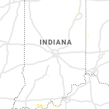
Indiana
| Local Time | Report Details |
|---|---|
| 10:20 AM CDT | Delayed report. em reported damage to several trees along shiloh rd near state route 3 in perry county IN, 47.7 miles E of Evansville, IN |
| 12:17 PM EDT | Quarter sized hail reported near Laconia, IN, 20.6 miles W of Louisville, KY, via social media - report of an estimate 1 in hail with damage to vehicles. |
Nebraska
| Local Time | Report Details |
|---|---|
| 10:30 AM CDT | Ping Pong Ball sized hail reported near Thedford, NE, 59.1 miles N of North Platte, NE, two separate reports of quarter to ping pong ball hail ongoing in thedford. |
| 9:55 AM MDT | Half Dollar sized hail reported near Arthur, NE, 51.6 miles WNW of North Platte, NE, picture via social media. |
| 11:00 AM CDT | Golf Ball sized hail reported near Seneca, NE, 59.3 miles SSW of Valentine, NE |
| 5:03 PM MDT | Tennis Ball sized hail reported near Benkelman, NE, 54.8 miles NW of Colby, KS, estimated time of report from radar. |
| 5:03 PM MDT | 5 inch diameter tree limb blown down. estimated time of report from rada in dundy county NE, 51.7 miles NNW of Colby, KS |
| 5:10 PM MDT | Storm damage reported in dundy county NE, 42.2 miles E of Yuma, CO |
| 5:30 PM MDT | Atleast 2 power poles leaning from the wind... 6 inch diameter tree limb blown down. estimated time of report from rada in dundy county NE, 51.9 miles NNW of Colby, KS |
| 5:30 PM MDT | Half of a locus tree was broken off in town... another tree was uproote in dundy county NE, 52.2 miles NNW of Colby, KS |
| 5:37 PM MDT | Mature pine tree was blown over. estimated time of report from rada in dundy county NE, 59.6 miles NNW of Colby, KS |
| 5:53 PM MDT | Tennis Ball sized hail reported near Imperial, NE, 60.7 miles ENE of Yuma, CO |
| 6:58 PM CDT | Quarter sized hail reported near Palisade, NE, 61 miles N of Colby, KS, occurred with 70 mph wind gusts. |
| 6:58 PM CDT | Occurred with 1 inch hai in hitchcock county NE, 61 miles N of Colby, KS |
| 6:01 PM MDT | Baseball sized hail reported near Wauneta, NE, 66.3 miles ENE of Yuma, CO, delayed report with photo via social media. time estimated by radar. |
| 6:06 PM MDT | Tennis Ball sized hail reported near Enders, NE, 65.8 miles ENE of Yuma, CO |
| 7:08 PM CDT | Quarter sized hail reported near Culbertson, NE, 57.5 miles NNE of Colby, KS, corn crop stripped of all its leaves. estimated time of report from radar. |
| 7:17 PM CDT | Quarter sized hail reported near Palisade, NE, 57.2 miles SSW of North Platte, NE, hail ranged from dime to quarter size. |
| 7:17 PM CDT | Quarter sized hail reported near Palisade, NE, 57.3 miles S of North Platte, NE, estimated time of report from radar. |
| 7:17 PM CDT | Two double pane windows on west side of house blown out from wind and 1 inch hail. estimated time of report from rada in hitchcock county NE, 57.3 miles S of North Platte, NE |
| 7:20 PM CDT | Storm damage reported in hitchcock county NE, 54.7 miles N of Colby, KS |
| 7:30 PM CDT | Power outage reported in stratton... culbertson... trenton... and palisad in hitchcock county NE, 52.9 miles N of Colby, KS |
| 7:33 PM CDT | Quarter sized hail reported near Palisade, NE, 56.6 miles S of North Platte, NE, at least 50 mph winds also observed at this time. |
| 7:40 PM CDT | Ping Pong Ball sized hail reported near Culbertson, NE, 56.3 miles S of North Platte, NE |
| 7:42 PM CDT | Golf Ball sized hail reported near Culbertson, NE, 52.9 miles S of North Platte, NE |
| 7:45 PM CDT | Two car garage door and window blown out. estimated time of report from rada in red willow county NE, 61.7 miles NNE of Colby, KS |
| 7:54 PM CDT | Storm damage reported in red willow county NE, 56.4 miles NNE of Colby, KS |
| 7:58 PM CDT | Storm damage reported in red willow county NE, 60.2 miles NNE of Colby, KS |
South Dakota
| Local Time | Report Details |
|---|---|
| 10:15 AM MDT | Quarter sized hail reported near Long Valley, SD, 59.8 miles NW of Valentine, NE, most of the hail was half inch a piece or two were larger. |
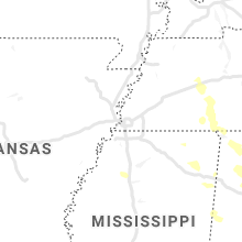
Mississippi
| Local Time | Report Details |
|---|---|
| 12:35 PM CDT | Tree down on powerline in monroe county MS, 29.3 miles NNE of Starkville, MS |
| 1:00 PM CDT | Tree on power line near mike parra rd and hwy 4 in lowndes county MS, 24.5 miles ENE of Starkville, MS |
| 1:00 PM CDT | Tree dow in lowndes county MS, 27.7 miles ENE of Starkville, MS |
| 6:48 PM CDT | Corrects previous non-tstm wnd dmg report from heidelberg. reports of multiple trees down in streets... trees on at least 1 home... and at least 1 car in heidelber in jasper county MS, 75.8 miles ESE of Jackson, MS |
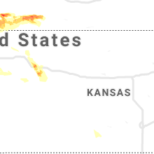
Colorado
| Local Time | Report Details |
|---|---|
| 1:49 PM MDT | Quarter sized hail reported near Colorado Springs, CO, 32.5 miles NNW of Pueblo, CO |
| 2:00 PM MDT | Golf Ball sized hail reported near Colorado Springs, CO, 34.5 miles NNW of Pueblo, CO, reported at fort carson image from social media (twitter). |
| 2:58 PM MDT | Hen Egg sized hail reported near Arriba, CO, 55.7 miles SSW of Yuma, CO |
| 3:03 PM MDT | Quarter sized hail reported near Arriba, CO, 54.5 miles SSW of Yuma, CO |
| 3:36 PM MDT | Quarter sized hail reported near Flagler, CO, 37.8 miles SSW of Yuma, CO |
| 3:50 PM MDT | Ping Pong Ball sized hail reported near Cope, CO, 31.7 miles SSW of Yuma, CO |
| 4:06 PM MDT | Reported large... dead tree blown over as well as numerous tree limbs dow in yuma county CO, 19.3 miles S of Yuma, CO |
| 4:12 PM MDT | Quarter sized hail reported near Canon City, CO, 37.2 miles WNW of Pueblo, CO |
| 4:34 PM MDT | Quarter sized hail reported near Wray, CO, 27.6 miles ESE of Yuma, CO, . |
| 4:35 PM MDT | Half Dollar sized hail reported near Wray, CO, 27.3 miles ESE of Yuma, CO |
| 4:42 PM MDT | Tennis Ball sized hail reported near Wray, CO, 27.5 miles E of Yuma, CO |
| 4:43 PM MDT | Quarter sized hail reported near Vernon, CO, 30.4 miles SE of Yuma, CO |
| 4:45 PM MDT | Golf Ball sized hail reported near Vernon, CO, 24.8 miles ESE of Yuma, CO, hail was a little bigger than golf ball size. this was estimated after the hail was outside in the rain for 10 minutes. |
| 4:45 PM MDT | Tennis Ball sized hail reported near Wray, CO, 35.7 miles E of Yuma, CO, hail was mostly nickel to quarter size. wind gusts of 40 mph also occurred. |
| 4:47 PM MDT | Quarter sized hail reported near Genoa, CO, 72.3 miles SW of Yuma, CO |
| 4:51 PM MDT | Golf Ball sized hail reported near Wray, CO, 33.1 miles E of Yuma, CO, estimated time of report from radar. |
| 4:53 PM MDT | Half Dollar sized hail reported near Wray, CO, 26.3 miles E of Yuma, CO |
| 5:00 PM MDT | Quarter sized hail reported near Hugo, CO, 75.4 miles SSW of Yuma, CO |
| 6:12 PM MDT | Asos station kril garfield county rgnl a in garfield county CO, 54.9 miles NE of Grand Junction, CO |
| 6:15 PM MDT | Quarter sized hail reported near Cheyenne Wells, CO, 80.6 miles WSW of Colby, KS, estimated time of report from radar. |
| 6:35 PM MDT | Half Dollar sized hail reported near Cheyenne Wells, CO, 80.2 miles WSW of Colby, KS |
| 7:00 PM MDT | Awos station kege eagle county rgnl airpor in eagle county CO, 69.5 miles SSE of Craig, CO |
| 7:12 PM MDT | Golf Ball sized hail reported near Sheridan Lake, CO, 93.5 miles SW of Colby, KS |
| 8:19 PM MDT | Quarter sized hail reported near Holly, CO, 76.9 miles W of Garden City, KS |
Ohio
| Local Time | Report Details |
|---|---|
| 4:57 PM EDT | Several large tree limbs downed. pea size hail also reported. time estimated from rada in clinton county OH, 37.6 miles NE of Cincinnati, OH |
| 5:06 PM EDT | One healthy tree downed on rosehill roa in franklin county OH, 9.8 miles E of Columbus, OH |
Georgia
| Local Time | Report Details |
|---|---|
| 5:38 PM EDT | Power pole reported down near the intersection of hamilton rd and veterans pkwy in muscogee county GA, 30.5 miles ESE of Auburn, AL |
| 5:46 PM EDT | Multiple trees down along river rd between bradley park dr and double churches rd in muscogee county GA, 28.5 miles E of Auburn, AL |
West Virginia
| Local Time | Report Details |
|---|---|
| 5:55 PM EDT | One tree reported down on rt 20 on hodam mountai in webster county WV, 37.4 miles SW of Elkins, WV |
Kentucky
| Local Time | Report Details |
|---|---|
| 6:03 PM EDT | Trees blown down... some on power-lines. time estimated from rada in bath county KY, 31 miles NNE of Irvine, KY |
| 6:05 PM EDT | Delayed report. dispatch reported tree down along hwy 412. time estimated from rada in marion county KY, 35.4 miles SSE of Louisville, KY |
| 6:15 PM EDT | Delayed report. dispatch reported trees down 1 mile north of 150. time estimated from rada in washington county KY, 32.8 miles SE of Louisville, KY |
| 6:16 PM EDT | Quarter sized hail reported near Olympia, KY, 31.7 miles NNE of Irvine, KY, estimated hail the size of quarters per social media post. trees also blown down. |
| 6:20 PM EDT | Dispatch reported trees down on thurman r in washington county KY, 33.8 miles ESE of Louisville, KY |
| 6:35 PM EDT | Delayed report. dispatch reported trees down near bear track road and palestine road. time estimated from rada in taylor county KY, 47.5 miles SSE of Louisville, KY |
| 6:42 PM EDT | Delayed report. dispatch reported trees down along old greensburg road. time estimated from rada in taylor county KY, 48.6 miles SSE of Louisville, KY |
| 6:48 PM EDT | Delayed report. dispatch reported 1 tree down along mitchellsburg road. time and location approximat in boyle county KY, 49 miles ESE of Louisville, KY |
| 7:00 PM EDT | Tree blown down taking down some power-lines. time estimated from rada in morgan county KY, 42.2 miles ENE of Irvine, KY |
| 7:59 PM EDT | Trees blown down. time estimated from rada in magoffin county KY, 49.6 miles E of Irvine, KY |
Pennsylvania
| Local Time | Report Details |
|---|---|
| 6:31 PM EDT | Downed trees and wires near old lancaster pike and hampshire road. time estimated from rada in berks county PA, 75.1 miles NNE of Baltimore, MD |
| 6:48 PM EDT | Downed trees and wires near schmehl road near blandon. time estimated from rada in berks county PA, 69.1 miles S of Scranton, PA |
| 6:53 PM EDT | Trees and wires down near sommers road near oley. time estimated from rada in berks county PA, 71.6 miles S of Scranton, PA |
| 7:07 PM EDT | 1 tree dow in schuylkill county PA, 64.7 miles E of State College, PA |
| 7:07 PM EDT | Downed tree and wires near the intersection of lobachsville road and old boyer road. time estimated from rada in berks county PA, 68.4 miles S of Scranton, PA |
Florida
| Local Time | Report Details |
|---|---|
| 5:42 PM CDT | Trees down near highway 9 in escambia county FL, 35.2 miles ENE of Mobile, AL |
| 6:45 PM CDT | Tree down along highway 82 a little north of highway in walton county FL, 40.6 miles NNE of Miramar Beach, FL |
North Dakota
| Local Time | Report Details |
|---|---|
| 8:38 PM CDT | Quarter sized hail reported near Tioga, ND, 38.5 miles NE of Williston, ND |
| 11:14 PM MDT | Ping Pong Ball sized hail reported near Medora, ND, 84.9 miles S of Williston, ND, ping pong ball size hail. |
Kansas
| Local Time | Report Details |
|---|---|
| 8:40 PM CDT | Several 2 inch tree limbs down. one 7 inch tree limb from a rotted tree was also down. time estimated based on rada in logan county KS, 21.2 miles SSE of Colby, KS |
| 8:45 PM CDT | 2 inch diameter tree limbs blown dow in thomas county KS, 16.5 miles SSE of Colby, KS |
| 8:56 PM CDT | Koel oakley airpor in logan county KS, 23.2 miles SSE of Colby, KS |
| 9:08 PM CDT | Golf Ball sized hail reported near Oakley, KS, 26.6 miles SE of Colby, KS, em relayed report of golfball size hail. smaller hail of quarters also reported. ground appeared white due to hail covering the ground. |
| 10:34 PM CDT | Corrects previous tstm wnd dmg report from 1 wnw lakin. corrects previous tstm wnd dmg report from 1 wnw lakin. semi blown over on mile marker 33 on highway 50. social in kearny county KS, 22.3 miles W of Garden City, KS |
| 11:18 PM CDT | Corrects previous tstm wnd gst report from 1 e ingalls. social media repor in gray county KS, 25.5 miles ESE of Garden City, KS |
| 11:21 PM CDT | Corrects previous tstm wnd gst report from 1 e ingalls. social media repor in gray county KS, 25.8 miles ESE of Garden City, KS |
| 11:39 PM CDT | Corrects previous non-tstm wnd gst report from 1 nne sublette. 1 nne sublette. awos station k19s 1 ne sublett in haskell county KS, 32.4 miles S of Garden City, KS |
Utah
| Local Time | Report Details |
|---|---|
| 7:40 PM MDT | Mesonet station utsla 1.8 n sigurd (utah dot i-70 at salina in sevier county UT, 19.2 miles NNE of Monroe, UT |
| 10:30 PM MDT | Mesonet station utlmp 4.0 nw levan (utah dot i-15 at mp 215 lampson canyon in juab county UT, 59.2 miles W of Price, UT |
| 11:50 PM MDT | Monument peak mesonet - elevation 10390 f in emery county UT, 19.7 miles W of Price, UT |
New Mexico
| Local Time | Report Details |
|---|---|
| 8:34 PM MDT | Storm damage reported in harding county NM, 70.6 miles NNW of Tucumcari, NM |
Oklahoma
| Local Time | Report Details |
|---|---|
| 2:05 AM CDT | Storm damage reported in woods county OK, 43.7 miles NNE of Woodward, OK |
Connect with Interactive Hail Maps