

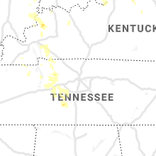
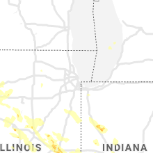
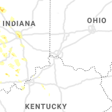
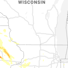
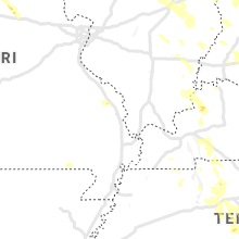
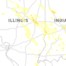
Hail Map for Saturday, July 11, 2020

Number of Impacted Households on 7/11/2020
0
Impacted by 1" or Larger Hail
0
Impacted by 1.75" or Larger Hail
0
Impacted by 2.5" or Larger Hail
Square Miles of Populated Area Impacted on 7/11/2020
0
Impacted by 1" or Larger Hail
0
Impacted by 1.75" or Larger Hail
0
Impacted by 2.5" or Larger Hail


Cities Most Affected by Hail Storms of 7/11/2020
| Hail Size | Demographics of Zip Codes Affected | ||||||
|---|---|---|---|---|---|---|---|
| City | Count | Average | Largest | Pop Density | House Value | Income | Age |
| Altoona, KS | 4 | 2.50 | 2.75 | 6 | $24k | $27.6k | 45.1 |
| Maple Hill, KS | 3 | 3.33 | 4.00 | 10 | $78k | $47.4k | 35.9 |
| Lakefield, MN | 4 | 2.13 | 2.50 | 10 | $48k | $34.9k | 44.0 |
| Norway, IA | 4 | 2.13 | 3.00 | 14 | $98k | $49.0k | 43.2 |
| Roland, IA | 3 | 2.25 | 2.50 | 24 | $100k | $48.2k | 36.6 |
| Garnett, KS | 3 | 2.25 | 3.00 | 23 | $62k | $34.1k | 41.2 |
| Waverly, KS | 2 | 3.00 | 4.00 | 7 | $56k | $36.0k | 44.7 |
| North Liberty, IA | 3 | 1.75 | 1.75 | 485 | $117k | $47.5k | 29.8 |
| Walford, IA | 2 | 2.25 | 2.75 | 425 | $153k | $65.3k | 35.1 |
| Westmoreland, KS | 2 | 2.25 | 2.75 | 6 | $55k | $32.4k | 41.9 |
| Welch, OK | 2 | 2.00 | 2.00 | 6 | $41k | $30.9k | 41.8 |
| Thayer, KS | 1 | 4.00 | 4.00 | 10 | $41k | $35.9k | 38.8 |
| Enid, OK | 2 | 1.88 | 2.00 | 170 | $39k | $26.6k | 33.1 |
| Dennis, KS | 2 | 1.88 | 2.00 | 14 | $43k | $27.9k | 38.5 |
| Auburn, KS | 2 | 1.88 | 2.00 | 64 | $89k | $48.6k | 41.4 |
| Hector, MN | 2 | 1.88 | 2.00 | 9 | $61k | $36.3k | 44.7 |
| Chetopa, KS | 2 | 1.88 | 2.00 | 11 | $31k | $25.4k | 46.6 |
| Lahoma, OK | 2 | 1.75 | 1.75 | 25 | $55k | $36.5k | 40.6 |
| Fort Dodge, IA | 2 | 1.75 | 1.75 | 173 | $68k | $34.6k | 38.4 |
| Van Horne, IA | 2 | 1.75 | 1.75 | 15 | $87k | $46.1k | 39.6 |
| Chanute, KS | 1 | 2.50 | 2.50 | 60 | $45k | $32.2k | 39.4 |
| Shell Rock, IA | 1 | 2.50 | 2.50 | 24 | $78k | $41.0k | 44.5 |
| Peoria, IL | 1 | 2.50 | 2.50 | 348 | $86k | $46.7k | 42.4 |
| Longton, KS | 1 | 2.50 | 2.50 | 3 | $27k | $23.5k | 42.1 |
| Stewart, MN | 1 | 2.50 | 2.50 | 11 | $80k | $41.0k | 43.2 |
| Collins, IA | 1 | 2.00 | 2.00 | 11 | $78k | $40.6k | 40.1 |
| Glenwood, MN | 1 | 2.00 | 2.00 | 29 | $79k | $35.4k | 47.0 |
| New Hartford, IA | 1 | 2.00 | 2.00 | 21 | $60k | $39.3k | 40.0 |
| Wesley, IA | 1 | 2.00 | 2.00 | 7 | $52k | $38.0k | 42.4 |
| Burlingame, KS | 1 | 2.00 | 2.00 | 18 | $60k | $34.4k | 42.3 |
| Edna, KS | 1 | 2.00 | 2.00 | 8 | $46k | $37.1k | 42.8 |
| Okabena, MN | 1 | 1.75 | 1.75 | 8 | $38k | $34.9k | 43.0 |
| Erie, KS | 1 | 1.75 | 1.75 | 15 | $44k | $32.1k | 43.7 |
| Freedom, OK | 1 | 1.75 | 1.75 | 1 | $45k | $32.6k | 47.0 |
| Pekin, IL | 1 | 1.75 | 1.75 | 617 | $77k | $40.2k | 39.4 |
| Goodwell, OK | 1 | 1.75 | 1.75 | 1 | $73k | $34.1k | 22.8 |
| Paxico, KS | 1 | 1.75 | 1.75 | 9 | $80k | $42.3k | 39.7 |
| Ruthven, IA | 1 | 1.75 | 1.75 | 12 | $55k | $32.0k | 46.3 |
| Wamego, KS | 1 | 1.75 | 1.75 | 58 | $86k | $45.2k | 36.1 |
| Lafayette, MN | 1 | 1.75 | 1.75 | 12 | $74k | $40.2k | 40.8 |
| Philo, IL | 1 | 1.75 | 1.75 | 51 | $97k | $58.9k | 37.6 |
| Mc Callsburg, IA | 1 | 1.75 | 1.75 | 10 | $73k | $39.7k | 38.4 |
| Fairland, OK | 1 | 1.75 | 1.75 | 38 | $59k | $29.3k | 43.1 |
| Amana, IA | 1 | 1.75 | 1.75 | 35 | $132k | $47.5k | 47.6 |
| Grove, OK | 1 | 1.75 | 1.75 | 161 | $104k | $27.4k | 50.1 |
| Urbana, IL | 1 | 1.75 | 1.75 | 4258 | $93k | $26.1k | 23.2 |
Hail and Wind Damage Spotted on 7/11/2020
Filter by Report Type:Hail ReportsWind Reports
States Impacted
Iowa, Minnesota, Oklahoma, Kansas, Florida, Indiana, Maine, New York, Illinois, Ohio, Kentucky, Wisconsin, Arizona, New Mexico, Arkansas, Texas, Missouri, TennesseeIowa
| Local Time | Report Details |
|---|---|
| 8:36 AM CDT | Quarter sized hail reported near New Hampton, IA, 48.5 miles E of Mason City, IA |
| 8:38 AM CDT | Quarter sized hail reported near Lawler, IA, 56.4 miles E of Mason City, IA, law enforcement reported significant crop damage due to hail 3 to 4 miles east of lawler. hail size estimated quarter sized or larger. |
| 8:41 AM CDT | Quarter sized hail reported near Fredericksburg, IA, 52.1 miles ESE of Mason City, IA, . |
| 8:50 AM CDT | Quarter sized hail reported near Waucoma, IA, 60 miles ESE of Mason City, IA, delayed report. northwest of hawkeye. relayed by law enforcement. |
| 8:57 AM CDT | Delayed report. 3 large trees down. time estimated from rada in fayette county IA, 61.3 miles ESE of Mason City, IA |
| 9:08 AM CDT | Delayed report. several farm out buildings damaged or blown down between w13 and w14 and 100th to 130th st. some corn flattened. time estimated from rada in fayette county IA, 58.7 miles NNW of Cedar Rapids, IA |
| 9:45 AM CDT | Quarter sized hail reported near Independence, IA, 38.3 miles NNW of Cedar Rapids, IA |
| 9:47 AM CDT | Quarter sized hail reported near Independence, IA, 35.7 miles NNW of Cedar Rapids, IA |
| 9:47 AM CDT | Quarter sized hail reported near Independence, IA, 36.5 miles NNW of Cedar Rapids, IA, hail for the last 2 minutes with hail coating the ground. |
| 9:47 AM CDT | Half Dollar sized hail reported near Independence, IA, 36.2 miles NNW of Cedar Rapids, IA |
| 9:47 AM CDT | Storm damage reported in buchanan county IA, 36.2 miles NNW of Cedar Rapids, IA |
| 9:49 AM CDT | Ping Pong Ball sized hail reported near Independence, IA, 35.5 miles NNW of Cedar Rapids, IA, initially reported 1 inch hail but it grew to 1.50 inches during the conversation. said it was windy but had no estimate on the wind speed. time estimated using radar. |
| 9:50 AM CDT | Quarter sized hail reported near Independence, IA, 35.8 miles NNW of Cedar Rapids, IA, numerous reports of hail golf ball size or larger. |
| 9:50 AM CDT | Ping Pong Ball sized hail reported near Independence, IA, 35.3 miles NNW of Cedar Rapids, IA |
| 10:10 AM CDT | Quarter sized hail reported near Central City, IA, 17.1 miles NNE of Cedar Rapids, IA, corrects previous hail report from central city to put the correct time in. relayed a report of 1 inch hail in central city from a deputy. |
| 10:20 AM CDT | Linn co ema called regarding a couple of large metal grain bins that were downed by the wind and blown across the field. along with those... a cattle and hay shed were in linn county IA, 21.3 miles N of Cedar Rapids, IA |
| 10:25 AM CDT | Tree on house approx. 2 north of central cit in linn county IA, 17.1 miles NNE of Cedar Rapids, IA |
| 10:25 AM CDT | Quarter sized hail reported near Central City, IA, 17.1 miles NNE of Cedar Rapids, IA |
| 10:32 AM CDT | Quarter sized hail reported near Central City, IA, 17.1 miles NNE of Cedar Rapids, IA, relayed a report of 1 inch hail in central city from a deputy. |
| 10:34 AM CDT | Large tree branch down near the intersection of barett and austin roads. also crop damage reported. photo from social medi in linn county IA, 12.4 miles NE of Cedar Rapids, IA |
| 10:35 AM CDT | Report of a large tree branch down on prairie chapel road one mile north of whitter. picture from social media. time estimated from rada in linn county IA, 14 miles NE of Cedar Rapids, IA |
| 10:39 AM CDT | Quarter sized hail reported near Springville, IA, 13.5 miles NE of Cedar Rapids, IA, social media report of quarter size hail and a wind gust of 60 mph. |
| 10:45 AM CDT | Large tree branch approximately 6-8 inches in diameter downed by wind in jones county IA, 20.5 miles ENE of Cedar Rapids, IA |
| 10:45 AM CDT | Em relayed report from fire department of multiple trees down and damage to corn crops on 52nd street southeast of martelle. time estimated from rada in jones county IA, 19.4 miles E of Cedar Rapids, IA |
| 11:00 AM CDT | Half Dollar sized hail reported near Stanwood, IA, 25.6 miles ESE of Cedar Rapids, IA, social media report. |
| 11:10 AM CDT | Half Dollar sized hail reported near Stanwood, IA, 25.6 miles ESE of Cedar Rapids, IA, social media report. |
| 11:15 AM CDT | Half Dollar sized hail reported near Tipton, IA, 31.5 miles ESE of Cedar Rapids, IA, fire department reports hail of quarter to half dollar size along with 0.60 inches of rain in under ten minutes. |
| 11:20 AM CDT | Quarter sized hail reported near Tipton, IA, 31.5 miles ESE of Cedar Rapids, IA, hail and torrential rain. |
| 2:15 PM CDT | Half Dollar sized hail reported near Spirit Lake, IA, 59.8 miles N of Storm Lake, IA, report via social media. |
| 2:15 PM CDT | Quarter sized hail reported near Clare, IA, 44.1 miles E of Storm Lake, IA, report via social media. |
| 2:27 PM CDT | Quarter sized hail reported near Fort Dodge, IA, 53 miles E of Storm Lake, IA, trained spotter reports quarter sized hail on the nw side of fort dodge. |
| 2:29 PM CDT | Golf Ball sized hail reported near Fort Dodge, IA, 51.7 miles ESE of Storm Lake, IA |
| 2:38 PM CDT | Ping Pong Ball sized hail reported near Fort Dodge, IA, 53.1 miles E of Storm Lake, IA, trained spotter reports ping pong ball sized hail near fort dodge. |
| 2:41 PM CDT | Golf Ball sized hail reported near Fort Dodge, IA, 53.7 miles ESE of Storm Lake, IA, quarter to golf ball sized hail se of fort dodge. |
| 2:52 PM CDT | Ping Pong Ball sized hail reported near Ruthven, IA, 38.4 miles NNE of Storm Lake, IA, storm spotter reports ping pong sized hail. |
| 2:52 PM CDT | Storm damage reported in clay county IA, 38.4 miles NNE of Storm Lake, IA |
| 2:54 PM CDT | Golf Ball sized hail reported near Ruthven, IA, 39.4 miles NNE of Storm Lake, IA, report via kicd. time estimated by radar. |
| 2:58 PM CDT | Quarter sized hail reported near Ruthven, IA, 36.7 miles NNE of Storm Lake, IA, report via kicd. |
| 3:15 PM CDT | Ping Pong Ball sized hail reported near Sheffield, IA, 17.7 miles S of Mason City, IA, social media report of ping pong ball sized hail in sheffield... ia. |
| 3:24 PM CDT | Hen Egg sized hail reported near Wesley, IA, 41.5 miles W of Mason City, IA |
| 3:26 PM CDT | Quarter sized hail reported near Clarksville, IA, 38.4 miles SE of Mason City, IA, nws employee reports quarter sized hail sw of clarksville... ia. |
| 3:30 PM CDT | Ping Pong Ball sized hail reported near Hanlontown, IA, 13.4 miles NW of Mason City, IA, delayed media report of ping pong ball sized hail just north of hanlontown around 3:30pm. |
| 3:34 PM CDT | Tennis Ball sized hail reported near Shell Rock, IA, 44 miles SE of Mason City, IA, report via social media. time estimated and location estimated by radar. |
| 3:40 PM CDT | Quarter sized hail reported near Story City, IA, 40.3 miles N of Des Moines, IA, trained spotter reported 1 inch hail at the intersection of e18 and r38 northwest of gilbert. |
| 3:46 PM CDT | Ping Pong Ball sized hail reported near New Hartford, IA, 48.8 miles SE of Mason City, IA, report via social media. |
| 3:51 PM CDT | Hen Egg sized hail reported near New Hartford, IA, 48.6 miles SE of Mason City, IA, courtesy of kwwl. report via social media and time and location estimated by radar. |
| 3:52 PM CDT | Ping Pong Ball sized hail reported near Story City, IA, 41.4 miles N of Des Moines, IA, law enforcement reported quarter to ping pong ball sized hail in story city. hail lasted 1 - 2 minutes. |
| 3:54 PM CDT | Storm damage reported in cerro gordo county IA, 6.6 miles W of Mason City, IA |
| 3:54 PM CDT | Quarter sized hail reported near Janesville, IA, 49 miles SE of Mason City, IA, time and location estimated by radar. courtesy of kwwl. |
| 4:02 PM CDT | Quarter sized hail reported near Mason City, IA, 1.6 miles N of Mason City, IA, trained spotter reports 1 inch hail one mile north of mason city... ia. |
| 4:20 PM CDT | Quarter sized hail reported near Cedar Falls, IA, 54.1 miles NW of Cedar Rapids, IA, courtesy of kwwl. report via social media. |
| 4:24 PM CDT | Quarter sized hail reported near Cedar Falls, IA, 54.8 miles NW of Cedar Rapids, IA |
| 4:31 PM CDT | Half Dollar sized hail reported near Cedar Falls, IA, 53.7 miles NW of Cedar Rapids, IA |
| 4:39 PM CDT | Quarter sized hail reported near Parkersburg, IA, 47.6 miles SSE of Mason City, IA |
| 4:50 PM CDT | Quarter sized hail reported near Van Horne, IA, 22.9 miles WNW of Cedar Rapids, IA |
| 5:05 PM CDT | Golf Ball sized hail reported near Van Horne, IA, 18.4 miles W of Cedar Rapids, IA |
| 5:08 PM CDT | Golf Ball sized hail reported near Van Horne, IA, 21.4 miles W of Cedar Rapids, IA |
| 5:10 PM CDT | Delayed report. a few branches down... tree down... and shed blown over. time estimated from rada in mitchell county IA, 36 miles ENE of Mason City, IA |
| 5:12 PM CDT | Half Dollar sized hail reported near Van Horne, IA, 18.4 miles W of Cedar Rapids, IA |
| 5:18 PM CDT | Golf Ball sized hail reported near Roland, IA, 41.9 miles N of Des Moines, IA, report via social media. |
| 5:20 PM CDT | Tennis Ball sized hail reported near Roland, IA, 40.5 miles N of Des Moines, IA, courtesy of kcci. report via social media. |
| 5:21 PM CDT | Quarter sized hail reported near Roland, IA, 40.5 miles N of Des Moines, IA, nickel to quarter sized hail. |
| 5:22 PM CDT | Half Dollar sized hail reported near Norway, IA, 13 miles WSW of Cedar Rapids, IA, em reported quarter to half dollar hail north of norway. |
| 5:24 PM CDT | Quarter sized hail reported near Newhall, IA, 13.8 miles W of Cedar Rapids, IA |
| 5:28 PM CDT | Golf Ball sized hail reported near Norway, IA, 13 miles WSW of Cedar Rapids, IA |
| 5:28 PM CDT | Tea Cup sized hail reported near Norway, IA, 13 miles WSW of Cedar Rapids, IA, corrects previous hail report from 2 se norway. |
| 5:30 PM CDT | Several large trees split or fallen. large tree limbs also snappe in linn county IA, 15.7 miles NNW of Cedar Rapids, IA |
| 5:30 PM CDT | Golf Ball sized hail reported near Mc Callsburg, IA, 41.7 miles NNE of Des Moines, IA, report via social media. |
| 5:30 PM CDT | Ping Pong Ball sized hail reported near Norway, IA, 12.1 miles WSW of Cedar Rapids, IA, reported at 3040 75th street norway ia. |
| 5:32 PM CDT | Quarter sized hail reported near Colo, IA, 34.2 miles NNE of Des Moines, IA, trained spotter reports quarter size hail on us 65 half way between colo and zearing. |
| 5:32 PM CDT | Half Dollar sized hail reported near Mc Callsburg, IA, 40.9 miles NNE of Des Moines, IA, trained spotter reported 1.25 inch hail 1 mile sw of mccallsburg. |
| 5:33 PM CDT | Ping Pong Ball sized hail reported near Norway, IA, 13.5 miles WSW of Cedar Rapids, IA |
| 5:33 PM CDT | Large tree branches down in center point. report from social media. time estimated from rada in linn county IA, 15.7 miles NNW of Cedar Rapids, IA |
| 5:34 PM CDT | Golf Ball sized hail reported near Norway, IA, 13.7 miles WSW of Cedar Rapids, IA |
| 5:35 PM CDT | Tennis Ball sized hail reported near Roland, IA, 41.5 miles N of Des Moines, IA, trained spotter at 620th ave and 120th st in story co reported 2.5 in hail at approximately 1735. |
| 5:39 PM CDT | Golf Ball sized hail reported near Walford, IA, 10.8 miles SW of Cedar Rapids, IA |
| 5:41 PM CDT | Baseball sized hail reported near Walford, IA, 10.4 miles SW of Cedar Rapids, IA |
| 5:45 PM CDT | Hen Egg sized hail reported near Norway, IA, 12.9 miles SW of Cedar Rapids, IA |
| 5:47 PM CDT | Golf Ball sized hail reported near Amana, IA, 13.8 miles SW of Cedar Rapids, IA |
| 5:48 PM CDT | Quarter sized hail reported near Nevada, IA, 30.4 miles NNE of Des Moines, IA, law enforcement reports 1 inch hail in nevada... ia. |
| 5:50 PM CDT | Storm damage reported in linn county IA, 5.1 miles N of Cedar Rapids, IA |
| 5:54 PM CDT | Storm damage reported in linn county IA, 12.3 miles NNE of Cedar Rapids, IA |
| 5:55 PM CDT | Hen Egg sized hail reported near Collins, IA, 27.7 miles NE of Des Moines, IA, delayed report from em:1 mile north of collins on hwy 65 of 2 inch hail (lasted 10 min... damage to siding). |
| 5:55 PM CDT | Ping Pong Ball sized hail reported near Collins, IA, 26.6 miles NE of Des Moines, IA, delayed report from em: ping pong ball sized hail in collins at approximately 1755. |
| 5:57 PM CDT | Several large tree branches dow in linn county IA, 2.4 miles NNE of Cedar Rapids, IA |
| 5:57 PM CDT | Metal shed blown across 29th ave in marion. time estimated from rada in linn county IA, 7 miles NE of Cedar Rapids, IA |
| 5:57 PM CDT | Storm damage reported in linn county IA, 1.8 miles NNE of Cedar Rapids, IA |
| 5:57 PM CDT | Storm damage reported in linn county IA, 1.8 miles NNE of Cedar Rapids, IA |
| 5:58 PM CDT | Ping Pong Ball sized hail reported near Norway, IA, 12.1 miles WSW of Cedar Rapids, IA, reported at 3040 75th street norway ia. |
| 6:00 PM CDT | Ping Pong Ball sized hail reported near Colo, IA, 33.4 miles NNE of Des Moines, IA, trained spotter reported 1.25 to 1.5 inch hail se of colo. |
| 6:00 PM CDT | Large tree down and went through a garag in linn county IA, 3.8 miles N of Cedar Rapids, IA |
| 6:00 PM CDT | Large tree snapped by the wind. about 2 ft diamete in linn county IA, 6.5 miles N of Cedar Rapids, IA |
| 6:03 PM CDT | Storm damage reported in linn county IA, 3.3 miles E of Cedar Rapids, IA |
| 6:04 PM CDT | Tree blown down by severe wind in linn county IA, 7 miles NE of Cedar Rapids, IA |
| 6:05 PM CDT | Wooden barn nearly flattened by strong wind in jones county IA, 18.9 miles E of Cedar Rapids, IA |
| 6:06 PM CDT | Some small tree damage and flagpole snappe in jones county IA, 22.6 miles ENE of Cedar Rapids, IA |
| 6:07 PM CDT | Golf Ball sized hail reported near North Liberty, IA, 15.2 miles S of Cedar Rapids, IA |
| 6:09 PM CDT | Golf Ball sized hail reported near North Liberty, IA, 16.2 miles SSE of Cedar Rapids, IA |
| 6:11 PM CDT | 4 inch tree limb dow in linn county IA, 5.9 miles NNE of Cedar Rapids, IA |
| 6:11 PM CDT | Quarter sized hail reported near Baxter, IA, 29.2 miles NE of Des Moines, IA, fire dept. reports quarter size hail in baxter... ia. |
| 6:14 PM CDT | Golf Ball sized hail reported near North Liberty, IA, 16 miles SSE of Cedar Rapids, IA, 5 minutes quarter to golf ball size hail. stopped hailing during the phone call. |
| 6:15 PM CDT | Very strong winds (estimated 60-70) with several broken branches that were several inches in diamete in jones county IA, 22.7 miles ENE of Cedar Rapids, IA |
| 6:18 PM CDT | Large tree down in field. time estimated from rada in jones county IA, 26.8 miles ENE of Cedar Rapids, IA |
| 6:20 PM CDT | Dot reported utility pole down on hwy 30 with power lines blocking both lanes of traffi in cedar county IA, 22 miles ESE of Cedar Rapids, IA |
| 6:21 PM CDT | Quarter sized hail reported near Victor, IA, 36.1 miles WSW of Cedar Rapids, IA |
| 6:22 PM CDT | Quarter sized hail reported near Tiffin, IA, 18.4 miles S of Cedar Rapids, IA |
| 6:22 PM CDT | Half Dollar sized hail reported near North Liberty, IA, 16.5 miles S of Cedar Rapids, IA |
| 6:25 PM CDT | Ping Pong Ball sized hail reported near Iowa City, IA, 22.6 miles SSE of Cedar Rapids, IA |
| 6:25 PM CDT | Ping Pong Ball sized hail reported near Coralville, IA, 20.1 miles S of Cedar Rapids, IA |
| 6:28 PM CDT | Relayed report from broadcast media of tree damage from clarence. photo from social media. time estimated from rada in cedar county IA, 32.2 miles E of Cedar Rapids, IA |
| 6:28 PM CDT | Quarter sized hail reported near Coralville, IA, 19.4 miles S of Cedar Rapids, IA |
| 6:30 PM CDT | Quarter sized hail reported near Kellogg, IA, 37.3 miles ENE of Des Moines, IA, trained spotter reported quarter sized hail 4 miles east of newton. |
| 6:30 PM CDT | Quarter sized hail reported near Iowa City, IA, 21.9 miles SSE of Cedar Rapids, IA |
| 6:30 PM CDT | Several trees uprooted with many powerlines dow in cedar county IA, 22.5 miles ESE of Cedar Rapids, IA |
| 6:35 PM CDT | Several trees reported down in tipto in cedar county IA, 31.5 miles ESE of Cedar Rapids, IA |
| 6:37 PM CDT | Quarter sized hail reported near Iowa City, IA, 24.7 miles SSE of Cedar Rapids, IA |
| 6:40 PM CDT | Storm damage reported in cedar county IA, 39.7 miles ESE of Cedar Rapids, IA |
| 6:40 PM CDT | Several large trees blown down and blocking traffic in tipto in cedar county IA, 31.5 miles ESE of Cedar Rapids, IA |
| 6:41 PM CDT | Law enforcement relayed report of trees down in toront in clinton county IA, 42.3 miles E of Cedar Rapids, IA |
| 6:44 PM CDT | Tree down on power line in muscatine county IA, 38.3 miles SE of Cedar Rapids, IA |
| 6:45 PM CDT | Trees reported down across the county. tree sizes unknown. power outage in elkader. likely occurred between 630 and 715 pm based on rada in clayton county IA, 62.6 miles NNE of Cedar Rapids, IA |
| 6:45 PM CDT | Large tree snapped and on tre in jones county IA, 20.5 miles ENE of Cedar Rapids, IA |
| 6:50 PM CDT | Multiple 4 inch tree limbs dow in scott county IA, 53.4 miles ESE of Cedar Rapids, IA |
| 6:50 PM CDT | Law enforcement relayed report of large tree down in calamus. 158th ave just south of 257th st... blocking the entire roadway. time estimated from rada in clinton county IA, 48.2 miles ESE of Cedar Rapids, IA |
| 6:54 PM CDT | Storm damage reported in jones county IA, 22.6 miles ENE of Cedar Rapids, IA |
| 7:00 PM CDT | Several large tree branches down due to severe wind in scott county IA, 60.5 miles ESE of Cedar Rapids, IA |
| 7:00 PM CDT | Storm damage reported in scott county IA, 62.3 miles ESE of Cedar Rapids, IA |
| 7:02 PM CDT | Law enforcement relayed report of large 3-4 ft diameter tree on 270th street southwest of dewitt. time estimated from rada in clinton county IA, 56.4 miles ESE of Cedar Rapids, IA |
| 7:03 PM CDT | Storm damage reported in scott county IA, 61.4 miles ESE of Cedar Rapids, IA |
| 7:05 PM CDT | Power poles down on the south side of park view. also receiving 60 mph wind in scott county IA, 61.8 miles ESE of Cedar Rapids, IA |
| 7:05 PM CDT | 2-3 inch tree limbs snapped off tree in scott county IA, 68.5 miles ESE of Cedar Rapids, IA |
| 7:14 PM CDT | Several trees down with estimated winds at 70 mp in scott county IA, 61.4 miles ESE of Cedar Rapids, IA |
| 7:19 PM CDT | Quarter sized hail reported near Davenport, IA, 60 miles ESE of Cedar Rapids, IA |
| 7:54 PM CDT | Quarter sized hail reported near Indianola, IA, 16.7 miles S of Des Moines, IA |
Minnesota
| Local Time | Report Details |
|---|---|
| 11:49 AM CDT | Reported at us hwy 12 and swift county road 31. measured 5.4 inch diameter tree branch snapped of in swift county MN, 24.5 miles NNE of Montevideo, MN |
| 12:30 PM CDT | Power pole blown dow in kandiyohi county MN, 29.7 miles ENE of Montevideo, MN |
| 12:33 PM CDT | Reported at willmar mn airpor in kandiyohi county MN, 30.8 miles ENE of Montevideo, MN |
| 1:00 PM CDT | Half Dollar sized hail reported near Bird Island, MN, 44.3 miles E of Montevideo, MN |
| 1:07 PM CDT | Ping Pong Ball sized hail reported near Lake Lillian, MN, 41.1 miles E of Montevideo, MN |
| 1:30 PM CDT | Golf Ball sized hail reported near Hector, MN, 50.6 miles ESE of Montevideo, MN |
| 1:43 PM CDT | Hen Egg sized hail reported near Hector, MN, 50.6 miles ESE of Montevideo, MN |
| 1:44 PM CDT | Golf Ball sized hail reported near Okabena, MN, 71 miles E of Sioux Falls, SD |
| 1:56 PM CDT | This accompanies the previous report of hail measured at 1.75 inche in jackson county MN, 68.5 miles N of Storm Lake, IA |
| 1:56 PM CDT | Golf Ball sized hail reported near Lakefield, MN, 68.5 miles N of Storm Lake, IA, also estimated winds of 60 mph. |
| 2:00 PM CDT | Tennis Ball sized hail reported near Lakefield, MN, 65.9 miles N of Storm Lake, IA, report via social media. |
| 2:00 PM CDT | Tennis Ball sized hail reported near Lakefield, MN, 65.8 miles N of Storm Lake, IA, delayed report. size estimation based on video posted on social media account... time estimated by radar. |
| 2:06 PM CDT | Golf Ball sized hail reported near Lakefield, MN, 61.9 miles N of Storm Lake, IA, report via social media. |
| 2:06 PM CDT | Tennis Ball sized hail reported near Stewart, MN, 62 miles ESE of Montevideo, MN |
| 2:10 PM CDT | Quarter sized hail reported near Glenwood, MN, 48.7 miles NNE of Montevideo, MN |
| 2:12 PM CDT | Half Dollar sized hail reported near Winthrop, MN, 60.8 miles WSW of Minneapolis, MN |
| 2:15 PM CDT | Quarter sized hail reported near Glenwood, MN, 46.3 miles NNE of Montevideo, MN |
| 2:23 PM CDT | Half Dollar sized hail reported near Winthrop, MN, 63 miles WSW of Minneapolis, MN |
| 2:24 PM CDT | Hen Egg sized hail reported near Glenwood, MN, 42.7 miles NNE of Montevideo, MN |
| 2:28 PM CDT | Quarter sized hail reported near Winthrop, MN, 62.2 miles WSW of Minneapolis, MN |
| 2:31 PM CDT | Quarter sized hail reported near Elbow Lake, MN, 69.2 miles SE of Fargo, ND, deputy estimated quarter sized hail. |
| 2:31 PM CDT | Quarter sized hail reported near Elbow Lake, MN, 69.5 miles SE of Fargo, ND, deputy estimated quarter sized hail. |
| 2:32 PM CDT | Quarter sized hail reported near Jeffers, MN, 67.5 miles SSE of Montevideo, MN, also estimated wing gusts to 60 mph. |
| 2:32 PM CDT | Quarter sized hail reported near Winthrop, MN, 61.3 miles WSW of Minneapolis, MN, 2 miles east of the intersection of hwy 15 and co rd. 8. |
| 2:38 PM CDT | Golf Ball sized hail reported near Lafayette, MN, 64.4 miles WSW of Minneapolis, MN |
| 2:42 PM CDT | Half Dollar sized hail reported near Jeffers, MN, 70.2 miles SSE of Montevideo, MN |
| 2:55 PM CDT | 4 inch diameter tree branches down. time estimate in nicollet county MN, 72.2 miles SW of Minneapolis, MN |
| 3:00 PM CDT | Road sign damage and roof damage reported along hwy 14 three miles west of nicollet. time estimate in nicollet county MN, 68.5 miles SW of Minneapolis, MN |
| 3:13 PM CDT | Damage to a roof near the north links golf course on lindsay d in nicollet county MN, 68.6 miles SW of Minneapolis, MN |
| 3:15 PM CDT | Tree down on judson bottom road. reported via twitter. photo included. time estimate in blue earth county MN, 70.9 miles SW of Minneapolis, MN |
| 3:22 PM CDT | Trees down and corn flattened on co rd 6 just south of hwy 14. photos of damage shared via faceboo in nicollet county MN, 67.7 miles SW of Minneapolis, MN |
| 3:25 PM CDT | Several tree branches down. time estimated. reported via twitter. photos include in blue earth county MN, 66.3 miles SSW of Minneapolis, MN |
| 3:27 PM CDT | 50kt wind gust measured at mankato regional airport observation platfor in blue earth county MN, 61.6 miles SSW of Minneapolis, MN |
| 3:30 PM CDT | Large trees snapped. time estimate in blue earth county MN, 63.6 miles SSW of Minneapolis, MN |
| 3:30 PM CDT | Pine tree uproote in le sueur county MN, 58 miles SSW of Minneapolis, MN |
| 3:40 PM CDT | Numerous trees down. also... several trees down north of town near duck lake... some blocking co rd. 26. time estimate in blue earth county MN, 59.7 miles SSW of Minneapolis, MN |
| 3:40 PM CDT | Trees down and corn blown over. reported via twitter. photos included. time estimate in waseca county MN, 60.3 miles SSW of Minneapolis, MN |
| 3:40 PM CDT | Several large tree limbs down. reported via twitter. time estimate in blue earth county MN, 63.1 miles SSW of Minneapolis, MN |
| 3:43 PM CDT | Quarter sized hail reported near Fairmont, MN, 72.6 miles WNW of Mason City, IA, reported via twitter on north side of fairmont along i-90. includes photo. |
| 3:45 PM CDT | Large tree snapped. reported via facebook. photo included. time estimate in waseca county MN, 63.3 miles SSW of Minneapolis, MN |
| 4:30 PM CDT | Tree damage reported. time estimate in freeborn county MN, 47.3 miles N of Mason City, IA |
| 4:38 PM CDT | A tree blown dow in mower county MN, 36.2 miles NNE of Mason City, IA |
| 4:41 PM CDT | Trees blown down on southwest side of tow in mower county MN, 36.9 miles NNE of Mason City, IA |
| 4:45 PM CDT | Power lines down due to fallen tree branches in the city of austi in mower county MN, 38 miles NNE of Mason City, IA |
Oklahoma
| Local Time | Report Details |
|---|---|
| 11:58 AM CDT | Storm damage reported in cleveland county OK, 15.5 miles S of Oklahoma City, OK |
| 6:42 PM CDT | Quarter sized hail reported near Woodward, OK, 0.9 miles S of Woodward, OK |
| 6:44 PM CDT | Golf Ball sized hail reported near Lahoma, OK, 72.7 miles NNW of Oklahoma City, OK |
| 6:46 PM CDT | Quarter sized hail reported near Ames, OK, 65.5 miles NW of Oklahoma City, OK |
| 6:52 PM CDT | Golf Ball sized hail reported near Lahoma, OK, 70.9 miles NNW of Oklahoma City, OK |
| 6:58 PM CDT | Half Dollar sized hail reported near Miami, OK, 65.1 miles SSE of Chanute, KS |
| 7:01 PM CDT | Ping Pong Ball sized hail reported near Enid, OK, 67.6 miles NNW of Oklahoma City, OK |
| 7:04 PM CDT | Golf Ball sized hail reported near Enid, OK, 67.6 miles NNW of Oklahoma City, OK |
| 7:07 PM CDT | Quarter sized hail reported near Enid, OK, 63.5 miles NNW of Oklahoma City, OK, kend observation |
| 7:10 PM CDT | Hen Egg sized hail reported near Welch, OK, 50.1 miles SSE of Chanute, KS, also reported a tree was snapped and a power line down at the same location near the oklahoma and kansas border to the northwest of welch. |
| 7:13 PM CDT | Quarter sized hail reported near Miami, OK, 67.8 miles SSE of Chanute, KS, damage to small tree limbs also occurring. |
| 7:15 PM CDT | Quarter sized hail reported near Fairland, OK, 71.1 miles SSE of Chanute, KS |
| 7:20 PM CDT | Hen Egg sized hail reported near Enid, OK, 67 miles NNW of Oklahoma City, OK, time estimated. |
| 7:20 PM CDT | Hen Egg sized hail reported near Welch, OK, 55.5 miles S of Chanute, KS, pics taken and sent via twitter |
| 7:22 PM CDT | Kwdg observatio in garfield county OK, 64.2 miles NNW of Oklahoma City, OK |
| 7:26 PM CDT | Golf Ball sized hail reported near Fairland, OK, 73.8 miles ENE of Tulsa, OK, storm tracker reported golfball hail near the intersection of hwy 59 and 125 south of fairland |
| 7:28 PM CDT | Ping Pong Ball sized hail reported near Ames, OK, 60.4 miles NNW of Oklahoma City, OK |
| 7:30 PM CDT | Oklahoma mesonet station near breckenridge in garfield county OK, 66.7 miles N of Oklahoma City, OK |
| 7:32 PM CDT | Golf Ball sized hail reported near Grove, OK, 74.7 miles ENE of Tulsa, OK |
| 7:35 PM CDT | Golf Ball sized hail reported near Freedom, OK, 23 miles NE of Woodward, OK, time estimated. |
| 7:35 PM CDT | Storm damage reported in craig county OK, 62.3 miles SSE of Chanute, KS |
| 7:40 PM CDT | Storm damage reported in craig county OK, 62.3 miles SSE of Chanute, KS |
| 7:50 PM CDT | Ping Pong Ball sized hail reported near Laverne, OK, 44.8 miles WNW of Woodward, OK |
| 7:58 PM CDT | Quarter sized hail reported near Laverne, OK, 42.3 miles WNW of Woodward, OK |
| 8:05 PM CDT | Quarter sized hail reported near Laverne, OK, 43.6 miles WNW of Woodward, OK |
| 8:10 PM CDT | Storm damage reported in mayes county OK, 47.6 miles ENE of Tulsa, OK |
| 8:15 PM CDT | Trees blown down on houses in mayes county OK, 39.2 miles ENE of Tulsa, OK |
| 8:17 PM CDT | Power lines down in disney state park in mayes county OK, 59.4 miles ENE of Tulsa, OK |
| 8:17 PM CDT | Power poles down near 436 and hwy 28 in mayes county OK, 46.6 miles ENE of Tulsa, OK |
| 8:19 PM CDT | Power lines down blocking county road e200 in craig county OK, 58.4 miles NE of Tulsa, OK |
| 8:19 PM CDT | Storm damage reported in mayes county OK, 42.9 miles ENE of Tulsa, OK |
| 8:21 PM CDT | Quarter sized hail reported near S Coffeyville, OK, 48.6 miles S of Chanute, KS |
| 8:23 PM CDT | Storm damage reported in rogers county OK, 27.2 miles NNE of Tulsa, OK |
| 8:25 PM CDT | Between pryor and salina in mayes county OK, 43.5 miles ENE of Tulsa, OK |
| 8:25 PM CDT | Roofs off and multiple trees down in mayes county OK, 48.1 miles ENE of Tulsa, OK |
| 8:30 PM CDT | Large trees down... boat shed heavily damaged... other notable wind damage on the south side of lake hudson. report relayed by broadcast media. time estimated from rada in mayes county OK, 46.3 miles E of Tulsa, OK |
| 8:40 PM CDT | Trees down just northeast of town in mayes county OK, 37.2 miles E of Tulsa, OK |
| 8:44 PM CDT | Tree down in delaware county OK, 55.5 miles N of Fort Smith, AR |
| 8:47 PM CDT | Viewer reports tree down in verdigris...time estimated by radar in rogers county OK, 17.8 miles ENE of Tulsa, OK |
| 8:48 PM CDT | Quarter sized hail reported near Laverne, OK, 33.8 miles NW of Woodward, OK |
| 8:55 PM CDT | Oklahoma mesonet station near cheroke in alfalfa county OK, 61.5 miles ENE of Woodward, OK |
| 8:56 PM CDT | Quarter sized hail reported near Claremore, OK, 20.2 miles ENE of Tulsa, OK, media relayed report via twitter |
| 9:00 PM CDT | Storm damage reported in cherokee county OK, 44.3 miles ESE of Tulsa, OK |
| 9:07 PM CDT | Ping Pong Ball sized hail reported near Owasso, OK, 14.2 miles NE of Tulsa, OK |
| 9:13 PM CDT | Quarter sized hail reported near Enid, OK, 79.1 miles E of Woodward, OK |
| 9:17 PM CDT | Ping Pong Ball sized hail reported near Tahlequah, OK, 48.1 miles NW of Fort Smith, AR |
| 9:20 PM CDT | Several 12-18 inch trees snapped in rogers county OK, 15.5 miles ENE of Tulsa, OK |
| 9:20 PM CDT | Trees down in stilwell...time estimated by radar in adair county OK, 31.6 miles NNW of Fort Smith, AR |
| 9:26 PM CDT | Also reported 1.5 inch hail and minor street flooding in cherokee county OK, 48.1 miles NW of Fort Smith, AR |
| 9:29 PM CDT | Wind gust reported at 412 and the creek turnpike in rogers county OK, 13.9 miles ENE of Tulsa, OK |
| 9:43 PM CDT | Reported at sallisaw eoc in sequoyah county OK, 21.4 miles WNW of Fort Smith, AR |
| 9:45 PM CDT | Measured at krvs riverside airport in jenks in tulsa county OK, 9 miles S of Tulsa, OK |
| 9:49 PM CDT | Storm damage reported in grant county OK, 55.2 miles SSW of Wichita, KS |
| 9:57 PM CDT | Wind gust reported at main and taft in sapulpa in creek county OK, 12.2 miles SSW of Tulsa, OK |
| 10:05 PM CDT | Storm damage reported in sequoyah county OK, 10.2 miles W of Fort Smith, AR |
| 10:08 PM CDT | Large tree and power pole down at redwood and wheeler in sequoyah county OK, 21.4 miles WNW of Fort Smith, AR |
| 10:09 PM CDT | Storm damage reported in sequoyah county OK, 11 miles WNW of Fort Smith, AR |
| 10:15 PM CDT | Measured at okmulgee airport in okmulgee county OK, 36.6 miles S of Tulsa, OK |
| 10:20 PM CDT | Metal roof panels peeled off of house. metal carport collapsed... ripped apart... and blown 50 yards south. damage occurred near lock and dam rd and harper r in le flore county OK, 12 miles SW of Fort Smith, AR |
| 10:25 PM CDT | Trees down in le flore county OK, 2.6 miles SSW of Fort Smith, AR |
| 10:25 PM CDT | Storm damage reported in le flore county OK, 17.3 miles SSW of Fort Smith, AR |
| 10:30 PM CDT | Storm damage reported in le flore county OK, 31.5 miles SSW of Fort Smith, AR |
| 10:35 PM CDT | Measured at robert s kerr airport in le flore county OK, 25.7 miles SSW of Fort Smith, AR |
| 10:35 PM CDT | Storm damage reported in le flore county OK, 31.5 miles SSW of Fort Smith, AR |
| 10:55 PM CDT | Storm damage reported in okmulgee county OK, 36.6 miles S of Tulsa, OK |
| 11:00 PM CDT | Tree down on a house in le flore county OK, 54.8 miles SSW of Fort Smith, AR |
| 11:00 PM CDT | Storm damage reported in le flore county OK, 15 miles SW of Fort Smith, AR |
| 11:00 PM CDT | Storm damage reported in le flore county OK, 15 miles SW of Fort Smith, AR |
| 11:11 PM CDT | Golf Ball sized hail reported near Goodwell, OK, 96.1 miles N of Amarillo, TX |
| 11:15 PM CDT | Storm damage reported in blaine county OK, 57.2 miles WNW of Oklahoma City, OK |
| 11:15 PM CDT | Storm damage reported in kingfisher county OK, 30.9 miles NW of Oklahoma City, OK |
| 11:20 PM CDT | Storm damage reported in canadian county OK, 30.6 miles WNW of Oklahoma City, OK |
| 11:23 PM CDT | Mcalester asos wind gust in pittsburg county OK, 42.7 miles NNE of Atoka, OK |
| 11:25 PM CDT | Storm damage reported in texas county OK, 96.9 miles N of Amarillo, TX |
| 11:25 PM CDT | Storm damage reported in canadian county OK, 30.6 miles WNW of Oklahoma City, OK |
| 11:35 PM CDT | Measured at clarence e page airport in canadian county OK, 16.3 miles W of Oklahoma City, OK |
| 11:35 PM CDT | Storm damage reported in grady county OK, 27.8 miles WSW of Oklahoma City, OK |
| 11:35 PM CDT | Storm damage reported in canadian county OK, 28.2 miles W of Oklahoma City, OK |
| 11:40 PM CDT | Storm damage reported in grady county OK, 27.8 miles WSW of Oklahoma City, OK |
| 11:40 PM CDT | Storm damage reported in oklahoma county OK, 8.3 miles WNW of Oklahoma City, OK |
| 11:50 PM CDT | Storm damage reported in mcclain county OK, 16.5 miles SSW of Oklahoma City, OK |
| 11:54 PM CDT | Storm damage reported in canadian county OK, 28.7 miles WNW of Oklahoma City, OK |
| 11:54 PM CDT | Storm damage reported in oklahoma county OK, 7.2 miles SW of Oklahoma City, OK |
| 11:55 PM CDT | Measured at sundance airport in canadian county OK, 13.4 miles NW of Oklahoma City, OK |
| 11:58 PM CDT | At national weather center in cleveland county OK, 20.6 miles SSE of Oklahoma City, OK |
| 11:58 PM CDT | Storm damage reported in cleveland county OK, 15.5 miles S of Oklahoma City, OK |
| 12:00 AM CDT | Power lines reported down in at least two locations in midwest cit in oklahoma county OK, 7.4 miles E of Oklahoma City, OK |
| 12:00 AM CDT | Storm damage reported in cleveland county OK, 16.2 miles S of Oklahoma City, OK |
| 12:01 AM CDT | Storm damage reported in oklahoma county OK, 8.2 miles ESE of Oklahoma City, OK |
| 12:02 AM CDT | Numerous power lines snapped and downed trees in south norman near classen and imhof in cleveland county OK, 20.3 miles SSE of Oklahoma City, OK |
| 12:05 AM CDT | Storm damage reported in cleveland county OK, 16.2 miles S of Oklahoma City, OK |
| 12:10 AM CDT | Storm damage reported in grady county OK, 13.5 miles SW of Oklahoma City, OK |
| 12:15 AM CDT | Storm damage reported in cleveland county OK, 15.5 miles S of Oklahoma City, OK |
| 12:19 AM CDT | Measured at a personal weather station near belmar golf cours in cleveland county OK, 12.9 miles SSE of Oklahoma City, OK |
| 12:22 AM CDT | Near sh-39 and cleveland-pottawatomie county lin in cleveland county OK, 38.1 miles SSE of Oklahoma City, OK |
| 12:25 AM CDT | Storm damage reported in caddo county OK, 57.8 miles SW of Oklahoma City, OK |
| 12:36 AM CDT | Half Dollar sized hail reported near Anadarko, OK, 49.2 miles SW of Oklahoma City, OK |
| 12:45 AM CDT | Storm damage reported in garvin county OK, 51.5 miles SE of Oklahoma City, OK |
| 12:47 AM CDT | Large tree limbs down in choctaw county OK, 43.8 miles SE of Atoka, OK |
| 12:50 AM CDT | Storm damage reported in garvin county OK, 51.5 miles SE of Oklahoma City, OK |
| 1:01 AM CDT | Storm damage reported in grady county OK, 57.5 miles SSW of Oklahoma City, OK |
| 1:35 AM CDT | Storm damage reported in carter county OK, 64 miles W of Atoka, OK |
| 1:41 AM CDT | Storm damage reported in carter county OK, 59.2 miles WSW of Atoka, OK |
| 2:17 AM CDT | Storm damage reported in comanche county OK, 60.3 miles N of Wichita Falls, TX |
| 2:25 AM CDT | Storm damage reported in canadian county OK, 30.6 miles WNW of Oklahoma City, OK |
| 2:35 AM CDT | Storm damage reported in canadian county OK, 28.2 miles W of Oklahoma City, OK |
Kansas
| Local Time | Report Details |
|---|---|
| 1:00 PM CDT | Baseball sized hail reported near Westmoreland, KS, 16.4 miles NNE of Manhattan, KS, several large size hailstones falling with some of the largest being baseball along with golf ball size hail. |
| 1:00 PM CDT | Tea Cup sized hail reported near Maple Hill, KS, 34.4 miles ESE of Manhattan, KS, spotter reported up to 3.5 inch hail around 1:00 pm. |
| 1:03 PM CDT | Golf Ball sized hail reported near Westmoreland, KS, 16.7 miles NNE of Manhattan, KS |
| 1:27 PM CDT | Golf Ball sized hail reported near Wamego, KS, 14.1 miles E of Manhattan, KS |
| 1:50 PM CDT | Golf Ball sized hail reported near Paxico, KS, 26.1 miles ESE of Manhattan, KS |
| 1:55 PM CDT | Grapefruit sized hail reported near Maple Hill, KS, 33.9 miles ESE of Manhattan, KS |
| 1:57 PM CDT | Tea Cup sized hail reported near Maple Hill, KS, 34.4 miles ESE of Manhattan, KS, corrects previous hail report from time from 2 nw dover. time was entered wrong and radar data was used for correct time. |
| 2:05 PM CDT | Hen Egg sized hail reported near Auburn, KS, 38.7 miles ESE of Manhattan, KS, social media post showing up to 2 inch hail. |
| 2:18 PM CDT | Hen Egg sized hail reported near Burlingame, KS, 44 miles ESE of Manhattan, KS, social media post showing up to 2 inch hail. |
| 2:20 PM CDT | Golf Ball sized hail reported near Auburn, KS, 43.8 miles ESE of Manhattan, KS |
| 2:21 PM CDT | Quarter sized hail reported near Auburn, KS, 44 miles ESE of Manhattan, KS |
| 3:07 PM CDT | Grapefruit sized hail reported near Waverly, KS, 49.5 miles N of Chanute, KS, time estimated by radar. |
| 3:09 PM CDT | Hen Egg sized hail reported near Waverly, KS, 48.8 miles N of Chanute, KS |
| 3:15 PM CDT | Quarter sized hail reported near Tecumseh, KS, 52.2 miles E of Manhattan, KS |
| 3:28 PM CDT | Quarter sized hail reported near Westphalia, KS, 39.2 miles N of Chanute, KS |
| 3:35 PM CDT | Quarter sized hail reported near Tonganoxie, KS, 27.2 miles W of Kansas City, MO |
| 3:37 PM CDT | Tea Cup sized hail reported near Garnett, KS, 41.3 miles N of Chanute, KS, measure 3.25 inch hail. |
| 3:39 PM CDT | Hen Egg sized hail reported near Garnett, KS, 41.8 miles N of Chanute, KS |
| 3:51 PM CDT | Quarter sized hail reported near Welda, KS, 32 miles NNE of Chanute, KS |
| 3:53 PM CDT | Golf Ball sized hail reported near Garnett, KS, 38.3 miles NNE of Chanute, KS |
| 3:57 PM CDT | Quarter sized hail reported near Welda, KS, 32 miles NNE of Chanute, KS |
| 4:08 PM CDT | Quarter sized hail reported near Moran, KS, 26.2 miles NNE of Chanute, KS, delayed report of quarter sized hail |
| 4:45 PM CDT | Ping Pong Ball sized hail reported near Humboldt, KS, 8.8 miles N of Chanute, KS, delayed report. lots of quarter size hail with some ping pong size mixed in. report via twitter. |
| 4:48 PM CDT | Quarter sized hail reported near Humboldt, KS, 8.8 miles N of Chanute, KS |
| 4:49 PM CDT | Half Dollar sized hail reported near Humboldt, KS, 8.3 miles NNE of Chanute, KS, hail at least half dollar size. spotter is just outside of the hail core. |
| 5:10 PM CDT | Half Dollar sized hail reported near Erie, KS, 14 miles ESE of Chanute, KS, 0.9 inches of rain in 15 min |
| 5:15 PM CDT | Penny sized hail also reported with leaves falling from the trees in neosho county KS, 14 miles ESE of Chanute, KS |
| 5:22 PM CDT | Quarter sized hail reported near Erie, KS, 13.6 miles SE of Chanute, KS, spotter estimated at least quarter size hail. could be larger...but spotter could not say for sure. gusty winds occurred as well...but no damage. |
| 5:22 PM CDT | Golf Ball sized hail reported near Erie, KS, 13.6 miles SE of Chanute, KS, delayed report. spotter called to follow up on previous report at this location. she found some larger stones up to golf ball size. |
| 5:31 PM CDT | 5 inch diamter tree limbs downed... described as massive tree damage in parsons. estimated 70 mph wind in labette county KS, 25.6 miles SSE of Chanute, KS |
| 5:35 PM CDT | Peak wind gust at a mesonet site in parsons (park1 in labette county KS, 23.3 miles SSE of Chanute, KS |
| 5:48 PM CDT | Half Dollar sized hail reported near Benedict, KS, 11.8 miles WSW of Chanute, KS, reported as slightly larger than quarters on the ground in rest... ks |
| 5:48 PM CDT | Hen Egg sized hail reported near Altoona, KS, 12.5 miles WSW of Chanute, KS, described as bigger than golf ball sized |
| 5:49 PM CDT | Tennis Ball sized hail reported near Altoona, KS, 12.7 miles WSW of Chanute, KS, estimated tennis ball based on photos |
| 5:50 PM CDT | Significant amount of tree damage. hay shed destroyed. report via twitter. time estimated based on rada in labette county KS, 34.7 miles SSE of Chanute, KS |
| 5:50 PM CDT | Ping Pong Ball sized hail reported near Oswego, KS, 34.7 miles SSE of Chanute, KS, time estimated via radar. report via twitter. |
| 5:54 PM CDT | Baseball sized hail reported near Altoona, KS, 15.8 miles SSW of Chanute, KS, baseball hail damaged car windshields. |
| 5:58 PM CDT | Tennis Ball sized hail reported near Chanute, KS, 5.6 miles E of Chanute, KS, estimated based on fb image |
| 5:59 PM CDT | Baseball sized hail reported near Altoona, KS, 12.3 miles SSW of Chanute, KS, busted windshield out |
| 6:02 PM CDT | Delayed report. roof peeled off building. multiple trees dow in labette county KS, 38 miles SSE of Chanute, KS |
| 6:02 PM CDT | Large trees down west of osweg in labette county KS, 37.5 miles SSE of Chanute, KS |
| 6:04 PM CDT | Quarter sized hail reported near Chetopa, KS, 46.9 miles SSE of Chanute, KS |
| 6:10 PM CDT | Grapefruit sized hail reported near Thayer, KS, 14.5 miles SSW of Chanute, KS, very large hail in photo with estimated size around 4 inches. |
| 6:18 PM CDT | Trained spotter estimates 70 mph near interchange of hwy 166 and 107 s in cherokee county KS, 50.6 miles SSE of Chanute, KS |
| 6:18 PM CDT | Golf Ball sized hail reported near Chetopa, KS, 50.6 miles SSE of Chanute, KS, trained spotter reports golf ball size hail near interchange of hwy 166 and 107 st. |
| 6:18 PM CDT | Hen Egg sized hail reported near Chetopa, KS, 48.6 miles SSE of Chanute, KS, delayed report via twitter. report of hail larger than golf ball size. time estimated based on nearby reports. |
| 6:25 PM CDT | Hen Egg sized hail reported near Dennis, KS, 22.9 miles S of Chanute, KS, delayed report from 3 miles west of dennis. time estimated based on radar. |
| 6:38 PM CDT | Golf Ball sized hail reported near Dennis, KS, 25.7 miles S of Chanute, KS, spotter is south of dennis. winds estimated 30 to 40 mph. |
| 7:00 PM CDT | Hen Egg sized hail reported near Edna, KS, 43.2 miles S of Chanute, KS, delayed report near edna. time estimated based on radar. |
| 7:08 PM CDT | Tennis Ball sized hail reported near Longton, KS, 38 miles WSW of Chanute, KS, delayed report. picture relayed via kake that shows hail just under baseball size. time estimated based on radar. |
| 7:19 PM CDT | Ping Pong Ball sized hail reported near Elk City, KS, 37.9 miles SW of Chanute, KS, reported along hwy 160 at the montgomery and elk county lines. |
| 7:27 PM CDT | Quarter sized hail reported near Elk City, KS, 35.1 miles SW of Chanute, KS |
| 7:29 PM CDT | Half Dollar sized hail reported near Elk Falls, KS, 45.9 miles WSW of Chanute, KS |
| 7:44 PM CDT | Quarter sized hail reported near Elk Falls, KS, 45.9 miles WSW of Chanute, KS |
| 8:12 PM CDT | Quarter sized hail reported near Havana, KS, 48.9 miles SSW of Chanute, KS |
Florida
| Local Time | Report Details |
|---|---|
| 2:29 PM EDT | Small tree limbs down with minor flooding at florida park drive and palm coast parkwa in flagler county FL, 59.5 miles SSE of Jacksonville, FL |
| 2:35 PM EDT | Tree fell onto house causing roof damagae near fischer lane and flamingo driv in flagler county FL, 59.2 miles SSE of Jacksonville, FL |
Indiana
| Local Time | Report Details |
|---|---|
| 3:01 PM EDT | Large limb removed from healthy tree. entangled in power lines. limb 10 to 12 inches in diameter. time estimated from rada in white county IN, 83.3 miles SSE of Chicago, IL |
| 3:07 PM EDT | Crop damage from wind and hail reported. relayed from wlf in white county IN, 79.2 miles NW of Indianapolis, IN |
| 3:26 PM EDT | Lots of trees and limbs downed. relayed from wlf in white county IN, 66.9 miles NNW of Indianapolis, IN |
| 3:26 PM EDT | Downed trees... limbs and powerlines in tow in white county IN, 69 miles NNW of Indianapolis, IN |
| 3:35 PM EDT | Spotter reports power outage. estimated 60 mph wind in tippecanoe county IN, 61.8 miles NNW of Indianapolis, IN |
| 4:15 PM EDT | Reports of trees down around hamilton county. time estimate in hamilton county IN, 27 miles NNE of Indianapolis, IN |
| 4:20 PM EDT | Roof blown off house. time estimated. location near sr 39 and 700 in clinton county IN, 48.9 miles NNW of Indianapolis, IN |
| 4:30 PM EDT | Tree damage around noblesville. a couple reports via twitte in hamilton county IN, 21.9 miles NNE of Indianapolis, IN |
| 4:50 PM EDT | Quarter sized hail reported near Indianapolis, IN, 7 miles NNW of Indianapolis, IN, quarter size hail near 56th and michigan rd. |
| 4:50 PM EDT | Quarter sized hail reported near Indianapolis, IN, 9.9 miles NNW of Indianapolis, IN, quarter size hail near 79th and michigan rd. |
| 4:52 PM EDT | 6 inch tree limbs broke near 56th street and lafayette r in marion county IN, 8.2 miles NW of Indianapolis, IN |
| 4:59 PM EDT | Quarter sized hail reported near Indianapolis, IN, 0.2 miles N of Indianapolis, IN, quarter size hail downtown. |
| 5:05 PM EDT | Quarter sized hail reported near Indianapolis, IN, 3.6 miles SSE of Indianapolis, IN, quarter size hail at keystone ave and troy ave. |
| 5:05 PM EDT | Large tree uprooted. time estimated from rada in montgomery county IN, 46.3 miles WNW of Indianapolis, IN |
| 5:45 PM EDT | Quarter sized hail reported near Indianapolis, IN, 3.7 miles NW of Indianapolis, IN |
| 5:52 PM EDT | Several large limbs downed in dale cemetery in connersvill in fayette county IN, 50.8 miles NW of Cincinnati, OH |
| 6:00 PM EDT | Tree reported to be blown onto house in west greensburg. time estimate in decatur county IN, 45.5 miles SE of Indianapolis, IN |
| 6:05 PM EDT | A tree was knocked down along with numerous small branches. a privacy fence was knocked ove in fayette county IN, 50.8 miles NW of Cincinnati, OH |
| 6:25 PM EDT | Large tree down just east of route 46 and route 101 intersection. multiple lines down and scattered power outages from osgood... sunman... milan area in ripley county IN, 33.4 miles WNW of Cincinnati, OH |
| 6:32 PM EDT | Quarter sized hail reported near Rosedale, IN, 54.4 miles E of Mattoon, IL |
| 7:08 PM EDT | Quarter sized hail reported near West Terre Haute, IN, 46.5 miles E of Mattoon, IL, several hailstones up to an inch. lots of smaller hail as well. |
| 7:12 PM EDT | Numerous reports of trees down throughout the county. time estimate in jackson county IN, 57.4 miles SSE of Indianapolis, IN |
| 7:15 PM EDT | Tree damage in needmore area of kentucky hollow r in lawrence county IN, 61.9 miles SSW of Indianapolis, IN |
| 7:18 PM EDT | Half Dollar sized hail reported near Terre Haute, IN, 52.2 miles E of Mattoon, IL |
| 7:22 PM EDT | Numerous trees damage in lawrence county IN, 61.2 miles SSW of Indianapolis, IN |
| 7:44 PM EDT | Delayed report. dispatch reports trees down along state route 56 near sale in washington county IN, 47.5 miles NNW of Louisville, KY |
| 7:47 PM EDT | Quarter sized hail reported near Terre Haute, IN, 51.7 miles E of Mattoon, IL |
| 7:53 PM EDT | Tree limbs dow in vigo county IN, 50 miles E of Mattoon, IL |
| 7:57 PM EDT | Delayed report. dispatch reports trees down along state route in scott county IN, 43 miles N of Louisville, KY |
| 8:00 PM EDT | Quarter sized hail reported near West Terre Haute, IN, 45.3 miles E of Mattoon, IL, also estimated 60 mph winds. |
| 8:10 PM EDT | Report of large branches down. estimated 50 mph wind gust in clark county IN, 21.5 miles N of Louisville, KY |
| 8:20 PM EDT | Clark county regional airport reported 51 knot gus in clark county IN, 26.4 miles N of Louisville, KY |
| 8:20 PM EDT | Social media report of trees down between crown ridge ln and 10th street. report also states that other very large limbs are down further along the stree in clark county IN, 23.6 miles N of Louisville, KY |
| 8:58 PM EDT | Delayed report. dispatch reported widespread tree damage across harrison county... including near corydo in harrison county IN, 26.4 miles NW of Louisville, KY |
| 9:00 PM EDT | Trees down near paol in orange county IN, 57.3 miles NW of Louisville, KY |
| 9:00 PM EDT | Em passing along report from dispatch of tree in roadway at 900 n 575 in dubois county IN, 55.5 miles NE of Evansville, IN |
| 12:25 AM EDT | Quarter sized hail reported near Terre Haute, IN, 52.7 miles E of Mattoon, IL, time estimated from radar. |
| 1:15 AM EDT | Tree down... blocking the road. power outage in knox county IN, 54.7 miles N of Evansville, IN |
Maine
| Local Time | Report Details |
|---|---|
| 3:36 PM EDT | Trees downs with possible tornad in cumberland county ME, 29.8 miles NW of Portland, ME |
New York
| Local Time | Report Details |
|---|---|
| 3:47 PM EDT | Trees dow in wayne county NY, 59.4 miles W of Syracuse, NY |
| 4:08 PM EDT | Trees down and wires down on roa in wayne county NY, 53.1 miles W of Syracuse, NY |
| 4:13 PM EDT | Large tree down in hastings in oswego county NY, 22.1 miles N of Syracuse, NY |
| 6:03 PM EDT | Tree down on road in castorland in lewis county NY, 56.2 miles S of Ogdensburg, NY |
| 6:06 PM EDT | Tree down on wires on river r in lewis county NY, 56.1 miles NE of Syracuse, NY |
| 6:10 PM EDT | Multiple reports of downed trees (and branches) and power lines in the town of valley cottage. some locations include millburn court and flower lane... kings highway be in rockland county NY, 29.6 miles N of Brooklyn, NY |
| 7:18 PM EDT | Tree down. time estimated by rada in ulster county NY, 67.8 miles S of Schenectady, NY |
| 7:19 PM EDT | Tree down on power lines. time estimated by rada in dutchess county NY, 70.3 miles N of Brooklyn, NY |
Illinois
| Local Time | Report Details |
|---|---|
| 4:05 PM CDT | Half Dollar sized hail reported near Secor, IL, 23.5 miles E of Peoria, IL |
| 4:38 PM CDT | Ping Pong Ball sized hail reported near Foosland, IL, 60.7 miles N of Mattoon, IL |
| 5:20 PM CDT | Golf Ball sized hail reported near Urbana, IL, 44.2 miles NNE of Mattoon, IL, on the east side of town |
| 5:25 PM CDT | Quarter sized hail reported near Normal, IL, 35.4 miles ESE of Peoria, IL |
| 5:35 PM CDT | Golf Ball sized hail reported near Philo, IL, 37.6 miles NNE of Mattoon, IL |
| 6:00 PM CDT | Quarter sized hail reported near Champaign, IL, 43 miles N of Mattoon, IL |
| 6:00 PM CDT | Ping Pong Ball sized hail reported near Champaign, IL, 43 miles N of Mattoon, IL, also reports of 1.25 inch hail in the same area. |
| 6:20 PM CDT | Tree branches blown off. estimated 60mph wind in champaign county IL, 36.4 miles NNE of Mattoon, IL |
| 7:07 PM CDT | Several photos from social media of tree damage in metro rock island. time estimated from rada in rock island county IL, 66.1 miles ESE of Cedar Rapids, IA |
| 7:10 PM CDT | Delayed report. several large tree branches down near 18th ave and 11th st in moline. photo from social media. time estimated from rada in rock island county IL, 68.4 miles ESE of Cedar Rapids, IA |
| 7:11 PM CDT | Multiple trees and power lines dow in rock island county IL, 69.8 miles ESE of Cedar Rapids, IA |
| 7:12 PM CDT | Storm damage reported in rock island county IL, 70.3 miles ESE of Cedar Rapids, IA |
| 7:14 PM CDT | Ping Pong Ball sized hail reported near Galva, IL, 42.9 miles NNW of Peoria, IL |
| 7:14 PM CDT | 5 1/2 inch diameter tree branch down in yard. time estimated from rada in rock island county IL, 68 miles NW of Peoria, IL |
| 7:15 PM CDT | Large tree branch snapped off tree. around 5.5 inches in diamete in rock island county IL, 68 miles NW of Peoria, IL |
| 7:27 PM CDT | Large pine tree uprooted in il 94 south of aledo. photo from social media. time estimated from rada in mercer county IL, 69.8 miles WNW of Peoria, IL |
| 7:29 PM CDT | Significant wind damage to a homestead. three large garage doors blown in... windows on three sides of the house broken... roof off a barn along with numerous trees dow in henry county IL, 64.2 miles NW of Peoria, IL |
| 7:32 PM CDT | Power lines down due to tree on powerline in mercer county IL, 65.1 miles NW of Peoria, IL |
| 7:35 PM CDT | Quarter sized hail reported near Atkinson, IL, 54.4 miles NNW of Peoria, IL |
| 7:41 PM CDT | Quarter sized hail reported near Peoria, IL, 5.2 miles SW of Peoria, IL |
| 7:42 PM CDT | Large area of flattened corn along with a few destroyed farm outbuildings at this locatio in henry county IL, 54.7 miles NNW of Peoria, IL |
| 7:55 PM CDT | Golf Ball sized hail reported near Pekin, IL, 5 miles S of Peoria, IL |
| 7:55 PM CDT | Tennis Ball sized hail reported near Peoria, IL, 5.2 miles SW of Peoria, IL |
| 7:55 PM CDT | Ping Pong Ball sized hail reported near Creve Coeur, IL, 3.7 miles S of Peoria, IL |
| 8:00 PM CDT | Storm damage reported in bureau county IL, 51.9 miles N of Peoria, IL |
| 8:05 PM CDT | Trees... power lines... and crops damaged near west jersey. time estimated by radar in stark county IL, 28.9 miles NW of Peoria, IL |
| 8:08 PM CDT | Quarter sized hail reported near Eureka, IL, 14.7 miles E of Peoria, IL |
| 8:14 PM CDT | Report of trees dow in peoria county IL, 18.7 miles NNW of Peoria, IL |
| 8:18 PM CDT | Storm damage reported in whiteside county IL, 72.5 miles N of Peoria, IL |
| 8:20 PM CDT | One tree limb down in peoria county IL, 19 miles W of Peoria, IL |
| 8:25 PM CDT | Storm damage reported in peoria county IL, 19 miles W of Peoria, IL |
| 8:25 PM CDT | Roof and sheeting torn off of a building in peoria county IL, 7.4 miles NW of Peoria, IL |
| 8:26 PM CDT | Ping Pong Ball sized hail reported near El Paso, IL, 26.7 miles E of Peoria, IL |
| 8:27 PM CDT | Storm damage reported in peoria county IL, 8 miles W of Peoria, IL |
| 8:29 PM CDT | Trees down. time estimated by rada in peoria county IL, 5.2 miles SW of Peoria, IL |
| 8:30 PM CDT | Video shared via social media shows damage to power lines in nelson. relayed by local radio statio in lee county IL, 76.5 miles N of Peoria, IL |
| 8:30 PM CDT | Large maple tree down on glen oak avenue in peoria county IL, 1.3 miles NNE of Peoria, IL |
| 8:30 PM CDT | Quarter sized hail reported near Trivoli, IL, 15.3 miles W of Peoria, IL, report of hail growing. |
| 8:34 PM CDT | Several 4 inch tree branches snapped by the strong wind in bureau county IL, 62.5 miles NNE of Peoria, IL |
| 8:35 PM CDT | Quarter sized hail reported near Chillicothe, IL, 16.4 miles NNE of Peoria, IL |
| 8:35 PM CDT | Public report of estimated 60-70mph wind gusts in mendot in la salle county IL, 64 miles NNE of Peoria, IL |
| 8:35 PM CDT | Trees down. time estimated by rada in peoria county IL, 4.3 miles W of Peoria, IL |
| 8:35 PM CDT | Trees and powerline downed via scanner traffi in la salle county IL, 52.3 miles NNE of Peoria, IL |
| 8:35 PM CDT | Eight inch tree down at bradley university. time estimated by rada in stark county IL, 28.9 miles NW of Peoria, IL |
| 8:35 PM CDT | Eight inch tree down at bradley university. time estimated by radar. corrected locatio in peoria county IL, 3.5 miles NNW of Peoria, IL |
| 8:36 PM CDT | Quarter sized hail reported near Pekin, IL, 8.7 miles SSW of Peoria, IL |
| 8:36 PM CDT | Half Dollar sized hail reported near Peoria, IL, 3.1 miles NNW of Peoria, IL |
| 8:40 PM CDT | Large tree and power lines down on high s in peoria county IL, 3.5 miles NNW of Peoria, IL |
| 8:40 PM CDT | Eight inch tree down. time estimated by rada in tazewell county IL, 7.3 miles E of Peoria, IL |
| 8:40 PM CDT | Eight inch tree down. time estimated by radar. corrected locatio in tazewell county IL, 11.3 miles SE of Peoria, IL |
| 8:45 PM CDT | 10 power poles down. time estimated by rada in woodford county IL, 20 miles ENE of Peoria, IL |
| 8:45 PM CDT | Trees down in town in peoria county IL, 21 miles WNW of Peoria, IL |
| 8:45 PM CDT | Trees down in peoria county IL, 17.1 miles NW of Peoria, IL |
| 8:46 PM CDT | Storm damage reported in tazewell county IL, 10.5 miles SE of Peoria, IL |
| 8:50 PM CDT | 20 inch tree down on road. the tree was rotted at the bas in tazewell county IL, 8.7 miles SSW of Peoria, IL |
| 8:50 PM CDT | 20 inch tree down on road. the tree was rotted at the bas in tazewell county IL, 8.7 miles SSW of Peoria, IL |
| 8:50 PM CDT | Large tree on the roadway in woodford county IL, 19.1 miles NE of Peoria, IL |
| 8:55 PM CDT | Several trees down. time estimated by rada in woodford county IL, 23.7 miles E of Peoria, IL |
| 9:00 PM CDT | Quarter sized hail reported near Hopedale, IL, 20.7 miles SSE of Peoria, IL |
| 9:00 PM CDT | Large area of corn flattened. time estimated by rada in woodford county IL, 30.9 miles E of Peoria, IL |
| 9:00 PM CDT | 10 inch tree down. time estimated by radar in tazewell county IL, 23.3 miles SE of Peoria, IL |
| 9:00 PM CDT | Crops flattened. time estimated by radar in tazewell county IL, 17.4 miles SE of Peoria, IL |
| 9:05 PM CDT | Storm damage reported in mclean county IL, 37.2 miles E of Peoria, IL |
| 9:05 PM CDT | Large tree down in mclean county IL, 31.9 miles E of Peoria, IL |
| 9:10 PM CDT | Storm damage reported in mclean county IL, 29.1 miles ESE of Peoria, IL |
| 9:15 PM CDT | Several power lines down in mclean county IL, 42.6 miles E of Peoria, IL |
| 9:17 PM CDT | Tree down on road in logan county IL, 43.6 miles S of Peoria, IL |
| 9:19 PM CDT | Multiple public reports of trees down around town. time estimated by rada in livingston county IL, 51.9 miles ENE of Peoria, IL |
| 9:20 PM CDT | Multiple trees down in town in de witt county IL, 50 miles SE of Peoria, IL |
| 9:20 PM CDT | Large tree branch down... approximately two feet round and 20 feet in length. time estimated by radar in mclean county IL, 42.8 miles ESE of Peoria, IL |
| 9:24 PM CDT | Multiple public reports of trees and power lines down around town. time estimated by rada in livingston county IL, 56.2 miles E of Peoria, IL |
| 9:25 PM CDT | 8-12 inch diameter limbs down in fairbury. time estimated by rada in livingston county IL, 56.7 miles E of Peoria, IL |
| 9:35 PM CDT | 12 inch tree limb fell on an apartment building in mclean county IL, 59.8 miles N of Mattoon, IL |
| 9:49 PM CDT | Reddick fire department reports power lines downed. time estimated by rada in kankakee county IL, 62.9 miles SSW of Chicago, IL |
| 9:50 PM CDT | Numerous trees and power lines down across tow in macon county IL, 39 miles NW of Mattoon, IL |
| 9:55 PM CDT | Relayed via spotter networ in will county IL, 52.2 miles SW of Chicago, IL |
| 10:00 PM CDT | Six inch diameter tree limb down. time estimated by rada in champaign county IL, 40.9 miles N of Mattoon, IL |
| 10:00 PM CDT | Power line down in east onarga. time estimated by rada in iroquois county IL, 83.3 miles SSW of Chicago, IL |
| 10:04 PM CDT | Storm damage reported in champaign county IL, 38.9 miles N of Mattoon, IL |
| 10:17 PM CDT | Private weather station recorded 68mph wind gus in iroquois county IL, 80.5 miles NNE of Mattoon, IL |
| 10:20 PM CDT | Large tree in roadway on rt 113 west of 3000 in kankakee county IL, 52.5 miles SSW of Chicago, IL |
Ohio
| Local Time | Report Details |
|---|---|
| 7:01 PM EDT | A few pieces of siding were pulled loose from a house and a fence was damaged on considine av in hamilton county OH, 3 miles W of Cincinnati, OH |
Kentucky
| Local Time | Report Details |
|---|---|
| 8:20 PM EDT | Report of tree ripped out of ground and large oak tree limb broke in jefferson county KY, 20 miles NNE of Louisville, KY |
| 8:25 PM EDT | Report of trees and powerlines down along taylorsville rd near breckenridge lan in jefferson county KY, 16.6 miles NNE of Louisville, KY |
| 8:30 PM EDT | Report of large tree down near hunsinger ln and hikes l in jefferson county KY, 16.7 miles NNE of Louisville, KY |
| 8:30 PM EDT | Report of billboard down in the middle of road at the intersection of grinstead dr and lexington r in jefferson county KY, 18.1 miles N of Louisville, KY |
| 8:44 PM EDT | Dispatch reports trees down near harrington mill r in shelby county KY, 30.9 miles ENE of Louisville, KY |
| 9:57 PM EDT | Dispatch reports trees down along louisville r in mercer county KY, 48.3 miles E of Louisville, KY |
| 9:57 PM EDT | Dispatch reports trees down near shakertown along lexington r in mercer county KY, 42.7 miles WNW of Irvine, KY |
| 10:16 PM EDT | Delayed report. dispatch reported trees down 2 miles north of lancaste in garrard county KY, 33.4 miles W of Irvine, KY |
Wisconsin
| Local Time | Report Details |
|---|---|
| 7:25 PM CDT | Powerlines down northwest of lancaster. reports of 50 mph wind gusts. location estimate in grant county WI, 70 miles SSE of La Crosse, WI |
| 7:35 PM CDT | Tree fell on a vehicl in grant county WI, 69.7 miles NE of Cedar Rapids, IA |
| 7:57 PM CDT | A tree down and some branches on power lines. time estimated from rada in lafayette county WI, 55.1 miles SW of Madison, WI |
Arizona
| Local Time | Report Details |
|---|---|
| 5:39 PM MST | Asos station kalk pioneer airfiel in cochise county AZ, 53.3 miles SE of Tucson, AZ |
| 5:46 PM MST | 5 power poles down in sierra vista near wilcox and s carmichae in cochise county AZ, 46.4 miles WNW of Douglas, AZ |
| 7:20 PM MST | Estimated winds in excess of 60 mph. nickel size hai in pima county AZ, 18.9 miles E of Tucson, AZ |
| 7:32 PM MST | Power outage related to thunderstorm wind damag in pima county AZ, 13.5 miles E of Tucson, AZ |
| 7:51 PM MST | Estimated 60 mph wind gusts with downed tree branche in pima county AZ, 8.7 miles NNW of Tucson, AZ |
| 7:52 PM MST | Large pine tree downe in pima county AZ, 8.2 miles N of Tucson, AZ |
| 8:00 PM MST | Downed tree reported at blacklidge and tucson blv in pima county AZ, 3.2 miles NNE of Tucson, AZ |
| 8:00 PM MST | Fence and tree branches downe in pima county AZ, 3.3 miles N of Tucson, AZ |
New Mexico
| Local Time | Report Details |
|---|---|
| 6:58 PM MDT | Quarter sized hail reported near , , 28.4 miles NNW of Tucumcari, NM |
Arkansas
| Local Time | Report Details |
|---|---|
| 8:53 PM CDT | Measured by kxna asos in benton county AR, 62.7 miles N of Fort Smith, AR |
| 10:20 PM CDT | Trees and power lines down in ft smith in sebastian county AR, 1.3 miles ENE of Fort Smith, AR |
Texas
| Local Time | Report Details |
|---|---|
| 9:06 PM CDT | Storm damage reported in gray county TX, 52.9 miles E of Amarillo, TX |
| 11:47 PM CDT | Storm damage reported in gray county TX, 52.9 miles E of Amarillo, TX |
| 3:27 AM CDT | Dfw asos reported a wind gust of 61 mp in tarrant county TX, 17 miles WNW of Dallas, TX |
| 3:28 AM CDT | Afw asos reported a wind gust of 58 mp in tarrant county TX, 33 miles WNW of Dallas, TX |
| 3:39 AM CDT | Ftw asos reported a 59 mph wind gus in tarrant county TX, 33 miles W of Dallas, TX |
| 3:49 AM CDT | Spotter measured a 66 mph wind gust using kestrel handhel in tarrant county TX, 35.6 miles W of Dallas, TX |
| 3:55 AM CDT | Gky asos reported a wind gust of 59 mph (delayed report in tarrant county TX, 18.7 miles WSW of Dallas, TX |
Missouri
| Local Time | Report Details |
|---|---|
| 10:15 PM CDT | Quarter sized hail reported near Mexico, MO, 29 miles ENE of Columbia, MO, time estimated from radar. |
| 10:24 PM CDT | Quarter sized hail reported near Mexico, MO, 25.7 miles ENE of Columbia, MO, time estimated from radar. a large amount of pea sized hail with quarter sized hail mixed in. |
Tennessee
| Local Time | Report Details |
|---|---|
| 3:09 AM CDT | A tree fell on a house east of indian mound in montgomery count in montgomery county TN, 51.2 miles WNW of Nashville, TN |
| 3:42 AM CDT | Power lines down and trees down along highway 4 in houston county TN, 48.9 miles W of Nashville, TN |
| 4:39 AM CDT | A tree was down in the roadway on beasley d in dickson county TN, 34.2 miles W of Nashville, TN |
Connect with Interactive Hail Maps