

Hail Map for Tuesday, May 15, 2012

Number of Impacted Households on 5/15/2012
0
Impacted by 1" or Larger Hail
0
Impacted by 1.75" or Larger Hail
0
Impacted by 2.5" or Larger Hail
Square Miles of Populated Area Impacted on 5/15/2012
0
Impacted by 1" or Larger Hail
0
Impacted by 1.75" or Larger Hail
0
Impacted by 2.5" or Larger Hail


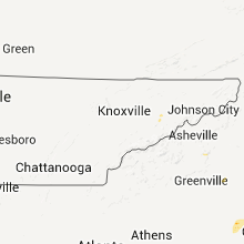


Cities Most Affected by Hail Storms of 5/15/2012
| Hail Size | Demographics of Zip Codes Affected | ||||||
|---|---|---|---|---|---|---|---|
| City | Count | Average | Largest | Pop Density | House Value | Income | Age |
| Savannah, GA | 2 | 1.75 | 1.75 | 438 | $73k | $29.0k | 33.3 |
| Jacksonville, FL | 1 | 1.75 | 1.75 | 600 | $80k | $40.7k | 35.1 |
| Silverstreet, SC | 1 | 1.75 | 1.75 | 19 | $76k | $31.6k | 45.8 |
| Rockport, TX | 1 | 1.75 | 1.75 | 205 | $82k | $31.5k | 49.5 |
| Gaston, SC | 1 | 1.75 | 1.75 | 235 | $77k | $33.4k | 34.4 |
| Port Wentworth, GA | 1 | 1.75 | 1.75 | 282 | $68k | $42.4k | 30.7 |
Hail and Wind Damage Spotted on 5/15/2012
Filter by Report Type:Hail ReportsWind Reports
States Impacted
North Carolina, Florida, South Carolina, Texas, Georgia, Nevada, Tennessee, Virginia, Michigan, Iowa, Illinois, Utah, MarylandNorth Carolina
| Local Time | Report Details |
|---|---|
| 1:30 PM EDT | Quarter sized hail reported near Lake Waccamaw, NC, 34.8 miles W of Wilmington, NC, dime to quarter size hail fell for approximately 2 minutes |
| 4:20 PM EDT | Quarter sized hail reported near Lumberton, NC, 57.9 miles WNW of Wilmington, NC, dime to quarter size hail fell for about 5 minutes and briefly covered the ground |
| 4:50 PM EDT | State park employee observed trees down along boys camp roa in rutherford county NC, 46.9 miles NNE of Greenville, SC |
| 5:09 PM EDT | Quarter sized hail reported near Princeton, NC, 36.2 miles SE of Raleigh, NC, quarter size hail reported at kornegay farm. |
| 5:56 PM EDT | Quarter sized hail reported near Wilson, NC, 37.4 miles E of Raleigh, NC, quarter size hail was reported along airport blvd near merch rd. |
| 7:50 PM EDT | A franklin county airport employee reports that a strong thunderstorm wind gust...estimated up to 60 mph...blew a parked aircraft off its pad and displaced it several f in franklin county NC, 23.9 miles NE of Raleigh, NC |
| 1:22 AM EDT | Large branches broken off tre in gaston county NC, 20.3 miles WNW of Charlotte, NC |
| 1:22 AM EDT | Trees and powerlines down on vance street and sherry lan in gaston county NC, 18.9 miles W of Charlotte, NC |
Florida
| Local Time | Report Details |
|---|---|
| 2:00 PM EDT | Clay electric reported trees were blown down into powerlines in the clay hill are in clay county FL, 23.3 miles SW of Jacksonville, FL |
| 2:39 PM EDT | Golf Ball sized hail reported near Jacksonville, FL, 6.8 miles N of Jacksonville, FL, media relayed a public report of golfball sized hail at north main street and busch drive. |
| 2:40 PM EDT | Powerlines were damaged due to thunderstorm winds blowing trees and debris into the lines. there were also reports of some lightning strikes damaging the powerlines. cu in duval county FL, 6.3 miles W of Jacksonville, FL |
| 3:30 PM EDT | The jacksonville electric authority reported widespread powerline damage across arlington and near craig airfield where trees and debris were blown into power lines fro in duval county FL, 4.6 miles E of Jacksonville, FL |
| 4:08 PM EDT | Large tree down at 1365 state road 206 in st. johns county FL, 46.2 miles SSE of Jacksonville, FL |
| 4:15 PM EDT | Quarter sized hail reported near Hilliard, FL, 32.3 miles NNW of Jacksonville, FL, hail of at least quarter sized fell between 415 pm and 430 pm. many cars pulled off u.s. highway 1 into the buford grove baptist church parking lot. |
| 4:25 PM EDT | Winds pushed a window off its track at the fire station at 320 south flagler. trained spotter estimated winds to be 70 mp in flagler county FL, 65.9 miles NNE of Orlando, FL |
| 5:40 PM EDT | 3 downed trees and a blown over screen enclosure. event time estimated by rada in lake county FL, 30.6 miles W of Orlando, FL |
| 7:10 PM EDT | Tree blown down across highway 46. briefly caused road closure. delayed report from brevard county em directo in brevard county FL, 33.1 miles ENE of Orlando, FL |
| 7:15 PM EDT | Usaf 54 ft wind tower number 819 measured wind gust of 54 kt/62 mph in brevard county FL, 34.1 miles ENE of Orlando, FL |
| 7:15 PM EDT | Usaf 54 ft wind tower number 108 measured wind gust of 55 kt/63 mph in brevard county FL, 49.1 miles E of Orlando, FL |
| 7:15 PM EDT | Tree blown down at intersection of westwood drive and bryn mawr drive. briefly blocked the roa in brevard county FL, 34 miles ENE of Orlando, FL |
| 7:20 PM EDT | Usaf 54 ft wind tower number 1102 measured wind gust of 52 kt/60 mph in brevard county FL, 47.9 miles E of Orlando, FL |
| 7:20 PM EDT | Usaf 54 ft wind tower number 62 measured wind gust of 56 kt/64 mph in brevard county FL, 49.1 miles E of Orlando, FL |
| 7:20 PM EDT | Torrential rai in brevard county FL, 34.2 miles ENE of Orlando, FL |
| 7:30 PM EDT | 60 mph gust measure from home weather station. also had penny sized hail at tim in brevard county FL, 33.3 miles E of Orlando, FL |
South Carolina
| Local Time | Report Details |
|---|---|
| 2:05 PM EDT | Quarter sized hail reported near Georgetown, SC, 51.8 miles ENE of Charleston, SC, nickel to quarter size hail fell at plantersville elementary school |
| 2:25 PM EDT | Quarter sized hail reported near Conway, SC, 68.4 miles WSW of Wilmington, NC |
| 3:05 PM EDT | Quarter sized hail reported near Green Sea, SC, 55.2 miles W of Wilmington, NC, hail to the size of quarters was reported. the hail lasted for 10 minutes. |
| 3:20 PM EDT | Quarter sized hail reported near Chesnee, SC, 42.8 miles ENE of Greenville, SC, hail ranging in size from dime to quarter sized fell from parris bridge road to around hidden springs drive with some of the larger hail around taft drive in the storm |
| 3:24 PM EDT | Tree down blocking sandy ford road near the intersection with country oak road. time estimated by rada in spartanburg county SC, 43.6 miles ENE of Greenville, SC |
| 4:41 PM EDT | Quarter sized hail reported near Pomaria, SC, 65.3 miles NNE of Augusta, GA, public reported quarter size hail along griffin road. |
| 4:43 PM EDT | Highway patrol reported trees down near bachman chapel road and interstate 2 in newberry county SC, 60.4 miles NNE of Augusta, GA |
| 5:42 PM EDT | Golf Ball sized hail reported near Silverstreet, SC, 53.3 miles NNE of Augusta, GA |
| 5:46 PM EDT | Highway patrol reported trees down in silverstreet along highway 34 and also along werts road and deadfall roa in newberry county SC, 53.3 miles NNE of Augusta, GA |
| 6:00 PM EDT | Quarter sized hail reported near Santee, SC, 33.8 miles NW of Charleston, SC, public reported nickel to quarter size hail near santee. |
| 6:04 PM EDT | Quarter sized hail reported near Newberry, SC, 58.3 miles NNE of Augusta, GA, public reported quarter size hail west of newberry from the cell that produced golf ball size hail in silverstreet earlier. |
| 6:10 PM EDT | Highway patrol reported trees down along interstate 95 between mile marker 107 and mile marker 10 in clarendon county SC, 33.7 miles NW of Charleston, SC |
| 6:18 PM EDT | Highway patrol reported trees down near the intersection of screaming eagle road and koon roa in richland county SC, 73.9 miles NW of Charleston, SC |
| 6:21 PM EDT | Highway patrol reported trees down screaming eagle road and hwy 60 in richland county SC, 71.5 miles NNW of Charleston, SC |
| 6:44 PM EDT | Quarter sized hail reported near Ridgeville, SC, 20.3 miles WSW of Charleston, SC, dorchester county 911 relayed report from firefighter of dime to quarter size hail and gusty winds. |
| 6:57 PM EDT | Highway patrol reported trees down along highway 261 and catchall roa in sumter county SC, 64.4 miles NNW of Charleston, SC |
| 7:01 PM EDT | Highway patrol reported trees down near the intersection of seymour road and sargent roa in sumter county SC, 61.3 miles NNW of Charleston, SC |
| 8:24 PM EDT | Quarter sized hail reported near Florence, SC, 76.8 miles NNE of Charleston, SC, quarter size hail reported along north williston road. |
| 8:38 PM EDT | Quarter sized hail reported near Wedgefield, SC, 54 miles NNW of Charleston, SC, public reported nickel to quarter size hail that partially covered the ground on tiverton church road. |
| 8:45 PM EDT | Golf Ball sized hail reported near Gaston, SC, 59.6 miles ENE of Augusta, GA, public reported quarter to golf ball size. |
| 8:58 PM EDT | Quarter sized hail reported near Swansea, SC, 63.2 miles ENE of Augusta, GA, public reported quarter size hail along boone lane. |
| 9:18 PM EDT | Quarter sized hail reported near St Matthews, SC, 62 miles NW of Charleston, SC, public reported hail up to quarter size that covered the ground. |
Texas
| Local Time | Report Details |
|---|---|
| 2:22 PM CDT | Quarter sized hail reported near Rockport, TX, 21.5 miles NE of Corpus Christi, TX |
| 2:30 PM CDT | Golf Ball sized hail reported near Rockport, TX, 24.8 miles NE of Corpus Christi, TX |
| 6:45 PM CDT | Quarter sized hail reported near Longview, TX, 59.1 miles W of Shreveport, LA, spotter reports quarter size hail in eastern longview...along harrison/gregg county line. |
Georgia
| Local Time | Report Details |
|---|---|
| 3:42 PM EDT | Quarter sized hail reported near Townsend, GA, 47.9 miles SSW of Savannah, GA, law enforcement relayed quarter size hail along highway 57. |
| 4:05 PM EDT | Liberty county warning point relayed a report of a tree down across highway 119 and highway 1 in liberty county GA, 31.2 miles SW of Savannah, GA |
| 4:05 PM EDT | Liberty county warning point reported a tree down at the intersection of big oak and oak creek road. time estimated by rada in liberty county GA, 29.8 miles SW of Savannah, GA |
| 4:23 PM EDT | Quarter sized hail reported near Richmond Hill, GA, 16.5 miles SW of Savannah, GA, trained spotter reported quarter size hail in keller. |
| 4:45 PM EDT | Golf Ball sized hail reported near Savannah, GA, 7.3 miles WNW of Savannah, GA, trained spotter at the savannah airport reported two minutes of hail up to the size of golf balls. |
| 4:47 PM EDT | Quarter sized hail reported near Savannah, GA, 9.5 miles WSW of Savannah, GA, trained spotter reported quarter size hail at berwick plantation. |
| 4:51 PM EDT | Ping Pong Ball sized hail reported near Savannah, GA, 7 miles WNW of Savannah, GA |
| 4:52 PM EDT | Quarter sized hail reported near Savannah, GA, 4.8 miles WNW of Savannah, GA, quarter size hail covering the ground. |
| 4:52 PM EDT | Golf Ball sized hail reported near Savannah, GA, 2.7 miles WNW of Savannah, GA, golfball size hail fell on foundation drive. |
| 4:53 PM EDT | Quarter sized hail reported near Savannah, GA, 7.3 miles WNW of Savannah, GA, trained spotter reported quarter size hail at the savannah airport. |
| 4:55 PM EDT | Quarter sized hail reported near Savannah, GA, 6.3 miles NW of Savannah, GA, trained spotter reported quarter size hail that fell for 2 minutes. |
| 4:55 PM EDT | Golf Ball sized hail reported near Savannah, GA, 7.1 miles NW of Savannah, GA, golfball size hail on bonney road. |
| 4:55 PM EDT | Golf Ball sized hail reported near Savannah, GA, 4.3 miles WNW of Savannah, GA |
| 5:00 PM EDT | Quarter sized hail reported near Waverly, GA, 52.4 miles N of Jacksonville, FL, quarter sized hail occurred in waverly between 5 pm and 515 pm. |
Nevada
| Local Time | Report Details |
|---|---|
| 2:21 PM PDT | Schell creek elk view ndot in white pine county NV, 12.5 miles SE of Ely, NV |
| 4:03 PM PDT | Ruby valley raws in elko county NV, 28.1 miles ESE of Elko, NV |
| 5:45 PM PDT | Storm damage reported in washoe county NV, 31.3 miles NNE of Reno, NV |
Tennessee
| Local Time | Report Details |
|---|---|
| 6:20 PM EDT | Quarter sized hail reported near Newport, TN, 41.2 miles E of Knoxville, TN |
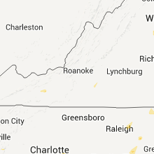
Virginia
| Local Time | Report Details |
|---|---|
| 6:52 PM EDT | Quarter sized hail reported near Max Meadows, VA, 61.3 miles WSW of Roanoke, VA, quarter size hail on lots gap road close to danner road...covered the ground to an inch in depth |
| 6:55 PM EDT | Power poles down just south of fort chiswel in wythe county VA, 59.5 miles WSW of Roanoke, VA |
| 7:24 PM EDT | One tree down on guilford road in franklin county VA, 18.2 miles SE of Roanoke, VA |
| 7:55 PM EDT | Quarter sized hail reported near Fredericksburg, VA, 60.8 miles N of Richmond, VA |
| 7:56 PM EDT | Quarter sized hail reported near Fredericksburg, VA, 61.6 miles N of Richmond, VA, most hail was nickel-size with a few stones larger |
| 7:56 PM EDT | Trees and branches down in stafford county VA, 61.6 miles N of Richmond, VA |
| 7:57 PM EDT | Quarter sized hail reported near Fredericksburg, VA, 61.5 miles N of Richmond, VA |
| 7:57 PM EDT | Half Dollar sized hail reported near Fredericksburg, VA, 60.8 miles N of Richmond, VA |
| 7:58 PM EDT | Half Dollar sized hail reported near Fredericksburg, VA, 61.6 miles N of Richmond, VA |
| 7:58 PM EDT | Trees down in stafford county VA, 61.6 miles N of Richmond, VA |
| 7:58 PM EDT | Uprooted tree in stafford county VA, 61.6 miles N of Richmond, VA |
| 8:05 PM EDT | 2 trees down near intersection of jefferson davis highway and perchwood roa in stafford county VA, 62.2 miles N of Richmond, VA |
Michigan
| Local Time | Report Details |
|---|---|
| 7:15 PM EDT | A couple of trees down. half inch diameter hail also fell. time estimated from rada in muskegon county MI, 41 miles NW of Grand Rapids, MI |
| 7:15 PM EDT | A couple of trees down. time estimated from rada in muskegon county MI, 41 miles NW of Grand Rapids, MI |
| 7:33 PM EDT | Two rotten trees down near green and 8s in newaygo county MI, 45.6 miles NNW of Grand Rapids, MI |
| 7:33 PM EDT | Two trees down near green and 8s in newaygo county MI, 45.6 miles NNW of Grand Rapids, MI |
| 7:33 PM EDT | Two rotten trees down near green and 8s in newaygo county MI, 42.6 miles NNW of Grand Rapids, MI |
| 8:21 PM EDT | Quarter sized hail reported near Manistee, MI, 51.2 miles SW of Traverse City, MI |
| 9:45 PM EDT | Several trees down on lake and elmwood drive. wind gust of 51 mph was measured near ther in kent county MI, 4 miles ESE of Grand Rapids, MI |
Iowa
| Local Time | Report Details |
|---|---|
| 6:17 PM CDT | Time estimated. 3 to 4 inch tree limb down at the quad city time in scott county IA, 62.5 miles ESE of Cedar Rapids, IA |
Illinois
| Local Time | Report Details |
|---|---|
| 6:20 PM CDT | Time estimated - in hilltop area 4 to 5 inch mulberry tree branches downed by thunderstorm wind gust in rock island county IL, 66.1 miles ESE of Cedar Rapids, IA |
| 6:20 PM CDT | Time estimated. 5 inch tree limb down in rock islan in rock island county IL, 65.8 miles ESE of Cedar Rapids, IA |
| 7:15 PM CDT | Wind speed e60 mph. 3 inch tree limbs down. delayed repor in henry county IL, 59.7 miles NW of Peoria, IL |
| 7:40 PM CDT | Road sign blown ove in henry county IL, 54.7 miles NW of Peoria, IL |
| 7:50 PM CDT | 5 inch diameter tree limbs down. nickel size hail also occurred with the stor in henry county IL, 43.1 miles NNW of Peoria, IL |
| 7:50 PM CDT | Garbage cans blown in henry county IL, 52.8 miles NW of Peoria, IL |
Utah
| Local Time | Report Details |
|---|---|
| 6:55 PM MDT | Causway s in tooele county UT, 94.4 miles NE of Ely, NV |
| 7:30 PM MDT | Bryce canyon airport in garfield county UT, 63.5 miles S of Monroe, UT |
| 9:25 PM MDT | Causeway s in tooele county UT, 94.4 miles NE of Ely, NV |
| 10:10 PM MDT | Callao s in tooele county UT, 80.1 miles NE of Ely, NV |
Maryland
| Local Time | Report Details |
|---|---|
| 9:31 PM EDT | Twelve inch diameter tree and several smaller trees were uprooted near the intersection of pierce road and delight cour in charles county MD, 46.7 miles SSW of Baltimore, MD |
Connect with Interactive Hail Maps