

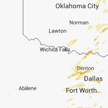
Hail Map for Thursday, October 2, 2014

Number of Impacted Households on 10/2/2014
0
Impacted by 1" or Larger Hail
0
Impacted by 1.75" or Larger Hail
0
Impacted by 2.5" or Larger Hail
Square Miles of Populated Area Impacted on 10/2/2014
0
Impacted by 1" or Larger Hail
0
Impacted by 1.75" or Larger Hail
0
Impacted by 2.5" or Larger Hail


Cities Most Affected by Hail Storms of 10/2/2014
| Hail Size | Demographics of Zip Codes Affected | ||||||
|---|---|---|---|---|---|---|---|
| City | Count | Average | Largest | Pop Density | House Value | Income | Age |
| Earle, AR | 2 | 1.75 | 1.75 | 22 | $35k | $22.1k | 33.6 |
| Clifton, KS | 1 | 1.75 | 1.75 | 5 | $25k | $25.5k | 45.6 |
| Lebanon, OK | 1 | 1.75 | 1.75 | 2 | $47k | $38.9k | 45.0 |
| Owasso, OK | 1 | 1.75 | 1.75 | 817 | $111k | $52.3k | 35.6 |
| Waco, TX | 1 | 1.75 | 1.75 | 5294 | $35k | $24.5k | 28.0 |
| Blue Rapids, KS | 1 | 1.75 | 1.75 | 11 | $31k | $32.0k | 44.2 |
| Clifton, TX | 1 | 1.75 | 1.75 | 24 | $63k | $34.7k | 47.4 |
| Denton, TX | 1 | 1.75 | 1.75 | 309 | $104k | $47.0k | 36.8 |
| Ponder, TX | 1 | 1.75 | 1.75 | 71 | $109k | $53.4k | 36.1 |
| Fort Worth, TX | 1 | 1.75 | 1.75 | 1552 | $30k | $20.0k | 32.9 |
| Justin, TX | 1 | 1.75 | 1.75 | 188 | $112k | $50.9k | 33.0 |
| Memphis, TN | 1 | 1.75 | 1.75 | 2309 | $133k | $62.4k | 38.7 |
Hail and Wind Damage Spotted on 10/2/2014
Filter by Report Type:Hail ReportsWind Reports
States Impacted
Kansas, Illinois, Oklahoma, Missouri, Arkansas, Texas, Mississippi, Tennessee, Louisiana, Kentucky, AlabamaKansas
| Local Time | Report Details |
|---|---|
| 7:05 AM CDT | Ping Pong Ball sized hail reported near Concordia, KS, 62.9 miles WNW of Manhattan, KS, ping pong ball size hail estimated from law enforcement. |
| 7:30 AM CDT | Golf Ball sized hail reported near Clifton, KS, 47 miles NW of Manhattan, KS |
| 8:12 AM CDT | Golf Ball sized hail reported near Blue Rapids, KS, 35 miles N of Manhattan, KS |
| 8:27 AM CDT | Widespread tree damage reported. large tree limbs and a few trees uprooted onto houses. relayed by e in marshall county KS, 37.4 miles NNE of Manhattan, KS |
| 8:30 AM CDT | Half Dollar sized hail reported near Wichita, KS, 5.6 miles ESE of Wichita, KS, delayed report of half dollar size hail reported near harry and rock |
| 8:32 AM CDT | Quarter sized hail reported near Wichita, KS, 6.9 miles E of Wichita, KS, quarter size hail reported near kellogg and greenwich |
| 8:58 AM CDT | Spotter also repored very heavy rain in nemaha county KS, 44.2 miles NE of Manhattan, KS |
Illinois
| Local Time | Report Details |
|---|---|
| 10:55 AM CDT | Three power poles damaged near palmyra illinois on route 111 with power outages reported in macoupin county IL, 56.4 miles N of Saint Louis, MO |
| 9:55 PM CDT | Storm damage reported in alexander county IL, 2.5 miles E of Cape Girardeau, MO |
Oklahoma
| Local Time | Report Details |
|---|---|
| 12:20 PM CDT | Large tree limbs and some trees down in a trailer park on the west side of tahlequah. some of the trailers were damaged. roof blown off a shed at tahlequah h in cherokee county OK, 48.1 miles NW of Fort Smith, AR |
| 12:20 PM CDT | Quarter sized hail reported near Tahlequah, OK, 48.1 miles NW of Fort Smith, AR, hail at tahlequah hs. |
| 12:26 PM CDT | Quarter sized hail reported near Broken Arrow, OK, 13.7 miles ESE of Tulsa, OK |
| 1:20 PM CDT | Storm damage reported in osage county OK, 18.2 miles N of Tulsa, OK |
| 2:19 PM CDT | Large trampoline blown upright against house in tulsa county OK, 13.1 miles S of Tulsa, OK |
| 2:20 PM CDT | Tree limbs down over sheridan rd and 108th st in tulsa county OK, 4.3 miles ESE of Tulsa, OK |
| 2:21 PM CDT | Tree branches and part of a privacy fence down near 106th and memorial in tulsa county OK, 4.3 miles ESE of Tulsa, OK |
| 2:23 PM CDT | Tree limbs down in tulsa county OK, 13.3 miles ESE of Tulsa, OK |
| 2:30 PM CDT | Quarter sized hail reported near Owasso, OK, 11.5 miles NE of Tulsa, OK, nickel to quarter size hail covering the ground east of owasso. |
| 2:31 PM CDT | Tree and tree limbs over the road at 75th st and 257th st in tulsa county OK, 13.3 miles ESE of Tulsa, OK |
| 2:35 PM CDT | Golf Ball sized hail reported near Owasso, OK, 11.5 miles NE of Tulsa, OK, on the northeast side of owasso. |
| 2:37 PM CDT | Quarter sized hail reported near Owasso, OK, 17.1 miles NE of Tulsa, OK |
| 2:45 PM CDT | Tree and roof damage near coweta... at the intersection of 101st and 225th street in wagoner county OK, 23.6 miles SE of Tulsa, OK |
| 2:51 PM CDT | Part of a roof missing from a home in rogers county OK, 27 miles E of Tulsa, OK |
| 2:52 PM CDT | Power pole snapped in wagoner county OK, 23.6 miles SE of Tulsa, OK |
| 3:07 PM CDT | Report of trees and power lines down between warner and webbers falls on intersection of hwy 64 and ross r in muskogee county OK, 40.9 miles WNW of Fort Smith, AR |
| 3:10 PM CDT | Storm damage reported in muskogee county OK, 40.9 miles WNW of Fort Smith, AR |
| 3:10 PM CDT | Quarter sized hail reported near Lebanon, OK, 52.5 miles WSW of Atoka, OK |
| 3:10 PM CDT | Golf Ball sized hail reported near Lebanon, OK, 52.5 miles WSW of Atoka, OK |
| 3:11 PM CDT | Tree limbs and power lines down in sequoyah county OK, 36 miles WNW of Fort Smith, AR |
| 3:35 PM CDT | Tree branches and signs blown down. relayed from facebook by kten-t in bryan county OK, 30.5 miles SSW of Atoka, OK |
| 4:12 PM CDT | Quarter sized hail reported near Mccurtain, OK, 43.8 miles WSW of Fort Smith, AR |
| 4:15 PM CDT | Storm damage reported in haskell county OK, 29.5 miles WSW of Fort Smith, AR |
| 4:30 PM CDT | Trees down in soper... blocking highway 7 in choctaw county OK, 34.7 miles SE of Atoka, OK |
| 4:30 PM CDT | Tree limbs and debris down on the north side of potea in le flore county OK, 25.7 miles SSW of Fort Smith, AR |
| 4:35 PM CDT | Power lines down north of spiro... near the intersection of hwy 59 and 9. time estimated by rada in le flore county OK, 14.1 miles SW of Fort Smith, AR |
| 4:40 PM CDT | Power lines down in antler in pushmataha county OK, 31 miles ESE of Atoka, OK |
| 4:55 PM CDT | Storm damage reported in choctaw county OK, 43.8 miles SE of Atoka, OK |
| 5:00 PM CDT | Tree snapped on the west side of eufaula. time estimated by rada in mcintosh county OK, 63.7 miles SSE of Tulsa, OK |
| 5:10 PM CDT | Storm damage reported in le flore county OK, 25.7 miles SSW of Fort Smith, AR |
| 5:30 PM CDT | Large tree uprooted in mcintosh county OK, 55.9 miles SSE of Tulsa, OK |
| 5:33 PM CDT | Trees down in city...numerous trees down in mccurtain county OK, 51.6 miles W of Nashville, AR |
| 5:49 PM CDT | Wind damage to a barn in muskogee county OK, 40.9 miles WNW of Fort Smith, AR |
Missouri
| Local Time | Report Details |
|---|---|
| 1:00 PM CDT | Trees down at intersection of hwys 14 and 5. flag pole blown down. damage approx 4-5 blocks wide in the area of ne 5th st. power line down. reports from both emergency in douglas county MO, 39.2 miles ESE of Springfield, MO |
| 2:24 PM CDT | Tree reported down in salem blocking roa in dent county MO, 0.9 miles NNW of Salem, MO |
| 2:30 PM CDT | Quarter sized hail reported near Pineville, MO, 73.9 miles SW of Springfield, MO |
| 2:50 PM CDT | Quarter sized hail reported near Bourbon, MO, 38.7 miles NNE of Salem, MO |
| 3:33 PM CDT | Several trees reported down across the eastern portions of douglas county. no roads reported blocke in douglas county MO, 57.2 miles ESE of Springfield, MO |
| 3:45 PM CDT | Small trees down on dittmer ridge roa in jefferson county MO, 32.3 miles SW of Saint Louis, MO |
| 3:53 PM CDT | Storm damage reported in jefferson county MO, 18.4 miles WSW of Saint Louis, MO |
| 4:00 PM CDT | 18 to 24 inch diameter trees uprooted and snapped in st. louis county MO, 14.9 miles WSW of Saint Louis, MO |
| 4:05 PM CDT | Three to four inch limbs down. two downspouts blown off house. antenna bent to the groun in dade county MO, 33.5 miles WNW of Springfield, MO |
| 4:10 PM CDT | Trees downed by high winds in st. louis county MO, 11 miles SW of Saint Louis, MO |
| 4:15 PM CDT | Storm damage reported in greene county MO, 17.6 miles WNW of Springfield, MO |
| 4:16 PM CDT | Tree reported down in cole camp. no roads blocke in benton county MO, 57.8 miles SW of Columbia, MO |
| 4:32 PM CDT | Several large tree limbs down around farm roads 66...125..and 68 in the vicinity of hwy in greene county MO, 7 miles N of Springfield, MO |
| 4:42 PM CDT | Ham radio antenna damaged by estimated 50 mph wind gust in greene county MO, 13.1 miles NNE of Springfield, MO |
| 5:03 PM CDT | Local law enforcement reported two large trees down and bill boards down in the tipton missouri are in moniteau county MO, 31.8 miles SW of Columbia, MO |
| 5:20 PM CDT | Quarter sized hail reported near Ava, MO, 34.8 miles ESE of Springfield, MO, 1 inch hail reported at y hwy and county road 501. |
| 5:23 PM CDT | Siding ripped off mobil home in av in douglas county MO, 39.2 miles ESE of Springfield, MO |
| 5:39 PM CDT | Wind damage to bleachers and backstop at south shelby high school. time estimated from rada in shelby county MO, 53.2 miles SSW of Kahoka, MO |
| 6:21 PM CDT | Quarter sized hail reported near Cabool, MO, 47.3 miles SW of Salem, MO, quarter sized hail reported on west side of town in cabool. |
| 6:49 PM CDT | One tree and numerous smaller limbs reported dow in howell county MO, 54.6 miles SSW of Salem, MO |
Arkansas
| Local Time | Report Details |
|---|---|
| 1:56 PM CDT | Half Dollar sized hail reported near Bentonville, AR, 69 miles N of Fort Smith, AR, hail fell for about 8 minutes... ranged from nickel to half dollar size. |
| 1:56 PM CDT | Quarter sized hail reported near Bentonville, AR, 69 miles N of Fort Smith, AR, pea to quarter size hail |
| 2:03 PM CDT | Quarter sized hail reported near Bentonville, AR, 69 miles N of Fort Smith, AR, pea to quarter size hail |
| 4:43 PM CDT | Golf Ball sized hail reported near Earle, AR, 24.7 miles WNW of Memphis, TN, golf ball sized hail. |
| 4:44 PM CDT | Golf Ball sized hail reported near Earle, AR, 24.7 miles WNW of Memphis, TN, winds estimated to be near 65 mph. |
| 4:57 PM CDT | Quarter sized hail reported near Earle, AR, 24.7 miles WNW of Memphis, TN, one inch hail in earle. |
| 4:58 PM CDT | Wood privacy fence blown over in sebastian county AR, 1.3 miles ENE of Fort Smith, AR |
| 5:00 PM CDT | Quarter sized hail reported near Fort Smith, AR, 1.3 miles ENE of Fort Smith, AR |
| 5:09 PM CDT | Tree limbs down in lavaca in sebastian county AR, 14.5 miles ESE of Fort Smith, AR |
| 5:24 PM CDT | Storm damage reported in franklin county AR, 28.7 miles ENE of Fort Smith, AR |
| 5:25 PM CDT | Trees down in the altus area... hwy 64 is blocked. time estimated by rada in franklin county AR, 37.6 miles E of Fort Smith, AR |
| 5:29 PM CDT | Power line and tree down on a house in franklin county AR, 34.1 miles ENE of Fort Smith, AR |
| 5:29 PM CDT | Trees reported down across shaver r in logan county AR, 35.7 miles E of Fort Smith, AR |
| 5:30 PM CDT | Power line and tree down on a house in franklin county AR, 37.6 miles E of Fort Smith, AR |
| 5:35 PM CDT | Trees reported down in pari in logan county AR, 40.1 miles E of Fort Smith, AR |
| 5:45 PM CDT | Trees down on highway 71 south of potte in polk county AR, 50.2 miles NW of Nashville, AR |
| 5:50 PM CDT | Numerous trees down in hatfiel in polk county AR, 48.2 miles NW of Nashville, AR |
| 5:59 PM CDT | Tree reported down across woodland r in johnson county AR, 50.2 miles E of Fort Smith, AR |
| 6:00 PM CDT | Storm damage reported in sevier county AR, 29 miles WNW of Nashville, AR |
| 6:04 PM CDT | Trees down in granni in polk county AR, 34.2 miles NW of Nashville, AR |
| 6:27 PM CDT | Tree reported down across hwy 27 north of danvill in yell county AR, 64.1 miles ESE of Fort Smith, AR |
| 6:30 PM CDT | Large oak tree down at the corner of oak and south street in jaspe in newton county AR, 81.6 miles ENE of Fort Smith, AR |
| 6:30 PM CDT | Tree reported down across the count in montgomery county AR, 43.3 miles NNE of Nashville, AR |
| 6:32 PM CDT | A few trees down in little river county AR, 25.1 miles SW of Nashville, AR |
| 6:32 PM CDT | A few trees down in little river county AR, 35.5 miles WSW of Nashville, AR |
| 6:35 PM CDT | Trees and power lines dow in pope county AR, 60.8 miles NW of Little Rock, AR |
| 6:40 PM CDT | Trees across the road in sevier county AR, 29 miles WNW of Nashville, AR |
| 6:45 PM CDT | Trees and power lines were blown dow in pike county AR, 31.4 miles NNE of Nashville, AR |
| 6:50 PM CDT | Multiple power lines down...one resulting in a resulting in a residental structure fir in marion county AR, 75 miles SSE of Springfield, MO |
| 6:55 PM CDT | Numerous tree limbs were blown dow in conway county AR, 45.6 miles NW of Little Rock, AR |
| 6:56 PM CDT | Trees reported down across us 27 in garland county AR, 47.3 miles NNE of Nashville, AR |
| 7:00 PM CDT | Large tree limbs and branches down hwy 71 cr 10 in miller county AR, 35.7 miles SSW of Nashville, AR |
| 7:00 PM CDT | Trees were blown down near amit in clark county AR, 31.4 miles NE of Nashville, AR |
| 7:00 PM CDT | Power lines down on highway 7 in montgomery county AR, 38.2 miles NE of Nashville, AR |
| 7:02 PM CDT | Power lines down on highway 7 in hot spring county AR, 40 miles NE of Nashville, AR |
| 7:05 PM CDT | Limbs were blown dow in perry county AR, 34.9 miles WNW of Little Rock, AR |
| 7:07 PM CDT | A tree was blown down onto a hous in perry county AR, 32.4 miles WNW of Little Rock, AR |
| 7:09 PM CDT | Storm damage reported in baxter county AR, 77.1 miles SE of Springfield, MO |
| 7:10 PM CDT | Trees and tree limbs down across the count in van buren county AR, 58.2 miles N of Little Rock, AR |
| 7:10 PM CDT | Trees down...power lines down near intersection 10 and 17 in miller county AR, 35.7 miles SSW of Nashville, AR |
| 7:15 PM CDT | Trees down hwys 67... 355... and 195 in hempstead county and in hope ar in hempstead county AR, 24.2 miles SE of Nashville, AR |
| 7:15 PM CDT | Two barns are damaged on creek trai in hot spring county AR, 46.5 miles NE of Nashville, AR |
| 7:23 PM CDT | Trees reported down on us 270 near the garland county fair ground in hot spring county AR, 41.7 miles WSW of Little Rock, AR |
| 7:25 PM CDT | A tree was blown down on interstate 30 southwest of social hil in hot spring county AR, 47.7 miles SW of Little Rock, AR |
| 7:27 PM CDT | Trees were blown down on interstate 30...and several cars crashed into the in clark county AR, 48.9 miles ENE of Nashville, AR |
| 7:30 PM CDT | Numerous trees down in lafayette county AR, 45.2 miles SSE of Nashville, AR |
| 7:33 PM CDT | A tree was blown down across hwy 9 and caused an accident. no injuries were reporte in conway county AR, 46.3 miles NW of Little Rock, AR |
| 7:34 PM CDT | A tree fell on a house in gurdon. numerous trees reported down across the county including on hwys 51...53... and 6 in clark county AR, 40.1 miles E of Nashville, AR |
| 7:35 PM CDT | Trees down all over little river... on ark 41... 108... 32 and on cr 29... 11... and 15 in little river county AR, 25.1 miles SW of Nashville, AR |
| 7:35 PM CDT | Tree down on highway 5 in owensvill in saline county AR, 32.3 miles WSW of Little Rock, AR |
| 7:39 PM CDT | Signs were blown down onto i-40 near mayflowe in faulkner county AR, 17.4 miles NNW of Little Rock, AR |
| 7:40 PM CDT | There is a tree on a house with occupants inside in the overton area of malver in hot spring county AR, 40.6 miles SW of Little Rock, AR |
| 7:44 PM CDT | Trees are down on highway 24 and highway 5 in ouachita county AR, 50.5 miles ESE of Nashville, AR |
| 7:50 PM CDT | Trees down in mountain vie in stone county AR, 77.9 miles N of Little Rock, AR |
| 7:55 PM CDT | Numerous tree limbs were blown dow in conway county AR, 45.6 miles NW of Little Rock, AR |
| 7:55 PM CDT | Tree fell on a truck with no injurie in saline county AR, 24.7 miles SW of Little Rock, AR |
| 7:59 PM CDT | Tree down on springhill road and meadowbroo in saline county AR, 15.6 miles SW of Little Rock, AR |
| 8:00 PM CDT | Power line down on interstate 30 between benton and bryan in saline county AR, 15.6 miles SW of Little Rock, AR |
| 8:05 PM CDT | Multiple trees down throughout the count in grant county AR, 31.2 miles SSW of Little Rock, AR |
| 8:10 PM CDT | Extensive tree damage at intersection of highway 5 and hilldal in saline county AR, 15.6 miles SW of Little Rock, AR |
| 8:11 PM CDT | Tree completely blocking highway 9 four miles north of eagle mill in ouachita county AR, 66.4 miles ESE of Nashville, AR |
| 8:15 PM CDT | Tree limbs down in cabo in lonoke county AR, 21 miles NE of Little Rock, AR |
| 8:15 PM CDT | Tree fell on a vehicle...with occupant trapped on highway 36 in pulaski county AR, 16.9 miles SSE of Little Rock, AR |
| 8:18 PM CDT | Large highway sign down on interstate 440 near interstate 53 in pulaski county AR, 3 miles SSE of Little Rock, AR |
| 8:21 PM CDT | Trees down on interstate 530...blocking the southbound lane in jefferson county AR, 31.2 miles SSE of Little Rock, AR |
| 8:24 PM CDT | Storm damage reported in pulaski county AR, 17.8 miles SSE of Little Rock, AR |
| 8:24 PM CDT | Storm damage reported in pulaski county AR, 17.8 miles SSE of Little Rock, AR |
| 8:30 PM CDT | Trees down on central high road and highway 16 in lonoke county AR, 21.3 miles SE of Little Rock, AR |
| 8:30 PM CDT | Trees and powerlines dow in lonoke county AR, 22.5 miles SE of Little Rock, AR |
| 8:35 PM CDT | A tree fell on a house causing an injur in jefferson county AR, 38.2 miles SE of Little Rock, AR |
| 8:55 PM CDT | This is at the stuttgart municipal airpor in prairie county AR, 39.8 miles ESE of Little Rock, AR |
| 9:00 PM CDT | Strong winds blew over a semi truck carrying chicken parts near highway 18 and highway 6 in jackson county AR, 75.5 miles WNW of Memphis, TN |
| 9:00 PM CDT | Trees were reported down near cornerview road and highway 13 in arkansas county AR, 54.5 miles ESE of Little Rock, AR |
| 9:00 PM CDT | Numerous trees down in the city with two homes damaged as wel in monroe county AR, 51 miles E of Little Rock, AR |
| 9:10 PM CDT | Tree reported down along old warren roa in drew county AR, 56.6 miles N of Bastrop, LA |
| 9:46 PM CDT | Thunderstorm winds gusting to 58 mph in caldwel in st. francis county AR, 43.9 miles W of Memphis, TN |
| 9:50 PM CDT | A freds discount store and a law firm had roof damage and windows blown ou in poinsett county AR, 47.3 miles NW of Memphis, TN |
| 9:57 PM CDT | Widespread trees uprooted and roof damage. estimated wind gusts up to 70 mp in poinsett county AR, 52.6 miles NW of Memphis, TN |
| 10:05 PM CDT | Several trees and power lines dow in poinsett county AR, 44.6 miles NW of Memphis, TN |
| 10:15 PM CDT | Semi truck full of chicken parts blown over on highway 18 and highway 6 in craighead county AR, 52.2 miles NNW of Memphis, TN |
| 10:18 PM CDT | Power poles and trees down near us highway 63 and nestle roa in craighead county AR, 58.7 miles NW of Memphis, TN |
Texas
| Local Time | Report Details |
|---|---|
| 1:58 PM CDT | Quarter sized hail reported near Decatur, TX, 55.9 miles WNW of Dallas, TX, paradise |
| 2:27 PM CDT | Quarter sized hail reported near Muenster, TX, 66.9 miles ESE of Wichita Falls, TX |
| 2:38 PM CDT | Half Dollar sized hail reported near Muenster, TX, 66.9 miles ESE of Wichita Falls, TX, a few were larger |
| 3:04 PM CDT | Golf Ball sized hail reported near Ponder, TX, 40.3 miles NW of Dallas, TX |
| 3:14 PM CDT | Quarter sized hail reported near Denton, TX, 36.8 miles NW of Dallas, TX, unt campus |
| 3:15 PM CDT | Golf Ball sized hail reported near Denton, TX, 38.5 miles NNW of Dallas, TX, 288 and i-35 on the north side of denton |
| 3:38 PM CDT | 3-4 inch tree limbs downed near byant irving and camp bowie in tarrant county TX, 36.3 miles W of Dallas, TX |
| 3:40 PM CDT | Quarter sized hail reported near Fort Worth, TX, 39.9 miles W of Dallas, TX, white settlement road about 2 miles west of loop 820. |
| 3:40 PM CDT | Golf Ball sized hail reported near Justin, TX, 36 miles NW of Dallas, TX, golfballs at the texas motor speedway |
| 3:42 PM CDT | Revolving door destroyed by estimated 70 mph winds at unt health science center in tarrant county TX, 31.8 miles W of Dallas, TX |
| 3:50 PM CDT | Quarter sized hail reported near Fort Worth, TX, 31.8 miles W of Dallas, TX, on the tcu campus |
| 3:50 PM CDT | 60 mph on the tcu campus in tarrant county TX, 31.8 miles W of Dallas, TX |
| 3:52 PM CDT | Broadcast hill and oakland in tarrant county TX, 31.8 miles W of Dallas, TX |
| 3:52 PM CDT | Golf Ball sized hail reported near Fort Worth, TX, 31.8 miles W of Dallas, TX, broadcast hill near oakland |
| 3:55 PM CDT | 2.5 foot tree uprooted on garden oaks near randoll mills park 1/2 mile s of i-30. time estimated in tarrant county TX, 19.2 miles W of Dallas, TX |
| 3:57 PM CDT | Bowen and arkansas lane in tarrant county TX, 19.2 miles W of Dallas, TX |
| 3:57 PM CDT | Bowen and arkansas lane in tarrant county TX, 19.2 miles W of Dallas, TX |
| 4:00 PM CDT | Trees with 12 inch bases and 6 inch limbs downed randall mill and fielder in tarrant county TX, 19.2 miles W of Dallas, TX |
| 4:02 PM CDT | Kgky asos in tarrant county TX, 19.2 miles W of Dallas, TX |
| 4:05 PM CDT | Trees down on park row in tarrant county TX, 19.2 miles W of Dallas, TX |
| 4:06 PM CDT | Euless in tarrant county TX, 16.9 miles WNW of Dallas, TX |
| 4:20 PM CDT | Structural damage to a building on the dallas baptist university campus. time estimate in dallas county TX, 1.1 miles ESE of Dallas, TX |
| 4:22 PM CDT | 18 to 20 inch base trees blown down in the 2000 block on east handle in tarrant county TX, 31.8 miles W of Dallas, TX |
| 4:22 PM CDT | Near dallas love field in dallas county TX, 1.1 miles ESE of Dallas, TX |
| 4:28 PM CDT | At krbd in dallas county TX, 6.9 miles SW of Dallas, TX |
| 4:34 PM CDT | At dallas love field kdal asos in dallas county TX, 1.1 miles ESE of Dallas, TX |
| 4:51 PM CDT | About 1 dozen homes damaged within the 100 block of jermome prairie and 200 block of cottonwood in rockwall county TX, 26.9 miles ENE of Dallas, TX |
| 5:05 PM CDT | Multiple trees downed in quinlan in hunt county TX, 39.6 miles ENE of Dallas, TX |
| 5:07 PM CDT | Half Dollar sized hail reported near Waxahachie, TX, 26.3 miles S of Dallas, TX, just west of the intersection of 287 and i-35 |
| 5:10 PM CDT | Several large trees downed on the texas a&m commerce campus. several building without powe in hunt county TX, 61.3 miles ENE of Dallas, TX |
| 5:10 PM CDT | Trees and power lines downed resulting in power outages in east paris. time estimated in lamar county TX, 61.2 miles SE of Atoka, OK |
| 5:12 PM CDT | Power poles downed near fm986 and county road 245 in kaufman county TX, 30.2 miles E of Dallas, TX |
| 5:14 PM CDT | Storm damage reported in van zandt county TX, 46.6 miles E of Dallas, TX |
| 5:14 PM CDT | Tree down on trailer in van zandt county TX, 63.1 miles E of Dallas, TX |
| 5:15 PM CDT | Trees down across road brought power line down in franklin county TX, 95.4 miles ENE of Dallas, TX |
| 5:18 PM CDT | Golf Ball sized hail reported near Clifton, TX, 51.6 miles NNE of Killeen, TX |
| 5:20 PM CDT | Power line downed on goliad between first baptist church and emma jam in rockwall county TX, 22.7 miles ENE of Dallas, TX |
| 5:20 PM CDT | 3 inch is diameter tree limbs downed near southwestern blvd and amesbury drive in dallas county TX, 1.1 miles ESE of Dallas, TX |
| 5:25 PM CDT | Multiple trees downed at the dallas zoo. power is out. time estimated in dallas county TX, 1.1 miles ESE of Dallas, TX |
| 5:31 PM CDT | At kslr sulphur springs municipal airport awos in hopkins county TX, 73.6 miles ENE of Dallas, TX |
| 5:34 PM CDT | Quarter sized hail reported near Red Oak, TX, 19.2 miles S of Dallas, TX, pecan hill |
| 5:35 PM CDT | Several mature trees downed and numerous power outages in south garland and central garland area in dallas county TX, 13.7 miles NE of Dallas, TX |
| 5:45 PM CDT | Storm damage reported in van zandt county TX, 63.1 miles E of Dallas, TX |
| 5:45 PM CDT | Large oak tree across road with power lines down in franklin county TX, 95.4 miles ENE of Dallas, TX |
| 5:50 PM CDT | Numerous trees down - all over county in red river county TX, 73.6 miles WSW of Nashville, AR |
| 5:56 PM CDT | Trees down county wide in franklin county TX, 95.4 miles ENE of Dallas, TX |
| 6:00 PM CDT | Tree down across the county in wood county TX, 78.9 miles E of Dallas, TX |
| 6:10 PM CDT | Numerous trees down...power lines down in titus county TX, 84.5 miles SW of Nashville, AR |
| 6:18 PM CDT | 10 inch diameter trees blown onto hwy 317 between crawford and valley mill in mclennan county TX, 35.7 miles NNE of Killeen, TX |
| 6:18 PM CDT | Billboards down on valley mills drive in mclennan county TX, 45.3 miles NE of Killeen, TX |
| 6:20 PM CDT | Numerous trees down...power lines down across the county in camp county TX, 78.7 miles WNW of Shreveport, LA |
| 6:25 PM CDT | Numerous trees down in bowie county TX, 60.2 miles SW of Nashville, AR |
| 6:40 PM CDT | Roof blown off house... siding ripped off southwest side of building on broadway avenue in bowie county TX, 51.2 miles SSW of Nashville, AR |
| 6:40 PM CDT | Roof blown off house... siding ripped off southwest side of building on broadway avenue in bowie county TX, 51.2 miles SSW of Nashville, AR |
| 6:45 PM CDT | Tree down across car in bowie county TX, 51.2 miles SSW of Nashville, AR |
| 6:50 PM CDT | Ryder truck overturned hwy 84 and 340 by estimated 60 mph winds in mclennan county TX, 45.3 miles NE of Killeen, TX |
| 6:53 PM CDT | Fences downed in mclennan county TX, 32.8 miles NNE of Killeen, TX |
| 6:55 PM CDT | Quarter sized hail reported near Waco, TX, 43.4 miles NE of Killeen, TX |
| 6:58 PM CDT | Half Dollar sized hail reported near Waco, TX, 43.4 miles NE of Killeen, TX |
| 6:58 PM CDT | Stage blown down at the heart of texas state fair in mclennan county TX, 45.3 miles NE of Killeen, TX |
| 6:59 PM CDT | Golf Ball sized hail reported near Waco, TX, 45.3 miles NE of Killeen, TX, just east of baylor university |
| 7:00 PM CDT | Hobby lobby on valley mills drive has major roof damage in mclennan county TX, 45.3 miles NE of Killeen, TX |
| 7:06 PM CDT | Ping Pong Ball sized hail reported near Waco, TX, 43.4 miles NE of Killeen, TX |
| 7:07 PM CDT | Overturned semi near highway 84 and central parkway in mclennan county TX, 45.3 miles NE of Killeen, TX |
| 7:09 PM CDT | Trees downed in the kerens area in navarro county TX, 55.6 miles SE of Dallas, TX |
| 7:15 PM CDT | Apartment building damage in waco in mclennan county TX, 45.3 miles NE of Killeen, TX |
| 7:15 PM CDT | Numerous trees down...power lines down in marion county TX, 39 miles WNW of Shreveport, LA |
| 7:15 PM CDT | Numerous trees down...power lines down in smith county TX, 89.5 miles W of Shreveport, LA |
| 7:18 PM CDT | Trees and powerlines downed near woodway in mclennan county TX, 41.8 miles NE of Killeen, TX |
| 7:25 PM CDT | Numerous trees down in upshur county TX, 71.7 miles WNW of Shreveport, LA |
| 7:27 PM CDT | Roof damage to a strip shopping center on bosque blvd in mclennan county TX, 45.3 miles NE of Killeen, TX |
| 7:38 PM CDT | Large tree across road in gregg county TX, 69.8 miles W of Shreveport, LA |
| 7:45 PM CDT | Numerous trees down...power lines down in cherokee county TX, 63.5 miles NW of Lufkin, TX |
| 7:55 PM CDT | Numerous trees donw on hwy 43 between henderson and tatum in rusk county TX, 57.3 miles WSW of Shreveport, LA |
| 8:10 PM CDT | Tree on home in elysian fields on strickland spring road... tree down in karnack... trees down countywide in harrison county TX, 20.1 miles W of Shreveport, LA |
| 8:12 PM CDT | Numerous trees down...power lines down across the county in rusk county TX, 56.5 miles N of Lufkin, TX |
| 8:15 PM CDT | Power lines down...numerous trees down all over county in cherokee county TX, 53.7 miles NW of Lufkin, TX |
| 8:40 PM CDT | Power lines down large tree down on lines on 59... north st. mary street in panola county TX, 42.8 miles SW of Shreveport, LA |
| 8:45 PM CDT | Tree down on vehicle on fm 1798 near fm 839... no injuries reported in rusk county TX, 56.5 miles N of Lufkin, TX |
| 8:45 PM CDT | Numerous trees down in panola county TX, 42.8 miles SW of Shreveport, LA |
| 8:50 PM CDT | 2 foot in diameter trees downed canyon creek and marlin road in bell county TX, 22.4 miles E of Killeen, TX |
| 9:15 PM CDT | Power lines down in nacogdoches county TX, 18.9 miles NNE of Lufkin, TX |
| 9:42 PM CDT | Multiple trees down along western part of county generally along highway 21 corridor southwest of crocket in houston county TX, 53.2 miles W of Lufkin, TX |
| 9:54 PM CDT | Multiple trees blown down along fm 230 corrido in houston county TX, 45.7 miles WSW of Lufkin, TX |
| 10:45 PM CDT | Power out around city in angelina county TX, 1.1 miles SW of Lufkin, TX |
Mississippi
| Local Time | Report Details |
|---|---|
| 3:45 PM CDT | Wind gust of 63 mph recorde in desoto county MS, 15.4 miles S of Memphis, TN |
| 3:45 PM CDT | Wind gust of 63 mph recorde in desoto county MS, 15.4 miles S of Memphis, TN |
| 3:51 PM CDT | Quarter sized hail reported near Southaven, MS, 12.7 miles SSE of Memphis, TN, spotter reported heavy downpour with quarter sized hail. |
| 4:45 PM CDT | Four trees down on lebanon road. reported by emergency managemen in jones county MS, 68.5 miles SE of Jackson, MS |
| 5:00 PM CDT | Numerous trees down along interstate 20 just east of brandon. reported by nws employee in rankin county MS, 12.4 miles E of Jackson, MS |
| 5:32 PM CDT | Tree down across salem r in scott county MS, 49.4 miles E of Jackson, MS |
| 5:40 PM CDT | Half Dollar sized hail reported near Conehatta, MS, 54.4 miles ENE of Jackson, MS, very strong winds were also reported |
| 5:45 PM CDT | Trees downed. tree across scalin rd at strum rd in newton county MS, 61 miles ENE of Jackson, MS |
| 6:25 PM CDT | Tree down on 37th st. rd crew had to remove the tre in lauderdale county MS, 75.1 miles S of Starkville, MS |
| 10:30 PM CDT | Possible tornado damage to strayhorn elementary schoo in tate county MS, 36.3 miles S of Memphis, TN |
| 10:39 PM CDT | Trees snapped and large branches down on highway 4 13 miles west of senatobi in tate county MS, 37.5 miles SSW of Memphis, TN |
| 11:00 PM CDT | Several trees dow in tate county MS, 36.7 miles S of Memphis, TN |
| 12:10 AM CDT | Pea sized hail and one tree on a house in the city limit in pontotoc county MS, 61.6 miles N of Starkville, MS |
| 2:00 AM CDT | Large limbs were blown down...one limb broke a window in winston county MS, 27.5 miles SSW of Starkville, MS |
Tennessee
| Local Time | Report Details |
|---|---|
| 3:57 PM CDT | Wind gust to 61 mph reported at memphis international airpor in shelby county TN, 1.4 miles S of Memphis, TN |
| 4:13 PM CDT | Golf Ball sized hail reported near Memphis, TN, 12.8 miles ENE of Memphis, TN, spotter reported large hail approximately golf ball sized around the area of i-40 and summer avenue. |
| 4:20 PM CDT | Quarter sized hail reported near Memphis, TN, 12.8 miles ENE of Memphis, TN, near bartlett blvd and elmore road. |
| 4:20 PM CDT | Multiple trees down on mendenhall and popla in shelby county TN, 11.5 miles SSW of Memphis, TN |
| 4:20 PM CDT | Multiple trees down on mendenhall and popla in shelby county TN, 11.5 miles SSW of Memphis, TN |
| 4:33 PM CDT | Large limbs down on house and on power lines in the east acres community of millington north of naval bas in shelby county TN, 15.3 miles NE of Memphis, TN |
| 4:34 PM CDT | Quarter sized hail reported near Millington, TN, 15.3 miles NE of Memphis, TN |
| 1:35 AM CDT | Facebook report of large tree limb blown down damaging a car. another report from public estimated wind gusts up to 60 mp in dickson county TN, 34.2 miles W of Nashville, TN |
| 2:26 AM CDT | Wsmv-tv reported a 66 mph wind gust at tennessee state university in davidson county TN, 2.3 miles W of Nashville, TN |
Louisiana
| Local Time | Report Details |
|---|---|
| 6:25 PM CDT | Numerous trees down...power lines down in caddo county LA, 4.3 miles SW of Shreveport, LA |
| 6:42 PM CDT | A tree fell on top of a mobile home on stewart road in haughto in bossier county LA, 13.9 miles E of Shreveport, LA |
| 6:42 PM CDT | Power lines down...numerous trees down in bossier county LA, 13.9 miles E of Shreveport, LA |
| 7:27 PM CDT | Tree down in webster county LA, 26.8 miles E of Shreveport, LA |
| 7:50 PM CDT | Power lines down on vivian airport road in caddo county LA, 28.3 miles NNW of Shreveport, LA |
| 8:30 PM CDT | Numerous trees down...power lines down northern bossier parish in bossier county LA, 12.1 miles N of Shreveport, LA |
| 8:31 PM CDT | Tree down behind 50 vandenberg on barksdale afb in bossier county LA, 4.6 miles ESE of Shreveport, LA |
| 8:40 PM CDT | A tree fell on the corner unit of the woodlawn terrace apartments on west 68th stree in caddo county LA, 4.3 miles SW of Shreveport, LA |
| 9:14 PM CDT | Tree fell on vehicle in broadmoor neighborhood in caddo county LA, 4.3 miles SW of Shreveport, LA |
| 9:45 PM CDT | Tree and power line down in bienville county LA, 43.8 miles ESE of Shreveport, LA |
Kentucky
| Local Time | Report Details |
|---|---|
| 12:12 AM CDT | Structural damage along main street at marshall county tir in marshall county KY, 50.2 miles N of Mc Kenzie, TN |
| 12:55 AM CDT | Trees down. construction barrels blown around i-24 some into nearby field east of cadiz as wel in trigg county KY, 64 miles NE of Mc Kenzie, TN |
| 1:23 AM CDT | Estimated 60 mph wind gust on ne side of hopkinsville with power out in christian county KY, 61.7 miles NW of Nashville, TN |
| 1:30 AM CDT | Storm damage reported in caldwell county KY, 62.5 miles SSW of Evansville, IN |
| 2:42 AM CDT | Asos at bowling green regional airport measured a 59 mph gus in warren county KY, 58.4 miles NNE of Nashville, TN |
Alabama
| Local Time | Report Details |
|---|---|
| 1:11 AM CDT | Damage within the city of red bay includes 2 roofs torn off of homes along highway 11 south. a tree blown onto a trailer home. trees down on stadium street...bostic str in franklin county AL, 36.3 miles SW of Florence, AL |
| 2:06 AM CDT | A tree was knocked down onto highway 17 / chisholm road in jacksonburg. a one car non-injury accident resulte in lauderdale county AL, 6.2 miles N of Florence, AL |
| 2:25 AM CDT | Power lines were knocked down at the intersection of oak street and cherry street in decatur. relayed via social medi in morgan county AL, 41.7 miles ESE of Florence, AL |
| 3:12 AM CDT | Metal was torn off a building at lockheed martin on research blvd. the debris damaged multiple vehicles and multiple vehicles were reportedly move in madison county AL, 54.3 miles E of Florence, AL |
| 3:13 AM CDT | A tree was knocked down on miller blv in madison county AL, 54.7 miles E of Florence, AL |
| 3:13 AM CDT | Gas lines were blown off the top of the publix grocery store on madison blv in madison county AL, 54.9 miles E of Florence, AL |
| 3:47 AM CDT | A tree was knocked down and power lines were down at cranford road and matt morrow road in ara in marshall county AL, 61.3 miles NNE of Birmingham, AL |
Connect with Interactive Hail Maps