

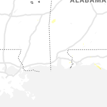
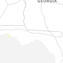
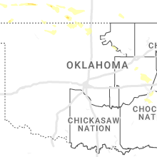
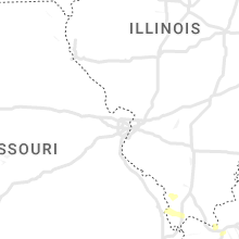
Hail Map for Saturday, August 5, 2023

Number of Impacted Households on 8/5/2023
0
Impacted by 1" or Larger Hail
0
Impacted by 1.75" or Larger Hail
0
Impacted by 2.5" or Larger Hail
Square Miles of Populated Area Impacted on 8/5/2023
0
Impacted by 1" or Larger Hail
0
Impacted by 1.75" or Larger Hail
0
Impacted by 2.5" or Larger Hail


Cities Most Affected by Hail Storms of 8/5/2023
| Hail Size | Demographics of Zip Codes Affected | ||||||
|---|---|---|---|---|---|---|---|
| City | Count | Average | Largest | Pop Density | House Value | Income | Age |
| Colorado Springs, CO | 16 | 2.33 | 4.00 | 53 | $95k | $33.9k | 37.0 |
| Elbert, CO | 2 | 1.88 | 2.00 | 23 | $220k | $76.4k | 45.1 |
| Almena, KS | 2 | 1.88 | 2.00 | 4 | $35k | $27.5k | 43.0 |
| Dresden, KS | 2 | 1.75 | 1.75 | 2 | $29k | $24.9k | 49.9 |
| Woodrow, CO | 1 | 2.50 | 2.50 | 1 | $83k | $31.6k | 43.3 |
| Kim, CO | 1 | 2.00 | 2.00 | 0 | $39k | $31.8k | 52.4 |
| Wray, CO | 1 | 1.75 | 1.75 | 5 | $72k | $33.4k | 39.1 |
| Limon, CO | 1 | 1.75 | 1.75 | 2 | $88k | $35.1k | 38.2 |
| Fowler, CO | 1 | 1.75 | 1.75 | 3 | $70k | $31.0k | 44.4 |
| Olney Springs, CO | 1 | 1.75 | 1.75 | 2 | $67k | $28.4k | 36.2 |
| Loveland, CO | 1 | 1.75 | 1.75 | 422 | $167k | $52.0k | 40.6 |
| Vernon, CO | 1 | 1.75 | 1.75 | 1 | $12k | $31.9k | 39.3 |
Hail and Wind Damage Spotted on 8/5/2023
Filter by Report Type:Hail ReportsWind Reports
States Impacted
Kansas, Oklahoma, Arkansas, Maine, Florida, Colorado, Texas, Tennessee, Indiana, Mississippi, Nebraska, Iowa, Alabama, IdahoKansas
| Local Time | Report Details |
|---|---|
| 7:20 AM CDT | Storm damage reported in chautauqua county KS, 55.3 miles SW of Chanute, KS |
| 7:52 AM CDT | Storm damage reported in montgomery county KS, 48.7 miles SSW of Chanute, KS |
| 11:23 AM CDT | 2 foot diameter tree branch dow in mcpherson county KS, 50.3 miles NNW of Wichita, KS |
| 11:55 AM CDT | Storm damage reported in pottawatomie county KS, 14.1 miles E of Manhattan, KS |
| 7:00 PM CDT | Golf Ball sized hail reported near Dresden, KS, 35.8 miles ENE of Colby, KS, pea to sporadic golf ball sized hail. |
| 7:15 PM CDT | 6:15-20 pm mt estimated wind gusts of 50-60 mp in rawlins county KS, 31 miles N of Colby, KS |
| 7:15 PM CDT | Reported via weather underground kksatwoo in rawlins county KS, 30.6 miles N of Colby, KS |
| 7:19 PM CDT | Golf Ball sized hail reported near Dresden, KS, 35.8 miles ENE of Colby, KS, social media report with picture of multiple golf ball sized hail stones. |
| 7:20 PM CDT | Trained spotter estimated wind gusts of 60-70 mp in rawlins county KS, 30.9 miles N of Colby, KS |
| 7:25 PM CDT | Storm damage reported in thomas county KS, 3 miles N of Colby, KS |
| 7:27 PM CDT | Ping Pong Ball sized hail reported near Norton, KS, 68.2 miles ENE of Colby, KS, report from mping: ping pong ball (1.50 in.). |
| 7:30 PM CDT | Quarter sized hail reported near Jennings, KS, 44.8 miles ENE of Colby, KS, several rounds of hail this size through :40 after. |
| 7:40 PM CDT | Quarter sized hail reported near Jennings, KS, 44.8 miles ENE of Colby, KS, corrects previous hail report from jennings. several rounds of hail this size through :50 after. |
| 7:44 PM CDT | Hen Egg sized hail reported near Almena, KS, 73.2 miles NNW of Hays, KS, delayed report... spotter reported hail that was just below tennis ball in size. time estimated from radar. |
| 7:44 PM CDT | Report from a trained spotter of 6 to 8 inch tree limbs down. the spotter and another spotter also reported whole trees down across town in almena. some house and vehic in norton county KS, 73.2 miles NNW of Hays, KS |
| 7:50 PM CDT | Social media report of estimated 60mph wind gus in decatur county KS, 40.1 miles NE of Colby, KS |
| 8:00 PM CDT | Golf Ball sized hail reported near Almena, KS, 73.3 miles NNW of Hays, KS, *** 1 inj *** golf ball sized hail caused damage to a camper... siding... and broke several windows in vehicles and the house. one person was hit in the head by hail an |
| 8:03 PM CDT | Half Dollar sized hail reported near Long Island, KS, 75.2 miles N of Hays, KS, also estimated 60 mph winds. |
| 8:03 PM CDT | Estimated 60 mph winds. also half dollar size hai in phillips county KS, 75.2 miles N of Hays, KS |
| 8:06 PM CDT | Unofficial personal statio in phillips county KS, 72.7 miles N of Hays, KS |
| 8:22 PM CDT | Storm damage reported in graham county KS, 47.6 miles NW of Hays, KS |
| 8:23 PM CDT | Spotter estimated 65-70 mph wind gust in graham county KS, 43.4 miles NW of Hays, KS |
| 8:27 PM CDT | Storm damage reported in graham county KS, 44.1 miles NW of Hays, KS |
| 8:30 PM CDT | Public report of estimated 60+ mph thunderstorm wind in gove county KS, 54 miles SSE of Colby, KS |
| 8:31 PM CDT | Storm damage reported in graham county KS, 44.1 miles NW of Hays, KS |
| 8:35 PM CDT | A power pole was broken at cr n and hwy 283. estimated time of repor in graham county KS, 42.2 miles NW of Hays, KS |
| 8:38 PM CDT | Estimated 80-90 mph wind gusts in town. reported a roaring sound with the win in graham county KS, 44.3 miles NW of Hays, KS |
| 8:59 PM CDT | Unofficial weather statio in rooks county KS, 40.2 miles N of Hays, KS |
| 9:05 PM CDT | Storm damage reported in rooks county KS, 33.1 miles N of Hays, KS |
| 9:06 PM CDT | Unofficial weather statio in rooks county KS, 24.8 miles N of Hays, KS |
| 9:16 PM CDT | Unofficial weather statio in rooks county KS, 29.2 miles NNE of Hays, KS |
| 9:16 PM CDT | Unofficial weather statio in rooks county KS, 32.6 miles NNE of Hays, KS |
| 9:18 PM CDT | Unofficial weather statio in rooks county KS, 29.2 miles NNE of Hays, KS |
| 9:22 PM CDT | Unofficial personal statio in osborne county KS, 34.3 miles NE of Hays, KS |
| 10:17 PM CDT | Storm damage reported in barton county KS, 44.4 miles SE of Hays, KS |
| 10:21 PM CDT | Storm damage reported in barton county KS, 38.4 miles SE of Hays, KS |
| 10:27 PM CDT | 55 to 60 mp in barton county KS, 54.3 miles SE of Hays, KS |
| 10:40 PM CDT | Corrects previous tstm wnd gst report from 5 n silica. corrects previous tstm wnd gst report from 6 nnw silic in rice county KS, 56.1 miles ESE of Hays, KS |
| 10:48 PM CDT | Storm damage reported in rice county KS, 59.4 miles NW of Wichita, KS |
| 10:56 PM CDT | Trees coming dow in reno county KS, 52.1 miles NW of Wichita, KS |
| 11:05 PM CDT | Power flickering and heavy rain and very strong winds and down tre in reno county KS, 44.8 miles NW of Wichita, KS |
| 11:06 PM CDT | Personal weather statio in reno county KS, 42.5 miles NW of Wichita, KS |
| 11:06 PM CDT | Storm damage reported in reno county KS, 41.8 miles WNW of Wichita, KS |
| 11:10 PM CDT | Personal weather statio in washington county KS, 40 miles NNW of Manhattan, KS |
| 11:10 PM CDT | Personal weather statio in washington county KS, 32 miles NNW of Manhattan, KS |
| 11:13 PM CDT | Storm damage reported in reno county KS, 41 miles NW of Wichita, KS |
| 11:15 PM CDT | 70+ estimated wind gusts north central part of hutchinson- north of fairgrounds. power is out. no hail... heavy rain & strong winds continue. some large tree damage in reno county KS, 41.5 miles NW of Wichita, KS |
| 11:15 PM CDT | Storm damage reported in mcpherson county KS, 50.3 miles NNW of Wichita, KS |
| 11:15 PM CDT | Large tree limbs down... size was 4 to 5 inch limbs which caused some roof damage to a hom in mcpherson county KS, 50.5 miles NNW of Wichita, KS |
| 11:16 PM CDT | Estimated 60-70 mp in mcpherson county KS, 50.1 miles NNW of Wichita, KS |
| 11:18 PM CDT | Storm damage reported in mcpherson county KS, 50.3 miles NNW of Wichita, KS |
| 11:23 PM CDT | Extremely high winds in the city of mcpherson right now. several locations without power 11:24 we have downed power lines at avenue a and main street in the city of mcp in mcpherson county KS, 50.3 miles NNW of Wichita, KS |
| 11:25 PM CDT | Corrects previous tstm wnd dmg report from mount hop in sedgwick county KS, 21.8 miles NW of Wichita, KS |
| 11:31 PM CDT | Personal weather station measured wind gus in sedgwick county KS, 17.6 miles WNW of Wichita, KS |
| 11:37 PM CDT | Storm damage reported in marion county KS, 38.8 miles N of Wichita, KS |
| 11:39 PM CDT | Storm damage reported in harvey county KS, 16.6 miles NNW of Wichita, KS |
| 11:41 PM CDT | Storm damage reported in harvey county KS, 24.3 miles N of Wichita, KS |
| 11:45 PM CDT | Corrects previous tstm wnd dmg report from 4 s maize. delayed report. time based on radar. approximately 12 inch diameter tree branch downe in sedgwick county KS, 7.2 miles WNW of Wichita, KS |
| 11:50 PM CDT | Personal weather station measured 62 mph gus in harvey county KS, 21.1 miles NNE of Wichita, KS |
| 11:51 PM CDT | Storm damage reported in sedgwick county KS, 7.7 miles NE of Wichita, KS |
| 11:51 PM CDT | Northbound lane of i-135 blocked due to vehicle accident in vicinity of highway 50 exit... vicinity of rest are in harvey county KS, 26.4 miles N of Wichita, KS |
| 11:54 PM CDT | Several branches dow in sedgwick county KS, 4.2 miles E of Wichita, KS |
| 11:55 PM CDT | Vehicle accident on us 50 and rock roa in harvey county KS, 30.9 miles N of Wichita, KS |
| 11:58 PM CDT | Corrects previous tstm wnd dmg report from potwi in butler county KS, 24.5 miles NE of Wichita, KS |
| 12:02 AM CDT | Power outag in marion county KS, 37 miles NE of Wichita, KS |
| 12:02 AM CDT | Lines down... poles on fire in wichita metro are in sedgwick county KS, 0.3 miles NW of Wichita, KS |
| 12:15 AM CDT | Storm damage reported in butler county KS, 26.6 miles ENE of Wichita, KS |
| 12:21 AM CDT | Storm damage reported in chase county KS, 57 miles NE of Wichita, KS |
| 12:27 AM CDT | Damaged power pole at the north end of the city; some power outages in the area. also a report of a tree down on the west side of el dorado (unknown size in butler county KS, 28.4 miles ENE of Wichita, KS |
| 12:29 AM CDT | Storm damage reported in greenwood county KS, 47.3 miles WNW of Chanute, KS |
| 12:31 AM CDT | Storm damage reported in greenwood county KS, 46.9 miles WNW of Chanute, KS |
| 12:53 AM CDT | Kfo in shawnee county KS, 50.5 miles ESE of Manhattan, KS |
| 1:16 AM CDT | Storm damage reported in neosho county KS, 1 miles SSW of Chanute, KS |
Oklahoma
| Local Time | Report Details |
|---|---|
| 7:30 AM CDT | Measured at the wynona oklahoma mesone in osage county OK, 31.4 miles NW of Tulsa, OK |
| 7:44 AM CDT | Broadcast media reports tree uprooted... pics relayed via social media. time estimated from rada in tulsa county OK, 3 miles SSE of Tulsa, OK |
| 8:53 AM CDT | Large tree dow in ottawa county OK, 65.3 miles SSE of Chanute, KS |
| 1:55 AM CDT | Mesonet station mayr may ranc in woods county OK, 44 miles NNE of Woodward, OK |
Arkansas
| Local Time | Report Details |
|---|---|
| 9:50 AM CDT | Large tree snapped at base of trunk. pic relayed via social media. time estimated from rada in washington county AR, 41.4 miles N of Fort Smith, AR |
| 10:30 AM CDT | Uprooted trees and numerous branches down. pics relayed via social media. time estimated from rada in madison county AR, 61.9 miles NE of Fort Smith, AR |
| 3:20 PM CDT | Large tree uprooted in burdett in mississippi county AR, 46.6 miles N of Memphis, TN |
Maine
| Local Time | Report Details |
|---|---|
| 3:00 PM EDT | Quarter sized hail reported near Burlington, ME, 32.8 miles NNE of Bangor, ME, estimated hail size from facebook photo. |
Florida
| Local Time | Report Details |
|---|---|
| 2:16 PM CDT | Report from mping: 1-inch tree limbs broken; shingles blown of in walton county FL, 7.2 miles E of Miramar Beach, FL |
| 2:16 PM CDT | Tree down near carson oaks ln and mack bayou roa in walton county FL, 3.2 miles ENE of Miramar Beach, FL |
Colorado
| Local Time | Report Details |
|---|---|
| 1:30 PM MDT | Quarter sized hail reported near Peyton, CO, 52.2 miles SSE of Denver, CO |
| 1:37 PM MDT | Golf Ball sized hail reported near Elbert, CO, 44.6 miles SE of Denver, CO, report via social media... with photos of roughly ping pong to golf ball size hail. time estimated by radar. |
| 1:43 PM MDT | Hen Egg sized hail reported near Elbert, CO, 46.5 miles SE of Denver, CO, social media report of up to 2 inch diameter hail on county road 102 east of elbert. time and location estimated by radar. |
| 2:00 PM MDT | Quarter sized hail reported near Kiowa, CO, 51.6 miles SE of Denver, CO |
| 2:13 PM MDT | Half Dollar sized hail reported near U S A F Academy, CO, 50 miles S of Denver, CO, report from mping: half dollar (1.25 in.). |
| 2:15 PM MDT | Quarter sized hail reported near U S A F Academy, CO, 51 miles NNW of Pueblo, CO |
| 2:20 PM MDT | Quarter sized hail reported near U S A F Academy, CO, 50.9 miles NNW of Pueblo, CO, located on i-25... just north of air force academy. |
| 2:22 PM MDT | Quarter sized hail reported near Colorado Springs, CO, 51.2 miles NNW of Pueblo, CO |
| 2:22 PM MDT | Quarter sized hail reported near U S A F Academy, CO, 50 miles S of Denver, CO, report from mping: quarter (1.00 in.). |
| 2:27 PM MDT | Half Dollar sized hail reported near Colorado Springs, CO, 49.5 miles N of Pueblo, CO, report from mping: half dollar (1.25 in.). |
| 2:35 PM MDT | Golf Ball sized hail reported near Colorado Springs, CO, 48.6 miles N of Pueblo, CO, pictures relayed via broadcast media. |
| 2:38 PM MDT | Half Dollar sized hail reported near Colorado Springs, CO, 51.3 miles S of Denver, CO |
| 2:40 PM MDT | Golf Ball sized hail reported near Colorado Springs, CO, 47 miles N of Pueblo, CO |
| 2:45 PM MDT | Ping Pong Ball sized hail reported near Colorado Springs, CO, 46.1 miles N of Pueblo, CO, numerous reports of hail 1.00 to 1.5 inches in this immediate region. |
| 2:46 PM MDT | Ping Pong Ball sized hail reported near Colorado Springs, CO, 43.9 miles N of Pueblo, CO |
| 2:46 PM MDT | Golf Ball sized hail reported near Colorado Springs, CO, 39.2 miles N of Pueblo, CO, report from mping: golf ball (1.75 in.). |
| 2:49 PM MDT | Golf Ball sized hail reported near Colorado Springs, CO, 44 miles N of Pueblo, CO |
| 2:53 PM MDT | Hen Egg sized hail reported near Colorado Springs, CO, 41.9 miles N of Pueblo, CO, numerous reports of ping pong to golf ball size hail. |
| 2:56 PM MDT | Ping Pong Ball sized hail reported near Colorado Springs, CO, 41.9 miles N of Pueblo, CO, report from mping: ping pong ball (1.50 in.). |
| 2:57 PM MDT | Hen Egg sized hail reported near Colorado Springs, CO, 41.9 miles N of Pueblo, CO |
| 2:59 PM MDT | Golf Ball sized hail reported near Colorado Springs, CO, 44.3 miles N of Pueblo, CO, report from mping: golf ball (1.75 in.). |
| 3:00 PM MDT | Ping Pong Ball sized hail reported near Colorado Springs, CO, 37.1 miles N of Pueblo, CO, report from mping: ping pong ball (1.50 in.). |
| 3:00 PM MDT | Ping Pong Ball sized hail reported near Colorado Springs, CO, 42.9 miles N of Pueblo, CO, report from mping: ping pong ball (1.50 in.). |
| 3:00 PM MDT | Golf Ball sized hail reported near Colorado Springs, CO, 42.8 miles N of Pueblo, CO |
| 3:05 PM MDT | Ping Pong Ball sized hail reported near Woodrow, CO, 57.1 miles SW of Yuma, CO |
| 3:08 PM MDT | Tennis Ball sized hail reported near Colorado Springs, CO, 35.8 miles N of Pueblo, CO, report from mping: tennis ball (2.50 in.). |
| 3:14 PM MDT | Baseball sized hail reported near Colorado Springs, CO, 33.8 miles N of Pueblo, CO, report from mping: baseball (2.75 in.). |
| 3:23 PM MDT | Half Dollar sized hail reported near Colorado Springs, CO, 32.9 miles N of Pueblo, CO, report from mping: half dollar (1.25 in.). |
| 3:23 PM MDT | Quarter sized hail reported near Colorado Springs, CO, 33.2 miles N of Pueblo, CO |
| 3:24 PM MDT | Tennis Ball sized hail reported near Woodrow, CO, 52.5 miles SW of Yuma, CO, delayed report via spotternetwork. time estimated by radar. |
| 3:26 PM MDT | Tennis Ball sized hail reported near Colorado Springs, CO, 31.9 miles NNE of Pueblo, CO, report from mping: tennis ball (2.50 in.). |
| 3:31 PM MDT | Half Dollar sized hail reported near Colorado Springs, CO, 32.9 miles N of Pueblo, CO |
| 3:35 PM MDT | Half Dollar sized hail reported near Colorado Springs, CO, 34.8 miles N of Pueblo, CO, relayed via social media. |
| 3:41 PM MDT | Golf Ball sized hail reported near Loveland, CO, 47.2 miles N of Denver, CO, *** 1 inj *** social media report from lake loveland park. estimated up to golf ball sized hail... though most stones were smaller. one swimmer sustained a large welt/b |
| 3:43 PM MDT | Quarter sized hail reported near Loveland, CO, 47.1 miles N of Denver, CO, several social media reports of dime to quarter size hail in loveland from lake loveland to centerra. time and location estimated. |
| 3:43 PM MDT | Quarter sized hail reported near Colorado Springs, CO, 27.9 miles NNE of Pueblo, CO, report from mping: quarter (1.00 in.). |
| 3:45 PM MDT | Grapefruit sized hail reported near Colorado Springs, CO, 25.3 miles NNE of Pueblo, CO, hail between 3 and 4 inches. |
| 3:46 PM MDT | Tea Cup sized hail reported near Colorado Springs, CO, 23.6 miles NNE of Pueblo, CO, measured 3.3 inch hail with picture on social media. |
| 3:47 PM MDT | Hen Egg sized hail reported near Colorado Springs, CO, 25.9 miles NNE of Pueblo, CO, report from mping: hen egg+ (2.25 in.). |
| 3:48 PM MDT | Tea Cup sized hail reported near Colorado Springs, CO, 22.4 miles NNE of Pueblo, CO, report from mping: baseball+ (3.25 in.). |
| 3:49 PM MDT | Tennis Ball sized hail reported near Colorado Springs, CO, 28.2 miles NE of Pueblo, CO, report from mping: tennis ball (2.50 in.). |
| 4:30 PM MDT | Golf Ball sized hail reported near Wray, CO, 26.2 miles ESE of Yuma, CO, delayed report... report of golf ball sized hail just north of vernon. |
| 4:31 PM MDT | Ping Pong Ball sized hail reported near Vernon, CO, 23.2 miles SE of Yuma, CO, trained spotter reports hail up to ping pong ball size. started out as quarter size... then went up to ping pong ball size. |
| 4:35 PM MDT | Golf Ball sized hail reported near Vernon, CO, 24.3 miles ESE of Yuma, CO, trained spotter reports hail ping pong to golf ball size. |
| 4:40 PM MDT | Half Dollar sized hail reported near Wray, CO, 27.6 miles ESE of Yuma, CO, observer called in a report of hail between quarter to half-dollar in size. hail was ongoing as of the call. |
| 4:59 PM MDT | Golf Ball sized hail reported near Fowler, CO, 33.5 miles ESE of Pueblo, CO |
| 5:05 PM MDT | Golf Ball sized hail reported near Olney Springs, CO, 36.6 miles E of Pueblo, CO |
| 6:10 PM MDT | Hen Egg sized hail reported near Kim, CO, 98 miles SE of Pueblo, CO, pictures via social media. |
| 6:14 PM MDT | Winds came from the back side of the thunderstorm as the storm was moving southeas in yuma county CO, 1.3 miles S of Yuma, CO |
| 6:20 PM MDT | Weatherlin in yuma county CO, 9 miles SSE of Yuma, CO |
| 7:50 PM MDT | Social media report. two trees uprooted on high plains blvd with a corn field flattened to the west. time estimated by rada in weld county CO, 41.4 miles N of Denver, CO |
| 7:54 PM MDT | Quarter sized hail reported near Fountain, CO, 31.1 miles N of Pueblo, CO, report from mping: quarter (1.00 in.). |
| 8:19 PM MDT | Half Dollar sized hail reported near Matheson, CO, 72.4 miles ESE of Denver, CO |
| 8:31 PM MDT | Golf Ball sized hail reported near Limon, CO, 76.6 miles NE of Pueblo, CO, hail lasted approximately 15 minutes. |
Texas
| Local Time | Report Details |
|---|---|
| 3:44 PM CDT | Half Dollar sized hail reported near Amarillo, TX, 4.9 miles W of Amarillo, TX, report from mping: half dollar (1.25 in.). |
| 3:46 PM CDT | Quarter sized hail reported near Amarillo, TX, 3.2 miles W of Amarillo, TX, report from mping: quarter (1.00 in.). |
| 3:53 PM CDT | Quarter sized hail reported near Amarillo, TX, 2.4 miles WSW of Amarillo, TX, photo submitted via social media. |
| 3:54 PM CDT | Quarter sized hail reported near Amarillo, TX, 3.7 miles SW of Amarillo, TX |
| 3:55 PM CDT | Quarter sized hail reported near Amarillo, TX, 2 miles W of Amarillo, TX |
| 3:55 PM CDT | Quarter sized hail reported near Amarillo, TX, 2.8 miles SW of Amarillo, TX |
| 4:00 PM CDT | Quarter sized hail reported near Amarillo, TX, 3.8 miles W of Amarillo, TX |
| 4:02 PM CDT | Quarter sized hail reported near Amarillo, TX, 2.1 miles WSW of Amarillo, TX, photo submitted via social media. |
| 4:05 PM CDT | Quarter sized hail reported near Amarillo, TX, 0.6 miles SSE of Amarillo, TX, report from mping: quarter (1.00 in.). |
| 4:05 PM CDT | Quarter sized hail reported near Amarillo, TX, 0.6 miles SW of Amarillo, TX |
| 9:35 PM CDT | A 61 mph wind gust was observed at 9:29pm. gusts weakened until the 78 mph gust at 9:35pm. a 66 mph gust occurred at 9:36p in sherman county TX, 81.3 miles NNW of Amarillo, TX |
| 9:35 PM CDT | A 61 mph wind gust was observed at 9:29pm. gusts weakened until the 78 mph gust at 9:35pm. a 66 mph gust occurred at 9:36p in sherman county TX, 81.3 miles NNW of Amarillo, TX |
| 9:40 PM CDT | Quarter sized hail reported near Stratford, TX, 79.2 miles N of Amarillo, TX, picture sent in to facebook. time estimated from radar. |
| 10:16 PM CDT | Mesonet gusted to 67 mph at 10:08pm followed by a 59 mph at 10:09pm... then dropped below severe limits. a 66 mph gust was observed at 10:13pm and peaked at 71 mph at 1 in sherman county TX, 64.4 miles N of Amarillo, TX |
| 10:48 PM CDT | Measured by mesonet. a 62 mph wind gust was observed at 10:47p in hutchinson county TX, 48.7 miles NNE of Amarillo, TX |
| 10:51 PM CDT | Observed by mesone in hutchinson county TX, 33 miles NNE of Amarillo, TX |
Tennessee
| Local Time | Report Details |
|---|---|
| 4:40 PM CDT | Public reported tree down off chester s in shelby county TN, 24 miles ENE of Memphis, TN |
| 4:40 PM CDT | Several trees down across arlingto in shelby county TN, 20.4 miles ENE of Memphis, TN |
| 4:40 PM CDT | Large tree uprooted in bartlett near memphis-arlington rd and venson d in shelby county TN, 11.7 miles ENE of Memphis, TN |
| 4:41 PM CDT | Several trees dow in shelby county TN, 11.8 miles ENE of Memphis, TN |
| 5:15 PM CDT | Tree down blocking road east boun in fayette county TN, 42.9 miles ENE of Memphis, TN |
| 5:25 PM CDT | Reported large tree down on highway 125 in bolivar... t in hardeman county TN, 62.8 miles SSW of Mc Kenzie, TN |
| 5:57 PM CDT | Trees and powerlines down in hornsb in hardeman county TN, 64.6 miles SSW of Mc Kenzie, TN |
| 5:57 PM CDT | Reported tree fallen on hous in hardeman county TN, 61.8 miles E of Memphis, TN |
| 5:58 PM CDT | Several trees down... powerlines down... and light post snapped in half across hardeman c in hardeman county TN, 58.9 miles E of Memphis, TN |
| 6:46 PM CDT | Tree and powerlines down on pyburns drive close to hwy 6 in hardin county TN, 34.8 miles NW of Florence, AL |
| 7:30 PM CDT | Adds to previous tstm wnd dmg report from 1 ssw saint joseph. dispatch reports power lines down across us-43 approx 1 mile north of state line and numerous trees down o in lawrence county TN, 17.2 miles NNE of Florence, AL |
| 7:34 PM CDT | Emergency manager reports a large tree across lexington highway (tn-227) southeast of lorett in lawrence county TN, 23.2 miles NE of Florence, AL |
Indiana
| Local Time | Report Details |
|---|---|
| 6:31 PM EDT | 8 inch diameter limbs and a tree are down across park ave between 13st and lafayette ave. per ham networ in vigo county IN, 52.8 miles E of Mattoon, IL |
Mississippi
| Local Time | Report Details |
|---|---|
| 5:48 PM CDT | Tree down in dorsey (fell onto chain link fence in itawamba county MS, 57.5 miles NNE of Starkville, MS |
| 5:51 PM CDT | Quarter sized hail reported near Fulton, MS, 55.6 miles SW of Florence, AL, quarter sized hail fell in fulton. size is estimated (no coins or measurements in the picture) and time is radar estimated. |
Nebraska
| Local Time | Report Details |
|---|---|
| 5:14 PM MDT | Weatherlink site brunswig sho in dundy county NE, 44.2 miles E of Yuma, CO |
| 7:55 PM CDT | Quarter sized hail reported near Guide Rock, NE, 57.6 miles S of Grand Island, NE, hail up to quarter size...most smaller. |
| 8:00 PM CDT | Quarter sized hail reported near Palisade, NE, 57.2 miles SSW of North Platte, NE, public report of nickel to quarter size hail. location estimated. |
| 8:33 PM CDT | Quarter sized hail reported near Inavale, NE, 59.9 miles SSW of Grand Island, NE, range from pea to quarter sized hail. time estimated from radar. |
| 10:17 PM CDT | Delayed report of 12-14 inch diameter tree and fence blown over. time estimated from rada in gage county NE, 73.5 miles SW of Omaha, NE |
| 10:29 PM CDT | Measured from a private weather statio in gage county NE, 70.7 miles SSW of Omaha, NE |
Iowa
| Local Time | Report Details |
|---|---|
| 6:25 PM CDT | Awos station klrj le mars airpor in plymouth county IA, 51.5 miles W of Storm Lake, IA |
| 9:05 PM CDT | Quarter size hail. tree blown on highway 59 blocking traffic in both direction in crawford county IA, 47.5 miles S of Storm Lake, IA |
| 9:27 PM CDT | Semi trailer blown over near the intersection of highway 71 and 110th st. time estimated from rada in carroll county IA, 35 miles SSE of Storm Lake, IA |
| 9:30 PM CDT | Outbuilding damaged... portions blown into field. delayed report. time estimated by rada in sac county IA, 33.5 miles SSE of Storm Lake, IA |
| 9:31 PM CDT | Tree damage near us7 in sac county IA, 33.8 miles SSE of Storm Lake, IA |
| 9:33 PM CDT | Reports of trees and a powerline down in the city of carrol in carroll county IA, 43.3 miles SSE of Storm Lake, IA |
| 9:33 PM CDT | Building structure damaged. time estimated by radar. delayed repor in sac county IA, 34.9 miles SSE of Storm Lake, IA |
| 9:45 PM CDT | Trees down south of bennett access. time estimated with rada in carroll county IA, 47.7 miles SE of Storm Lake, IA |
| 9:53 PM CDT | Tree blown down and blocking highway 175 in lake cit in calhoun county IA, 35.5 miles SE of Storm Lake, IA |
Alabama
| Local Time | Report Details |
|---|---|
| 6:30 PM CDT | Report of a tree down on power lines along highway 278 at brentwood d in lamar county AL, 52.6 miles NE of Starkville, MS |
| 6:50 PM CDT | Report of a tree down near the 100 block of old natchez trace rd. time estimated by rada in colbert county AL, 26.6 miles WSW of Florence, AL |
| 6:57 PM CDT | Power lines across alabama highway 172 between hackleburg and hodge in marion county AL, 37 miles SSW of Florence, AL |
| 7:00 PM CDT | Report of a pole down or leaning near the 4000 block of cross lane. time estimated by rada in colbert county AL, 17.9 miles W of Florence, AL |
| 7:22 PM CDT | Trees and power lines down along highways 44 and 129 on the southwest side of brillian in marion county AL, 54.1 miles S of Florence, AL |
| 7:24 PM CDT | Corrects previous tstm wnd dmg report from 2 ene sheffield. report of a tree down on the 1600 block of southern boulevard. time estimated by rada in colbert county AL, 2.1 miles S of Florence, AL |
| 7:24 PM CDT | Corrects previous tstm wnd dmg report from 2 ene sheffield. report of a tree down on the 1600 block of southern boulevard. time estimated by rada in colbert county AL, 2.1 miles S of Florence, AL |
| 7:25 PM CDT | Report of a tree down near mt. mills rd and highway 247. time estimated by rada in colbert county AL, 17.4 miles SW of Florence, AL |
| 7:27 PM CDT | Report of a tree down near ridge point in colbert county AL, 6.3 miles S of Florence, AL |
| 7:30 PM CDT | Report of a tree down near north hook street. time estimated by rada in colbert county AL, 4.6 miles SSW of Florence, AL |
| 7:30 PM CDT | A social media report of a tree knocked onto a truck in downtown florenc in lauderdale county AL, 0.3 miles W of Florence, AL |
| 7:32 PM CDT | Tree and power lines down along county road 19 near highway 12 in marion county AL, 42.1 miles S of Florence, AL |
| 7:33 PM CDT | Report of a tree down near the 500 block of southeast 17th street. time estimated by rada in colbert county AL, 3.6 miles SSW of Florence, AL |
| 7:35 PM CDT | Storm spotter reports trees snapped or uprooted near the foresthill subdivision in florenc in lauderdale county AL, 3.4 miles N of Florence, AL |
| 7:35 PM CDT | Report of a tree down near the 300 block of north atlanta avenue. time estimated by rada in colbert county AL, 2.9 miles SSW of Florence, AL |
| 7:36 PM CDT | Quarter sized hail reported near Killen, AL, 15.2 miles NE of Florence, AL, social media photo of hail up to quarter size. time estimated by radar. |
| 7:40 PM CDT | Numerous trees down around natural bridge and lynn with power outages reporte in winston county AL, 49.2 miles S of Florence, AL |
| 7:40 PM CDT | Emergency manager reports numerous trees down as well as power lines from russellville to phill campbell. time estimated by rada in franklin county AL, 26.4 miles S of Florence, AL |
| 7:49 PM CDT | Report of a tree down near spout springs rd and river rd. time estimated by rada in colbert county AL, 11.2 miles E of Florence, AL |
| 7:50 PM CDT | Report of a tree down near river road and point road. time estimated by rada in colbert county AL, 13.5 miles E of Florence, AL |
| 8:24 PM CDT | Tree down on highway 17 near geiger. another tree down on highway 116 between geiger and gainesville. time estimated via rada in sumter county AL, 50.7 miles SE of Starkville, MS |
| 9:05 PM CDT | Trees were knocked down in berli in cullman county AL, 45.5 miles N of Birmingham, AL |
| 9:26 PM CDT | Trees down near hwy 107 and cr 5 in fayette county AL, 57.8 miles ENE of Starkville, MS |
| 9:35 PM CDT | Multiple trees down near sale in fayette county AL, 41.6 miles WNW of Birmingham, AL |
Idaho
| Local Time | Report Details |
|---|---|
| 9:25 PM MDT | Quarter sized hail reported near Idaho Falls, ID, 9 miles SSE of Idaho Falls, ID, quarter-sized hail...some were larger. |
Connect with Interactive Hail Maps