

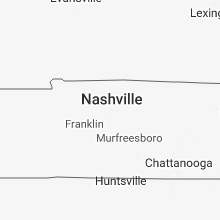
Hail Map for Thursday, August 9, 2018

Number of Impacted Households on 8/9/2018
0
Impacted by 1" or Larger Hail
0
Impacted by 1.75" or Larger Hail
0
Impacted by 2.5" or Larger Hail
Square Miles of Populated Area Impacted on 8/9/2018
0
Impacted by 1" or Larger Hail
0
Impacted by 1.75" or Larger Hail
0
Impacted by 2.5" or Larger Hail


Cities Most Affected by Hail Storms of 8/9/2018
| Hail Size | Demographics of Zip Codes Affected | ||||||
|---|---|---|---|---|---|---|---|
| City | Count | Average | Largest | Pop Density | House Value | Income | Age |
| Ash Fork, AZ | 2 | 1.75 | 1.75 | 0 | $57k | $24.5k | 50.9 |
Hail and Wind Damage Spotted on 8/9/2018
Filter by Report Type:Hail ReportsWind Reports
States Impacted
Massachusetts, Arizona, Alabama, Maine, Tennessee, Georgia, Kansas, Louisiana, Florida, Missouri, New Mexico, South Carolina, Michigan, Wisconsin, California, Indiana, Arkansas, Texas, NevadaMassachusetts
| Local Time | Report Details |
|---|---|
| 10:09 AM EDT | Large limbs and wire down on eldridge park way in barnstable county MA, 72.9 miles E of Providence, RI |
| 10:12 AM EDT | Multiple wires down on rock harbor road. tree and wires down on monument roa in barnstable county MA, 72.9 miles E of Providence, RI |
| 10:17 AM EDT | Top half of a small tree and wires down across brick hill road and tonset roa in barnstable county MA, 72.9 miles E of Providence, RI |
Arizona
| Local Time | Report Details |
|---|---|
| 7:23 AM MST | **delayed report** 6 power poles down near hunt hwy and gary rd. time est. on repor in pinal county AZ, 33.7 miles ESE of Phoenix, AZ |
| 3:05 PM MST | Half Dollar sized hail reported near Flagstaff, AZ, 2.1 miles SW of Flagstaff, AZ, reported at 2050 w university ave... flagstaff... az. |
| 3:08 PM MST | Quarter sized hail reported near Flagstaff, AZ, 2.8 miles SSW of Flagstaff, AZ |
| 3:10 PM MST | Half Dollar sized hail reported near Flagstaff, AZ, 2.8 miles SSW of Flagstaff, AZ, largest stones 1.25".several one inch stones observed. |
| 3:10 PM MST | Ping Pong Ball sized hail reported near Flagstaff, AZ, 3.5 miles SSW of Flagstaff, AZ, reported at 5078 s amethyst... flagstaff... az. |
| 3:20 PM MST | Quarter sized hail reported near Flagstaff, AZ, 5.6 miles W of Flagstaff, AZ, observed 1 inch hail on i-40 1/2 mile west of exit 190. |
| 3:33 PM MST | Hen Egg sized hail reported near , , 11.8 miles W of Flagstaff, AZ, measured up to 2 inch hail stones on camp navajo. the duration of the hail event was 10 minutes. |
| 4:30 PM MST | Golf Ball sized hail reported near Ash Fork, AZ, 57.1 miles W of Flagstaff, AZ, 1 3/4 inch hail... 39mph winds... 0.45 inches of rain. the duration of the hail event was 20 minutes. |
| 4:30 PM MST | Golf Ball sized hail reported near Ash Fork, AZ, 56.1 miles W of Flagstaff, AZ, a group on motorcycles reported golf ball size hail on route 66 between ash fork and seligman. the duration of the hail event was 20 minutes. |
| 5:15 PM MST | Half Dollar sized hail reported near , , 37.4 miles WSW of Flagstaff, AZ, perkinsville road north of the intersection with drake road. photo with quarter to compare size. estimated time between about 5:15 and 5:40 pm. |
| 8:30 PM MST | Tree limbs of 6-8 inches in diameter snapped near west lone mountain road and westland rd in vistanci in maricopa county AZ, 26.7 miles NW of Phoenix, AZ |
| 9:14 PM MST | Flood control district automated weather station at mcmicken dam near grand ave and loop 30 in maricopa county AZ, 25.5 miles NW of Phoenix, AZ |
| 11:45 PM MST | Report of trees down near power rd and germann rd. time estimated based on rada in maricopa county AZ, 25.2 miles ESE of Phoenix, AZ |
Alabama
| Local Time | Report Details |
|---|---|
| 12:02 PM CDT | A tree was reported down along the intersection of warrenton road and point of pines in guntersvill in marshall county AL, 62.8 miles NNE of Birmingham, AL |
| 12:30 PM CDT | Power lines down onto highway 132. sub-severe winds probable. time estimated from rada in etowah county AL, 47 miles NE of Birmingham, AL |
| 12:35 PM CDT | Tree downed into the roadway at lawson gap road and mountainboro road. sub-severe winds probable. time estimated from rada in etowah county AL, 57.1 miles NE of Birmingham, AL |
| 12:36 PM CDT | Tree downed and blocking traffic at sligo road and egypt road. sub-severe winds probable. time estimated from rada in etowah county AL, 55.2 miles NE of Birmingham, AL |
| 12:40 PM CDT | Tree downed along bloodworth drive with power lines entangled. sub-severe winds probable. time estimated from rada in etowah county AL, 56.9 miles NE of Birmingham, AL |
| 12:40 PM CDT | Tree downed along oak drive. sub-severe winds probable. time estimated from rada in etowah county AL, 60.2 miles NE of Birmingham, AL |
| 1:00 PM CDT | Tree downed along owls hollow road with complete road blockage. sub-severe winds probable. time estimated from rada in etowah county AL, 69.4 miles NE of Birmingham, AL |
| 1:15 PM CDT | Tree on power lines and power lines down. sub-severe winds probable. time estimated from rada in cherokee county AL, 65 miles SSW of Chattanooga, TN |
| 1:21 PM CDT | Tree on power lines and power lines down. sub-severe winds probable. time estimated from rada in cherokee county AL, 65.3 miles SSW of Chattanooga, TN |
| 1:24 PM CDT | Tree blocking part of the roadway along al hwy 273 near blue pon in cherokee county AL, 61.6 miles SSW of Chattanooga, TN |
| 1:39 PM CDT | Tree and power lines down along county rd 14 near ellisville. radar estimated 40-50mph wind in cherokee county AL, 70.7 miles SSW of Chattanooga, TN |
| 1:51 PM CDT | Tree blocking road at hwy 35 and county rd 114 near gaylesville. winds likely below severe criteri in cherokee county AL, 53.7 miles SSW of Chattanooga, TN |
Maine
| Local Time | Report Details |
|---|---|
| 1:14 PM EDT | Corrects previous tstm wnd dmg report from levant. power lines down and poles snapped. budget rd... black rd... and union s in penobscot county ME, 9.1 miles WNW of Bangor, ME |
| 1:18 PM EDT | Power lines down and poles snapped. budget rd... black rd... and union s in penobscot county ME, 9.1 miles WNW of Bangor, ME |
| 1:20 PM EDT | Corrects previous tstm wnd dmg report from kenduskeag. em reports 10 power poles snapped off on rte 15 in kenduskea in penobscot county ME, 11.8 miles NW of Bangor, ME |
| 1:25 PM EDT | Dairy farmer reports several large trees down and several sections of metal roofing torn off a barn along route 15 near kenduskeag/glenburn town lin in penobscot county ME, 8.7 miles NW of Bangor, ME |
| 1:26 PM EDT | Picture on social media shows a tree down on a house along lancaster brook r in penobscot county ME, 8.7 miles NW of Bangor, ME |
| 1:48 PM EDT | Em reports 10 power poles snapped off on rte 15 in kenduskea in penobscot county ME, 11.8 miles NW of Bangor, ME |
| 2:20 PM EDT | Tree down on masthill rd. tree down on williams pond rd involving power line in hancock county ME, 15.4 miles S of Bangor, ME |
| 5:00 PM EDT | One tree down next to the somerset county sherrif's offic in somerset county ME, 46.7 miles W of Bangor, ME |
| 6:40 PM EDT | Pictures of multiple trees down and damage to the roof of a mobile home relayed by wag in aroostook county ME, 25 miles SSE of Caribou, ME |
Tennessee
| Local Time | Report Details |
|---|---|
| 1:02 PM CDT | Tspotter report and photo of a tree split on 12 oaks road and tree limbs down on huntington place in coffee county TN, 56.1 miles WNW of Chattanooga, TN |
| 1:28 PM CDT | Tspotter report and photo of a tree down on ingram street in coffee county TN, 52.4 miles NW of Chattanooga, TN |
Georgia
| Local Time | Report Details |
|---|---|
| 3:00 PM EDT | Report of a tree down on i-285 eb past flat shoals rd. multiple cars were hit in acciden in dekalb county GA, 6.7 miles ESE of Atlanta, GA |
| 3:40 PM EDT | Tree down at the intersection of i-285 onramp from i-85 and u.s. hwy 29/roosevelt hwy in fulton county GA, 10.5 miles SSW of Atlanta, GA |
| 3:40 PM EDT | One tree down on powerlines at oleander drive and five forks tricku in gwinnett county GA, 18.4 miles ENE of Atlanta, GA |
| 4:15 PM EDT | Caller reported a tree down over powerlines in sw pickens county with the thunderstorm outflow in pickens county GA, 47 miles N of Atlanta, GA |
| 4:25 PM EDT | Several trees down (some on powerlines) in eastern douglasville area including 1 tree down on i-20 westbound at north county line rd near the lee rd exit blocking multi in douglas county GA, 16.7 miles W of Atlanta, GA |
| 4:44 PM EDT | Via twitter... at least 3 trees down in the vacinity of mt paran rd nw and w conway dr nw in buckhead in fulton county GA, 8.7 miles NNW of Atlanta, GA |
| 4:55 PM EDT | Tree down on the entrance ramp from riverdale rd onto i-85 n in clayton county GA, 9.1 miles SSW of Atlanta, GA |
| 5:03 PM EDT | Tree down blocking all lanes along puckett creek r in cherokee county GA, 35.8 miles N of Atlanta, GA |
| 5:35 PM EDT | Tree down across roadway sr 87 e at ocmulgee east blvd in bibb county GA, 80.8 miles SE of Atlanta, GA |
| 5:45 PM EDT | Reports of a tree down across powerlines on ga 255 at goat neck rd in white county GA, 61.5 miles WSW of Greenville, SC |
| 5:49 PM EDT | Screven county 911 center reported a tree down along millhaven road near the johnson grove road intersection. time of event was estimated from radar dat in screven county GA, 42.6 miles SSE of Augusta, GA |
| 5:55 PM EDT | Report of a tree down on jessie cole rd... north of mancheste in meriwether county GA, 55.1 miles ENE of Auburn, AL |
| 6:15 PM EDT | Large tree down in bonaire on church st at old perry rd in houston county GA, 83.8 miles NNW of Douglas, GA |
| 6:15 PM EDT | Tree down across winder hwy ay adella dr in jackson county GA, 51.5 miles ENE of Atlanta, GA |
| 6:15 PM EDT | Tree on a house and car on ward rd outside of houschton. no injuries reported in jackson county GA, 47.3 miles ENE of Atlanta, GA |
| 6:50 PM EDT | 911 call center reported trees down along athens and cole roads in franklin county GA, 51.5 miles SW of Greenville, SC |
Kansas
| Local Time | Report Details |
|---|---|
| 2:15 PM CDT | A large haybarn was destroyed... along with several downed power poles. the likely culprit was an intense localized microburs in neosho county KS, 13.8 miles SSE of Chanute, KS |
| 4:10 PM CDT | Tree limbs down. some 6 to 8 inches in diameter. winds estimated 50-60 mph. delayed repor in kingman county KS, 43.6 miles W of Wichita, KS |
| 5:24 PM CDT | Reported at lawrence municipal airpor in douglas county KS, 34.9 miles W of Kansas City, MO |
Louisiana
| Local Time | Report Details |
|---|---|
| 2:15 PM CDT | Storage building lost metal roofing during stor in bossier county LA, 7.7 miles SE of Shreveport, LA |
Florida
| Local Time | Report Details |
|---|---|
| 3:42 PM EDT | 911 call center reported power line down on ponte vedra blvd. time estimated based on rada in st. johns county FL, 21.3 miles SE of Jacksonville, FL |
| 4:51 PM EDT | Report relayed via trained spotter reports downed powerlines at the intersection of west taft vineland road and sidney hayes road. this is approximately 3 miles west of in orange county FL, 8.2 miles S of Orlando, FL |
| 4:51 PM EDT | Asos at orlando international measured peak gust of 60mph or 52 knots from the west-southwes in orange county FL, 8.5 miles SSE of Orlando, FL |
| 4:54 PM EDT | Kmco asos update wind gust to 60 knots or 69mp in orange county FL, 8.5 miles SSE of Orlando, FL |
| 5:31 PM EDT | Half Dollar sized hail reported near Miami, FL, 10.9 miles W of Miami, FL, public picture and video received of pea sized hail falling with embedded larger pieces estimated up to half dollar. |
| 6:00 PM EDT | Usaf wind tower 0714 measured peak gust of 50 knots or 58 mph from the southwes in brevard county FL, 38.5 miles E of Orlando, FL |
| 8:55 PM EDT | A trained spotter estimated winds gusting to 60-65mph in port mayaca as a storm moved onshore from lake okeechobe in martin county FL, 25.2 miles SW of Port Saint Lucie, FL |
Missouri
| Local Time | Report Details |
|---|---|
| 3:13 PM CDT | Quarter sized hail reported near Webb City, MO, 63.9 miles SE of Chanute, KS, social media picture of quarter size hail. time estimated via radar. |
| 3:25 PM CDT | Multiple 2-3 inch limbs broken off and dime sized hail. timing estimated from rada in greene county MO, 18.1 miles WNW of Springfield, MO |
| 3:45 PM CDT | Pea sized hail and small limbs broken. isolated pockets of corn with tops broken off. estimated winds of 45-50mp in jasper county MO, 55.8 miles W of Springfield, MO |
| 3:51 PM CDT | Trained spotter reported a 60 mph wind gust in saginaw... m in newton county MO, 66.2 miles W of Springfield, MO |
| 5:56 PM CDT | Downburst winds caused shingle loss at one residence near the intersection of highway b and highway 3 in cedar county MO, 42.2 miles NW of Springfield, MO |
| 6:19 PM CDT | Public weather station along the missouri/arkansas border along the white river measured a 67mph wind gus in barry county MO, 55.1 miles SSW of Springfield, MO |
New Mexico
| Local Time | Report Details |
|---|---|
| 2:20 PM MDT | Golf Ball sized hail reported near , , 18.8 miles ENE of Taos, NM, observer reported golf ball sized hail at 02...20pm and brief tornado near eagle nest lake shortly after 02...30pm. observer also reported overturned trailer near the l |
| 3:33 PM MDT | Quarter sized hail reported near Ilfeld, NM, 65.8 miles ENE of Albuquerque, NM, trained spotter reported estimated quarter-sized hail and heavy rainfall with storm. |
| 3:35 PM MDT | Quarter sized hail reported near Maxwell, NM, 51.5 miles ENE of Taos, NM |
| 4:28 PM MDT | Kgup aso in mckinley county NM, 88 miles SSW of Farmington, NM |
South Carolina
| Local Time | Report Details |
|---|---|
| 5:10 PM EDT | Trees down along lincoln and ora roads in laurens county SC, 37.7 miles ESE of Greenville, SC |
| 5:10 PM EDT | Lines down and power outage along garrett and slippery rock roads in laurens county SC, 36.3 miles ESE of Greenville, SC |
| 5:12 PM EDT | Schp reported a tree down at lincoln rd and ora rd in laurens county SC, 37.7 miles ESE of Greenville, SC |
| 5:42 PM EDT | Trees down near the intersection of pine log rd and storm branch rd. time estimated from rada in aiken county SC, 7.4 miles E of Augusta, GA |
| 5:47 PM EDT | Spotter heard on scanner report of couple trees down near jackso in aiken county SC, 14.8 miles SE of Augusta, GA |
| 5:55 PM EDT | Schp reported trees down along holland rd in greenville county SC, 19.3 miles ESE of Greenville, SC |
| 6:10 PM EDT | Quarter sized hail reported near Fountain Inn, SC, 25.1 miles ESE of Greenville, SC, public reported quarter (1.00 in) size hail |
| 6:10 PM EDT | Public reported two large trees uprooted. trees were healthy and were 30-40 feet tall. times were estimated by rada in allendale county SC, 35.2 miles SE of Augusta, GA |
| 7:00 PM EDT | South carolina highway patrol reported a tree down in the 1200 block of penny creek driv in colleton county SC, 47.1 miles WSW of Charleston, SC |
| 7:08 PM EDT | South carolina highway patrol reported a tree down in the 2300 block of hendersonville highway and us-17 alternat in colleton county SC, 45 miles WSW of Charleston, SC |
| 7:09 PM EDT | Trained spotter reported multiple trees down on ivanhoe road. time estimated by rada in colleton county SC, 43.8 miles WSW of Charleston, SC |
| 7:14 PM EDT | Colleton county fire and rescue reported a large tree down blocking all four lanes of south jefferies boulevar in colleton county SC, 44.1 miles WSW of Charleston, SC |
| 7:18 PM EDT | Trained spotter reported a tree down on us 17 north alternat in colleton county SC, 48.5 miles WSW of Charleston, SC |
| 7:26 PM EDT | South carolina highway patrol reported 2 trees down on i-95. one tree was down near mile marker 53 northbound and the other was down between mile markers 54 and 5 in colleton county SC, 45.3 miles WSW of Charleston, SC |
| 7:28 PM EDT | South carolina highway patrol reported a tree down in the 2000 block of bells highwa in colleton county SC, 43.4 miles WSW of Charleston, SC |
| 7:33 PM EDT | South carolina highway patrol reported a tree down in the 2200 block of green pond highwa in colleton county SC, 43.3 miles WSW of Charleston, SC |
| 7:33 PM EDT | South carolina highway patrol reported a tree down on highway 303 near rivers stree in colleton county SC, 43.8 miles WSW of Charleston, SC |
| 7:33 PM EDT | South carolina highway patrol reported a tree down on highway 64 about a half mile from rodeo driv in colleton county SC, 41.5 miles WSW of Charleston, SC |
| 7:35 PM EDT | South carolina highway patrol reported a tree down on highway 15 near wire roa in dorchester county SC, 34.7 miles W of Charleston, SC |
| 7:37 PM EDT | South carolina highway patrol reported a tree down on charleston highway near the intersection with st. peters roa in colleton county SC, 41.6 miles SW of Charleston, SC |
| 7:46 PM EDT | South carolina highway patrol reported a tree down on jacksonboro road near the intersection with bodison memorial driv in colleton county SC, 34.1 miles SW of Charleston, SC |
| 7:49 PM EDT | *** 1 inj *** colleton county fire and rescue reported a tree down on a house near the 10400 block of cottageville highway. one person sustained minor injuries as the t in colleton county SC, 32.4 miles WSW of Charleston, SC |
| 7:49 PM EDT | *** 1 inj *** colleton county fire and rescue reported a tree down on a house near the 10400 block of cottageville highway. one person sustained minor injuries as the t in colleton county SC, 32.4 miles WSW of Charleston, SC |
| 7:50 PM EDT | South carolina highway patrol reported a tree down on peirce road between elf jac way and mcdanieltown roa in colleton county SC, 28.8 miles WSW of Charleston, SC |
| 7:57 PM EDT | Trees down blocking roadway on long sumpit road near milner road. time estimated from rada in newberry county SC, 50.7 miles N of Augusta, GA |
| 8:02 PM EDT | South carolina highway patrol reported a tree down on hw-17 alternate near clubhouse roa in dorchester county SC, 25.1 miles SW of Charleston, SC |
| 8:02 PM EDT | Dorchester county 911 center reported a tree down along highway 61 near the bacons bridge road intersection. time of event was estimated from radar dat in dorchester county SC, 20.5 miles SW of Charleston, SC |
| 8:03 PM EDT | The charleston county 911 center reported a tree down along salters hill road near hollywood. time of event was estimated from radar dat in charleston county SC, 32.4 miles SSW of Charleston, SC |
| 8:05 PM EDT | South carolina highway patrol reported a tree down near 8600 moffett roa in charleston county SC, 39.7 miles SSW of Charleston, SC |
| 8:07 PM EDT | Charleston county 911 center reported a tree down on power lines near the intersection of county line and hyde park roads. time of event was estimated from radar dat in charleston county SC, 27.7 miles SSW of Charleston, SC |
| 8:16 PM EDT | A tree was blown down onto dorchester road near wescott park. time of event was estimated from radar dat in dorchester county SC, 19.6 miles SSW of Charleston, SC |
| 8:24 PM EDT | A 5 inch diameter tree limb fell on a driveway in the boltons landing subdivision in west ashle in charleston county SC, 27.1 miles S of Charleston, SC |
| 8:25 PM EDT | A tree was reported down in summerville near gahagan park. the tree fell on a power line between house in charleston county SC, 15.8 miles SW of Charleston, SC |
| 8:32 PM EDT | A tree was reported down beside a house on opal avenu in charleston county SC, 28.7 miles S of Charleston, SC |
| 8:32 PM EDT | A tree was reported down beside a house on opal avenu in charleston county SC, 28.7 miles S of Charleston, SC |
| 8:40 PM EDT | A large tree fell on a house in the area of of blakeway and schooner streets on daniel island. the house sustained roof damage and water leaked into the upstairs bedroo in berkeley county SC, 24.5 miles SSE of Charleston, SC |
| 8:43 PM EDT | Police dispatch reported a tree down on u.s. highway 17 at the mathis ferry road intersection in mt. pleasant. the tree was blocking part of the road. time was estimate in charleston county SC, 27.8 miles SSE of Charleston, SC |
Michigan
| Local Time | Report Details |
|---|---|
| 5:50 PM EDT | Reports of several large downed tree limbs (one of 12 to 14 inches) and arcing power line in st. joseph county MI, 57 miles NNW of Fort Wayne, IN |
| 6:05 PM EDT | Several reports of trees... limbs... and branches downed around the area near cassopolis and vandalia. no information on size/health of tree in cass county MI, 72.2 miles NW of Fort Wayne, IN |
Wisconsin
| Local Time | Report Details |
|---|---|
| 5:15 PM CDT | Large tree down with high winds and pea size hai in rock county WI, 31.2 miles SE of Madison, WI |
California
| Local Time | Report Details |
|---|---|
| 3:20 PM PDT | Quarter sized hail reported near Angelus Oaks, CA, 32.4 miles W of Yucca Valley, CA, report of quarter-sized hail south of angelus oaks on highway 38. |
| 11:26 PM PDT | Measured at kblh aso in riverside county CA, 62.7 miles SSW of Lake Havasu City, AZ |
Indiana
| Local Time | Report Details |
|---|---|
| 6:51 PM EDT | Mishawaka pd posted on twitter that there was a large tree down blocking filbert road between day rd. and mckinley hw in st. joseph county IN, 70 miles NW of Fort Wayne, IN |
| 7:17 PM EDT | Some branches downed and minor flooding observed. branches about 2 inches in diamete in elkhart county IN, 61.6 miles NW of Fort Wayne, IN |
| 7:17 PM EDT | Tree down blocking road on cr 24 and cr in elkhart county IN, 61.7 miles NW of Fort Wayne, IN |
| 7:34 PM EDT | Reports of trees/limbs downed in goshen. no specifics on tree health/size/locatio in elkhart county IN, 51.9 miles NW of Fort Wayne, IN |
| 6:45 PM CDT | Trees were blown down across a road. time estimate in porter county IN, 37.7 miles ESE of Chicago, IL |
Arkansas
| Local Time | Report Details |
|---|---|
| 6:52 PM CDT | Quarter sized hail reported near Rogers, AR, 68.3 miles NNE of Fort Smith, AR, photo of hail that fell in prairie creek relayed by media on twitter. time estimated by radar. |
| 6:52 PM CDT | Quarter sized hail reported near Rogers, AR, 68.8 miles NNE of Fort Smith, AR, photo of hail that fell in prairie creek relayed by media on twitter. time estimated by radar. |
Texas
| Local Time | Report Details |
|---|---|
| 8:15 PM CDT | Tree down on county road 4680 south of boyd in wise county TX, 49.8 miles WNW of Dallas, TX |
| 8:15 PM CDT | 15-inch tree blocking highway 114 west of boyd in wise county TX, 51.7 miles WNW of Dallas, TX |
Nevada
| Local Time | Report Details |
|---|---|
| 9:20 PM PDT | South boulder basin buoy measured a gust to 58 mp in clark county NV, 23.4 miles ESE of Las Vegas, NV |
Connect with Interactive Hail Maps