

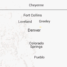
Hail Map for Friday, July 27, 2012

Number of Impacted Households on 7/27/2012
0
Impacted by 1" or Larger Hail
0
Impacted by 1.75" or Larger Hail
0
Impacted by 2.5" or Larger Hail
Square Miles of Populated Area Impacted on 7/27/2012
0
Impacted by 1" or Larger Hail
0
Impacted by 1.75" or Larger Hail
0
Impacted by 2.5" or Larger Hail


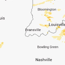


Cities Most Affected by Hail Storms of 7/27/2012
| Hail Size | Demographics of Zip Codes Affected | ||||||
|---|---|---|---|---|---|---|---|
| City | Count | Average | Largest | Pop Density | House Value | Income | Age |
| Alma, MI | 1 | 1.75 | 1.75 | 160 | $76k | $35.9k | 34.6 |
Hail and Wind Damage Spotted on 7/27/2012
Filter by Report Type:Hail ReportsWind Reports
States Impacted
Kentucky, North Carolina, Virginia, West Virginia, Indiana, Michigan, South Carolina, Georgia, Alabama, Missouri, Pennsylvania, Ohio, Montana, Idaho, Mississippi, South Dakota, Oklahoma, Nebraska, WyomingKentucky
| Local Time | Report Details |
|---|---|
| 12:05 PM EDT | Tree down on denny lan in pulaski county KY, 60.5 miles SW of Irvine, KY |
| 12:11 PM EDT | Powerlines down near conley bottom resor in wayne county KY, 69.9 miles SW of Irvine, KY |
| 5:08 PM EDT | Storm damage reported in boone county KY, 9.7 miles WSW of Cincinnati, OH |
| 5:08 PM EDT | Large trees down in boone county KY, 10.9 miles SW of Cincinnati, OH |
| 5:14 PM EDT | Several trees dow in boone county KY, 12.4 miles SW of Cincinnati, OH |
| 5:25 PM EDT | Shingles torn off a roof near kentucky route 16 in taylor mill. numerous trees down in the are in kenton county KY, 7.4 miles S of Cincinnati, OH |
| 6:02 PM EDT | Tree reported down on race track road in the milton area in trimble county KY, 53.4 miles NNE of Louisville, KY |
| 6:06 PM EDT | Partial roof ripped off of a garage on culls ridge road near bedford in trimble county KY, 51.5 miles SW of Cincinnati, OH |
| 6:17 PM EDT | 12 inch diameter tree down in boone county KY, 13 miles WSW of Cincinnati, OH |
| 6:22 PM EDT | Storm damage reported in carroll county KY, 46 miles SW of Cincinnati, OH |
| 6:42 PM EDT | Tree down on dawkins road in oldham county KY, 33.6 miles NNE of Louisville, KY |
| 6:42 PM EDT | Tree down on westport and highway 524 in oldham county KY, 35.4 miles NNE of Louisville, KY |
| 6:55 PM EDT | Several trees down in grant county KY, 29.9 miles S of Cincinnati, OH |
| 7:10 PM EDT | A few trees down in pendleton county KY, 31.6 miles SSE of Cincinnati, OH |
| 7:19 PM EDT | Half of a maple tree down on power lines about 1 mile east of ballard hs in jefferson county KY, 21.4 miles NNE of Louisville, KY |
| 7:24 PM EDT | Trees down on clore jackson road in shelby county KY, 34.6 miles NE of Louisville, KY |
| 7:25 PM EDT | Tree down on power line. reported through faceboo in harrison county KY, 50.7 miles SSE of Cincinnati, OH |
| 7:26 PM EDT | Numerous trees down near cynthiana in harrison county KY, 50.7 miles SSE of Cincinnati, OH |
| 7:28 PM EDT | Quarter sized hail reported near Louisville, KY, 21.7 miles NNE of Louisville, KY, report of quarter size hail in rolling hills via facebook |
| 7:30 PM EDT | Quarter sized hail reported near Louisville, KY, 22.1 miles NNE of Louisville, KY, quarter size hail reported near westport and goose creek road |
| 7:36 PM EDT | Quarter sized hail reported near Louisville, KY, 22.7 miles NNE of Louisville, KY, spotter reports quarter size hail |
| 7:37 PM EDT | Large tree fell on a house on nole ave in franklin county KY, 48.2 miles ENE of Louisville, KY |
| 7:40 PM EDT | Trees and power lines reported down in nicholas county KY, 42.2 miles N of Irvine, KY |
| 7:46 PM EDT | Trees down on elizaville roa in fleming county KY, 49.9 miles N of Irvine, KY |
| 7:46 PM EDT | Multiple reports of widespread trees and power lines down making roads impassable including in the thornhill area in franklin county KY, 49.7 miles ENE of Louisville, KY |
| 7:49 PM EDT | Trees down on fleming roa in fleming county KY, 49.6 miles NNE of Irvine, KY |
| 7:50 PM EDT | Trees down with some on cars on mockingbird lane...high street...ky 36 on railroad tracks...ox bow road...and locust grove road in nicholas county KY, 42.2 miles N of Irvine, KY |
| 7:51 PM EDT | Trees down in bethe in bath county KY, 38.4 miles N of Irvine, KY |
| 7:51 PM EDT | Trees down on taylor mill roa in fleming county KY, 54.6 miles NNE of Irvine, KY |
| 8:00 PM EDT | Trees down on ringos mills roa in fleming county KY, 43.8 miles NNE of Irvine, KY |
| 8:00 PM EDT | Trees down on day roa in bath county KY, 30.7 miles NNE of Irvine, KY |
| 8:10 PM EDT | Trees down in salt lic in bath county KY, 34.9 miles NNE of Irvine, KY |
| 8:18 PM EDT | Trees down on highway 37 in rowan county KY, 49.5 miles NE of Irvine, KY |
| 8:18 PM EDT | Trees down on kentucky 799 north of morehea in rowan county KY, 49.5 miles NE of Irvine, KY |
| 8:21 PM EDT | Trees down on us 60 near rowan and carter county lin in rowan county KY, 51.3 miles NE of Irvine, KY |
| 8:23 PM EDT | Trees down on dry creek roa in rowan county KY, 45.8 miles NE of Irvine, KY |
| 8:26 PM EDT | Northeast ymca reports destroyed greenhouse and two large downed trees in jefferson county KY, 20.8 miles NNE of Louisville, KY |
| 8:30 PM EDT | Large treen down on highway 504 near gimle in elliott county KY, 55.4 miles NE of Irvine, KY |
| 8:30 PM EDT | Trees down on highways 519 and 100 in morgan county KY, 39.6 miles NE of Irvine, KY |
| 8:31 PM EDT | Storm damage reported in anderson county KY, 45.3 miles E of Louisville, KY |
| 8:31 PM EDT | Telephone poles reported down along with blown transformers near i-65 in jefferson county KY, 16.1 miles N of Louisville, KY |
| 8:35 PM EDT | Numerous trees down on route 60 around the town of globe in carter county KY, 57.1 miles NE of Irvine, KY |
| 8:35 PM EDT | One tree down on hwy 46 in menifee county KY, 20.9 miles NE of Irvine, KY |
| 8:35 PM EDT | Tops of a pine tree and sycamore tree were broken of in morgan county KY, 40.5 miles ENE of Irvine, KY |
| 8:36 PM EDT | Lex reported 57 knot gust in fayette county KY, 35.4 miles NW of Irvine, KY |
| 8:40 PM EDT | Numerous trees down around olive hill...reports of power outages as well in carter county KY, 60.3 miles NE of Irvine, KY |
| 8:40 PM EDT | 18 tree down on u.s. 62 near wild turkey trace in anderson county KY, 43 miles E of Louisville, KY |
| 8:45 PM EDT | Reports of numerous trees down as well as power outages in anderson county in anderson county KY, 40.2 miles E of Louisville, KY |
| 8:50 PM EDT | Large branches broke in carter county KY, 68.7 miles NE of Irvine, KY |
| 8:57 PM EDT | Quarter sized hail reported near Grayson, KY, 68.7 miles NE of Irvine, KY |
| 8:58 PM EDT | Trees down on hwy 46 in johnson county KY, 58.5 miles ENE of Irvine, KY |
| 9:03 PM EDT | Trees down on hwy 109 in johnson county KY, 61.4 miles ENE of Irvine, KY |
| 9:15 PM EDT | Storm damage reported in lawrence county KY, 57.7 miles WSW of Charleston, WV |
| 9:15 PM EDT | Trees down on little mud lick roa in johnson county KY, 63.2 miles E of Irvine, KY |
| 9:18 PM EDT | Dispatch reports tree down with power outages in meade county KY, 25.3 miles W of Louisville, KY |
| 9:27 PM EDT | Dispatch reports trees down near knob creek road and ky 44 w along with a blown transformer in bullitt county KY, 8.5 miles W of Louisville, KY |
| 9:32 PM EDT | Large portion of tree down in eastern spencer county... time and location estimated in spencer county KY, 26.1 miles ENE of Louisville, KY |
| 9:44 PM EDT | Trees down at 4400 waddy road in shelby county KY, 37.4 miles ENE of Louisville, KY |
| 10:10 PM EDT | Tree down on a house... temporarily trapping a person inside in the henderson woods subdivisio in hardin county KY, 18.9 miles SW of Louisville, KY |
| 10:11 PM EDT | Tree down on a home in meade county KY, 22.2 miles WSW of Louisville, KY |
| 10:23 PM EDT | Tree down in hardin county KY, 21.5 miles SSW of Louisville, KY |
| 10:26 PM EDT | Tree down and partially blocking springfield roa in hardin county KY, 21.5 miles SSW of Louisville, KY |
| 10:37 PM EDT | Siding and a portion of a roof blown off of a house via facebook in larue county KY, 28.8 miles S of Louisville, KY |
| 10:37 PM EDT | Trees and power lines down in larue county KY, 28.8 miles S of Louisville, KY |
| 10:41 PM EDT | Dispatch reports trees down across the county in larue county KY, 21.5 miles S of Louisville, KY |
| 11:10 PM EDT | Dispatch reports tree blocking road in bengal in taylor county KY, 45.5 miles SSE of Louisville, KY |
| 11:13 PM EDT | Dispatch reports trees down in taylor county KY, 48.4 miles SSE of Louisville, KY |
| 11:15 PM EDT | Power lines down on hord street in taylor county KY, 48.4 miles SSE of Louisville, KY |
| 11:26 PM EDT | Trees down across power line in taylor county KY, 47.7 miles SSE of Louisville, KY |
| 11:44 PM EDT | Trees down on highway 63 in pulaski county KY, 51.2 miles SW of Irvine, KY |
| 10:50 PM CDT | Reports called into local radio station of trees down in the salem community...approx. 5 east of russell springs in russell county KY, 70.3 miles SW of Irvine, KY |
| 11:57 PM EDT | Trees down on highway 19 in pulaski county KY, 58.3 miles SW of Irvine, KY |
| 12:05 AM EDT | Tree down on denny lan in pulaski county KY, 60.5 miles SW of Irvine, KY |
| 12:11 AM EDT | Powerlines down near conley bottom resor in wayne county KY, 69.9 miles SW of Irvine, KY |
North Carolina
| Local Time | Report Details |
|---|---|
| 1:59 PM EDT | Tree blown down on a house... time estimated by radar in randolph county NC, 56 miles W of Raleigh, NC |
| 3:30 PM EDT | Numerous trees blown down in hendersonville and on the north side of town. reports of trees down on 7 different roads so fa in henderson county NC, 34.6 miles NNE of Greenville, SC |
| 3:44 PM EDT | Trees down on holbert cove roa in polk county NC, 35.6 miles NNE of Greenville, SC |
| 4:05 PM EDT | Trees and power lines down... time estimated by radar in forsyth county NC, 70.5 miles NNE of Charlotte, NC |
| 4:12 PM EDT | Trees down in three locations in the green creek communit in polk county NC, 41.2 miles NE of Greenville, SC |
| 4:16 PM EDT | Two trees dow in burke county NC, 60.3 miles WNW of Charlotte, NC |
| 4:20 PM EDT | Trees down valley road at tangle lane. road close in forsyth county NC, 70.5 miles NNE of Charlotte, NC |
| 4:25 PM EDT | Numerous trees down. numerous power lines down. reynolda roa in forsyth county NC, 69.9 miles NNE of Charlotte, NC |
| 4:30 PM EDT | 250 year old tree fell across yard and onto a hous in forsyth county NC, 70.7 miles NNE of Charlotte, NC |
| 4:52 PM EDT | Two trees down near the intersection of vashti road and highway 16 along with 3 large limbs down on a nearby residenc in alexander county NC, 55.7 miles NNW of Charlotte, NC |
| 4:54 PM EDT | A tree was blown down on cool springs road and another on chief thomas rd in the same are in iredell county NC, 45.5 miles N of Charlotte, NC |
| 5:00 PM EDT | Duke power reported 5000 power outages due to fallen limbs and trees across power line in forsyth county NC, 67.6 miles NNE of Charlotte, NC |
| 5:10 PM EDT | Tree down at piedmont electric in person county NC, 44.5 miles NNW of Raleigh, NC |
| 5:17 PM EDT | A tree and multiple large tree limbs were blown down near the intersection of highway 772 and dillard roa in stokes county NC, 60.7 miles S of Roanoke, VA |
| 5:20 PM EDT | Large tree limbs blown down. time estimate in person county NC, 41.3 miles NNW of Raleigh, NC |
| 5:31 PM EDT | Tree down in alamance county NC, 54 miles WNW of Raleigh, NC |
| 5:35 PM EDT | Tree down in alamance county NC, 54 miles WNW of Raleigh, NC |
| 5:37 PM EDT | Multiple trees and power lines down... transformer damaged in alamance county NC, 52.3 miles WNW of Raleigh, NC |
| 5:40 PM EDT | Trees down in the vicinity of mooresvill in iredell county NC, 24.7 miles N of Charlotte, NC |
| 5:50 PM EDT | Tree down in alamance county NC, 48.3 miles WNW of Raleigh, NC |
| 5:53 PM EDT | Trees down in the vicinity of davidso in mecklenburg county NC, 19.1 miles N of Charlotte, NC |
| 6:02 PM EDT | Tree down in alamance county NC, 41.4 miles WNW of Raleigh, NC |
| 6:02 PM EDT | Trees and powerlines down in alamance county NC, 40.8 miles WNW of Raleigh, NC |
| 6:05 PM EDT | Trees and power lines down along graham rd near highway 15 in rowan county NC, 29.6 miles NNE of Charlotte, NC |
| 6:24 PM EDT | Trees down near breeze and guess road in orange county NC, 37 miles NW of Raleigh, NC |
| 6:30 PM EDT | A few locations with powerlines down and at least two of those with limbs bringing the powerlines dow in cabarrus county NC, 22.2 miles NNE of Charlotte, NC |
| 6:50 PM EDT | Numerous trees down in siler city in chatham county NC, 46.2 miles W of Raleigh, NC |
| 6:55 PM EDT | Trees down between waxhaw and monroe. also a powerline down on highway 74 in monroe causing power to be out for part of the cit in union county NC, 21.6 miles SSE of Charlotte, NC |
| 7:00 PM EDT | County 911 call center reports several trees down in the louisburg are in franklin county NC, 29 miles NE of Raleigh, NC |
| 7:24 PM EDT | Tree down on austin road in stanly county NC, 28.5 miles E of Charlotte, NC |
| 7:30 PM EDT | Tree down on home...hwy 740 and thompson rd in stanly county NC, 41.6 miles ENE of Charlotte, NC |
| 7:40 PM EDT | Quarter sized hail reported near Raleigh, NC, 6.2 miles NE of Raleigh, NC, quarter size hail |
| 7:45 PM EDT | Chatham 911 call center reports several trees down just west of siler city near the randolph county lin in chatham county NC, 50.6 miles W of Raleigh, NC |
Virginia
| Local Time | Report Details |
|---|---|
| 2:15 PM EDT | Numerous large limbs down on clear fork creek road in bland county VA, 66.9 miles NE of Bristol, TN |
| 2:35 PM EDT | Tree down on old mountain road in bland county VA, 62.6 miles ENE of Bristol, TN |
| 2:35 PM EDT | A tree was blown down along grapefield road near the community of bastia in bland county VA, 67 miles W of Roanoke, VA |
| 2:50 PM EDT | Tree down on byrnes chapel road in bland county VA, 54.9 miles W of Roanoke, VA |
| 3:20 PM EDT | Large tree down on house at 245 huntstown road. no injuries...but extensive damage to hom in pittsylvania county VA, 42.4 miles SE of Roanoke, VA |
| 3:33 PM EDT | Powerlines down on daytona road in roanoke county VA, 4.1 miles N of Roanoke, VA |
| 3:37 PM EDT | Tree and powerlines down on apple orchard lane in botetourt county VA, 10.1 miles NNE of Roanoke, VA |
| 3:37 PM EDT | Tree down near howbert ave and main street in city of roanoke county VA, 1.3 miles SW of Roanoke, VA |
| 3:54 PM EDT | Three trees down on 4000 block of highway 5 in halifax county VA, 64 miles NNW of Raleigh, NC |
| 3:58 PM EDT | Tree down on northern end of acorn roa in halifax county VA, 58 miles ESE of Roanoke, VA |
| 4:07 PM EDT | Hwy sign blown down at routes 122 and 11 in franklin county VA, 13.8 miles SSE of Roanoke, VA |
| 4:09 PM EDT | Tree down at hardy rd and lynville creek in franklin county VA, 11.3 miles SE of Roanoke, VA |
| 4:15 PM EDT | Trees down in saxe area in charlotte county VA, 68.7 miles SW of Richmond, VA |
| 4:28 PM EDT | Three trees down on us36 in charlotte county VA, 60.4 miles SW of Richmond, VA |
| 4:32 PM EDT | Tree down on lynville drive in franklin county VA, 11.4 miles ESE of Roanoke, VA |
| 4:32 PM EDT | Tree down on parkway ave at the park in franklin county VA, 21.7 miles SE of Roanoke, VA |
| 4:41 PM EDT | 2 trees down on lee jackson hwy near shortcut roa in bedford county VA, 39.1 miles ENE of Roanoke, VA |
| 4:46 PM EDT | Numerous trees...limbs...and wires down throughout lynchburg. siding off a building on park avenu in city of lynchburg county VA, 45.1 miles ENE of Roanoke, VA |
| 4:48 PM EDT | Tree down in amherst county VA, 44.4 miles ENE of Roanoke, VA |
| 4:50 PM EDT | Two trees down along lynchburg reservoir about 3/4 mile upstream of pedlar dam in amherst county VA, 46 miles NE of Roanoke, VA |
| 4:54 PM EDT | Storm damage reported in james city county VA, 47.6 miles E of Richmond, VA |
| 4:55 PM EDT | Numerous trees...limbs...and wires down throughout the town of amherst. large portion of town without powe in amherst county VA, 53.7 miles ENE of Roanoke, VA |
| 5:02 PM EDT | Tree down in amherst county VA, 52.7 miles ENE of Roanoke, VA |
| 5:05 PM EDT | Several trees down in amherst county VA, 56.5 miles ENE of Roanoke, VA |
| 5:06 PM EDT | Power lines down in amherst county VA, 53.4 miles ENE of Roanoke, VA |
| 5:06 PM EDT | Power lines and phone lines down in amherst county VA, 54.2 miles ENE of Roanoke, VA |
| 5:07 PM EDT | Tree down along route 60 in nelson county VA, 63.4 miles ENE of Roanoke, VA |
| 5:12 PM EDT | Numerous large tree limbs blown down along old galilee roa in amherst county VA, 59.9 miles ENE of Roanoke, VA |
| 5:15 PM EDT | Tree down along route 60 at robertson ln in nelson county VA, 63.4 miles ENE of Roanoke, VA |
| 5:30 PM EDT | Tree down across hair rd in prince george county VA, 35.7 miles SE of Richmond, VA |
| 5:31 PM EDT | Three trees down near hines rd in prince george county VA, 35.3 miles SE of Richmond, VA |
West Virginia
| Local Time | Report Details |
|---|---|
| 2:17 PM EDT | Numerous trees down on houses and power lines on doc fox road in summers county WV, 51.4 miles WNW of Roanoke, VA |
| 2:41 PM EDT | Numerous trees down throughout union and vicinit in monroe county WV, 38.8 miles WNW of Roanoke, VA |
| 2:41 PM EDT | Tree down in road 3 miles south of unio in monroe county WV, 37.3 miles WNW of Roanoke, VA |
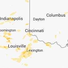
Indiana
| Local Time | Report Details |
|---|---|
| 2:20 PM EDT | Numerous reports of transformer and power lines down and trees down around the flora area. roof off a chicken coop blown off. no power in flora at time. time of transfo in carroll county IN, 56.8 miles NNW of Indianapolis, IN |
| 2:35 PM EDT | Also quarter size hail and tree limb damag in hamilton county IN, 14.1 miles NNE of Indianapolis, IN |
| 2:55 PM EDT | Several trees downed just southeast of tow in parke county IN, 54.5 miles W of Indianapolis, IN |
| 3:20 PM EDT | Several trees downed in madison townshi in putnam county IN, 41.2 miles W of Indianapolis, IN |
| 3:45 PM EDT | Several trees downed in the burney area near cr100s and cr850 in decatur county IN, 42.2 miles SE of Indianapolis, IN |
| 3:47 PM EDT | Quarter sized hail reported near Brownsburg, IN, 13.7 miles WNW of Indianapolis, IN |
| 3:50 PM EDT | Estimated wind gust of 55-60 mph in elkhart county IN, 43.8 miles NW of Fort Wayne, IN |
| 3:55 PM EDT | Several large trees down. part of roofing removed from business. billboard blown dow in fayette county IN, 51.1 miles NW of Cincinnati, OH |
| 4:09 PM EDT | On sr37 just north of tow in monroe county IN, 45.1 miles SSW of Indianapolis, IN |
| 4:10 PM EDT | Quarter sized hail reported near Indianapolis, IN, 10.6 miles NNW of Indianapolis, IN, from spotternetwork. most hailstones were half inch. |
| 4:15 PM EDT | Several trees toppled in union county IN, 45 miles NNW of Cincinnati, OH |
| 4:15 PM EDT | Half Dollar sized hail reported near Indianapolis, IN, 11.6 miles NNE of Indianapolis, IN |
| 4:15 PM EDT | Quarter sized hail reported near Tipton, IN, 32.6 miles N of Indianapolis, IN, time estimated from radar. late report. |
| 4:35 PM EDT | Twelve inch diameter tree snapped off at base near intersection of north hartstrait road and ratliff road in monroe county IN, 45.3 miles SSW of Indianapolis, IN |
| 4:52 PM EDT | 3 semi trucks overturned on i-275 in dearborn county IN, 17.5 miles W of Cincinnati, OH |
| 5:00 PM EDT | Smashed corn crib and large tree uproote in monroe county IN, 51.8 miles SSW of Indianapolis, IN |
| 5:20 PM EDT | Storm damage reported in jackson county IN, 61.4 miles S of Indianapolis, IN |
| 5:22 PM EDT | 50 foot dead tree blown down in jennings county IN, 59.2 miles SSE of Indianapolis, IN |
| 5:23 PM EDT | Six to eight diameter tree down on west 2nd street. pea size hai in jackson county IN, 57.4 miles SSE of Indianapolis, IN |
| 5:25 PM EDT | Three inch diameter tree limbs down in jennings county IN, 58.6 miles SSE of Indianapolis, IN |
| 5:26 PM EDT | Transformer blown off utility pole and on fire. railroad crossing arms broken off on u.s. 50. numerous traffic lights and trees broken. all these reports verified as be in jackson county IN, 57.4 miles SSE of Indianapolis, IN |
| 5:30 PM EDT | Storm damage reported in monroe county IN, 56.2 miles SSW of Indianapolis, IN |
| 5:30 PM EDT | Part of a roof peeled off at the hillcrest shops strip mall near the intersection of state route 37 and sieboldt quarry road in juda in lawrence county IN, 59.2 miles SSW of Indianapolis, IN |
| 5:33 PM EDT | Spotter estimates wind gust of 60 mph... wind gust destroyed anemometer in scott county IN, 54.6 miles N of Louisville, KY |
| 5:36 PM EDT | Spotter reports lots of large tree limbs down in jefferson county IN, 55.4 miles N of Louisville, KY |
| 5:40 PM EDT | Two trees snapped in half in ripley county IN, 33.6 miles W of Cincinnati, OH |
| 5:43 PM EDT | Trees reported down on state road 7 as well as other trees and power lines down on the north and eastern portions of the county in jefferson county IN, 56.7 miles WSW of Cincinnati, OH |
| 5:50 PM EDT | Twenty trees downed from paris crossing to sr7 in southeast part of count in jennings county IN, 55.6 miles WSW of Cincinnati, OH |
| 5:52 PM EDT | Trees down on north street in austi in scott county IN, 52.1 miles N of Louisville, KY |
| 6:03 PM EDT | Trees down on east main street in austi in scott county IN, 52.1 miles N of Louisville, KY |
| 6:05 PM EDT | Storm damage reported in lawrence county IN, 65.2 miles SSW of Indianapolis, IN |
| 6:05 PM EDT | Quarter sized hail reported near Bedford, IN, 65.2 miles SSW of Indianapolis, IN |
| 6:10 PM EDT | Partial metal roof ripped off in jefferson county IN, 52.9 miles WSW of Cincinnati, OH |
| 6:21 PM EDT | Spotter called in report of estimated 60 to 65 mph winds with shingles coming off of roof in scott county IN, 43 miles N of Louisville, KY |
| 6:27 PM EDT | Tree down at 5600 split stump road in lexington... i in scott county IN, 46 miles N of Louisville, KY |
| 6:27 PM EDT | Report of 8 inch diameter tree limb on house in clark county IN, 41.2 miles NNE of Louisville, KY |
| 6:31 PM EDT | Tree limbs of about a foot in diameter down and a roof came off of a shed in clark county IN, 41.2 miles NNE of Louisville, KY |
| 7:05 PM EDT | Several trees downed in the tunnelton and fort ritner area in lawrence county IN, 67.5 miles NNW of Louisville, KY |
| 7:22 PM EDT | Dispatch reports a few trees down near campbellsburg in washington county IN, 54.4 miles NNW of Louisville, KY |
| 7:50 PM EDT | Tree reported down in backyard via facebook in dubois county IN, 44.3 miles NE of Evansville, IN |
| 7:54 PM EDT | Dispatch reports trees down in northeastern jasper in dubois county IN, 46.5 miles NE of Evansville, IN |
| 7:55 PM EDT | Tree down in floyd county IN, 24.4 miles NNW of Louisville, KY |
| 8:17 PM EDT | Dispatch reports tree down in crawford county IN, 46.9 miles WNW of Louisville, KY |
Michigan
| Local Time | Report Details |
|---|---|
| 2:30 PM EDT | One foot diameter tree down at 11 mile and milford rd. no evidence of lightning strik in oakland county MI, 36.8 miles S of Flint, MI |
| 2:30 PM EDT | Quarter sized hail reported near Wixom, MI, 32 miles SSE of Flint, MI |
| 2:31 PM EDT | Half Dollar sized hail reported near Alma, MI, 56.3 miles WNW of Flint, MI |
| 2:34 PM EDT | Golf Ball sized hail reported near Alma, MI, 55.4 miles WNW of Flint, MI |
| 2:35 PM EDT | Several 2-4 inch diameter limbs down in oakland county MI, 39.7 miles S of Flint, MI |
| 2:47 PM EDT | Quarter sized hail reported near Alma, MI, 54.5 miles WNW of Flint, MI |
| 2:50 PM EDT | Quarter sized hail reported near Edmore, MI, 44.2 miles NE of Grand Rapids, MI |
| 3:20 PM EDT | Ping Pong Ball sized hail reported near Breckenridge, MI, 47.4 miles NW of Flint, MI, rainfalll of one inch. wind est at 50 mph |
South Carolina
| Local Time | Report Details |
|---|---|
| 2:58 PM EDT | A few large limbs down at table rock state par in pickens county SC, 15.5 miles NNW of Greenville, SC |
| 3:32 PM EDT | Highway patrol reported a tree down across the roadway at the intersection of camp rawls road and magpie stree in aiken county SC, 30.1 miles ENE of Augusta, GA |
| 3:34 PM EDT | A tree was reported down along interstate 95 near beach roa in colleton county SC, 45.3 miles WSW of Charleston, SC |
| 3:34 PM EDT | One tree was reported down along interstate 95 between black creek road and crosby corner roa in colleton county SC, 48 miles WSW of Charleston, SC |
| 3:39 PM EDT | A few trees down in the six mile are in pickens county SC, 12.6 miles W of Greenville, SC |
| 3:41 PM EDT | The colleton county 911 center relayed a report of a tree down near the intersection of hiers corner road and forest circl in colleton county SC, 43.5 miles WSW of Charleston, SC |
| 3:52 PM EDT | A tree was blown down bringing down 2 power pole in pickens county SC, 6.7 miles WSW of Greenville, SC |
| 3:57 PM EDT | Highway patrol reported a tree in the roadway at kennedy pond road and trotter roa in aiken county SC, 29.9 miles ENE of Augusta, GA |
| 4:00 PM EDT | Highway patrol reported trees down along highway 178 at johnson king road and mack edisto roa in lexington county SC, 47.6 miles ENE of Augusta, GA |
| 4:03 PM EDT | Highway patrol reported a tree in the roadway at woodfield road and independent boulevar in aiken county SC, 13.1 miles ESE of Augusta, GA |
| 4:13 PM EDT | One tree was reported down on bonnie dune roa in colleton county SC, 43.3 miles SW of Charleston, SC |
| 4:16 PM EDT | Highway patrol reported at tree down in windsor in aiken county SC, 26.3 miles E of Augusta, GA |
| 4:22 PM EDT | Highway patrol reported a tree down along i-26 in the westbound direction at mile marker 6 in lexington county SC, 60 miles NE of Augusta, GA |
| 4:24 PM EDT | Trees down with a few in roadway in spartanburg county SC, 40.6 miles ENE of Greenville, SC |
| 4:37 PM EDT | Highway patrol reported power lines in the roadway at highway 34 and kellytown roa in kershaw county SC, 68 miles S of Charlotte, NC |
| 4:44 PM EDT | Power line down on crenshaw r in cherokee county SC, 49.7 miles ENE of Greenville, SC |
| 4:44 PM EDT | Sheriff dispatch reported a roof blown off of a storage building and trees down along cedar creek roa in chesterfield county SC, 67 miles SE of Charlotte, NC |
| 4:44 PM EDT | Sheriff dispatch reported a house damaged and power lines down on cedar creek road near highway 10 in chesterfield county SC, 66.8 miles SE of Charlotte, NC |
| 4:44 PM EDT | Sheriff dispatch reported a tree on a house and power lines down on cedar creek road near highway 10 in chesterfield county SC, 66.8 miles SE of Charlotte, NC |
| 4:46 PM EDT | Large tree down near intersection of highways 79 and 36 in marlboro county SC, 74.1 miles ESE of Charlotte, NC |
| 4:52 PM EDT | Trees down on providence road in town. 1 tree also down on pleasant school rd northeast of tow in cherokee county SC, 46.9 miles W of Charlotte, NC |
| 5:02 PM EDT | The jasper county 911 call center reported a tree down on best stree in jasper county SC, 15.2 miles N of Savannah, GA |
| 5:02 PM EDT | The jasper county 911 call center relayed a report of a tree down on moorer avenu in jasper county SC, 13.8 miles N of Savannah, GA |
| 5:20 PM EDT | Tree down across railroad tracks on high point road. time estimated by rada in darlington county SC, 74.8 miles SE of Charlotte, NC |
| 5:22 PM EDT | Tree in roadway and large limbs down in musgrove mill st p in spartanburg county SC, 44.5 miles ESE of Greenville, SC |
| 5:23 PM EDT | Public reported a tree uprooted and limbs on powerlines near mcbe in chesterfield county SC, 64.1 miles SE of Charlotte, NC |
| 5:25 PM EDT | One tree was reported down near the intersection of shadowmoss parkway and ashley river roa in charleston county SC, 24.1 miles S of Charleston, SC |
| 5:25 PM EDT | Two trees were reported down along highway 36 in hampton county SC, 52.7 miles N of Savannah, GA |
| 5:25 PM EDT | Tree down on pocotaligo roa in hampton county SC, 55.2 miles N of Savannah, GA |
| 5:28 PM EDT | Tree down in highway at us 52 and rosenwald road south of society hil in darlington county SC, 75.6 miles SE of Charlotte, NC |
| 5:36 PM EDT | Trees down in the sharon and york are in york county SC, 30.5 miles SW of Charlotte, NC |
| 5:46 PM EDT | One tree was reported down near the intersection of needles road and joe frazier roa in beaufort county SC, 30.5 miles NE of Savannah, GA |
| 6:10 PM EDT | Tree reported down at intersection of hwy 15 and east old camden road. time estimated by rada in darlington county SC, 74.4 miles SE of Charlotte, NC |
| 6:14 PM EDT | Trees down around fort mil in york county SC, 15.8 miles SSW of Charlotte, NC |
| 6:20 PM EDT | Tree on roadway at intersection of midway school road and highway 7 in laurens county SC, 48.9 miles SE of Greenville, SC |
| 6:25 PM EDT | One tree down on oak ridge drive and another at the intersection of panola avenue and south main stree in greenwood county SC, 50 miles NNW of Augusta, GA |
| 6:25 PM EDT | Tree down at intersection of old milton road and jefferson davis roa in laurens county SC, 52.3 miles SE of Greenville, SC |
| 6:28 PM EDT | Charleston county dispatch center reported a tree down on point of pines rd on edisto islan in charleston county SC, 46.5 miles SSW of Charleston, SC |
| 6:29 PM EDT | Tree down near the intersection of highway 164 and rodd driv in charleston county SC, 38.8 miles SSW of Charleston, SC |
| 6:35 PM EDT | One tree was reported down near the intersection of moffett road and highway 17 in charleston county SC, 40 miles SSW of Charleston, SC |
| 6:56 PM EDT | Trees and large limbs down in cedar lake subdivision in greenwood county SC, 49.7 miles SSE of Greenville, SC |
| 7:10 PM EDT | Highway patrol reported a tree down at brown chapel road and brown chapel driv in newberry county SC, 58.3 miles NNE of Augusta, GA |
| 7:12 PM EDT | Sheriff dispatch reported a tree down in the city of newberr in newberry county SC, 59.1 miles NNE of Augusta, GA |
| 7:26 PM EDT | Numerous trees and powerlines were blown down in the tamassee communit in oconee county SC, 24.1 miles W of Greenville, SC |
| 7:34 PM EDT | Public reported several large limbs down along with some pine tree topped by strong winds along hollywood roa in saluda county SC, 47.7 miles N of Augusta, GA |
| 7:40 PM EDT | Sheriff dispatch reported trees down on power lines along old cherokee trai in saluda county SC, 48.5 miles NNE of Augusta, GA |
| 8:27 PM EDT | Large limbs down in ninety-six national historic sit in greenwood county SC, 46.4 miles N of Augusta, GA |
| 9:20 PM EDT | Tree in roadway at intersection of highway 25 and highway 41 in greenville county SC, 17.9 miles NNE of Greenville, SC |
| 9:23 PM EDT | Power lines down and tree down on fews chapel road near hwy 101 in greenville county SC, 22.3 miles NE of Greenville, SC |
Georgia
| Local Time | Report Details |
|---|---|
| 3:07 PM EDT | The bulloch county 911 center relayed a report of trees and power lines down near the intersection of union church road and nevils daisy roa in bulloch county GA, 44.5 miles WNW of Savannah, GA |
| 3:56 PM EDT | The effingham 911 call center relayed a report of one tree down near the intersection of highway 17 and springfield tusculum roa in effingham county GA, 29.1 miles NW of Savannah, GA |
| 4:00 PM EDT | Wilkinson 911 relayed a report of numerous trees down in toomsboro...time is based on rada in wilkinson county GA, 78.1 miles SW of Augusta, GA |
| 4:00 PM EDT | Polk county 911 relayed a report of several trees down south of cedartown. time is based on rada in polk county GA, 51.7 miles WNW of Atlanta, GA |
| 4:51 PM EDT | 7 trees down and several power lines down from east newnan to turin area in coweta county GA, 35.2 miles SW of Atlanta, GA |
| 4:51 PM EDT | Media relayed a report of trees and powerlines down on airline road. time is based on rada in henry county GA, 24.6 miles SE of Atlanta, GA |
| 5:05 PM EDT | One tree reported down in western jefferson county. time is based on rada in jefferson county GA, 42.6 miles SW of Augusta, GA |
| 5:26 PM EDT | Sheriff dispatch reported power lines down near craig roa in burke county GA, 19 miles SSW of Augusta, GA |
| 5:29 PM EDT | Sheriff dispatch reported several trees down along highway 56 between waynesboro and midvill in burke county GA, 34.6 miles SSW of Augusta, GA |
| 5:30 PM EDT | Sheriff dispatch reported trees down just west of applin in columbia county GA, 23.6 miles WNW of Augusta, GA |
| 5:36 PM EDT | Newton county 911 relayed a report of a few trees down in far southern newton county. time is based on rada in newton county GA, 35.2 miles ESE of Atlanta, GA |
| 5:37 PM EDT | Fayette county 911 relayed a report of a tree down on highway 92. time is based on rada in fayette county GA, 31.6 miles S of Atlanta, GA |
| 5:37 PM EDT | Sheriff dispatch reported several trees down in the count in burke county GA, 32.7 miles S of Augusta, GA |
| 5:43 PM EDT | Spalding county 911 relayed a report of four trees down on powerlines in northern spalding county. time is based on rada in spalding county GA, 37.1 miles S of Atlanta, GA |
| 5:47 PM EDT | Butts county 911 relayed a report of two trees down in western butts county. time is based on rada in butts county GA, 38.2 miles SE of Atlanta, GA |
| 6:15 PM EDT | Lamar county 911 relayed a report of a tree down and a powerline down in far northern lamar county. time is based on rada in lamar county GA, 42 miles SSE of Atlanta, GA |
| 6:20 PM EDT | Pike county relayed a report of two trees down on highway 18. time is based on rada in pike county GA, 45.1 miles S of Atlanta, GA |
| 7:20 PM EDT | Muscogee county 911 relayed a report of several trees down in north columbus. time is based on rada in muscogee county GA, 29.5 miles ESE of Auburn, AL |
Alabama
| Local Time | Report Details |
|---|---|
| 3:15 PM CDT | Trees down on power lines in wadle in randolph county AL, 35.7 miles N of Auburn, AL |
| 3:53 PM CDT | Trees were downed along county road 821 at highway 22 in dekalb county AL, 60.7 miles SW of Chattanooga, TN |
| 3:55 PM CDT | Tree reported down along county road 104 and al highway 227 near geraldin in dekalb county AL, 62 miles SW of Chattanooga, TN |
| 3:55 PM CDT | Three power lines down along county road 20 near county road 10 in dekalb county AL, 62.2 miles SW of Chattanooga, TN |
| 3:55 PM CDT | Trees reported down along al highway 227 near harris funeral hom in dekalb county AL, 62.6 miles SW of Chattanooga, TN |
| 3:55 PM CDT | Three power lines reported down along county road 52 one half mile east of gilberts crossroad in dekalb county AL, 58.5 miles SW of Chattanooga, TN |
| 3:57 PM CDT | A power pole was snapped and power lines were downed along county road 46. trees were downed along county roads 46 near county roads 52 and 16 in dekalb county AL, 60.6 miles SW of Chattanooga, TN |
| 4:15 PM CDT | Power line down across state road in oneont in blount county AL, 35.2 miles NNE of Birmingham, AL |
| 4:15 PM CDT | Tree down blocking deaver walker road in locust for in blount county AL, 28.2 miles NNE of Birmingham, AL |
| 4:37 PM CDT | Numerous trees and some power lines downed across the city of oneonta. time estimated from rada in blount county AL, 35.5 miles NNE of Birmingham, AL |
| 4:43 PM CDT | Quarter sized hail reported near Oneonta, AL, 37 miles NNE of Birmingham, AL |
| 7:38 PM CDT | Widespread swath of trees and power lines downed across the county from north of vernon to hightogy. time estimated from rada in lamar county AL, 45.9 miles ENE of Starkville, MS |
| 8:07 PM CDT | Several trees and power lines reported down south of vernon. more specific information will be released as additional reports come i in lamar county AL, 44.7 miles ENE of Starkville, MS |
Missouri
| Local Time | Report Details |
|---|---|
| 3:17 PM CDT | A few large trees and 6 inches limbs down by downburst winds in st. francois county MO, 55.9 miles SSW of Saint Louis, MO |
| 3:25 PM CDT | A few large trees and large tree limbs down greater than 6 inches in st. francois county MO, 58.3 miles SSW of Saint Louis, MO |
| 5:03 PM CDT | Lot of tree branches down. very heavy rain associated with the stor in cape girardeau county MO, 13.7 miles SW of Cape Girardeau, MO |
| 6:45 PM CDT | Quarter sized hail reported near Poplar Bluff, MO, 56.4 miles WSW of Cape Girardeau, MO, quarter size hail reported. winds estimated 60 to 70 mph associated with this storm. downed trees reported. |
Pennsylvania
| Local Time | Report Details |
|---|---|
| 4:55 PM EDT | Trees down in benner township in centre county PA, 5.7 miles NNE of State College, PA |
Ohio
| Local Time | Report Details |
|---|---|
| 4:58 PM EDT | Several large trees snapped in hamilton county OH, 13 miles WNW of Cincinnati, OH |
| 5:00 PM EDT | A band stage was damaged in forest par in hamilton county OH, 12.9 miles N of Cincinnati, OH |
| 5:02 PM EDT | A tree was downed at the fernbank golf cours in hamilton county OH, 10.5 miles W of Cincinnati, OH |
| 5:04 PM EDT | A tree was downed in sayler par in hamilton county OH, 10 miles W of Cincinnati, OH |
| 5:11 PM EDT | 4 inch diameter branches down in downtown cincinnat in hamilton county OH, 2.3 miles N of Cincinnati, OH |
| 5:39 PM EDT | A few large limbs dow in clermont county OH, 16.2 miles ESE of Cincinnati, OH |
| 5:55 PM EDT | Trees and power lines down. time estimated from rada in brown county OH, 31.9 miles E of Cincinnati, OH |
| 5:59 PM EDT | 6 trees down and one camper blown into a field. tree limbs on power lines causing power outage. tree blown on to truck in downtow in clinton county OH, 30.9 miles ENE of Cincinnati, OH |
Montana
| Local Time | Report Details |
|---|---|
| 3:20 PM MDT | Quarter sized hail reported near Missoula, MT, 0.7 miles WSW of Missoula, MT |
| 3:25 PM MDT | Quarter sized hail reported near Missoula, MT, 0.3 miles SE of Missoula, MT |
| 4:58 PM MDT | Storm damage reported in park county MT, 25.3 miles E of Bozeman, MT |
| 10:10 PM MDT | Quarter sized hail reported near Kalispell, MT, 14.6 miles S of Whitefish, MT |
| 10:50 PM MDT | Quarter sized hail reported near Kalispell, MT, 18.4 miles SSW of Whitefish, MT |
| 11:01 PM MDT | Quarter sized hail reported near Whitefish, MT, 0.3 miles E of Whitefish, MT |
Idaho
| Local Time | Report Details |
|---|---|
| 3:25 PM MDT | Measured at the blue dome arl frd site in clark county ID, 56.4 miles NW of Idaho Falls, ID |
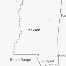
Mississippi
| Local Time | Report Details |
|---|---|
| 4:44 PM CDT | A couple trees were down along hwy 500 between tuscola and lena as well as atkins r in leake county MS, 42.3 miles ENE of Jackson, MS |
South Dakota
| Local Time | Report Details |
|---|---|
| 4:10 PM MDT | Storm damage reported in meade county SD, 17.5 miles NW of Rapid City, SD |
| 4:55 PM MDT | Storm damage reported in meade county SD, 16.2 miles NNW of Rapid City, SD |
| 4:55 PM MDT | Quarter sized hail reported near Piedmont, SD, 13.8 miles NW of Rapid City, SD |
| 4:55 PM MDT | Quarter sized hail reported near Sturgis, SD, 16.2 miles NNW of Rapid City, SD |
| 5:45 PM MDT | Storm damage reported in pennington county SD, 4.2 miles S of Rapid City, SD |
| 5:53 PM MDT | Storm damage reported in pennington county SD, 8.8 miles ESE of Rapid City, SD |
| 6:19 PM MDT | Storm damage reported in pennington county SD, 32.7 miles E of Rapid City, SD |
| 6:36 PM MDT | Measured at the wasta rwis in pennington county SD, 36.9 miles E of Rapid City, SD |
| 6:37 PM MDT | Storm damage reported in pennington county SD, 38.9 miles E of Rapid City, SD |
| 7:00 PM MDT | Storm damage reported in pennington county SD, 49.8 miles E of Rapid City, SD |
| 7:20 PM MDT | Storm damage reported in pennington county SD, 51.3 miles ESE of Rapid City, SD |
Oklahoma
| Local Time | Report Details |
|---|---|
| 5:45 PM CDT | Storm damage reported in murray county OK, 48.5 miles WNW of Atoka, OK |
Nebraska
| Local Time | Report Details |
|---|---|
| 6:47 PM MDT | Storm damage reported in scotts bluff county NE, 0.6 miles NNE of Scottsbluff, NE |
Wyoming
| Local Time | Report Details |
|---|---|
| 8:35 PM MDT | Storm damage reported in hot springs county WY, 44.5 miles N of Riverton, WY |
| 8:35 PM MDT | Hot springs state park. tree uprooted. tore off a number of cottonwood tree branche in hot springs county WY, 44.1 miles NNE of Riverton, WY |
Connect with Interactive Hail Maps