

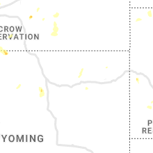
Hail Map for Wednesday, July 6, 2022

Number of Impacted Households on 7/6/2022
0
Impacted by 1" or Larger Hail
0
Impacted by 1.75" or Larger Hail
0
Impacted by 2.5" or Larger Hail
Square Miles of Populated Area Impacted on 7/6/2022
0
Impacted by 1" or Larger Hail
0
Impacted by 1.75" or Larger Hail
0
Impacted by 2.5" or Larger Hail


Cities Most Affected by Hail Storms of 7/6/2022
| Hail Size | Demographics of Zip Codes Affected | ||||||
|---|---|---|---|---|---|---|---|
| City | Count | Average | Largest | Pop Density | House Value | Income | Age |
| Zortman, MT | 4 | 2.25 | 2.75 | 0 | $98k | $22.1k | 56.2 |
| Albert, KS | 2 | 2.50 | 2.50 | 2 | $44k | $37.1k | 50.2 |
| Havre, MT | 2 | 2.25 | 2.50 | 9 | $84k | $30.8k | 35.8 |
| Hays, MT | 2 | 2.13 | 2.50 | 0 | $52k | $20.4k | 26.4 |
| Wolf Point, MT | 2 | 1.88 | 2.00 | 2 | $52k | $27.0k | 33.4 |
| La Crosse, KS | 2 | 1.75 | 1.75 | 8 | $41k | $31.5k | 47.7 |
| Moore, MT | 1 | 2.50 | 2.50 | 1 | $60k | $31.1k | 46.0 |
| Moccasin, MT | 1 | 2.00 | 2.00 | 1 | $45k | $28.1k | 52.3 |
| Connellys Springs, NC | 1 | 1.75 | 1.75 | 117 | $82k | $37.4k | 40.4 |
| Jetmore, KS | 1 | 1.75 | 1.75 | 2 | $48k | $34.5k | 43.8 |
| Box Elder, MT | 1 | 1.75 | 1.75 | 6 | $36k | $23.6k | 22.9 |
| Hobson, MT | 1 | 1.75 | 1.75 | 1 | $65k | $31.4k | 49.0 |
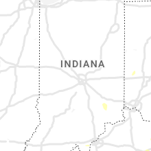
Hail and Wind Damage Spotted on 7/6/2022
Filter by Report Type:Hail ReportsWind Reports
States Impacted
Indiana, Ohio, Kentucky, Tennessee, North Carolina, Virginia, Montana, West Virginia, Colorado, South Carolina, Oklahoma, Kansas, Wyoming, Texas, Idaho, MarylandIndiana
| Local Time | Report Details |
|---|---|
| 8:22 AM EDT | Several small tree branches and one larger limb of estimated 12 inches in diameter down on buckeye roa in st. joseph county IN, 66.7 miles NW of Fort Wayne, IN |
| 1:15 PM EDT | Rush county em reports trees down at intersection of 725 w and 1000 in rush county IN, 30.4 miles E of Indianapolis, IN |
| 1:15 PM EDT | Decatur county emergency management reports trees down at 700w and state road 4 in decatur county IN, 43.2 miles SE of Indianapolis, IN |
| 1:45 PM EDT | Fallen trees in ripley county IN, 44.9 miles W of Cincinnati, OH |
| 1:49 PM EDT | Vehicle damage from debris reported in ripley county IN, 42.2 miles W of Cincinnati, OH |
| 2:15 PM EDT | Trees down in dearborn county IN, 27.3 miles W of Cincinnati, OH |
| 2:29 PM EDT | Trees down in dearborn county IN, 21.5 miles W of Cincinnati, OH |
| 2:53 PM EDT | Multiple trees uprooted and powerlines down in scottsburg... i in scott county IN, 48.5 miles N of Louisville, KY |
| 3:14 PM EDT | Reports of trees and powerlines down along hwy 6 in harrison county IN, 25.1 miles NW of Louisville, KY |
| 3:14 PM EDT | Tree down on a house on hertzsch rd in jeffersonville. numerous other reports of trees and powerlines down in clark count in clark county IN, 20.8 miles N of Louisville, KY |
| 3:37 PM EDT | Reports of trees and powerlines down along doolittle hill rd in elizabeth... i in harrison county IN, 16.6 miles WNW of Louisville, KY |
| 5:35 PM EDT | Winds downed one tree of unknown size and health at 1529 south old us highway 27. time estimated by rada in randolph county IN, 64.2 miles S of Fort Wayne, IN |
Ohio
| Local Time | Report Details |
|---|---|
| 12:33 PM EDT | Medium-sized branches fell. photo submitted to media. time estimated from rada in montgomery county OH, 53 miles N of Cincinnati, OH |
| 12:43 PM EDT | Tree down near carillon and s patterson in montgomery county OH, 46 miles NNE of Cincinnati, OH |
| 1:34 PM EDT | Quarter sized hail reported near Londonderry, OH, 47.1 miles SSE of Columbus, OH, large limbs also observed down. time estimated from radar. |
| 2:15 PM EDT | Large tree down in clermont county OH, 17.5 miles E of Cincinnati, OH |
| 2:48 PM EDT | Large tree down on roe stree in hamilton county OH, 7.2 miles ENE of Cincinnati, OH |
| 2:51 PM EDT | Storm damage reported in hamilton county OH, 4.6 miles E of Cincinnati, OH |
| 2:57 PM EDT | Roof shingles blown off house on glencrest lane. time estimated from rada in clermont county OH, 15.2 miles NE of Cincinnati, OH |
| 2:58 PM EDT | Numerous trees down falling on homes/ fences. several trees uprooted. others snapped at trun in clermont county OH, 16.1 miles ENE of Cincinnati, OH |
| 2:58 PM EDT | Large tree down in hamilton county OH, 10 miles E of Cincinnati, OH |
| 3:00 PM EDT | Siding of upper level of house ripped off exposing interior room. numerous trees and large limbs dow in clermont county OH, 15.8 miles ENE of Cincinnati, OH |
| 3:00 PM EDT | Large tree down into a home... causing significant roof damage in clermont county OH, 16.2 miles ENE of Cincinnati, OH |
| 3:02 PM EDT | Eight mature trees down near stoker cour in clermont county OH, 16.7 miles ENE of Cincinnati, OH |
| 3:07 PM EDT | Likely tornado hit near goshen township fire station. time estimated from rada in clermont county OH, 20.4 miles ENE of Cincinnati, OH |
| 3:20 PM EDT | Trees down and shingles blown off roof in brown county OH, 27.5 miles E of Cincinnati, OH |
| 3:34 PM EDT | Window shutters blown off house. time estimated from rada in brown county OH, 35.3 miles ESE of Cincinnati, OH |
| 3:39 PM EDT | Roof blown off house. time estimated from rada in highland county OH, 38.6 miles ENE of Cincinnati, OH |
| 4:04 PM EDT | Pole snapped in half - wires on roadway. time estimated from rada in adams county OH, 55.8 miles ESE of Cincinnati, OH |
| 4:06 PM EDT | Tree fell into power lines. time estimated from rada in adams county OH, 57.4 miles ESE of Cincinnati, OH |
| 4:28 PM EDT | Multiple trees down in scioto county OH, 72.8 miles ESE of Cincinnati, OH |
| 4:51 PM EDT | Multiple trees down in scioto county OH, 74.9 miles WNW of Charleston, WV |
| 5:18 PM EDT | Tree down at kitts hil in lawrence county OH, 53 miles WNW of Charleston, WV |
| 5:29 PM EDT | Tree down at south poin in lawrence county OH, 51.3 miles W of Charleston, WV |
Kentucky
| Local Time | Report Details |
|---|---|
| 12:58 PM EDT | Tree reported down at the corner of spout springs road and hardwicks creek road. time estimated via rada in powell county KY, 8.8 miles NNE of Irvine, KY |
| 1:30 PM EDT | Tree reported down across red lick rd. at the intersection of murphys flat r in estill county KY, 4.9 miles S of Irvine, KY |
| 1:43 PM EDT | Large limbs (greater than 3 in) down in neighbors yar in floyd county KY, 61.7 miles E of Irvine, KY |
| 2:31 PM EDT | Storm damage reported in boone county KY, 9.2 miles WSW of Cincinnati, OH |
| 2:38 PM EDT | Parts of roofing blown off of home in kenton county KY, 3.5 miles WSW of Cincinnati, OH |
| 2:40 PM EDT | Branches down on ky-8. time estimated from rada in hamilton county OH, 4.4 miles WSW of Cincinnati, OH |
| 2:40 PM EDT | Branches down on ky-8. time estimated from rada in kenton county KY, 4 miles WSW of Cincinnati, OH |
| 2:45 PM EDT | Numerous trees down. time estimated from rada in campbell county KY, 4.8 miles SSE of Cincinnati, OH |
| 2:50 PM EDT | Several downed trees blocking roads w of bromley in kenton county KY, 4 miles WSW of Cincinnati, OH |
| 3:10 PM EDT | Multiple reports of trees and powerlines down around downtown louisville including 18th & market and 8th & broadwa in jefferson county KY, 19.1 miles N of Louisville, KY |
| 3:12 PM EDT | Multiple reports of trees and powerlines down around downtown louisville including 600 block of e kentucky street... 1300 block of washington street... and the 200 bloc in jefferson county KY, 17.4 miles N of Louisville, KY |
| 3:29 PM EDT | Reports of powerline down on 1800 block of landing r in oldham county KY, 30.4 miles N of Louisville, KY |
| 3:33 PM EDT | Reports of trees and powerlines down on 8000 block of todds point roa in oldham county KY, 26.3 miles NE of Louisville, KY |
| 3:37 PM EDT | Tree down on west moody lane and elder park r in oldham county KY, 31.5 miles NNE of Louisville, KY |
| 3:47 PM EDT | Powerlines down around 7500 arnoldtown roa in jefferson county KY, 11.9 miles NNW of Louisville, KY |
| 2:49 PM CDT | Reports of multiple trees down along with power outages near stephensport and union star... k in breckinridge county KY, 41.9 miles W of Louisville, KY |
| 3:49 PM EDT | Trees and power lines down in eminence... kentuck in henry county KY, 39.8 miles NE of Louisville, KY |
| 3:59 PM EDT | Numerous reports of trees down across northern portions of the county. community of hillview and east of there hardest hit with trees and powerlines dow in bullitt county KY, 6.7 miles NNE of Louisville, KY |
| 4:02 PM EDT | Power poles blown down at the intersection of beechwood avenue and plainview avenue in shelbyville. time estimated from rada in shelby county KY, 30.6 miles ENE of Louisville, KY |
| 4:08 PM EDT | Trees down at the intersection of harley-thompson road and benson pike. time estimated from rada in shelby county KY, 37.7 miles ENE of Louisville, KY |
| 4:10 PM EDT | Trees down at the intersection of benson pike and elmburg road. time estimated from rada in shelby county KY, 39 miles ENE of Louisville, KY |
| 4:24 PM EDT | Report of trees down along evergreen rd at the 3600 block and at bridgeport r in franklin county KY, 45.1 miles ENE of Louisville, KY |
| 4:26 PM EDT | Tree blown over along stonetown road. nearby weather station observed 48 mph wind gust. time estimated from rada in scott county KY, 55.3 miles NW of Irvine, KY |
| 4:30 PM EDT | Tree branches greater than 1 foot in diameter were blown down. time estimated from rada in scott county KY, 50.8 miles NW of Irvine, KY |
| 4:31 PM EDT | Reports of trees down on the 200 block of e eagle driv in woodford county KY, 48.1 miles WNW of Irvine, KY |
| 4:33 PM EDT | Trees down across evergreen road near bridgeport road. time estimated from rada in franklin county KY, 43.5 miles ENE of Louisville, KY |
| 4:34 PM EDT | Multiple trees down between garrison and black oak in lewis county KY, 75 miles NNE of Irvine, KY |
| 4:40 PM EDT | Trees reported down as well as a transformer blown along mt. caramel rd in downtown flemingsbur in fleming county KY, 52.1 miles NNE of Irvine, KY |
| 4:40 PM EDT | Report of a few trees down along west water street near downtown flemingsbur in fleming county KY, 51.3 miles NNE of Irvine, KY |
| 4:42 PM EDT | Reports of trees down along leitchfield rd in cecilia... k in hardin county KY, 25.7 miles SSW of Louisville, KY |
| 4:42 PM EDT | Trees down and large branches broken off in the masterson station are in fayette county KY, 41.4 miles NW of Irvine, KY |
| 4:44 PM EDT | The facade of a building in downtown georgetown collapsed. time estimated from rada in scott county KY, 47.5 miles NW of Irvine, KY |
| 4:47 PM EDT | Tree and power lines down on hamilton par in fayette county KY, 39.2 miles NW of Irvine, KY |
| 4:49 PM EDT | Trees down at the intersection of bryan station road and hume road. time estimated from rada in fayette county KY, 36 miles NW of Irvine, KY |
| 5:01 PM EDT | Widespread reports of trees down across the county. locations include winchester... kentuck in clark county KY, 23.8 miles NNW of Irvine, KY |
| 5:05 PM EDT | Two trees down along highway 421 near the jackson county water compan in jackson county KY, 22.3 miles S of Irvine, KY |
| 5:10 PM EDT | Trees down along highway 68 near the jessamine county line. trees also down in other parts of the count in mercer county KY, 41.2 miles WNW of Irvine, KY |
| 5:18 PM EDT | Trees and power lines down at flatwood in greenup county KY, 67.6 miles WNW of Charleston, WV |
| 4:22 PM CDT | Metal structure sustained damage from severe thunderstorm winds off of anneta roa in grayson county KY, 51.1 miles SW of Louisville, KY |
| 5:25 PM EDT | Multiple trees down along kentucky hwy 1050. time estimated by rada in montgomery county KY, 19.2 miles NNE of Irvine, KY |
| 5:25 PM EDT | Multiple trees down along hwy 599. time estimated by rada in montgomery county KY, 17.9 miles NNE of Irvine, KY |
| 5:29 PM EDT | Multiple trees and powerlines down at summit in boyd county KY, 57.9 miles W of Charleston, WV |
| 5:30 PM EDT | Multiple trees down in the means area. time estimated by rada in menifee county KY, 20.9 miles NE of Irvine, KY |
| 5:35 PM EDT | Tree down on hwy 82. time estimated by rada in estill county KY, 7.6 miles N of Irvine, KY |
| 5:37 PM EDT | Tree down on a house on fallen timber branch rd. time estimated by rada in menifee county KY, 20.2 miles NE of Irvine, KY |
| 5:45 PM EDT | Large tree limb fell on a power line on white oak rd. time estimated by rada in estill county KY, 2.1 miles N of Irvine, KY |
| 6:05 PM EDT | Report of a tree down on ky 1036 near mm 1. time estimated from rada in lee county KY, 11.9 miles E of Irvine, KY |
| 6:08 PM EDT | Trees down along goshen road outside of stanford... kentuck in lincoln county KY, 35.6 miles WSW of Irvine, KY |
| 6:10 PM CDT | Trees down along highway 55 near mills road intersectio in russell county KY, 77.8 miles SSE of Louisville, KY |
| 7:55 PM EDT | Multiple trees down in the isom are in letcher county KY, 55.4 miles NW of Bristol, TN |
Tennessee
| Local Time | Report Details |
|---|---|
| 2:39 PM EDT | Trees down at big ridge state park. time estimate in union county TN, 19.3 miles N of Knoxville, TN |
| 3:05 PM EDT | Trees down in maynardville and luttrell areas. time estimated from rada in union county TN, 20.9 miles NNE of Knoxville, TN |
| 3:05 PM EDT | Several trees dow in claiborne county TN, 43.1 miles NNE of Knoxville, TN |
| 4:00 PM EDT | Trees down along big hill road in mooresbur in hawkins county TN, 47 miles NE of Knoxville, TN |
| 4:02 PM EDT | Trees down on galbraith springs roa in hawkins county TN, 49.7 miles NE of Knoxville, TN |
| 3:14 PM CDT | Multiple trees reported down in the area off highway 70 on shady lan in putnam county TN, 73.5 miles N of Chattanooga, TN |
| 5:15 PM EDT | Tree down on hwy 27 north of sunbright. time estimate in morgan county TN, 46.4 miles WNW of Knoxville, TN |
| 5:28 PM EDT | Tree down on rome road. time and location estimate in morgan county TN, 46.5 miles WNW of Knoxville, TN |
| 5:40 PM EDT | Tree down at morgan county fairgrounds. time estimate in morgan county TN, 43.1 miles WNW of Knoxville, TN |
| 6:25 PM EDT | Several trees down along post oak valley road in rockwood. time estimate in roane county TN, 40.9 miles W of Knoxville, TN |
| 6:30 PM EDT | Trees down along roane state highway and east to kingston. more trees down in southern part of county as well. time estimate in roane county TN, 37.5 miles W of Knoxville, TN |
| 7:45 PM EDT | Trees down in coker creek. also in other locations across the southern and southeast parts of the count in monroe county TN, 52.6 miles SSW of Knoxville, TN |
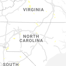
North Carolina
| Local Time | Report Details |
|---|---|
| 2:55 PM EDT | Trees down in bethlehem and along the lake near hwy 16 in alexander county NC, 47.3 miles NNW of Charlotte, NC |
| 3:00 PM EDT | Significant roof damage at a hosiery mill on claude brittain rd in hildebra in burke county NC, 47.5 miles NW of Charlotte, NC |
| 3:05 PM EDT | Public reported trees down with one on trailer... roof ripped off house... destroyed barn from a likely microburst on buzz lowman st in burke county NC, 48 miles NW of Charlotte, NC |
| 3:21 PM EDT | Numerous trees down with a few on homes on old laurel roa in burke county NC, 48.5 miles NW of Charlotte, NC |
| 3:21 PM EDT | Golf Ball sized hail reported near Connellys Springs, NC, 48.5 miles NW of Charlotte, NC, report of golf ball sized hail. |
| 3:40 PM EDT | Amateur radio reported large trees down on hwy 18 in burke county NC, 47.2 miles NW of Charlotte, NC |
| 4:00 PM EDT | Several trees down in the town of yadkinvill in yadkin county NC, 64 miles N of Charlotte, NC |
| 4:12 PM EDT | 911 call center reported large trees blocking roadway and damaged a bridge on houser farm rd in lincoln county NC, 38.5 miles WNW of Charlotte, NC |
| 4:30 PM EDT | 911 call center reported trees and powerlines down on woodrow hoyle rd in cleveland county NC, 46.2 miles WNW of Charlotte, NC |
| 4:32 PM EDT | 911 call center reported a large tree blocking roadway on bess chapel church rd in lincoln county NC, 36.9 miles WNW of Charlotte, NC |
| 4:45 PM EDT | 911 call center reported trees down on shuford lake rd in cleveland county NC, 45.2 miles WNW of Charlotte, NC |
| 5:00 PM EDT | 911 call center reported numerous trees down in hendersonville in henderson county NC, 34.6 miles NNE of Greenville, SC |
| 5:05 PM EDT | Tree down on thomasville road. time estimated by rada in davidson county NC, 66.9 miles NE of Charlotte, NC |
| 5:10 PM EDT | 911 call center reported trees down on tobe bridge rd in cleveland county NC, 33.9 miles WNW of Charlotte, NC |
| 5:12 PM EDT | 911 call center reported trees down on elk mountain scenic hwy in buncombe county NC, 55.9 miles N of Greenville, SC |
| 5:14 PM EDT | Power outage was caused by fallen trees damaging equipmen in guilford county NC, 65.7 miles W of Raleigh, NC |
| 5:15 PM EDT | 911 call center reported numerous trees down and powerlines down on oak grove and bethlehem rd in cleveland county NC, 29.7 miles W of Charlotte, NC |
| 5:16 PM EDT | One tree down along curry road. time estimated by rada in davidson county NC, 69 miles NE of Charlotte, NC |
| 5:30 PM EDT | Numerous large limbs and a few trees down near trinity elementary and trinity high school in randolph county NC, 66.3 miles NE of Charlotte, NC |
| 5:35 PM EDT | 911 call center reported trees down on el bethel rd in cleveland county NC, 31.8 miles W of Charlotte, NC |
| 5:48 PM EDT | 911 call center reported trees down on structure on w 5th ave in gaston county NC, 20.1 miles W of Charlotte, NC |
| 5:55 PM EDT | Tree down on green acres roa in wilkes county NC, 62.1 miles ESE of Bristol, TN |
| 5:55 PM EDT | Tree down on yellow banks roa in wilkes county NC, 64.7 miles ESE of Bristol, TN |
| 5:55 PM EDT | Tree down on red top roa in wilkes county NC, 58.6 miles ESE of Bristol, TN |
| 5:55 PM EDT | Tree down on north marley ford roa in wilkes county NC, 60.3 miles ESE of Bristol, TN |
| 6:00 PM EDT | Tree down on traphill roa in wilkes county NC, 66.1 miles ESE of Bristol, TN |
| 6:00 PM EDT | Fallen trees or limbs damaged equipment and resulted in power outage. time estimated by rada in randolph county NC, 62.6 miles W of Raleigh, NC |
| 6:45 PM EDT | Power outage was caused by fallen trees damaging equipmen in wake county NC, 9.2 miles ENE of Raleigh, NC |
| 6:59 PM EDT | Trees dow in wake county NC, 9.7 miles ENE of Raleigh, NC |
| 6:59 PM EDT | Minor structural damage to house along buffalo r in wake county NC, 9.4 miles ENE of Raleigh, NC |
| 7:00 PM EDT | Video shared showing a tree down on a home along jackson oaks ct. time estimated by rada in wake county NC, 10 miles ENE of Raleigh, NC |
| 7:14 PM EDT | Multiple trees dow in person county NC, 44 miles NW of Raleigh, NC |
| 7:15 PM EDT | Trees dow in wake county NC, 9.7 miles ENE of Raleigh, NC |
| 7:27 PM EDT | Multiple reports came into the call center of down trees and powerlines around the hurdle mills area. time estimated by rada in person county NC, 40.5 miles NW of Raleigh, NC |
| 7:30 PM EDT | Tree down around the area of middlesex. time estimated by rada in nash county NC, 24.9 miles E of Raleigh, NC |
| 7:42 PM EDT | Trees blown down off spring meadow lane in monro in union county NC, 23.3 miles SE of Charlotte, NC |
| 7:46 PM EDT | Tree and powerlines down in the bailey area along pine st. time estimated by rada in nash county NC, 29.9 miles E of Raleigh, NC |
| 7:56 PM EDT | Trees down. time estimated by rada in wake county NC, 9.7 miles ENE of Raleigh, NC |
| 8:11 PM EDT | Trees down in paynes taver in person county NC, 45.4 miles NNW of Raleigh, NC |
| 8:16 PM EDT | Trees down. time estimated by rada in wake county NC, 9.2 miles ENE of Raleigh, NC |
| 8:20 PM EDT | Fallen trees or limbs damaged equipment and resulted in power outage. time estimated by rada in franklin county NC, 39 miles NE of Raleigh, NC |
| 9:07 PM EDT | Trees down northwest of warrenton along ridgway-warrenton road. time estimated by rada in warren county NC, 50.2 miles NNE of Raleigh, NC |
| 9:18 PM EDT | Reports of trees down along macon-embro road in macon... nc. time estimated by rada in warren county NC, 55 miles NE of Raleigh, NC |
| 9:25 PM EDT | Tree down west of littleto in warren county NC, 58.6 miles NE of Raleigh, NC |
| 9:30 PM EDT | Dispatch reported trees down and cars driving into fallen trees near oak cit in martin county NC, 76.3 miles E of Raleigh, NC |
| 9:54 PM EDT | Tree down in the micro... nc area. time estimated by rada in johnston county NC, 28.9 miles ESE of Raleigh, NC |
| 9:55 PM EDT | Tree down on brantley road. time estimated by rada in nash county NC, 22.9 miles E of Raleigh, NC |
| 10:10 PM EDT | Fallen trees or limbs damaged equipment and resulted in power outage. time estimated by rada in nash county NC, 29.4 miles E of Raleigh, NC |
| 10:10 PM EDT | Tree down on edwards road. time estimated by rada in johnston county NC, 35.7 miles SE of Raleigh, NC |
| 10:30 PM EDT | Spotter reported trees down and shingles blown off a roof. report relayed via nws wilmingto in greene county NC, 59.4 miles ESE of Raleigh, NC |
| 10:40 PM EDT | Tree down near intersection of hwy 82 and w thornton rd. time estimated by rada in harnett county NC, 36.3 miles S of Raleigh, NC |
| 10:41 PM EDT | Tree down along burnett road. time estimated by rada in cumberland county NC, 37 miles S of Raleigh, NC |
| 10:42 PM EDT | Tree down along julian road. time estimated by rada in cumberland county NC, 37.6 miles S of Raleigh, NC |
| 10:43 PM EDT | Tree down near the intersection of norris rd and burnett rd. time estimated by rada in cumberland county NC, 37.7 miles S of Raleigh, NC |
| 10:43 PM EDT | Tree down along dunn road. time estimated by rada in cumberland county NC, 37.6 miles S of Raleigh, NC |
| 10:45 PM EDT | Multiple reports of trees down in the godwin falcon area. time estimated by rada in cumberland county NC, 39 miles S of Raleigh, NC |
| 11:22 PM EDT | Utiliy company reports multiple outages in the dover are in craven county NC, 75.5 miles NNE of Wilmington, NC |
| 11:30 PM EDT | Tree down near massey road producing a power outage. time estimated by rada in wayne county NC, 48 miles SE of Raleigh, NC |
| 11:35 PM EDT | Tree down near country club road. time estimated by rada in wayne county NC, 49.9 miles SE of Raleigh, NC |
| 11:50 PM EDT | Utility company reports multiple power outages in an area northwest of new ber in craven county NC, 79.2 miles NE of Wilmington, NC |
| 12:09 AM EDT | Multiple power outages reported along strawberry branch r in lenoir county NC, 71.2 miles NNE of Wilmington, NC |
Virginia
| Local Time | Report Details |
|---|---|
| 3:06 PM EDT | Multiple trees down in the pound are in wise county VA, 42 miles NNW of Bristol, TN |
| 3:49 PM EDT | Siding torn off the side of a home in churchvill in augusta county VA, 60.5 miles SE of Elkins, WV |
| 3:51 PM EDT | Tree down on a car on churchville avenue near intersection with eastwood driv in augusta county VA, 62.1 miles SE of Elkins, WV |
| 3:59 PM EDT | Tree down on a car on devon roa in augusta county VA, 66.4 miles SE of Elkins, WV |
| 4:02 PM EDT | Multiple trees down and power lines down on aiken street in staunto in augusta county VA, 66.5 miles SE of Elkins, WV |
| 4:06 PM EDT | Several reports of trees down throughout the city of staunto in augusta county VA, 67.7 miles SE of Elkins, WV |
| 4:09 PM EDT | Multiple trees down in 100 block of first stree in augusta county VA, 69.5 miles SE of Elkins, WV |
| 4:16 PM EDT | Several large limbs down along clearfork roa in tazewell county VA, 59.2 miles NE of Bristol, TN |
| 4:27 PM EDT | Several reports of trees down across eastern augusta count in augusta county VA, 74 miles SE of Elkins, WV |
| 4:30 PM EDT | Corrects previous non-tstm wnd dmg report from 2 wsw fairfield. several trees down along the interstat in rockbridge county VA, 53.2 miles NE of Roanoke, VA |
| 4:30 PM EDT | Tree down on lyndhurst roa in augusta county VA, 76.3 miles NE of Roanoke, VA |
| 4:55 PM EDT | Trees down on highway 16 outside mario in smyth county VA, 43.5 miles ENE of Bristol, TN |
| 4:55 PM EDT | Corrects previous tstm wnd dmg report from 1 se marion. trees down on highway 16 outside mario in smyth county VA, 44.9 miles ENE of Bristol, TN |
| 4:55 PM EDT | Several trees down on highway 60 wes in amherst county VA, 52.8 miles ENE of Roanoke, VA |
| 5:00 PM EDT | Corrects previous tstm wnd dmg report from 2 se marion. corrects previous tstm wnd dmg report from 1 se marion. trees down on highway 16 outside mario in smyth county VA, 44.9 miles ENE of Bristol, TN |
| 5:20 PM EDT | Numerous power outages and trees down in southern prince george along route 3 in prince george county VA, 36.2 miles SSE of Richmond, VA |
| 5:25 PM EDT | Tree down. time estimate in sussex county VA, 38 miles SSE of Richmond, VA |
| 5:34 PM EDT | Several trees down across southern portions of buckingham county in the toga are in buckingham county VA, 53.8 miles W of Richmond, VA |
| 5:41 PM EDT | Tree down along spring grove roa in appomattox county VA, 57.4 miles E of Roanoke, VA |
| 5:42 PM EDT | Tree down on bent creek roa in appomattox county VA, 57.4 miles E of Roanoke, VA |
| 5:44 PM EDT | Tree down on paradise roa in appomattox county VA, 54.5 miles ENE of Roanoke, VA |
| 5:47 PM EDT | Trees down along route 4 in sussex county VA, 46.7 miles SSE of Richmond, VA |
| 5:55 PM EDT | Multiple trees down along north creek road and oakville roa in appomattox county VA, 59.8 miles E of Roanoke, VA |
| 5:56 PM EDT | Tree down on roadwa in appomattox county VA, 61.5 miles E of Roanoke, VA |
| 6:00 PM EDT | Tree down along prince edward hwy in farmville... va. time estimate in prince edward county VA, 46.4 miles WSW of Richmond, VA |
| 6:00 PM EDT | Multiple power outages reporte in sussex county VA, 51.9 miles SSE of Richmond, VA |
| 6:05 PM EDT | Trees down partially blocking route 4 in cumberland county VA, 41.5 miles WSW of Richmond, VA |
| 6:05 PM EDT | Trees dow in prince edward county VA, 48 miles WSW of Richmond, VA |
| 6:05 PM EDT | Trees dow in prince edward county VA, 52.1 miles WSW of Richmond, VA |
| 6:05 PM EDT | Wire dow in prince edward county VA, 42.5 miles WSW of Richmond, VA |
| 6:10 PM EDT | Tree down. time estimate in prince edward county VA, 44.8 miles WSW of Richmond, VA |
| 6:10 PM EDT | Tree down. time estimate in prince edward county VA, 41.4 miles WSW of Richmond, VA |
| 6:15 PM EDT | Tree down. time estimate in prince edward county VA, 37.1 miles WSW of Richmond, VA |
| 6:20 PM EDT | Wires down. time estimate in prince edward county VA, 42.5 miles WSW of Richmond, VA |
| 6:25 PM EDT | Tree down. time estimate in prince edward county VA, 35 miles WSW of Richmond, VA |
| 6:26 PM EDT | Trees and power lines dow in southampton county VA, 55.8 miles SSE of Richmond, VA |
| 6:30 PM EDT | Wires dow in prince edward county VA, 49.4 miles WSW of Richmond, VA |
| 6:30 PM EDT | Trees down on route 628 near burkevill in nottoway county VA, 36.8 miles SW of Richmond, VA |
| 6:41 PM EDT | Trees down on route 609 near capro in southampton county VA, 60.1 miles SSE of Richmond, VA |
| 6:43 PM EDT | Trees down route 607 near old courthouse r in amelia county VA, 25.5 miles SW of Richmond, VA |
| 6:43 PM EDT | Trees down on burkeville r in lunenburg county VA, 42.5 miles SW of Richmond, VA |
| 6:45 PM EDT | Numerous trees down in pheni in charlotte county VA, 66.9 miles E of Roanoke, VA |
| 6:49 PM EDT | Numerous trees down across the county. vdot and law enforcement working several road closures due to downed tree in nottoway county VA, 34.7 miles SW of Richmond, VA |
| 6:54 PM EDT | Trees down on scuffletown road. time estimated by rada in charlotte county VA, 66.7 miles WSW of Richmond, VA |
| 6:56 PM EDT | Trees down on cub creek church road. time estimated by rada in charlotte county VA, 67.7 miles WSW of Richmond, VA |
| 7:05 PM EDT | Two trees down on south lee highway near high bridge church roa in rockbridge county VA, 31.7 miles NE of Roanoke, VA |
| 7:09 PM EDT | Several trees down in charlotte courthous in charlotte county VA, 62.3 miles WSW of Richmond, VA |
| 7:25 PM EDT | Couple of trees down in sax in charlotte county VA, 68.3 miles SW of Richmond, VA |
| 7:58 PM EDT | Trees down on river road. time estimated by rada in halifax county VA, 66.5 miles NNW of Raleigh, NC |
| 8:00 PM EDT | Trees down along berry hill road. time estimated by rada in halifax county VA, 65.7 miles NNW of Raleigh, NC |
| 8:10 PM EDT | Power lines down east of chase cit in mecklenburg county VA, 62.5 miles SW of Richmond, VA |
| 8:11 PM EDT | Multiple trees and power lines down due to thunderstorm winds in the cluster springs area of halifax count in halifax county VA, 60.1 miles NNW of Raleigh, NC |
| 12:35 AM EDT | Several trees... wires... and poles blew down near the intersection of va-642 hoadly road and purcell roa in prince william county VA, 60.4 miles SW of Baltimore, MD |
| 12:40 AM EDT | There was about half a dozen reports of trees blown down between hoadley and bethe in prince william county VA, 57.6 miles SW of Baltimore, MD |
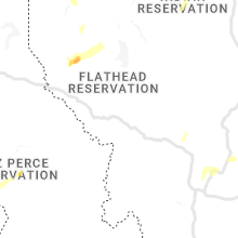
Montana
| Local Time | Report Details |
|---|---|
| 1:15 PM MDT | Quarter sized hail reported near Stanford, MT, 54.7 miles ESE of Great Falls, MT |
| 3:30 PM MDT | Quarter sized hail reported near Culbertson, MT, 41.8 miles W of Williston, ND, report relayed via twitter. |
| 3:45 PM MDT | Quarter sized hail reported near Frazer, MT, 28.8 miles ENE of Glasgow, MT, report relayed via facebook. |
| 3:50 PM MDT | Quarter sized hail reported near Frazer, MT, 31.7 miles E of Glasgow, MT, mainly nickels with quarter-sized hail mixed in. |
| 3:50 PM MDT | Spotter estimated 50-60mph gus in valley county MT, 31.7 miles E of Glasgow, MT |
| 4:04 PM MDT | Half Dollar sized hail reported near Loma, MT, 45.5 miles SW of Havre, MT, updates previous hail report for virgelle. spotter submitted additional photos of various sizes of hail. a few stones may be closer to 1.5 inches. |
| 4:30 PM MDT | Golf Ball sized hail reported near Wolf Point, MT, 46.7 miles E of Glasgow, MT, relayed via facebook. |
| 4:35 PM MDT | Half Dollar sized hail reported near Frazer, MT, 35.4 miles E of Glasgow, MT, relayed via facebook as a silver dollar-sized hail. |
| 4:40 PM MDT | Quarter sized hail reported near Wolf Point, MT, 46.7 miles E of Glasgow, MT, relayed via facebook. |
| 4:40 PM MDT | Golf Ball sized hail reported near Hays, MT, 59.6 miles SE of Havre, MT, reported half inch to golfball sized hail. mostly just heavy rainfall right now and calm winds. |
| 4:43 PM MDT | Relayed via facebook. also reported nickel-sized hai in roosevelt county MT, 46.7 miles E of Glasgow, MT |
| 4:45 PM MDT | Quarter sized hail reported near Wolf Point, MT, 47.1 miles E of Glasgow, MT, relayed via facebook. |
| 4:45 PM MDT | Half Dollar sized hail reported near Wolf Point, MT, 46.7 miles E of Glasgow, MT, relayed via facebook. |
| 4:50 PM MDT | Golf Ball sized hail reported near Hobson, MT, 76.1 miles ESE of Great Falls, MT, hail up to golf ball size falling in hobson. |
| 4:50 PM MDT | Hen Egg sized hail reported near Wolf Point, MT, 47.7 miles ESE of Glasgow, MT |
| 4:52 PM MDT | Golf Ball sized hail reported near Box Elder, MT, 22.4 miles SW of Havre, MT, reported mostly quarter-sized hail with some golf-ball sized. also reported 0.80 inch precipitation over 30 minutes. time estimated by radar. |
| 5:02 PM MDT | Tennis Ball sized hail reported near Moore, MT, 80.2 miles ESE of Great Falls, MT, pictures submitted via social media of very large hail near moore. |
| 5:09 PM MDT | Ping Pong Ball sized hail reported near Wolf Point, MT, 54.7 miles ESE of Glasgow, MT, relayed via facebook. |
| 5:12 PM MDT | Tennis Ball sized hail reported near Hays, MT, 61.3 miles SE of Havre, MT, pictures relayed via social media of very large hail near hays. time of event from radar. |
| 5:28 PM MDT | Ping Pong Ball sized hail reported near Havre, MT, 5 miles W of Havre, MT, pictures submitted of hail measured with ruler. spotter also reported 45 mph wind gusts. |
| 5:35 PM MDT | Golf Ball sized hail reported near Zortman, MT, 68.8 miles SE of Havre, MT, corrects incorrect time from previous hail report from zortman. |
| 5:35 PM MDT | Half Dollar sized hail reported near Moore, MT, 84.6 miles ESE of Great Falls, MT, pictures submitted of hail in moore. |
| 5:35 PM MDT | Hen Egg sized hail reported near Havre, MT, 4.5 miles W of Havre, MT, hail around egg size falling west of havre. |
| 5:35 PM MDT | Half Dollar sized hail reported near Vida, MT, 61.7 miles ESE of Glasgow, MT |
| 5:35 PM MDT | Baseball sized hail reported near Zortman, MT, 68.5 miles SE of Havre, MT, corrects timing from the previous hail report from zortman... due to connection issues. relayed via facebook. |
| 5:36 PM MDT | Ping Pong Ball sized hail reported near Zortman, MT, 68.8 miles SE of Havre, MT, corrects incorrect time from previous hail report from zortman. also reported 0.43 in of rain in 15 min. |
| 5:37 PM MDT | Tennis Ball sized hail reported near Havre, MT, 8.2 miles W of Havre, MT, hail up to tennis ball size. time estimated. |
| 5:52 PM MDT | Hen Egg sized hail reported near Moccasin, MT, 75.3 miles ESE of Great Falls, MT, pictures submitted via social media of golf ball to egg size hail near moccasin. |
| 6:30 PM MDT | Quarter sized hail reported near Ledger, MT, 55.5 miles NNW of Great Falls, MT, reported 1 inch hail over a 30 minute period. |
| 6:34 PM MDT | Golf Ball sized hail reported near Zortman, MT, 68.8 miles SE of Havre, MT |
| 6:36 PM MDT | Ping Pong Ball sized hail reported near Zortman, MT, 68.8 miles SE of Havre, MT, also reported 0.43 in of rain in 15 min. |
| 7:01 PM MDT | Quarter sized hail reported near Jordan, MT, 35.7 miles SSE of Glasgow, MT, also reported 1 in of rainfall in 15 min. |
| 7:13 PM MDT | Quarter sized hail reported near Roundup, MT, 55.7 miles N of Billings, MT, report of dime to quarter size hail via social media. |
| 7:30 PM MDT | Observed via raws sit in valley county MT, 32.6 miles SSW of Glasgow, MT |
| 7:36 PM MDT | Relayed via facebook. 1.9 in rainfall with pea-sized hai in valley county MT, 15.4 miles SE of Glasgow, MT |
| 7:49 PM MDT | Baseball sized hail reported near Zortman, MT, 68.5 miles SE of Havre, MT, relayed via facebook. |
West Virginia
| Local Time | Report Details |
|---|---|
| 3:54 PM EDT | Tree down between elk river road north and queen road. time estimated by rada in kanawha county WV, 21.2 miles ENE of Charleston, WV |
| 5:13 PM EDT | Trees on powerlines. corrected time from previous ls in putnam county WV, 18.4 miles NW of Charleston, WV |
| 5:30 PM EDT | Tree down at 1596 virginia street eas in kanawha county WV, 1.2 miles SE of Charleston, WV |
| 5:35 PM EDT | Tree reported down in westbound lanes of interstate 64 at mile marker in wayne county WV, 46.9 miles W of Charleston, WV |
| 5:40 PM EDT | Tree down at 19794 maccorkle ave s in kanawha county WV, 13.8 miles SE of Charleston, WV |
| 5:45 PM EDT | Multiple trees dow in kanawha county WV, 9.5 miles WNW of Charleston, WV |
| 5:48 PM EDT | Tree down at 1500 virginia st eas in kanawha county WV, 0.9 miles SE of Charleston, WV |
| 5:54 PM EDT | Power lines down across hamli in lincoln county WV, 25.5 miles W of Charleston, WV |
| 6:06 PM EDT | Tree down at 1588 kilby street charlesto in kanawha county WV, 1.7 miles ESE of Charleston, WV |
| 6:10 PM EDT | Multiple trees down at yawkey. time estimated by rada in lincoln county WV, 19.6 miles WSW of Charleston, WV |
| 7:21 PM EDT | Trees on powerline in putnam county WV, 18.4 miles NW of Charleston, WV |
Colorado
| Local Time | Report Details |
|---|---|
| 2:20 PM MDT | Quarter sized hail reported near Kiowa, CO, 38.5 miles SE of Denver, CO |
| 2:40 PM MDT | Quarter sized hail reported near Kiowa, CO, 34.1 miles ESE of Denver, CO |
| 2:43 PM MDT | Quarter sized hail reported near Kiowa, CO, 33.8 miles ESE of Denver, CO |
| 3:05 PM MDT | Quarter sized hail reported near Hugo, CO, 73.8 miles NE of Pueblo, CO, estimated wind gusts to 60 mph... along with heavy rain along highway 71. |
| 3:15 PM MDT | Quarter sized hail reported near Sedalia, CO, 38.4 miles SSW of Denver, CO |
| 3:28 PM MDT | Quarter sized hail reported near Strasburg, CO, 36.4 miles E of Denver, CO |
| 3:48 PM MDT | Quarter sized hail reported near Strasburg, CO, 36.3 miles E of Denver, CO |
| 4:44 PM MDT | Measured wind gust of 60 mph with thunderstorm in el paso county CO, 43.6 miles N of Pueblo, CO |
| 8:10 PM MDT | Quarter sized hail reported near Rocky Ford, CO, 44.6 miles ESE of Pueblo, CO |
| 8:15 PM MDT | Deputy relayed from state patrol of high winds associated with storm north of kit carson. exact magnitude was unknown at this time. location estimated based on rada in cheyenne county CO, 87.6 miles S of Yuma, CO |
| 8:35 PM MDT | Public report of high winds and heavy rainfall. speed was estimate in cheyenne county CO, 93.7 miles S of Yuma, CO |
| 8:39 PM MDT | Storm damage reported in otero county CO, 61.6 miles ESE of Pueblo, CO |
| 8:51 PM MDT | Storm damage reported in otero county CO, 61.6 miles ESE of Pueblo, CO |
| 10:00 PM MDT | Storm damage reported in prowers county CO, 95.7 miles W of Garden City, KS |
South Carolina
| Local Time | Report Details |
|---|---|
| 5:10 PM EDT | 911 call center reported tree fell down on powerline on village west ct off vanderbilt rd in spartanburg county SC, 36.6 miles ENE of Greenville, SC |
| 6:18 PM EDT | Highway patrol reported a tree blocking the roadway near the intersection of hwy. 178 and hwy. 302 in pelio in lexington county SC, 46.1 miles ENE of Augusta, GA |
| 6:55 PM EDT | 911 call center reported trees and powerlines down on e fairfield rd in greenville county SC, 19.7 miles ENE of Greenville, SC |
| 7:32 PM EDT | Sheriff dispatch reported a tree down near the intersection of seven pines road and pioneer road north of snellin in barnwell county SC, 31.7 miles ESE of Augusta, GA |
| 8:07 PM EDT | Sheriff dispatch reported a tree down along hwy. 102 near the shiloh fish hous in chesterfield county SC, 56.1 miles SE of Charlotte, NC |
| 8:11 PM EDT | Sheriffs dispatch reported a tree down across the old chester road near hwy. 32 in fairfield county SC, 58.5 miles SSW of Charlotte, NC |
| 8:11 PM EDT | Highway patrol reported trees down along hwy. 176 and hwy. 121 near the intersection of both roadways. the trees are blocking the roadwa in newberry county SC, 65.3 miles ESE of Greenville, SC |
| 8:15 PM EDT | Highway patrol reported a downed tree across hwy. 176 near lon stoudemire trai in newberry county SC, 62.5 miles NE of Augusta, GA |
| 8:36 PM EDT | Sheriff dispatch reported at tree down along freeman roa in chesterfield county SC, 53.7 miles ESE of Charlotte, NC |
| 8:43 PM EDT | Highway patrol reported a tree down on i20 at exit 98 westboun in kershaw county SC, 70.4 miles S of Charlotte, NC |
| 8:50 PM EDT | Sheriffs dispatch reported several trees down along hwy. 521 between camden and westvill in kershaw county SC, 60.3 miles SSE of Charlotte, NC |
Oklahoma
| Local Time | Report Details |
|---|---|
| 4:10 PM CDT | Storm damage reported in harper county OK, 39.3 miles NW of Woodward, OK |
Kansas
| Local Time | Report Details |
|---|---|
| 4:30 PM CDT | Golf Ball sized hail reported near La Crosse, KS, 22.9 miles S of Hays, KS |
| 4:33 PM CDT | Golf Ball sized hail reported near La Crosse, KS, 22.9 miles S of Hays, KS, public report was posted on social media via broadcast media. |
| 5:11 PM CDT | Tennis Ball sized hail reported near Albert, KS, 33.3 miles SSE of Hays, KS, delayed report via social media and kwch. |
| 5:19 PM CDT | Tennis Ball sized hail reported near Albert, KS, 33 miles SSE of Hays, KS, estimated size based on image and time based on radar. |
| 5:24 PM CDT | Golf Ball sized hail reported near Jetmore, KS, 53.1 miles E of Garden City, KS, report made via nwschat. |
| 5:29 PM CDT | Storm damage reported in barton county KS, 44.4 miles SE of Hays, KS |
| 5:48 PM CDT | Awos station kgbd great bend municipal airp in barton county KS, 43.8 miles SE of Hays, KS |
| 6:25 PM CDT | Corrects previous tstm wnd dmg report from ellinwood. an observer found multiple 6 to 8 inch tree limbs down and estimated 70 to 80 mph wind in barton county KS, 53.8 miles SE of Hays, KS |
| 6:26 PM CDT | Quarter sized hail reported near Ellinwood, KS, 55.9 miles SE of Hays, KS, spotter estimated quarter sized hail and reported a large tree limb that was down from strong winds. |
| 6:26 PM CDT | Spotter reported 1 inch hail along with a large tree limb that fel in barton county KS, 55.9 miles SE of Hays, KS |
| 6:55 PM CDT | Spotter also reported pea sized hai in rice county KS, 64.2 miles SE of Hays, KS |
| 6:59 PM CDT | Mesonet station qnrk1 staffor in stafford county KS, 68.4 miles SE of Hays, KS |
| 7:27 PM CDT | An observer found multiple 6 to 8 inch tree limbs down and estimated 70 to 80 mph wind in barton county KS, 53.8 miles SE of Hays, KS |
| 8:32 PM CDT | Storm damage reported in lincoln county KS, 66.7 miles E of Hays, KS |
| 8:34 PM CDT | Home weather station measuremen in lincoln county KS, 72.6 miles E of Hays, KS |
Wyoming
| Local Time | Report Details |
|---|---|
| 3:59 PM MDT | Powell awos measured wind gust of 58kts at 215 in park county WY, 64.6 miles SSW of Billings, MT |
Texas
| Local Time | Report Details |
|---|---|
| 6:17 PM CDT | Storm damage reported in hutchinson county TX, 42.2 miles NE of Amarillo, TX |
Idaho
| Local Time | Report Details |
|---|---|
| 7:16 PM PDT | Quarter sized hail reported near Nezperce, ID, 21.8 miles NNW of Grangeville, ID, nickel to quarter size hail remains on the ground about 20 minutes after the storm moved through. time estimated from radar. |
| 7:20 PM PDT | Half Dollar sized hail reported near Nezperce, ID, 21.8 miles NNW of Grangeville, ID, report via social media. time estimated from radar. |
| 7:20 PM PDT | Quarter sized hail reported near Nezperce, ID, 22.4 miles NNW of Grangeville, ID, report and video via social media. time estimated from radar. |
Maryland
| Local Time | Report Details |
|---|---|
| 3:35 AM EDT | Tree blown down across highway 301 closing some of the highway. time estimated from rada in queen anne's county MD, 37.9 miles ESE of Baltimore, MD |
Connect with Interactive Hail Maps