

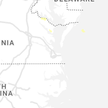
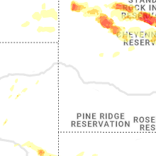
Hail Map for Tuesday, July 5, 2022

Number of Impacted Households on 7/5/2022
0
Impacted by 1" or Larger Hail
0
Impacted by 1.75" or Larger Hail
0
Impacted by 2.5" or Larger Hail
Square Miles of Populated Area Impacted on 7/5/2022
0
Impacted by 1" or Larger Hail
0
Impacted by 1.75" or Larger Hail
0
Impacted by 2.5" or Larger Hail


Cities Most Affected by Hail Storms of 7/5/2022
| Hail Size | Demographics of Zip Codes Affected | ||||||
|---|---|---|---|---|---|---|---|
| City | Count | Average | Largest | Pop Density | House Value | Income | Age |
| Timber Lake, SD | 2 | 3.25 | 4.00 | 0 | $32k | $28.3k | 38.9 |
| Harrison, NE | 1 | 4.00 | 4.00 | 0 | $37k | $28.2k | 49.9 |
| Ridgeview, SD | 1 | 4.00 | 4.00 | 0 | $25k | $19.7k | 28.3 |
| Lake Wilson, MN | 1 | 2.75 | 2.75 | 7 | $29k | $31.7k | 45.2 |
| Torrington, WY | 1 | 2.50 | 2.50 | 13 | $79k | $33.0k | 43.0 |
| Glendo, WY | 1 | 2.00 | 2.00 | 0 | $80k | $23.0k | 52.4 |
| Highmore, SD | 1 | 1.75 | 1.75 | 1 | $35k | $30.0k | 48.2 |
| Bison, SD | 1 | 1.75 | 1.75 | 0 | $35k | $28.6k | 46.8 |
| Meadow, SD | 1 | 1.75 | 1.75 | 0 | $31k | $19.7k | 43.8 |
| Medicine Lake, MT | 1 | 1.75 | 1.75 | 0 | $27k | $30.2k | 48.2 |
| Republican City, NE | 1 | 1.75 | 1.75 | 4 | $45k | $31.1k | 55.5 |
| Lemmon, SD | 1 | 1.75 | 1.75 | 2 | $85k | $28.6k | 50.7 |
| Prairie City, SD | 1 | 1.75 | 1.75 | 0 | $34k | $29.0k | 43.3 |
| Richland, MT | 1 | 1.75 | 1.75 | 0 | $42k | $37.1k | 51.4 |
| Glencross, SD | 1 | 1.75 | 1.75 | 4 | $0k | $0.0k | 46.5 |
| Malta, MT | 1 | 1.75 | 1.75 | 0 | $64k | $31.5k | 46.6 |
| Grass Range, MT | 1 | 1.75 | 1.75 | 0 | $38k | $27.1k | 50.3 |
Hail and Wind Damage Spotted on 7/5/2022
Filter by Report Type:Hail ReportsWind Reports
States Impacted
South Dakota, Indiana, Ohio, Kentucky, Virginia, Nebraska, Minnesota, Texas, Maryland, Tennessee, North Carolina, Montana, Iowa, Wyoming, Wisconsin, Delaware, Illinois, South CarolinaSouth Dakota
| Local Time | Report Details |
|---|---|
| 6:30 AM MDT | Golf Ball sized hail reported near Lemmon, SD, 99.7 miles SW of Bismarck, ND |
| 6:40 AM MDT | Golf Ball sized hail reported near Prairie City, SD, 110.2 miles N of Rapid City, SD, hail was mainly half-inch... but there were pieces up to the size of a golf ball. |
| 6:40 AM MDT | Hail was mainly half-inch... but there were pieces up to the size of a golf bal in harding county SD, 110.2 miles N of Rapid City, SD |
| 7:30 AM MDT | Golf Ball sized hail reported near Bison, SD, 95.4 miles NNE of Rapid City, SD |
| 7:30 AM MDT | Storm damage reported in perkins county SD, 101.1 miles NNE of Rapid City, SD |
| 7:48 AM MDT | Golf Ball sized hail reported near Meadow, SD, 96.1 miles NNE of Rapid City, SD, hail from 0748-0800 |
| 7:50 AM MDT | Quarter sized hail reported near Faith, SD, 92.6 miles NNE of Rapid City, SD, hail and wind lasted from 0750 to around 0810 |
| 7:50 AM MDT | Hail and wind lasted from 0750 to around 0810 in perkins county SD, 92.6 miles NNE of Rapid City, SD |
| 8:05 AM MDT | Many trees uproote in corson county SD, 94.7 miles NW of Pierre, SD |
| 8:10 AM MDT | Damage picture relayed via social media. extensive damage to large outdoor storage building. time approximated by rada in corson county SD, 93.2 miles NW of Pierre, SD |
| 8:10 AM MDT | Wind and hail from 0750 to 0810 in perkins county SD, 92.6 miles NNE of Rapid City, SD |
| 8:10 AM MDT | Quarter sized hail reported near Faith, SD, 92.6 miles NNE of Rapid City, SD, wind and hail from 0750 to 0810 |
| 8:13 AM MDT | Storm damage reported in harding county SD, 106 miles N of Rapid City, SD |
| 8:15 AM MDT | Extensive damage north of isabel. damage to trees... trees uprooted... broken house and vehicle windows... machine shed destroyed... grain bins destroyed... complete lo in dewey county SD, 91.5 miles NW of Pierre, SD |
| 8:20 AM MDT | Tennis Ball sized hail reported near Timber Lake, SD, 87.4 miles NNW of Pierre, SD, winds estimated at 70-80 mph. skylights broke out of house. damage to pvc fence. tree branches down. |
| 8:37 AM MDT | Grapefruit sized hail reported near Timber Lake, SD, 83.2 miles NNW of Pierre, SD, relayed via social media picture... comparing to dollar bill. time estimated by radar. |
| 8:40 AM MDT | Sdsu mesone in dewey county SD, 80.9 miles NNW of Pierre, SD |
| 8:40 AM MDT | Storm damage reported in meade county SD, 87.5 miles NE of Rapid City, SD |
| 8:55 AM MDT | Golf Ball sized hail reported near Glencross, SD, 78.3 miles NNW of Pierre, SD, heavy rain... out of electricity for 30 minutes. |
| 9:13 AM MDT | Grapefruit sized hail reported near Ridgeview, SD, 67.5 miles N of Pierre, SD, 2.5 inches of rain fell as well. |
| 9:30 AM MDT | Storm damage reported in meade county SD, 62.9 miles NNE of Rapid City, SD |
| 9:31 AM MDT | Mesonet station 204 ridgeview (sddot in dewey county SD, 54.3 miles NNW of Pierre, SD |
| 9:32 AM MDT | Time estimated from rada in meade county SD, 62.4 miles NNE of Rapid City, SD |
| 10:55 AM CDT | Personal weather statio in sully county SD, 28.9 miles NNW of Pierre, SD |
| 9:55 AM MDT | Storm damage reported in meade county SD, 73.3 miles NE of Rapid City, SD |
| 11:09 AM CDT | Mesonet station 157 forest city (sddot in potter county SD, 44.4 miles N of Pierre, SD |
| 10:15 AM MDT | Storm damage reported in meade county SD, 73.3 miles NE of Rapid City, SD |
| 10:15 AM MDT | Occurred at oahe da in stanley county SD, 6.1 miles NNW of Pierre, SD |
| 11:21 AM CDT | Mesonet station 212 agar (sddot in potter county SD, 39 miles NNE of Pierre, SD |
| 11:26 AM CDT | Mesonet station 212 agar (sddot in potter county SD, 39 miles NNE of Pierre, SD |
| 10:32 AM MDT | Storm damage reported in pennington county SD, 20 miles E of Rapid City, SD |
| 11:35 AM CDT | Personal weather statio in sully county SD, 33 miles NE of Pierre, SD |
| 10:40 AM MDT | Thunderstorm outflow wind in haakon county SD, 44 miles WSW of Pierre, SD |
| 11:53 AM CDT | Asos station kpir pierre muni a in hughes county SD, 3.6 miles ENE of Pierre, SD |
| 11:57 AM CDT | Mesonet station 13 vivian (sddot in lyman county SD, 22 miles S of Pierre, SD |
| 12:05 PM CDT | Mesonet station 185 blunt (sddot in hughes county SD, 16.5 miles ENE of Pierre, SD |
| 12:10 PM CDT | Mesonet station dvi01443 pierr in hughes county SD, 3.1 miles ENE of Pierre, SD |
| 12:10 PM CDT | Golf Ball sized hail reported near Highmore, SD, 46.6 miles ENE of Pierre, SD, also had 60 mph winds. |
| 12:15 PM CDT | Roof blown off hom in hyde county SD, 46.2 miles ENE of Pierre, SD |
| 12:15 PM CDT | Sd mesonet station hihs in hyde county SD, 45.4 miles ENE of Pierre, SD |
| 12:16 PM CDT | Mesonet station 215 jct sd47/sd26 (sddot in hyde county SD, 52.7 miles ENE of Pierre, SD |
| 12:33 PM CDT | Mesonet station 312 ree heights (sddot in hand county SD, 58 miles ENE of Pierre, SD |
| 12:36 PM CDT | Mesonet station 215 jct sd47/sd26 (sddot in hyde county SD, 52.7 miles ENE of Pierre, SD |
| 12:38 PM CDT | Mesonet station 312 ree heights (sddot in hand county SD, 58 miles ENE of Pierre, SD |
| 12:42 PM CDT | Personal weather statio in hand county SD, 61.4 miles E of Pierre, SD |
| 12:44 PM CDT | Mesonet station 183 macs corner (sddot in hyde county SD, 45.7 miles E of Pierre, SD |
| 12:50 PM CDT | Storm damage reported in hand county SD, 68.1 miles E of Pierre, SD |
| 12:51 PM CDT | Mesonet station 289 lees corner (sddot in buffalo county SD, 54.4 miles ESE of Pierre, SD |
| 12:51 PM CDT | Mesonet station 158 miranda (sddot in hand county SD, 45.5 miles SSW of Aberdeen, SD |
| 12:51 PM CDT | Mesonet station 215 jct sd47/sd26 (sddot in hyde county SD, 52.7 miles ENE of Pierre, SD |
| 12:53 PM CDT | Mesonet station 312 ree heights (sddot in hand county SD, 58 miles ENE of Pierre, SD |
| 12:54 PM CDT | Mesonet station 183 macs corner (sddot in hyde county SD, 45.7 miles E of Pierre, SD |
| 12:55 PM CDT | Via sd mesonet ocms in lyman county SD, 60.7 miles SE of Pierre, SD |
| 1:00 PM CDT | Trees uprooted and major tree limb damage in tow in hand county SD, 68.1 miles E of Pierre, SD |
| 1:03 PM CDT | Storm damage reported in tripp county SD, 43.1 miles NE of Valentine, NE |
| 1:06 PM CDT | Mesonet station 158 miranda (sddot in hand county SD, 45.5 miles SSW of Aberdeen, SD |
| 1:10 PM CDT | Storm damage reported in todd county SD, 24.1 miles NNW of Valentine, NE |
| 1:17 PM CDT | Mesonet station rhus2 danforth 5 e. time estimated via rada in hand county SD, 78.8 miles E of Pierre, SD |
| 1:19 PM CDT | Storm damage reported in tripp county SD, 50.3 miles NE of Valentine, NE |
| 1:20 PM CDT | Measured from personal weather statio in jerauld county SD, 77.6 miles E of Pierre, SD |
| 1:24 PM CDT | Mesonet station 183 macs corner (sddot in hyde county SD, 45.7 miles E of Pierre, SD |
| 1:26 PM CDT | Mesonet station 289 lees corner (sddot in buffalo county SD, 54.4 miles ESE of Pierre, SD |
| 1:30 PM CDT | Awos station k4x4 wessington spring in jerauld county SD, 92.7 miles ESE of Pierre, SD |
| 1:35 PM CDT | Estimated 60-65 mph and a shelf clou in aurora county SD, 89.8 miles WNW of Sioux Falls, SD |
| 1:37 PM CDT | Mesonet station 154 sd rwis platte-winner bridg in charles mix county SD, 68.7 miles NNW of Oneill, NE |
| 1:38 PM CDT | Storm damage reported in tripp county SD, 40.2 miles ENE of Valentine, NE |
| 1:40 PM CDT | Trained spotter relayed via county emergency manage in beadle county SD, 72.4 miles S of Aberdeen, SD |
| 1:40 PM CDT | Mesonet station 164 sd rwis wolse in beadle county SD, 69 miles S of Aberdeen, SD |
| 1:41 PM CDT | Mesonet station 289 lees corner (sddot in buffalo county SD, 54.4 miles ESE of Pierre, SD |
| 1:50 PM CDT | Mesonet station 305 sd rwis lan in jerauld county SD, 93.3 miles WNW of Sioux Falls, SD |
| 1:53 PM CDT | Storm damage reported in tripp county SD, 40.2 miles ENE of Valentine, NE |
| 1:59 PM CDT | Mesonet station 284 jct sd28/sd37 (sddot in spink county SD, 58.7 miles SSE of Aberdeen, SD |
| 2:03 PM CDT | Asos station khon huron regional airpor in beadle county SD, 74.9 miles S of Aberdeen, SD |
| 2:05 PM CDT | Mesonet station 304 sd rwis corsic in douglas county SD, 64.8 miles N of Oneill, NE |
| 2:05 PM CDT | Mesonet station 6 sd rwis forestbur in sanborn county SD, 72.5 miles WNW of Sioux Falls, SD |
| 2:10 PM CDT | Mesonet station ew7290 butte 8nn in gregory county SD, 40.9 miles NNW of Oneill, NE |
| 2:10 PM CDT | Storm damage reported in sanborn county SD, 84.5 miles WNW of Sioux Falls, SD |
| 2:24 PM CDT | Mesonet station 244 sd rwis ft. randall da in gregory county SD, 41.1 miles N of Oneill, NE |
| 2:27 PM CDT | Mesonet station 26 sd rwis trip in hutchinson county SD, 63.5 miles NNE of Oneill, NE |
| 2:28 PM CDT | Asos station kmhe mitchell municipal airpor in davison county SD, 67.4 miles WNW of Sioux Falls, SD |
| 2:30 PM CDT | Also noted that there were multiple trees down across the are in beadle county SD, 78.3 miles SSE of Aberdeen, SD |
| 2:30 PM CDT | Mesonet station 305 sd rwis lan in jerauld county SD, 93.3 miles WNW of Sioux Falls, SD |
| 2:38 PM CDT | Mesonet station 6 sd rwis forestbur in sanborn county SD, 72.5 miles WNW of Sioux Falls, SD |
| 2:42 PM CDT | Mesonet station 211 sd rwis cavou in beadle county SD, 79.2 miles SSE of Aberdeen, SD |
| 2:50 PM CDT | Storm damage reported in bon homme county SD, 60.2 miles NE of Oneill, NE |
| 2:52 PM CDT | Asos station kmhe mitchell municipal airpor in davison county SD, 67.4 miles WNW of Sioux Falls, SD |
| 2:55 PM CDT | Mesonet station 179 sd rwis tyndal in bon homme county SD, 57 miles NE of Oneill, NE |
| 3:00 PM CDT | Stop sign blown over. also noted pea to quarter size hai in mccook county SD, 42 miles WNW of Sioux Falls, SD |
| 3:06 PM CDT | Significant roof damage to agriculture building. time estimated via rada in miner county SD, 51.2 miles NW of Sioux Falls, SD |
| 3:15 PM CDT | Reported from personal weather statio in mccook county SD, 37.3 miles WNW of Sioux Falls, SD |
| 3:16 PM CDT | Mesonet station 297 sd rwis howard. rwis sustained gusts 70+ mph for roughly 20 to 30 minute in miner county SD, 52 miles NW of Sioux Falls, SD |
| 3:20 PM CDT | Awos station kykn yankton municipal airpor in yankton county SD, 53.9 miles SW of Sioux Falls, SD |
| 3:20 PM CDT | Significant roof damage to salem armor in mccook county SD, 34.9 miles WNW of Sioux Falls, SD |
| 3:20 PM CDT | Mesonet station 213 sd rwis alexandri in hanson county SD, 49.8 miles W of Sioux Falls, SD |
| 3:22 PM CDT | Personal weather station: ksdspring in bon homme county SD, 47.6 miles NE of Oneill, NE |
| 3:28 PM CDT | Mesonet station 197 sd rwis gayvill in yankton county SD, 52.1 miles SSW of Sioux Falls, SD |
| 3:30 PM CDT | Mesonet station 297 sd rwis howar in miner county SD, 52 miles NW of Sioux Falls, SD |
| 3:35 PM CDT | Quarter sized hail reported near Sioux Falls, SD, 4 miles SW of Sioux Falls, SD |
| 3:36 PM CDT | Personal weather station: ksdbridg in hutchinson county SD, 35.2 miles W of Sioux Falls, SD |
| 3:37 PM CDT | Storm damage reported in mccook county SD, 24.9 miles WNW of Sioux Falls, SD |
| 3:53 PM CDT | An nws employee reported 85-90 mph winds near the wall lake are in minnehaha county SD, 11.5 miles W of Sioux Falls, SD |
| 4:03 PM CDT | Mesonet station 176 sd rwis davi in lincoln county SD, 20 miles S of Sioux Falls, SD |
| 4:08 PM CDT | Mesonet station 310 sd rwis parke in turner county SD, 21.3 miles SW of Sioux Falls, SD |
| 4:25 PM CDT | Mesonet station ctns2 colton 2 ese (sd mesonet in minnehaha county SD, 17.4 miles NNW of Sioux Falls, SD |
| 4:28 PM CDT | Mesonet station 53 sd rwis north sioux cit in union county SD, 68 miles W of Storm Lake, IA |
| 4:32 PM CDT | Mesonet station 53 sd rwis north sioux cit in union county SD, 68 miles W of Storm Lake, IA |
| 4:32 PM CDT | Mesonet station 176 sd rwis davi in lincoln county SD, 20 miles S of Sioux Falls, SD |
| 4:33 PM CDT | Asos station kfsd sioux falls airpor in minnehaha county SD, 2.6 miles NNW of Sioux Falls, SD |
Indiana
| Local Time | Report Details |
|---|---|
| 9:00 AM EDT | Trees branches of 1-3 inches in diameter snapped along us-30 near crazy joes fireworks. time estimated from rada in kosciusko county IN, 48.9 miles WNW of Fort Wayne, IN |
| 9:05 AM EDT | 2 healthy 1 foot in diameter pine trees snapped. time estimated from rada in kosciusko county IN, 39.5 miles WNW of Fort Wayne, IN |
| 9:50 AM EDT | Powerlines down in water along us 24 between cr 1100 n and sr 11 in huntington county IN, 14.6 miles WSW of Fort Wayne, IN |
| 3:45 PM EDT | 12-15 inch trees downed on the north side of rushville. may have been weakened by storms last wee in rush county IN, 39.2 miles ESE of Indianapolis, IN |
| 4:52 PM CDT | Tree limbs on power lines in chandler and near newburg in warrick county IN, 11.5 miles ENE of Evansville, IN |
| 8:30 PM EDT | Multiple trees down with the largest eight to ten inches in diameter just south of smith field. time estimated from rada in allen county IN, 5.2 miles NNW of Fort Wayne, IN |
| 8:31 PM EDT | Report from mping: trees uprooted or snapped; roof blown of in allen county IN, 8.7 miles N of Fort Wayne, IN |
| 8:33 PM EDT | Wind gusts of 55 to 60 mp in allen county IN, 12.2 miles NW of Fort Wayne, IN |
| 8:35 PM EDT | Trees down on south wayne ave. time estimated from rada in allen county IN, 3.2 miles WSW of Fort Wayne, IN |
| 8:37 PM EDT | Trained spotter south side fort wayne... estimated 70 mph gusts... wall cloud forming nort in allen county IN, 4.1 miles SW of Fort Wayne, IN |
| 8:40 PM EDT | Report from mping: 3-inch tree limbs broken; power poles broke in allen county IN, 8.8 miles NNE of Fort Wayne, IN |
| 8:40 PM EDT | Fence blown down... flag pole bent to the groun in allen county IN, 7.1 miles NE of Fort Wayne, IN |
| 8:42 PM EDT | Trees downed at us 30 and doyle rd in allen county IN, 6.3 miles E of Fort Wayne, IN |
| 8:45 PM EDT | Large partially rotten tree limb broken in new have in allen county IN, 4.3 miles ESE of Fort Wayne, IN |
| 8:45 PM EDT | Large tree down across monroeville rd... east of us 27. time estimated from rada in allen county IN, 6.8 miles SSE of Fort Wayne, IN |
| 8:45 PM EDT | Several large trees down... up to eight inches in diameter near besocson church. time estimated from rada in allen county IN, 9.4 miles E of Fort Wayne, IN |
| 8:45 PM EDT | Two foot diameter tree uprooted... blocking sagimore c in allen county IN, 5.2 miles NE of Fort Wayne, IN |
| 8:50 PM EDT | Tree limbs down and estimated wind gusts to 60 mp in allen county IN, 8.7 miles NW of Fort Wayne, IN |
Ohio
| Local Time | Report Details |
|---|---|
| 1:22 PM EDT | Quarter sized hail reported near Loveland, OH, 14.3 miles NE of Cincinnati, OH, 1 inch hail reported from spotter |
| 1:23 PM EDT | Quarter sized hail reported near Loveland, OH, 14.7 miles NE of Cincinnati, OH, 1 inch hail reported via mping |
| 2:37 PM EDT | Multiple trees down near lakeview acres in brown county OH, 37.9 miles ESE of Cincinnati, OH |
| 9:07 PM EDT | Large tree down and shingles off a roo in van wert county OH, 21.4 miles ESE of Fort Wayne, IN |
| 12:05 AM EDT | Numerous trees and power lines down. time estimated from rada in delaware county OH, 20.6 miles NNE of Columbus, OH |
Kentucky
| Local Time | Report Details |
|---|---|
| 1:34 PM EDT | Tree down on brown ridge rd. time estimated by rada in rowan county KY, 50.7 miles NE of Irvine, KY |
| 1:50 PM EDT | Tree reported down across big mandy rd at the intersection of carl fannin r in morgan county KY, 47.6 miles ENE of Irvine, KY |
| 2:40 PM EDT | Tree down on rockcastle rd. time estimated by rada in martin county KY, 59.3 miles WSW of Charleston, WV |
| 2:42 PM EDT | Tree down on tug river rd. time estimated by rada in martin county KY, 55 miles WSW of Charleston, WV |
| 3:05 PM EDT | Tree down on fishtrap rd. time estimated by rada in pike county KY, 58.8 miles N of Bristol, TN |
| 3:05 PM EDT | Tree down on us 460. time estimated by rada in pike county KY, 59.7 miles NNW of Bristol, TN |
Virginia
| Local Time | Report Details |
|---|---|
| 2:00 PM EDT | A tree was down along va-206 near delegate drive. the tree was blocking the westbound lan in king george county VA, 59 miles NNE of Richmond, VA |
| 2:34 PM EDT | Multiple trees down along jordan town road... north of stewartsville roa in bedford county VA, 10 miles E of Roanoke, VA |
| 2:36 PM EDT | Tree down along 11 roughly 2 miles south of natural bridg in botetourt county VA, 29.9 miles NE of Roanoke, VA |
| 2:48 PM EDT | Numerous trees down in the chamblissburg area... including along route 2 in bedford county VA, 12.2 miles E of Roanoke, VA |
| 2:56 PM EDT | Numerous trees down in the goodview are in bedford county VA, 12.9 miles ESE of Roanoke, VA |
| 3:00 PM EDT | Corrects previous tstm wnd dmg report from goodview. numerous trees down in the goodview are in bedford county VA, 12.9 miles ESE of Roanoke, VA |
| 3:03 PM EDT | Tree down at residenc in franklin county VA, 14.5 miles ESE of Roanoke, VA |
| 3:05 PM EDT | Power outages in the mount holly area. time estimate in westmoreland county VA, 65.1 miles NE of Richmond, VA |
| 3:13 PM EDT | Multiple trees down in both neighbors yard in bedford county VA, 35.5 miles ENE of Roanoke, VA |
| 3:19 PM EDT | 2 trees down on otterhill roa in bedford county VA, 27.6 miles E of Roanoke, VA |
| 3:35 PM EDT | Numerous trees reported down across the city of lynchbur in city of lynchburg county VA, 42.9 miles ENE of Roanoke, VA |
| 4:16 PM EDT | Trees down. limbs damage in carroll county VA, 63.9 miles SW of Roanoke, VA |
| 4:20 PM EDT | Several trees down in the baywood are in grayson county VA, 66.8 miles E of Bristol, TN |
| 4:20 PM EDT | Tree down on mosco roa in pittsylvania county VA, 43 miles SSE of Roanoke, VA |
| 4:23 PM EDT | Tree down on halifax roa in pittsylvania county VA, 44.7 miles SE of Roanoke, VA |
| 4:25 PM EDT | A few trees down on the southeast side of gala in carroll county VA, 68.2 miles SW of Roanoke, VA |
| 4:30 PM EDT | Tree down on cranberry lan in carroll county VA, 64.3 miles SW of Roanoke, VA |
| 4:40 PM EDT | Tree down in dunganno in scott county VA, 21.5 miles NW of Bristol, TN |
| 4:44 PM EDT | Tree down on brandon roa in pittsylvania county VA, 51.6 miles SE of Roanoke, VA |
| 4:50 PM EDT | Thunderstorm winds blew a tree down near the new hope churc in charlotte county VA, 67.8 miles WSW of Richmond, VA |
| 4:55 PM EDT | 3 trees down near danville community colleg in city of danville county VA, 55.4 miles SSE of Roanoke, VA |
| 4:57 PM EDT | Corrects previous tstm wnd dmg report from danville city. 3 trees down near danville community colleg in city of danville county VA, 55.4 miles SSE of Roanoke, VA |
| 5:08 PM EDT | Thunderstorm winds blew a tree down on sylvan hill road near sax in charlotte county VA, 68.7 miles SW of Richmond, VA |
Nebraska
| Local Time | Report Details |
|---|---|
| 1:48 PM CDT | Storm damage reported in cherry county NE, 0.3 miles S of Valentine, NE |
| 2:24 PM CDT | Several large tree limbs down. time from rada in cherry county NE, 34.6 miles SSW of Valentine, NE |
| 2:26 PM CDT | Storm damage reported in holt county NE, 32.2 miles NNW of Oneill, NE |
| 2:30 PM CDT | Storm damage reported in boyd county NE, 32.9 miles NNW of Oneill, NE |
| 2:39 PM CDT | Measured at flying m and d ranch mesonet sit in holt county NE, 32.2 miles NNW of Oneill, NE |
| 3:05 PM CDT | Tree limbs of 4 in diameter snapped. winds estimated to be 50 mp in knox county NE, 28.4 miles NE of Oneill, NE |
| 3:10 PM CDT | Storm damage reported in holt county NE, 0.2 miles NNW of Oneill, NE |
| 3:38 PM CDT | Tree down on a power line along highway 1 in knox county NE, 33.3 miles ENE of Oneill, NE |
| 3:44 PM CDT | Tree and large limbs down on the golf cours in knox county NE, 62.5 miles ENE of Oneill, NE |
| 3:50 PM CDT | Power line down. time estimated based on radar dat in cedar county NE, 57.8 miles SW of Sioux Falls, SD |
| 4:00 PM CDT | Storm damage reported in cedar county NE, 66.4 miles SSW of Sioux Falls, SD |
| 4:15 PM CDT | Trees down on highway 12 west of ober in cedar county NE, 61.1 miles SSW of Sioux Falls, SD |
| 4:36 PM CDT | Storm damage reported in madison county NE, 69.9 miles ESE of Oneill, NE |
| 4:33 PM MDT | 61 knot gust at sidney airpor in cheyenne county NE, 63.4 miles SE of Scottsbluff, NE |
| 6:01 PM MDT | Grapefruit sized hail reported near Harrison, NE, 33.6 miles NNW of Scottsbluff, NE, trained spotter reports via social media and nwschat a measured 4.3 diameter hail stone. |
| 7:13 PM CDT | Report from mping: 3-inch tree limbs broken; power poles broken. estimated 60 mph wind gus in sarpy county NE, 5.6 miles S of Omaha, NE |
| 8:09 PM CDT | Power is out. lots of tree limbs down. probably 60 to 70 mph winds up. lasted about 15 minutes. fb repor in harlan county NE, 70.2 miles SW of Grand Island, NE |
| 8:09 PM CDT | Golf Ball sized hail reported near Republican City, NE, 70.2 miles SW of Grand Island, NE, golf ball size at the largest in huntley. power is out. lots of tree limbs down. probably 60 to 70 mph winds up. lasted about 15 minutes. fb report. |
| 8:40 PM CDT | Large tree limb down.(8-10 inches) fb repor in phelps county NE, 64.1 miles WSW of Grand Island, NE |
Minnesota
| Local Time | Report Details |
|---|---|
| 3:59 PM CDT | Baseball sized hail reported near Lake Wilson, MN, 50.5 miles NE of Sioux Falls, SD, golf ball to baseball size hail. |
| 4:42 PM CDT | Mn006: beaver creek i-90 mp in rock county MN, 18.2 miles ENE of Sioux Falls, SD |
| 5:05 PM CDT | Storm damage reported in rock county MN, 32.8 miles ENE of Sioux Falls, SD |
| 5:15 PM CDT | Penny size hail and multiple trees down... including one that is 2 foot in diameter across 3rd av in cottonwood county MN, 80 miles SSE of Montevideo, MN |
| 7:40 PM CDT | Broadcast media reported tree branches down approximately 6 inches in diameter. time estimated by rada in freeborn county MN, 40.9 miles NNW of Mason City, IA |
Texas
| Local Time | Report Details |
|---|---|
| 4:05 PM CDT | Storm damage reported in lubbock county TX, 4.5 miles SSW of Lubbock, TX |
| 7:44 PM CDT | West texas mesonet report in hall county TX, 41.2 miles W of Childress, TX |
Maryland
| Local Time | Report Details |
|---|---|
| 5:05 PM EDT | Numerous trees and branches down near springfield road... odell road... and ellington driv in prince georges county MD, 24.1 miles SW of Baltimore, MD |
| 5:49 PM EDT | Trees down off of owensville road northwest of galesvill in anne arundel county MD, 29.7 miles S of Baltimore, MD |
| 5:57 PM EDT | Trees down between md-2 and muddy creek roa in anne arundel county MD, 27.7 miles S of Baltimore, MD |
| 6:22 PM EDT | Two trees down off of brooks woods road between w bay front road and greenock roa in anne arundel county MD, 34.5 miles S of Baltimore, MD |
Tennessee
| Local Time | Report Details |
|---|---|
| 5:07 PM EDT | Trees down near the food city on volunteer parkwa in sullivan county TN, 2.3 miles SSE of Bristol, TN |
| 5:30 PM EDT | Corrects previous tstm wnd dmg report from 4 ne watauga. few trees dow in carter county TN, 13.2 miles S of Bristol, TN |
| 5:32 PM EDT | Many trees down from near highway 11w and phipps bend road and southeast along phipps bend road toward the holston river. time estimate in hawkins county TN, 34.2 miles WSW of Bristol, TN |
| 5:35 PM EDT | Quarter sized hail reported near Church Hill, TN, 27.5 miles W of Bristol, TN, nickel to quarter sized hail fell for 2 to 3 minutes. time estimated. |
| 7:15 PM EDT | A few trees dow in scott county TN, 51.4 miles NW of Knoxville, TN |
| 6:25 PM CDT | Report of trees down and one barn collapsed south of gallatin. locations include peach valley... nichols lane... and lock 4 roa in sumner county TN, 21.7 miles NE of Nashville, TN |
| 7:30 PM EDT | Tree down on lindsey mill circle. time estimate in campbell county TN, 24.3 miles NNW of Knoxville, TN |
| 8:10 PM EDT | Tree down at heiskell rd. and bullrun valley drive. time estimate in knox county TN, 10.5 miles NW of Knoxville, TN |
| 8:10 PM EDT | Tree down at beaver ridge road and oak ridge hwy. time estimate in knox county TN, 8.6 miles WNW of Knoxville, TN |
| 8:10 PM EDT | Tree down at intersection of emory road and dry gap pike. time estimate in knox county TN, 7.6 miles NNW of Knoxville, TN |
| 8:15 PM EDT | Tree down on west copeland drive in powell. also west emory road and brickyard road. power lines down in the area too. time estimate in knox county TN, 8.7 miles NW of Knoxville, TN |
| 8:15 PM EDT | Half Dollar sized hail reported near Powell, TN, 7.8 miles NW of Knoxville, TN, video on social media from broadcast media of half dollar sized hail falling in powell. time estimated. |
| 8:25 PM EDT | Tree down on woodson drive. time estimate in knox county TN, 2.8 miles S of Knoxville, TN |
North Carolina
| Local Time | Report Details |
|---|---|
| 5:31 PM EDT | Large tree down on a hous in surry county NC, 71.5 miles N of Charlotte, NC |
| 5:32 PM EDT | Numerous trees dow in wilkes county NC, 69.4 miles N of Charlotte, NC |
| 5:38 PM EDT | One tree down along concord church r in person county NC, 51.6 miles NNW of Raleigh, NC |
| 5:38 PM EDT | Numerous trees and power lines down. power line down on a vehicle along fish dam creek r in surry county NC, 71.5 miles N of Charlotte, NC |
| 6:05 PM EDT | Trees and power lines down on shiloh church r in forsyth county NC, 74.4 miles SSW of Roanoke, VA |
| 6:10 PM EDT | Report from mping: trees uprooted or snappe in forsyth county NC, 76.2 miles S of Roanoke, VA |
| 6:15 PM EDT | Several trees down in ferguso in wilkes county NC, 58.8 miles SE of Bristol, TN |
| 6:16 PM EDT | Trees and power lines down at southwest school rd. and lewisville-clemmons r in forsyth county NC, 63 miles NNE of Charlotte, NC |
| 6:17 PM EDT | Trees down in the woods near a residence in kings creek. time estimated from rada in caldwell county NC, 61.7 miles NNW of Charlotte, NC |
| 6:17 PM EDT | Report from mping: 3-inch tree limbs broken; power poles broke in forsyth county NC, 73.9 miles NE of Charlotte, NC |
| 6:18 PM EDT | Trees down near hopkins r in forsyth county NC, 74.2 miles NNE of Charlotte, NC |
| 6:20 PM EDT | Tree in roadway at north peak dr. and vancouver c in forsyth county NC, 77.2 miles NNE of Charlotte, NC |
| 6:20 PM EDT | Several gusts in excess of 50 mph were measured... including one at 59 mp in forsyth county NC, 66.2 miles NNE of Charlotte, NC |
| 6:26 PM EDT | Trees down across highway 68 in oak ridg in guilford county NC, 76 miles S of Roanoke, VA |
| 6:27 PM EDT | Public reported large oak tree blocking roadway on myers mill rd in union grove in iredell county NC, 55.4 miles N of Charlotte, NC |
| 6:31 PM EDT | Greensboro observation measured a peak wind gust of 53 kts at 631 p in guilford county NC, 75.9 miles WNW of Raleigh, NC |
| 6:34 PM EDT | A few trees reported down just north of downtown advanc in davie county NC, 55.6 miles NNE of Charlotte, NC |
| 6:36 PM EDT | Greensboro observation measured a peak wind gust of 56 kts at 636 p in guilford county NC, 75.9 miles WNW of Raleigh, NC |
| 6:40 PM EDT | Numerous trees reported down in mocksvill in davie county NC, 49.3 miles NNE of Charlotte, NC |
| 6:41 PM EDT | Detached garage collapsed in oxford near the intersection of hillcrest dr and forest rd. time estimated by rada in granville county NC, 37.1 miles N of Raleigh, NC |
| 6:43 PM EDT | Power outage was caused by fallen trees damaging equipment. time estimated by rada in granville county NC, 34.1 miles N of Raleigh, NC |
| 6:53 PM EDT | Report from mping: trees uprooted or snappe in davidson county NC, 65.1 miles NE of Charlotte, NC |
| 6:56 PM EDT | Trees down near the intersection of enola rd and hwy 18 in morganto in burke county NC, 59.5 miles NW of Charlotte, NC |
| 6:59 PM EDT | Trees down near davidson-davie community colleg in davidson county NC, 57.8 miles NE of Charlotte, NC |
| 7:00 PM EDT | A few trees reported down just west of statesvill in iredell county NC, 39.4 miles N of Charlotte, NC |
| 7:01 PM EDT | Report from mping: 1-inch tree limbs broken; shingles blown of in davidson county NC, 59.5 miles NE of Charlotte, NC |
| 7:05 PM EDT | Power outage was caused by fallen trees damaging equipment. time estimated by rada in franklin county NC, 26.8 miles NNE of Raleigh, NC |
| 7:05 PM EDT | Power outage was caused by fallen trees damaging equipment. time estimated by rada in davidson county NC, 50.4 miles NNE of Charlotte, NC |
| 7:06 PM EDT | Numerous trees reported down in mario in mcdowell county NC, 64 miles S of Bristol, TN |
| 7:10 PM EDT | 911 call center reported trees down and a structural fire due to lightning on corn hill rd in burke county NC, 49 miles NW of Charlotte, NC |
| 7:11 PM EDT | One tree down in hendricks grov in davidson county NC, 52.9 miles NE of Charlotte, NC |
| 7:13 PM EDT | Multiple trees down along harrison roa in rowan county NC, 36.3 miles NNE of Charlotte, NC |
| 7:15 PM EDT | Tree down on a house at charles st. and oakwood d in rowan county NC, 40.1 miles NE of Charlotte, NC |
| 7:25 PM EDT | A few trees reported down off cooksville rd in val in lincoln county NC, 38.6 miles NW of Charlotte, NC |
| 7:25 PM EDT | Power outage was caused by fallen trees damaging equipment. time estimated by rada in randolph county NC, 52.5 miles W of Raleigh, NC |
| 7:48 PM EDT | Public reported trees topped and power lines down on upper brush creek rd. time estimated from rada in buncombe county NC, 45.9 miles NNE of Greenville, SC |
| 8:05 PM EDT | Trees down along kendrick av in mecklenburg county NC, 4 miles N of Charlotte, NC |
| 8:08 PM EDT | Trees and power lines down along yuma s in mecklenburg county NC, 4.2 miles NE of Charlotte, NC |
| 8:10 PM EDT | Trees down along south stream blv in mecklenburg county NC, 5.5 miles WSW of Charlotte, NC |
| 8:10 PM EDT | Trees down along dalehurst d in mecklenburg county NC, 2.9 miles ENE of Charlotte, NC |
| 8:10 PM EDT | 911 call center reported a tree down on a house and knocked power line down on ridgeway dr in cleveland county NC, 39.2 miles W of Charlotte, NC |
| 8:10 PM EDT | 911 call center reported a tree blocked roadway and brought down powerlines. also caused a transformer to blow on s morgan st in cleveland county NC, 39.8 miles W of Charlotte, NC |
| 8:15 PM EDT | *** 4 inj *** 911 call center reported a tree fell down on two vehicles and caused an accident. three people were trapped in the car by large tree limbs and four injuri in cleveland county NC, 41.6 miles W of Charlotte, NC |
| 8:20 PM EDT | Numerous trees and power lines down around mint hil in mecklenburg county NC, 10.5 miles ESE of Charlotte, NC |
Montana
| Local Time | Report Details |
|---|---|
| 3:44 PM MDT | Golf Ball sized hail reported near Grass Range, MT, 94 miles N of Billings, MT, report via facebook of hail up to golf balls about 7 miles north of grass range. time of event is radar estimated. |
| 4:12 PM MDT | Quarter sized hail reported near Malta, MT, 55.8 miles W of Glasgow, MT |
| 4:40 PM MDT | Golf Ball sized hail reported near Malta, MT, 46.1 miles WNW of Glasgow, MT, report relayed via facebook. quarter-sized hail also reported. |
| 6:15 PM MDT | Golf Ball sized hail reported near Richland, MT, 38.9 miles NE of Glasgow, MT, reported via facebook. |
| 6:25 PM MDT | Quarter sized hail reported near Wolf Point, MT, 40.2 miles ENE of Glasgow, MT, family member relayed quarter-sized hail report to the trained spotter providing this report. |
| 7:00 PM MDT | Quarter sized hail reported near Cohagen, MT, 62.9 miles NW of Miles City, MT |
| 7:34 PM MDT | Storm damage reported in daniels county MT, 72.8 miles WNW of Williston, ND |
| 8:20 PM MDT | Golf Ball sized hail reported near Medicine Lake, MT, 47.2 miles WNW of Williston, ND |
| 8:20 PM MDT | Quarter sized hail reported near Medicine Lake, MT, 47.2 miles WNW of Williston, ND, corrects previous hail report from medicine lake; incorrect time. reported relayed via facebook. |
| 8:50 PM MDT | Storm damage reported in prairie county MT, 51.5 miles NNE of Miles City, MT |
| 8:50 PM MDT | Quarter sized hail reported near Terry, MT, 51.5 miles NNE of Miles City, MT |
| 8:52 PM MDT | Quarter sized hail reported near Medicine Lake, MT, 47.2 miles WNW of Williston, ND, reported relayed via facebook. |
| 8:58 PM MDT | Reported via the raws site at medicine lak in sheridan county MT, 46.1 miles WNW of Williston, ND |
Iowa
| Local Time | Report Details |
|---|---|
| 4:51 PM CDT | A trained spotter reported many snapped power poles... a 3 foot diameter tree down... and many 2 - 4 inch diameter branches dow in o'brien county IA, 43.5 miles NNW of Storm Lake, IA |
| 4:52 PM CDT | Asos station ksux sioux gateway airpor in woodbury county IA, 63 miles WSW of Storm Lake, IA |
| 4:59 PM CDT | From a personal weather station near hartle in o'brien county IA, 40.6 miles NNW of Storm Lake, IA |
| 5:30 PM CDT | Storm damage reported in lyon county IA, 35 miles ESE of Sioux Falls, SD |
| 5:39 PM CDT | Personal weather statio in palo alto county IA, 31.9 miles NE of Storm Lake, IA |
| 6:00 PM CDT | Storm damage reported in emmet county IA, 57.4 miles NNE of Storm Lake, IA |
| 6:14 PM CDT | Storm damage reported in o'brien county IA, 41.5 miles NNW of Storm Lake, IA |
| 6:15 PM CDT | Storm damage reported in kossuth county IA, 54.3 miles W of Mason City, IA |
| 6:30 PM CDT | The clay county em reported many downed trees just west of royal... iow in clay county IA, 28.8 miles N of Storm Lake, IA |
| 6:38 PM CDT | Winds estimated to be 60 to 70 mph at this location... with numerous branches up to 3 inches in diameter downe in hancock county IA, 30.5 miles W of Mason City, IA |
| 6:47 PM CDT | 61 mph gust. 2-4 in diameter limbs dow in shelby county IA, 41.7 miles NE of Omaha, NE |
| 6:50 PM CDT | Quarter sized hail reported near Kensett, IA, 14.7 miles N of Mason City, IA |
| 6:54 PM CDT | 12 inch diameter trees and power lines down. few trees uprooted. time estimated from rada in winnebago county IA, 23.5 miles WNW of Mason City, IA |
| 7:03 PM CDT | Numerous trees down in the city of algona. tree diameter over 6 inches to 12 inches. awning at the gas station blown down... and at least one large tree on a vehicle at in kossuth county IA, 52.3 miles W of Mason City, IA |
| 7:06 PM CDT | Storm damage reported in hancock county IA, 22.6 miles WNW of Mason City, IA |
| 7:10 PM CDT | Asos station kmcw mason city airpor in cerro gordo county IA, 6.5 miles W of Mason City, IA |
| 7:26 PM CDT | Emergency management also reports downed powerline in hardin county IA, 43.4 miles S of Mason City, IA |
| 7:40 PM CDT | Peak wind gust from the steamboat rock rwis statio in hardin county IA, 48.6 miles S of Mason City, IA |
| 8:35 PM CDT | Emergency manager reported trees and powerlines down across the county. wind continued for several minutes. leading edge of storm approximately moved through between 83 in buchanan county IA, 35.8 miles NNW of Cedar Rapids, IA |
| 8:51 PM CDT | Estimated gusts of 60-7 in buchanan county IA, 36.2 miles NNW of Cedar Rapids, IA |
| 8:55 PM CDT | 6 to 8 inch tree branch dow in buchanan county IA, 36.2 miles NNW of Cedar Rapids, IA |
| 9:00 PM CDT | Trees down at wildcat bluff state park. relayed by emergency manager.. may have been caused by thunderstorm outflow winds. relayed by emergency managemen in benton county IA, 18.5 miles NW of Cedar Rapids, IA |
| 9:04 PM CDT | Storm damage reported in buchanan county IA, 35.7 miles NNW of Cedar Rapids, IA |
| 9:05 PM CDT | Wind gusts began around 905 and lasted about 10 to 15 minute in linn county IA, 3.1 miles NNE of Cedar Rapids, IA |
| 9:07 PM CDT | Estimated winds with gust front. brief power outage. winds under 50 mph now. former spotte in linn county IA, 4.4 miles N of Cedar Rapids, IA |
| 9:10 PM CDT | Damage to exterior building signage at kcrg tv studios. time estimated from rada in linn county IA, 0.8 miles ENE of Cedar Rapids, IA |
| 9:11 PM CDT | Outflow winds knocked out powe in linn county IA, 5.1 miles N of Cedar Rapids, IA |
| 9:14 PM CDT | Large limbs dow in linn county IA, 3.1 miles NNE of Cedar Rapids, IA |
| 9:15 PM CDT | Tree dow in linn county IA, 4.5 miles N of Cedar Rapids, IA |
| 9:16 PM CDT | Estimated thunderstorm wind gust of 60 mp in linn county IA, 5.6 miles NNE of Cedar Rapids, IA |
| 9:20 PM CDT | Reported a 70 mph wind gust but no damage was reporte in linn county IA, 3.3 miles E of Cedar Rapids, IA |
| 9:20 PM CDT | Power outage to in linn county IA, 5.9 miles NNE of Cedar Rapids, IA |
| 9:20 PM CDT | Storm damage reported in linn county IA, 12.4 miles NNE of Cedar Rapids, IA |
| 9:21 PM CDT | Power lines down. winds estimated to be sustained at 55 mp in linn county IA, 5.1 miles N of Cedar Rapids, IA |
| 9:21 PM CDT | 3-inch tree limbs broken; power poles broke in linn county IA, 5.2 miles NNE of Cedar Rapids, IA |
| 9:41 PM CDT | Storm damage reported in wapello county IA, 61.1 miles NW of Kahoka, MO |
| 9:58 PM CDT | Law enforcement reports trees dow in cedar county IA, 29.4 miles ESE of Cedar Rapids, IA |
| 10:00 PM CDT | Power lines down. time estimate in cedar county IA, 32.2 miles E of Cedar Rapids, IA |
| 10:00 PM CDT | Power lines down south of tipton. time estimate in cedar county IA, 33.2 miles ESE of Cedar Rapids, IA |
| 10:40 PM CDT | 8-10 inch diameter tree limb down. time estimated from rada in scott county IA, 66.3 miles ESE of Cedar Rapids, IA |
Wyoming
| Local Time | Report Details |
|---|---|
| 4:00 PM MDT | Hen Egg sized hail reported near Glendo, WY, 76 miles NW of Scottsbluff, NE, social media post. duration 10 minutes. |
| 4:36 PM MDT | Tennis Ball sized hail reported near Torrington, WY, 55.2 miles NW of Scottsbluff, NE, report received via facebook. hail went through wind shield of vehicle. time estimated from radar. |
| 5:22 PM MDT | Storm damage reported in goshen county WY, 42.2 miles NNW of Scottsbluff, NE |
| 5:27 PM MDT | Storm damage reported in goshen county WY, 43.1 miles NNW of Scottsbluff, NE |
| 7:03 PM MDT | Quarter sized hail reported near Gillette, WY, 15.1 miles SSE of Gillette, WY |
Wisconsin
| Local Time | Report Details |
|---|---|
| 5:30 PM CDT | Corn laying flat in field due to wind damag in rock county WI, 30.5 miles S of Madison, WI |
| 5:30 PM CDT | Quarter sized hail reported near Orfordville, WI, 31.2 miles SSE of Madison, WI, corrects time of previous hail report from orfordville. report of quarter size and slightly larger hail. |
| 5:34 PM CDT | Quarter sized hail reported near Orfordville, WI, 31.2 miles SSE of Madison, WI, estimated at a little over an inch. via citgo gas station. |
| 5:44 PM CDT | Quarter sized hail reported near Orfordville, WI, 31.2 miles SSE of Madison, WI, report of quarter size and slightly larger hail. |
| 5:50 PM CDT | Quarter sized hail reported near Orfordville, WI, 31.2 miles SSE of Madison, WI, nickel to quarter sized hail. |
Delaware
| Local Time | Report Details |
|---|---|
| 6:58 PM EDT | Trees down on liberty street in harrington... de. time estimated via rada in kent county DE, 49 miles NNW of Ocean City, MD |
Illinois
| Local Time | Report Details |
|---|---|
| 6:00 PM CDT | Tree snapped near shirland road and moody road east of shirland. tree blocking roadway. tree appeared to be dead. time estimated by rada in winnebago county IL, 44.4 miles SSE of Madison, WI |
| 7:08 PM CDT | Tree branches downed in belvidere. 40-ft tree downed onto power lines near lincoln avenue and appleton road. time estimated by rada in boone county IL, 62.2 miles SSE of Madison, WI |
| 7:35 PM CDT | Small tree snapped at base... blocking melms road northwest of hampshire. relayed via spotter network. time estimated by rada in kane county IL, 51.9 miles WNW of Chicago, IL |
| 7:45 PM CDT | Quarter sized hail reported near Genoa, IL, 55.5 miles WNW of Chicago, IL, 1 inch hail reported just south of genoa. time estimated by radar. |
| 11:01 PM CDT | 1-inch tree limbs broken; shingles blown of in rock island county IL, 68.4 miles ESE of Cedar Rapids, IA |
| 11:35 PM CDT | Report from mping: 3-inch tree limbs broke in knox county IL, 45.3 miles WNW of Peoria, IL |
South Carolina
| Local Time | Report Details |
|---|---|
| 7:15 PM EDT | 911 call center reported multiple trees down on spencer creek rd in spartanburg county SC, 28 miles NE of Greenville, SC |
| 7:28 PM EDT | Tree down on mobile home on miller hodge rd in spartanburg county SC, 30.9 miles ENE of Greenville, SC |
| 7:36 PM EDT | Measured wind gust of 62 mph using handheld anemometer. radar downburst signature nearb in spartanburg county SC, 31 miles ENE of Greenville, SC |
| 7:40 PM EDT | 911 call center reported multiple trees down on highway 292 near inman in spartanburg county SC, 32.7 miles ENE of Greenville, SC |
| 7:50 PM EDT | 911 call center reported multiple trees down in spartanburg county SC, 32.9 miles ENE of Greenville, SC |
| 8:20 PM EDT | 911 call center reported several powerlines down and severe pole damag in spartanburg county SC, 43 miles ENE of Greenville, SC |
Connect with Interactive Hail Maps