

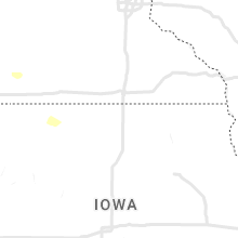
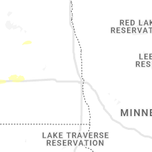
Hail Map for Saturday, July 9, 2022

Number of Impacted Households on 7/9/2022
0
Impacted by 1" or Larger Hail
0
Impacted by 1.75" or Larger Hail
0
Impacted by 2.5" or Larger Hail
Square Miles of Populated Area Impacted on 7/9/2022
0
Impacted by 1" or Larger Hail
0
Impacted by 1.75" or Larger Hail
0
Impacted by 2.5" or Larger Hail


Cities Most Affected by Hail Storms of 7/9/2022
| Hail Size | Demographics of Zip Codes Affected | ||||||
|---|---|---|---|---|---|---|---|
| City | Count | Average | Largest | Pop Density | House Value | Income | Age |
| Melstone, MT | 2 | 1.75 | 1.75 | 0 | $55k | $31.0k | 47.1 |
| Roundup, MT | 2 | 1.75 | 1.75 | 4 | $55k | $25.4k | 48.9 |
| Musselshell, MT | 1 | 2.00 | 2.00 | 0 | $56k | $22.5k | 56.5 |
| Miles City, MT | 1 | 2.00 | 2.00 | 3 | $63k | $29.9k | 41.9 |
| Harlowton, MT | 1 | 1.75 | 1.75 | 0 | $54k | $25.4k | 44.8 |
Hail and Wind Damage Spotted on 7/9/2022
Filter by Report Type:Hail ReportsWind Reports
States Impacted
North Dakota, Virginia, Alabama, South Carolina, Mississippi, Arkansas, Florida, Texas, Montana, North Carolina, New Mexico, WyomingNorth Dakota
| Local Time | Report Details |
|---|---|
| 10:55 AM CDT | Awos station ky19 manda in morton county ND, 6.2 miles WSW of Bismarck, ND |
| 11:40 AM CDT | Estimated 60 mph winds with estimated penny size hail... although spotter noted it was hard to tell hail size due to heavy rain. reported crop damage as wel in emmons county ND, 27.2 miles SE of Bismarck, ND |
| 11:49 AM CDT | Quarter sized hail reported near Hazelton, ND, 32.3 miles ESE of Bismarck, ND, relayed through social media. report of dime to quarter size hail. |
| 1:15 AM MDT | Beach airport asos reported 79 mph gust. emergency manager reported estimated 8 inch tree limbs down in beac in golden valley county ND, 86.6 miles SSW of Williston, ND |
| 1:17 AM MDT | 10 meter observation reported by the ndawn statio in golden valley county ND, 91.9 miles ENE of Miles City, MT |
| 1:19 AM MDT | Sustained wind was measured at 50 mph. reported by the ndawn statio in golden valley county ND, 75.8 miles S of Williston, ND |
| 1:28 AM MDT | Social media repor in billings county ND, 88.2 miles S of Williston, ND |
| 1:49 AM MDT | Reported by the ndawn statio in billings county ND, 68.1 miles SSE of Williston, ND |
| 2:05 AM MDT | Asos station kdik dickinson airpor in stark county ND, 95.9 miles W of Bismarck, ND |
| 2:12 AM MDT | Ndawn reporting sit in dunn county ND, 67.6 miles SSE of Williston, ND |
| 2:30 AM MDT | Nddot site near gladston in stark county ND, 85 miles W of Bismarck, ND |
| 2:50 AM MDT | Nddot site near golden valle in mercer county ND, 69.1 miles WNW of Bismarck, ND |
| 3:55 AM CDT | Estimated 60 mph wind gusts were accompanied by one inch hail. the one inch hail lasted less than a minut in morton county ND, 54.5 miles W of Bismarck, ND |
| 4:14 AM CDT | Ndawn sit in ward county ND, 20.5 miles SE of Minot, ND |
| 5:05 AM CDT | Nddot reporting site on the interstate 94 bridg in burleigh county ND, 2.6 miles WNW of Bismarck, ND |
| 5:20 AM CDT | Nddot reporting sit in pierce county ND, 57.2 miles E of Minot, ND |
| 5:50 AM CDT | Storm damage reported in rolette county ND, 59.3 miles NW of Devils Lake, ND |
| 6:43 AM CDT | Ndawn station reporte in stutsman county ND, 83.1 miles S of Devils Lake, ND |
Virginia
| Local Time | Report Details |
|---|---|
| 1:45 PM EDT | Cluster of power outages near downtown norfolk and norfolk state university. time estimate in city of norfolk county VA, 13.9 miles WNW of Virginia Beach, VA |
Alabama
| Local Time | Report Details |
|---|---|
| 3:49 PM CDT | Corrects previous tstm wnd dmg report from 2 se strawberry. a storage shed was blown across a roadway and destroyed near hopewell roa in blount county AL, 52.5 miles NNE of Birmingham, AL |
| 3:49 PM CDT | Multiple trees and power lines were blown down. a few manufactured homes were damaged. a storage shed was blown across a roadway and destroye in blount county AL, 54.8 miles NNE of Birmingham, AL |
| 4:11 PM CDT | Corrects previous tstm wnd dmg report from 2 nnw muscle shoals. a tree was reported down at the intersection of reservation road and ccc camp roa in colbert county AL, 2 miles SE of Florence, AL |
| 4:12 PM CDT | Report from mping: 3-inch tree limbs broken; power poles broke in lauderdale county AL, 3.2 miles ENE of Florence, AL |
| 4:12 PM CDT | A tree was reported down at the intersection of reservation road and ccc camp roa in colbert county AL, 2 miles SE of Florence, AL |
| 4:14 PM CDT | A tree was reported down at the intersection of pepi drive and 2nd stree in colbert county AL, 4.2 miles SE of Florence, AL |
| 4:16 PM CDT | A storage shed was blown across a roadway and destroyed near hopewell roa in blount county AL, 52.5 miles NNE of Birmingham, AL |
| 4:19 PM CDT | Corrects previous tstm wnd dmg report from 5 nne littleville. tree downed at spring valley rd and three mile l in colbert county AL, 10 miles SSE of Florence, AL |
| 4:20 PM CDT | A tree was reported down at 848 golf drive near the intersection of gargis lane and bracken drive. time was estimated from rada in colbert county AL, 8.9 miles SSE of Florence, AL |
| 4:20 PM CDT | Tree downed at spring valley rd and three mile l in colbert county AL, 10 miles SSE of Florence, AL |
| 4:21 PM CDT | A tree was reported down at 3171 ricks lane. time was estimated from rada in colbert county AL, 10.4 miles SSE of Florence, AL |
| 4:22 PM CDT | Corrects previous tstm wnd dmg report from 5 sw leighton. tree downed at ricks ln and fuller store r in colbert county AL, 10.6 miles SSE of Florence, AL |
| 4:24 PM CDT | Storm damage reported in etowah county AL, 45.6 miles NE of Birmingham, AL |
| 4:30 PM CDT | Damage to shed like structures... as well as tractor trailor rigs blown over (in a lot). time estimated from rada in colbert county AL, 8.7 miles SSE of Florence, AL |
| 4:30 PM CDT | Tree downed at ricks ln and fuller store r in colbert county AL, 10.6 miles SSE of Florence, AL |
| 4:32 PM CDT | Several trees and power lines were blown down mainly just east of vincent to harpersville. a few roadways were blocke in shelby county AL, 26.2 miles ESE of Birmingham, AL |
| 4:38 PM CDT | Several trees were blown down in and around hamilto in marion county AL, 48.3 miles SSW of Florence, AL |
| 4:46 PM CDT | Corrects previous tstm wnd dmg report from 7 s town creek. report of 4 inch tree limbs down in yard... carport across the street flipped... a large tree uprooted down t in lawrence county AL, 21 miles SE of Florence, AL |
| 4:59 PM CDT | Corrects previous tstm wnd dmg report from 1 nnw guin. a few trees were blown down in and around gui in marion county AL, 58.3 miles SSW of Florence, AL |
| 5:00 PM CDT | Storm damage reported in etowah county AL, 54 miles ENE of Birmingham, AL |
| 5:07 PM CDT | A few trees were blown down in and around winfiel in marion county AL, 59.9 miles S of Florence, AL |
| 5:14 PM CDT | A few trees were blown down in and around gui in marion county AL, 58.3 miles SSW of Florence, AL |
| 5:42 PM CDT | A few trees were blown down around pell cit in st. clair county AL, 30.5 miles E of Birmingham, AL |
| 5:52 PM CDT | Report of 4 inch tree limbs down in yard... carport across the street flipped... a large tree uprooted down the street... and large limbs down on neighbors house. time in lawrence county AL, 21 miles SE of Florence, AL |
| 6:23 PM CDT | Sporadic tree down reports including vestavia hills... hoover... mountain broo in jefferson county AL, 5 miles SSE of Birmingham, AL |
| 6:36 PM CDT | A few trees were blown down from woodstock to near west blocto in bibb county AL, 31.1 miles SW of Birmingham, AL |
| 6:48 PM CDT | A few trees were blown down in and around chelse in shelby county AL, 17.9 miles SE of Birmingham, AL |
| 7:10 PM CDT | A few trees down in the jemison area with roadway blockage in some case in chilton county AL, 38.9 miles S of Birmingham, AL |
South Carolina
| Local Time | Report Details |
|---|---|
| 4:51 PM EDT | A 911 call center reported a tree down near parris island gateway and burton creek dr. time was estimated via radar dat in beaufort county SC, 31 miles NE of Savannah, GA |
| 4:51 PM EDT | A member of the public reported a 58 mph wind gust measured by an ambient weather station sensor in downtown beaufort near the woods memorial bridge. time estimated via in beaufort county SC, 34.4 miles NE of Savannah, GA |
| 5:29 PM EDT | An emergency manager reported structural damage to a residental property located along the 900 block of palmetto blvd. pictures show portions of a metal roof were blown in colleton county SC, 51.9 miles SSW of Charleston, SC |
| 5:38 PM EDT | A 911 call center reported a tree down near mathews dr and mingo way. time estimated via radar dat in beaufort county SC, 24.6 miles ENE of Savannah, GA |
Mississippi
| Local Time | Report Details |
|---|---|
| 4:10 PM CDT | Several large tree limbs were blown dow in lafayette county MS, 64.4 miles SSE of Memphis, TN |
| 4:18 PM CDT | Large tree branch fell on a vehicl in monroe county MS, 48.2 miles NNE of Starkville, MS |
| 4:30 PM CDT | Tree down off of highway. other reports of tree limbs down across eastern pontotoc count in pontotoc county MS, 60.1 miles N of Starkville, MS |
| 4:40 PM CDT | Corrects previous tstm wnd dmg report from verona. several trees reported down across southern lee county. large trees fell on two homes in the verona are in lee county MS, 50.2 miles N of Starkville, MS |
| 4:55 PM CDT | Some medium size tree limbs were blown down near dorsey... m in itawamba county MS, 58.2 miles NNE of Starkville, MS |
| 5:38 PM CDT | A tree was blown down at the intersection of county roads 100 and 12 in carroll county MS, 62.8 miles W of Starkville, MS |
| 5:42 PM CDT | A tree was blown down on highway 9 just before vampire road. likely subsevere storm or related to outflow boundar in webster county MS, 28.1 miles WNW of Starkville, MS |
| 5:53 PM CDT | Reported at kgl in washington county MS, 72.7 miles NE of Bastrop, LA |
| 5:55 PM CDT | Ob from kgl in washington county MS, 72.7 miles NE of Bastrop, LA |
| 5:55 PM CDT | Trees were blown down in multiple places in the county. a power line was brought down on double springs roa in oktibbeha county MS, 15.7 miles WNW of Starkville, MS |
| 5:56 PM CDT | A tree was blown down along highway 17 near county road 14 in carroll county MS, 66.3 miles W of Starkville, MS |
| 6:10 PM CDT | Three pine trees down hwy 25 south of louisville just north of george woods road. road blocked. report via social medi in winston county MS, 38.3 miles SW of Starkville, MS |
| 6:18 PM CDT | A couple of trees were blown down in ackerma in choctaw county MS, 23.5 miles WSW of Starkville, MS |
| 6:18 PM CDT | Trees were blown down in several areas across the count in sunflower county MS, 84.6 miles NNW of Jackson, MS |
| 6:45 PM CDT | Tree downed across van williamson road at hwy 3 in winston county MS, 33.5 miles SSW of Starkville, MS |
| 6:52 PM CDT | Two trees were blown down along highway 12 east near the choctaw and attala counties line... in the mccool are in attala county MS, 37.6 miles WSW of Starkville, MS |
| 7:15 PM CDT | Trees were blown down on ebenezer roa in holmes county MS, 49.4 miles N of Jackson, MS |
| 7:47 PM CDT | A tree was blown down on highway 43 near cauthen roa in madison county MS, 40.5 miles NE of Jackson, MS |
| 8:02 PM CDT | A tree was blown down on red dog roa in leake county MS, 47.4 miles NE of Jackson, MS |
| 8:33 PM CDT | Trees were blown down on john day roa in madison county MS, 34 miles NE of Jackson, MS |
| 8:38 PM CDT | A tree was blown down on sherrill roa in madison county MS, 37.1 miles NE of Jackson, MS |
| 9:25 PM CDT | Trees were blown down... mainly in the northern part of the county. some trees fell onto power line in rankin county MS, 20.1 miles NE of Jackson, MS |
Arkansas
| Local Time | Report Details |
|---|---|
| 4:26 PM CDT | Trees were blown down on amherst road north of star city. report relayed by south arkansas weather social media accoun in lincoln county AR, 53.8 miles SSE of Little Rock, AR |
| 4:26 PM CDT | Trees were blown down on alco road west of star city. report relayed by south arkansas weather social media accoun in lincoln county AR, 58.2 miles SSE of Little Rock, AR |
| 4:29 PM CDT | Trees were blown down on avalon road just north of star cit in lincoln county AR, 61 miles SSE of Little Rock, AR |
| 4:43 PM CDT | A power line was blown down onto highway 54 near holly spring in lincoln county AR, 65.9 miles SSE of Little Rock, AR |
| 5:05 PM CDT | Trees were blown down on belmont street near the community cente in desha county AR, 74.8 miles SE of Little Rock, AR |
Florida
| Local Time | Report Details |
|---|---|
| 5:50 PM EDT | Large tree down on sr 11 in the 1900 block... roadway obstructe in flagler county FL, 63.1 miles N of Orlando, FL |
Texas
| Local Time | Report Details |
|---|---|
| 5:18 PM CDT | Trees dow in cass county TX, 54.5 miles NW of Shreveport, LA |
| 5:40 PM CDT | Fences and numerous trees dow in upshur county TX, 77.9 miles W of Shreveport, LA |
| 5:50 PM CDT | Several trees dow in cass county TX, 43.7 miles NW of Shreveport, LA |
| 6:15 PM CDT | San saba awos reported a 67 mph wind gus in san saba county TX, 58.7 miles W of Killeen, TX |
| 6:18 PM CDT | Pictures were posted to social media of multiple trees that were blown down on mound pond road... fm 2198... cypress drive... and bois d arc lane in the uncertain commu in harrison county TX, 25.6 miles WNW of Shreveport, LA |
| 7:20 PM CDT | Roof damage reported at liquor store at highway 67 and fm 381 in rowena. time estimated via rada in runnels county TX, 58 miles SSW of Abilene, TX |
| 7:25 PM CDT | Corrects previous tstm wnd dmg report from 5 se granbury. ham report of a roof blown off at 3104 power plant ct in the granbury are in hood county TX, 60.2 miles WSW of Dallas, TX |
| 7:25 PM CDT | Corrects previous tstm wnd dmg report from 5 se granbury. ham report of a roof blown off at 3104 power plant ct in the granbury are in hood county TX, 60.2 miles WSW of Dallas, TX |
| 7:27 PM CDT | Quarter sized hail reported near Miles, TX, 60.2 miles SSW of Abilene, TX, nickel to quarter size hail was reported. |
| 7:39 PM CDT | Ham report of a roof blown off at 3104 power plant ct in the granbury are in hood county TX, 60.2 miles WSW of Dallas, TX |
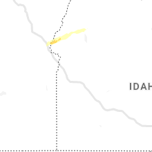
Montana
| Local Time | Report Details |
|---|---|
| 4:21 PM MDT | Quarter sized hail reported near Clinton, MT, 15.3 miles ESE of Missoula, MT |
| 5:10 PM MDT | Quarter sized hail reported near Lakeside, MT, 32.5 miles SSE of Whitefish, MT, photo retrieved via social media. time estimated via radar. |
| 5:15 PM MDT | Ping Pong Ball sized hail reported near Lakeside, MT, 29.7 miles SSE of Whitefish, MT, photo retrieved via social media. time estimated via radar. |
| 5:24 PM MDT | Ping Pong Ball sized hail reported near Bigfork, MT, 27 miles SSE of Whitefish, MT |
| 5:26 PM MDT | Quarter sized hail reported near Bigfork, MT, 27 miles SSE of Whitefish, MT |
| 5:30 PM MDT | Ping Pong Ball sized hail reported near Bigfork, MT, 26 miles SSE of Whitefish, MT, photo retrieved via social media. time estimated via radar. |
| 6:16 PM MDT | Ping Pong Ball sized hail reported near Harlowton, MT, 77.8 miles NE of Bozeman, MT, spotter sent report and pictures via social media. |
| 6:19 PM MDT | Half Dollar sized hail reported near Harlowton, MT, 77.8 miles NE of Bozeman, MT, pictures sent via social media. |
| 6:25 PM MDT | Quarter sized hail reported near Harlowton, MT, 77.7 miles NE of Bozeman, MT, pea to quarter sized hail. |
| 6:28 PM MDT | Golf Ball sized hail reported near Harlowton, MT, 72.7 miles NW of Billings, MT |
| 6:48 PM MDT | Ping Pong Ball sized hail reported near Condon, MT, 45.8 miles NNE of Missoula, MT |
| 6:55 PM MDT | Quarter sized hail reported near Lavina, MT, 66.9 miles NNW of Billings, MT |
| 7:00 PM MDT | Asos station khvr havre airport. 64 mph wind gus in hill county MT, 4.5 miles W of Havre, MT |
| 7:29 PM MDT | Wind gust of 58 mph recorded at an ambient weather station in winifre in fergus county MT, 69.9 miles S of Havre, MT |
| 7:36 PM MDT | Golf Ball sized hail reported near Roundup, MT, 64.5 miles N of Billings, MT, broken windows |
| 8:35 PM MDT | Observed via the malta asos sit in phillips county MT, 60.4 miles WNW of Glasgow, MT |
| 8:45 PM MDT | Storm damage reported in musselshell county MT, 56.1 miles NNW of Billings, MT |
| 8:58 PM MDT | Quarter sized hail reported near Sand Springs, MT, 91.4 miles NNE of Billings, MT |
| 9:03 PM MDT | Golf Ball sized hail reported near Melstone, MT, 58.6 miles NNE of Billings, MT |
| 9:06 PM MDT | Via saco mt dot sit in phillips county MT, 35.3 miles WNW of Glasgow, MT |
| 9:12 PM MDT | Golf Ball sized hail reported near Melstone, MT, 64.1 miles NNE of Billings, MT |
| 9:18 PM MDT | Golf Ball sized hail reported near Roundup, MT, 55 miles N of Billings, MT |
| 9:23 PM MDT | Quarter sized hail reported near Roundup, MT, 53.6 miles N of Billings, MT |
| 9:30 PM MDT | Via the mt meso site at blm vandali in valley county MT, 25.1 miles NNW of Glasgow, MT |
| 9:37 PM MDT | Hen Egg sized hail reported near Musselshell, MT, 52.8 miles NNE of Billings, MT |
| 9:44 PM MDT | Via bluff creek raws sit in valley county MT, 48.8 miles NNW of Glasgow, MT |
| 9:44 PM MDT | Via king coulee raws sit in valley county MT, 32.6 miles SSW of Glasgow, MT |
| 9:47 PM MDT | Quarter sized hail reported near Melstone, MT, 58.6 miles NNE of Billings, MT |
| 9:51 PM MDT | Half Dollar sized hail reported near Melstone, MT, 64.1 miles NNE of Billings, MT |
| 10:04 PM MDT | Corrects previous report from 1 nne glasgow. highest gust from the glasgow asos statio in valley county MT, 1.3 miles NE of Glasgow, MT |
| 10:10 PM MDT | Via the saint marie marco sit in valley county MT, 15.8 miles NNE of Glasgow, MT |
| 10:15 PM MDT | Report relayed via facebook on an home weather statio in valley county MT, 36.6 miles ENE of Glasgow, MT |
| 10:30 PM MDT | Report relayed via faceboo in roosevelt county MT, 44 miles E of Glasgow, MT |
| 10:50 PM MDT | Via the fort peck dam sit in mccone county MT, 16.8 miles SE of Glasgow, MT |
| 10:51 PM MDT | Hen Egg sized hail reported near Miles City, MT, 21.8 miles NW of Miles City, MT, public reported |
| 11:18 PM MDT | Picture of weather station relayed via faceboo in roosevelt county MT, 69 miles WNW of Williston, ND |
| 11:26 PM MDT | 6 inch diameter tree branches down at mile marker 14 and 4 inch diameter branches down at mile marker 13 on kinsey rd./mt 489 in custer county MT, 11.7 miles NNE of Miles City, MT |
| 11:30 PM MDT | Storm damage reported in custer county MT, 2.5 miles NW of Miles City, MT |
| 11:43 PM MDT | Quarter sized hail reported near Terry, MT, 29.4 miles NE of Miles City, MT, reported by storm spotter. |
| 11:43 PM MDT | Estimated by storm spotte in prairie county MT, 29.4 miles NE of Miles City, MT |
| 11:55 PM MDT | Quarter sized hail reported near Terry, MT, 36.7 miles NE of Miles City, MT, relayed via facebook. |
| 11:55 PM MDT | Relayed via faceboo in prairie county MT, 47.9 miles N of Miles City, MT |
| 11:58 PM MDT | Ndawn sit in sheridan county MT, 61.4 miles NW of Williston, ND |
| 1:02 AM CDT | Raws site in northwest divide count in divide county ND, 59.5 miles NNW of Williston, ND |
| 12:35 AM MDT | Storm damage reported in fallon county MT, 63.5 miles E of Miles City, MT |
| 12:42 AM MDT | Storm damage reported in fallon county MT, 76.1 miles E of Miles City, MT |
| 12:53 AM MDT | Reported via mt dot sit in dawson county MT, 83.7 miles ENE of Miles City, MT |
North Carolina
| Local Time | Report Details |
|---|---|
| 6:25 PM EDT | 911 call center reported tree blocking roadway on indian trail fairview rd and 1st ave in union county NC, 17 miles ESE of Charlotte, NC |
| 6:30 PM EDT | 911 call center reported tree block roadway on boyte rd and valley st in union county NC, 23.3 miles SE of Charlotte, NC |
| 11:30 PM EDT | Powerlines blown down. time estimated by rada in sampson county NC, 45.3 miles NNW of Wilmington, NC |
New Mexico
| Local Time | Report Details |
|---|---|
| 7:25 PM MDT | Asos station kabq albuquerque intl sunpor in bernalillo county NM, 2.9 miles SE of Albuquerque, NM |
Wyoming
| Local Time | Report Details |
|---|---|
| 11:50 PM MDT | Storm damage reported in sheridan county WY, 79.5 miles WNW of Gillette, WY |
Connect with Interactive Hail Maps