

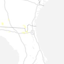
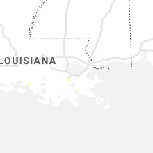
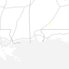
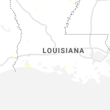
Hail Map for Friday, July 3, 2020

Number of Impacted Households on 7/3/2020
0
Impacted by 1" or Larger Hail
0
Impacted by 1.75" or Larger Hail
0
Impacted by 2.5" or Larger Hail
Square Miles of Populated Area Impacted on 7/3/2020
0
Impacted by 1" or Larger Hail
0
Impacted by 1.75" or Larger Hail
0
Impacted by 2.5" or Larger Hail


Cities Most Affected by Hail Storms of 7/3/2020
| Hail Size | Demographics of Zip Codes Affected | ||||||
|---|---|---|---|---|---|---|---|
| City | Count | Average | Largest | Pop Density | House Value | Income | Age |
| Camp Crook, SD | 1 | 1.75 | 1.75 | 0 | $44k | $25.5k | 41.5 |
| Eads, CO | 1 | 1.75 | 1.75 | 0 | $49k | $30.4k | 48.7 |
| Brockway, MT | 1 | 1.75 | 1.75 | 0 | $31k | $23.4k | 42.5 |
Hail and Wind Damage Spotted on 7/3/2020
Filter by Report Type:Hail ReportsWind Reports
States Impacted
Louisiana, Missouri, Colorado, New York, Florida, Pennsylvania, Georgia, South Dakota, Utah, Montana, New Jersey, Idaho, Nebraska, MinnesotaLouisiana
| Local Time | Report Details |
|---|---|
| 11:30 AM CDT | Multiple power poles brought down along hwy la 308 near the valentine bridge. relayed via social media in lafourche county LA, 32.4 miles SW of New Orleans, LA |
| 12:50 PM CDT | Large tree down on middle road just before jess easley trai in webster county LA, 31.5 miles ENE of Shreveport, LA |
Missouri
| Local Time | Report Details |
|---|---|
| 2:15 PM CDT | Wind damage to small area along rinehart road... shary view road... including the savannah place and stephens estates subdivisions just east of hwy 65 and just south of in taney county MO, 36.1 miles S of Springfield, MO |
Colorado
| Local Time | Report Details |
|---|---|
| 1:56 PM MDT | Quarter sized hail reported near Colorado Springs, CO, 48.8 miles SSE of Denver, CO |
| 2:48 PM MDT | Quarter sized hail reported near Castle Rock, CO, 24.5 miles S of Denver, CO, report from mping: quarter (1.00 in.). |
| 2:54 PM MDT | Quarter sized hail reported near Castle Rock, CO, 24 miles SSE of Denver, CO |
| 4:32 PM MDT | Quarter sized hail reported near Hasty, CO, 90.6 miles E of Pueblo, CO |
| 5:30 PM MDT | Golf Ball sized hail reported near Eads, CO, 90.7 miles ENE of Pueblo, CO, 0.40 inches of water. |
| 5:57 PM MDT | Quarter sized hail reported near Woodrow, CO, 47.4 miles WSW of Yuma, CO, hail covering the highway. |
| 6:10 PM MDT | Quarter sized hail reported near Kit Carson, CO, 98.7 miles S of Yuma, CO |
| 6:11 PM MDT | Storm damage reported in weld county CO, 75.2 miles SSW of Scottsbluff, NE |
| 6:29 PM MDT | Pea sized hail and sustained wind around 30 to 40 mph also reporte in cheyenne county CO, 95.8 miles S of Yuma, CO |
| 7:02 PM MDT | Ping Pong Ball sized hail reported near Cheyenne Wells, CO, 75.3 miles S of Yuma, CO, quarter to ping pong ball hail. |
| 9:04 PM MDT | Asos station kitr burlington co airpor in kit carson county CO, 65.7 miles SSE of Yuma, CO |
New York
| Local Time | Report Details |
|---|---|
| 4:00 PM EDT | Scattered trees knocked down in the kingston are in ulster county NY, 61 miles S of Schenectady, NY |
Florida
| Local Time | Report Details |
|---|---|
| 4:45 PM EDT | The baker county dispatchy report a tree blown down on thier complex. the time of the event was based on rada in baker county FL, 28.4 miles W of Jacksonville, FL |
| 6:15 PM EDT | Tree down on south jefferson stree in jefferson county FL, 25.3 miles ENE of Tallahassee, FL |
Pennsylvania
| Local Time | Report Details |
|---|---|
| 5:14 PM EDT | Trees uprooted or snapped. mping report in luzerne county PA, 34.8 miles WSW of Scranton, PA |
| 5:20 PM EDT | Multiple reports of trees and wires down in fishing creek... orange... and scott township in columbia county PA, 41.2 miles WSW of Scranton, PA |
| 6:40 PM EDT | A couple of trees downed in hamburg. time estimated from rada in berks county PA, 61 miles SSW of Scranton, PA |
| 7:05 PM EDT | Several reports of downed trees and wires in heidelberg. time estimated from rada in berks county PA, 77.2 miles SSW of Scranton, PA |
| 7:07 PM EDT | An mping report of trees uprooted or snapped. fire and ems scanner traffic also reports downed trees in this area. time estimated from rada in berks county PA, 76.7 miles SSW of Scranton, PA |
| 7:08 PM EDT | Several reports of downed trees and wires across robesonia. time estimated from rada in berks county PA, 77.2 miles SSW of Scranton, PA |
| 7:57 PM EDT | Downed tree on state highway 29 southbound south of kingwood station-barbertown road. all lanes closed. time estimated from rada in hunterdon county NJ, 59.2 miles WSW of Brooklyn, NY |
Georgia
| Local Time | Report Details |
|---|---|
| 5:42 PM EDT | Multiple streets in thomasville with trees down via thomasville pd faceboo in thomas county GA, 29 miles NNE of Tallahassee, FL |
South Dakota
| Local Time | Report Details |
|---|---|
| 4:43 PM CDT | Single telephone pole snapped of in union county SD, 35 miles S of Sioux Falls, SD |
| 4:45 PM CDT | Mesonet station 16 sd rwis beresfor in union county SD, 35.1 miles S of Sioux Falls, SD |
| 5:09 PM CDT | Storm damage reported in clay county SD, 53.7 miles S of Sioux Falls, SD |
| 5:30 PM CDT | A couple of 3 inch diameter tree branches down in tow in union county SD, 59.8 miles S of Sioux Falls, SD |
| 5:40 PM CDT | A few tree branches down and shingles blown off hom in union county SD, 60.5 miles S of Sioux Falls, SD |
| 7:35 PM MDT | Golf Ball sized hail reported near Camp Crook, SD, 105.2 miles ESE of Miles City, MT, hail ranged from 1/2" to golf ball size. |
| 2:19 AM MDT | Storm damage reported in corson county SD, 66.3 miles S of Bismarck, ND |
| 3:06 AM MDT | Storm damage reported in corson county SD, 83.7 miles S of Bismarck, ND |
Utah
| Local Time | Report Details |
|---|---|
| 4:08 PM MDT | Signal peak raws in sevier county UT, 3.3 miles E of Monroe, UT |
Montana
| Local Time | Report Details |
|---|---|
| 4:25 PM MDT | Storm damage reported in big horn county MT, 41 miles E of Billings, MT |
| 4:40 PM MDT | Mesonet station k7s6 3.6 s white sulphur springs (gtfwfo in meagher county MT, 57 miles N of Bozeman, MT |
| 5:33 PM MDT | Storm damage reported in rosebud county MT, 74.9 miles W of Miles City, MT |
| 5:45 PM MDT | Quarter sized hail reported near Broadus, MT, 66.7 miles N of Gillette, WY |
| 5:56 PM MDT | Mesonet station mtmdp macdonald pass (mt dot in lewis and clark county MT, 80.8 miles SW of Great Falls, MT |
| 7:00 PM MDT | Golf Ball sized hail reported near Brockway, MT, 48 miles SSE of Glasgow, MT, been hailing for over 10 minutes with stones up to the size of golf balls. |
| 7:15 PM MDT | Quarter sized hail reported near Brockway, MT, 61 miles N of Miles City, MT, lots of hail the size of quarters at largest. |
| 7:38 PM MDT | Storm damage reported in fallon county MT, 76.1 miles E of Miles City, MT |
| 7:40 PM MDT | Quarter sized hail reported near Fort Peck, MT, 35.1 miles SE of Glasgow, MT |
| 7:45 PM MDT | Winds broke an inch and a half to two inch diameter branch off of a large tree. also reports dime sized hail and heavy rai in cascade county MT, 1.1 miles NW of Great Falls, MT |
| 8:10 PM MDT | Mesonet station pnhm8 hoyt 16ese/pine hill. time estimated by rada in wibaux county MT, 65.7 miles ENE of Miles City, MT |
| 8:15 PM MDT | Quarter sized hail reported near Wibaux, MT, 83.9 miles ENE of Miles City, MT, hailed for approx 15 min... winds up to an estimated 50 mph as well. |
| 9:47 PM MDT | Corrects previous tstm wnd gst report from 8 nne snowden. us-2 mt dot stateline observation site recorded 67 mph gust associated with thunderstorm in roosevelt county MT, 19.8 miles W of Williston, ND |
| 9:47 PM MDT | Corrects previous tstm wnd gst report from 8 nne snowden. us-2 mt dot stateline observation site recorded 67 mph gust associated with thunderstorm in roosevelt county MT, 19.8 miles W of Williston, ND |
New Jersey
| Local Time | Report Details |
|---|---|
| 6:42 PM EDT | Wires down on mcafee glenwood rd in glenwood. time estimated from rada in sussex county NJ, 46.2 miles NNW of Brooklyn, NY |
| 6:43 PM EDT | Wires down on glenwood rd in vernon valley. time estimated from rada in sussex county NJ, 46.5 miles NW of Brooklyn, NY |
| 6:49 PM EDT | Downed tree on nj-284 southbound near layton rd. lane restrictions were put in place. time estimated from rada in sussex county NJ, 48.1 miles NW of Brooklyn, NY |
| 6:53 PM EDT | Trees and wires down on valley view dr. time estimated from rada in sussex county NJ, 44.9 miles NW of Brooklyn, NY |
| 7:30 PM EDT | Wires downed in montville. time estimated from rada in morris county NJ, 25.3 miles NW of Brooklyn, NY |
| 7:32 PM EDT | Several reports of downed trees and wires in boonton. time estimated from rada in morris county NJ, 26.3 miles WNW of Brooklyn, NY |
| 7:32 PM EDT | Downed tree and wires on us-46 westbound at cr-618. time estimated from rada in morris county NJ, 27.8 miles WNW of Brooklyn, NY |
| 7:40 PM EDT | Wires downed in pine brook. time estimated from rada in morris county NJ, 21.7 miles WNW of Brooklyn, NY |
| 7:42 PM EDT | Wires downed in hanover. time estimated from rada in morris county NJ, 22.1 miles WNW of Brooklyn, NY |
| 7:46 PM EDT | Numerous trees and wires downed in morris plains. time estimated from rada in morris county NJ, 27.4 miles WNW of Brooklyn, NY |
| 7:49 PM EDT | A tree was downed onto a house on columbia rd near morristown. time estimated from rada in morris county NJ, 24 miles WNW of Brooklyn, NY |
| 7:50 PM EDT | Tree downed onto wires on green st. time estimated from rada in morris county NJ, 26.6 miles WNW of Brooklyn, NY |
| 7:50 PM EDT | Wires down in florham park. time estimated from rada in morris county NJ, 22.5 miles WNW of Brooklyn, NY |
| 7:52 PM EDT | A tree fell onto a house on filmore dr. time estimated from rada in morris county NJ, 24.5 miles WNW of Brooklyn, NY |
| 7:52 PM EDT | Tree down on woodland ave. time estimated from rada in morris county NJ, 25.4 miles WNW of Brooklyn, NY |
| 7:53 PM EDT | Power lines downed in madison. time estimated from rada in morris county NJ, 23 miles WNW of Brooklyn, NY |
| 8:25 PM EDT | Wires down in south plainfield. time estimated from rada in middlesex county NJ, 23.7 miles WSW of Brooklyn, NY |
| 8:26 PM EDT | Tree limbs down onto wires on woodland ave in s plainfield. time estimated from rada in middlesex county NJ, 22.2 miles WSW of Brooklyn, NY |
| 8:34 PM EDT | Tree fell on hous in essex county NJ, 14.2 miles WNW of Brooklyn, NY |
Idaho
| Local Time | Report Details |
|---|---|
| 5:00 PM MDT | Mesonet station 8419 - kettle butte. thunderstorm outflow wind in bonneville county ID, 19.4 miles WNW of Idaho Falls, ID |
| 6:00 PM MDT | Bald mountai in blaine county ID, 76.3 miles N of Twin Falls, ID |
Nebraska
| Local Time | Report Details |
|---|---|
| 7:11 PM MDT | Quarter sized hail reported near Bushnell, NE, 49.4 miles SSW of Scottsbluff, NE |
Minnesota
| Local Time | Report Details |
|---|---|
| 2:55 AM CDT | Peak wind measured at a personal weather statio in marshall county MN, 57 miles WSW of Roseau, MN |
Connect with Interactive Hail Maps