

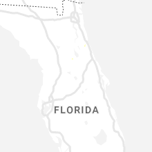
Hail Map for Sunday, July 3, 2022

Number of Impacted Households on 7/3/2022
0
Impacted by 1" or Larger Hail
0
Impacted by 1.75" or Larger Hail
0
Impacted by 2.5" or Larger Hail
Square Miles of Populated Area Impacted on 7/3/2022
0
Impacted by 1" or Larger Hail
0
Impacted by 1.75" or Larger Hail
0
Impacted by 2.5" or Larger Hail


Cities Most Affected by Hail Storms of 7/3/2022
| Hail Size | Demographics of Zip Codes Affected | ||||||
|---|---|---|---|---|---|---|---|
| City | Count | Average | Largest | Pop Density | House Value | Income | Age |
| Wasta, SD | 3 | 2.17 | 2.75 | 1 | $26k | $26.4k | 38.0 |
| Rapelje, MT | 2 | 1.75 | 1.75 | 0 | $43k | $23.8k | 45.4 |
| Owanka, SD | 1 | 1.75 | 1.75 | 1 | $125k | $80.0k | 43.8 |
Hail and Wind Damage Spotted on 7/3/2022
Filter by Report Type:Hail ReportsWind Reports
States Impacted
South Dakota, Georgia, Texas, Washington, South Carolina, Oklahoma, North Carolina, Montana, Arkansas, Kansas, Nebraska, Minnesota, North DakotaSouth Dakota
| Local Time | Report Details |
|---|---|
| 12:18 PM CDT | In addition to strong winds... heavy rain was also reported but not measured ye in aurora county SD, 88.5 miles ESE of Pierre, SD |
| 12:18 PM CDT | In addition to hail and strong winds... heavy rain was also reported but not measured ye in jerauld county SD, 84.4 miles ESE of Pierre, SD |
| 2:54 PM CDT | Ping Pong Ball sized hail reported near Wolsey, SD, 73.1 miles S of Aberdeen, SD |
| 3:58 PM CDT | Sanborn county sheriff reports damage to 7 power poles along hwy 34 - 6 are broken and the last is cracke in sanborn county SD, 85.7 miles WNW of Sioux Falls, SD |
| 4:06 PM CDT | Quarter sized hail reported near Woonsocket, SD, 85.1 miles WNW of Sioux Falls, SD |
| 4:17 PM CDT | Mesonet station 6 sd rwis forestbur in sanborn county SD, 72.5 miles WNW of Sioux Falls, SD |
| 3:30 PM MDT | Quarter sized hail reported near Black Hawk, SD, 8.7 miles NW of Rapid City, SD |
| 3:33 PM MDT | Storm damage reported in fall river county SD, 66.9 miles SW of Rapid City, SD |
| 3:38 PM MDT | Storm damage reported in fall river county SD, 66.9 miles SW of Rapid City, SD |
| 3:43 PM MDT | Storm damage reported in fall river county SD, 66.9 miles SW of Rapid City, SD |
| 3:48 PM MDT | Storm damage reported in fall river county SD, 66.9 miles SW of Rapid City, SD |
| 4:00 PM MDT | Quarter sized hail reported near Piedmont, SD, 10.3 miles N of Rapid City, SD |
| 4:28 PM MDT | Golf Ball sized hail reported near Owanka, SD, 34 miles E of Rapid City, SD, 30-40 mph winds with the hail |
| 4:45 PM MDT | Quarter sized hail reported near Philip, SD, 70.3 miles WSW of Pierre, SD |
| 4:45 PM MDT | Storm damage reported in haakon county SD, 70.3 miles WSW of Pierre, SD |
| 4:50 PM MDT | Quarter sized hail reported near Sturgis, SD, 26.5 miles NW of Rapid City, SD |
| 4:50 PM MDT | Baseball sized hail reported near Wasta, SD, 39.3 miles E of Rapid City, SD |
| 4:52 PM MDT | Quarter sized hail reported near Sturgis, SD, 26.3 miles NNW of Rapid City, SD |
| 4:53 PM MDT | Half Dollar sized hail reported near Sturgis, SD, 26.3 miles NNW of Rapid City, SD |
| 4:56 PM MDT | Hen Egg sized hail reported near Wasta, SD, 38.9 miles E of Rapid City, SD |
| 5:08 PM MDT | Golf Ball sized hail reported near Wasta, SD, 39 miles E of Rapid City, SD, time estimated via radar |
| 5:35 PM MDT | Quarter sized hail reported near Philip, SD, 61.2 miles WSW of Pierre, SD, mostly smaller... but some up to quarter sized. also estimated wind gusts up to 50 mph. |
| 7:12 PM MDT | Storm damage reported in haakon county SD, 54.5 miles W of Pierre, SD |
| 9:13 PM CDT | Half Dollar sized hail reported near Leola, SD, 28.4 miles NW of Aberdeen, SD |
| 8:25 PM MDT | Storm damage reported in haakon county SD, 44 miles WSW of Pierre, SD |
| 9:42 PM CDT | Mesonet station 13 vivian (sddot in lyman county SD, 22 miles S of Pierre, SD |
| 9:05 PM MDT | Storm damage reported in jackson county SD, 69.3 miles E of Rapid City, SD |
| 10:05 PM CDT | Mesonet station 185 blunt (sddot in hughes county SD, 16.5 miles ENE of Pierre, SD |
| 11:19 PM CDT | Telephone call repor in edmunds county SD, 26.4 miles W of Aberdeen, SD |
| 11:20 PM CDT | Mesonet station 173 craven (sddot in edmunds county SD, 21.5 miles W of Aberdeen, SD |
| 11:42 PM CDT | Mesonet station 13 vivian (sddot in lyman county SD, 22 miles S of Pierre, SD |
| 11:08 PM MDT | Storm damage reported in harding county SD, 106 miles N of Rapid City, SD |
| 12:10 AM CDT | Asos station kabr aberdeen rgnl a in brown county SD, 3.3 miles E of Aberdeen, SD |
| 12:14 AM CDT | Fort pierre raw in lyman county SD, 17.4 miles S of Pierre, SD |
| 12:16 AM CDT | Mesonet station 175 mellette (sddot in spink county SD, 20.7 miles S of Aberdeen, SD |
| 12:46 AM CDT | Mesonet station 285 14w lower brule (sddot in lyman county SD, 31.1 miles SE of Pierre, SD |
Georgia
| Local Time | Report Details |
|---|---|
| 2:29 PM EDT | Tree down 900 block cherokee trail near rossville in walker county GA, 5.3 miles S of Chattanooga, TN |
| 2:30 PM EDT | Tree down at park stree and indiana street in walker county GA, 22.5 miles S of Chattanooga, TN |
| 2:58 PM EDT | Tree down at 400 block of cotter rd in catoosa county GA, 14.7 miles SE of Chattanooga, TN |
| 2:58 PM EDT | Tree down at poplar springs and oak st and tree down at baggett rd and john drive in catoosa county GA, 13.4 miles SE of Chattanooga, TN |
| 3:07 PM EDT | Tree down at dixie highway and wilson r in morgan county GA, 51.2 miles ESE of Atlanta, GA |
| 3:12 PM EDT | Power line down on pricemill rd near paxson dairy rd in morgan county GA, 51.9 miles E of Atlanta, GA |
| 5:21 PM EDT | Tree down at east mccarty st and n hospital rd in washington county GA, 58.5 miles SW of Augusta, GA |
| 5:21 PM EDT | Powerlines down at fall line fwy and deepstep rd in washington county GA, 59.5 miles WSW of Augusta, GA |
| 5:26 PM EDT | Tree down at meadowbrook dr and meadowbrook cir in rockdale county GA, 20.6 miles ESE of Atlanta, GA |
| 5:30 PM EDT | Tree down at revel cove dr and lancaster creek cir in rockdale county GA, 21.3 miles ESE of Atlanta, GA |
| 6:03 PM EDT | Tree down on beaverdam road at beaver trail in oglethorpe county GA, 66 miles ENE of Atlanta, GA |
| 6:07 PM EDT | Ping Pong Ball sized hail reported near Athens, GA, 55.6 miles ENE of Atlanta, GA, ping pong sized hail reported by caller in athens... ga. |
| 6:12 PM EDT | 1 large oak tree down on anna dr north of annas wal in clarke county GA, 55 miles ENE of Atlanta, GA |
| 6:35 PM EDT | Tree down on hwy 78 at pete dickens rd in oconee county GA, 49.8 miles ENE of Atlanta, GA |
| 6:40 PM EDT | Tree and power lines on road at jacks creek rd and old good hope rd in walton county GA, 45.1 miles E of Atlanta, GA |
| 6:59 PM EDT | Two trees down at massedonia rd near watson springs rd and price rd in greene county GA, 68 miles E of Atlanta, GA |
| 7:04 PM EDT | Tree and powerlines down s dogwood road and pine st in greene county GA, 66.8 miles WNW of Augusta, GA |
| 7:04 PM EDT | Tree down at konahetah dr and konahetah rd in towns county GA, 64.6 miles W of Greenville, SC |
Texas
| Local Time | Report Details |
|---|---|
| 2:15 PM CDT | Wood shed/outbuilding damaged and two large aluminum barn doors blown out. time est via rada in montague county TX, 55.8 miles E of Wichita Falls, TX |
| 4:04 PM CDT | Also a gust to 59 mph at 403 pm. west texas mesone in cottle county TX, 36.8 miles S of Childress, TX |
| 6:22 PM CDT | West texas mesonet in briscoe county TX, 55.9 miles W of Childress, TX |
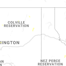
Washington
| Local Time | Report Details |
|---|---|
| 1:15 PM PDT | Quarter sized hail reported near Oakesdale, WA, 39.5 miles S of Spokane, WA |
| 2:08 PM PDT | Trees down along aladdin road. from facebook report. time is estimated from rada in stevens county WA, 66.7 miles NNW of Spokane, WA |
| 2:08 PM PDT | Downed tree and wires near tara drive. time estimated from rada in stevens county WA, 67.6 miles NNW of Spokane, WA |
| 2:26 PM PDT | Downed power lines and power outages reported in the echo valley area. report via social media. time estimated from rada in stevens county WA, 71.3 miles NNW of Spokane, WA |
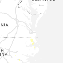
South Carolina
| Local Time | Report Details |
|---|---|
| 4:20 PM EDT | Quarter sized hail reported near Graniteville, SC, 11.1 miles ENE of Augusta, GA, spotter reported quarter size hail and estimated 60 mph wind gust near graniteville saint hill fire department. |
Oklahoma
| Local Time | Report Details |
|---|---|
| 4:10 PM CDT | Storm damage reported in bryan county OK, 34.5 miles SSW of Atoka, OK |
North Carolina
| Local Time | Report Details |
|---|---|
| 5:13 PM EDT | Trees down near south mill in camden county NC, 25.8 miles SSW of Virginia Beach, VA |
| 5:13 PM EDT | Roof blown off of the russel auto parts store near south mill in pasquotank county NC, 28.2 miles SW of Virginia Beach, VA |
| 5:38 PM EDT | Tree down near elizabeth cit in pasquotank county NC, 34.6 miles SSW of Virginia Beach, VA |
| 5:43 PM EDT | Farmers reported gusts estimated at 60 mp in montgomery county NC, 47.9 miles ENE of Charlotte, NC |
Montana
| Local Time | Report Details |
|---|---|
| 3:25 PM MDT | Quarter sized hail reported near Conner, MT, 48.1 miles N of Salmon, ID, picture with measurement of 1 inch hail stones. |
| 3:40 PM MDT | Quarter sized hail reported near Sand Springs, MT, 91.4 miles NNE of Billings, MT, fence knocked down on property as well. |
| 4:04 PM MDT | Luftborough hill do in garfield county MT, 88.3 miles SSW of Glasgow, MT |
| 5:03 PM MDT | Golf Ball sized hail reported near Rapelje, MT, 38.1 miles WNW of Billings, MT, 51 mph wind and golf ball size hail. |
| 5:04 PM MDT | Golf Ball sized hail reported near Rapelje, MT, 38.6 miles WNW of Billings, MT, report sent via social media with pictures and video. |
| 5:50 PM MDT | Quarter sized hail reported near Jordan, MT, 56.4 miles NNW of Miles City, MT, report relayed from facebook. mostly dime but some quarters mixed in. |
| 5:55 PM MDT | 7 inch branch blown down. pictures sent via social medi in yellowstone county MT, 4.7 miles NE of Billings, MT |
| 6:15 PM MDT | Storm damage reported in yellowstone county MT, 16.3 miles NE of Billings, MT |
| 6:20 PM MDT | Also reported pea-sized hai in prairie county MT, 47.3 miles N of Miles City, MT |
| 6:20 PM MDT | Quarter sized hail reported near Shepherd, MT, 14.3 miles NNE of Billings, MT, picture of quarter size hail sent via social media. |
| 6:40 PM MDT | Corrects previous non-tstm wnd gst report from 2 e helena. asos station khln helena airpor in lewis and clark county MT, 70.3 miles SSW of Great Falls, MT |
| 6:58 PM MDT | Storm damage reported in prairie county MT, 45.8 miles NNE of Miles City, MT |
| 7:03 PM MDT | Quarter sized hail reported near Terry, MT, 37.4 miles NE of Miles City, MT, reported via facebook. |
| 7:03 PM MDT | Half Dollar sized hail reported near Terry, MT, 37.4 miles NE of Miles City, MT, report relayed via facebook. |
| 7:08 PM MDT | Quarter sized hail reported near Custer, MT, 46.1 miles ENE of Billings, MT, marble to quarter size hail with 50-60 mph winds. |
| 7:20 PM MDT | Fort howes raws in powder river county MT, 76.6 miles NNW of Gillette, WY |
| 8:06 PM MDT | Ping Pong Ball sized hail reported near Ashland, MT, 54.8 miles S of Miles City, MT, power out and very heavy rain. |
| 8:15 PM MDT | Quarter sized hail reported near Volborg, MT, 50.9 miles S of Miles City, MT |
| 8:42 PM MDT | Mesonet site mtbv in dawson county MT, 83.6 miles ENE of Miles City, MT |
| 8:55 PM MDT | Quarter sized hail reported near Baker, MT, 74.5 miles E of Miles City, MT, storm chaser sent picture of quarter sized hail via social media. |
| 9:03 PM MDT | Cannonball creek raws. time estimated from rada in fallon county MT, 85.1 miles E of Miles City, MT |
| 9:10 PM MDT | Quarter sized hail reported near Baker, MT, 74.6 miles E of Miles City, MT, storm chaser report of quarter sized hail. |
| 9:33 PM MDT | Quarter sized hail reported near Ashland, MT, 56.7 miles S of Miles City, MT, report via social media. |
Arkansas
| Local Time | Report Details |
|---|---|
| 6:10 PM CDT | Small tree trunk broken. video and report relayed via twitter from now-retired broadcast me in benton county AR, 61.3 miles N of Fort Smith, AR |
| 6:10 PM CDT | Large tree limbs downed on west brown road. photos relayed via twitte in benton county AR, 60.7 miles N of Fort Smith, AR |
Kansas
| Local Time | Report Details |
|---|---|
| 5:45 PM MDT | Sherman county kansas mesonet site reported 59 mph gus in sherman county KS, 42.3 miles W of Colby, KS |
| 7:00 PM CDT | City of oberlin reported to have lost power when thunderstorm passed. exact location of damaged power poles unknown at this tim in decatur county KS, 40.1 miles NE of Colby, KS |
| 6:00 PM MDT | Power lines blown down in the road 14 between road 60 and 61 reported via social media. time estimated by reporte in sherman county KS, 42.3 miles W of Colby, KS |
| 6:00 PM MDT | Power lines reported down between rd 13 and 14 on road 59. hog hut also blown 30 feet and a t-post was bent. time estimated by reporte in sherman county KS, 43.1 miles WSW of Colby, KS |
| 6:00 PM MDT | Report received of power poles down on road 11 back west relayed via dispatc in sherman county KS, 44.8 miles W of Colby, KS |
| 6:05 PM MDT | Report of power poles blown down at location received. time estimated by rada in sherman county KS, 23.4 miles WSW of Colby, KS |
Nebraska
| Local Time | Report Details |
|---|---|
| 7:17 PM CDT | Storm damage reported in frontier county NE, 33.8 miles SSE of North Platte, NE |
| 7:25 PM CDT | Report received of estimated 50 to 60 mph near the trenton da in hitchcock county NE, 53.3 miles N of Colby, KS |
| 7:48 PM CDT | Storm damage reported in frontier county NE, 42.2 miles SSE of North Platte, NE |
| 8:20 PM CDT | Time estimated from radar and nearby 50 mph gust observatio in furnas county NE, 82.5 miles NE of Colby, KS |
| 8:32 PM MDT | Storm damage reported in garden county NE, 71.3 miles W of North Platte, NE |
Minnesota
| Local Time | Report Details |
|---|---|
| 7:20 PM CDT | Quarter sized hail reported near Henning, MN, 70 miles ESE of Fargo, ND, mainly dime and nickel size hail. measured some quarter size hail. |
North Dakota
| Local Time | Report Details |
|---|---|
| 11:01 PM MDT | Ndawn station 4 w bowma in bowman county ND, 114.8 miles E of Miles City, MT |
| 11:22 PM MDT | Asos station kdik dickinson airpor in stark county ND, 95.9 miles W of Bismarck, ND |
| 11:32 PM MDT | Relayed via social medi in slope county ND, 105.1 miles W of Bismarck, ND |
| 12:00 AM MDT | Private weather instrument observatio in hettinger county ND, 78.5 miles W of Bismarck, ND |
| 12:05 AM MDT | Williams lookout raws observatio in hettinger county ND, 68.3 miles WSW of Bismarck, ND |
| 2:20 AM CDT | Mesonet station 327800 7 ssw sawyer (ndawn in ward county ND, 20.1 miles SSE of Minot, ND |
Connect with Interactive Hail Maps