

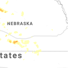
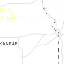
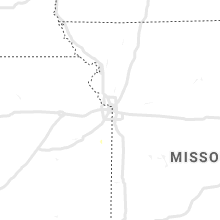
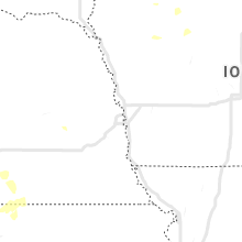
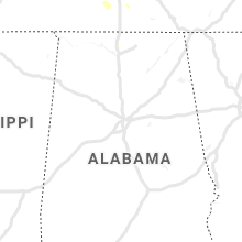
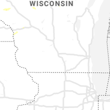
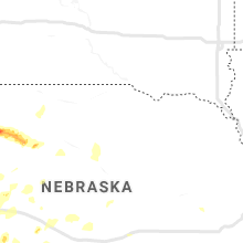
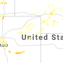
Hail Map for Thursday, July 4, 2019

Number of Impacted Households on 7/4/2019
0
Impacted by 1" or Larger Hail
0
Impacted by 1.75" or Larger Hail
0
Impacted by 2.5" or Larger Hail
Square Miles of Populated Area Impacted on 7/4/2019
0
Impacted by 1" or Larger Hail
0
Impacted by 1.75" or Larger Hail
0
Impacted by 2.5" or Larger Hail


Cities Most Affected by Hail Storms of 7/4/2019
| Hail Size | Demographics of Zip Codes Affected | ||||||
|---|---|---|---|---|---|---|---|
| City | Count | Average | Largest | Pop Density | House Value | Income | Age |
| Glendo, WY | 3 | 3.00 | 4.25 | 0 | $80k | $23.0k | 52.4 |
| Gordon, NE | 3 | 2.25 | 2.50 | 2 | $46k | $28.0k | 45.1 |
| Whitman, NE | 3 | 1.83 | 2.00 | 0 | $22k | $33.4k | 35.5 |
| Mullen, NE | 2 | 1.75 | 1.75 | 0 | $41k | $28.7k | 49.6 |
| Wheatland, WY | 1 | 3.00 | 3.00 | 3 | $89k | $35.1k | 47.3 |
| Rapid City, SD | 1 | 2.00 | 2.00 | 111 | $119k | $47.4k | 44.3 |
| Parker, CO | 1 | 2.00 | 2.00 | 472 | $232k | $78.4k | 38.4 |
| Moorcroft, WY | 1 | 1.75 | 1.75 | 2 | $86k | $42.3k | 37.7 |
| Merriman, NE | 1 | 1.75 | 1.75 | 0 | $30k | $26.6k | 47.3 |
| Arapahoe, NE | 1 | 1.75 | 1.75 | 6 | $45k | $29.4k | 46.4 |
| Thedford, NE | 1 | 1.75 | 1.75 | 0 | $39k | $31.7k | 46.4 |
Hail and Wind Damage Spotted on 7/4/2019
Filter by Report Type:Hail ReportsWind Reports
States Impacted
Wyoming, North Carolina, Virginia, Michigan, South Carolina, Maryland, Florida, Georgia, Nebraska, Colorado, Wisconsin, Utah, South DakotaWyoming
| Local Time | Report Details |
|---|---|
| 6:05 AM MDT | Ping Pong Ball sized hail reported near Casper, WY, 22.1 miles N of Casper, WY, junction of interstate 25 and highway 259. |
| 3:58 PM MDT | Golf Ball sized hail reported near Moorcroft, WY, 30.2 miles NE of Gillette, WY |
| 4:46 PM MDT | Tea Cup sized hail reported near Wheatland, WY, 33.6 miles NNE of Laramie, WY, on county road 12. 2 to 2.5 inch hail common. largest 3 inches. |
| 4:52 PM MDT | Quarter sized hail reported near Hulett, WY, 51.1 miles ENE of Gillette, WY |
| 5:10 PM MDT | Storm damage reported in fremont county WY, 25.3 miles W of Riverton, WY |
| 5:15 PM MDT | Rain over the last 24 hours in campbell county WY, 39.9 miles SSW of Gillette, WY |
| 5:30 PM MDT | Report via social medi in washakie county WY, 74.7 miles NE of Riverton, WY |
| 5:54 PM MDT | Quarter sized hail reported near Chugwater, WY, 53.6 miles ENE of Laramie, WY, law enforcement hwy patrol observed quarter sized hail and rotation with storm. |
| 6:02 PM MDT | Half Dollar sized hail reported near Chugwater, WY, 53.5 miles W of Scottsbluff, NE, storm chaser observed hail the size of half dollar |
| 6:08 PM MDT | Quarter sized hail reported near Chugwater, WY, 49.4 miles W of Scottsbluff, NE, hail up to size of quarters falling |
| 6:19 PM MDT | Ping Pong Ball sized hail reported near Evansville, WY, 3.7 miles ENE of Casper, WY, cole creek area |
| 6:38 PM MDT | Ping Pong Ball sized hail reported near Kaycee, WY, 61.2 miles NNW of Casper, WY, mostly nickle to quarter sized hail |
| 6:55 PM MDT | Time estimated using radar in campbell county WY, 55.3 miles SSE of Gillette, WY |
| 7:09 PM MDT | Quarter sized hail reported near Kaycee, WY, 56.6 miles SW of Gillette, WY |
| 7:45 PM MDT | Storm damage reported in weston county WY, 62.3 miles SE of Gillette, WY |
| 7:55 PM MDT | Storm damage reported in weston county WY, 55.6 miles WSW of Rapid City, SD |
| 8:44 PM MDT | Quarter sized hail reported near Douglas, WY, 58.2 miles SE of Casper, WY |
| 9:33 PM MDT | Grapefruit sized hail reported near Glendo, WY, 72.5 miles ESE of Casper, WY, softball sized hail falling 6 miles south of glenco reported by storm chaser. |
| 9:35 PM MDT | Storm damage reported in platte county WY, 73.4 miles ESE of Casper, WY |
| 9:45 PM MDT | Quarter sized hail reported near Glendo, WY, 73.3 miles ESE of Casper, WY, spotter observed hail the size of quarters near glendo. |
| 9:48 PM MDT | Half Dollar sized hail reported near Glendo, WY, 73.3 miles ESE of Casper, WY |
| 9:55 PM MDT | Golf Ball sized hail reported near Glendo, WY, 73.4 miles ESE of Casper, WY, ongoing at this time. |
| 10:00 PM MDT | Half Dollar sized hail reported near Glendo, WY, 73.4 miles ESE of Casper, WY, half dollar hail at cassa at 10pm |
| 10:02 PM MDT | Tea Cup sized hail reported near Glendo, WY, 75 miles ESE of Casper, WY, glendo marina. numerous cars in parking lot damaged. windows broken. sky lights in buildings shattered. |
North Carolina
| Local Time | Report Details |
|---|---|
| 1:12 PM EDT | Trees down on power line in montgomery county NC, 61.2 miles E of Charlotte, NC |
| 2:00 PM EDT | Correction: thunderstorm winds downed a tree onto a house along dacian avenu in durham county NC, 21.2 miles NW of Raleigh, NC |
| 2:27 PM EDT | 911 call center reported trees down on old beatty ford rd at intersections with rockwell rd and d earnhardt rd. time estimated by rada in rowan county NC, 32.1 miles NE of Charlotte, NC |
| 2:30 PM EDT | Corrects previous tstm wnd dmg report from 1 nw apex. skywarn coordinator reports a large limb down blocking portions of the roadway near the intersection of old apex r in wake county NC, 12.3 miles WSW of Raleigh, NC |
| 2:40 PM EDT | Barn lost its roof and an rv was rolled over onto its side. fields of corn blown down and debris scattered along parts of raynor road. time approximated by rada in johnston county NC, 32.3 miles SSE of Raleigh, NC |
| 2:57 PM EDT | Thunderstorm winds downed two trees... one on millstone road and another on mcdonald church road. time estimated via rada in richmond county NC, 69.8 miles E of Charlotte, NC |
| 3:15 PM EDT | Outflow winds from a thunderstorm downed a tree along second street. time estimated via rada in richmond county NC, 60.8 miles ESE of Charlotte, NC |
| 3:20 PM EDT | Tree reported down on house and car. no injuries. time estimated by rada in orange county NC, 41.4 miles NW of Raleigh, NC |
| 3:20 PM EDT | Tree down across driveway. time estimated by rada in orange county NC, 41.9 miles NW of Raleigh, NC |
| 4:00 PM EDT | Fire dept/rescue reported a tree down on roseway c in cabarrus county NC, 12.9 miles NE of Charlotte, NC |
| 4:05 PM EDT | Skywarn coordinator reports a large limb down blocking portions of the roadway near the intersection of old apex road and maynard roa in wake county NC, 12.3 miles WSW of Raleigh, NC |
| 4:08 PM EDT | Thunderstorm winds downed a tree along branch road near the intersection of farmdale roa in wake county NC, 8.6 miles SE of Raleigh, NC |
| 4:10 PM EDT | Fire dept/rescue reported trees down on power lines on hoover ave at reed s in cabarrus county NC, 19.9 miles NE of Charlotte, NC |
| 4:10 PM EDT | Fire dept/rescue reported a tree down on power lines on meadowview ave sw in cabarrus county NC, 18.2 miles NE of Charlotte, NC |
| 4:18 PM EDT | Thunderstorm winds downed a tree along bethlehem road near the intersection of grasshopper road. report relayed via social medi in wake county NC, 9.7 miles ESE of Raleigh, NC |
| 4:40 PM EDT | Thunderstorm winds downed a small tree near the intersection of nc 97 and old us 264. report relayed via social medi in wake county NC, 20 miles E of Raleigh, NC |
| 4:43 PM EDT | Thunderstorm winds downed trees and limbs onto powerlines... resulting in numerous power outages. time estimated via rada in wake county NC, 16.2 miles SW of Raleigh, NC |
| 4:43 PM EDT | Tree down on grigsby ave. time estimated by rada in wake county NC, 14.5 miles SW of Raleigh, NC |
| 4:51 PM EDT | Thunderstorm winds resulted in downed powerlines along old holly springs apex road. time estimated via rada in wake county NC, 14.1 miles SW of Raleigh, NC |
| 4:51 PM EDT | Thunderstorm winds downed a tree near the intersection of buckhorn duncan road near duncan cook roa in wake county NC, 18.6 miles SW of Raleigh, NC |
| 5:02 PM EDT | Thunderstorm winds downed a tree near the intersection of holly springs road and sancroft driv in wake county NC, 11 miles SW of Raleigh, NC |
| 5:46 PM EDT | Ping Pong Ball sized hail reported near Taylorsville, NC, 53.5 miles NNW of Charlotte, NC, amateur radio reported ping pong ball (1.50') size hail on walker foundry loop on hwy 16. |
| 6:00 PM EDT | Fire dept/rescue reported numerous trees and power lines down on nc highway 16 in alexander county NC, 52 miles NNW of Charlotte, NC |
| 6:08 PM EDT | Thunderstorm winds downed a tree near the community of centervill in franklin county NC, 41.3 miles NE of Raleigh, NC |
| 7:45 PM EDT | 911 call center reported numerous trees down in the chimney rock area. time estimated from rada in rutherford county NC, 46.7 miles NNE of Greenville, SC |
| 8:15 PM EDT | Social media reported trees down on smith waldrop rd. time estimated from rada in polk county NC, 41.2 miles NE of Greenville, SC |
| 8:20 PM EDT | 911 call center reported trees down in the columbus area. time estimated from rada in polk county NC, 36.7 miles NE of Greenville, SC |
| 8:20 PM EDT | 911 call center reported trees blocking us 74. time estimated from rada in polk county NC, 43.7 miles NE of Greenville, SC |
Virginia
| Local Time | Report Details |
|---|---|
| 1:13 PM EDT | Frank. co. fire reports of tree down with powerlines on hopkins valley lane of toms knob rd. timing estimated by rada in franklin county VA, 28.1 miles SSE of Roanoke, VA |
| 1:40 PM EDT | Tree down at the glade hill rescue squad. time estimated based on rada in franklin county VA, 19.9 miles SSE of Roanoke, VA |
| 2:22 PM EDT | 911 call center for pittsylvania co. reported one tree down on strawberry rd. timing estimated by rada in pittsylvania county VA, 39.7 miles SE of Roanoke, VA |
| 3:20 PM EDT | Buckingham co. dispatch reported downed tree at the intersection of troublesome creek rd. and fanny white rd. timing estimated by rada in buckingham county VA, 47.9 miles W of Richmond, VA |
| 3:45 PM EDT | Tree down at the intersection of james river rd. and porters r in albemarle county VA, 54.6 miles WNW of Richmond, VA |
| 4:00 PM EDT | Trees and wires down on a vehicle on s. oak ln. in the city of waynesboro in city of waynesboro county VA, 77.5 miles NE of Roanoke, VA |
| 4:30 PM EDT | Trees down throughout the eastern half of the county. time approximated by rada in mecklenburg county VA, 65.2 miles SSW of Richmond, VA |
| 5:30 PM EDT | Trees down near intersection of cowpasture river highway... and mountain valley road. time estimated by rada in bath county VA, 53.2 miles NNE of Roanoke, VA |
Michigan
| Local Time | Report Details |
|---|---|
| 1:42 PM EDT | Powerlines and tree limbs downed along north territorial between hankerd and dexter townhall road in washtenaw county MI, 45.4 miles SSW of Flint, MI |
| 8:30 PM EDT | Numerous large trees downed onto buildings... vehicles and power lines. street flooding on m-5 in roscommon county MI, 54.1 miles SE of Traverse City, MI |
South Carolina
| Local Time | Report Details |
|---|---|
| 1:45 PM EDT | A few trees blown dow in chester county SC, 33.4 miles S of Charlotte, NC |
| 1:53 PM EDT | Most of the shingles on a shed were blown off as well as a playhouse being tipped over and trampoline was lifted and flipped ove in york county SC, 28.8 miles SSW of Charlotte, NC |
| 2:00 PM EDT | Lexington dot and local media reported a large tree down blocking the eastbound lanes of interstate 20 near mile marker 60. time estimate in lexington county SC, 58.2 miles NE of Augusta, GA |
| 2:13 PM EDT | Several trees and a few power lines down in the city of rock hil in york county SC, 22.3 miles SSW of Charlotte, NC |
| 2:20 PM EDT | Multiple trees down in the lower part and upper part of the county. a more specific report will come late in chester county SC, 33.6 miles SSW of Charlotte, NC |
| 2:56 PM EDT | Schp reported a tree down on argent blvd before the hardeeville fire departmen in jasper county SC, 18.7 miles NNE of Savannah, GA |
| 3:04 PM EDT | Schp reported power lines down at bees creek road and scarlett ibis driv in jasper county SC, 25.6 miles NNE of Savannah, GA |
| 3:04 PM EDT | Reports of both a tree and power lines down at the entrance of heron crossing apartment in jasper county SC, 28.1 miles NNE of Savannah, GA |
| 3:39 PM EDT | Schp reported a tree down on mitchellville r in jasper county SC, 26.9 miles NNE of Savannah, GA |
| 4:11 PM EDT | A 911 call center reported a tree down on highway 52 near highway 40 in berkeley county SC, 3 miles ENE of Charleston, SC |
| 4:15 PM EDT | A 911 call center reported a tree down near the intersection of mudville rd and state r in berkeley county SC, 14.4 miles W of Charleston, SC |
| 4:15 PM EDT | A church steeple was blown off a roof a church along old black oak road. time estimated from radar dat in berkeley county SC, 4.3 miles NE of Charleston, SC |
| 4:15 PM EDT | A 911 call center reported a tree down in a wooded area behind a large department stor in berkeley county SC, 1.6 miles NE of Charleston, SC |
| 4:49 PM EDT | A 911 call center reported a tree down at the 1800 block on old highway in berkeley county SC, 16.5 miles NW of Charleston, SC |
| 5:00 PM EDT | Tree down on taylor dr near us hwy 1 (main st) in lexington. time estimate in lexington county SC, 55.1 miles NE of Augusta, GA |
| 8:40 PM EDT | Schp reported a tree down at harper st and belton highway in anderson county SC, 17.6 miles SSE of Greenville, SC |
| 8:40 PM EDT | Schp reported a tree down at 1206 garren r in anderson county SC, 18.4 miles SSE of Greenville, SC |
| 8:43 PM EDT | Schp reported a tree down at highway 20 and youth center r in anderson county SC, 19.1 miles SSE of Greenville, SC |
| 8:55 PM EDT | Public caller reported a few trees down in the campobello are in spartanburg county SC, 32.4 miles NE of Greenville, SC |
| 9:00 PM EDT | 911 call center reported trees down on patterson rd & skyline d in spartanburg county SC, 31.2 miles NE of Greenville, SC |
Maryland
| Local Time | Report Details |
|---|---|
| 1:47 PM EDT | Branches down on wires at in the 3500 block of madonna l in prince georges county MD, 22.7 miles SSW of Baltimore, MD |
| 2:11 PM EDT | Tree down near the intersection of alesia lineboro rd. and schalk 1 r in carroll county MD, 30.2 miles NNW of Baltimore, MD |
| 4:42 PM EDT | Trees down near the intersection of marshall hall rd. and fenwick r in charles county MD, 50.3 miles SSW of Baltimore, MD |
Florida
| Local Time | Report Details |
|---|---|
| 2:41 PM EDT | Gust of 58 mph recorded at mesonet station dw3253 tamp in hillsborough county FL, 32 miles NNE of Bradenton, FL |
| 3:00 PM EDT | Powerline reported down 1100 block of a1a north. time of event based on rada in st. johns county FL, 21.3 miles SE of Jacksonville, FL |
| 3:05 PM EDT | Action news jacksonville posted a picture of a tree split and hanging over austn park drive in nocatee on social medi in st. johns county FL, 20.1 miles SE of Jacksonville, FL |
| 4:46 PM EDT | Relayed from em director: sheriff office report of metal roofing blown off webster wholesale market and trees downed on cr 478 and reports of trees down and power outag in sumter county FL, 41.7 miles W of Orlando, FL |
| 5:39 PM EDT | Bronson fire department report of tree on power lines blocking sr-24 and ne 99 plac in levy county FL, 81.5 miles SW of Jacksonville, FL |
| 5:40 PM EDT | Trained spotter reported large tree limbs downed and panels of fencing flung by strong wind gusts. time of damage based on radar dat in alachua county FL, 77.6 miles SW of Jacksonville, FL |
Georgia
| Local Time | Report Details |
|---|---|
| 3:25 PM EDT | A tree was reported down on beautiful zion church road and highway 28 in bryan county GA, 33.6 miles W of Savannah, GA |
Nebraska
| Local Time | Report Details |
|---|---|
| 2:53 PM MDT | Quarter sized hail reported near Gordon, NE, 87.6 miles W of Valentine, NE, pea to quarter size hail and heavy rain. |
| 3:12 PM MDT | Half Dollar sized hail reported near Gordon, NE, 84.8 miles W of Valentine, NE, quarter to half dollar size hail |
| 3:26 PM MDT | Tennis Ball sized hail reported near Gordon, NE, 81.8 miles W of Valentine, NE, hail ranging from pea size to tennis ball size. most of the hail was golf ball size. heavy rain reported as well with ponding in the yard. |
| 4:30 PM MDT | Tennis Ball sized hail reported near Gordon, NE, 79.9 miles WSW of Valentine, NE, significant damage from wind and hail... including shattered windows. hail measured 2.25+ in. smaller hail nearly covered ground. |
| 4:30 PM MDT | Significant structure damage from wind and hail. wind estimated 80 mph. tin roof peeled off and windows shattere in cherry county NE, 79.9 miles WSW of Valentine, NE |
| 4:43 PM MDT | Golf Ball sized hail reported near Gordon, NE, 70.3 miles WSW of Valentine, NE, had golf ball size hail with the majority as moth ball and pea size. |
| 4:43 PM MDT | Golf Ball sized hail reported near Merriman, NE, 62.6 miles WSW of Valentine, NE, had golf ball size hail with the majority as moth ball and pea size. |
| 5:23 PM MDT | Hen Egg sized hail reported near Whitman, NE, 60.2 miles WSW of Valentine, NE, estimated hail size. three windows broken at house. |
| 5:29 PM MDT | Golf Ball sized hail reported near Whitman, NE, 60.2 miles WSW of Valentine, NE, roof damage and windows damaged/broken. very strong winds but no wind estimate avail. |
| 5:30 PM MDT | Golf Ball sized hail reported near Whitman, NE, 56 miles WSW of Valentine, NE |
| 5:59 PM MDT | Golf Ball sized hail reported near Mullen, NE, 54.4 miles SW of Valentine, NE |
| 6:09 PM MDT | Golf Ball sized hail reported near Mullen, NE, 52.1 miles SW of Valentine, NE |
| 6:09 PM MDT | Tree limbs down and broken windows with winds estimated at least 50-60 mp in cherry county NE, 52.1 miles SW of Valentine, NE |
| 6:50 PM MDT | Quarter sized hail reported near Seneca, NE, 51.1 miles SSW of Valentine, NE |
| 8:50 PM CDT | Golf Ball sized hail reported near Thedford, NE, 55.6 miles S of Valentine, NE, time estimated by radar. |
| 12:26 AM CDT | Quarter sized hail reported near Eustis, NE, 54.5 miles SE of North Platte, NE |
| 12:41 AM CDT | Via davis weatherlink statio in furnas county NE, 80.9 miles SE of North Platte, NE |
| 12:45 AM CDT | Golf Ball sized hail reported near Arapahoe, NE, 67.3 miles SE of North Platte, NE, report via facebook. |
| 1:10 AM CDT | Pws station knesuthe2 in lincoln county NE, 19.8 miles W of North Platte, NE |
| 1:35 AM CDT | Power line down across roadway at highway 23 and 734 road... reported by law enforcemen in phelps county NE, 67.6 miles WSW of Grand Island, NE |
| 2:25 AM CDT | Storm damage reported in custer county NE, 38.6 miles E of North Platte, NE |
| 2:45 AM CDT | Large tree limb damage to healthy tree. time estimated from rada in adams county NE, 22.6 miles S of Grand Island, NE |
| 2:52 AM CDT | Corrects previous tstm wnd gst report from 2 nnw broken bow. asos station kbbw broken bow airpor in custer county NE, 61.4 miles ENE of North Platte, NE |
| 3:24 AM CDT | Weather station kneharva in clay county NE, 24.5 miles SSE of Grand Island, NE |
| 3:47 AM CDT | Time estimated from rada in holt county NE, 29.6 miles SW of Oneill, NE |
Colorado
| Local Time | Report Details |
|---|---|
| 3:34 PM MDT | Half Dollar sized hail reported near Monument, CO, 45.2 miles SSE of Denver, CO |
| 3:35 PM MDT | Ping Pong Ball sized hail reported near Monument, CO, 45.3 miles S of Denver, CO, pic via social media. time estimated by radar. |
| 3:36 PM MDT | Half Dollar sized hail reported near Monument, CO, 45.4 miles S of Denver, CO, pic via social media. |
| 3:40 PM MDT | Half Dollar sized hail reported near Monument, CO, 45 miles S of Denver, CO |
| 3:43 PM MDT | Ping Pong Ball sized hail reported near Monument, CO, 45.2 miles SSE of Denver, CO, softer hail. |
| 3:50 PM MDT | Quarter sized hail reported near Parker, CO, 20.9 miles SE of Denver, CO |
| 3:52 PM MDT | Quarter sized hail reported near Monument, CO, 44.6 miles S of Denver, CO, via pic on social media. |
| 4:04 PM MDT | Ping Pong Ball sized hail reported near Peyton, CO, 44.2 miles N of Pueblo, CO |
| 4:05 PM MDT | Quarter sized hail reported near Peyton, CO, 44.2 miles N of Pueblo, CO |
| 4:13 PM MDT | Half Dollar sized hail reported near Franktown, CO, 32.2 miles SSE of Denver, CO |
| 4:20 PM MDT | Quarter sized hail reported near Franktown, CO, 27.9 miles SSE of Denver, CO |
| 4:45 PM MDT | Half Dollar sized hail reported near Parker, CO, 21.1 miles SE of Denver, CO |
| 4:52 PM MDT | Hen Egg sized hail reported near Parker, CO, 21.7 miles SE of Denver, CO |
| 4:54 PM MDT | Quarter sized hail reported near Parker, CO, 20.8 miles SE of Denver, CO |
| 5:05 PM MDT | Ping Pong Ball sized hail reported near Parker, CO, 20.1 miles SE of Denver, CO, report via twitter. |
| 5:29 PM MDT | Quarter sized hail reported near Lone Tree, CO, 14.8 miles SSE of Denver, CO, report via twitter. |
| 5:30 PM MDT | Quarter sized hail reported near Englewood, CO, 12.9 miles SSE of Denver, CO |
| 5:35 PM MDT | Quarter sized hail reported near Englewood, CO, 12.5 miles SSE of Denver, CO, ar1171. |
| 5:38 PM MDT | Half Dollar sized hail reported near Littleton, CO, 13.2 miles S of Denver, CO, report via twitter. |
| 5:38 PM MDT | Half Dollar sized hail reported near Lone Tree, CO, 15.3 miles SSE of Denver, CO |
| 5:55 PM MDT | Quarter sized hail reported near Aurora, CO, 10.2 miles SE of Denver, CO, ar1141. |
| 6:05 PM MDT | Ping Pong Ball sized hail reported near Fort Lupton, CO, 26 miles NNE of Denver, CO |
| 6:20 PM MDT | Quarter sized hail reported near Denver, CO, 3.2 miles WSW of Denver, CO, report via twitter. |
| 6:23 PM MDT | Ping Pong Ball sized hail reported near Littleton, CO, 12.7 miles SW of Denver, CO |
| 6:25 PM MDT | Quarter sized hail reported near Littleton, CO, 12.3 miles SW of Denver, CO, report via twitter. |
| 6:26 PM MDT | Quarter sized hail reported near Morrison, CO, 11.3 miles SW of Denver, CO |
| 6:28 PM MDT | Quarter sized hail reported near Denver, CO, 2.6 miles WNW of Denver, CO, report via twitter. |
| 6:30 PM MDT | Ping Pong Ball sized hail reported near Littleton, CO, 9.5 miles SW of Denver, CO |
| 6:36 PM MDT | Quarter sized hail reported near Denver, CO, 6.9 miles WSW of Denver, CO |
| 6:40 PM MDT | Quarter sized hail reported near Ramah, CO, 58.9 miles NE of Pueblo, CO |
| 6:43 PM MDT | Quarter sized hail reported near Denver, CO, 4.5 miles SSE of Denver, CO, reported at university of denver... ge27. |
| 6:57 PM MDT | Quarter sized hail reported near Broomfield, CO, 13.1 miles NNW of Denver, CO, reported at broomfield by kansas spotter sn523. |
| 7:50 PM MDT | Quarter sized hail reported near Cope, CO, 31.7 miles SSW of Yuma, CO |
| 7:50 PM MDT | Ping Pong Ball sized hail reported near Fort Collins, CO, 51.2 miles N of Denver, CO, lasted approximately 8 minutes. |
| 8:50 PM MDT | Half Dollar sized hail reported near Carr, CO, 43.3 miles SE of Laramie, WY |
Wisconsin
| Local Time | Report Details |
|---|---|
| 4:46 PM CDT | Tree uprooted and landed on a house in manawa. there were no injuries. time estimated by rada in waupaca county WI, 44.6 miles W of Green Bay, WI |
| 6:49 PM CDT | Large branches down in manitowoc county WI, 30.5 miles SSE of Green Bay, WI |
| 6:50 PM CDT | One branch dow in monroe county WI, 23.6 miles ENE of La Crosse, WI |
Utah
| Local Time | Report Details |
|---|---|
| 4:35 PM MDT | Storm damage reported in tooele county UT, 84.9 miles WSW of Salt Lake City, UT |
| 5:05 PM MDT | Storm damage reported in box elder county UT, 60.5 miles WNW of Salt Lake City, UT |
| 5:30 PM MDT | Storm damage reported in tooele county UT, 40.6 miles W of Salt Lake City, UT |
| 5:50 PM MDT | Storm damage reported in weber county UT, 33.1 miles NW of Salt Lake City, UT |
| 6:00 PM MDT | Storm damage reported in box elder county UT, 45 miles NW of Salt Lake City, UT |
| 6:05 PM MDT | Storm damage reported in salt lake county UT, 2.6 miles WNW of Salt Lake City, UT |
| 6:13 PM MDT | Downed trees and fence in salt lake county UT, 1.6 miles ENE of Salt Lake City, UT |
| 6:30 PM MDT | Storm damage reported in weber county UT, 30.4 miles N of Salt Lake City, UT |
South Dakota
| Local Time | Report Details |
|---|---|
| 6:45 PM MDT | Quarter sized hail reported near Fort Meade, SD, 25.6 miles NNW of Rapid City, SD |
| 8:48 PM MDT | Rapid creek out of it's banks in rochfor in pennington county SD, 24.5 miles W of Rapid City, SD |
| 8:55 PM MDT | Quarter sized hail reported near Rapid City, SD, 4.2 miles S of Rapid City, SD |
| 9:00 PM MDT | Hen Egg sized hail reported near Rapid City, SD, 4.2 miles S of Rapid City, SD |
| 9:05 PM MDT | Quarter sized hail reported near Rapid City, SD, 3.4 miles ESE of Rapid City, SD |
| 9:06 PM MDT | Storm damage reported in pennington county SD, 8.8 miles ESE of Rapid City, SD |
| 10:05 PM MDT | Time estimated from radar in pennington county SD, 51.3 miles ESE of Rapid City, SD |
| 10:14 PM MDT | Storm damage reported in pennington county SD, 49.8 miles E of Rapid City, SD |
| 10:38 PM MDT | Storm damage reported in jackson county SD, 72.3 miles ESE of Rapid City, SD |
| 10:45 PM MDT | Storm damage reported in haakon county SD, 65.9 miles WSW of Pierre, SD |
| 11:24 PM MDT | Storm damage reported in haakon county SD, 44 miles WSW of Pierre, SD |
| 11:37 PM MDT | Storm damage reported in stanley county SD, 26.3 miles W of Pierre, SD |
Connect with Interactive Hail Maps