

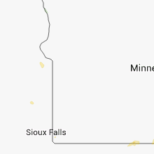
Hail Map for Sunday, June 1, 2014

Number of Impacted Households on 6/1/2014
0
Impacted by 1" or Larger Hail
0
Impacted by 1.75" or Larger Hail
0
Impacted by 2.5" or Larger Hail
Square Miles of Populated Area Impacted on 6/1/2014
0
Impacted by 1" or Larger Hail
0
Impacted by 1.75" or Larger Hail
0
Impacted by 2.5" or Larger Hail


Cities Most Affected by Hail Storms of 6/1/2014
| Hail Size | Demographics of Zip Codes Affected | ||||||
|---|---|---|---|---|---|---|---|
| City | Count | Average | Largest | Pop Density | House Value | Income | Age |
| Fowler, KS | 1 | 2.50 | 2.50 | 1 | $41k | $36.1k | 41.5 |
| Alliance, NE | 1 | 2.50 | 2.50 | 10 | $73k | $39.4k | 40.8 |
| Minneola, KS | 1 | 1.75 | 1.75 | 1 | $52k | $33.0k | 42.5 |
| Alton, KS | 1 | 1.75 | 1.75 | 2 | $15k | $33.2k | 48.8 |
| Ulysses, KS | 1 | 1.75 | 1.75 | 11 | $79k | $39.7k | 32.8 |
| Ashland, KS | 1 | 1.75 | 1.75 | 0 | $37k | $34.7k | 44.3 |
| Calhan, CO | 1 | 1.75 | 1.75 | 17 | $121k | $42.2k | 39.6 |
| Protection, KS | 1 | 1.75 | 1.75 | 1 | $25k | $29.5k | 46.8 |
Hail and Wind Damage Spotted on 6/1/2014
Filter by Report Type:Hail ReportsWind Reports
States Impacted
South Dakota, Nebraska, Iowa, Wisconsin, Colorado, Kansas, Illinois, Wyoming, Oklahoma, MissouriSouth Dakota
| Local Time | Report Details |
|---|---|
| 8:30 AM CDT | Small branches down in deuel county SD, 48.4 miles WSW of Montevideo, MN |
| 1:35 PM CDT | Storm damage reported in yankton county SD, 56.1 miles SW of Sioux Falls, SD |
| 1:48 PM CDT | Quarter sized hail reported near Yankton, SD, 50.6 miles SW of Sioux Falls, SD, quarter size hail and over 2 inches of rainfall |
| 2:06 PM CDT | Sheet metal building blown onto road at intersection of sd 46 and us 8 in yankton county SD, 45.6 miles SW of Sioux Falls, SD |
| 2:50 PM CDT | Large branch blown off tree by winds estimated at 50 mp in minnehaha county SD, 3.7 miles ESE of Sioux Falls, SD |
| 3:10 PM CDT | Strong winds and 1.50 inch rainfall in clay county SD, 47.8 miles S of Sioux Falls, SD |
Nebraska
| Local Time | Report Details |
|---|---|
| 9:15 AM MDT | Quarter sized hail reported near Paxton, NE, 28.2 miles W of North Platte, NE, heavy rainfall with pea size hail...a few hail stones the size of quarters. |
| 12:46 PM CDT | Quarter sized hail reported near Elwood, NE, 57.2 miles ESE of North Platte, NE, brief down pour covered ground in hail ranging in size from peas to quarters. |
| 2:04 PM CDT | Quarter sized hail reported near Cambridge, NE, 66.3 miles SSE of North Platte, NE, quarter sized hail with a 60 mph wind gust. |
| 2:11 PM CDT | Half Dollar sized hail reported near Bloomfield, NE, 51.9 miles ENE of Oneill, NE |
| 2:11 PM CDT | Delayed report of damage. several reports of damage in and around pender. damage to trees... barns... parks. estimated 60 to 70 mph wind in thurston county NE, 70.9 miles NW of Omaha, NE |
| 4:19 PM CDT | Storm damage reported in saunders county NE, 33.9 miles W of Omaha, NE |
| 4:25 PM CDT | Tree blown onto house. relayed from the weather channe in dodge county NE, 31.1 miles WNW of Omaha, NE |
| 4:27 PM CDT | Storm damage reported in burt county NE, 36.6 miles NNW of Omaha, NE |
| 3:47 PM MDT | Storm damage reported in sioux county NE, 21.3 miles NW of Scottsbluff, NE |
| 4:53 PM CDT | 192nd and q street are in douglas county NE, 3.6 miles W of Omaha, NE |
| 4:55 PM CDT | Nickel sized hail to in douglas county NE, 16.2 miles W of Omaha, NE |
| 4:55 PM CDT | Storm damage reported in washington county NE, 17.8 miles NW of Omaha, NE |
| 4:55 PM CDT | Storm damage reported in sarpy county NE, 17.7 miles WSW of Omaha, NE |
| 5:21 PM CDT | At eppley airpor in douglas county NE, 3.4 miles NE of Omaha, NE |
| 4:30 PM MDT | 0.4 inch rain and small hai in morrill county NE, 19.2 miles ENE of Scottsbluff, NE |
| 5:33 PM CDT | Storm damage reported in cass county NE, 17.5 miles S of Omaha, NE |
| 4:35 PM MDT | Ping Pong Ball sized hail reported near Hemingford, NE, 40.2 miles NE of Scottsbluff, NE |
| 4:40 PM MDT | Tennis Ball sized hail reported near Alliance, NE, 49.2 miles NE of Scottsbluff, NE, via social media. |
| 5:01 PM MDT | Very heavy rai in box butte county NE, 43.1 miles ENE of Scottsbluff, NE |
| 5:01 PM MDT | Storm damage reported in box butte county NE, 45.8 miles ENE of Scottsbluff, NE |
| 5:05 PM MDT | Precipitation of .93 along with pea-sized hai in box butte county NE, 50.2 miles ENE of Scottsbluff, NE |
| 5:12 PM MDT | 40 to 50 mph sustained winds with gusts estimated over 60 mph. shingles off shopp. pea sized hail also occurred. very heavy rain at time of this repor in sheridan county NE, 52.5 miles ENE of Scottsbluff, NE |
| 6:25 PM CDT | Large three foot diameter tree snapped seven feet up and fell on a hous in jefferson county NE, 74.1 miles NNW of Manhattan, KS |
| 5:55 PM MDT | Estimated 50 to 60 mph wind gusts...small tree branches down. also pea sized hail covering ground at time of this repor in grant county NE, 79.4 miles NW of North Platte, NE |
| 6:10 PM MDT | Estimated 60 to 70 mph wind gusts as thunderstorms passed. also pea sized hai in grant county NE, 55.9 miles NW of North Platte, NE |
| 6:25 PM MDT | Estimated 60 mph thunderstorm wind gusts. blew over grill and lawn furnitur in grant county NE, 72.8 miles NW of North Platte, NE |
| 6:50 PM MDT | Storm damage reported in hooker county NE, 61.3 miles NNW of North Platte, NE |
| 6:50 PM MDT | Also heavy rain at time of this repor in hooker county NE, 63.1 miles NNW of North Platte, NE |
| 9:00 PM CDT | Storm damage reported in custer county NE, 37.5 miles ENE of North Platte, NE |
Iowa
| Local Time | Report Details |
|---|---|
| 1:56 PM CDT | Quarter sized hail reported near Le Mars, IA, 50.9 miles WNW of Storm Lake, IA |
| 3:09 PM CDT | 12 inch tree limbs down along with a few trees around tow in plymouth county IA, 50.1 miles S of Sioux Falls, SD |
| 3:30 PM CDT | Storm damage reported in plymouth county IA, 50.3 miles WNW of Storm Lake, IA |
| 3:30 PM CDT | Storm damage reported in woodbury county IA, 62.4 miles WSW of Storm Lake, IA |
| 3:32 PM CDT | Lots of dust blown up as storm was moving in. no rain ye in woodbury county IA, 59.5 miles WSW of Storm Lake, IA |
| 3:35 PM CDT | Storm damage reported in plymouth county IA, 50.9 miles WNW of Storm Lake, IA |
| 3:48 PM CDT | Heavy rain and strong winds lasted about 15 minute in sioux county IA, 44.2 miles SE of Sioux Falls, SD |
| 4:16 PM CDT | A couple of trees down in ida county IA, 26.4 miles WSW of Storm Lake, IA |
| 4:30 PM CDT | Storm damage reported in harrison county IA, 38.2 miles N of Omaha, NE |
| 5:15 PM CDT | Storm damage reported in harrison county IA, 20.8 miles N of Omaha, NE |
| 5:15 PM CDT | Trees down...including onto a power line...around the city of council bluff in pottawattamie county IA, 4.4 miles ESE of Omaha, NE |
| 5:30 PM CDT | Tree down near 270th st and highway 6 blocking 270th st. time estimated from rada in pottawattamie county IA, 10.5 miles E of Omaha, NE |
| 7:11 PM CDT | Storm damage reported in webster county IA, 51.5 miles NNW of Des Moines, IA |
Wisconsin
| Local Time | Report Details |
|---|---|
| 2:55 PM CDT | Tree limbs down cit in waupaca county WI, 37.7 miles WSW of Green Bay, WI |
| 5:43 PM CDT | 60 ft by 120 ft pole barn blown down. steel sheeting from pole barn was blown about 1/4 mile from southwest to northeast. 16 inch diameter spruce tree snapped off near in lafayette county WI, 40.7 miles SW of Madison, WI |
Colorado
| Local Time | Report Details |
|---|---|
| 2:18 PM MDT | Quarter sized hail reported near Cheyenne Wells, CO, 83.9 miles WSW of Colby, KS |
| 12:23 AM MDT | Quarter sized hail reported near Limon, CO, 76.8 miles ESE of Denver, CO, time estimated based on radar |
| 12:47 AM MDT | Quarter sized hail reported near Hugo, CO, 79 miles SSW of Yuma, CO, time estimated based on radar. |
| 1:20 AM MDT | Golf Ball sized hail reported near Calhan, CO, 36.3 miles NNE of Pueblo, CO, windshiedls broken...skylights broken. report relayed from media. |
Kansas
| Local Time | Report Details |
|---|---|
| 3:27 PM CDT | Quarter sized hail reported near Norton, KS, 66.9 miles ENE of Colby, KS |
| 2:30 PM MDT | Quarter sized hail reported near Kendall, KS, 40.1 miles WNW of Garden City, KS |
| 3:52 PM CDT | Quarter sized hail reported near Alton, KS, 44.2 miles NNE of Hays, KS |
| 3:53 PM CDT | Quarter sized hail reported near Winona, KS, 43.4 miles SSW of Colby, KS |
| 4:07 PM CDT | Quarter sized hail reported near Lakin, KS, 26.9 miles NW of Garden City, KS |
| 4:21 PM CDT | Quarter sized hail reported near Alton, KS, 46.1 miles NNE of Hays, KS |
| 4:28 PM CDT | Quarter sized hail reported near Stockton, KS, 39.4 miles N of Hays, KS |
| 4:35 PM CDT | Quarter sized hail reported near Scott City, KS, 47.5 miles N of Garden City, KS |
| 4:43 PM CDT | Quarter sized hail reported near Alton, KS, 38.5 miles NNE of Hays, KS, up to quarter size |
| 4:50 PM CDT | Quarter sized hail reported near Oakley, KS, 41.8 miles SSE of Colby, KS |
| 5:00 PM CDT | Golf Ball sized hail reported near Alton, KS, 46.1 miles NNE of Hays, KS |
| 5:08 PM CDT | Vis dropped down to 1 block with heavy rain. est 60 mph winds in jewell county KS, 72.8 miles S of Grand Island, NE |
| 5:08 PM CDT | Half Dollar sized hail reported near Marienthal, KS, 40.9 miles NNW of Garden City, KS, quarter to half dollar size hail was falling. |
| 5:10 PM CDT | 60 mph straight line winds in gove county KS, 49.2 miles ESE of Colby, KS |
| 5:20 PM CDT | Quarter sized hail reported near Osborne, KS, 51.9 miles NE of Hays, KS |
| 5:20 PM CDT | Storm damage reported in osborne county KS, 51.9 miles NE of Hays, KS |
| 5:20 PM CDT | Ping Pong Ball sized hail reported near Osborne, KS, 51.9 miles NE of Hays, KS, time estimated from radar |
| 5:30 PM CDT | Large tree limbs broken in webber. report received via radio station in superio in jewell county KS, 70.4 miles SSE of Grand Island, NE |
| 5:33 PM CDT | From the kdot rwis sit in trego county KS, 30.5 miles WNW of Hays, KS |
| 5:47 PM CDT | Storm damage reported in republic county KS, 82.3 miles SSE of Grand Island, NE |
| 5:47 PM CDT | Storm damage reported in republic county KS, 82.3 miles SSE of Grand Island, NE |
| 5:48 PM CDT | Quarter sized hail reported near Johnson, KS, 49.2 miles SW of Garden City, KS |
| 5:55 PM CDT | Quarter sized hail reported near Grainfield, KS, 36.7 miles ESE of Colby, KS, quarter inch hail fell a little before 6 pm cdt and covered the ground. |
| 6:00 PM CDT | Quarter sized hail reported near Grainfield, KS, 34 miles SE of Colby, KS, quarter size hail covered the ground. |
| 6:05 PM CDT | 25 to 30 power poles downed from high winds along highway 281. delayed report. time approximated from rada in russell county KS, 28.2 miles ENE of Hays, KS |
| 6:07 PM CDT | Quarter sized hail reported near Ulysses, KS, 38.8 miles SW of Garden City, KS, hail ranged from pea to quarter sized. |
| 6:08 PM CDT | Golf Ball sized hail reported near Ulysses, KS, 46.5 miles SW of Garden City, KS |
| 6:22 PM CDT | Storm damage reported in russell county KS, 26.9 miles ENE of Hays, KS |
| 6:29 PM CDT | Storm damage reported in russell county KS, 26 miles E of Hays, KS |
| 6:35 PM CDT | Esitmated wind sustained 40-50 mph... and gusts to 65 mp in ford county KS, 43.8 miles E of Garden City, KS |
| 6:43 PM CDT | Ping Pong Ball sized hail reported near Nekoma, KS, 30.3 miles S of Hays, KS, hail was quarter to ping pong ball size. |
| 6:45 PM CDT | Numerous 8 inch diameter tree branches dow in ford county KS, 73.9 miles ESE of Garden City, KS |
| 6:45 PM CDT | Storm damage reported in ford county KS, 44 miles ESE of Garden City, KS |
| 6:53 PM CDT | Storm damage reported in washington county KS, 46.7 miles NW of Manhattan, KS |
| 6:58 PM CDT | Awning of a porch was torn from the roofing in the 1300 block of sunnysid in ford county KS, 49.3 miles ESE of Garden City, KS |
| 7:00 PM CDT | Power pole blown dow in ford county KS, 50 miles ESE of Garden City, KS |
| 7:01 PM CDT | Quarter sized hail reported near Dodge City, KS, 49.3 miles ESE of Garden City, KS |
| 7:06 PM CDT | Report from dodge city aso in ford county KS, 51.2 miles ESE of Garden City, KS |
| 7:08 PM CDT | Estimated winds 60-70 mph. torrential rainfal in lincoln county KS, 69.2 miles E of Hays, KS |
| 7:09 PM CDT | Large transmission power line dow in ford county KS, 46.9 miles ESE of Garden City, KS |
| 7:30 PM CDT | A 15x30 foot metal shed was blown about 200 feet. 2-3 inch diameter tree limbs blown dow in ford county KS, 65.6 miles ESE of Garden City, KS |
| 7:35 PM CDT | Storm damage reported in barton county KS, 45.9 miles SE of Hays, KS |
| 7:35 PM CDT | Small branches were blown dow in ford county KS, 69.3 miles ESE of Garden City, KS |
| 7:38 PM CDT | 4 to 8 inch diameter trees...up to 30 feet in length...down and closing kansas highway 18 south of benningto in ottawa county KS, 56.8 miles WSW of Manhattan, KS |
| 7:45 PM CDT | Storm damage reported in ford county KS, 73.9 miles ESE of Garden City, KS |
| 7:54 PM CDT | Several 3 to 4 inch diameter tree branches dow in dickinson county KS, 47 miles WSW of Manhattan, KS |
| 8:00 PM CDT | Storm damage reported in dickinson county KS, 41.2 miles WSW of Manhattan, KS |
| 8:01 PM CDT | Ping Pong Ball sized hail reported near Minneola, KS, 62.4 miles SE of Garden City, KS, also had 60 mph winds. |
| 8:01 PM CDT | Also had ping ping ball sized hai in clark county KS, 62.4 miles SE of Garden City, KS |
| 8:04 PM CDT | Storm damage reported in meade county KS, 62.3 miles SE of Garden City, KS |
| 8:11 PM CDT | Estimated 60-65 mph winds in dickinson county KS, 35.2 miles WSW of Manhattan, KS |
| 8:11 PM CDT | Tennis Ball sized hail reported near Fowler, KS, 54.9 miles SE of Garden City, KS |
| 8:15 PM CDT | Wooden ticket booth at the ballpark was blown over. 3 inch diameter tree limbs dow in dickinson county KS, 31.3 miles SW of Manhattan, KS |
| 8:18 PM CDT | Golf Ball sized hail reported near Minneola, KS, 60.9 miles SE of Garden City, KS, it hailed from 818 pm until 828 pm and covered the ground. |
| 8:20 PM CDT | Storm damage reported in kiowa county KS, 78.2 miles NNE of Woodward, OK |
| 8:30 PM CDT | Storm damage reported in geary county KS, 25.2 miles SW of Manhattan, KS |
| 8:33 PM CDT | Quarter sized hail reported near Minneola, KS, 68.8 miles SE of Garden City, KS |
| 8:40 PM CDT | Measured on home weather statio in geary county KS, 16 miles WSW of Manhattan, KS |
| 8:50 PM CDT | A stretch of us160 had 24 power poles blown down starting 3 miles east of coldwate in comanche county KS, 57.4 miles N of Woodward, OK |
| 9:05 PM CDT | Wet macroburst took down a half mile of power poles. numerous trees were heavily damaged in the northwest part of the county as wel in comanche county KS, 57.7 miles N of Woodward, OK |
| 9:08 PM CDT | Golf Ball sized hail reported near Ashland, KS, 59.7 miles NNW of Woodward, OK |
| 9:35 PM CDT | Golf Ball sized hail reported near Protection, KS, 42.7 miles N of Woodward, OK |
| 9:58 PM CDT | Quarter sized hail reported near Bucklin, KS, 70.6 miles N of Woodward, OK |
| 10:47 PM CDT | Tree down in ottawa around 1047 p in franklin county KS, 49.8 miles SW of Kansas City, MO |
Illinois
| Local Time | Report Details |
|---|---|
| 3:45 PM CDT | Clay co ema reported several power poles leaning...with 4 broken at the top...just north of the clay-effingham county line along route 4 in effingham county IL, 39.1 miles SSW of Mattoon, IL |
| 7:20 PM CDT | 8 inch tree branch blown onto power lines. the branch is hanging from the lines... is smoking and there are occasional spark in la salle county IL, 45.9 miles NNE of Peoria, IL |
| 7:45 PM CDT | Numerous small limbs down. two limbs of 8 to 10 inches in diameter and 15 to 20 feet in length also down. delayed repor in mercer county IL, 58.4 miles NW of Peoria, IL |
| 8:00 PM CDT | Tree limbs of 6 to 8 inches dow in henry county IL, 60.4 miles NW of Peoria, IL |
Wyoming
| Local Time | Report Details |
|---|---|
| 3:37 PM MDT | Quarter sized hail reported near Yoder, WY, 43.7 miles W of Scottsbluff, NE, time estimated based on radar. |
Oklahoma
| Local Time | Report Details |
|---|---|
| 9:30 PM CDT | May ranch mesonet in woods county OK, 43.7 miles NNE of Woodward, OK |
| 9:35 PM CDT | May ranch mesonet in woods county OK, 43.7 miles NNE of Woodward, OK |
| 10:05 PM CDT | Storm damage reported in woods county OK, 42.3 miles ENE of Woodward, OK |
| 10:25 PM CDT | Storm damage reported in alfalfa county OK, 61.5 miles ENE of Woodward, OK |
| 2:30 AM CDT | Quarter sized hail reported near Perkins, OK, 42.7 miles NE of Oklahoma City, OK |
Missouri
| Local Time | Report Details |
|---|---|
| 11:56 PM CDT | Trees and fences blown over. trampoline blown 300 feet in cass county MO, 21.5 miles SSE of Kansas City, MO |
Connect with Interactive Hail Maps