

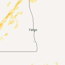
Hail Map for Thursday, June 2, 2011

Number of Impacted Households on 6/2/2011
0
Impacted by 1" or Larger Hail
0
Impacted by 1.75" or Larger Hail
0
Impacted by 2.5" or Larger Hail
Square Miles of Populated Area Impacted on 6/2/2011
0
Impacted by 1" or Larger Hail
0
Impacted by 1.75" or Larger Hail
0
Impacted by 2.5" or Larger Hail


Cities Most Affected by Hail Storms of 6/2/2011
| Hail Size | Demographics of Zip Codes Affected | ||||||
|---|---|---|---|---|---|---|---|
| City | Count | Average | Largest | Pop Density | House Value | Income | Age |
| Gettysburg, SD | 2 | 2.13 | 2.50 | 3 | $45k | $31.2k | 49.2 |
| Morristown, SD | 2 | 1.75 | 1.75 | 1 | $10k | $20.2k | 45.1 |
| Terry, MT | 1 | 1.75 | 1.75 | 0 | $36k | $26.3k | 55.3 |
| Hendersonville, NC | 1 | 1.75 | 1.75 | 797 | $141k | $41.9k | 51.6 |
| Kyle, SD | 1 | 1.75 | 1.75 | 0 | $27k | $23.9k | 24.1 |
| Columbia, SC | 1 | 1.75 | 1.75 | 2085 | $106k | $48.1k | 36.1 |
Hail and Wind Damage Spotted on 6/2/2011
Filter by Report Type:Hail ReportsWind Reports
States Impacted
North Carolina, Montana, South Carolina, Georgia, Alabama, Louisiana, Mississippi, Texas, South Dakota, New Mexico, North Dakota, Kansas, Michigan, MinnesotaNorth Carolina
| Local Time | Report Details |
|---|---|
| 7:58 PM UTC | Quarter sized hail reported near Pisgah Forest, NC, 30.3 miles N of Greenville, SC, quarter sized hail reported to fall on the asheville highway between brevard and mills river. location was matched with radar data. |
| 8:00 PM UTC | Quarter sized hail reported near Hendersonville, NC, 39.1 miles NNE of Greenville, SC, quarter sized hail fell at clear creek elementary school. |
| 8:00 PM UTC | Golf Ball sized hail reported near Hendersonville, NC, 37.6 miles N of Greenville, SC |
| 8:05 PM UTC | Quarter sized hail reported near Hendersonville, NC, 35.4 miles NNE of Greenville, SC, media reports quarter size hail at highway 64 and interstate 26. |
| 8:10 PM UTC | Quarter sized hail reported near Etowah, NC, 34.4 miles N of Greenville, SC |
| 8:21 PM UTC | Quarter sized hail reported near Rutherfordton, NC, 53.6 miles NNE of Greenville, SC, nickel to quarter sized hail fell for a short time along with some gusty wind in the shingle hollow area. |
| 8:38 PM UTC | A tree down on garrett roa in polk county NC, 42.7 miles NNE of Greenville, SC |
| 8:40 PM UTC | Quarter sized hail reported near Mill Spring, NC, 44.4 miles NNE of Greenville, SC, quarter size hail at lake adger rd and coopers gap rd. |
| 8:42 PM UTC | Quarter sized hail reported near Mill Spring, NC, 44.1 miles NNE of Greenville, SC, dime to quarter sized hail fell on highway 9 just south of sunny view. |
| 9:00 PM UTC | Quarter sized hail reported near Candler, NC, 42.7 miles N of Greenville, SC |
| 9:12 PM UTC | Power lines down in trees and tree on fire on charlotte roa in rutherford county NC, 51.4 miles NE of Greenville, SC |
| 9:35 PM UTC | Tree down along oak grove church rd and business hwy 7 in rutherford county NC, 56.1 miles W of Charlotte, NC |
| 9:37 PM UTC | Quarter sized hail reported near Forest City, NC, 54.3 miles NE of Greenville, SC |
| 9:45 PM UTC | Many large limbs blown down around ott in macon county NC, 47.5 miles WNW of Greenville, SC |
| 11:25 PM UTC | Quarter sized hail reported near Gastonia, NC, 18.8 miles W of Charlotte, NC |
| 11:28 PM UTC | Half Dollar sized hail reported near Gastonia, NC, 18.8 miles W of Charlotte, NC |
| 11:30 PM UTC | Quarter sized hail reported near Gastonia, NC, 18.9 miles W of Charlotte, NC, quarter size hail on franlin blvd. |
Montana
| Local Time | Report Details |
|---|---|
| 8:20 PM UTC | Quarter sized hail reported near Malta, MT, 57 miles WNW of Glasgow, MT, hail falling for 10 mins...still falling at time of call |
| 8:20 PM UTC | Quarter sized hail reported near Malta, MT, 58.3 miles W of Glasgow, MT, dime to quarter sized hail...started hailing about 5 mins before the call. hail is accumulating |
| 8:23 PM UTC | Quarter sized hail reported near Forsyth, MT, 52.9 miles W of Miles City, MT |
| 8:25 PM UTC | Quarter sized hail reported near Malta, MT, 58.3 miles W of Glasgow, MT, dime to quarter sized hail...started hailing about 5 mins before the call. hail is accumulating |
| 8:30 PM UTC | Quarter sized hail reported near Malta, MT, 57 miles WNW of Glasgow, MT, hail falling for 10 mins...still falling at time of call |
| 10:08 PM UTC | Storm damage reported in valley county MT, 10.3 miles SE of Glasgow, MT |
| 10:12 PM UTC | Golf Ball sized hail reported near Terry, MT, 36.9 miles NE of Miles City, MT |
South Carolina
| Local Time | Report Details |
|---|---|
| 8:37 PM UTC | Quarter sized hail reported near Simpsonville, SC, 22.2 miles E of Greenville, SC |
| 9:30 PM UTC | Quarter sized hail reported near Spartanburg, SC, 37.1 miles ENE of Greenville, SC, quarter size hail at strange court. also frequent lightning with structure hit by lightning. |
| 9:35 PM UTC | Tree down on a house on winsmith avenu in spartanburg county SC, 38.8 miles ENE of Greenville, SC |
| 9:35 PM UTC | A few trees were blown down. spotter only had pea sized hail at his hous in pickens county SC, 12.7 miles NW of Greenville, SC |
| 9:52 PM UTC | Power lines blown dow in spartanburg county SC, 47.3 miles ENE of Greenville, SC |
| 10:15 PM UTC | Quarter sized hail reported near Spartanburg, SC, 37.1 miles ENE of Greenville, SC |
| 10:30 PM UTC | Tree reported down on a house on sparkle drive. also another spotter reports other trees down in the lockhart are in chester county SC, 46.2 miles SW of Charlotte, NC |
| 10:55 PM UTC | Golf Ball sized hail reported near Columbia, SC, 74.6 miles NE of Augusta, GA, local meteorologist reported marble to golf ball size hail. |
| 11:48 PM UTC | Quarter sized hail reported near Columbia, SC, 73.5 miles ENE of Augusta, GA, 1 inch hail reported by public |
| 12:00 AM UTC | Quarter sized hail reported near Columbia, SC, 73.5 miles ENE of Augusta, GA, public reports quarter sized hail on usc campus |
| 12:05 AM UTC | Trees down in irmo reported by public in richland county SC, 61.8 miles NE of Augusta, GA |
| 12:05 AM UTC | Tree down on dreher island roa in richland county SC, 67.5 miles NE of Augusta, GA |
| 12:05 AM UTC | Trees down on monticello road in richland county SC, 68.4 miles NE of Augusta, GA |
| 12:06 AM UTC | Tree down on kennerly road near us 76 reported by highway patrol in richland county SC, 63.5 miles NE of Augusta, GA |
| 12:15 AM UTC | Trees down on coon road reported by sheriff in richland county SC, 69.6 miles S of Charlotte, NC |
| 12:15 AM UTC | Highway patrol reported trees down at pilgram church road and cherokee roa in lexington county SC, 56 miles NE of Augusta, GA |
| 12:15 AM UTC | Public reported pontoon boats damaged...trees down and a sea wall damaged along power point lane at lake murra in lexington county SC, 56.4 miles NE of Augusta, GA |
| 8:20 PM EDT | Trees and limbs down hwy 215 near glenns bridge rd reported by sheriff in fairfield county SC, 67.5 miles NE of Augusta, GA |
| 12:25 AM UTC | Trees down at the governors mansion. tree fell on and crushed the first gentlemans vehicl in richland county SC, 64.7 miles NE of Augusta, GA |
| 12:25 AM UTC | Highway patrol reported trees down old barnwell road near highway in lexington county SC, 59.7 miles NE of Augusta, GA |
| 12:28 AM UTC | Event occurred between 813 pm 06/02/2011 and 828 pm 06/02/2011 in lexington county SC, 61.9 miles NE of Augusta, GA |
| 12:28 AM UTC | Highway patrol reporgted trees down near the interchange of hwy 378 and i-2 in lexington county SC, 61.4 miles NE of Augusta, GA |
| 12:30 AM UTC | Trees down estimated 50 mph wind reported by nws employee in richland county SC, 62.1 miles NE of Augusta, GA |
| 12:32 AM UTC | Trees in roadway near i-26 and julius richardson rd reported by hwy patrol in richland county SC, 62.7 miles NE of Augusta, GA |
| 12:35 AM UTC | Trees dow in richland county SC, 63.8 miles NE of Augusta, GA |
| 12:36 AM UTC | Tree in roadway near sc 277 and bull st reported by hwy patrol in richland county SC, 73.5 miles ENE of Augusta, GA |
| 12:40 AM UTC | Trees in roadway near hines rd and smyrna rd reported by hwy patrol in richland county SC, 69.1 miles S of Charlotte, NC |
| 12:40 AM UTC | Quarter sized hail reported near Columbia, SC, 73.5 miles ENE of Augusta, GA, 1 inch hail reported by public in columbia. |
| 12:45 AM UTC | Tree in roadway dooley rd near i-20 reported by hwy patrol in lexington county SC, 56 miles NE of Augusta, GA |
| 12:46 AM UTC | Tree in roadway near pleasant view rd and sc 6 reported by highway patro in lexington county SC, 51.6 miles ENE of Augusta, GA |
| 12:46 AM UTC | Tree in roadway near us 321 and glenn rd reported by hwy patrol in lexington county SC, 59 miles ENE of Augusta, GA |
| 12:47 AM UTC | Tree in roadway near sc 6 and sardis church rd reported by hwy patrol in lexington county SC, 55.2 miles ENE of Augusta, GA |
| 12:48 AM UTC | Quarter sized hail reported near Elgin, SC, 72.6 miles S of Charlotte, NC, public reported one inch hail near lugoff. |
| 12:54 AM UTC | County sheriff dispatch reported trees down at north road and slab landing roa in orangeburg county SC, 53.7 miles E of Augusta, GA |
| 1:00 AM UTC | Sheriff dispatch reported trees and power lines down at fairview road and benedict roa in orangeburg county SC, 58.4 miles E of Augusta, GA |
| 1:15 AM UTC | Trees in roadway on bonnet rd reported by hwy patrol in aiken county SC, 39.5 miles E of Augusta, GA |
| 1:16 AM UTC | Sheriff dispatch reported trees and power lines down at keiser brown road and neeses hw in orangeburg county SC, 44.8 miles E of Augusta, GA |
| 1:20 AM UTC | Highway patrol reported tree down at bethel church at bethel church roa in sumter county SC, 48.8 miles NNW of Charleston, SC |
| 1:23 AM UTC | Highway patrol reported tree in the roadway along highway 70 west of denmar in bamberg county SC, 47.3 miles ESE of Augusta, GA |
| 1:24 AM UTC | Sheriff dispatch reported trees and power lines down at savannah hwy and willow swamp r in orangeburg county SC, 49 miles E of Augusta, GA |
| 1:25 AM UTC | Trees in roadway near presidential drive and magnolia reported by hwy patrol in orangeburg county SC, 53.6 miles WNW of Charleston, SC |
| 1:32 AM UTC | Trees in roadway near sc 6 and us 176 reported by hwy patro in calhoun county SC, 58.3 miles NW of Charleston, SC |
| 1:33 AM UTC | Sheriff dispatch reported trees and power lines down at binnicker bridge road and cope roa in orangeburg county SC, 54.4 miles E of Augusta, GA |
| 1:42 AM UTC | Trees in roadway on us 321 near neeses reported by hwy patrol in orangeburg county SC, 49 miles E of Augusta, GA |
| 1:49 AM UTC | Trees in roadway reported by hwy patral near burke road and kinley in calhoun county SC, 59.7 miles WNW of Charleston, SC |
| 2:28 AM UTC | Law enforcement reported 1 tree down near the intersection of highway 21 and highway 6 in colleton county SC, 53.3 miles WSW of Charleston, SC |
| 2:37 AM UTC | 2 reports of trees down on route 601 near crocketvill in hampton county SC, 57.8 miles N of Savannah, GA |
| 2:37 AM UTC | Trees downed by thunderstorm winds in colleton county SC, 50.2 miles WSW of Charleston, SC |
| 2:45 AM UTC | Law enforcement reported 1 tree down near the intersection of ruffin road and mount carmel roa in colleton county SC, 42.8 miles WSW of Charleston, SC |
| 2:57 AM UTC | Trees downed by thunderstorm winds in colleton county SC, 35 miles WSW of Charleston, SC |
| 3:05 AM UTC | Trees downed by thunderstorm winds in colleton county SC, 35.3 miles WSW of Charleston, SC |
| 3:18 AM UTC | Trees down in the community of gray in jasper county SC, 40.8 miles N of Savannah, GA |
Georgia
| Local Time | Report Details |
|---|---|
| 10:15 PM UTC | Quarter sized hail reported near Fort Benning, GA, 44.2 miles ESE of Auburn, AL, public reported one inch hail. |
Alabama
| Local Time | Report Details |
|---|---|
| 10:35 PM UTC | Two small trees blown down...one fell onto a powerline. winds estimated at 40 mph by emergency manage in tuscaloosa county AL, 51.1 miles WSW of Birmingham, AL |
Louisiana
| Local Time | Report Details |
|---|---|
| 11:28 PM UTC | Transmition lines were blown down off the steele truss towers...not sure if the tower is down...also a few cross beam power poles are down. this damage suggests a high in catahoula county LA, 86.5 miles NNE of Lafayette, LA |
| 11:28 PM UTC | Update...numerous trees and power poles blown over in the monterey area and along state highway 129. a shed was blown across the roadway...hitting a moving vehicle. ear in concordia county LA, 87.2 miles NNE of Lafayette, LA |
| 11:30 PM UTC | Trees were downed across state highway 129 just north of montere in concordia county LA, 88.6 miles NNE of Lafayette, LA |
| 11:38 PM UTC | Transmition lines were blown down off the steele truss towers...not sure if the tower is down...also a few cross beam power poles are down. this damage suggests a high in catahoula county LA, 86.5 miles NNE of Lafayette, LA |
| 11:42 PM UTC | Numerous reports from the public of wind damage on the west side of ville platte. several trees were blown down with some falling on houses. minor roof damage occurred in evangeline county LA, 36 miles NNW of Lafayette, LA |
| 12:02 AM UTC | A power pole and lines dow in catahoula county LA, 88.1 miles S of Bastrop, LA |
| 12:25 AM UTC | Evangeline 911 reports numerous trees down across the northern portion of the parish. power is also out over most of this are in evangeline county LA, 45.4 miles NNW of Lafayette, LA |
| 12:30 AM UTC | Public reported several trees were blown down in big bend on hamburg road and in moreauvill in avoyelles county LA, 55.8 miles N of Lafayette, LA |
| 12:45 AM UTC | Avoyelles 911 reports numerous trees down across the southern portion of the parish. also reporting power out over most of this are in avoyelles county LA, 49.1 miles N of Lafayette, LA |
| 12:47 AM UTC | Public reported several trees were uprooted on meat market road northwest of oakdal in allen county LA, 61.4 miles NW of Lafayette, LA |
| 1:02 AM UTC | Sheriffs department reports trees down stretching from cheneyville to alexandri in rapides county LA, 56.8 miles NNW of Lafayette, LA |
| 1:20 AM UTC | Public report of a mobile home in mittie suffering damage to its carport as well as a large tree branch through its roof in allen county LA, 63.1 miles WNW of Lafayette, LA |
| 1:45 AM UTC | Ping Pong Ball sized hail reported near Deridder, LA, 53.8 miles NNE of Beaumont, TX, public report via kplc-tv of ping pong ball-sized hail along highway 171 between de ridder and longville |
Mississippi
| Local Time | Report Details |
|---|---|
| 11:28 PM UTC | Update...numerous trees and power poles blown over in the monterey area and along state highway 129. a shed was blown across the roadway...hitting a moving vehicle. ear in clay county MS, 19.8 miles NNW of Starkville, MS |
Texas
| Local Time | Report Details |
|---|---|
| 11:43 PM UTC | Storm damage reported in el paso county TX, 10.3 miles NNE of El Paso, TX |
South Dakota
| Local Time | Report Details |
|---|---|
| 12:30 AM UTC | Half Dollar sized hail reported near Keldron, SD, 88 miles SW of Bismarck, ND, nssl shave report |
| 12:55 AM UTC | Quarter sized hail reported near Keldron, SD, 84.1 miles SW of Bismarck, ND |
| 1:00 AM UTC | Quarter sized hail reported near Keldron, SD, 76.8 miles SW of Bismarck, ND, nssl shave |
| 1:05 AM UTC | Golf Ball sized hail reported near Morristown, SD, 76.5 miles SW of Bismarck, ND, nssl shave report...avg est 1 inch...max est 1.75 inches |
| 1:05 AM UTC | Golf Ball sized hail reported near Morristown, SD, 76.8 miles SW of Bismarck, ND, nssl shave report |
| 1:17 AM UTC | Quarter sized hail reported near Keldron, SD, 86.9 miles SW of Bismarck, ND, nssl shave report |
| 1:18 AM UTC | Golf Ball sized hail reported near Kyle, SD, 63.1 miles SE of Rapid City, SD |
| 1:35 AM UTC | Quarter sized hail reported near Kyle, SD, 64.5 miles SE of Rapid City, SD |
| 2:12 AM UTC | Quarter sized hail reported near Interior, SD, 65.5 miles ESE of Rapid City, SD |
| 2:38 AM UTC | Storm damage reported in haakon county SD, 69.2 miles WSW of Pierre, SD |
| 3:30 AM UTC | Quarter sized hail reported near Midland, SD, 39.6 miles W of Pierre, SD |
| 3:42 AM UTC | Pea size hail as well in stanley county SD, 27.2 miles W of Pierre, SD |
| 4:15 AM UTC | Storm damage reported in stanley county SD, 31 miles NW of Pierre, SD |
| 4:15 AM UTC | Lots of pea hail with the winds stripped the leaves from the tree in corson county SD, 85.5 miles SSW of Bismarck, ND |
| 4:15 AM UTC | Quarter sized hail reported near Fort Pierre, SD, 31 miles NW of Pierre, SD |
| 4:22 AM UTC | Measured at grand river raws site in corson county SD, 83.1 miles S of Bismarck, ND |
| 4:47 AM UTC | Ping Pong Ball sized hail reported near McLaughlin, SD, 68.8 miles S of Bismarck, ND |
| 4:55 AM UTC | Gettysburg super awos. time based on nearby sdsu sit in potter county SD, 48.5 miles NNE of Pierre, SD |
| 5:45 AM UTC | Golf Ball sized hail reported near Gettysburg, SD, 61.7 miles N of Pierre, SD, hail stones ranged from nickles to golf ball sized. estimated time based on radar. |
| 5:45 AM UTC | Tennis Ball sized hail reported near Gettysburg, SD, 55.9 miles N of Pierre, SD, ranged between nickles to tennis ball. |
New Mexico
| Local Time | Report Details |
|---|---|
| 12:48 AM UTC | Storm damage reported in otero county NM, 59.5 miles NNE of El Paso, TX |
North Dakota
| Local Time | Report Details |
|---|---|
| 1:57 AM UTC | Ping Pong Ball sized hail reported near Kramer, ND, 41.3 miles NE of Minot, ND, report relayed by the media. |
| 3:00 AM UTC | Half Dollar sized hail reported near Bottineau, ND, 61.5 miles NE of Minot, ND, ...pea to half dallor sized hail... 0.53 of rainfall over last 30 to 45 minutes... |
| 5:35 AM UTC | Storm damage reported in emmons county ND, 46.8 miles SSE of Bismarck, ND |
| 5:50 AM UTC | Pole barn destroyed. stock trailer was rolled approximately 200 fee in emmons county ND, 46.1 miles ESE of Bismarck, ND |
| 6:40 AM UTC | Relay by state radio in stutsman county ND, 70.3 miles E of Bismarck, ND |
| 7:25 AM UTC | Relay by state radio in foster county ND, 47.5 miles SSW of Devils Lake, ND |
| 7:35 AM UTC | Storm damage reported in foster county ND, 47.5 miles SSW of Devils Lake, ND |
| 7:38 AM UTC | Downed trees and power lines. relay by state radi in foster county ND, 47.5 miles SSW of Devils Lake, ND |
| 7:44 AM UTC | The wind gust was measured at the ndawn mesonet station located 8 miles north of mchenry in eddy count in eddy county ND, 32.7 miles SSE of Devils Lake, ND |
| 7:45 AM UTC | Many large tree branches blown dow in griggs county ND, 57.8 miles SE of Devils Lake, ND |
| 8:00 AM UTC | Cattle pens were damaged and a large tank was blown across the roa in eddy county ND, 29 miles SSE of Devils Lake, ND |
| 8:30 AM UTC | Viewer reported trees were uprooted and on a hous in grand forks county ND, 64.8 miles ESE of Devils Lake, ND |
| 8:40 AM UTC | Several mature evergreen trees were uproote in walsh county ND, 52 miles ENE of Devils Lake, ND |
| 8:45 AM UTC | The roof to a barn built in 1985 is gone. there are also 2 to 3 inch in diameter tree branches on the groun in walsh county ND, 56.6 miles ENE of Devils Lake, ND |
| 9:05 AM UTC | Large tree branches were blown dow in pembina county ND, 67.5 miles WSW of Roseau, MN |
| 9:15 AM UTC | Large tree branches were blown down around town. a 58 mph wind gust was measured at the cavalier awo in pembina county ND, 74.1 miles NE of Devils Lake, ND |
Kansas
| Local Time | Report Details |
|---|---|
| 2:10 AM UTC | Storm damage reported in stevens county KS, 66.8 miles SSW of Garden City, KS |
| 3:30 AM UTC | Storm damage reported in kearny county KS, 15.1 miles WSW of Garden City, KS |
Michigan
| Local Time | Report Details |
|---|---|
| 4:17 AM UTC | Wind gust measured from the northwes in houghton county MI, 77.9 miles WNW of Marquette, MI |
| 7:30 AM UTC | Storm damage reported in alger county MI, 69.3 miles E of Marquette, MI |
Minnesota
| Local Time | Report Details |
|---|---|
| 9:20 AM UTC | Quarter sized hail reported near Lake Bronson, MN, 41.5 miles W of Roseau, MN, very strongs winds also occurred knocking many large branches down. |
| 9:25 AM UTC | Quarter sized hail reported near Lake Bronson, MN, 34.7 miles W of Roseau, MN |
Connect with Interactive Hail Maps