

Hail Map for Friday, June 2, 2023

Number of Impacted Households on 6/2/2023
0
Impacted by 1" or Larger Hail
0
Impacted by 1.75" or Larger Hail
0
Impacted by 2.5" or Larger Hail
Square Miles of Populated Area Impacted on 6/2/2023
0
Impacted by 1" or Larger Hail
0
Impacted by 1.75" or Larger Hail
0
Impacted by 2.5" or Larger Hail


Cities Most Affected by Hail Storms of 6/2/2023
| Hail Size | Demographics of Zip Codes Affected | ||||||
|---|---|---|---|---|---|---|---|
| City | Count | Average | Largest | Pop Density | House Value | Income | Age |
| Fort Stockton, TX | 5 | 2.10 | 2.75 | 6 | $41k | $27.4k | 36.2 |
| Sheffield, TX | 2 | 3.00 | 3.00 | 0 | $48k | $24.0k | 39.1 |
| Sanderson, TX | 2 | 2.13 | 2.25 | 0 | $26k | $23.9k | 44.7 |
| Ozona, TX | 1 | 2.75 | 2.75 | 0 | $52k | $29.9k | 39.5 |
| Andrews, TX | 1 | 2.00 | 2.00 | 19 | $43k | $34.1k | 33.4 |
| Midland, TX | 1 | 1.75 | 1.75 | 2379 | $40k | $27.4k | 30.6 |
Hail and Wind Damage Spotted on 6/2/2023
Filter by Report Type:Hail ReportsWind Reports
States Impacted
Pennsylvania, New Mexico, New York, Texas, Maine, Massachusetts, Iowa, Florida, Connecticut, Alabama, Minnesota, New Hampshire, Nebraska, North Dakota, Oklahoma, Missouri, Vermont, New Jersey, MontanaPennsylvania
| Local Time | Report Details |
|---|---|
| 12:53 PM EDT | Mutliple trees down on cliff park roa in pike county PA, 43.7 miles E of Scranton, PA |
| 1:00 PM EDT | Wires down on raymondskill road... just south of silver springs road. via dispatch scanner. radar-estimated tim in pike county PA, 42.8 miles E of Scranton, PA |
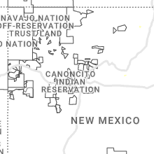
New Mexico
| Local Time | Report Details |
|---|---|
| 11:30 AM MDT | Quarter sized hail reported near Villanueva, NM, 73.4 miles E of Albuquerque, NM, damage: shredded leaves. |
| 12:15 PM MDT | Quarter sized hail reported near Hobbs, NM, 76.1 miles NW of Odessa, TX, quarter size hail observed in downtown hobbs. |
| 12:15 PM MDT | Ping Pong Ball sized hail reported near Hobbs, NM, 76.1 miles NW of Odessa, TX |
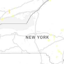
New York
| Local Time | Report Details |
|---|---|
| 1:40 PM EDT | Downed trees and wires between veeder road and state hwy 334 in the town of mohaw in montgomery county NY, 25 miles WNW of Schenectady, NY |
| 2:10 PM EDT | Two trees down on scribner ave and middlefort lane in middleburg in schoharie county NY, 24.6 miles SW of Schenectady, NY |
| 2:36 PM EDT | Tree down blocking road. via county dispatch feed. radar-estimated tim in otsego county NY, 44.3 miles WSW of Schenectady, NY |
| 2:40 PM EDT | 2 large trees downe in fulton county NY, 31.3 miles NNW of Schenectady, NY |
| 3:55 PM EDT | Quarter sized hail reported near West Hurley, NY, 56 miles S of Schenectady, NY, time estimated from radar |
| 4:10 PM EDT | Tree down on road. via county dispatch feed. radar-estimated tim in otsego county NY, 64 miles SE of Syracuse, NY |
| 4:20 PM EDT | Large tree dow in ulster county NY, 57.9 miles SSW of Schenectady, NY |
| 4:25 PM EDT | Ping Pong Ball sized hail reported near Herkimer, NY, 55.1 miles WNW of Schenectady, NY |
| 4:25 PM EDT | Trees and wires down on watkins road in herkimer county NY, 54.5 miles E of Syracuse, NY |
| 4:40 PM EDT | Tree limbs down on rte 209 in hurley. time estimated from rada in ulster county NY, 62.6 miles S of Schenectady, NY |
| 4:42 PM EDT | Multiple trees down in hurley. time estimated from rada in ulster county NY, 61.9 miles S of Schenectady, NY |
| 5:45 PM EDT | Tree and wires down along county highway 12. via county dispatch feed. radar-estimated tim in otsego county NY, 58.9 miles ESE of Syracuse, NY |
| 6:08 PM EDT | Quarter sized hail reported near Pawling, NY, 62.9 miles NNE of Brooklyn, NY, hail size estimated from images posted on social media. |
| 6:08 PM EDT | One large tree down on beacon r in dutchess county NY, 62.9 miles NNE of Brooklyn, NY |
| 6:10 PM EDT | Large tree and wires down on old route 5 in dutchess county NY, 63.1 miles NNE of Brooklyn, NY |
| 6:15 PM EDT | Trees down on ny rte 133 with 2 lanes blocke in westchester county NY, 36.7 miles NNE of Brooklyn, NY |
Texas
| Local Time | Report Details |
|---|---|
| 12:54 PM CDT | Storm damage reported in oldham county TX, 52.5 miles W of Amarillo, TX |
| 1:20 PM CDT | Power poles down along sh18. time estimated from rada in pecos county TX, 64.7 miles SSW of Odessa, TX |
| 1:24 PM CDT | Golf Ball sized hail reported near Fort Stockton, TX, 64.7 miles SSW of Odessa, TX, golf ball sized hail observed along sh18 north of ft stockton. |
| 1:57 PM CDT | Storm damage reported in hartley county TX, 69 miles NW of Amarillo, TX |
| 2:32 PM CDT | Golf Ball sized hail reported near Fort Stockton, TX, 71.2 miles ENE of Alpine, TX, em also reports broken power poles. |
| 2:42 PM CDT | Tennis Ball sized hail reported near Fort Stockton, TX, 72.9 miles ENE of Alpine, TX, em reports tennis ball sized hail 10 miles south of i-10 on fm 2023. |
| 2:50 PM CDT | Mesonet station 25 seminole 2 in gaines county TX, 63.3 miles NNW of Odessa, TX |
| 2:55 PM CDT | Golf Ball sized hail reported near Fort Stockton, TX, 72.6 miles ENE of Alpine, TX, em reports golf ball size hail on fm 2023 south of i-10. |
| 3:17 PM CDT | This west texas mesonet site also measured a gust to 59 mph at 3:20 p in hale county TX, 20.6 miles NNE of Lubbock, TX |
| 3:39 PM CDT | Measured by the west texas mesonet. it also gusted to 58 mph at 3:38 pm and 59 mph at 3:40 p in lubbock county TX, 11.6 miles NE of Lubbock, TX |
| 3:53 PM CDT | Baseball sized hail reported near Fort Stockton, TX, 84.5 miles S of Odessa, TX, along harral rd. just west of s st. hwy 2886. |
| 3:55 PM CDT | Awos station ke11 andrew in andrews county TX, 34.4 miles NNW of Odessa, TX |
| 4:38 PM CDT | Measured by the west texas mesonet. gusts to 58 mph and 60 mph were measured at 4:36 pm and 4:37 pm... respectivel in lynn county TX, 42.9 miles S of Lubbock, TX |
| 4:39 PM CDT | 61 mph thunderstorm wind gust measured by mesonet at 4:39 p.m. cd in lipscomb county TX, 58.1 miles WSW of Woodward, OK |
| 4:39 PM CDT | Hen Egg sized hail reported near Andrews, TX, 37 miles NW of Odessa, TX, hail observed along ranch rd 181. |
| 4:41 PM CDT | Tea Cup sized hail reported near Sheffield, TX, 91 miles SSE of Odessa, TX |
| 4:43 PM CDT | Peak wind gust measured by the west texas mesonet. also gusted to 81 mph at 4:44 pm... with several other severe caliber gusts from 4:36 pm to 4:46 p in lynn county TX, 42.9 miles S of Lubbock, TX |
| 4:58 PM CDT | Ping Pong Ball sized hail reported near Fort Stockton, TX, 67.5 miles E of Alpine, TX, hail observed along us285. |
| 5:05 PM CDT | West texas mesonet in garza county TX, 40.3 miles SSE of Lubbock, TX |
| 5:14 PM CDT | Tea Cup sized hail reported near Sheffield, TX, 86.8 miles SSE of Odessa, TX |
| 5:17 PM CDT | Ping Pong Ball sized hail reported near , , 19.2 miles NNW of Odessa, TX, hail observed on us385. |
| 5:50 PM CDT | Half Dollar sized hail reported near , , 15.7 miles NNW of Odessa, TX, report from mping: half dollar (1.25 in.). |
| 5:54 PM CDT | Quarter sized hail reported near , , 18.7 miles NNW of Odessa, TX, report from mping: quarter (1.00 in.). |
| 5:55 PM CDT | Storm damage reported in childress county TX, 3.9 miles W of Childress, TX |
| 6:02 PM CDT | Half Dollar sized hail reported near Gardendale, TX, 11.8 miles N of Odessa, TX |
| 6:09 PM CDT | West texas mesonet in childress county TX, 2.2 miles NNE of Childress, TX |
| 6:21 PM CDT | Half Dollar sized hail reported near Midland, TX, 19 miles NE of Odessa, TX, report from mping: half dollar (1.25 in.). |
| 6:25 PM CDT | Ping Pong Ball sized hail reported near Midland, TX, 18.2 miles NE of Odessa, TX, ping pong ball size hail reported near north wal-mart in midland. time estimated by radar. |
| 6:27 PM CDT | Quarter sized hail reported near Midland, TX, 19.9 miles NE of Odessa, TX, lots of nickel to quarter size hail. |
| 6:29 PM CDT | Quarter sized hail reported near Midland, TX, 18.2 miles NE of Odessa, TX, report from mping: quarter (1.00 in.). |
| 6:30 PM CDT | Quarter sized hail reported near Midland, TX, 18.6 miles NE of Odessa, TX, measured quarter size hail in central midland. |
| 6:33 PM CDT | Half Dollar sized hail reported near Midland, TX, 18.2 miles NE of Odessa, TX, report from mping: half dollar (1.25 in.). |
| 6:35 PM CDT | Quarter sized hail reported near Midland, TX, 22.6 miles NE of Odessa, TX, report from mping: quarter (1.00 in.). |
| 6:37 PM CDT | Golf Ball sized hail reported near Midland, TX, 20.7 miles ENE of Odessa, TX, multiple hail reports of ping pong to golf ball size hail. |
| 6:38 PM CDT | Half Dollar sized hail reported near Midland, TX, 18.6 miles NE of Odessa, TX, report from mping: half dollar (1.25 in.). |
| 6:40 PM CDT | West texas mesonet in kent county TX, 72.2 miles NW of Abilene, TX |
| 6:45 PM CDT | Half Dollar sized hail reported near Midland, TX, 26 miles ENE of Odessa, TX, report from mping: half dollar (1.25 in.). |
| 6:47 PM CDT | Baseball sized hail reported near Ozona, TX, 70.8 miles NNW of Del Rio, TX, baseball size hail was reported. |
| 6:48 PM CDT | Quarter sized hail reported near Midland, TX, 30.6 miles ENE of Odessa, TX, quarter size hail reported in greenwood. |
| 6:48 PM CDT | Half Dollar sized hail reported near Midland, TX, 28 miles ENE of Odessa, TX, report from mping: half dollar (1.25 in.). |
| 6:50 PM CDT | Hen Egg sized hail reported near Sanderson, TX, 87.2 miles ESE of Alpine, TX, photo showing approximately 2 inch hail along us highway 90. |
| 6:55 PM CDT | Asos station ksnk snyder winsto in scurry county TX, 72.6 miles WNW of Abilene, TX |
| 7:04 PM CDT | Hen Egg sized hail reported near Sanderson, TX, 80.2 miles ESE of Alpine, TX, report from mping: hen egg+ (2.25 in.). |
| 7:11 PM CDT | Half Dollar sized hail reported near Midland, TX, 36.1 miles ENE of Odessa, TX, wind driven hail... winds estimated at 60 mph. |
| 8:54 PM CDT | Quarter sized hail reported near Comstock, TX, 33.8 miles NW of Del Rio, TX, at 08:54 pm... dime and quarter size hail was reported at seminole canyon state park. |
| 8:59 PM CDT | Mesonet station 97 throckmorton 1s in throckmorton county TX, 59.1 miles NNE of Abilene, TX |
| 10:18 PM CDT | Ping Pong Ball sized hail reported near Brackettville, TX, 29.1 miles E of Del Rio, TX, a 1.5 inch hail report from brackettville (from a viewer/cjs). |
| 11:20 PM CDT | At 11:20 pm... a 62 mph wind gust was reported at the weather station of southeast uvalde (eaa in uvalde county TX, 70 miles E of Del Rio, TX |
| 11:23 PM CDT | Report from mping: 1-inch tree limbs broken; shingles blown of in kerr county TX, 58.1 miles NW of San Antonio, TX |
| 11:35 PM CDT | Hondo asos 51 knot gus in medina county TX, 41 miles W of San Antonio, TX |
| 11:42 PM CDT | Report from mping: 1-inch tree limbs broken; shingles blown of in bexar county TX, 23.4 miles NNW of San Antonio, TX |
| 12:12 AM CDT | 50 knot wind gust at stinson aso in bexar county TX, 6 miles SSE of San Antonio, TX |
Maine
| Local Time | Report Details |
|---|---|
| 1:54 PM EDT | Multiple trees dow in somerset county ME, 57.3 miles WNW of Bangor, ME |
| 2:30 PM EDT | Trees down on wire in somerset county ME, 46.7 miles W of Bangor, ME |
| 2:47 PM EDT | Tree blocking roa in somerset county ME, 50.2 miles W of Bangor, ME |
| 2:47 PM EDT | Numerous trees down on wires and trees blocking road in somerset county ME, 33.3 miles W of Bangor, ME |
| 2:48 PM EDT | Tree down on power lines. time estimated via rada in somerset county ME, 32.9 miles W of Bangor, ME |
| 3:06 PM EDT | Trees and power lines down across lake driv in cumberland county ME, 36.4 miles NW of Portland, ME |
| 4:01 PM EDT | Tree reported down on wires on river rd. time estimated from rada in oxford county ME, 28.9 miles WNW of Portland, ME |
| 4:06 PM EDT | Social media video of large tree down blocking main stree in york county ME, 28.4 miles WNW of Portland, ME |
Massachusetts
| Local Time | Report Details |
|---|---|
| 2:31 PM EDT | Tree down blocking rte 148 at colette roa in worcester county MA, 38.4 miles WNW of Providence, RI |
Iowa
| Local Time | Report Details |
|---|---|
| 1:58 PM CDT | Delayed report. large... healthy tree snapped at trunk near ferguson. estimated size was 2 and a half feet in diameter. report submitted via social medi in marshall county IA, 43.9 miles ENE of Des Moines, IA |
| 2:59 PM CDT | Storm damage reported in des moines county IA, 39.7 miles NE of Kahoka, MO |
| 3:03 PM CDT | Delayed repor in polk county IA, 4.7 miles SSW of Des Moines, IA |
| 3:20 PM CDT | 6 inch diameter tree limb down. image submitted via social medi in polk county IA, 4.4 miles W of Des Moines, IA |
Florida
| Local Time | Report Details |
|---|---|
| 3:10 PM EDT | A thunderstorm produced a wind gust of 61 mph at mesonet station 1343w (weatherstem in broward county FL, 30.5 miles N of Miami, FL |
Connecticut
| Local Time | Report Details |
|---|---|
| 4:00 PM EDT | Quarter sized hail reported near Danielson, CT, 22.6 miles W of Providence, RI, quarter size hail in east killingly relayed by media. |
| 4:18 PM EDT | Quarter sized hail reported near Middletown, CT, 65.6 miles WSW of Providence, RI |
Alabama
| Local Time | Report Details |
|---|---|
| 3:03 PM CDT | Corrects previous tstm wnd dmg report from 4 n new market. tree down and power pole down near school house road and buddy williamso in madison county AL, 63.8 miles W of Chattanooga, TN |
| 3:15 PM CDT | Tree down and power pole down near school house road and buddy williamso in madison county AL, 63.8 miles W of Chattanooga, TN |
| 4:35 PM CDT | Trees down and small hail in the sheffield are in colbert county AL, 2.8 miles S of Florence, AL |
| 4:35 PM CDT | A tree was reported down near the intersection of ne 17th avenue and ne 28th stree in colbert county AL, 2.3 miles SSW of Florence, AL |
| 4:36 PM CDT | A power pole was reported damaged and leaning due to strong winds at this locatio in colbert county AL, 4.2 miles S of Florence, AL |
| 4:36 PM CDT | A tree was reported down at 600 n montgomery avenu in colbert county AL, 3.1 miles SSW of Florence, AL |
| 4:36 PM CDT | A tree was reported down at this location on pine stree in colbert county AL, 4.6 miles SSW of Florence, AL |
| 4:36 PM CDT | A tree was blown down near the intersection of e 5th street and annapolis avenu in colbert county AL, 2.9 miles SSW of Florence, AL |
| 4:37 PM CDT | A tree was reported down near the intersection of s nashville avenue and e saywell stree in colbert county AL, 3.8 miles SSW of Florence, AL |
| 4:38 PM CDT | A tree was blown down at 1205 sw 13th avenu in colbert county AL, 3.8 miles SSW of Florence, AL |
| 4:38 PM CDT | Corrects previous tstm wnd dmg report from 1 ssw sheffield. a tree was reported down at this location on pine stree in colbert county AL, 4.6 miles SSW of Florence, AL |
| 5:56 PM CDT | A tree knocked down along county road 703 in east cullman. time estimated from rada in cullman county AL, 44.1 miles N of Birmingham, AL |
Minnesota
| Local Time | Report Details |
|---|---|
| 3:30 PM CDT | Social media picture of tree blown over in byro in olmsted county MN, 67 miles NNE of Mason City, IA |
New Hampshire
| Local Time | Report Details |
|---|---|
| 4:30 PM EDT | Corrects previous tstm wnd dmg report from 3 ene middleton. delayed report. trees and branches down blocking traffic on railroad ave. time estimated via rada in carroll county NH, 40.1 miles WSW of Portland, ME |
| 4:50 PM EDT | Delayed report...multiple trees down at the farmington country club. time estimated by rada in strafford county NH, 44.3 miles WSW of Portland, ME |
| 6:09 PM EDT | Half Dollar sized hail reported near Bradford, NH, 88 miles WSW of Portland, ME, time estimated from radar. |
| 6:20 PM EDT | Delayed report...trees down on gleason falls rd north of hillsboro. tree diameter up to 8 inches. time estimated by rada in hillsborough county NH, 92.2 miles WSW of Portland, ME |
| 6:25 PM EDT | Trees down near route 3 in hillsborough county NH, 94.3 miles WSW of Portland, ME |
| 6:30 PM EDT | Quarter sized hail reported near Hillsborough, NH, 94.1 miles WSW of Portland, ME, delayed report...quarter size hail observed. time estimated by radar. |
| 6:30 PM EDT | Quarter sized hail reported near Washington, NH, 95.9 miles WSW of Portland, ME |
| 6:30 PM EDT | Delayed report. trees and branches down blocking traffic on railroad ave. time estimated via rada in carroll county NH, 40.1 miles WSW of Portland, ME |
| 6:40 PM EDT | Quarter sized hail reported near Bennington, NH, 85.2 miles NNW of Providence, RI, delayed report...broadcast media and multiple social media observed hail of quarter-size falling for 10 minutes. |
| 6:45 PM EDT | Quarter sized hail reported near Marlow, NH, 91.8 miles ENE of Schenectady, NY, delayed report...1-inch hail observed at cohoos pond. time estimated. |
Nebraska
| Local Time | Report Details |
|---|---|
| 2:52 PM MDT | Quarter sized hail reported near Minatare, NE, 9.6 miles ESE of Scottsbluff, NE |
| 3:54 PM CDT | Roof peeled off chicken outbuildin in gage county NE, 67.6 miles SSW of Omaha, NE |
| 3:06 PM MDT | Quarter sized hail reported near Minatare, NE, 13 miles ESE of Scottsbluff, NE, report from mping: quarter (1.00 in.). |
| 5:01 PM CDT | Delayed report from earlier this evening. unofficial personal weather statio in merrick county NE, 22.2 miles NE of Grand Island, NE |
North Dakota
| Local Time | Report Details |
|---|---|
| 3:55 PM CDT | Awos station kd57 glen ulli in morton county ND, 51.7 miles W of Bismarck, ND |
Oklahoma
| Local Time | Report Details |
|---|---|
| 4:05 PM CDT | Storm damage reported in texas county OK, 87.9 miles SW of Garden City, KS |
| 4:45 PM CDT | Storm damage reported in beaver county OK, 67.8 miles WNW of Woodward, OK |
| 11:15 PM CDT | 68 mph from the southeas in jefferson county OK, 55.8 miles ENE of Wichita Falls, TX |
Missouri
| Local Time | Report Details |
|---|---|
| 4:05 PM CDT | Reported at kirksville regional airpor in adair county MO, 49 miles WSW of Kahoka, MO |
| 4:59 PM CDT | Strong winds knocked down tree branches that downed powerline in linn county MO, 61.8 miles NNW of Columbia, MO |
| 8:39 PM CDT | Multiple trees down across road in buchanan county MO, 38.1 miles NNW of Kansas City, MO |
Vermont
| Local Time | Report Details |
|---|---|
| 5:53 PM EDT | Tree down and power outage from thunderstorm downburs in chittenden county VT, 10.1 miles E of Burlington, VT |
New Jersey
| Local Time | Report Details |
|---|---|
| 7:16 PM EDT | Storm damage reported in mercer county NJ, 51.7 miles WSW of Brooklyn, NY |
Montana
| Local Time | Report Details |
|---|---|
| 5:44 PM MDT | Mesonet station kigm8 king coule in valley county MT, 32.6 miles SSW of Glasgow, MT |
Connect with Interactive Hail Maps