

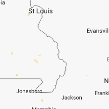
Hail Map for Sunday, June 22, 2014

Number of Impacted Households on 6/22/2014
0
Impacted by 1" or Larger Hail
0
Impacted by 1.75" or Larger Hail
0
Impacted by 2.5" or Larger Hail
Square Miles of Populated Area Impacted on 6/22/2014
0
Impacted by 1" or Larger Hail
0
Impacted by 1.75" or Larger Hail
0
Impacted by 2.5" or Larger Hail


Cities Most Affected by Hail Storms of 6/22/2014
| Hail Size | Demographics of Zip Codes Affected | ||||||
|---|---|---|---|---|---|---|---|
| City | Count | Average | Largest | Pop Density | House Value | Income | Age |
| Yuma, CO | 2 | 2.13 | 2.50 | 7 | $84k | $32.3k | 37.1 |
| Darrouzett, TX | 2 | 2.13 | 2.50 | 0 | $33k | $33.3k | 42.3 |
| Bird City, KS | 2 | 1.75 | 1.75 | 1 | $43k | $27.5k | 46.6 |
| Nunn, CO | 2 | 1.75 | 1.75 | 4 | $104k | $41.1k | 41.3 |
| Victoria, KS | 1 | 2.75 | 2.75 | 8 | $70k | $33.5k | 42.6 |
| Englewood, KS | 1 | 2.00 | 2.00 | 0 | $22k | $23.4k | 51.8 |
| Canadian, TX | 1 | 1.75 | 1.75 | 3 | $57k | $35.4k | 35.6 |
| Scott City, KS | 1 | 1.75 | 1.75 | 6 | $72k | $40.5k | 41.5 |
| Stoneham, CO | 1 | 1.75 | 1.75 | 0 | $90k | $30.8k | 47.3 |
Hail and Wind Damage Spotted on 6/22/2014
Filter by Report Type:Hail ReportsWind Reports
States Impacted
Alabama, Florida, Georgia, Iowa, South Carolina, Mississippi, Oklahoma, Missouri, Colorado, Kansas, Wyoming, Texas, Illinois, Arkansas, New MexicoAlabama
| Local Time | Report Details |
|---|---|
| 12:15 PM CDT | A couple of trees down in the city of tallassee in tallapoosa county AL, 23.1 miles WSW of Auburn, AL |
| 2:05 PM CDT | Quarter sized hail reported near Livingston, AL, 67.2 miles NW of Camden, AL, also a report of a tree down on county rd 12 |
| 3:35 PM CDT | Covington county ema reports trees and power lines down in the community of gant in covington county AL, 62.4 miles SE of Camden, AL |
| 3:55 PM CDT | Covington county ema reports tin roof damage to barns and a home...and several trees down along a one mile stretch of potter roa in covington county AL, 65.8 miles N of Miramar Beach, FL |
Florida
| Local Time | Report Details |
|---|---|
| 1:15 PM EDT | Nws employee reported large branches downed causing damage to screens on lanai patio in clay county FL, 17.4 miles S of Jacksonville, FL |
| 1:15 PM EDT | Nws employee reported multiple large trees downed in the fleming island are in clay county FL, 17.5 miles S of Jacksonville, FL |
| 1:15 PM EDT | Areas of wind damage along hibernia road to water oak lan in clay county FL, 18.2 miles S of Jacksonville, FL |
| 1:15 PM CDT | Power pole and lines down on 15th stree in bay county FL, 33.6 miles E of Miramar Beach, FL |
| 2:55 PM EDT | Storm damage reported in nassau county FL, 22.5 miles NNE of Jacksonville, FL |
| 3:10 PM EDT | Fire rescue reported a tree across the roadwa in flagler county FL, 60.1 miles SSE of Jacksonville, FL |
| 3:12 PM EDT | Fire rescue reported a tree downed onto power line in flagler county FL, 57.6 miles SSE of Jacksonville, FL |
| 3:50 PM EDT | Trees down on power lines on highway 19 n at barnes roa in jefferson county FL, 26.9 miles ENE of Tallahassee, FL |
Georgia
| Local Time | Report Details |
|---|---|
| 1:24 PM EDT | Storm damage reported in bacon county GA, 21.9 miles E of Douglas, GA |
| 2:17 PM EDT | Quarter sized hail reported near Saint Simons Island, GA, 60.7 miles NNE of Jacksonville, FL, social media report of quarter-sized hail. |
| 2:18 PM EDT | Storm damage reported in glynn county GA, 58.7 miles NNE of Jacksonville, FL |
| 3:25 PM EDT | Multiple trees down in lanier county GA, 34.6 miles SSW of Douglas, GA |
| 4:00 PM EDT | Trees down on georgia highway 50 and melton mill roa in terrell county GA, 80.2 miles SE of Auburn, AL |
| 4:09 PM EDT | Large tree down in dawson in terrell county GA, 86.3 miles SE of Auburn, AL |
| 4:13 PM EDT | Several trees down and some power lines. roof blown off mobile home and blown across a stree in lowndes county GA, 53.3 miles SSW of Douglas, GA |
| 5:00 PM EDT | Roof blown off of a business onto cars in the parking lot in lake par in lowndes county GA, 60.4 miles SSW of Douglas, GA |
| 5:50 PM EDT | Trees down in tyty and chula. time estimated by rada in tift county GA, 41.4 miles W of Douglas, GA |
Iowa
| Local Time | Report Details |
|---|---|
| 12:35 PM CDT | Lost part of roof to a home on the north side of burlington. numerous tree limbs were reported down along with some powerlines. time of the event was estimated using ra in des moines county IA, 41.4 miles NE of Kahoka, MO |
| 2:14 PM CDT | Some small branches down in poweshiek county IA, 45.7 miles WSW of Cedar Rapids, IA |
| 2:58 PM CDT | Part of a machine shop roof blown off. time estimated from rada in mahaska county IA, 59.4 miles ESE of Des Moines, IA |
| 3:03 PM CDT | 8 inch diameter tree blown over. dime size hail also reported. time estimated from rada in wapello county IA, 65 miles ESE of Des Moines, IA |
| 5:20 PM CDT | Numerous reports of trees down across the count in lee county IA, 23.8 miles NE of Kahoka, MO |
South Carolina
| Local Time | Report Details |
|---|---|
| 2:20 PM EDT | Power lines down on augusta highway at interstate 9 in colleton county SC, 37.8 miles WSW of Charleston, SC |
| 2:25 PM EDT | Power lines down in the roadway maple ridge road at highway 6 in colleton county SC, 37 miles WSW of Charleston, SC |
| 2:40 PM EDT | Tree in roadway at wesley grove road and rehoboth roa in colleton county SC, 31.5 miles WSW of Charleston, SC |
Mississippi
| Local Time | Report Details |
|---|---|
| 1:40 PM CDT | Report of a tree fell on a house on highway 1 in jasper county MS, 57.5 miles ESE of Jackson, MS |
| 1:55 PM CDT | Report of a tree down on county road 39 by the post office in vossburg...which was blocking the roa in jasper county MS, 76.5 miles ESE of Jackson, MS |
| 2:00 PM CDT | Report of a tree down on county road 39 by the post office in vossburg...which was blocking the roa in jasper county MS, 76.5 miles ESE of Jackson, MS |
| 2:25 PM CDT | Report of wind damage to a barn and some trees blown down at 6441 county road 57 south of miz in smith county MS, 47.8 miles SE of Jackson, MS |
| 2:25 PM CDT | Report of 70mph winds measured in taylorsvill in smith county MS, 54.6 miles SE of Jackson, MS |
| 2:56 PM CDT | Report of a tree down on interstate 59 at mile marker 10 in jones county MS, 75.5 miles ESE of Jackson, MS |
| 3:25 PM CDT | Quarter sized hail reported near Louisville, MS, 36.5 miles SW of Starkville, MS, reports of dime to quarter size hail. |
| 4:28 PM CDT | Storm damage reported in desoto county MS, 18.5 miles SE of Memphis, TN |
| 4:30 PM CDT | Quarter sized hail reported near Olive Branch, MS, 17.9 miles SE of Memphis, TN, one inch hail and downed trees reported near hwy 302 and alexander road. |
| 4:40 PM CDT | Awning completely destroyed at a church near highland st and pigeon roost roa in desoto county MS, 18.5 miles SE of Memphis, TN |
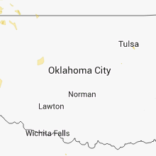
Oklahoma
| Local Time | Report Details |
|---|---|
| 3:10 PM CDT | Quarter sized hail reported near Owasso, OK, 11.5 miles NE of Tulsa, OK |
| 4:22 PM CDT | Five telephone lines blown down in knowle in beaver county OK, 52.3 miles NW of Woodward, OK |
| 5:37 PM CDT | Quarter sized hail reported near Laverne, OK, 49.7 miles WNW of Woodward, OK |
| 6:10 PM CDT | Storm damage reported in beaver county OK, 49.3 miles WNW of Woodward, OK |
| 9:15 PM CDT | Storm damage reported in texas county OK, 96.9 miles N of Amarillo, TX |
| 10:25 PM CDT | Storm damage reported in beaver county OK, 49.3 miles WNW of Woodward, OK |
| 11:05 PM CDT | Storm damage reported in harper county OK, 29.8 miles NNW of Woodward, OK |
| 11:10 PM CDT | Storm damage reported in harper county OK, 29.8 miles NNW of Woodward, OK |
| 12:00 AM CDT | Storm damage reported in woodward county OK, 25.3 miles NE of Woodward, OK |
| 12:05 AM CDT | Storm damage reported in woodward county OK, 25.3 miles NE of Woodward, OK |
| 4:00 AM CDT | Oklahoma mesonet observatio in stephens county OK, 60.7 miles NE of Wichita Falls, TX |
Missouri
| Local Time | Report Details |
|---|---|
| 3:27 PM CDT | Quarter sized hail reported near O Fallon, MO, 29.9 miles WNW of Saint Louis, MO, a few hail stones to the size of quarters....most pea to dime sized. |
| 3:27 PM CDT | Quarter sized hail reported near O Fallon, MO, 29.5 miles WNW of Saint Louis, MO, twin chimney sub division |
| 3:31 PM CDT | Quarter sized hail reported near O Fallon, MO, 29.9 miles WNW of Saint Louis, MO, has lasted 10 minutes... though little accumulation |
| 4:15 PM CDT | Staff at the pulltite campground along the current river reported winds of at least 60 mp in shannon county MO, 22 miles S of Salem, MO |
| 4:55 PM CDT | 1 to 2 inch limbs down across the stree in clark county MO, 0.8 miles NW of Kahoka, MO |
| 5:05 PM CDT | Tree limbs down and a branch went through the roof of a trailer hom in clark county MO, 0.1 miles SSW of Kahoka, MO |
| 6:40 PM CDT | Storm damage reported in platte county MO, 27.2 miles NW of Kansas City, MO |
| 8:58 PM CDT | Near route e and ware road. public reported several 18-24 inch diameter trees downed. report via law enforcement. time is estimate in pettis county MO, 60.4 miles WSW of Columbia, MO |
Colorado
| Local Time | Report Details |
|---|---|
| 2:48 PM MDT | Half Dollar sized hail reported near Pueblo, CO, 15.2 miles SSW of Pueblo, CO |
| 3:34 PM MDT | Quarter sized hail reported near Pueblo, CO, 0.4 miles NNE of Pueblo, CO |
| 3:41 PM MDT | Half Dollar sized hail reported near Carr, CO, 47.1 miles SE of Laramie, WY, wall cloud near by |
| 3:43 PM MDT | Quarter sized hail reported near Nunn, CO, 61.8 miles SE of Laramie, WY |
| 3:46 PM MDT | Ping Pong Ball sized hail reported near Pueblo, CO, 5.1 miles ENE of Pueblo, CO |
| 4:20 PM MDT | Half Dollar sized hail reported near Fort Collins, CO, 55.1 miles SSE of Laramie, WY |
| 4:20 PM MDT | Golf Ball sized hail reported near Nunn, CO, 59.6 miles SE of Laramie, WY |
| 4:21 PM MDT | Golf Ball sized hail reported near Nunn, CO, 57.6 miles SE of Laramie, WY |
| 4:21 PM MDT | Golf Ball sized hail reported near Stoneham, CO, 68.7 miles S of Scottsbluff, NE |
| 4:21 PM MDT | Quarter sized hail reported near Fort Collins, CO, 58 miles N of Denver, CO |
| 4:33 PM MDT | 8 to 10 inch tree limbs blown dow in kiowa county CO, 93.9 miles SW of Colby, KS |
| 4:38 PM MDT | Storm damage reported in kiowa county CO, 76.5 miles WNW of Garden City, KS |
| 4:43 PM MDT | Storm damage reported in kiowa county CO, 77.1 miles WNW of Garden City, KS |
| 4:50 PM MDT | Half Dollar sized hail reported near Fort Collins, CO, 55.1 miles SSE of Laramie, WY |
| 5:01 PM MDT | Storm damage reported in otero county CO, 61.8 miles ESE of Pueblo, CO |
| 5:01 PM MDT | Quarter sized hail reported near Sheridan Lake, CO, 80.5 miles WNW of Garden City, KS |
| 5:34 PM MDT | Golf Ball sized hail reported near Yuma, CO, 5 miles N of Yuma, CO |
| 5:45 PM MDT | Tennis Ball sized hail reported near Yuma, CO, 5.6 miles N of Yuma, CO, late report. time estimated by radar. |
| 6:25 PM MDT | Storm damage reported in baca county CO, 106.5 miles WSW of Garden City, KS |
| 6:44 PM MDT | Quarter sized hail reported near Log Lane Village, CO, 59.5 miles W of Yuma, CO, heavy rain |
| 6:47 PM MDT | Springfield asos in baca county CO, 106.5 miles WSW of Garden City, KS |
| 6:59 PM MDT | Ute canyon raws in baca county CO, 115.1 miles WSW of Garden City, KS |
| 7:07 PM MDT | Ping Pong Ball sized hail reported near Brush, CO, 49 miles WNW of Yuma, CO, very heavy rain with hail |
Kansas
| Local Time | Report Details |
|---|---|
| 4:12 PM CDT | Hen Egg sized hail reported near Englewood, KS, 53.1 miles NW of Woodward, OK |
| 4:40 PM CDT | Quarter sized hail reported near Gorham, KS, 16.8 miles E of Hays, KS |
| 4:46 PM CDT | Quarter sized hail reported near Kinsley, KS, 63.8 miles SSW of Hays, KS |
| 4:48 PM CDT | Quarter sized hail reported near Russell, KS, 26 miles E of Hays, KS |
| 4:50 PM CDT | Storm damage reported in ford county KS, 49 miles ESE of Garden City, KS |
| 4:55 PM CDT | Baseball sized hail reported near Victoria, KS, 14.5 miles ESE of Hays, KS, hail was golf ball to baseball size. |
| 4:58 PM CDT | Quarter sized hail reported near Russell, KS, 22.7 miles SE of Hays, KS, the hail was turning the ground white. |
| 5:15 PM CDT | Quarter sized hail reported near Dodge City, KS, 47.9 miles ESE of Garden City, KS |
| 5:20 PM CDT | Ping pong ball size hail was also reporte in ford county KS, 44.2 miles ESE of Garden City, KS |
| 5:20 PM CDT | Ping Pong Ball sized hail reported near Dodge City, KS, 44.2 miles ESE of Garden City, KS |
| 5:25 PM CDT | Half Dollar sized hail reported near Bird City, KS, 29.8 miles WNW of Colby, KS |
| 5:30 PM CDT | Quarter sized hail reported near Dodge City, KS, 44 miles ESE of Garden City, KS, four inch diameter tree limbs were also downed. |
| 5:34 PM CDT | Golf Ball sized hail reported near Bird City, KS, 35.5 miles NW of Colby, KS |
| 5:36 PM CDT | Quarter sized hail reported near Bird City, KS, 35.5 miles NW of Colby, KS, mostly 1/2 to 3/4 inch diameter. some hailstones 1 inch in diameter. spotter is located on the east side of bird city. |
| 5:40 PM CDT | Very heavy rain also reported with 1/4 mile visibilit in barton county KS, 40.7 miles SE of Hays, KS |
| 5:43 PM CDT | Quarter sized hail reported near Bird City, KS, 35.5 miles NW of Colby, KS |
| 5:47 PM CDT | Quarter sized hail reported near Bison, KS, 22.7 miles SSE of Hays, KS, hail was nickel to quarter size. |
| 5:50 PM CDT | Quarter sized hail reported near Offerle, KS, 71.8 miles E of Garden City, KS |
| 6:00 PM CDT | Golf Ball sized hail reported near Bird City, KS, 37.9 miles NW of Colby, KS, late report. |
| 6:10 PM CDT | 50-60 mph winds estimated in atchison county KS, 45.7 miles NW of Kansas City, MO |
| 5:40 PM MDT | Roof off of a barn and large 20 by 30 foot doors buckled from the win in greeley county KS, 58.5 miles NW of Garden City, KS |
| 5:44 PM MDT | Storm damage reported in greeley county KS, 61.6 miles NW of Garden City, KS |
| 5:44 PM MDT | Storm damage reported in greeley county KS, 58.9 miles NW of Garden City, KS |
| 6:57 PM CDT | Quarter sized hail reported near Leoti, KS, 53.3 miles NNW of Garden City, KS |
| 7:20 PM CDT | Structural damage to buildings and 4 to 6 inch in diameter tree branches snapped off trees. winds were estimated around 75 mp in logan county KS, 31 miles SSW of Colby, KS |
| 7:25 PM CDT | Golf Ball sized hail reported near Scott City, KS, 24.5 miles NNW of Garden City, KS |
| 7:30 PM CDT | Several large limbs down in the city of topeka. some of these impacted power lines as wel in shawnee county KS, 48.2 miles E of Manhattan, KS |
| 7:50 PM CDT | Tree limbs broken in addition to windows of a building downtow in kearny county KS, 14.1 miles W of Garden City, KS |
| 7:55 PM CDT | Powerline down and transformer blown in johnson county KS, 5 miles SSW of Kansas City, MO |
| 7:55 PM CDT | Powerline down and transformer blown in johnson county KS, 8.1 miles SW of Kansas City, MO |
| 7:58 PM CDT | Tree down on power line in kansas city k in wyandotte county KS, 2.6 miles W of Kansas City, MO |
| 7:59 PM CDT | Storm damage reported in kearny county KS, 14.1 miles W of Garden City, KS |
| 8:10 PM CDT | Semi roll over due to thunderstorm winds at mile marker 130 on highway 83. time estimated by rada in logan county KS, 43.2 miles SSE of Colby, KS |
| 8:18 PM CDT | Mesonet station 1 ene garden city /ks010/ in finney county KS, 1.9 miles ENE of Garden City, KS |
| 8:36 PM CDT | Storm damage reported in lane county KS, 41.5 miles NNE of Garden City, KS |
| 8:48 PM CDT | Storm damage reported in gray county KS, 27.2 miles SE of Garden City, KS |
| 8:50 PM CDT | Quarter sized hail reported near Hugoton, KS, 60.9 miles SSW of Garden City, KS |
| 9:01 PM CDT | Storm damage reported in gove county KS, 23.3 miles SE of Colby, KS |
| 9:08 PM CDT | Storm damage reported in gray county KS, 32 miles SE of Garden City, KS |
| 9:15 PM CDT | Storm damage reported in sedgwick county KS, 5.7 miles SSE of Wichita, KS |
| 9:26 PM CDT | Storm damage reported in meade county KS, 51.3 miles SSE of Garden City, KS |
| 9:26 PM CDT | Storm damage reported in seward county KS, 53.2 miles S of Garden City, KS |
| 9:44 PM CDT | Ten inch diameter tree limb blown dow in meade county KS, 55.8 miles SSE of Garden City, KS |
| 9:47 PM CDT | Storm damage reported in meade county KS, 55.2 miles SSE of Garden City, KS |
| 10:07 PM CDT | Storm damage reported in clark county KS, 64.6 miles NW of Woodward, OK |
| 10:10 PM CDT | Storm damage reported in clark county KS, 64.6 miles NW of Woodward, OK |
Wyoming
| Local Time | Report Details |
|---|---|
| 3:20 PM MDT | Quarter sized hail reported near Worland, WY, 58.7 miles N of Riverton, WY, facebook report of quarter size hail lasting for 3 minutes |
| 3:24 PM MDT | Quarter sized hail reported near Worland, WY, 58.7 miles N of Riverton, WY, ground covered with nickel to quarter sized hail |
| 4:19 PM MDT | Reported at casper–natrona county international airport in natrona county WY, 7.5 miles WNW of Casper, WY |
| 5:23 PM MDT | 6 inch branch broke off a cottonwood tree. winds estimated at 50 mp in converse county WY, 24.5 miles E of Casper, WY |
Texas
| Local Time | Report Details |
|---|---|
| 4:58 PM CDT | Winds in excess of 60 mph and many trees downed at mccowan valley on lake whitney in hill county TX, 61.9 miles NNE of Killeen, TX |
| 6:08 PM CDT | Several trees down on highway 185 just west of lake waco in mclennan county TX, 41.1 miles NE of Killeen, TX |
| 6:15 PM CDT | Kact asos reported 59 mph at 611 p in mclennan county TX, 45.3 miles NE of Killeen, TX |
| 6:15 PM CDT | Numerous trees down along flat rock road on the north side of lake waco in mclennan county TX, 45.2 miles NE of Killeen, TX |
| 6:20 PM CDT | 10-12 inch in diameter tree fell through a fence and on to a hous in mclennan county TX, 45.3 miles NE of Killeen, TX |
| 7:05 PM CDT | Golf Ball sized hail reported near Darrouzett, TX, 51.9 miles W of Woodward, OK |
| 7:08 PM CDT | Tennis Ball sized hail reported near Darrouzett, TX, 51.9 miles W of Woodward, OK |
| 7:18 PM CDT | Quarter sized hail reported near Booker, TX, 61.4 miles W of Woodward, OK |
| 8:46 PM CDT | Ping Pong Ball sized hail reported near Perryton, TX, 71.5 miles WSW of Woodward, OK, high winds also. |
| 9:40 PM CDT | Storm damage reported in hemphill county TX, 68.7 miles WSW of Woodward, OK |
| 9:42 PM CDT | Golf Ball sized hail reported near Canadian, TX, 66.2 miles WSW of Woodward, OK, very strong winds as well |
| 10:12 PM CDT | Quarter sized hail reported near Canadian, TX, 65.7 miles WSW of Woodward, OK |
| 10:32 PM CDT | Storm damage reported in roberts county TX, 66.5 miles NE of Amarillo, TX |
| 10:40 PM CDT | Storm damage reported in ochiltree county TX, 80.8 miles NE of Amarillo, TX |
| 10:48 PM CDT | Storm damage reported in roberts county TX, 71.1 miles NE of Amarillo, TX |
| 11:11 PM CDT | Winds estimated at 60 to 70 mph in gray county TX, 55.6 miles ENE of Amarillo, TX |
| 11:25 PM CDT | Sustained 73 mph wind with a gust to 93 mph.. in gray county TX, 56 miles ENE of Amarillo, TX |
| 11:25 PM CDT | Large trees down in pampa in gray county TX, 56.2 miles ENE of Amarillo, TX |
| 11:25 PM CDT | Widespread straight line wind damage in pampa including trees and powerlines down...power outages...and at least one house fire caused by the storms in gray county TX, 54.7 miles ENE of Amarillo, TX |
| 11:28 PM CDT | Winds estimated at 65 to 70 mph. power out across tow in gray county TX, 60.6 miles ENE of Amarillo, TX |
| 11:30 PM CDT | Storm damage reported in potter county TX, 5.8 miles N of Amarillo, TX |
| 11:35 PM CDT | Couple of homes damaged. time estimated based on rada in roberts county TX, 75.1 miles ENE of Amarillo, TX |
| 11:35 PM CDT | Storm damage reported in potter county TX, 8.8 miles NNE of Amarillo, TX |
| 11:35 PM CDT | Storm damage reported in gray county TX, 56 miles ENE of Amarillo, TX |
| 11:36 PM CDT | Storm damage reported in randall county TX, 11 miles SSW of Amarillo, TX |
| 11:38 PM CDT | Roof blown off a carport and a large tree blown down. damage on the north side of amarill in potter county TX, 0.9 miles WNW of Amarillo, TX |
| 11:38 PM CDT | Storm damage reported in randall county TX, 5.4 miles S of Amarillo, TX |
| 11:38 PM CDT | Storm damage reported in potter county TX, 8.8 miles NNE of Amarillo, TX |
| 11:38 PM CDT | Roof blown off a carport and a large tree blown down. damage on the north side of amarill in potter county TX, 0.9 miles ESE of Amarillo, TX |
| 11:39 PM CDT | Storm damage reported in randall county TX, 7.7 miles SSW of Amarillo, TX |
| 11:40 PM CDT | Storm damage reported in gray county TX, 56 miles ENE of Amarillo, TX |
| 11:45 PM CDT | Storm damage reported in randall county TX, 7 miles SSE of Amarillo, TX |
| 11:46 PM CDT | Storm damage reported in randall county TX, 7 miles SSE of Amarillo, TX |
| 11:46 PM CDT | Storm damage reported in potter county TX, 6.5 miles E of Amarillo, TX |
| 11:47 PM CDT | Storm damage reported in potter county TX, 10.3 miles ENE of Amarillo, TX |
| 11:47 PM CDT | Storm damage reported in randall county TX, 10.2 miles SSW of Amarillo, TX |
| 12:04 AM CDT | Storm damage reported in randall county TX, 17.1 miles SSE of Amarillo, TX |
| 12:05 AM CDT | Storm damage reported in randall county TX, 16.8 miles SSE of Amarillo, TX |
| 12:10 AM CDT | Storm damage reported in gray county TX, 59.5 miles NNW of Childress, TX |
| 12:19 AM CDT | Storm damage reported in armstrong county TX, 24.6 miles SE of Amarillo, TX |
| 12:30 AM CDT | Storm damage reported in donley county TX, 53.1 miles NW of Childress, TX |
| 1:00 AM CDT | Measured by the west texas mesonet in parmer county TX, 62 miles SW of Amarillo, TX |
| 1:05 AM CDT | Recorded by the west texas mesonet in hall county TX, 28.1 miles NW of Childress, TX |
| 1:50 AM CDT | Sampled by the west texas mesonet in castro county TX, 55.8 miles SSW of Amarillo, TX |
| 2:33 AM CDT | Observed by the west texas mesonet. another 60 mph wind gust also occurred at 235 a in hale county TX, 40.5 miles NNE of Lubbock, TX |
| 2:51 AM CDT | West texas mesonet observation in wilbarger county TX, 48.8 miles E of Childress, TX |
| 3:30 AM CDT | Detected by the west texas mesonet in crosby county TX, 39.7 miles E of Lubbock, TX |
| 4:15 AM CDT | Measured at kickapoo airport /kcwc/. spotters report trees down in wichita fall in wichita county TX, 4.1 miles S of Wichita Falls, TX |
| 6:21 AM CDT | 4-5 inch diameter tree down and 4-5 inch limb down in keller in tarrant county TX, 28.4 miles WNW of Dallas, TX |
Illinois
| Local Time | Report Details |
|---|---|
| 5:26 PM CDT | Quarter sized hail reported near Hanna City, IL, 10.6 miles W of Peoria, IL, measured quarter sized hail and 1.30 inches of rain in 30 minutes...swop report. |
| 5:26 PM CDT | Quarter sized hail reported near Hanna City, IL, 11 miles WSW of Peoria, IL, measured quarter sized hail...swop report. |
| 5:32 PM CDT | Roof damage to garag in knox county IL, 43.2 miles W of Peoria, IL |
| 5:36 PM CDT | Reported several trees broken off above the base with some smaller trees uprooted...up to a foot in diameter. larger limbs broken off in the softer woood maple trees. w in hancock county IL, 29.2 miles E of Kahoka, MO |
| 5:36 PM CDT | Wooden high tension line poles and wires blown down north of the town of powellto in hancock county IL, 25.6 miles ENE of Kahoka, MO |
| 5:37 PM CDT | Trees and power lines dow in hancock county IL, 19.1 miles E of Kahoka, MO |
| 5:38 PM CDT | Near the intersection of county road 1500east and 2500n damage to the roof of a grain bin north of the road with a down tree with exposed root-ball south of the roa in hancock county IL, 29.3 miles ENE of Kahoka, MO |
| 5:40 PM CDT | Power lines down near colusa. time was estimated from rada in hancock county IL, 30.7 miles ENE of Kahoka, MO |
| 5:42 PM CDT | Tree branches of an unknown diameter were reported down. heavy rain was also fallin in hancock county IL, 29.2 miles E of Kahoka, MO |
| 6:00 PM CDT | Trees power lines and poles down across portions of hancock count in hancock county IL, 33.1 miles E of Kahoka, MO |
| 6:03 PM CDT | A spotter reported 1 to 3 inch tree limbs down with his weather station reporting a peak gust of 56 mp in mcdonough county IL, 49 miles E of Kahoka, MO |
| 6:07 PM CDT | Trained spotter estimated winds up to 70 mph with heavy rain. report received via espotte in mcdonough county IL, 46.4 miles E of Kahoka, MO |
Arkansas
| Local Time | Report Details |
|---|---|
| 6:05 PM CDT | Powerpole down on hwy 14 in crittenden county AR, 24.1 miles WNW of Memphis, TN |
New Mexico
| Local Time | Report Details |
|---|---|
| 6:40 PM MDT | Quarter sized hail reported near Folsom, NM, 100 miles SSE of Pueblo, CO, quarter size hail up to 2 inches deep at the intersection of state route 551 and 456...ne of folsom |
Connect with Interactive Hail Maps