

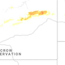
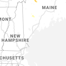
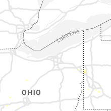
Hail Map for Thursday, June 27, 2019

Number of Impacted Households on 6/27/2019
0
Impacted by 1" or Larger Hail
0
Impacted by 1.75" or Larger Hail
0
Impacted by 2.5" or Larger Hail
Square Miles of Populated Area Impacted on 6/27/2019
0
Impacted by 1" or Larger Hail
0
Impacted by 1.75" or Larger Hail
0
Impacted by 2.5" or Larger Hail


Cities Most Affected by Hail Storms of 6/27/2019
| Hail Size | Demographics of Zip Codes Affected | ||||||
|---|---|---|---|---|---|---|---|
| City | Count | Average | Largest | Pop Density | House Value | Income | Age |
| Chinook, MT | 1 | 2.50 | 2.50 | 0 | $63k | $28.3k | 45.6 |
| Circle, MT | 1 | 2.00 | 2.00 | 0 | $43k | $28.5k | 47.1 |
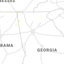
| Centre, AL | 1 | 1.75 | 1.75 | 72 | $82k | $30.2k | 45.0 |
Hail and Wind Damage Spotted on 6/27/2019
Filter by Report Type:Hail ReportsWind Reports
States Impacted
Iowa, Minnesota, Missouri, Ohio, Mississippi, Alabama, Wisconsin, Virginia, West Virginia, Maine, Pennsylvania, Tennessee, Montana, Georgia, Kentucky, Louisiana, Florida, Kansas, South Carolina, New Mexico, New York, North DakotaIowa
| Local Time | Report Details |
|---|---|
| 7:00 AM CDT | Quarter sized hail reported near George, IA, 37.5 miles ESE of Sioux Falls, SD, received report via social media... pea to quarter size hail along with strong winds and heavy rain. |
| 8:23 AM CDT | Quarter sized hail reported near Larchwood, IA, 20.8 miles ESE of Sioux Falls, SD, received report via social media... quarter sized hail fell for about 4 minutes. |
| 8:35 AM CDT | Tree branches down... estimated at 60 mp in lyon county IA, 31.3 miles ESE of Sioux Falls, SD |
| 8:55 AM CDT | Tree branch down (estimated at 3 inches diameter)... estimate wind gust of 60 mp in sioux county IA, 36.4 miles SSE of Sioux Falls, SD |
| 12:30 PM CDT | Quarter sized hail reported near , , 44.3 miles ENE of Mason City, IA, time estimated from radar. |
| 12:35 PM CDT | Quarter sized hail reported near Elma, IA, 39 miles E of Mason City, IA |
| 12:37 PM CDT | Quarter sized hail reported near Everly, IA, 36 miles N of Storm Lake, IA |
| 12:38 PM CDT | Quarter sized hail reported near Everly, IA, 35 miles N of Storm Lake, IA, quarter sized hail and estimated 50 mph wind gusts. |
| 12:42 PM CDT | Storm damage reported in clay county IA, 36.1 miles N of Storm Lake, IA |
| 12:43 PM CDT | Ping Pong Ball sized hail reported near Spencer, IA, 36.1 miles N of Storm Lake, IA, sent pictures via social media... time based on radar. |
| 12:46 PM CDT | Quarter sized hail reported near Spencer, IA, 33.5 miles N of Storm Lake, IA |
| 12:48 PM CDT | Branches blown down in town via charles city pd in floyd county IA, 28.1 miles E of Mason City, IA |
| 12:48 PM CDT | Half Dollar sized hail reported near Spencer, IA, 34.1 miles N of Storm Lake, IA, picture received via social media... referenced to size of a quarter. |
| 12:50 PM CDT | Quarter sized hail reported near Spencer, IA, 34.1 miles N of Storm Lake, IA, received report via social media. pea to nickel size hail... with occasional quarter size. high wind gusts reported as well. |
| 1:04 PM CDT | Quarter sized hail also reported and will be in a separate ls in palo alto county IA, 38.3 miles NNE of Storm Lake, IA |
| 1:04 PM CDT | Quarter sized hail reported near Ruthven, IA, 38.3 miles NNE of Storm Lake, IA |
| 2:15 PM CDT | A few trees reported dow in clayton county IA, 49.1 miles N of Cedar Rapids, IA |
| 2:15 PM CDT | Tree down along hwy 56. estimated 40 to 50 mph wind in clayton county IA, 62.2 miles N of Cedar Rapids, IA |
| 2:50 PM CDT | Ping Pong Ball sized hail reported near Quasqueton, IA, 28.8 miles N of Cedar Rapids, IA, public report including photo relayed by cbs2 twitter. time confirmed by radar. |
| 3:35 PM CDT | 1-2 inch tree limbs blown dow in jones county IA, 30.4 miles NE of Cedar Rapids, IA |
| 3:45 PM CDT | Ping Pong Ball sized hail reported near Monticello, IA, 29.2 miles NE of Cedar Rapids, IA |
| 5:25 PM CDT | Quarter sized hail reported near Aurora, IA, 44.5 miles N of Cedar Rapids, IA, delayed report via social media. |
Minnesota
| Local Time | Report Details |
|---|---|
| 7:50 AM CDT | 67.7 mph wind gust... wind direction ws in cottonwood county MN, 67 miles SSE of Montevideo, MN |
| 9:30 AM CDT | Tree snapped ~8-12 inch diameter. time estimated from rada in wright county MN, 26.1 miles W of Minneapolis, MN |
| 10:05 PM CDT | Quarter sized hail reported near Lake City, MN, 61.1 miles SE of Minneapolis, MN, relayed via wabasha county dispatch. |
| 10:10 PM CDT | Quarter sized hail reported near Lake City, MN, 60.3 miles SE of Minneapolis, MN, relayed via picture on social media. |
Missouri
| Local Time | Report Details |
|---|---|
| 8:00 AM CDT | A tree fell across u.s. 6 in butler county MO, 60.3 miles WSW of Cape Girardeau, MO |
Ohio
| Local Time | Report Details |
|---|---|
| 12:09 PM EDT | Trees downe in clinton county OH, 42.3 miles NE of Cincinnati, OH |
| 12:37 PM EDT | Several large limbs downed on multiple properties along middleboro road near rte 22/3. time estimated by rada in warren county OH, 30 miles NE of Cincinnati, OH |
| 12:44 PM EDT | Flag pole bent at base near intersection of norman st. and randolph st. time estimated by rada in clinton county OH, 42.4 miles ENE of Cincinnati, OH |
| 1:30 PM EDT | One tree down over road. time estimated from radar dat in champaign county OH, 40.6 miles WNW of Columbus, OH |
| 1:35 PM EDT | Storm damage reported in clark county OH, 45.3 miles W of Columbus, OH |
| 4:05 PM EDT | Quarter sized hail reported near Mansfield, OH, 62.1 miles NNE of Columbus, OH |
| 5:29 PM EDT | Tree damage east side of canfield. picture from social medi in mahoning county OH, 56.8 miles NW of Pittsburgh, PA |
| 6:15 PM EDT | South ave and state route 224 semi trailer blown ove in mahoning county OH, 52.1 miles NW of Pittsburgh, PA |
Mississippi
| Local Time | Report Details |
|---|---|
| 11:30 AM CDT | Large tree down in residents yar in pontotoc county MS, 61.2 miles NNW of Starkville, MS |
| 11:40 AM CDT | Large tree uprooted and down along cr 8 in union county MS, 68.4 miles N of Starkville, MS |
| 11:45 AM CDT | Multiple trees and powerlines down in blue spring in union county MS, 64.5 miles N of Starkville, MS |
| 11:45 AM CDT | Large tree uprooted in residents yar in union county MS, 67.9 miles WSW of Florence, AL |
| 11:45 AM CDT | Multiple trees down on roads and cars in ripley c in tippah county MS, 69.3 miles ESE of Memphis, TN |
| 11:47 AM CDT | Numerous trees and power outages across tippah c in tippah county MS, 66.7 miles ESE of Memphis, TN |
| 11:55 AM CDT | Large tree down on winchester d in lee county MS, 60.4 miles N of Starkville, MS |
| 12:01 PM CDT | Tree down at first united methodist churc in lee county MS, 62.5 miles N of Starkville, MS |
| 12:01 PM CDT | Large tree down on dozier hill r in pontotoc county MS, 58.3 miles N of Starkville, MS |
| 12:20 PM CDT | Some trees down around property along lake pioming in lee county MS, 60.7 miles N of Starkville, MS |
| 12:55 PM CDT | Several trees were blown down in the south and east side of the county and some trees were blown down in grenad in grenada county MS, 61.7 miles WNW of Starkville, MS |
| 1:00 PM CDT | A large tree down on winchester drive blocking the roa in monroe county MS, 40.9 miles NNE of Starkville, MS |
| 1:35 PM CDT | A tree was blown down in starkville. gust was likely subsever in oktibbeha county MS, 0.3 miles NNE of Starkville, MS |
| 1:43 PM CDT | A tree was blown down along ms highway 35 south and 3 trees were blown down along ms highway 430 west of vaide in carroll county MS, 59.7 miles W of Starkville, MS |
| 1:46 PM CDT | A tree was blown down along ms highway 17 sout in carroll county MS, 66.3 miles W of Starkville, MS |
| 1:54 PM CDT | A tree was blown down and snapped a power pole in vaide in carroll county MS, 55 miles W of Starkville, MS |
| 3:15 PM CDT | About 5 or 6 trees were blown down around the county... including near the city of madiso in madison county MS, 11.7 miles NNE of Jackson, MS |
| 4:45 PM CDT | Trees were blown down in quitman... including one on a house. a tree was blown down on a house on 3rd street in shubuta and another was on a house along highway 18w in in clarke county MS, 84.6 miles W of Camden, AL |
| 5:00 PM CDT | A tree was blown down near lynn road. the time of the event was estimated by rada in harrison county MS, 64 miles WSW of Mobile, AL |
| 5:10 PM CDT | Quarter sized hail reported near Biloxi, MS, 51.6 miles WSW of Mobile, AL, quarter size hail was observed. |
| 5:10 PM CDT | Trees and power lines were blown dow in jackson county MS, 51.6 miles WSW of Mobile, AL |
| 5:15 PM CDT | A tree was blown down. the time of the event was estimated by rada in jackson county MS, 47.1 miles WSW of Mobile, AL |
| 5:20 PM CDT | Trees down in southeast wayne county including a tree on a powerline. report via social medi in wayne county MS, 65.2 miles NNW of Mobile, AL |
| 5:30 PM CDT | Trees down in southeast wayne county including a tree on a powerline. report via social medi in wayne county MS, 65.2 miles NNW of Mobile, AL |
| 7:00 PM CDT | 2 trees were blown down around the port gibson area... and a power line was blown down along vine stree in claiborne county MS, 51.8 miles WSW of Jackson, MS |
Alabama
| Local Time | Report Details |
|---|---|
| 11:51 AM CDT | Multiple trees down reported on hwy 75 in phil campbell. time estimated based on rada in franklin county AL, 29.7 miles S of Florence, AL |
| 11:52 AM CDT | Multiple trees down in phil campbell at hwy 243 and hwy 175. time estimated based on rada in franklin county AL, 28.3 miles S of Florence, AL |
| 12:09 PM CDT | Trees were knocked down on highway 24 in franklin county AL, 23.6 miles S of Florence, AL |
| 12:09 PM CDT | Trees were knocked down on highway 24 in franklin county AL, 33.6 miles S of Florence, AL |
| 12:47 PM CDT | Emergency manager reports multiple trees down in red bay on hwy 247. time approximated by rada in franklin county AL, 33 miles SW of Florence, AL |
| 1:24 PM CDT | A few trees were blown down. winds estimated at 45 to 50 mp in lamar county AL, 56.2 miles NE of Starkville, MS |
| 1:42 PM CDT | Multiple trees were blown down along highway 10 in fayette county AL, 59.7 miles ENE of Starkville, MS |
| 1:42 PM CDT | A tree was blown dow in fayette county AL, 59.7 miles ENE of Starkville, MS |
| 1:50 PM CDT | A tree was blown down and landed on a home. winds were estimated around 50 mp in fayette county AL, 55.9 miles E of Starkville, MS |
| 1:54 PM CDT | A few trees were blown down around kennedy. winds estimated at 45 to 50 mp in lamar county AL, 48.3 miles E of Starkville, MS |
| 2:02 PM CDT | A few trees were blown down around pickens county. winds estimated around 45 mp in pickens county AL, 44.1 miles ESE of Starkville, MS |
| 2:36 PM CDT | A tree was blown down onto a transformer and produced a fire. winds estimated at 35 to 45 mp in sumter county AL, 47.5 miles SE of Starkville, MS |
| 2:49 PM CDT | A tree was knocked down onto manningham driv in madison county AL, 52.9 miles E of Florence, AL |
| 3:11 PM CDT | A tree was blown dow in greene county AL, 66.9 miles SE of Starkville, MS |
| 3:12 PM CDT | A tree was blown dow in greene county AL, 68.3 miles SE of Starkville, MS |
| 3:12 PM CDT | *** 1 inj *** a tree was blown down and landed on a small boy. he was transported to a local hospita in greene county AL, 60.3 miles ESE of Starkville, MS |
| 3:19 PM CDT | Several trees were blown down around forklan in greene county AL, 56.9 miles NW of Camden, AL |
| 3:25 PM CDT | A tree was blown down near highway 14 and highway 6 in hale county AL, 62 miles NNW of Camden, AL |
| 3:26 PM CDT | *** 1 inj *** a tree fell on a woman in foscue creek par in marengo county AL, 49.7 miles NW of Camden, AL |
| 3:28 PM CDT | Corrects previous tstm wnd dmg report from 1 sse harper hill. a tree was blown down near harper hill along highway 6 in hale county AL, 61.3 miles NNW of Camden, AL |
| 3:32 PM CDT | A tree was blown down near harper hill along highway 6 in hale county AL, 61.3 miles NNW of Camden, AL |
| 3:32 PM CDT | A tree was blown down at sage road and cr 2 in hale county AL, 55.2 miles NNW of Camden, AL |
| 3:33 PM CDT | A tree was blown down along highway 1 in hale county AL, 53 miles NNW of Camden, AL |
| 3:48 PM CDT | Several trees blown down in western perry county across from newber in perry county AL, 43.4 miles NNW of Camden, AL |
| 5:09 PM CDT | Half Dollar sized hail reported near Centre, AL, 64.9 miles SSW of Chattanooga, TN, near cr 31 ans cr 40. |
| 5:12 PM CDT | Golf Ball sized hail reported near Centre, AL, 64.8 miles SSW of Chattanooga, TN |
| 5:15 PM CDT | Multiple trees were blown down north of cedar bluff on cr 7 in cherokee county AL, 56.8 miles SSW of Chattanooga, TN |
| 5:24 PM CDT | Trees and power lines were blown down along cr 25 in cherokee county AL, 61.2 miles S of Chattanooga, TN |
| 5:25 PM CDT | Reports of trees down along highway 84 in the coffeeville community. also a report of trees down in the scyrene communit in clarke county AL, 49.1 miles WSW of Camden, AL |
| 5:28 PM CDT | A large tree was blown down and blocking cr 80 just north of highway in cherokee county AL, 57 miles SSW of Chattanooga, TN |
| 5:48 PM CDT | A tree was blown down on valley acres roa in cherokee county AL, 63.7 miles SSW of Chattanooga, TN |
| 6:10 PM CDT | Several reports of trees limbs down around the citronelle area. report of siding ripped off a home. reports and pictures via social medi in mobile county AL, 29.9 miles NNW of Mobile, AL |
| 6:30 PM CDT | Quarter sized hail reported near Axis, AL, 17.6 miles N of Mobile, AL, picture of hailstones of varying sizes including one hailstone the size of a quarter. pictures via social media. |
| 6:35 PM CDT | Reports of trees and limbs down in the semmes area. pictures and reports via social medi in mobile county AL, 13.9 miles WNW of Mobile, AL |
| 6:45 PM CDT | Numerous reports of trees down in several spots in midtown mobile. powerlines on the road near springhill av in mobile county AL, 2.8 miles W of Mobile, AL |
| 6:45 PM CDT | Trees down just south of langan par in mobile county AL, 6.4 miles W of Mobile, AL |
| 6:55 PM CDT | Trees down near riviere du chien rd and near dauphin island pkwy (near the dog river in mobile county AL, 6.6 miles SW of Mobile, AL |
| 7:00 PM CDT | Trees down in the irvington community. pictures and reports via social medi in mobile county AL, 16.1 miles SW of Mobile, AL |
| 7:00 PM CDT | Trees down west of bay minette along hwy 22 in baldwin county AL, 20.3 miles NE of Mobile, AL |
| 7:05 PM CDT | Trees down along county rd 64 and along county rd 13 in daphne with debris in the roa in baldwin county AL, 11.4 miles ESE of Mobile, AL |
| 7:18 PM CDT | Mesonet station fmoa1 fort morgan... al measured wind gusts up to 63mp in baldwin county AL, 31.5 miles S of Mobile, AL |
| 7:36 PM CDT | Powerlines down in the gulf shores are in baldwin county AL, 35.4 miles SE of Mobile, AL |
| 9:15 PM CDT | Awos station at kvoa viosca knoll (768) measured a wind gust of 67mp in gmz670 county AL, 101.6 miles S of Mobile, AL |
Wisconsin
| Local Time | Report Details |
|---|---|
| 1:30 PM CDT | Trees and power lines down in the city of la crosse. boat flipped over on french islan in la crosse county WI, 1.6 miles NE of La Crosse, WI |
| 1:35 PM CDT | Nws employee reports multiple branches down... including a large branc in la crosse county WI, 10.5 miles NE of La Crosse, WI |
| 1:54 PM CDT | Trees down in and just north of town. causing power outages to in monroe county WI, 23.8 miles ENE of La Crosse, WI |
| 2:00 PM CDT | Received a picture of a large branch snapped from a tree. time estimated from rada in monroe county WI, 23.8 miles ENE of La Crosse, WI |
| 2:12 PM CDT | Most of a large tree blown down. time estimated from rada in vernon county WI, 25.2 miles SE of La Crosse, WI |
| 3:18 PM CDT | Iowa county emergency management reports lots of trees down between mineral point and aren in iowa county WI, 27.1 miles WNW of Madison, WI |
| 3:19 PM CDT | Numerous trees down around baraboo with some power lines down as wel in sauk county WI, 32.7 miles NNW of Madison, WI |
| 3:30 PM CDT | Swath of trees dow in dane county WI, 20.4 miles NW of Madison, WI |
| 3:40 PM CDT | Top half of mature maple snapped off onto garage on university ave in middleton. many branches down als in dane county WI, 5.4 miles WNW of Madison, WI |
| 3:40 PM CDT | Several large trees down in middleton and west madiso in dane county WI, 6.3 miles W of Madison, WI |
| 3:40 PM CDT | Trees down near briggsvill in marquette county WI, 41.7 miles NNW of Madison, WI |
| 3:40 PM CDT | Numerous tree limbs down south of portage near hwy 16 and 5 in columbia county WI, 28.8 miles N of Madison, WI |
| 3:45 PM CDT | Pictures of large branches dow in dane county WI, 12.5 miles N of Madison, WI |
| 3:50 PM CDT | Trees down and extensive pier damage on lake puckawa in marquette county WI, 49.2 miles NNE of Madison, WI |
| 3:50 PM CDT | Large oak tree down in monona... winnequah and maywood streets. power lines affected. large limbs down nearby als in dane county WI, 2.5 miles ESE of Madison, WI |
| 3:55 PM CDT | Storm damage reported in dane county WI, 12 miles NE of Madison, WI |
| 4:01 PM CDT | Storm damage reported in waushara county WI, 68.4 miles N of Madison, WI |
| 4:05 PM CDT | Storm damage reported in green lake county WI, 48.4 miles NNE of Madison, WI |
| 4:05 PM CDT | Trees dow in green lake county WI, 57 miles NNE of Madison, WI |
| 4:05 PM CDT | Trees dow in green lake county WI, 64.3 miles NNE of Madison, WI |
| 4:15 PM CDT | Large tree branches down and one large tree down on highway 152 in between mount morris and wautom in waushara county WI, 66.3 miles WSW of Green Bay, WI |
| 4:15 PM CDT | Corrects previous tstm wnd dmg report from fox lake. trees and powerlines dow in dodge county WI, 41.9 miles NE of Madison, WI |
| 4:15 PM CDT | Trees and powerlines dow in dodge county WI, 41.9 miles NE of Madison, WI |
| 4:20 PM CDT | Trees down across the are in green county WI, 25.1 miles S of Madison, WI |
| 4:20 PM CDT | Trees dow in rock county WI, 34 miles SSE of Madison, WI |
| 4:20 PM CDT | Large trees dow in fond du lac county WI, 59.7 miles NNE of Madison, WI |
| 4:25 PM CDT | Powerlines and trees dow in dodge county WI, 38.4 miles NE of Madison, WI |
| 4:25 PM CDT | Trees down around waupac in waupaca county WI, 53.3 miles WSW of Green Bay, WI |
| 4:27 PM CDT | Storm damage reported in dodge county WI, 42.5 miles NE of Madison, WI |
| 4:30 PM CDT | Trees down across the are in rock county WI, 32.9 miles SE of Madison, WI |
| 4:35 PM CDT | Trees down across the are in rock county WI, 42.7 miles SSE of Madison, WI |
| 4:40 PM CDT | Billboard damag in fond du lac county WI, 57 miles SSW of Green Bay, WI |
| 4:40 PM CDT | Numerous trees down in the eastern side of jefferson county... more so by sullivan. power lines down there as well with 4...000 people without powe in jefferson county WI, 40.6 miles E of Madison, WI |
| 4:45 PM CDT | Storm damage reported in fond du lac county WI, 56.6 miles SSW of Green Bay, WI |
| 4:45 PM CDT | Trees down in the city of fond du la in fond du lac county WI, 55.8 miles SSW of Green Bay, WI |
| 4:45 PM CDT | Large trees dow in fond du lac county WI, 55.5 miles SSW of Green Bay, WI |
| 4:45 PM CDT | 8 trees down... with 1-2 dozen large limbs down als in waukesha county WI, 45.4 miles E of Madison, WI |
| 4:47 PM CDT | Large tree limbs down throughout the southwest portion of oconomowoc. some shingles peeled back on house in waukesha county WI, 43.9 miles E of Madison, WI |
| 4:50 PM CDT | Trees and powerlines down. roof caved in due to tree fallin in washington county WI, 54.1 miles ENE of Madison, WI |
| 4:50 PM CDT | Large tree dow in washington county WI, 53.6 miles ENE of Madison, WI |
| 4:50 PM CDT | Tree uproote in waukesha county WI, 46.6 miles E of Madison, WI |
| 4:55 PM CDT | Shingle damag in waukesha county WI, 51.5 miles E of Madison, WI |
| 4:55 PM CDT | Trees and wires down between omro and winneconn in winnebago county WI, 49.6 miles SW of Green Bay, WI |
| 5:00 PM CDT | Storm damage reported in washington county WI, 60.1 miles ENE of Madison, WI |
| 5:00 PM CDT | Numerous trees down near carroll universit in waukesha county WI, 58.7 miles E of Madison, WI |
| 5:00 PM CDT | Structural damage to garag in waukesha county WI, 59.3 miles E of Madison, WI |
| 5:00 PM CDT | Structural damage to apartment. wall caved i in waukesha county WI, 58.8 miles E of Madison, WI |
| 5:00 PM CDT | Tree down on manitowoc road. time estimated based on rada in winnebago county WI, 30.7 miles SW of Green Bay, WI |
| 5:05 PM CDT | Tree down on house. county n and kennedy avenue. time estimated by rada in outagamie county WI, 23.4 miles SW of Green Bay, WI |
| 5:05 PM CDT | Storm damage reported in calumet county WI, 26.9 miles SSW of Green Bay, WI |
| 5:10 PM CDT | Few large trees and powerlines dow in walworth county WI, 54.9 miles SE of Madison, WI |
| 5:10 PM CDT | Trees dow in outagamie county WI, 23.4 miles SW of Green Bay, WI |
| 5:10 PM CDT | Trees dow in outagamie county WI, 22.5 miles W of Green Bay, WI |
| 5:10 PM CDT | Few trees down in stockbridge and town of harriso in calumet county WI, 34.4 miles SSW of Green Bay, WI |
| 5:12 PM CDT | Trees and powerlines down across the are in waukesha county WI, 64.9 miles E of Madison, WI |
| 5:15 PM CDT | A few trees dow in outagamie county WI, 27.1 miles SW of Green Bay, WI |
| 5:20 PM CDT | Multiple tree branches dow in ozaukee county WI, 71.8 miles E of Madison, WI |
| 5:23 PM CDT | Tree damage in pell lak in walworth county WI, 58.7 miles NW of Chicago, IL |
| 5:25 PM CDT | Large tree blown ove in milwaukee county WI, 73.3 miles E of Madison, WI |
| 5:30 PM CDT | Large tree uprooted on the west side of the city. tree fell on and damaged ca in brown county WI, 0.5 miles ESE of Green Bay, WI |
| 5:33 PM CDT | Large trees dow in milwaukee county WI, 73.5 miles E of Madison, WI |
| 5:40 PM CDT | Large tree down near mitchell airpor in milwaukee county WI, 74.6 miles N of Chicago, IL |
| 5:56 PM CDT | Large tree dow in washington county WI, 65.1 miles E of Madison, WI |
Virginia
| Local Time | Report Details |
|---|---|
| 2:35 PM EDT | Quarter sized hail reported near Raphine, VA, 63.1 miles NE of Roanoke, VA, quarter size hail |
| 2:44 PM EDT | Quarter sized hail reported near Raphine, VA, 63.1 miles NE of Roanoke, VA, quarter size hail |
| 5:12 PM EDT | Tree down on staplechase and riders in fairfax county VA, 47.8 miles WSW of Baltimore, MD |
| 5:19 PM EDT | Tree down in the 5000 block of brentwood farm driv in fairfax county VA, 51.4 miles SW of Baltimore, MD |
| 5:39 PM EDT | Trees down on 3100 block of shepherds mill roa in clarke county VA, 70.8 miles W of Baltimore, MD |
| 5:56 PM EDT | Trees down on 2300 block of river roa in clarke county VA, 72.7 miles W of Baltimore, MD |
| 6:01 PM EDT | Quarter sized hail reported near Alexandria, VA, 45.7 miles SW of Baltimore, MD, pea to quarter size hail |
| 7:07 PM EDT | Tree down near leeds manor road and stillhouse roa in fauquier county VA, 80.4 miles WSW of Baltimore, MD |
| 7:15 PM EDT | Tree down in the 4100 block of potts creek road... time estimated from rada in alleghany county VA, 30.9 miles NNW of Roanoke, VA |
| 7:48 PM EDT | Large branches down blocking fort valley road at spring mountain roa in shenandoah county VA, 80 miles E of Elkins, WV |
| 8:02 PM EDT | Tree down near bristersburg road and elk ridge roa in fauquier county VA, 68.8 miles N of Richmond, VA |
West Virginia
| Local Time | Report Details |
|---|---|
| 3:51 PM EDT | Tree on a house on pumphouse lan in berkeley county WV, 77.1 miles W of Baltimore, MD |
| 4:06 PM EDT | Storm damage reported in berkeley county WV, 73.8 miles W of Baltimore, MD |
| 4:07 PM EDT | Storm damage reported in berkeley county WV, 73.8 miles W of Baltimore, MD |
| 4:12 PM EDT | Storm damage reported in berkeley county WV, 73.8 miles W of Baltimore, MD |
| 4:20 PM EDT | Tree down on wires in the 700 block of hatchery roa in berkeley county WV, 75.8 miles W of Baltimore, MD |
| 4:21 PM EDT | Wires down on 700 block of hatchery roa in berkeley county WV, 75.8 miles W of Baltimore, MD |
| 4:53 PM EDT | Numerous reports of trees and wires down throughout the town of ranso in jefferson county WV, 67 miles W of Baltimore, MD |
| 5:00 PM EDT | Large tree fallen onto a house at 46 pumphouse ln in berkeley county WV, 77.1 miles W of Baltimore, MD |
Maine
| Local Time | Report Details |
|---|---|
| 4:06 PM EDT | Quarter sized hail reported near Jay, ME, 56.8 miles N of Portland, ME, food city in livermore falls stated there was quarter size hail at their location. |
Pennsylvania
| Local Time | Report Details |
|---|---|
| 4:06 PM EDT | Wires down in area. time estimated based on rada in washington county PA, 19.2 miles W of Pittsburgh, PA |
| 4:10 PM EDT | Several trees down in allegheny county PA, 6.7 miles E of Pittsburgh, PA |
| 4:20 PM EDT | Quarter sized hail reported near Pittsburgh, PA, 3 miles SSE of Pittsburgh, PA, estimated dime to quarter size |
| 4:32 PM EDT | Wires down in area. time estimated based on rada in washington county PA, 16.7 miles W of Pittsburgh, PA |
| 4:34 PM EDT | Multiple trees down at quicksilver golf club. time updated to match radar signatur in washington county PA, 15.8 miles WSW of Pittsburgh, PA |
| 4:35 PM EDT | Coal valley rd closed between rt 837 and rt 885 for a tree down blocking the roadway in allegheny county PA, 8.8 miles SSE of Pittsburgh, PA |
| 4:42 PM EDT | Multiple trees down at quicksilver golf club in washington county PA, 15.8 miles WSW of Pittsburgh, PA |
| 4:50 PM EDT | Wires down on manchester hill rd in westmoreland county PA, 18.9 miles ENE of Pittsburgh, PA |
| 5:40 PM EDT | Trees down in young township in indiana county PA, 35.6 miles ENE of Pittsburgh, PA |
| 6:20 PM EDT | Trees and power lines down in green township in indiana county PA, 55.5 miles W of State College, PA |
| 6:27 PM EDT | Trees and power lines down at mcclain rd and mt jackson rd in lawrence county PA, 43.2 miles NW of Pittsburgh, PA |
Tennessee
| Local Time | Report Details |
|---|---|
| 3:20 PM CDT | Trees and power lines were downed in the centertown are in warren county TN, 57.2 miles ESE of Nashville, TN |
| 4:40 PM CDT | Trees down across northwestern portion of count in putnam county TN, 67.6 miles E of Nashville, TN |
| 4:59 PM CDT | Quarter sized hail reported near Cowan, TN, 40.6 miles WNW of Chattanooga, TN, a few pieces of quarter size hail reported in cowan. time estimated by radar. |
| 5:05 PM CDT | Trees down...1 of which fell on a vehicl in marshall county TN, 37.3 miles S of Nashville, TN |
| 5:40 PM CDT | Tree down at temple hills rd and sneed r in williamson county TN, 10.1 miles SSW of Nashville, TN |
| 5:55 PM CDT | Multiple trees down near jaspe in marion county TN, 18.3 miles W of Chattanooga, TN |
| 6:02 PM CDT | Power lines down in wilson county TN, 12.2 miles ENE of Nashville, TN |
| 6:03 PM CDT | Tree blown down across mccrory lan in davidson county TN, 2.3 miles W of Nashville, TN |
| 6:05 PM CDT | Trees down near academy and bradshaw in wilson county TN, 21.7 miles ENE of Nashville, TN |
| 6:06 PM CDT | Tree down along old charlotte pik in cheatham county TN, 17.5 miles WNW of Nashville, TN |
| 6:15 PM CDT | Estimated 65 mph wind gus in davidson county TN, 9.6 miles NE of Nashville, TN |
| 6:15 PM CDT | Estimated 65 mph wind gus in wilson county TN, 11.9 miles E of Nashville, TN |
| 6:20 PM CDT | Tree down across dickerson bay d in sumner county TN, 23.5 miles NE of Nashville, TN |
| 6:34 PM CDT | Trees down across the eastern half of county. tree down on a house in greenbrie in robertson county TN, 17.4 miles N of Nashville, TN |
| 11:15 PM EDT | A few trees down generally southeast of fincastl in campbell county TN, 28.6 miles N of Knoxville, TN |
| 12:15 AM EDT | A few trees down generally south of fincastl in campbell county TN, 27.1 miles NNW of Knoxville, TN |
Montana
| Local Time | Report Details |
|---|---|
| 2:25 PM MDT | Quarter sized hail reported near Clancy, MT, 71.4 miles NW of Bozeman, MT, second hand report of quarter sized hail reported in clancy by krtv. |
| 4:03 PM MDT | Quarter sized hail reported near Great Falls, MT, 0.8 miles ENE of Great Falls, MT |
| 4:05 PM MDT | Quarter sized hail reported near Great Falls, MT, 1.1 miles NW of Great Falls, MT, quarter sized hail reported on the northwest side of great falls. |
| 4:15 PM MDT | Wind gust estimated to be at least 70 mph. power outage. knocked over trees onto houses on 4th avenue sout in cascade county MT, 19.4 miles ESE of Great Falls, MT |
| 4:15 PM MDT | Wind gust estimated to be at least 70 mph. power outage. knocked over trees onto houses on 4th avenue sout in cascade county MT, 19.4 miles ESE of Great Falls, MT |
| 4:45 PM MDT | Awos station k1bm brav in judith basin county MT, 46.6 miles ESE of Great Falls, MT |
| 5:13 PM MDT | Quarter sized hail reported near Stanford, MT, 65 miles ESE of Great Falls, MT |
| 5:19 PM MDT | Storm damage reported in chouteau county MT, 59.1 miles SSW of Havre, MT |
| 5:33 PM MDT | Storm damage reported in fergus county MT, 69.8 miles ESE of Great Falls, MT |
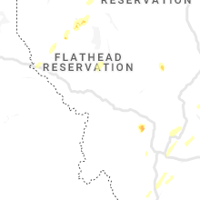
| 5:33 PM MDT | Chokecherry tree down on private property. lots of heavy... intense pea-sized hail and brief outflow winds reported with stor in flathead county MT, 13.2 miles S of Whitefish, MT |
| 5:49 PM MDT | Storm damage reported in fergus county MT, 81.5 miles S of Havre, MT |
| 5:55 PM MDT | Storm damage reported in hill county MT, 4.2 miles WSW of Havre, MT |
| 5:55 PM MDT | Asos station khvr havre ap aso in hill county MT, 4.5 miles W of Havre, MT |
| 6:30 PM MDT | Time estimated from rada in blaine county MT, 21.7 miles ESE of Havre, MT |
| 6:35 PM MDT | Spotter reports at least one tree down partially blocking a road south of chinoo in blaine county MT, 21.4 miles E of Havre, MT |
| 6:40 PM MDT | Tennis Ball sized hail reported near Chinook, MT, 23.1 miles NE of Havre, MT, measured n of chinook by canadian border. storm is showing signs of rotation with wall cloud but not dropping anything at the moment. windshield damage to my friends tr |
| 6:48 PM MDT | Storm damage reported in blaine county MT, 20.4 miles E of Havre, MT |
| 6:55 PM MDT | Storm chase in phillips county MT, 71.1 miles SE of Havre, MT |
| 7:00 PM MDT | Awos station ks71 chinook ap in blaine county MT, 19.6 miles E of Havre, MT |
| 7:04 PM MDT | Electricity outag in blaine county MT, 41.8 miles E of Havre, MT |
| 7:10 PM MDT | 10 inch tree branches blown out of the tops of trees. estimated wind gusts over 70 mp in phillips county MT, 74.9 miles SE of Havre, MT |
| 7:12 PM MDT | Ping Pong Ball sized hail reported near Judith Gap, MT, 73.4 miles NW of Billings, MT, dime to ping-pong ball sized hail. |
| 7:18 PM MDT | Mesonet station fblm8 fort belknap raw in blaine county MT, 47.1 miles ESE of Havre, MT |
| 7:20 PM MDT | Quarter sized hail reported near Ryegate, MT, 71.4 miles NNW of Billings, MT |
| 7:20 PM MDT | Several power poles down on 7 mile road going into zortman off of us 191. no power in the area. trees were bending in the wind when the storm passe in phillips county MT, 69 miles SE of Havre, MT |
| 7:28 PM MDT | Mesonet station mtmal malta 35 in phillips county MT, 75 miles ESE of Havre, MT |
| 7:28 PM MDT | Malta south at highway 19 in phillips county MT, 58 miles WNW of Glasgow, MT |
| 7:32 PM MDT | Mesonet station aldm8 zortman 1 in phillips county MT, 70 miles SE of Havre, MT |
| 7:45 PM MDT | 6 inch diameter tree branches broken by thunderstorm winds as the storm passe in phillips county MT, 66.1 miles WSW of Glasgow, MT |
| 8:13 PM MDT | Estimated wind gus in phillips county MT, 42.2 miles WSW of Glasgow, MT |
| 9:08 PM MDT | Bluff creek raws in valley county MT, 48.8 miles NNW of Glasgow, MT |
| 9:29 PM MDT | Storm damage reported in valley county MT, 2.3 miles NW of Glasgow, MT |
| 9:31 PM MDT | Estimated wind gus in phillips county MT, 42.2 miles WSW of Glasgow, MT |
| 12:05 AM MDT | Hen Egg sized hail reported near Circle, MT, 71 miles N of Miles City, MT, heavy rain |
| 12:10 AM MDT | Half Dollar sized hail reported near Circle, MT, 71 miles N of Miles City, MT, estimated 60 mph wind gusts. heavy rain. |
| 12:40 AM MDT | Dime size hail and 0.55 rainfal in dawson county MT, 72.5 miles NNE of Miles City, MT |
Georgia
| Local Time | Report Details |
|---|---|
| 5:13 PM EDT | 1-2 trees down at maple dr and selman ave. approx 20 trees down total across summerville and areas just west of summervill in chattooga county GA, 39.1 miles S of Chattanooga, TN |
| 6:03 PM EDT | Quarter sized hail reported near Lyerly, GA, 44.9 miles S of Chattanooga, TN, large hail starting to cover the ground at ga hwy 114 and oak hill rd in lyerly |
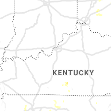
Kentucky
| Local Time | Report Details |
|---|---|
| 5:03 PM CDT | Report of a couple trees down along hwy 1590 near hay road and hwy 135 in clinton county KY, 89.7 miles NW of Knoxville, TN |
| 6:30 PM CDT | Trees down along hwy 8 in adair county KY, 67.9 miles SSE of Louisville, KY |
| 6:52 PM CDT | Large tree down on main st and kentucky av in simpson county KY, 39.6 miles NNE of Nashville, TN |
| 6:52 PM CDT | Large tree down at ky 73 and morgantown r in simpson county KY, 46.3 miles N of Nashville, TN |
| 7:00 PM CDT | Multiple trees and power lines down around franklin... k in simpson county KY, 40.5 miles NNE of Nashville, TN |
| 7:02 PM CDT | Several large tree branches down in woodburn... k in warren county KY, 48.4 miles NNE of Nashville, TN |
| 7:17 PM CDT | Tree down on baker nature trai in logan county KY, 47.7 miles N of Nashville, TN |
| 7:27 PM CDT | Powerlines down along the 300 block of glen lily roa in warren county KY, 60.2 miles NNE of Nashville, TN |
| 7:27 PM CDT | Tree and power lines down along the 400 block of w 12th avenu in warren county KY, 60.2 miles NNE of Nashville, TN |
Louisiana
| Local Time | Report Details |
|---|---|
| 5:20 PM CDT | Tree damage in a residential area near flannery road park. location is about 9 miles east of downtown baton roug in livingston county LA, 63.4 miles WNW of New Orleans, LA |
| 5:45 PM CDT | Quarter sized hail reported near Belle Chasse, LA, 8.5 miles SSE of New Orleans, LA, quarter size hail was observed. |
| 6:36 PM CDT | Power lines down near walmart neighborhood market at w park ave and westside blv in terrebonne county LA, 46.1 miles WSW of New Orleans, LA |
Florida
| Local Time | Report Details |
|---|---|
| 7:00 PM EDT | Tree down on east side of madison... f in madison county FL, 52.6 miles E of Tallahassee, FL |
| 7:20 PM EDT | Tree down on i-10 w bound near mm 24 in madison county FL, 46.6 miles E of Tallahassee, FL |
| 7:32 PM EDT | Tree down on hwy 90 between greenville and madiso in madison county FL, 44.3 miles E of Tallahassee, FL |
Kansas
| Local Time | Report Details |
|---|---|
| 6:45 PM CDT | Mesonet station dw5288 kendal in kearny county KS, 35.4 miles W of Garden City, KS |
| 10:57 PM CDT | Reported at garden city regional airpor in finney county KS, 8.8 miles ESE of Garden City, KS |
South Carolina
| Local Time | Report Details |
|---|---|
| 10:35 PM EDT | Officials report multiple trees blown down across the northeastern part of the county. trees down across old river rd...mooresville rd...shilo rd...and pickens dr. even in anderson county SC, 8.5 miles SSE of Greenville, SC |
| 11:30 PM EDT | Schp reported a tree down at wren school rd and highway 17 in anderson county SC, 10.1 miles SSE of Greenville, SC |
| 11:38 PM EDT | Trees blown down on a house and camper at shilo rd and wells r in oconee county SC, 20.1 miles WSW of Greenville, SC |
| 11:43 PM EDT | Schp reported a tree down at liberty highway and allgood rd in anderson county SC, 12.2 miles SSW of Greenville, SC |
New Mexico
| Local Time | Report Details |
|---|---|
| 8:49 PM MDT | Kprz awo in roosevelt county NM, 73.1 miles SSE of Tucumcari, NM |
| 9:00 PM MDT | Storm damage reported in curry county NM, 56.5 miles SSE of Tucumcari, NM |
| 9:04 PM MDT | Storm damage reported in curry county NM, 56.5 miles SSE of Tucumcari, NM |
New York
| Local Time | Report Details |
|---|---|
| 12:15 AM EDT | Reports of dime sized hail and several trees down where highway 9 intersects with interstate 87 just outside of champlai in clinton county NY, 37.5 miles NNW of Burlington, VT |
North Dakota
| Local Time | Report Details |
|---|---|
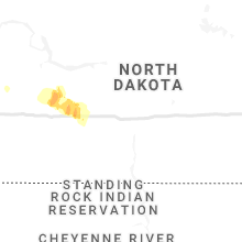
| 6:26 AM CDT | Quarter sized hail reported near Glen Ullin, ND, 51.1 miles WNW of Bismarck, ND, wind estimated at 60 mph shaving branches off a cottonwood tree. |
Connect with Interactive Hail Maps