

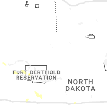
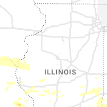
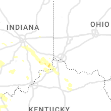
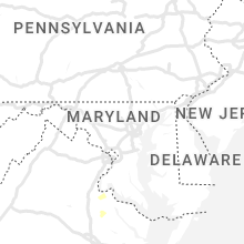
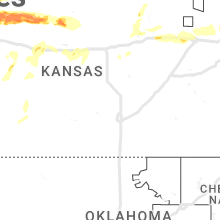
Hail Map for Friday, June 30, 2023

Number of Impacted Households on 6/30/2023
0
Impacted by 1" or Larger Hail
0
Impacted by 1.75" or Larger Hail
0
Impacted by 2.5" or Larger Hail
Square Miles of Populated Area Impacted on 6/30/2023
0
Impacted by 1" or Larger Hail
0
Impacted by 1.75" or Larger Hail
0
Impacted by 2.5" or Larger Hail


Cities Most Affected by Hail Storms of 6/30/2023
| Hail Size | Demographics of Zip Codes Affected | ||||||
|---|---|---|---|---|---|---|---|
| City | Count | Average | Largest | Pop Density | House Value | Income | Age |
| Marion, IL | 5 | 2.15 | 2.75 | 194 | $73k | $33.1k | 41.2 |
| Lexington, MO | 3 | 3.42 | 4.25 | 76 | $66k | $35.4k | 40.2 |
| Maple Hill, KS | 1 | 4.00 | 4.00 | 10 | $78k | $47.4k | 35.9 |
| Holt, MO | 2 | 1.88 | 2.00 | 86 | $123k | $57.3k | 44.6 |
| Edson, KS | 2 | 1.88 | 2.00 | 1 | $84k | $30.4k | 48.7 |
| Kearney, MO | 2 | 1.88 | 2.00 | 234 | $133k | $63.1k | 38.1 |
| Carbondale, IL | 2 | 1.75 | 1.75 | 307 | $42k | $9.9k | 30.9 |
| Benton, IL | 2 | 1.75 | 1.75 | 114 | $52k | $29.3k | 43.4 |
| Goodland, KS | 2 | 1.75 | 1.75 | 9 | $65k | $33.1k | 41.5 |
| Herrin, IL | 1 | 3.00 | 3.00 | 699 | $50k | $28.9k | 38.2 |
| Johnston City, IL | 1 | 2.75 | 2.75 | 222 | $42k | $30.4k | 40.9 |
| Colorado Springs, CO | 1 | 2.00 | 2.00 | 2639 | $120k | $48.7k | 35.1 |
| Chamois, MO | 1 | 2.00 | 2.00 | 11 | $35k | $32.6k | 41.4 |
| Eureka, MO | 1 | 1.75 | 1.75 | 367 | $157k | $73.2k | 39.4 |
| Plainville, KS | 1 | 1.75 | 1.75 | 8 | $43k | $30.7k | 42.6 |
| Carterville, IL | 1 | 1.75 | 1.75 | 265 | $72k | $34.9k | 36.5 |
| Boonville, MO | 1 | 1.75 | 1.75 | 77 | $81k | $37.1k | 37.5 |
| Pacific, MO | 1 | 1.75 | 1.75 | 209 | $117k | $48.3k | 39.6 |
| Vienna, IL | 1 | 1.75 | 1.75 | 30 | $62k | $32.2k | 38.7 |
| Lathrop, MO | 1 | 1.75 | 1.75 | 43 | $85k | $41.0k | 39.4 |
| Grover, MO | 1 | 1.75 | 1.75 | 1905 | $205k | $78.8k | 38.3 |
| Richmond, MO | 1 | 1.75 | 1.75 | 52 | $76k | $36.1k | 41.2 |
| Tamaroa, IL | 1 | 1.75 | 1.75 | 25 | $56k | $35.7k | 42.1 |
| Anna, IL | 1 | 1.75 | 1.75 | 115 | $63k | $28.8k | 43.8 |
Hail and Wind Damage Spotted on 6/30/2023
Filter by Report Type:Hail ReportsWind Reports
States Impacted
Iowa, Missouri, Illinois, Alabama, Georgia, Colorado, Texas, Maryland, Mississippi, Kansas, Virginia, Kentucky, Tennessee, Oklahoma, North Carolina, New Mexico, IndianaIowa
| Local Time | Report Details |
|---|---|
| 7:08 AM CDT | Measured by personal weather statio in ringgold county IA, 72 miles SSW of Des Moines, IA |
| 7:23 AM CDT | Asos station klwd lamoni airpor in decatur county IA, 67.9 miles SSW of Des Moines, IA |
| 8:30 AM CDT | Reported by kiic radi in monroe county IA, 57 miles SE of Des Moines, IA |
Missouri
| Local Time | Report Details |
|---|---|
| 7:12 AM CDT | Storm damage reported in harrison county MO, 72.4 miles SSW of Des Moines, IA |
| 7:40 AM CDT | Large tree branches down throughout town. power remains ou in wayne county IA, 69.9 miles S of Des Moines, IA |
| 7:52 AM CDT | A few tree limbs dow in putnam county MO, 73.6 miles SSE of Des Moines, IA |
| 4:47 PM CDT | Quarter sized hail reported near Mokane, MO, 31.7 miles SE of Columbia, MO |
| 5:03 PM CDT | Ping Pong Ball sized hail reported near Chamois, MO, 35.1 miles SE of Columbia, MO |
| 5:06 PM CDT | Hen Egg sized hail reported near Chamois, MO, 35.8 miles ESE of Columbia, MO |
| 5:08 PM CDT | Ping Pong Ball sized hail reported near Chamois, MO, 35.8 miles ESE of Columbia, MO, chamois resident observed hail between peas up to ping pong balls. |
| 5:15 PM CDT | Quarter sized hail reported near Chamois, MO, 36.7 miles ESE of Columbia, MO, quarter-sized hail at mark lieneke farm. |
| 5:32 PM CDT | Ping Pong Ball sized hail reported near Hermann, MO, 46.6 miles ESE of Columbia, MO |
| 5:50 PM CDT | Quarter sized hail reported near Saint Louis, MO, 13 miles SSW of Saint Louis, MO |
| 6:00 PM CDT | Golf Ball sized hail reported near Grover, MO, 24.1 miles W of Saint Louis, MO |
| 6:01 PM CDT | Quarter sized hail reported near Saint Louis, MO, 10.4 miles SSW of Saint Louis, MO |
| 6:02 PM CDT | Half Dollar sized hail reported near Saint Louis, MO, 12.2 miles SSW of Saint Louis, MO, at the intersection of telegraph road and cliff cave road. |
| 6:05 PM CDT | Ping Pong Ball sized hail reported near Eureka, MO, 24.5 miles WSW of Saint Louis, MO |
| 6:06 PM CDT | Golf Ball sized hail reported near Eureka, MO, 26.4 miles WSW of Saint Louis, MO, half dollar size and larger hail in eureka... legends area. |
| 6:08 PM CDT | Quarter sized hail reported near Eureka, MO, 24.9 miles WSW of Saint Louis, MO |
| 6:10 PM CDT | Quarter sized hail reported near Eureka, MO, 24.2 miles WSW of Saint Louis, MO |
| 6:12 PM CDT | Golf Ball sized hail reported near Pacific, MO, 29.5 miles WSW of Saint Louis, MO, report from mping: golf ball (1.75 in.). |
| 6:16 PM CDT | Large tree blow ove in st. louis county MO, 21.1 miles WSW of Saint Louis, MO |
| 6:28 PM CDT | 5 trees the size of power poles blown down in high ridge... m in jefferson county MO, 21.8 miles WSW of Saint Louis, MO |
| 6:29 PM CDT | Quarter sized hail reported near Ballwin, MO, 19.9 miles WSW of Saint Louis, MO, report from mping: quarter (1.00 in.). |
| 6:39 PM CDT | Corrects previous tstm wnd dmg report from 1 ene oakville. report from mping: trees uprooted or snapped; roof blown off. time estimated from rada in st. louis county MO, 13.4 miles SSW of Saint Louis, MO |
| 6:39 PM CDT | Corrects previous tstm wnd dmg report from 1 ne oakville. 3 limbs down and flagpole bent ove in st. louis county MO, 13 miles SSW of Saint Louis, MO |
| 6:41 PM CDT | Numerous tree branches up to 4 inches in diameter littered the groun in jefferson county MO, 17.3 miles SW of Saint Louis, MO |
| 6:50 PM CDT | 12-inch diameter trees limbs were thrown 40 f in st. louis county MO, 12.1 miles SSW of Saint Louis, MO |
| 6:52 PM CDT | 3 limbs down and flagpole bent ove in st. louis county MO, 13 miles SSW of Saint Louis, MO |
| 6:55 PM CDT | Report from mping: trees uprooted or snapped; roof blown off. time estimated from rada in st. louis county MO, 13.4 miles SSW of Saint Louis, MO |
| 6:56 PM CDT | Quarter sized hail reported near Kearney, MO, 20.8 miles NE of Kansas City, MO, report from mping: quarter (1.00 in.). |
| 6:58 PM CDT | Quarter sized hail reported near Kearney, MO, 22.3 miles NE of Kansas City, MO |
| 7:01 PM CDT | Hen Egg sized hail reported near Kearney, MO, 22 miles NNE of Kansas City, MO, report via social media. |
| 7:01 PM CDT | Ping Pong Ball sized hail reported near Kearney, MO, 22 miles NNE of Kansas City, MO, report via social media. |
| 7:04 PM CDT | Quarter sized hail reported near Kearney, MO, 22 miles NNE of Kansas City, MO, report from mping: quarter (1.00 in.). |
| 7:08 PM CDT | Golf Ball sized hail reported near Kearney, MO, 22 miles NNE of Kansas City, MO, report via social media. |
| 7:12 PM CDT | Golf Ball sized hail reported near Holt, MO, 27.3 miles NNE of Kansas City, MO, 2-3 minutes of golf ball sized hail at this location. ground covered with smaller hail. |
| 7:13 PM CDT | Hen Egg sized hail reported near Holt, MO, 27.3 miles NNE of Kansas City, MO, reported via social media. |
| 7:18 PM CDT | Ping Pong Ball sized hail reported near Middletown, MO, 49.3 miles ENE of Columbia, MO |
| 7:18 PM CDT | Ping Pong Ball sized hail reported near Middletown, MO, 48.1 miles ENE of Columbia, MO |
| 7:20 PM CDT | Ping Pong Ball sized hail reported near Middletown, MO, 51.2 miles ENE of Columbia, MO |
| 7:30 PM CDT | Golf Ball sized hail reported near Lathrop, MO, 35.1 miles NNE of Kansas City, MO, trex gas station near lathrop. |
| 7:39 PM CDT | Quarter sized hail reported near Richmond, MO, 34.6 miles ENE of Kansas City, MO, caseys general store in richmond. |
| 7:40 PM CDT | Golf Ball sized hail reported near Richmond, MO, 35.4 miles ENE of Kansas City, MO, shirkey golf club in richmond. |
| 7:52 PM CDT | Grapefruit sized hail reported near Lexington, MO, 38.7 miles E of Kansas City, MO, delayed report: social media report with photo attached of larger than 4 inch hail. |
| 7:52 PM CDT | Tea Cup sized hail reported near Lexington, MO, 38.7 miles E of Kansas City, MO, delayed report from social media/broadcast media. |
| 7:52 PM CDT | Quarter sized hail reported near Lexington, MO, 38.2 miles E of Kansas City, MO |
| 7:53 PM CDT | Tennis Ball sized hail reported near Lexington, MO, 39.1 miles E of Kansas City, MO, lexington middle school. |
| 8:01 PM CDT | Half Dollar sized hail reported near Saint Louis, MO, 11.4 miles WNW of Saint Louis, MO |
| 8:05 PM CDT | Half Dollar sized hail reported near Hawk Point, MO, 55.5 miles WNW of Saint Louis, MO |
| 8:07 PM CDT | Ping Pong Ball sized hail reported near Hawk Point, MO, 55.5 miles WNW of Saint Louis, MO |
| 8:10 PM CDT | Half Dollar sized hail reported near Saint Louis, MO, 10 miles WNW of Saint Louis, MO |
| 9:01 PM CDT | Large limbs down on roadwa in st. louis county MO, 13.1 miles W of Saint Louis, MO |
| 9:04 PM CDT | Multiple trees on roadway in st. louis county MO, 9.4 miles W of Saint Louis, MO |
| 9:09 PM CDT | Large tree down blocking roa in st. louis county MO, 10.9 miles W of Saint Louis, MO |
| 9:12 PM CDT | Quarter sized hail reported near Saint Louis, MO, 9.9 miles NW of Saint Louis, MO |
| 9:12 PM CDT | Quarter sized hail reported near Saint Louis, MO, 10.3 miles NW of Saint Louis, MO |
| 9:14 PM CDT | Quarter sized hail reported near Saint Louis, MO, 9.5 miles WNW of Saint Louis, MO |
| 9:16 PM CDT | Ping Pong Ball sized hail reported near Saint Louis, MO, 11.6 miles NW of Saint Louis, MO |
| 9:18 PM CDT | Quarter sized hail reported near Saint Louis, MO, 10 miles NNW of Saint Louis, MO |
| 9:19 PM CDT | Quarter sized hail reported near Saint Louis, MO, 9.2 miles NW of Saint Louis, MO |
| 9:58 PM CDT | Storm damage reported in buchanan county MO, 49.2 miles NNW of Kansas City, MO |
| 10:03 PM CDT | Storm damage reported in buchanan county MO, 49.2 miles NNW of Kansas City, MO |
| 10:03 PM CDT | Delayed report: tree damage shown on social media in the stone crest area of st. josep in buchanan county MO, 47.3 miles NNW of Kansas City, MO |
| 10:44 PM CDT | Tree blocking highway c... 4 miles north of camero in dekalb county MO, 49.8 miles NNE of Kansas City, MO |
| 10:45 PM CDT | Cameron memorial airpor in clinton county MO, 46.2 miles NNE of Kansas City, MO |
| 10:51 PM CDT | Storm damage reported in daviess county MO, 61.8 miles NNE of Kansas City, MO |
| 11:10 PM CDT | Golf Ball sized hail reported near Boonville, MO, 22.5 miles W of Columbia, MO, isle of capri casino. |
| 11:42 PM CDT | Tree down in trento in grundy county MO, 85.1 miles NE of Kansas City, MO |
| 1:10 AM CDT | Law enforcement estimated 60 mph wind through kirksville... which caused a tree limb to come down on a power lin in adair county MO, 48.9 miles WSW of Kahoka, MO |
Illinois
| Local Time | Report Details |
|---|---|
| 7:34 AM CDT | Widespread tree damage around town. numerous large trees blown down as well as tree limbs and power lines. via pictures on faceboo in washington county IL, 33.7 miles ESE of Saint Louis, MO |
| 4:52 PM CDT | Half Dollar sized hail reported near Carbondale, IL, 30.7 miles NE of Cape Girardeau, MO |
| 5:00 PM CDT | Golf Ball sized hail reported near Carbondale, IL, 32.1 miles NE of Cape Girardeau, MO |
| 5:01 PM CDT | Half Dollar sized hail reported near Carbondale, IL, 30.7 miles NE of Cape Girardeau, MO, corrects previous hail report from 3 nne makanda. |
| 5:19 PM CDT | Quarter sized hail reported near Carterville, IL, 41.3 miles NE of Cape Girardeau, MO, report from mping: quarter (1.00 in.). |
| 5:20 PM CDT | Golf Ball sized hail reported near Anna, IL, 19.5 miles NE of Cape Girardeau, MO |
| 5:20 PM CDT | Tea Cup sized hail reported near Herrin, IL, 41.8 miles NE of Cape Girardeau, MO |
| 5:21 PM CDT | Quarter sized hail reported near Carterville, IL, 41.1 miles NE of Cape Girardeau, MO |
| 5:22 PM CDT | Golf Ball sized hail reported near Carterville, IL, 41.7 miles NE of Cape Girardeau, MO |
| 5:24 PM CDT | Quarter sized hail reported near Marion, IL, 44 miles NE of Cape Girardeau, MO, damage to the ballpark. |
| 5:24 PM CDT | Golf Ball sized hail reported near Marion, IL, 44.9 miles NE of Cape Girardeau, MO, numerous damaged vehicles from golf ball sized hail. |
| 5:25 PM CDT | Golf Ball sized hail reported near Marion, IL, 43.7 miles NE of Cape Girardeau, MO, report from mping: golf ball (1.75 in.). |
| 5:25 PM CDT | Ping Pong Ball sized hail reported near Anna, IL, 20 miles ENE of Cape Girardeau, MO |
| 5:27 PM CDT | Quarter sized hail reported near Marion, IL, 45.3 miles NE of Cape Girardeau, MO |
| 5:28 PM CDT | Ping Pong Ball sized hail reported near Marion, IL, 42.6 miles NE of Cape Girardeau, MO, airplane at airport has busted windows. |
| 5:30 PM CDT | Golf Ball sized hail reported near Marion, IL, 42.5 miles NE of Cape Girardeau, MO, major damage to multiple vehicles at car dealership. |
| 5:31 PM CDT | Ping Pong Ball sized hail reported near Marion, IL, 45.7 miles NE of Cape Girardeau, MO |
| 5:34 PM CDT | Quarter sized hail reported near Marion, IL, 47.1 miles NE of Cape Girardeau, MO, report from mping: quarter (1.00 in.). |
| 5:35 PM CDT | Baseball sized hail reported near Johnston City, IL, 49.1 miles NE of Cape Girardeau, MO |
| 5:37 PM CDT | Quarter sized hail reported near Anna, IL, 23.5 miles ENE of Cape Girardeau, MO, report from mping: quarter (1.00 in.). |
| 5:40 PM CDT | Golf Ball sized hail reported near Carbondale, IL, 33.9 miles NE of Cape Girardeau, MO |
| 5:44 PM CDT | Baseball sized hail reported near Marion, IL, 50.8 miles NE of Cape Girardeau, MO |
| 5:54 PM CDT | Baseball sized hail reported near Marion, IL, 48 miles NE of Cape Girardeau, MO, damaged caused by baseball sized hail. |
| 6:03 PM CDT | Golf Ball sized hail reported near Vienna, IL, 33.2 miles ENE of Cape Girardeau, MO |
| 6:05 PM CDT | Quarter sized hail reported near Cypress, IL, 29.3 miles E of Cape Girardeau, MO |
| 6:31 PM CDT | Quarter sized hail reported near West Frankfort, IL, 53.6 miles NE of Cape Girardeau, MO |
| 6:31 PM CDT | Half Dollar sized hail reported near West Frankfort, IL, 53.2 miles NE of Cape Girardeau, MO |
| 6:46 PM CDT | Corrects previous tstm wnd dmg report from 1 se columbia. trees and power lines down at the intersection of st. paul street and gardner stree in monroe county IL, 12.9 miles S of Saint Louis, MO |
| 6:49 PM CDT | Corrects previous tstm wnd dmg report from 2 se columbia. large tree blown over. limbs blocking illinois route in monroe county IL, 13 miles S of Saint Louis, MO |
| 6:55 PM CDT | Lots of mature trees blown down onto bohleysville road south southwest of millstadt. via faceboo in st. clair county IL, 15.1 miles SSE of Saint Louis, MO |
| 6:56 PM CDT | Estimated 60 mph winds and nickel sized hai in monroe county IL, 15.1 miles S of Saint Louis, MO |
| 6:56 PM CDT | Trees and power lines down at the intersection of st. paul street and gardner stree in monroe county IL, 12.9 miles S of Saint Louis, MO |
| 7:02 PM CDT | Quarter sized hail reported near Mc Leansboro, IL, 53.7 miles W of Evansville, IN |
| 7:02 PM CDT | Quarter sized hail reported near Thompsonville, IL, 59.3 miles W of Evansville, IN, corrects previous hail report from 1 ssw mcleansboro. |
| 7:04 PM CDT | Large tree blown over. limbs blocking hwy in monroe county IL, 13 miles S of Saint Louis, MO |
| 7:05 PM CDT | Tree down in smithton... il. picture via twitte in st. clair county IL, 18.8 miles SE of Saint Louis, MO |
| 7:11 PM CDT | Damage city wide. power poles blown down and top of silo blown off. various size limbs all over road in st. clair county IL, 21.2 miles SE of Saint Louis, MO |
| 7:13 PM CDT | Golf Ball sized hail reported near Benton, IL, 57.7 miles NE of Cape Girardeau, MO, corrects previous hail report from 2 sse benton. |
| 7:13 PM CDT | Golf Ball sized hail reported near Benton, IL, 58.2 miles NE of Cape Girardeau, MO |
| 7:16 PM CDT | Em at the freeburg ema office reported wind gust and power outag in st. clair county IL, 21.2 miles SE of Saint Louis, MO |
| 7:20 PM CDT | 8 ft diameter tree blown ove in st. clair county IL, 26 miles ESE of Saint Louis, MO |
| 7:31 PM CDT | Significant tree damage in st. libory. home sustained damage to the roof and several limbs snappe in st. clair county IL, 31.9 miles SE of Saint Louis, MO |
| 7:34 PM CDT | Corrects previous tstm wnd dmg report from venedy. widespread tree damage around town. numerous large trees blown down as well as tree limbs and power lines. via pictur in washington county IL, 33.7 miles ESE of Saint Louis, MO |
| 7:36 PM CDT | Quarter sized hail reported near Mascoutah, IL, 27.2 miles SE of Saint Louis, MO, report from mping: quarter (1.00 in.). |
| 7:37 PM CDT | 4 tree limbs dow in washington county IL, 38.3 miles ESE of Saint Louis, MO |
| 7:37 PM CDT | Multiple large treetops blown of in washington county IL, 37.3 miles ESE of Saint Louis, MO |
| 7:45 PM CDT | Report from mping: 3-inch tree limbs broken; power poles broke in washington county IL, 41.8 miles ESE of Saint Louis, MO |
| 7:47 PM CDT | Report from mping: trees uprooted or snapped; roof blown of in washington county IL, 45.9 miles ESE of Saint Louis, MO |
| 7:53 PM CDT | Wind damage reported throughout the town of nashville... il by the county emergency manage in washington county IL, 48.4 miles ESE of Saint Louis, MO |
| 7:57 PM CDT | Large tree dow in washington county IL, 48.7 miles ESE of Saint Louis, MO |
| 8:10 PM CDT | Widespread wind damage around town. numerous large trees blown down... one fell onto a house. also... a number of trees blown down onto illinois route 15. lots of tree in washington county IL, 58.5 miles ESE of Saint Louis, MO |
| 8:25 PM CDT | Multiple trees and powerlines dow in jefferson county IL, 73.1 miles ESE of Saint Louis, MO |
| 8:30 PM CDT | Half Dollar sized hail reported near Troy, IL, 19.4 miles ENE of Saint Louis, MO |
| 8:30 PM CDT | Golf Ball sized hail reported near Tamaroa, IL, 58.5 miles NNE of Cape Girardeau, MO |
| 8:43 PM CDT | Storm damage reported in jefferson county IL, 72.2 miles ESE of Saint Louis, MO |
| 8:53 PM CDT | Large tree down on state route 142 and county road 200 in hamilton county IL, 62.1 miles WNW of Evansville, IN |
| 8:56 PM CDT | Reports of power lines down on golf course rd and n west s in hamilton county IL, 55 miles W of Evansville, IN |
| 9:40 PM CDT | Multiple tree limbs 6 inches in diameter down along sheridan ave. one tree 14 inches in diameter down in an alley way behind sheridan ave. time estimated by rada in madison county IL, 18.4 miles NE of Saint Louis, MO |
| 10:50 PM CDT | Quarter sized hail reported near Mattoon, IL, 0.3 miles ESE of Mattoon, IL, report of varying hail sizes ranging from pea... dime... and nickel. a few measured in at 1 inch. |
| 2:30 AM CDT | Multiple reports of trees and limbs down around quincy. time estimated from rada in adams county IL, 39 miles SSE of Kahoka, MO |
| 3:00 AM CDT | Public estimated 60 mph wind in adams county IL, 39 miles SE of Kahoka, MO |
Alabama
| Local Time | Report Details |
|---|---|
| 12:46 PM CDT | A few trees blown down in the centre area... mainly on the east side of tow in cherokee county AL, 64.4 miles SSW of Chattanooga, TN |
| 1:28 PM CDT | Trees down at several locations in the count in cleburne county AL, 63.1 miles W of Atlanta, GA |
| 2:07 PM CDT | Trees blown down at various locations in the count in randolph county AL, 47.7 miles N of Auburn, AL |
| 2:07 PM CDT | Corrects previous tstm wnd gst report from 2 nw wedowee... al for wind speed. mesonet station wedowee recorded a wind gust to 58 mp in randolph county AL, 49.8 miles N of Auburn, AL |
| 2:42 PM CDT | Several trees down around lanett... a in chambers county AL, 24.8 miles NE of Auburn, AL |
| 2:49 PM CDT | Several trees down around valley... a in chambers county AL, 23.8 miles NE of Auburn, AL |
| 2:56 PM CDT | Several trees down near beulah... a in lee county AL, 19 miles ENE of Auburn, AL |
| 3:10 PM CDT | Tree knocked down... crushing campe in lee county AL, 6.9 miles ENE of Auburn, AL |
| 3:16 PM CDT | Several trees down near smiths station... a in lee county AL, 22.8 miles ESE of Auburn, AL |
| 3:51 PM CDT | Tree down reports in various locations of the count in russell county AL, 26.6 miles SSE of Auburn, AL |
Georgia
| Local Time | Report Details |
|---|---|
| 1:50 PM EDT | Trees and powerlines reported dow in polk county GA, 43.4 miles WNW of Atlanta, GA |
| 1:54 PM EDT | Trees and powerlines reported dow in polk county GA, 54.7 miles WNW of Atlanta, GA |
| 1:54 PM EDT | Tree down on levans rd near the interstate bridg in carroll county GA, 39.2 miles W of Atlanta, GA |
| 1:55 PM EDT | Multiple trees and powerlines down along seab green rd with one tree going through hom in polk county GA, 57.8 miles WNW of Atlanta, GA |
| 1:56 PM EDT | Trees and powerlines reported dow in polk county GA, 55.2 miles WNW of Atlanta, GA |
| 1:58 PM EDT | Trees and powerlines reported dow in polk county GA, 50.9 miles WNW of Atlanta, GA |
| 2:12 PM EDT | Tree down at the 200 block of riviera d in carroll county GA, 37.1 miles WSW of Atlanta, GA |
| 2:20 PM EDT | Tree and powerlines down on mill pond crossing... leading to a power outage in the subdivisio in carroll county GA, 39.4 miles WSW of Atlanta, GA |
| 2:30 PM EDT | Tree down and powerlines down at snooky dr and winndale r in paulding county GA, 25.5 miles WNW of Atlanta, GA |
| 2:30 PM EDT | Powerline down at azalea dr and windsor r in coweta county GA, 33.1 miles SW of Atlanta, GA |
| 2:30 PM EDT | Tree down near the intersection of tommy lee cook rd and jim starr r in coweta county GA, 28.7 miles SW of Atlanta, GA |
| 2:30 PM EDT | Powerlines down at lazenby rd and welcome r in coweta county GA, 36.6 miles SW of Atlanta, GA |
| 2:32 PM EDT | Powerlines down at franklin rd and newnan bypass r in coweta county GA, 36.7 miles SW of Atlanta, GA |
| 2:32 PM EDT | Powerlines down at festiva dr and sweetbriar r in coweta county GA, 36.5 miles SW of Atlanta, GA |
| 2:35 PM EDT | Tree down on powerlines on the 1700 block of davenport mill r in carroll county GA, 47.6 miles WSW of Atlanta, GA |
| 2:36 PM EDT | Powerlines down at mary freeman rd and lower fayetteville r in coweta county GA, 31.9 miles SW of Atlanta, GA |
| 2:36 PM EDT | Powerlines down at mary freeman rd and fox ridge d in coweta county GA, 32.5 miles SW of Atlanta, GA |
| 2:38 PM EDT | Powerlines down at highway 16 e and joe cox r in coweta county GA, 33.9 miles SSW of Atlanta, GA |
| 2:38 PM EDT | Tree down at the 900 block of south hwy 100 to the south of bowdo in carroll county GA, 52.5 miles WSW of Atlanta, GA |
| 2:40 PM EDT | Multiple trees down across northern heard... exact location of damage uncertai in heard county GA, 49 miles WSW of Atlanta, GA |
| 2:40 PM EDT | Tree down on a home at the 100 block of winchester d in coweta county GA, 32.1 miles SSW of Atlanta, GA |
| 2:44 PM EDT | Tree reported down at the intersection of handy rd and boy scout r in coweta county GA, 41.5 miles SW of Atlanta, GA |
| 2:45 PM EDT | Two trees reported snapped at the 200 block of handy r in coweta county GA, 39.7 miles SW of Atlanta, GA |
| 2:45 PM EDT | Tree down at boy scout rd and handy r in coweta county GA, 41.5 miles SW of Atlanta, GA |
| 2:45 PM EDT | Tree on house at bowers dr and holbrooke dr... southwest of newna in coweta county GA, 39 miles SW of Atlanta, GA |
| 2:50 PM EDT | Tree down at along s highway 29 near college st in morelan in coweta county GA, 39 miles SW of Atlanta, GA |
| 2:50 PM EDT | Tree down near the intersection of gordon rd and alex stephens r in coweta county GA, 36.4 miles SW of Atlanta, GA |
| 2:59 PM EDT | Tree down near the intersection of hwy 29 and college s in coweta county GA, 39 miles SW of Atlanta, GA |
| 3:00 PM EDT | Tree down at classic rd and lowery rd northeast of grantvill in coweta county GA, 42.2 miles SW of Atlanta, GA |
| 3:05 PM EDT | Numerous trees and powerlines down with some on houses in the town of hogansvill in troup county GA, 49.9 miles SW of Atlanta, GA |
| 3:05 PM EDT | Tree and powerlines down along lovac davis rd near indian bend dr as well as garrett r in troup county GA, 42.6 miles NNE of Auburn, AL |
| 3:10 PM EDT | Tree down on powerlines at tin bridge rd and cedar ridge r in troup county GA, 46.9 miles NE of Auburn, AL |
| 3:11 PM EDT | Tree down at perkins rd and sims r in troup county GA, 49.7 miles NE of Auburn, AL |
| 3:12 PM EDT | Numerous reports of trees and powerlines down north of vernon st... west of martha berry hwy... east of country club rd... and south of west point lak in troup county GA, 40.4 miles NE of Auburn, AL |
| 3:12 PM EDT | Multiple reports of trees and powerlines down north of lafayette pkwy... east of martha berry hwy... and south and west of davis rd bypas in troup county GA, 41 miles NE of Auburn, AL |
| 3:13 PM EDT | Multiple reports of trees and powerlines down between hamilton rd and truitt ave and lafayette pkwy and w lukken industrial d in troup county GA, 38.7 miles NE of Auburn, AL |
| 3:14 PM EDT | Two reports of trees down near mountville at camp viola rd and charles heard r in troup county GA, 46 miles NE of Auburn, AL |
| 3:14 PM EDT | Downed powerlines on sr 109 (greenville rd) and boddie r in troup county GA, 44.7 miles NE of Auburn, AL |
| 3:14 PM EDT | Two reports of trees down along upper big springs rd near the i85 overpass between s davis rd and callaway church r in troup county GA, 40.3 miles NE of Auburn, AL |
| 3:14 PM EDT | Multiple reports of trees down along west point rd between bradfield dr and hudson r in troup county GA, 35.2 miles NE of Auburn, AL |
| 3:14 PM EDT | Tree down at towns rd and greenville r in troup county GA, 43.4 miles NE of Auburn, AL |
| 3:15 PM EDT | Multiple trees down with some on houses in the town of hogansvill in troup county GA, 49.9 miles SW of Atlanta, GA |
| 3:16 PM EDT | Multiple reports of trees and powerlines down along upper big springs rd near lower big springs r in troup county GA, 42 miles NE of Auburn, AL |
| 3:18 PM EDT | Multiple reports of trees down ga 27 and i85 near bartley rd and whitesville rd in troup county GA, 37.1 miles NE of Auburn, AL |
| 3:19 PM EDT | Two trees down along new hutchinson mill rd near cannonville rd and bartley r in troup county GA, 33.6 miles NE of Auburn, AL |
| 3:20 PM EDT | A couple of trees down near the intersection of reidsboro rd and drew allen rd per e in pike county GA, 42.6 miles S of Atlanta, GA |
| 3:21 PM EDT | Tree down along salem rd near oak grove r in troup county GA, 36.8 miles NE of Auburn, AL |
| 3:22 PM EDT | Two trees down along salem chipley rd near turkey cree in troup county GA, 38.2 miles ENE of Auburn, AL |
| 3:42 PM EDT | Powerlines down at walton rd and martin mill r in coweta county GA, 35.1 miles SSW of Atlanta, GA |
| 4:00 PM EDT | Several trees reported down on rush creek hwy and chestnut grove r in talbot county GA, 50.6 miles ENE of Auburn, AL |
| 4:15 PM EDT | Top of a large oak tree broken off near the intersection of twin chapel rd and maudie l in muscogee county GA, 30 miles E of Auburn, AL |
| 5:00 PM EDT | Downed powerlines on sr 109 (greenville rd) and boddie r in troup county GA, 44.7 miles NE of Auburn, AL |
| 7:39 PM EDT | Powerlines down at highway 16 e and joe cox r in coweta county GA, 33.9 miles SSW of Atlanta, GA |
Colorado
| Local Time | Report Details |
|---|---|
| 1:26 PM MDT | Quarter sized hail reported near Colorado Springs, CO, 29.8 miles NNW of Pueblo, CO |
| 1:26 PM MDT | Hen Egg sized hail reported near Colorado Springs, CO, 32.7 miles N of Pueblo, CO |
Texas
| Local Time | Report Details |
|---|---|
| 2:50 PM CDT | Quarter sized hail reported near Amarillo, TX, 4.4 miles ESE of Amarillo, TX, mostly nickel size with a few quarter size hail along i-40 between eastern and lakeside. |
| 4:45 PM CDT | Storm damage reported in gray county TX, 59.5 miles NNW of Childress, TX |
| 4:46 PM CDT | From west texas mesonet statio in pecos county TX, 49 miles NE of Alpine, TX |
| 4:55 PM CDT | Downed power poles and trees between belding and west side of fort stockton. roof blown off of garag in pecos county TX, 57.5 miles NE of Alpine, TX |
| 5:20 PM CDT | Measured by the west texas mesonet. a gust to 60 mph was also measwured at 5:19 p in hockley county TX, 21.5 miles WNW of Lubbock, TX |
| 6:38 PM CDT | Measured by the west texas mesonet. additional severe caliber gusts through the observation time at 6:40 p in crosby county TX, 39.8 miles E of Lubbock, TX |
| 6:44 PM CDT | Peak wind gust measured by the west texas mesonet. additional severe caliber gusts occurred between 6:38 and 6:45 pm... including a 70 mph wind gust at 6:38 p in crosby county TX, 39.8 miles E of Lubbock, TX |
| 7:38 PM CDT | West texas mesone in dickens county TX, 56.9 miles E of Lubbock, TX |
| 8:01 PM CDT | Storm damage reported in borden county TX, 60.4 miles SE of Lubbock, TX |
| 8:56 PM CDT | Storm damage reported in scurry county TX, 67.7 miles WNW of Abilene, TX |
| 9:38 PM CDT | Storm damage reported in fisher county TX, 54.6 miles WNW of Abilene, TX |
| 11:12 PM CDT | Storm damage reported in haskell county TX, 49.7 miles N of Abilene, TX |
| 11:28 PM CDT | Storm damage reported in shackelford county TX, 35 miles NE of Abilene, TX |
| 1:43 AM CDT | Storm damage reported in potter county TX, 15.6 miles NNW of Amarillo, TX |
Maryland
| Local Time | Report Details |
|---|---|
| 4:29 PM EDT | Tree down onto road at 10000 green view way in howard county MD, 16.3 miles WSW of Baltimore, MD |
| 4:32 PM EDT | Trees blew down in the 6000 block of lochridge roa in howard county MD, 16.3 miles WSW of Baltimore, MD |
| 4:33 PM EDT | Trees blew down around the 10000 blcok of green view wa in howard county MD, 16.3 miles WSW of Baltimore, MD |
| 4:35 PM EDT | Trees and poles blew down on broken land parkway between hickory ridge road and us-29 columbia pik in howard county MD, 15 miles WSW of Baltimore, MD |
| 4:43 PM EDT | Trees blew down near the intersection of overheart lane and pressed gentia in howard county MD, 14.6 miles WSW of Baltimore, MD |
| 4:46 PM EDT | Trees and wires blew down near the intersection of us-1 washington boulevard and kit kat roa in howard county MD, 11.5 miles SW of Baltimore, MD |
Mississippi
| Local Time | Report Details |
|---|---|
| 3:55 PM CDT | Tree downed on ms hwy 14 east of kosciusk in attala county MS, 44.5 miles SW of Starkville, MS |
Kansas
| Local Time | Report Details |
|---|---|
| 3:10 PM MDT | Golf Ball sized hail reported near Goodland, KS, 47.8 miles WNW of Colby, KS, lots of hail that has broken branches... windows. |
| 3:27 PM MDT | Golf Ball sized hail reported near Goodland, KS, 38.3 miles W of Colby, KS, golf ball size hail on highway 27 about 10 miles north of goodland around 3:25 to 3:30 pm mdt. time estimated via radar. social media report with picture. |
| 3:38 PM MDT | Quarter sized hail reported near Edson, KS, 27.8 miles WNW of Colby, KS |
| 3:38 PM MDT | Reported at least 60 mph with torrential rai in sherman county KS, 27.8 miles WNW of Colby, KS |
| 3:40 PM MDT | Powerline blown down from one of the electric poles. estimated time of repor in sherman county KS, 31.2 miles WNW of Colby, KS |
| 3:41 PM MDT | Golf Ball sized hail reported near Edson, KS, 27.8 miles WNW of Colby, KS, reported via facebook. |
| 3:41 PM MDT | Received from faceboo in sherman county KS, 27.8 miles WNW of Colby, KS |
| 3:41 PM MDT | Hen Egg sized hail reported near Edson, KS, 27.8 miles WNW of Colby, KS, corrects previous hail report from 13 n edson. hail up to 2 inches in diameter. |
| 4:03 PM MDT | Lots of pea-sized hail as wel in sherman county KS, 27.3 miles W of Colby, KS |
| 5:17 PM CDT | Quarter sized hail reported near Colby, KS, 3.7 miles N of Colby, KS, report via facebook. |
| 5:25 PM CDT | The awos in colby (kcbk) reported sustained winds at 43 mph gusting to 60 mph (37g52 knots) at 425 pm mdt (2225 utc). note: dialed into awo in thomas county KS, 1.6 miles N of Colby, KS |
| 5:25 PM CDT | Quarter sized hail reported near Colby, KS, 3.7 miles N of Colby, KS, facebook report of quarter size hail 4 miles north of colby. time estimated via radar. |
| 5:29 PM CDT | The awos in colby (kcbk) reported a wind gust to 64 mph (56 knots) at 429 pm mdt (2229 utc). note: dialed into awo in thomas county KS, 1.6 miles N of Colby, KS |
| 5:40 PM CDT | Quarter sized hail reported near Wakefield, KS, 24.6 miles W of Manhattan, KS |
| 5:45 PM CDT | Storm damage reported in geary county KS, 17.9 miles WSW of Manhattan, KS |
| 5:49 PM CDT | Mesonet station up841 1.9 w monument (upr in logan county KS, 20.5 miles S of Colby, KS |
| 5:55 PM CDT | Half Dollar sized hail reported near Milford, KS, 17.9 miles WSW of Manhattan, KS |
| 6:10 PM CDT | Gas station employee estimated 60 mph wind gust in edwards county KS, 65 miles S of Hays, KS |
| 6:31 PM CDT | Public reported 50-60 mph wind gust in ness county KS, 34.9 miles SW of Hays, KS |
| 6:35 PM CDT | Quarter sized hail reported near Hoxie, KS, 41.9 miles E of Colby, KS, facebook report of nickel to quarter size hail 13 miles northeast of hoxie. time estimated via radar. |
| 6:40 PM CDT | Quarter sized hail reported near Manhattan, KS, 3.4 miles WNW of Manhattan, KS |
| 6:40 PM CDT | Quarter sized hail reported near Manhattan, KS, 0.9 miles NNW of Manhattan, KS, social media report. |
| 6:50 PM CDT | Quarter sized hail reported near Manhattan, KS, 6.1 miles S of Manhattan, KS |
| 6:55 PM CDT | Quarter sized hail reported near Hill City, KS, 43.7 miles NW of Hays, KS, spotter reported quarter size hail and estimated wind gusts up to 80 mph. |
| 6:57 PM CDT | Quarter sized hail reported near Hill City, KS, 43.1 miles NW of Hays, KS, spotter reported quarter size hail 1 mile east of hill city. time estimated via radar. |
| 6:58 PM CDT | The asos in hill city (khlc) measured sustained winds at 51 mph (44 knots) gusting to 64 knots (75 mph) at 2358 ut in graham county KS, 43.6 miles NW of Hays, KS |
| 7:00 PM CDT | Facebook report indicating that a semi with a load of cows was blown over on highway 283... just south of town road q. time estimated via rada in norton county KS, 66.8 miles ENE of Colby, KS |
| 7:00 PM CDT | Corrects previous tstm wnd dmg report from 5 n hill city. as of 8 pm mdt... graham county emergency management reported up to 15 power poles blown over or snapped by hi in graham county KS, 48.1 miles NW of Hays, KS |
| 7:02 PM CDT | The asos in hill city (khlc) measured sustained winds at 56 mph (49 knots) gusting to 79 mph (69 knots) at 0002 ut in graham county KS, 43.6 miles NW of Hays, KS |
| 7:10 PM CDT | Spotter estimated 75 mph wind gust in graham county KS, 39.4 miles NNW of Hays, KS |
| 7:10 PM CDT | Quarter sized hail reported near Bogue, KS, 39.1 miles NNW of Hays, KS, spotter reported pea to quarter size hail. time estimated via radar. |
| 7:14 PM CDT | Reported relayed via kake of some tree damage in damar. time est from rada in rooks county KS, 33.7 miles NNW of Hays, KS |
| 7:20 PM CDT | Storm damage reported in wabaunsee county KS, 19.1 miles ESE of Manhattan, KS |
| 7:20 PM CDT | Ping Pong Ball sized hail reported near Mc Farland, KS, 19.4 miles ESE of Manhattan, KS |
| 7:25 PM CDT | Ping Pong Ball sized hail reported near Stockton, KS, 35.3 miles N of Hays, KS, report via twitter of ping pong ball sized hail. time estimated from radar. |
| 7:28 PM CDT | Camper overturned at webster lak in rooks county KS, 37.7 miles N of Hays, KS |
| 7:39 PM CDT | Golf Ball sized hail reported near Plainville, KS, 31.6 miles N of Hays, KS, report via facebook of golf ball size hail accompanied by 30 to 40 mph winds. |
| 7:45 PM CDT | Ping Pong Ball sized hail reported near Rossville, KS, 31.2 miles E of Manhattan, KS, time estimated radar. delayed report. |
| 7:56 PM CDT | Storm damage reported in wabaunsee county KS, 34.4 miles ESE of Manhattan, KS |
| 7:56 PM CDT | Ping Pong Ball sized hail reported near Maple Hill, KS, 34.4 miles ESE of Manhattan, KS |
| 7:57 PM CDT | Grapefruit sized hail reported near Maple Hill, KS, 30.2 miles ESE of Manhattan, KS |
| 8:02 PM CDT | Half Dollar sized hail reported near Topeka, KS, 35 miles ESE of Manhattan, KS |
| 8:08 PM CDT | 4-5 inch diameter limbs blown down. estimated 70 to 75 mph wind in shawnee county KS, 42.4 miles ESE of Manhattan, KS |
| 8:12 PM CDT | Storm damage reported in shawnee county KS, 45.2 miles ESE of Manhattan, KS |
| 8:17 PM CDT | Two to three inch tree branch blown dow in shawnee county KS, 52.3 miles ESE of Manhattan, KS |
| 8:20 PM CDT | Report of at least 8 power poles blown over/snapped from the this evenings stor in graham county KS, 48.1 miles NW of Hays, KS |
| 8:22 PM CDT | Multiple 4 to 8 inch diameter tree branches down near intersection of strait and seward. time estimated from rada in shawnee county KS, 50.7 miles E of Manhattan, KS |
| 8:24 PM CDT | Asos station ktop topek in shawnee county KS, 50.6 miles E of Manhattan, KS |
| 8:35 PM CDT | Time estimated rada in jefferson county KS, 51 miles W of Kansas City, MO |
| 8:35 PM CDT | Storm damage reported in russell county KS, 25.5 miles E of Hays, KS |
| 8:48 PM CDT | 10 to 12 inch tree branches down at 31st and k-4 highwa in jefferson county KS, 52.5 miles E of Manhattan, KS |
| 8:52 PM CDT | Ping Pong Ball sized hail reported near Osborne, KS, 49.3 miles NE of Hays, KS, ongoing ping pong ball sized hail. |
| 8:57 PM CDT | Power lines down and a structure fire reported in the are in jefferson county KS, 43 miles W of Kansas City, MO |
| 8:58 PM CDT | 5 inch diameter limb fell on hous in jefferson county KS, 39.9 miles WNW of Kansas City, MO |
| 8:58 PM CDT | Multiple trees down throughout the town of oskaloos in jefferson county KS, 40.3 miles W of Kansas City, MO |
| 9:00 PM CDT | Roof damage at jefferson north high school. occurred on initial gust front. time estimated from rada in jefferson county KS, 39.8 miles WNW of Kansas City, MO |
| 9:01 PM CDT | 14-16 inch tree limbs down. time estimated rada in jefferson county KS, 39.6 miles WNW of Kansas City, MO |
| 9:03 PM CDT | Quarter sized hail reported near Oskaloosa, KS, 39.9 miles WNW of Kansas City, MO |
| 9:05 PM CDT | Power lines down in nortonville. time estimated by rada in jefferson county KS, 45.3 miles WNW of Kansas City, MO |
| 9:15 PM CDT | 235th and dempsey road east of mclouth k in leavenworth county KS, 29.6 miles WNW of Kansas City, MO |
| 9:20 PM CDT | Storm damage reported in mitchell county KS, 62.7 miles ENE of Hays, KS |
| 9:30 PM CDT | Caseys in atchiso in atchison county KS, 43.4 miles NW of Kansas City, MO |
| 9:35 PM CDT | Storm damage reported in saline county KS, 70.6 miles WSW of Manhattan, KS |
| 9:44 PM CDT | Reported from social medi in leavenworth county KS, 24.3 miles NW of Kansas City, MO |
Virginia
| Local Time | Report Details |
|---|---|
| 5:48 PM EDT | County 911 reports a tree down near the corner of perimeter rd and maracossic d in caroline county VA, 41.3 miles NNE of Richmond, VA |
Kentucky
| Local Time | Report Details |
|---|---|
| 5:35 PM CDT | Tree down on south green stree in barren county KY, 69.7 miles S of Louisville, KY |
| 5:40 PM CDT | Quarter sized hail reported near Glasgow, KY, 69.7 miles S of Louisville, KY |
| 5:45 PM CDT | Ping Pong Ball sized hail reported near Providence, KY, 41.1 miles SSW of Evansville, IN |
| 5:49 PM CDT | Tree down at intersection of siddens and finney r in barren county KY, 68.8 miles NE of Nashville, TN |
| 6:09 PM CDT | Two trees down on roseville r in barren county KY, 69.5 miles NE of Nashville, TN |
| 6:16 PM CDT | Ping Pong Ball sized hail reported near Lucas, KY, 61.7 miles NE of Nashville, TN |
| 6:30 PM CDT | Pole barn metal partially peeled of in christian county KY, 64.1 miles S of Evansville, IN |
| 6:35 PM CDT | Trees and powerlines down near the crofton shelte in christian county KY, 64.1 miles S of Evansville, IN |
| 6:35 PM CDT | Trees down thunderstorm wind damag in hopkins county KY, 40.7 miles S of Evansville, IN |
| 6:38 PM CDT | Tree down in yar in allen county KY, 53.9 miles NE of Nashville, TN |
| 6:38 PM CDT | Quarter sized hail reported near Fountain Run, KY, 59 miles NE of Nashville, TN |
| 6:38 PM CDT | Trees down in fountain ru in monroe county KY, 59.4 miles NE of Nashville, TN |
| 6:39 PM CDT | Trees down in gamalie in monroe county KY, 63 miles ENE of Nashville, TN |
| 6:39 PM CDT | Quarter sized hail reported near Scottsville, KY, 51.8 miles NE of Nashville, TN |
| 6:45 PM CDT | Roof and tree damage from thunderstorm wind in christian county KY, 61.1 miles NW of Nashville, TN |
| 6:56 PM CDT | Quarter sized hail reported near Scottsville, KY, 51.5 miles NE of Nashville, TN |
| 7:25 PM CDT | Quarter sized hail reported near Franklin, KY, 39.3 miles NNE of Nashville, TN, dimes and quarters near franklin. |
| 7:38 PM CDT | Tree down on east gallatin stree in logan county KY, 34.9 miles N of Nashville, TN |
| 7:39 PM CDT | Tree down on tamara r in logan county KY, 33.5 miles N of Nashville, TN |
| 7:40 PM CDT | Tree down on trimble r in logan county KY, 34.7 miles N of Nashville, TN |
| 11:10 PM CDT | Tree damage reported near daviess county fish and game. time estimated by rad in daviess county KY, 32.4 miles ESE of Evansville, IN |
| 11:30 PM CDT | One tree downed and another uproote in hancock county KY, 45.4 miles ESE of Evansville, IN |
| 1:22 AM EDT | Trees and powerlines dow in switzerland county IN, 31.8 miles SW of Cincinnati, OH |
| 1:45 AM EDT | *** 1 inj *** large trees down. four homes damaged from trees. unknown number of injuries... at least one. telphone poles snappe in gallatin county KY, 30.1 miles SW of Cincinnati, OH |
Tennessee
| Local Time | Report Details |
|---|---|
| 6:52 PM CDT | Corrects previous tstm wnd dmg report from red boiling spring. tree on house near lafayette road and east main street. power outages across the count in macon county TN, 57.5 miles ENE of Nashville, TN |
| 7:16 PM CDT | Multiple trees down across road. time estimated on rada in sumner county TN, 29.2 miles NE of Nashville, TN |
| 7:44 PM CDT | Corrects previous tstm wnd dmg report from 6 ne cedar hill. tree on house near highway 161 and corbin sneed road. power lines down across the count in robertson county TN, 30.8 miles NNW of Nashville, TN |
| 7:45 PM CDT | Corrects previous tstm wnd dmg report from 6 ssw bethpage. multiple trees down across brights lane. time estimated on rada in sumner county TN, 28.7 miles NE of Nashville, TN |
| 7:58 PM CDT | Several trees down on hwy 31 between gallatin and westmorelan in sumner county TN, 34.3 miles NE of Nashville, TN |
| 7:58 PM CDT | Corrects previous tstm wnd dmg report from 2 w orlinda. multiple trees and power lines down near highway 49 e and east church street. widespread power outages across ro in robertson county TN, 30 miles N of Nashville, TN |
| 8:09 PM CDT | Large tree down blocking road. time estimated on rada in williamson county TN, 12.7 miles SSE of Nashville, TN |
| 8:16 PM CDT | Tree down blocking road. time estimated on rada in rutherford county TN, 18.1 miles SE of Nashville, TN |
| 8:20 PM CDT | Corrects previous tstm wnd dmg report from 1 nnw hendersonville. large tree down near east main street and park roa in sumner county TN, 13.6 miles NE of Nashville, TN |
| 8:27 PM CDT | Two power poles snapped in this area. about 8200 power outages across wilson count in wilson county TN, 17.3 miles E of Nashville, TN |
| 8:28 PM CDT | Corrects previous tstm wnd dmg report from 3 w nashville. large tree down blocking dr walter s davis road. time estimated on rada in davidson county TN, 2.9 miles W of Nashville, TN |
| 8:34 PM CDT | Storm damage reported in wilson county TN, 14.5 miles E of Nashville, TN |
| 8:40 PM CDT | Corrects previous tstm wnd dmg report from 2 sse belinda city. two power poles snapped in this area. about 8200 power outages across wilson count in wilson county TN, 17.3 miles E of Nashville, TN |
| 8:43 PM CDT | Corrects previous tstm wnd dmg report from 3 ne antioch. tree fell on car near long hunter lane and nashboro boulevard. time estimated on rada in davidson county TN, 9.4 miles SE of Nashville, TN |
| 8:45 PM CDT | Large limb punched hole through roof of hom in williamson county TN, 19.7 miles SSW of Nashville, TN |
| 8:45 PM CDT | Corrects previous tstm wnd dmg report from 1 wnw smyrna. tree down blocking road. time estimated on rada in rutherford county TN, 18.1 miles SE of Nashville, TN |
| 8:52 PM CDT | A couple trees down in lenox villag in davidson county TN, 10.9 miles SSE of Nashville, TN |
| 8:53 PM CDT | Corrects previous tstm wnd dmg report from 4 ese brentwood. multiple trees and power lines down near concord road and sunset roa in williamson county TN, 13.2 miles SSE of Nashville, TN |
| 8:55 PM CDT | Corrects previous tstm wnd dmg report from 4 e brentwood. large tree down blocking road. time estimated on rada in williamson county TN, 12.7 miles SSE of Nashville, TN |
| 8:59 PM CDT | Large tree limb broken. time estimated on rada in williamson county TN, 18.2 miles SSW of Nashville, TN |
| 9:00 PM CDT | Corrects previous tstm wnd dmg report from 3 sw antioch. a couple trees down in lenox villag in davidson county TN, 10.9 miles SSE of Nashville, TN |
| 9:01 PM CDT | Corrects previous tstm wnd dmg report from 2 nne spring hill. multiple trees down in the spring hill area. time estimated on rada in williamson county TN, 28.4 miles SSW of Nashville, TN |
| 9:10 PM CDT | Trees down across county... power lines down. likely caused by outflow well ahead of storm in maury county TN, 40.5 miles SSW of Nashville, TN |
| 9:20 PM CDT | Corrects previous tstm wnd dmg report from 3 ssw franklin. large limb punched hole through roof of home along heathersett driv in williamson county TN, 19.7 miles SSW of Nashville, TN |
Oklahoma
| Local Time | Report Details |
|---|---|
| 7:00 PM CDT | Storm damage reported in washita county OK, 73.8 miles SSE of Woodward, OK |
| 7:35 PM CDT | Storm damage reported in dewey county OK, 44.2 miles SSE of Woodward, OK |
North Carolina
| Local Time | Report Details |
|---|---|
| 10:02 PM EDT | Several reports of trees down in the area. power outages also note in chatham county NC, 22.2 miles WNW of Raleigh, NC |
| 10:13 PM EDT | Trees down resulting in power outage in chatham county NC, 22.9 miles W of Raleigh, NC |
| 10:53 PM EDT | Trees down resulting in power outage in chatham county NC, 29.7 miles WSW of Raleigh, NC |
New Mexico
| Local Time | Report Details |
|---|---|
| 8:50 PM MDT | Quarter sized hail reported near Roy, NM, 68.2 miles N of Tucumcari, NM, damage to windows and skylights. |
Indiana
| Local Time | Report Details |
|---|---|
| 11:50 PM EDT | Quarter sized hail reported near Shelbyville, IN, 31.5 miles SE of Indianapolis, IN |
| 11:56 PM EDT | Multiple small trees downed near a she in decatur county IN, 36.2 miles SE of Indianapolis, IN |
| 12:05 AM EDT | Several trees downed in tow in decatur county IN, 41.3 miles SE of Indianapolis, IN |
| 12:30 AM EDT | Half mile swath of trees downed near iron mine road and 1000 south. appears to be straight line wind per emergency manager. time estimated from rada in decatur county IN, 49.8 miles SE of Indianapolis, IN |
| 12:47 AM EDT | Tree blown down across hopewell road in ripley county IN, 42.8 miles W of Cincinnati, OH |
| 12:58 AM EDT | Tree down across roa in ripley county IN, 36.4 miles W of Cincinnati, OH |
| 1:04 AM EDT | Several trees down across western half of the county especiall in ohio county IN, 34.3 miles WSW of Cincinnati, OH |
| 1:19 AM EDT | Numerous trees and large branches down. time estimated from rada in switzerland county IN, 29.1 miles SW of Cincinnati, OH |
| 1:25 AM EDT | Storm damage reported in clay county IN, 52.7 miles WSW of Indianapolis, IN |
| 1:26 AM EDT | Trees down on white roa in ohio county IN, 24.9 miles WSW of Cincinnati, OH |
| 1:35 AM EDT | Half Dollar sized hail reported near Columbus, IN, 48.1 miles S of Indianapolis, IN, report from mping: half dollar (1.25 in.). |
| 1:40 AM CDT | Storm damage reported in vanderburgh county IN, 7.8 miles N of Evansville, IN |
Connect with Interactive Hail Maps