

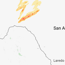
Hail Map for Wednesday, May 2, 2018

Number of Impacted Households on 5/2/2018
0
Impacted by 1" or Larger Hail
0
Impacted by 1.75" or Larger Hail
0
Impacted by 2.5" or Larger Hail
Square Miles of Populated Area Impacted on 5/2/2018
0
Impacted by 1" or Larger Hail
0
Impacted by 1.75" or Larger Hail
0
Impacted by 2.5" or Larger Hail


Cities Most Affected by Hail Storms of 5/2/2018
| Hail Size | Demographics of Zip Codes Affected | ||||||
|---|---|---|---|---|---|---|---|
| City | Count | Average | Largest | Pop Density | House Value | Income | Age |
| Rockford, IL | 4 | 2.31 | 3.00 | 1103 | $93k | $45.5k | 39.3 |
| Lake Villa, IL | 3 | 1.92 | 2.00 | 1543 | $166k | $69.3k | 38.2 |
| Sweetwater, OK | 2 | 2.63 | 2.75 | 5 | $29k | $21.9k | 42.0 |
| Nickerson, KS | 2 | 2.13 | 2.50 | 16 | $48k | $33.2k | 40.0 |
| Twin Lakes, WI | 2 | 2.00 | 2.00 | 583 | $140k | $51.4k | 40.0 |
| Antioch, IL | 2 | 1.75 | 1.75 | 800 | $167k | $58.6k | 39.7 |
| Richmond, IL | 1 | 2.75 | 2.75 | 141 | $188k | $63.3k | 41.6 |
| Forgan, OK | 1 | 2.50 | 2.50 | 1 | $45k | $34.8k | 39.6 |
| Lanark, IL | 1 | 2.00 | 2.00 | 38 | $81k | $45.7k | 49.5 |
| Quanah, TX | 1 | 2.00 | 2.00 | 5 | $30k | $28.1k | 43.6 |
| Williams Bay, WI | 1 | 2.00 | 2.00 | 715 | $161k | $53.0k | 43.8 |
| Spring Grove, IL | 1 | 2.00 | 2.00 | 572 | $201k | $66.8k | 41.0 |
| Granite, OK | 1 | 1.75 | 1.75 | 5 | $38k | $28.4k | 37.0 |
| Burlington, KS | 1 | 1.75 | 1.75 | 29 | $67k | $40.9k | 41.6 |
| Fremont, MI | 1 | 1.75 | 1.75 | 110 | $92k | $39.4k | 41.6 |
| Murray, IA | 1 | 1.75 | 1.75 | 12 | $50k | $32.9k | 39.5 |
| Mangum, OK | 1 | 1.75 | 1.75 | 9 | $32k | $24.4k | 42.3 |
| Genoa City, WI | 1 | 1.75 | 1.75 | 278 | $113k | $46.7k | 35.2 |
| Morrison, IL | 1 | 1.75 | 1.75 | 47 | $84k | $43.1k | 44.3 |
| Lee, IL | 1 | 1.75 | 1.75 | 20 | $128k | $49.3k | 38.9 |
| Lone Wolf, OK | 1 | 1.75 | 1.75 | 5 | $37k | $29.1k | 50.3 |
Hail and Wind Damage Spotted on 5/2/2018
Filter by Report Type:Hail ReportsWind Reports
Oklahoma
| Local Time | Report Details |
|---|---|
| 12:34 PM CDT | Tennis Ball sized hail reported near Forgan, OK, 70.9 miles WNW of Woodward, OK |
| 3:10 PM CDT | Quarter sized hail reported near Hollis, OK, 24.4 miles NE of Childress, TX |
| 3:25 PM CDT | Storm damage reported in beaver county OK, 49.3 miles WNW of Woodward, OK |
| 3:35 PM CDT | Tennis Ball sized hail reported near Sweetwater, OK, 71.2 miles SSW of Woodward, OK |
| 3:40 PM CDT | Baseball sized hail reported near Sweetwater, OK, 72 miles NNE of Childress, TX |
| 4:15 PM CDT | Golf Ball sized hail reported near Mangum, OK, 45.9 miles NE of Childress, TX |
| 4:15 PM CDT | Golf Ball sized hail reported near Granite, OK, 59.8 miles NE of Childress, TX, time approximated. |
| 4:30 PM CDT | 12 inch diameter tree down as wel in kiowa county OK, 70.1 miles ENE of Childress, TX |
| 4:30 PM CDT | Multiple barns and portable buildings damaged. shingle damage to home in greer county OK, 59.8 miles NE of Childress, TX |
| 4:56 PM CDT | Storm damage reported in jackson county OK, 55.6 miles ENE of Childress, TX |
| 5:18 PM CDT | Highway poles down at us 54 and 136 in kiowa county OK, 80.8 miles NNW of Wichita Falls, TX |
| 5:31 PM CDT | Quarter sized hail reported near Altus, OK, 52.3 miles ENE of Childress, TX |
| 5:52 PM CDT | Storm damage reported in tillman county OK, 41.1 miles NW of Wichita Falls, TX |
| 6:24 PM CDT | Measured with a davis vantagevue instrumen in tillman county OK, 39.5 miles NW of Wichita Falls, TX |
| 6:24 PM CDT | Storm damage reported in tillman county OK, 41.1 miles NW of Wichita Falls, TX |
| 6:24 PM CDT | Ping Pong Ball sized hail reported near Drummond, OK, 64.1 miles NNW of Oklahoma City, OK |
| 6:30 PM CDT | Golf Ball sized hail reported near Lone Wolf, OK, 67.4 miles NE of Childress, TX, dime to golf ball hail hwy 146 and 2550. |
| 6:41 PM CDT | Half Dollar sized hail reported near Gracemont, OK, 46.1 miles WSW of Oklahoma City, OK |
| 6:42 PM CDT | Metal roof taken off hous in caddo county OK, 51.2 miles WSW of Oklahoma City, OK |
| 7:05 PM CDT | Storm damage reported in tillman county OK, 26.1 miles NNW of Wichita Falls, TX |
| 7:20 PM CDT | Ping Pong Ball sized hail reported near Verden, OK, 37.4 miles SW of Oklahoma City, OK, mping. |
| 7:40 PM CDT | Storm damage reported in cotton county OK, 34.8 miles NNE of Wichita Falls, TX |
| 8:00 PM CDT | Storm damage reported in grady county OK, 54.3 miles SSW of Oklahoma City, OK |
| 9:23 PM CDT | Storm damage reported in payne county OK, 52.4 miles NNE of Oklahoma City, OK |
| 9:30 PM CDT | Hardesty and gordon cooper in pottawatomie county OK, 38.7 miles ESE of Oklahoma City, OK |
| 9:35 PM CDT | Storm damage reported in lincoln county OK, 42.4 miles ENE of Oklahoma City, OK |
| 9:35 PM CDT | Storm damage reported in lincoln county OK, 42.5 miles ENE of Oklahoma City, OK |
| 10:00 PM CDT | Storm damage reported in osage county OK, 56.4 miles NW of Tulsa, OK |
| 10:05 PM CDT | Storm damage reported in noble county OK, 65.3 miles WNW of Tulsa, OK |
| 10:29 PM CDT | Storm damage reported in tulsa county OK, 1.5 miles SSE of Tulsa, OK |
| 10:30 PM CDT | Large portions of a roof from nearby buildings and a large advertising billboard were strewn across the intersection of 13th street and peoria. time estimated by rada in tulsa county OK, 4.3 miles ESE of Tulsa, OK |
| 10:40 PM CDT | Large tree branch located about 3/4 mile south of 66th st n... on lewis in tulsa county OK, 4.3 miles ESE of Tulsa, OK |
| 11:00 PM CDT | Roof of a carport attached to a garage was ripped off and lofted 60 to 70 feet to the northeast of its original location. damage to trees and powerlines around town als in nowata county OK, 48.6 miles S of Chanute, KS |
| 12:15 AM CDT | Storm damage reported in tillman county OK, 44.2 miles NW of Wichita Falls, TX |
Kansas
| Local Time | Report Details |
|---|---|
| 1:00 PM CDT | Quarter sized hail reported near Meade, KS, 63.7 miles SSE of Garden City, KS |
| 1:20 PM CDT | Quarter sized hail reported near Fowler, KS, 61.9 miles SE of Garden City, KS |
| 1:28 PM CDT | Quarter sized hail reported near Bucklin, KS, 71.1 miles ESE of Garden City, KS |
| 1:32 PM CDT | Quarter sized hail reported near Bucklin, KS, 71.1 miles ESE of Garden City, KS, quarter size. |
| 1:35 PM CDT | Quarter sized hail reported near Minneola, KS, 61.5 miles SE of Garden City, KS, dime to quarter size. |
| 2:05 PM CDT | Storm damage reported in ford county KS, 71.1 miles ESE of Garden City, KS |
| 2:13 PM CDT | Half Dollar sized hail reported near Bucklin, KS, 73.9 miles ESE of Garden City, KS |
| 2:39 PM CDT | Ping Pong Ball sized hail reported near Larned, KS, 57.5 miles SSE of Hays, KS |
| 2:40 PM CDT | Quarter sized hail reported near Mullinville, KS, 79.8 miles N of Woodward, OK, ed o'neal on the road... 1 mile east of mullinville nickel-quarter size hail. |
| 2:40 PM CDT | Storm damage reported in kiowa county KS, 81.5 miles N of Woodward, OK |
| 2:40 PM CDT | Half Dollar sized hail reported near Larned, KS, 49.3 miles SSE of Hays, KS |
| 2:50 PM CDT | Quarter sized hail reported near Greensburg, KS, 81.3 miles N of Woodward, OK |
| 3:02 PM CDT | Quarter sized hail reported near Saint John, KS, 67.6 miles SSE of Hays, KS |
| 3:02 PM CDT | Storm damage reported in stafford county KS, 63.6 miles SSE of Hays, KS |
| 3:10 PM CDT | Storm damage reported in pratt county KS, 86.9 miles SSE of Hays, KS |
| 3:12 PM CDT | Quarter sized hail reported near Byers, KS, 78.7 miles SSE of Hays, KS |
| 3:13 PM CDT | 3 inch diameter tree limbs dow in barton county KS, 50.8 miles SE of Hays, KS |
| 3:20 PM CDT | Quarter sized hail reported near Pratt, KS, 86.6 miles NNE of Woodward, OK |
| 3:22 PM CDT | Quarter sized hail reported near Greensburg, KS, 81.3 miles N of Woodward, OK, around 6 inches of hail on the ground. hail fog reducing visibility. |
| 3:30 PM CDT | Quarter sized hail reported near Iuka, KS, 78.6 miles W of Wichita, KS |
| 3:30 PM CDT | Trained spotter reported roofs blown off two buildings in iuk in pratt county KS, 76.5 miles W of Wichita, KS |
| 3:33 PM CDT | Quarter sized hail reported near Iuka, KS, 76.5 miles W of Wichita, KS |
| 3:35 PM CDT | Storm damage reported in barton county KS, 50.2 miles ESE of Hays, KS |
| 3:35 PM CDT | Reported at pratt industrial airpor in pratt county KS, 77.5 miles W of Wichita, KS |
| 3:39 PM CDT | Storm damage reported in pratt county KS, 69.9 miles W of Wichita, KS |
| 3:43 PM CDT | 4 power poles down 4 miles north of pratt on highway 28 in pratt county KS, 77 miles W of Wichita, KS |
| 3:48 PM CDT | Storm damage reported in pratt county KS, 67.3 miles W of Wichita, KS |
| 4:04 PM CDT | Quarter sized hail reported near Abbyville, KS, 51.9 miles WNW of Wichita, KS |
| 4:17 PM CDT | Golf Ball sized hail reported near Nickerson, KS, 51.7 miles NW of Wichita, KS |
| 4:17 PM CDT | Tennis Ball sized hail reported near Nickerson, KS, 52.1 miles NW of Wichita, KS |
| 4:45 PM CDT | Strong winds reported along the gust front. power is out in the are in clay county KS, 33.3 miles WNW of Manhattan, KS |
| 4:58 PM CDT | Storm damage reported in clay county KS, 35.2 miles WNW of Manhattan, KS |
| 5:08 PM CDT | Half Dollar sized hail reported near Mcpherson, KS, 50.3 miles NNW of Wichita, KS, 50 mph wind also reported. |
| 5:15 PM CDT | Quarter sized hail reported near Galva, KS, 48.4 miles NNW of Wichita, KS, mping hail report |
| 5:22 PM CDT | Storm damage reported in riley county KS, 24.4 miles NW of Manhattan, KS |
| 5:33 PM CDT | Possible tornado damage to a house - coincident with the circulation. radar estimated time. details unknown at this tim in marshall county KS, 30.7 miles NNW of Manhattan, KS |
| 5:35 PM CDT | Roof damage to a hom in marshall county KS, 31.6 miles N of Manhattan, KS |
| 5:40 PM CDT | Windows blown out of home and shed destroye in marshall county KS, 37.1 miles NNW of Manhattan, KS |
| 5:45 PM CDT | Storm damage reported in riley county KS, 4.4 miles NW of Manhattan, KS |
| 5:45 PM CDT | Local weather station report on the north side of tow in riley county KS, 0.4 miles W of Manhattan, KS |
| 5:48 PM CDT | Large tree fell on a hous in marshall county KS, 36.4 miles N of Manhattan, KS |
| 5:48 PM CDT | Tree limbs dow in marshall county KS, 37 miles N of Manhattan, KS |
| 5:57 PM CDT | Roof and siding damage to a home. shed destroye in marshall county KS, 38.3 miles NNE of Manhattan, KS |
| 5:57 PM CDT | Roof and siding damage to a hom in marshall county KS, 38.1 miles NNE of Manhattan, KS |
| 5:59 PM CDT | Tree limbs down. power poles damaged. siding damage to a hom in marshall county KS, 41.4 miles NNE of Manhattan, KS |
| 6:00 PM CDT | Tree limbs dow in marshall county KS, 46.5 miles NNE of Manhattan, KS |
| 6:09 PM CDT | Storm damage reported in nemaha county KS, 46.2 miles NNE of Manhattan, KS |
| 6:15 PM CDT | Quarter sized hail reported near Marion, KS, 48.9 miles NNE of Wichita, KS, public reported nickel to quarter size hail. |
| 6:20 PM CDT | Storm damage reported in nemaha county KS, 43.7 miles NE of Manhattan, KS |
| 7:23 PM CDT | Academia report in lyon county KS, 54.4 miles SSE of Manhattan, KS |
| 7:25 PM CDT | Storm damage reported in doniphan county KS, 63.8 miles NW of Kansas City, MO |
| 7:25 PM CDT | Storm damage reported in greenwood county KS, 52.6 miles NW of Chanute, KS |
| 7:48 PM CDT | Storm damage reported in doniphan county KS, 49.4 miles NNW of Kansas City, MO |
| 8:07 PM CDT | Golf Ball sized hail reported near Burlington, KS, 39.7 miles NNW of Chanute, KS |
| 8:21 PM CDT | 8-10 healthy pear tree limbs broken off tre in coffey county KS, 37.4 miles N of Chanute, KS |
| 8:22 PM CDT | Storm damage reported in anderson county KS, 44 miles N of Chanute, KS |
| 8:40 PM CDT | Storm damage reported in franklin county KS, 49.8 miles SW of Kansas City, MO |
| 8:58 PM CDT | Storm damage reported in johnson county KS, 33.1 miles SW of Kansas City, MO |
| 9:01 PM CDT | Delayed report. tree down and power outage reported. time matched to rada in johnson county KS, 28.1 miles SSW of Kansas City, MO |
| 9:01 PM CDT | 2 power poles and 1 tree 4 inches in diameter down. time radar estimate in miami county KS, 48.5 miles SSW of Kansas City, MO |
| 9:04 PM CDT | Quarter sized hail reported near Blue Mound, KS, 38.7 miles NE of Chanute, KS |
| 9:15 PM CDT | Delayed report. power lines down at metcalf and 135th. nearby multiple trees 8 inches in diameter also down. time matched to rada in johnson county KS, 14.1 miles SSW of Kansas City, MO |
| 9:15 PM CDT | Delayed report. multiple windows blown out and minor roof damage reported at middle school near 135th and nall ave. nearby power poles snapped. time matched to rada in johnson county KS, 13.7 miles SSW of Kansas City, MO |
| 9:15 PM CDT | Power poles snapped 133rd and mission in leawood in johnson county KS, 14.9 miles S of Kansas City, MO |
| 9:18 PM CDT | Storm damage reported in linn county KS, 50.3 miles S of Kansas City, MO |
| 11:31 PM CDT | Storm damage reported in labette county KS, 43.2 miles S of Chanute, KS |
| 11:35 PM CDT | Utility poles dow in montgomery county KS, 41 miles SSW of Chanute, KS |
Texas
| Local Time | Report Details |
|---|---|
| 1:49 PM CDT | Quarter sized hail reported near Perryton, TX, 78.1 miles W of Woodward, OK, hail between penny and quarter sized reported... with accumulation in spots. heavy rainfall also has occurred with recent storms. |
| 2:41 PM CDT | Quarter sized hail reported near Booker, TX, 63.6 miles W of Woodward, OK |
| 4:52 PM CDT | Hen Egg sized hail reported near Quanah, TX, 32.3 miles ESE of Childress, TX |
| 5:05 PM CDT | Measured by the west texas mesone in stonewall county TX, 56.4 miles NNW of Abilene, TX |
| 5:34 PM CDT | Power poles down. tractor trailers blown ove in jones county TX, 25.9 miles NNW of Abilene, TX |
| 5:40 PM CDT | Storm damage reported in knox county TX, 67.1 miles N of Abilene, TX |
| 5:41 PM CDT | Storm damage reported in wilbarger county TX, 45.5 miles E of Childress, TX |
| 5:45 PM CDT | 60 to 70 mph winds estimate in wilbarger county TX, 49.5 miles WNW of Wichita Falls, TX |
| 5:50 PM CDT | Storm damage reported in haskell county TX, 49.7 miles N of Abilene, TX |
| 5:50 PM CDT | Travel trailer blown over...part of roof torn off of high school...several power poles snapped between haskell and stamford along highway 277 in haskell county TX, 49 miles N of Abilene, TX |
| 5:51 PM CDT | Storm damage reported in jones county TX, 32.5 miles N of Abilene, TX |
| 6:01 PM CDT | Storm damage reported in haskell county TX, 61.5 miles N of Abilene, TX |
| 6:25 PM CDT | Quarter sized hail reported near Stamford, TX, 31.8 miles N of Abilene, TX |
| 7:15 PM CDT | Quarter sized hail reported near Lueders, TX, 25.2 miles NNE of Abilene, TX |
| 7:29 PM CDT | Storm damage reported in throckmorton county TX, 59.1 miles NNE of Abilene, TX |
| 8:00 PM CDT | Half Dollar sized hail reported near Sonora, TX, 83.1 miles N of Del Rio, TX |
| 8:12 PM CDT | Tin roofing and insulation blown off windthurst high school. a residential home also lost its roof. time estimated based on rada in archer county TX, 22.9 miles S of Wichita Falls, TX |
| 9:43 PM CDT | Storm damage reported in fisher county TX, 54.6 miles WNW of Abilene, TX |
| 10:20 PM CDT | 74 mph wind gust reported by west texas mesonet. roof damage reported in town of seagraves in gaines county TX, 61.1 miles SW of Lubbock, TX |
| 10:47 PM CDT | Quarter sized hail reported near Nocona, TX, 44.3 miles E of Wichita Falls, TX, 1-1.25" hail was reported 2 miles nnw of nocona |
| 10:50 PM CDT | Quarter sized hail reported near Nocona, TX, 45.2 miles E of Wichita Falls, TX, on club lake road in nocona |
| 10:52 PM CDT | Half Dollar sized hail reported near Haskell, TX, 40.7 miles N of Abilene, TX, quarter size and larger hail falling at intersection of fm 618 and highway 277 |
| 1:50 AM CDT | Storm damage reported in lubbock county TX, 16.4 miles SE of Lubbock, TX |
Iowa
| Local Time | Report Details |
|---|---|
| 2:56 PM CDT | Quarter sized hail reported near Manson, IA, 34.7 miles ESE of Storm Lake, IA |
| 5:51 PM CDT | Quarter sized hail reported near Clarinda, IA, 66.8 miles SE of Omaha, NE |
| 5:54 PM CDT | Quarter sized hail reported near Clinton, IA, 75 miles E of Cedar Rapids, IA, delayed report |
| 6:00 PM CDT | Quarter sized hail reported near New Market, IA, 68.9 miles SE of Omaha, NE, torrential rain and lots of quarter sized hail. |
| 6:28 PM CDT | Quarter sized hail reported near Murray, IA, 42.2 miles SSW of Des Moines, IA, heavy rain and quarter sized hail. |
| 6:35 PM CDT | Golf Ball sized hail reported near Murray, IA, 42.2 miles SSW of Des Moines, IA, hail on going for 10 minutes. up to golf ball sized. |
| 6:51 PM CDT | Quarter sized hail reported near Tingley, IA, 59.4 miles SSW of Des Moines, IA |
| 7:04 PM CDT | Power pole blown down in keokuk county IA, 51.4 miles SW of Cedar Rapids, IA |
| 7:24 PM CDT | Quarter sized hail reported near Kalona, IA, 27.6 miles S of Cedar Rapids, IA |
| 7:48 PM CDT | Quarter sized hail reported near Riverside, IA, 30.3 miles SSE of Cedar Rapids, IA |
| 7:59 PM CDT | Storm damage reported in johnson county IA, 28.9 miles SSE of Cedar Rapids, IA |
Illinois
| Local Time | Report Details |
|---|---|
| 4:30 PM CDT | Large tree branch broken. reported by off duty nws employee. time estimate in kendall county IL, 41.1 miles SW of Chicago, IL |
| 4:45 PM CDT | Several telephone poles snapped in half on renwick road in will county IL, 28.6 miles SW of Chicago, IL |
| 4:45 PM CDT | A couple tree limbs two inches in diameter down and pea size hail in will county IL, 32.9 miles SW of Chicago, IL |
| 4:46 PM CDT | Quarter sized hail reported near Summit Argo, IL, 12.1 miles SW of Chicago, IL, report via twitter |
| 4:51 PM CDT | 58 knot gus in cook county IL, 9.4 miles SW of Chicago, IL |
| 4:52 PM CDT | Multiple reports of damange from strong winds and quarter size hail near midway airport. damage to trees... vehicles... light poles... and houses including siding and a in cook county IL, 9.4 miles SW of Chicago, IL |
| 4:53 PM CDT | Quarter sized hail reported near Chicago, IL, 9.4 miles SW of Chicago, IL, reported by southwest airlines employee. |
| 5:00 PM CDT | Roof damage to a building across from washington park at 51st and king drive...5035 king drive. also downed trees in the area. damage resulted in an evacuation order by in cook county IL, 5.8 miles S of Chicago, IL |
| 5:03 PM CDT | Chicago oemc reports numerous trees down and an apartment building roof peeled back. damage is east of the dan ryan/i-94 possibly to the lake and between 63rd and 39th in cook county IL, 0.3 miles SSE of Chicago, IL |
| 5:10 PM CDT | 18 power poles downed...along with a corn crib and metal silos in a debris field oriented roughly toward east. location a quarter mile south of 6731n 2250 in kankakee county IL, 48.2 miles SSW of Chicago, IL |
| 5:10 PM CDT | 20 power poles downed and several roofs pulled bac in kankakee county IL, 48.9 miles SSW of Chicago, IL |
| 5:15 PM CDT | Quarter sized hail reported near Bourbonnais, IL, 51.6 miles SSW of Chicago, IL, quarter size hail and 60 mph wind gusts. |
| 5:23 PM CDT | Quarter sized hail reported near Savanna, IL, 78.6 miles SSW of Madison, WI |
| 5:35 PM CDT | Quarter sized hail reported near Mount Carroll, IL, 76 miles SSW of Madison, WI |
| 5:53 PM CDT | Half Dollar sized hail reported near Milledgeville, IL, 72.7 miles SSW of Madison, WI |
| 5:54 PM CDT | Hen Egg sized hail reported near Lanark, IL, 71 miles SSW of Madison, WI, via facebook...delayed report. |
| 5:54 PM CDT | Quarter sized hail reported near Winnebago, IL, 55.9 miles S of Madison, WI, penny to quarter size hail on the southwest side of winnebago |
| 6:00 PM CDT | Quarter sized hail reported near West Brooklyn, IL, 72.5 miles NNE of Peoria, IL, mainly dime to nickel size hail... but one quarter size stone. |
| 6:05 PM CDT | Golf Ball sized hail reported near Rockford, IL, 62.1 miles SSE of Madison, WI, multiple reports of golf ball sized hail around the rockford airport. |
| 6:07 PM CDT | Hen Egg sized hail reported near Rockford, IL, 62 miles SSE of Madison, WI, report relayed by rockford ham net |
| 6:10 PM CDT | Ping Pong Ball sized hail reported near Rockford, IL, 62.5 miles SSE of Madison, WI |
| 6:14 PM CDT | Tennis Ball sized hail reported near Rockford, IL, 57.9 miles SSE of Madison, WI, multiple social media reports of 2.5 inch diamater hail in far se rockford |
| 6:14 PM CDT | Tea Cup sized hail reported near Rockford, IL, 57.9 miles SSE of Madison, WI, delayed report via twitter from far southeast rockford. |
| 6:16 PM CDT | Golf Ball sized hail reported near Lee, IL, 67.8 miles W of Chicago, IL, social media report |
| 6:21 PM CDT | Quarter sized hail reported near Morrison, IL, 79.7 miles NNW of Peoria, IL |
| 6:23 PM CDT | Half Dollar sized hail reported near Belvidere, IL, 63 miles SSE of Madison, WI, relayed via rfd ham net |
| 6:25 PM CDT | Golf Ball sized hail reported near Morrison, IL, 79.7 miles NNW of Peoria, IL |
| 6:27 PM CDT | Ping Pong Ball sized hail reported near Morrison, IL, 79.8 miles NNW of Peoria, IL |
| 6:32 PM CDT | Quarter sized hail reported near Byron, IL, 67.5 miles S of Madison, WI |
| 6:35 PM CDT | Quarter sized hail reported near Dekalb, IL, 57.7 miles W of Chicago, IL |
| 6:40 PM CDT | Quarter sized hail reported near Dekalb, IL, 57.7 miles W of Chicago, IL, milner ave and south 1st street. quarter sized hail covering the ground. time estimated. |
| 7:06 PM CDT | Ping Pong Ball sized hail reported near Gilberts, IL, 40.8 miles WNW of Chicago, IL, relayed via twitter. |
| 7:18 PM CDT | Downed pine tree about 40 feet tall. estimated winds arouind 65 mp in cook county IL, 28.8 miles WNW of Chicago, IL |
| 9:10 PM CDT | Baseball sized hail reported near Richmond, IL, 53.9 miles NW of Chicago, IL, 2.5 to 2.75 inch diameter hail relayed via facebook. |
| 9:20 PM CDT | Golf Ball sized hail reported near Antioch, IL, 46.5 miles NNW of Chicago, IL, from lake county skywarn. route 59 and grass lake road. |
| 9:20 PM CDT | Hen Egg sized hail reported near Spring Grove, IL, 49.5 miles NW of Chicago, IL, 2.25 inch diameter hail via lake county skywarn. nearest intersection winn road and route 12. |
| 9:28 PM CDT | Golf Ball sized hail reported near Antioch, IL, 46.5 miles NNW of Chicago, IL, hail stones between golfball and egg sized. numerous branches down. damage to siding and cars. |
| 9:31 PM CDT | Ping Pong Ball sized hail reported near Antioch, IL, 46.5 miles NNW of Chicago, IL, relayed via twitter. |
| 9:31 PM CDT | Golf Ball sized hail reported near Lake Villa, IL, 43.5 miles NNW of Chicago, IL, at deep lake road just south of grass lake road. |
| 9:32 PM CDT | Quarter sized hail reported near Lake Villa, IL, 43.5 miles NNW of Chicago, IL |
| 9:33 PM CDT | Hen Egg sized hail reported near Lake Villa, IL, 43.5 miles NNW of Chicago, IL, 2.25 inch diameter hail at fairfield and petite lake road. |
| 9:34 PM CDT | Quarter sized hail reported near Lake Villa, IL, 42.2 miles NNW of Chicago, IL, relayed via twitter. |
| 9:34 PM CDT | Hen Egg sized hail reported near Lake Villa, IL, 43.5 miles NNW of Chicago, IL, relayed via twitter. |
Indiana
| Local Time | Report Details |
|---|---|
| 5:46 PM CDT | Multiple trees of unknown size snapped... power pole snapped... and trailer flipped on us 41 in lowell. time estimate in lake county IN, 42.6 miles SSE of Chicago, IL |
| 6:20 PM CDT | Measured via mobile weather station at sr 10 and cr 400e in jasper count in jasper county IN, 58.9 miles SE of Chicago, IL |
| 7:56 PM EDT | Asos station sbn... south bend international a in st. joseph county IN, 68.8 miles E of Chicago, IL |
| 8:00 PM EDT | Trees uprooted... large branches snappe in st. joseph county IN, 72.3 miles E of Chicago, IL |
| 7:10 PM CDT | 10-15" diameter trees downe in starke county IN, 59.3 miles SE of Chicago, IL |
| 7:10 PM CDT | Tree down onto roadwa in la porte county IN, 57.8 miles SE of Chicago, IL |
| 8:15 PM EDT | Dime sized hail as wel in elkhart county IN, 62 miles NW of Fort Wayne, IN |
| 8:20 PM EDT | Numerous trees limbs snappe in elkhart county IN, 58.2 miles NW of Fort Wayne, IN |
| 8:23 PM EDT | Power lines down in the cit in st. joseph county IN, 69.2 miles NW of Fort Wayne, IN |
| 8:30 PM EDT | Several power poles down near martin in st. joseph county IN, 65.8 miles NW of Fort Wayne, IN |
| 8:30 PM EDT | Limbs and trees dow in elkhart county IN, 62.7 miles NW of Fort Wayne, IN |
| 8:31 PM EDT | Several trees and branches dow in st. joseph county IN, 65.4 miles NW of Fort Wayne, IN |
| 8:36 PM EDT | Downed trees and fence in elkhart county IN, 64.9 miles NW of Fort Wayne, IN |
| 8:04 PM CDT | Storm damage reported in lake county IN, 36.9 miles SSE of Chicago, IL |
| 8:23 PM CDT | Half Dollar sized hail reported near Crown Point, IN, 36 miles SSE of Chicago, IL, via mping. |
Wisconsin
| Local Time | Report Details |
|---|---|
| 7:00 PM CDT | Quarter sized hail reported near Mineral Point, WI, 43.3 miles WSW of Madison, WI, picture from social media. |
| 7:55 PM CDT | Quarter sized hail reported near Evansville, WI, 20.7 miles SSE of Madison, WI |
| 7:57 PM CDT | Power out in tow in jefferson county WI, 24.1 miles E of Madison, WI |
| 7:58 PM CDT | Mutiple large trees down due to wind in and around lake mills. one tree fell on a car. no injurie in jefferson county WI, 24.1 miles E of Madison, WI |
| 8:18 PM CDT | Quarter sized hail reported near Ixonia, WI, 44.8 miles ENE of Madison, WI, based on a picture from social media. |
| 8:20 PM CDT | Ping pong size hail along with est 50-60 mph winds put holes in siding of hous in rock county WI, 33.5 miles SSE of Madison, WI |
| 8:20 PM CDT | Measured at the janesville airpor in rock county WI, 35.9 miles SSE of Madison, WI |
| 8:22 PM CDT | Ping Pong Ball sized hail reported near Janesville, WI, 33.8 miles SSE of Madison, WI |
| 8:35 PM CDT | Via broadcast medi in washington county WI, 62.1 miles ENE of Madison, WI |
| 8:42 PM CDT | Quarter sized hail reported near Waukesha, WI, 57.3 miles E of Madison, WI, est 55 mph winds. |
| 8:44 PM CDT | Also quarter sized hail covering the groun in waukesha county WI, 58.2 miles E of Madison, WI |
| 8:45 PM CDT | Via broadcast medi in ozaukee county WI, 72 miles E of Madison, WI |
| 8:51 PM CDT | Quarter sized hail reported near Fontana, WI, 55.5 miles SE of Madison, WI, mping. |
| 8:55 PM CDT | Half Dollar sized hail reported near Williams Bay, WI, 54.8 miles SE of Madison, WI, picture via broadcast media on twitter. |
| 8:57 PM CDT | Hen Egg sized hail reported near Williams Bay, WI, 54.5 miles SE of Madison, WI, social media picture. diameter of 2.25 inches. |
| 9:15 PM CDT | Hen Egg sized hail reported near Twin Lakes, WI, 54.4 miles NW of Chicago, IL, pictures of hail between 2 and 2.25 inches from twin lakes. |
| 9:15 PM CDT | Golf Ball sized hail reported near Genoa City, WI, 55.2 miles NW of Chicago, IL, two independent reports of golf ball sized hail in genoa city. |
| 9:35 PM CDT | Hen Egg sized hail reported near Twin Lakes, WI, 54.4 miles NW of Chicago, IL, pictures of hail between 2 and 2.25 inches from twin lakes. |
Missouri
| Local Time | Report Details |
|---|---|
| 7:18 PM CDT | Delayed report. numerous camper trailers overturned. time matched to rada in holt county MO, 78.9 miles NNW of Kansas City, MO |
| 7:25 PM CDT | Storm damage reported in holt county MO, 80.6 miles NNW of Kansas City, MO |
| 7:48 PM CDT | 4 powerpoles down and farm equipment tipped over. reported at hwy h south of hwy a in graham m in nodaway county MO, 77.5 miles NNW of Kansas City, MO |
| 7:55 PM CDT | Storm damage reported in nodaway county MO, 84.8 miles SE of Omaha, NE |
| 7:55 PM CDT | Delayed report...4 power poles down. time estimated based on rada in nodaway county MO, 78.2 miles NNW of Kansas City, MO |
| 7:58 PM CDT | Storm damage reported in nodaway county MO, 71.4 miles SE of Omaha, NE |
| 8:12 PM CDT | Large tree down blocking hwy 4 in nodaway county MO, 86.2 miles N of Kansas City, MO |
| 8:15 PM CDT | Two large morton buildings reported blown over. damage to a fence. reported at 21283 navy rd parnell m in nodaway county MO, 87.6 miles SE of Omaha, NE |
| 9:23 PM CDT | Delayed report. multiple large trees down in belton. time matched to rada in cass county MO, 20.4 miles S of Kansas City, MO |
| 9:23 PM CDT | Delayed report from social media. large tree down on vehicle. time matched to rada in jackson county MO, 13.9 miles SSE of Kansas City, MO |
| 9:25 PM CDT | Signs down and tree damage at the mcdonalds near harry s truman road in jackson county MO, 15 miles S of Kansas City, MO |
| 9:28 PM CDT | Delayed report. 8 inch tree down on vehicle. time matched to rada in jackson county MO, 8.8 miles SE of Kansas City, MO |
| 9:43 PM CDT | Estimated 60 to 70 in cass county MO, 27.4 miles SE of Kansas City, MO |
| 11:03 PM CDT | Quarter sized hail reported near Lowry City, MO, 68.6 miles NNW of Springfield, MO |
| 12:20 AM CDT | Trees a telephone pole and powerslines were reported down from rangeline road to zora roa in jasper county MO, 64.8 miles SE of Chanute, KS |
| 12:22 AM CDT | Tree fell in the area of austin st causing damage to several vehicle in jasper county MO, 64.8 miles SE of Chanute, KS |
| 12:28 AM CDT | Tree down cross the road at county road 220 and highway in jasper county MO, 64.5 miles W of Springfield, MO |
Michigan
| Local Time | Report Details |
|---|---|
| 8:28 PM EDT | Power poles dow in st. joseph county MI, 60.6 miles NW of Fort Wayne, IN |
| 8:45 PM EDT | Golf Ball sized hail reported near Fremont, MI, 35 miles NNW of Grand Rapids, MI, photos relayed through broadcast media. |
| 8:47 PM EDT | Power poles dow in st. joseph county MI, 60.5 miles NNW of Fort Wayne, IN |
| 8:50 PM EDT | Tree down blocking 72nd and luce south of fremont. time estimate in newaygo county MI, 33.7 miles NNW of Grand Rapids, MI |
| 8:52 PM EDT | Quarter sized hail reported near Fremont, MI, 37.3 miles NNW of Grand Rapids, MI |
| 8:55 PM EDT | Quarter sized hail reported near Fremont, MI, 35.4 miles NNW of Grand Rapids, MI, south of fremont at 64th and m82. |
| 9:00 PM EDT | Roof damage on garag in cass county MI, 63.5 miles NW of Fort Wayne, IN |
| 9:20 PM EDT | Storm damage reported in jackson county MI, 67.7 miles SW of Flint, MI |
| 9:22 PM EDT | Storm damage reported in branch county MI, 59.9 miles N of Fort Wayne, IN |
| 9:29 PM EDT | Appx 14-inch limb from tree fell across road... power outage on church st at daugherty st... 2107 hr in branch county MI, 59.8 miles N of Fort Wayne, IN |
| 9:32 PM EDT | Storm damage reported in hillsdale county MI, 74.7 miles NNE of Fort Wayne, IN |
| 9:48 PM EDT | Large tree down on waldron roa in hillsdale county MI, 71.1 miles NNE of Fort Wayne, IN |
| 9:49 PM EDT | Delayed report - damage to house caused by downed tree in lenawee county MI, 76.1 miles SSW of Flint, MI |
| 10:03 PM EDT | Delayed report -- trees and powerlines down in lenawee county MI, 71.6 miles SSW of Flint, MI |
| 10:04 PM EDT | Delayed report - trees and powerlines down in lenawee county MI, 71.9 miles SSW of Flint, MI |
| 10:04 PM EDT | Delayed report - trees and powerlines down in lenawee county MI, 71.3 miles SSW of Flint, MI |
| 10:38 PM EDT | Gust measured at detroit willow run airport. estimated gusts between 50 - 60 mph also confirmed from weather spotte in wayne county MI, 54.5 miles S of Flint, MI |
Connect with Interactive Hail Maps