

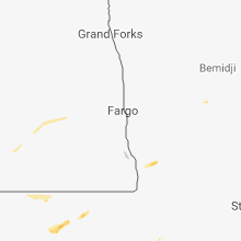
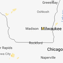
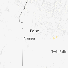
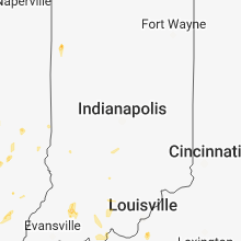
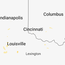
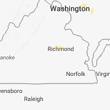
Hail Map for Sunday, May 27, 2018

Number of Impacted Households on 5/27/2018
0
Impacted by 1" or Larger Hail
0
Impacted by 1.75" or Larger Hail
0
Impacted by 2.5" or Larger Hail
Square Miles of Populated Area Impacted on 5/27/2018
0
Impacted by 1" or Larger Hail
0
Impacted by 1.75" or Larger Hail
0
Impacted by 2.5" or Larger Hail


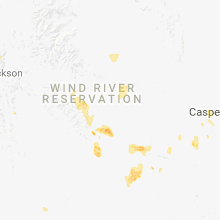


Cities Most Affected by Hail Storms of 5/27/2018
| Hail Size | Demographics of Zip Codes Affected | ||||||
|---|---|---|---|---|---|---|---|
| City | Count | Average | Largest | Pop Density | House Value | Income | Age |
| Pampa, TX | 9 | 2.08 | 2.75 | 41 | $38k | $31.6k | 38.4 |
| Laramie, WY | 3 | 2.00 | 2.50 | 16 | $119k | $32.2k | 27.6 |
| Idalia, CO | 2 | 1.75 | 1.75 | 1 | $119k | $36.3k | 34.9 |
| Colby, KS | 1 | 1.75 | 1.75 | 13 | $79k | $37.3k | 35.7 |
| Casper, WY | 1 | 1.75 | 1.75 | 46 | $79k | $31.2k | 35.0 |
| Skellytown, TX | 1 | 1.75 | 1.75 | 1 | $29k | $32.2k | 46.9 |
| Morocco, IN | 1 | 1.75 | 1.75 | 11 | $75k | $35.1k | 43.3 |
| Horse Creek, WY | 1 | 1.75 | 1.75 | 0 | $0k | $13.8k | 49.5 |
Hail and Wind Damage Spotted on 5/27/2018
Filter by Report Type:Hail ReportsWind Reports
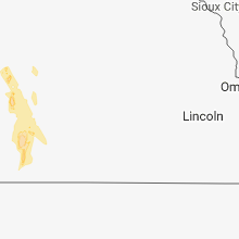
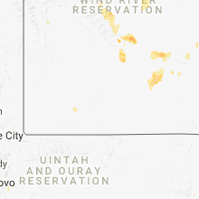
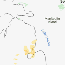
States Impacted
Florida, North Dakota, Minnesota, Idaho, Illinois, Maryland, Kentucky, Michigan, Iowa, Wyoming, Missouri, Colorado, Kansas, Nebraska, Wisconsin, West Virginia, Oklahoma, Ohio, Indiana, Tennessee, Texas, Montana, South DakotaFlorida
| Local Time | Report Details |
|---|---|
| 8:41 AM EDT | Se wind gust in amz651 county FL, 12.8 miles SE of Miami, FL |
| 4:04 PM EDT | Martin co fire rescue reports damage from near us1 and cove rd. powerlines and railroad signals damaged and trampoline moved. local media wptv reports numerous trees do in martin county FL, 13.7 miles SE of Port Saint Lucie, FL |
North Dakota
| Local Time | Report Details |
|---|---|
| 9:10 AM CDT | Storm damage reported in richland county ND, 42.6 miles S of Fargo, ND |
Minnesota
| Local Time | Report Details |
|---|---|
| 9:36 AM CDT | Storm damage reported in otter tail county MN, 53.3 miles SE of Fargo, ND |
Idaho
| Local Time | Report Details |
|---|---|
| 10:32 AM MDT | Quarter sized hail reported near Heyburn, ID, 36.2 miles E of Twin Falls, ID, reported via kmvt. time estimated via radar. |
| 5:05 PM MDT | Tree snapped at tip. second tree on house... no damage per sheriff dept. time estimated per rada in blaine county ID, 66.4 miles N of Twin Falls, ID |
| 5:05 PM MDT | Tree toppled into roadway blocking one lane of traffic. time estimated per rada in blaine county ID, 78.4 miles N of Twin Falls, ID |
Illinois
| Local Time | Report Details |
|---|---|
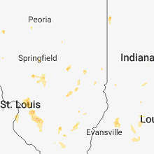
| 2:00 PM CDT | Quarter sized hail reported near Morrisonville, IL, 58.1 miles W of Mattoon, IL |
| 2:34 PM CDT | Quarter sized hail reported near Sherman, IL, 55.4 miles S of Peoria, IL |
| 2:45 PM CDT | Estimated wind gust of 60 mph pushed an empty enclosed car trailer 75 feet across a lot. multiple large branches down with power outages reported. most of the damage wa in sangamon county IL, 64.8 miles W of Mattoon, IL |
| 3:14 PM CDT | Quarter sized hail reported near Ferris, IL, 29.2 miles E of Kahoka, MO |
| 3:24 PM CDT | Half Dollar sized hail reported near Virden, IL, 65.1 miles NNE of Saint Louis, MO |
| 4:00 PM CDT | Time estimated from radar. power pole and lines down on e. 900th and n. 220 in mcdonough county IL, 53.6 miles ENE of Kahoka, MO |
| 4:26 PM CDT | Large tree branch blown down. broken branch took down a power line to the residence... which then set a house fir in rock island county IL, 68.6 miles ESE of Cedar Rapids, IA |
| 4:35 PM CDT | Ping Pong Ball sized hail reported near Effingham, IL, 27.9 miles SSW of Mattoon, IL, public photo posted on wcia facebook page. |
| 5:55 PM CDT | Quarter sized hail reported near Moro, IL, 22.4 miles NNE of Saint Louis, MO, time estimated by radar. |
| 6:03 PM CDT | Storm damage reported in madison county IL, 19.8 miles NNE of Saint Louis, MO |
| 6:17 PM CDT | Madison co. skywarn net called to relay information about a power outage at dunlap lake with tree limbs down around edwardsville. pea size hail was reported around edwa in madison county IL, 18.8 miles NE of Saint Louis, MO |
| 6:20 PM CDT | Quarter sized hail reported near Troy, IL, 17.4 miles E of Saint Louis, MO, hail was a mix of dime and quarter size. |
| 6:20 PM CDT | Quarter sized hail reported near Lebanon, IL, 20.6 miles E of Saint Louis, MO |
| 6:25 PM CDT | Corrects previous non-tstm wnd dmg report from lebanon. large tree limb blown down onto south monroe street. via facebook with pictur in st. clair county IL, 20.6 miles E of Saint Louis, MO |
| 6:26 PM CDT | Ping Pong Ball sized hail reported near Lebanon, IL, 21.2 miles E of Saint Louis, MO, hail was still falling at the time of the call. |
| 6:34 PM CDT | Quarter sized hail reported near Okawville, IL, 37.7 miles ESE of Saint Louis, MO, residents in okawville forwarded pictures to okawville police. time estimated by radar. |
| 6:42 PM CDT | Quarter sized hail reported near Okawville, IL, 37.7 miles ESE of Saint Louis, MO, corrects previous hail report from okawville. residents in okawville forwarded pictures to okawville police. time estimated by radar. (office called back to provide the |
| 6:50 PM CDT | Tree snapped off at base. trunk appears partially rotten at bas in st. clair county IL, 26.8 miles ESE of Saint Louis, MO |
Maryland
| Local Time | Report Details |
|---|---|
| 3:38 PM EDT | Tree down near the intersection of md-30 hanover pike and basler roa in carroll county MD, 27.8 miles NNW of Baltimore, MD |
Kentucky
| Local Time | Report Details |
|---|---|
| 3:40 PM EDT | Tree uprooted near morehead. time estimated from rada in rowan county KY, 46.4 miles NE of Irvine, KY |
| 3:45 PM EDT | Tree and limbs down. media relayed public report via twitte in bullitt county KY, 1.5 miles SE of Louisville, KY |
| 3:48 PM EDT | Multiple trees and power lines down on chapeze lane and tanglewood roa in bullitt county KY, 3.9 miles SSE of Louisville, KY |
| 3:49 PM CDT | Trees down... one on a house and another blocking a road. no injurie in breckinridge county KY, 51.1 miles WSW of Louisville, KY |
Michigan
| Local Time | Report Details |
|---|---|
| 3:41 PM EDT | Trees blown down over road due to high wind in ogemaw county MI, 63.5 miles SSW of Alpena, MI |
| 7:41 PM UTC | *** 1 fatal *** trees blown down over road due to high winds. update: 1 fatality reporte in ogemaw county MI, 63.3 miles SSW of Alpena, MI |
| 3:50 PM EDT | Central dispatch reports multiple 10-14 inch diameter trees down on baseline rd between winn rd and lincoln rd as well as on beal city rd. time is approximat in isabella county MI, 62.3 miles NE of Grand Rapids, MI |
| 4:08 PM EDT | Quarter sized hail reported near Mount Pleasant, MI, 66.4 miles NW of Flint, MI, quarter size hail at outdoor adventures. time is approximate. |
| 4:10 PM EDT | Report relayed via social media. several trees and power lines down near pinnacle estates. some trees uprooted as well. time estimate in arenac county MI, 73.4 miles SSW of Alpena, MI |
| 4:15 PM EDT | Central dispatch reports a 24 inch diameter tree is down on river rd between loomis rd and chippewa r in isabella county MI, 64.7 miles NW of Flint, MI |
| 4:20 PM EDT | Quarter sized hail reported near East Tawas, MI, 47.9 miles S of Alpena, MI, report relayed via social media. time estimated from radar. |
| 4:20 PM EDT | Report of 8 inch tree limbs down. time estimated from rada in iosco county MI, 47.9 miles S of Alpena, MI |
| 4:30 PM EDT | Many reports of trees and power lines down in iosco county. from scanner traffi in iosco county MI, 52.9 miles S of Alpena, MI |
| 4:40 PM EDT | Call of capsized boat in need of help near shoreline park. time and location approximat in lhz349 county MI, 54.8 miles S of Alpena, MI |
| 5:07 PM EDT | Huron county central dispatch reported four trees down near bay port... with one tree fallen over power lines near brushs marin in huron county MI, 58.6 miles NNE of Flint, MI |
| 6:36 PM EDT | Saginaw county central dispatch had a few reports of trees down around st. charles. time is approximat in saginaw county MI, 30.8 miles NW of Flint, MI |
| 10:50 PM EDT | Several trees and power lines damaged in an area centered on m-19 and 32 mile rd. roof overhang damage to a building on gleason st. reported by richmond p in macomb county MI, 49.5 miles ESE of Flint, MI |
Iowa
| Local Time | Report Details |
|---|---|
| 2:48 PM CDT | Quarter sized hail reported near Le Claire, IA, 72.7 miles ESE of Cedar Rapids, IA |
| 2:55 PM CDT | Half Dollar sized hail reported near Le Claire, IA, 72.7 miles ESE of Cedar Rapids, IA, hail has ended. the duration of the hail event was 5 minutes. |
| 3:05 PM CDT | Quarter sized hail reported near Bennett, IA, 39.8 miles ESE of Cedar Rapids, IA |
| 3:10 PM CDT | 1 inch diameter branches dow in cedar county IA, 39.5 miles ESE of Cedar Rapids, IA |
| 3:10 PM CDT | Quarter sized hail reported near Bennett, IA, 39.8 miles ESE of Cedar Rapids, IA, corrects previous hail report from 2 ssw bennett. |
| 3:12 PM CDT | Quarter sized hail reported near Bennett, IA, 39.8 miles ESE of Cedar Rapids, IA |
| 3:18 PM CDT | Quarter sized hail reported near Bennett, IA, 39.5 miles ESE of Cedar Rapids, IA, correction to earlier report. the hail also was accompanied by minor wind damage of 1 inch diameter limbs and one inch of rain. |
| 3:21 PM CDT | Quarter sized hail reported near Le Claire, IA, 72.4 miles ESE of Cedar Rapids, IA |
Wyoming
| Local Time | Report Details |
|---|---|
| 2:17 PM MDT | Golf Ball sized hail reported near Laramie, WY, 15.7 miles SE of Laramie, WY, golf ball sized hail reported from a storm chaser west of buford. |
| 2:31 PM MDT | Quarter sized hail reported near Laramie, WY, 8.3 miles ESE of Laramie, WY, near exit 323 along interstate 80 |
| 2:35 PM MDT | Tennis Ball sized hail reported near Laramie, WY, 14.9 miles SE of Laramie, WY, reported via social media |
| 3:16 PM MDT | Golf Ball sized hail reported near Laramie, WY, 10.1 miles SE of Laramie, WY, large hail caused damage to cars and trailers in the pole mtn area. |
| 3:20 PM MDT | Golf Ball sized hail reported near Horse Creek, WY, 25.6 miles E of Laramie, WY |
| 3:46 PM MDT | Ping Pong Ball sized hail reported near Alcova, WY, 32.9 miles WSW of Casper, WY |
| 3:50 PM MDT | Half Dollar sized hail reported near Casper, WY, 1.4 miles S of Casper, WY |
| 3:53 PM MDT | Quarter sized hail reported near Casper, WY, 1.4 miles S of Casper, WY, at casper medical center |
| 3:53 PM MDT | Golf Ball sized hail reported near Casper, WY, 1.4 miles S of Casper, WY, dan cooper measured after hail core moved on |
| 4:10 PM MDT | Quarter sized hail reported near Cheyenne, WY, 22.2 miles ESE of Laramie, WY |
| 4:42 PM MDT | At grass creek divide raws in hot spring county in hot springs county WY, 63.9 miles NNW of Riverton, WY |
| 5:34 PM MDT | Asos recorded in big horn county WY, 92 miles SSE of Billings, MT |
| 5:41 PM MDT | Two power poles dow in big horn county WY, 92 miles SSE of Billings, MT |
| 5:46 PM MDT | Around the basin and greybull area 9 powerlines down. also... reports of tree and tree limbs dow in big horn county WY, 95.1 miles N of Riverton, WY |
| 5:48 PM MDT | 4 telephone lines down and several trees down on houses... many trees uprooted and road signs downed as wel in big horn county WY, 95.1 miles N of Riverton, WY |
| 6:10 PM MDT | Meeteetse rim wydot sensor measured wind gusts of 66... 70... and 76 mph between 600 pm and 620 pm md in park county WY, 90.7 miles NNW of Riverton, WY |
| 8:20 PM MDT | Storm damage reported in custer county SD, 45 miles WSW of Rapid City, SD |
Missouri
| Local Time | Report Details |
|---|---|
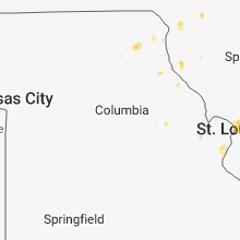
| 3:34 PM CDT | Quarter sized hail reported near Saint Louis, MO, 8.9 miles SW of Saint Louis, MO |
| 5:29 PM CDT | Quarter sized hail reported near New Florence, MO, 49.4 miles E of Columbia, MO |
| 5:31 PM CDT | Quarter sized hail reported near New Florence, MO, 46.2 miles E of Columbia, MO, employee traveling along i-70 reported 1.00 hail at mile marker 174. |
| 5:44 PM CDT | Quarter sized hail reported near Palmyra, MO, 51.1 miles S of Kahoka, MO, spotter reported hail the size of quarters and dimes near elm and county road 267. |
| 5:51 PM CDT | Half Dollar sized hail reported near Palmyra, MO, 50.8 miles S of Kahoka, MO, time estimated by radar. from wgem. |
Colorado
| Local Time | Report Details |
|---|---|
| 2:40 PM MDT | Ping Pong Ball sized hail reported near Holyoke, CO, 38.9 miles NE of Yuma, CO |
| 3:59 PM MDT | Quarter sized hail reported near Wray, CO, 37.6 miles ENE of Yuma, CO, public called in a report of measured 1 inch hail at their location. |
| 4:50 PM MDT | Mesonet station e7755... akro in washington county CO, 25.4 miles W of Yuma, CO |
| 5:32 PM MDT | Storm damage reported in logan county CO, 47 miles NW of Yuma, CO |
| 5:35 PM MDT | Awos station stk... sterlin in logan county CO, 45.1 miles NW of Yuma, CO |
| 5:38 PM MDT | Quarter sized hail reported near Sterling, CO, 56.9 miles NNW of Yuma, CO |
| 5:40 PM MDT | Quarter sized hail reported near Stoneham, CO, 58.6 miles NW of Yuma, CO |
| 5:47 PM MDT | Storm damage reported in logan county CO, 54.6 miles NNW of Yuma, CO |
| 6:12 PM MDT | Storm damage reported in kit carson county CO, 64.6 miles SSE of Yuma, CO |
| 6:15 PM MDT | Quarter sized hail reported near Julesburg, CO, 60.8 miles NNE of Yuma, CO |
| 7:15 PM MDT | Half Dollar sized hail reported near Burlington, CO, 50.2 miles SSE of Yuma, CO |
| 7:23 PM MDT | Ping Pong Ball sized hail reported near Bethune, CO, 50.7 miles SSE of Yuma, CO, quarter to golf ball size hail reported 8-10 miles north of bethune at 7:23 pm mdt. |
| 8:40 PM MDT | Golf Ball sized hail reported near Idalia, CO, 46.1 miles SE of Yuma, CO |
| 8:40 PM MDT | Golf Ball sized hail reported near Idalia, CO, 45.8 miles SE of Yuma, CO, twitter report of golfball size hail in southeast yuma county. |
Kansas
| Local Time | Report Details |
|---|---|
| 3:59 PM CDT | Half Dollar sized hail reported near Johnson, KS, 63.3 miles WSW of Garden City, KS |
| 4:25 PM CDT | Half Dollar sized hail reported near Ulysses, KS, 39.6 miles WSW of Garden City, KS |
| 3:30 PM MDT | Quarter sized hail reported near Kendall, KS, 41.9 miles WSW of Garden City, KS |
| 3:42 PM MDT | Reports of tree limbs blown down and some broken windows in vehicles and building in hamilton county KS, 37 miles W of Garden City, KS |
| 4:45 PM CDT | Quarter sized hail reported near Kendall, KS, 35.4 miles W of Garden City, KS |
| 4:50 PM CDT | Pea size hail also reported with this stor in kearny county KS, 34.8 miles W of Garden City, KS |
| 4:53 PM CDT | Mesonet station d5288... 1 e kendal in kearny county KS, 35.4 miles W of Garden City, KS |
| 4:16 PM MDT | Ping Pong Ball sized hail reported near Tribune, KS, 55.4 miles NW of Garden City, KS, law enforcement reported 1.0 to 1.5" hail neat whitelaw. |
| 5:28 PM CDT | Spotter called in a measured wind report of 62 mp in wichita county KS, 56.6 miles SSW of Colby, KS |
| 4:29 PM MDT | Blowing dust accompanied the wind in sherman county KS, 35.8 miles W of Colby, KS |
| 6:34 PM CDT | Golf Ball sized hail reported near Colby, KS, 4 miles W of Colby, KS |
| 7:05 PM CDT | Quarter sized hail reported near Mc Donald, KS, 32.2 miles NNW of Colby, KS |
| 7:40 PM CDT | Quarter sized hail reported near Mc Donald, KS, 32.2 miles NNW of Colby, KS |
| 9:51 PM CDT | Quarter sized hail reported near Saint Francis, KS, 44.7 miles ESE of Yuma, CO |
Nebraska
| Local Time | Report Details |
|---|---|
| 3:15 PM MDT | Quarter sized hail reported near Champion, NE, 55.1 miles NE of Yuma, CO |
| 3:35 PM MDT | Quarter sized hail reported near Venango, NE, 60.9 miles NE of Yuma, CO |
| 3:48 PM MDT | Quarter sized hail reported near Brule, NE, 58.9 miles W of North Platte, NE, twitter report. |
| 3:48 PM MDT | Ping Pong Ball sized hail reported near Brule, NE, 60.8 miles W of North Platte, NE |
| 4:00 PM MDT | Quarter sized hail reported near Brule, NE, 57.8 miles W of North Platte, NE |
| 4:01 PM MDT | Ping Pong Ball sized hail reported near Grant, NE, 53.6 miles WSW of North Platte, NE |
| 4:15 PM MDT | Ping Pong Ball sized hail reported near Ogallala, NE, 49 miles W of North Platte, NE |
| 4:18 PM MDT | Quarter sized hail reported near Grant, NE, 57 miles WSW of North Platte, NE, hail ranging from pea to quarter size |
| 4:30 PM MDT | Quarter sized hail reported near Grant, NE, 53.3 miles WSW of North Platte, NE |
| 4:46 PM MDT | Ping Pong Ball sized hail reported near Madrid, NE, 47.8 miles WSW of North Platte, NE |
| 6:11 PM MDT | Storm damage reported in cheyenne county NE, 62 miles SE of Scottsbluff, NE |
| 6:31 PM MDT | Davis weather station in deuel county NE, 68.8 miles NNE of Yuma, CO |
| 6:47 PM MDT | Trained spotter estimated gust. small hail als in garden county NE, 73.7 miles ESE of Scottsbluff, NE |
| 6:55 PM MDT | Imperial asos kiml in chase county NE, 62.6 miles SW of North Platte, NE |
| 7:00 PM MDT | Reports of trees up to 2.5 feet in diameter down in oshkosh. reports of power outages from oshkosh to lisco via coop observer and nppd. time is estimate in garden county NE, 75.3 miles ESE of Scottsbluff, NE |
| 7:03 PM MDT | Quarter sized hail reported near Gering, NE, 2.2 miles S of Scottsbluff, NE |
| 7:15 PM MDT | An irrigation pivot was blown over near cr 26 and lake minitar in scotts bluff county NE, 7.2 miles NE of Scottsbluff, NE |
| 7:15 PM MDT | Storm damage reported in garden county NE, 62.4 miles E of Scottsbluff, NE |
| 7:24 PM MDT | Storm damage reported in sioux county NE, 73.1 miles N of Scottsbluff, NE |
| 7:32 PM MDT | Academia source. 10e ogallala on i-80 gusts of 72 and 78 mp in keith county NE, 40 miles W of North Platte, NE |
| 7:32 PM MDT | 2 power poles blown down along county road in scotts bluff county NE, 9.3 miles SE of Scottsbluff, NE |
| 8:50 PM CDT | Reports of tree branches that are 6 to 8 inches in diameter have been blown off tree in lincoln county NE, 11.4 miles W of North Platte, NE |
| 7:54 PM MDT | Quarter sized hail reported near Crawford, NE, 58.6 miles NNE of Scottsbluff, NE |
| 7:54 PM MDT | Storm damage reported in dawes county NE, 58.6 miles NNE of Scottsbluff, NE |
| 9:10 PM CDT | Storm damage reported in mcpherson county NE, 34.6 miles NNW of North Platte, NE |
| 9:20 PM CDT | Storm damage reported in mcpherson county NE, 39.3 miles NNW of North Platte, NE |
Wisconsin
| Local Time | Report Details |
|---|---|
| 4:26 PM CDT | Several large branches down. branches 8 to 10 inches in diameter. near intersection of county p and roosevelt r in dodge county WI, 47.9 miles ENE of Madison, WI |
| 4:29 PM CDT | 8 inch diameter hardwood tree down at hwy p 1/2 mile north of hwy cw. time estimated from rada in waukesha county WI, 47.4 miles E of Madison, WI |
West Virginia
| Local Time | Report Details |
|---|---|
| 5:53 PM EDT | Trees down on trough road near hardy/hampshire county border in hardy county WV, 54.8 miles ENE of Elkins, WV |
Oklahoma
| Local Time | Report Details |
|---|---|
| 5:19 PM CDT | Storm damage reported in texas county OK, 94.9 miles SSW of Garden City, KS |
Ohio
| Local Time | Report Details |
|---|---|
| 6:25 PM EDT | Power poles and electrical lines down over petersburg roa in highland county OH, 53 miles E of Cincinnati, OH |
| 6:25 PM EDT | Tree down over carper lan in highland county OH, 52.8 miles E of Cincinnati, OH |
Indiana
| Local Time | Report Details |
|---|---|
| 6:35 PM EDT | Quarter sized hail reported near Winslow, IN, 33.8 miles NE of Evansville, IN, nickel to quarter size hail in the town of winslow. |
| 6:35 PM EDT | Delayed report. several trees damaged in tow in pike county IN, 33.8 miles NE of Evansville, IN |
| 7:07 PM CDT | Golf Ball sized hail reported near Morocco, IN, 67.2 miles SSE of Chicago, IL |
Tennessee
| Local Time | Report Details |
|---|---|
| 7:00 PM EDT | Several trees down just west of lenoir city... t in loudon county TN, 24.5 miles WSW of Knoxville, TN |
Texas
| Local Time | Report Details |
|---|---|
| 6:15 PM CDT | Quarter sized hail reported near Gruver, TX, 76.4 miles NNE of Amarillo, TX |
| 8:00 PM CDT | Golf Ball sized hail reported near Pampa, TX, 52.3 miles ENE of Amarillo, TX, golf ball size hail on highway 60 southwest of pampa. |
| 8:10 PM CDT | Quarter sized hail reported near Skellytown, TX, 45.4 miles NE of Amarillo, TX, hail between dime to nickle... with a few quarter size... mixed in. also... heavy rainfall producing localized street flooding. |
| 8:33 PM CDT | Golf ball size hail reporte in carson county TX, 45.1 miles NE of Amarillo, TX |
| 8:33 PM CDT | Golf Ball sized hail reported near Skellytown, TX, 45.1 miles NE of Amarillo, TX, golf ball size hail reported. |
| 8:34 PM CDT | Quarter sized hail reported near Skellytown, TX, 45 miles NE of Amarillo, TX, report received via mping. |
| 8:36 PM CDT | Quarter sized hail reported near Skellytown, TX, 45 miles NE of Amarillo, TX, report of quarter size hail and strong outflow winds from storm. |
| 8:36 PM CDT | Report of quarter size hail and strong outflow winds from stor in carson county TX, 45 miles NE of Amarillo, TX |
| 8:50 PM CDT | Golf Ball sized hail reported near Pampa, TX, 46.6 miles ENE of Amarillo, TX, report received via spotter network. |
| 9:00 PM CDT | Deputy reported transformers were blowing up around him off highway 60 southwest of pampa with very strong winds in gray county TX, 52.3 miles ENE of Amarillo, TX |
| 9:00 PM CDT | Golf Ball sized hail reported near Pampa, TX, 52.3 miles ENE of Amarillo, TX, golf ball size hail on highway 60 southwest of pampa. |
| 9:06 PM CDT | Potential rfd from thunderstor in gray county TX, 49.2 miles ENE of Amarillo, TX |
| 9:15 PM CDT | Hen Egg sized hail reported near Pampa, TX, 51.7 miles ENE of Amarillo, TX, facebook report with photos |
| 9:17 PM CDT | Baseball sized hail reported near Pampa, TX, 54.7 miles ENE of Amarillo, TX, baseball hail a few blocks north of the bowling alley. |
| 9:20 PM CDT | Baseball sized hail reported near Pampa, TX, 54.4 miles ENE of Amarillo, TX, facebook report |
| 9:22 PM CDT | Golf Ball sized hail reported near Pampa, TX, 51.8 miles ENE of Amarillo, TX, local official south of pampa reporting golf ball size hail. |
| 9:25 PM CDT | Tennis Ball sized hail reported near Pampa, TX, 54.1 miles ENE of Amarillo, TX, tennis ball hail |
| 9:26 PM CDT | Golf Ball sized hail reported near Pampa, TX, 53.7 miles ENE of Amarillo, TX |
| 9:47 PM CDT | Storm damage reported in gray county TX, 60.6 miles ENE of Amarillo, TX |
Montana
| Local Time | Report Details |
|---|---|
| 5:51 PM MDT | Quarter sized hail reported near Laurel, MT, 14.5 miles WSW of Billings, MT |
South Dakota
| Local Time | Report Details |
|---|---|
| 8:22 PM CDT | Storm damage reported in todd county SD, 28.9 miles NNW of Valentine, NE |
| 8:45 PM CDT | Quarter sized hail reported near Mission, SD, 30.2 miles N of Valentine, NE |
| 8:23 PM MDT | Quarter sized hail reported near Oelrichs, SD, 62.2 miles S of Rapid City, SD |
| 8:50 PM MDT | Time estimated from radar in fall river county SD, 46.3 miles S of Rapid City, SD |
| 9:23 PM MDT | Storm damage reported in custer county SD, 27.7 miles S of Rapid City, SD |
| 9:27 PM MDT | 70-80 mph wind gusts; camper was blown over onto it's side in custer county SD, 22.9 miles S of Rapid City, SD |
| 9:30 PM MDT | Time estimated from radar in oglala lakota county SD, 72.8 miles SE of Rapid City, SD |
| 10:14 PM MDT | Small to medium branches blown off pine tree in pennington county SD, 6.8 miles SW of Rapid City, SD |
| 10:23 PM MDT | Storm damage reported in pennington county SD, 15.2 miles E of Rapid City, SD |
Connect with Interactive Hail Maps