

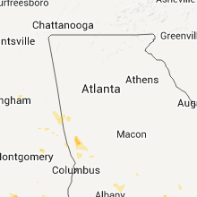
Hail Map for Thursday, August 11, 2011

Number of Impacted Households on 8/11/2011
0
Impacted by 1" or Larger Hail
0
Impacted by 1.75" or Larger Hail
0
Impacted by 2.5" or Larger Hail
Square Miles of Populated Area Impacted on 8/11/2011
0
Impacted by 1" or Larger Hail
0
Impacted by 1.75" or Larger Hail
0
Impacted by 2.5" or Larger Hail


Cities Most Affected by Hail Storms of 8/11/2011
| Hail Size | Demographics of Zip Codes Affected | ||||||
|---|---|---|---|---|---|---|---|
| City | Count | Average | Largest | Pop Density | House Value | Income | Age |
| Milesville, SD | 2 | 2.38 | 2.75 | 1 | $33k | $27.9k | 37.5 |
| Valentine, NE | 1 | 2.75 | 2.75 | 3 | $68k | $29.9k | 44.3 |
| Imperial, NE | 1 | 2.50 | 2.50 | 2 | $67k | $34.4k | 41.3 |
| Gregory, SD | 1 | 1.75 | 1.75 | 4 | $39k | $24.8k | 49.2 |
| Johnstown, NE | 1 | 1.75 | 1.75 | 1 | $33k | $29.1k | 48.3 |
| Deadwood, SD | 1 | 1.75 | 1.75 | 18 | $78k | $32.3k | 48.5 |
| Dunning, NE | 1 | 1.75 | 1.75 | 0 | $21k | $26.7k | 46.1 |
Hail and Wind Damage Spotted on 8/11/2011
Filter by Report Type:Hail ReportsWind Reports
States Impacted
Oklahoma, North Carolina, Georgia, Montana, Florida, South Dakota, South Carolina, Minnesota, Alabama, Virginia, Texas, North Dakota, Colorado, Nebraska, New Mexico, Wyoming, KansasOklahoma
| Local Time | Report Details |
|---|---|
| 2:25 PM UTC | Quarter sized hail reported near Blanchard, OK, 23.6 miles SSW of Oklahoma City, OK, blanchard pd |
| 4:00 PM UTC | Storm damage reported in carter county OK, 64.8 miles W of Atoka, OK |
North Carolina
| Local Time | Report Details |
|---|---|
| 5:40 PM UTC | 3 trees down in yadkin county NC, 68.8 miles N of Charlotte, NC |
| 5:51 PM UTC | Tree down in wilkes county NC, 66.9 miles N of Charlotte, NC |
| 5:54 PM UTC | Quarter sized hail reported near Hudson, NC, 57.2 miles NW of Charlotte, NC, quarter size hail near hwy 321-a and connelly springs rd. |
| 6:49 PM UTC | Two trees down on hwy 10 in between casar and toluc in cleveland county NC, 46.7 miles WNW of Charlotte, NC |
| 6:56 PM UTC | At least one large tree down in the davie academy road area along with several other large branches. this location is just south of interstate 4 in davie county NC, 46 miles NNE of Charlotte, NC |
| 8:06 PM UTC | Several large limbs and at least one pine tree down along with some powerlines down in davidson. the time was obtained from doppler velocity data as the wind max crosse in mecklenburg county NC, 19.1 miles N of Charlotte, NC |
| 8:10 PM UTC | Davidson p.d. reports 10 to 15 trees blown down or topped by wind along main street. rail fence leveled by wind as wel in mecklenburg county NC, 19.1 miles N of Charlotte, NC |
| 8:15 PM UTC | Trees and power lines down along bethel church roa in mecklenburg county NC, 17.8 miles N of Charlotte, NC |
| 8:18 PM UTC | Trees and power lines down along old statesville roa in mecklenburg county NC, 13.6 miles N of Charlotte, NC |
| 8:26 PM UTC | Six aircraft damaged and one tree down at kjqf concord regional airpor in cabarrus county NC, 13.1 miles NE of Charlotte, NC |
| 8:32 PM UTC | Several trees down in and around dallas...2 trees that fell on separate houses...and several other trees either down or snapped off about half way up the tre in gaston county NC, 20.3 miles WNW of Charlotte, NC |
| 8:40 PM UTC | Spotter took a photograph of approaching storm at fire department which verified this time. several large limbs were downed from this storm as it went through the are in cabarrus county NC, 15.1 miles NE of Charlotte, NC |
| 9:00 PM UTC | Quarter sized hail reported near McAdenville, NC, 14 miles W of Charlotte, NC, spotter reports quarter size hail along hickory grove road. |
| 9:08 PM UTC | Half Dollar sized hail reported near Mt Holly, NC, 10.6 miles WNW of Charlotte, NC, half dollar sized hail falling just outside of belmont. |
| 9:08 PM UTC | A few large limbs down along with the large hai in gaston county NC, 10.6 miles WNW of Charlotte, NC |
| 9:13 PM UTC | Measured 50 kt gust at clt airpor in mecklenburg county NC, 5.9 miles W of Charlotte, NC |
| 9:20 PM UTC | Debris in roadway from winds at yorkmont and billy graham parkway near charlotte airpor in mecklenburg county NC, 1.6 miles SSE of Charlotte, NC |
| 9:30 PM UTC | Quarter sized hail reported near Charlotte, NC, 1.6 miles SSE of Charlotte, NC, quarter size hail on south blvd in charlotte. |
| 9:55 PM UTC | County reports a structure moved off its foundation by wind gusts at abby walk lane near mckee roa in mecklenburg county NC, 11.6 miles SSE of Charlotte, NC |
| 10:00 PM UTC | Large tree on roa in mecklenburg county NC, 11 miles SSE of Charlotte, NC |
| 10:00 PM UTC | A few trees down in water oak are in union county NC, 14.5 miles SSE of Charlotte, NC |
| 10:12 PM UTC | Trees down on pleasant grove roa in union county NC, 19.7 miles SSE of Charlotte, NC |
Georgia
| Local Time | Report Details |
|---|---|
| 6:00 PM UTC | Harris county 911 reports several downed trees in the northwestern portion of count in harris county GA, 35 miles ENE of Auburn, AL |
| 6:31 PM UTC | Waverly hall police department reports several trees and lines down on ga hwy 85 heading towards mancheste in harris county GA, 44.2 miles E of Auburn, AL |
| 6:35 PM UTC | Wtvm-tv relayed reports of a few downed trees and powerlines in waverly hal in harris county GA, 43.5 miles E of Auburn, AL |
| 6:54 PM UTC | Marion county 911 relayed reports of a couple of downed tree in marion county GA, 57.8 miles E of Auburn, AL |
| 9:55 PM UTC | Trees were down along yawn road. the time of damage was based on rada in jeff davis county GA, 33.6 miles NE of Douglas, GA |
| 10:05 PM UTC | Trees were blown down along mora road and bridgetown roa in coffee county GA, 13.2 miles WSW of Douglas, GA |
| 10:30 PM UTC | 911 center relayed public report of structural damage to residential home along with downed trees. time estimated by doppler rada in atkinson county GA, 14.9 miles SSW of Douglas, GA |
| 10:45 PM UTC | Emergency manager reported straight line wind event on antioch church road that knocked several trees onto a power substation. this event knocked power out to a large p in atkinson county GA, 12.9 miles SSW of Douglas, GA |
| 10:45 PM UTC | Emergency manager reported straight line wind event on sutton road that tore the front porch awning off a mobile home and peeled back part of the roof. no injuries were in atkinson county GA, 12.6 miles SSW of Douglas, GA |
| 11:23 PM UTC | Trained spotter reported numerous downed trees on powerline in ware county GA, 41.2 miles SE of Douglas, GA |
| 11:25 PM UTC | Three trees were blown down onto power lines along the gibbs street extentio in ware county GA, 36.2 miles SE of Douglas, GA |
Montana
| Local Time | Report Details |
|---|---|
| 6:27 PM UTC | Quarter sized hail reported near Ballantine, MT, 20.7 miles NE of Billings, MT |
| 6:27 PM UTC | Quarter sized hail reported near Worden, MT, 18.5 miles NE of Billings, MT |
| 9:05 PM UTC | Quarter sized hail reported near Cohagen, MT, 67.6 miles S of Glasgow, MT |
| 9:20 PM UTC | Quarter sized hail reported near Cohagen, MT, 67.6 miles S of Glasgow, MT |
| 9:55 PM UTC | Quarter sized hail reported near Worden, MT, 18.5 miles NE of Billings, MT |
| 9:58 PM UTC | Quarter sized hail reported near Ballantine, MT, 20.7 miles NE of Billings, MT |
| 10:45 PM UTC | Large tree downed in tow in big horn county MT, 43.5 miles E of Billings, MT |
| 10:46 PM UTC | Broken windows due to hail and rain. hail size unknown. crops flattened. sheds blown ove in big horn county MT, 43.6 miles E of Billings, MT |
| 10:58 PM UTC | Storm damage reported in phillips county MT, 39.4 miles NW of Glasgow, MT |
| 10:58 PM UTC | Quarter sized hail reported near Fallon, MT, 38 miles ENE of Miles City, MT, accompanied by brief heavy rain. |
| 11:00 PM UTC | Winds at 75 mph driving dime size hail. heavy damage to home. power poles blown down. 300 acres sugar beet crop destroyed. numerous vehicles with broken windows seen on in big horn county MT, 43.5 miles E of Billings, MT |
| 11:20 PM UTC | 60-70 mph winds with one half inch hail. large trees missing limbs and leave in custer county MT, 53.1 miles E of Miles City, MT |
| 11:20 PM UTC | Quarter sized hail reported near Crow Agency, MT, 64.2 miles E of Billings, MT, estimated 50 mph winds combined with the hail to break windows. hail accumulated to 6 to 8 inches. |
| 11:30 PM UTC | Tree limbs broken and leaves gone in big horn county MT, 83.2 miles NW of Gillette, WY |
| 11:37 PM UTC | Quarter sized hail reported near Havre, MT, 1 miles SSW of Havre, MT, 1 inch hail at downtown havre. |
| 12:08 AM UTC | Along with dime size hail and received 0.54 inches rai in powder river county MT, 68.2 miles S of Miles City, MT |
| 12:45 AM UTC | Storm damage reported in powder river county MT, 70 miles SSE of Miles City, MT |
| 1:15 AM UTC | Very strong winds broke twigs and snapped 2 inch branches off of trees. measured 0.10 of rai in carter county MT, 72 miles NNE of Gillette, WY |
| 1:30 AM UTC | Quarter sized hail reported near Alzada, MT, 64 miles NE of Gillette, WY, 50-60 mph winds driving quarter size hail and heavy rains. |
Florida
| Local Time | Report Details |
|---|---|
| 6:48 PM UTC | Tree limbs down as well as damage to a homemade greenhous in bay county FL, 46.5 miles ESE of Miramar Beach, FL |
| 11:15 PM UTC | The jacksonville electric authority confirmed that power line crews responded to scattered power outages across the jacksonville southside inlcuding along san pablo and in duval county FL, 13.6 miles ESE of Jacksonville, FL |
South Dakota
| Local Time | Report Details |
|---|---|
| 6:50 PM UTC | Quarter sized hail reported near Rapid City, SD, 14.3 miles WSW of Rapid City, SD |
| 7:55 PM UTC | Baseball sized hail reported near Milesville, SD, 71 miles W of Pierre, SD |
| 8:00 PM UTC | Hen Egg sized hail reported near Milesville, SD, 66.4 miles W of Pierre, SD |
| 9:20 PM UTC | Quarter sized hail reported near Onida, SD, 28.6 miles NE of Pierre, SD, hail in drifts up to 1 foot deep. |
| 9:25 PM UTC | Half Dollar sized hail reported near Midland, SD, 42 miles WSW of Pierre, SD |
| 9:30 PM UTC | Golf Ball sized hail reported near Deadwood, SD, 28.1 miles WNW of Rapid City, SD |
| 9:47 PM UTC | Ping pong sized hail and 60 mph winds reported in jones county SD, 42.8 miles SW of Pierre, SD |
| 9:47 PM UTC | Ping Pong Ball sized hail reported near Okaton, SD, 42.8 miles SW of Pierre, SD, ping pong sized hail and 60 mph winds reported |
| 9:58 PM UTC | Quarter sized hail reported near Blackhawk, SD, 10.9 miles NW of Rapid City, SD |
| 10:05 PM UTC | Quarter sized hail reported near Murdo, SD, 37.6 miles SSW of Pierre, SD, quarter size hail in murdo proper |
| 10:30 PM UTC | Storm damage reported in stanley county SD, 9.6 miles S of Pierre, SD |
| 10:40 PM UTC | Storm damage reported in hand county SD, 68.1 miles E of Pierre, SD |
| 10:40 PM UTC | Grain bins blown over. trucks blown off of highwa in lyman county SD, 34.8 miles SSE of Pierre, SD |
| 10:45 PM UTC | Shingles blown off of house and damage to deck. lots of tree damag in lyman county SD, 40.5 miles SE of Pierre, SD |
| 10:52 PM UTC | Gusts 60 to 70 mph in hand county SD, 73.4 miles SSW of Aberdeen, SD |
| 10:58 PM UTC | Storm damage reported in mellette county SD, 47.4 miles N of Valentine, NE |
| 11:00 PM UTC | Pea size hail with the win in mellette county SD, 50.7 miles S of Pierre, SD |
| 11:07 PM UTC | Roof removed off local business and blown into powerline in beadle county SD, 70.5 miles S of Aberdeen, SD |
| 11:07 PM UTC | Trees down in beadle county SD, 70.5 miles S of Aberdeen, SD |
| 11:20 PM UTC | Storm damage reported in lyman county SD, 62.2 miles SE of Pierre, SD |
| 11:30 PM UTC | Branches knocked off. .75 inches of rai in tripp county SD, 54.1 miles SSE of Pierre, SD |
| 11:35 PM UTC | Quarter sized hail reported near Winner, SD, 39.1 miles NNE of Valentine, NE |
| 12:09 AM UTC | Storm damage reported in beadle county SD, 77 miles S of Aberdeen, SD |
| 12:20 AM UTC | Golf Ball sized hail reported near Gregory, SD, 51.1 miles E of Valentine, NE |
| 12:40 AM UTC | Trees and powerlines down in davison county SD, 66.4 miles WNW of Sioux Falls, SD |
| 1:05 AM UTC | Also pea sized hail in hutchinson county SD, 47.6 miles WSW of Sioux Falls, SD |
| 2:20 AM UTC | Quarter sized hail reported near Buffalo, SD, 104.7 miles N of Rapid City, SD, gusts estimated at up to 50 mph. |
| 2:35 AM UTC | Marble size hai in butte county SD, 49.2 miles NNW of Rapid City, SD |
South Carolina
| Local Time | Report Details |
|---|---|
| 8:00 PM UTC | Quarter sized hail reported near Bowman, SC, 31.9 miles WNW of Charleston, SC, quarter size hail and one oak tree blown down on harts road. |
| 8:00 PM UTC | Several trees down in this area...4 trees down on lee cemetery road...trees on powerlines at sardis road and old bumcombe road...tree down in the 5400 block of whitmire in union county SC, 58.9 miles ESE of Greenville, SC |
| 8:00 PM UTC | Quarter size hail and one oak tree blown down on harts roa in dorchester county SC, 31.9 miles WNW of Charleston, SC |
| 8:25 PM UTC | Several trees down on ebenezer r in orangeburg county SC, 36.7 miles WNW of Charleston, SC |
| 9:00 PM UTC | Several trees down in this area...4 trees down on lee cemetery road...trees on powerlines at intersection of sardis road and old buncombe road...a tree down in the 5400 in union county SC, 58.9 miles ESE of Greenville, SC |
| 9:00 PM UTC | Several trees down in this area...4 trees down on lee cemetery road...trees on powerlines at sardis road and old bumcombe road...tree down in the 5400 block of whitmire in union county SC, 58.9 miles ESE of Greenville, SC |
| 9:18 PM UTC | Power lines down at sardis rd and old buncombe rd. tree also down on old buncombe rd. time estimated from rada in union county SC, 57.2 miles ESE of Greenville, SC |
| 9:23 PM UTC | Tree down on lee cemetary rd. time estimated from rada in union county SC, 57.3 miles ESE of Greenville, SC |
| 9:40 PM UTC | Several trees down on maybinton rd. time estimated by rada in newberry county SC, 64.7 miles SW of Charlotte, NC |
| 9:54 PM UTC | Trees down along sessions road near 25 mile cree in kershaw county SC, 69.8 miles S of Charlotte, NC |
| 9:55 PM UTC | Several trees down across tee pee trail r in kershaw county SC, 70.5 miles S of Charlotte, NC |
| 10:10 PM UTC | Widespread structural damage. outstorage bldgs blown in kershaw county SC, 71.9 miles S of Charlotte, NC |
| 11:26 PM UTC | Tree down on ruby road near chapel hill road. time of event estimated by rada in darlington county SC, 69.2 miles SE of Charlotte, NC |
| 12:24 AM UTC | Tree down in oak grove area near elberry rd. time of event estimated by rada in dillon county SC, 83.1 miles NNE of Charleston, SC |
| 12:35 AM UTC | Tree down on hoffmyer rd near entrance to florence mal in florence county SC, 69.5 miles N of Charleston, SC |
| 12:37 AM UTC | Tree down on mechanicville r in florence county SC, 72.4 miles N of Charleston, SC |
| 1:00 AM UTC | Tree down near intersection of antioch church road and sc 38. time of event esimtated by rada in marion county SC, 81.9 miles NNE of Charleston, SC |
| 1:35 AM UTC | Tree down across state road s-34-9 near gresha in marion county SC, 61.4 miles NE of Charleston, SC |
Minnesota
| Local Time | Report Details |
|---|---|
| 8:50 PM UTC | Half Dollar sized hail reported near Erskine, MN, 55.5 miles WNW of Bemidji, MN, quarter to walnut sized hail for a few minutes. |
Alabama
| Local Time | Report Details |
|---|---|
| 9:50 PM UTC | Quarter sized hail reported near Killen, AL, 12.9 miles ENE of Florence, AL, quarter size hail reported in the town of center star. time estimated based on radar. |
| 10:00 PM UTC | Quarter sized hail reported near Killen, AL, 12.9 miles ENE of Florence, AL, quarter size hail reported in the town of center star. |
| 10:02 PM UTC | Multiple trees blown down around spout springs road and wheeler view drive northeast of ford cit in lauderdale county AL, 12.3 miles E of Florence, AL |
| 10:02 PM UTC | Multiple trees blown down around scott springs road and wheeler view drive northeast of ford cit in lauderdale county AL, 10.6 miles E of Florence, AL |
| 10:02 PM UTC | Multiple trees blown down around spout springs road and wheeler view drive northeast of ford cit in colbert county AL, 12.3 miles E of Florence, AL |
| 11:41 PM UTC | Mulitple trees and powerlines down in the walnut hill area near the intersection of county roads 50 and 4 in tallapoosa county AL, 18.5 miles WNW of Auburn, AL |
| 11:50 PM UTC | 1940 update. single 18-22 inch sweetgum down on cnty in pike county AL, 48 miles SW of Auburn, AL |
| 11:50 PM UTC | No known damage at this tim in pike county AL, 48 miles SW of Auburn, AL |
Virginia
| Local Time | Report Details |
|---|---|
| 10:15 PM UTC | Tree down on power line in pittsylvania county VA, 53.3 miles SE of Roanoke, VA |
| 10:15 PM UTC | Damage to house and fences in pittsylvania county VA, 51.5 miles SE of Roanoke, VA |
Texas
| Local Time | Report Details |
|---|---|
| 10:18 PM UTC | Reported by kamc automated weather station in lamb county TX, 43.7 miles NNW of Lubbock, TX |
| 10:18 PM UTC | Reported by kamc automated weather station at olton airport in lamb county TX, 45.2 miles NNW of Lubbock, TX |
| 10:26 PM UTC | Power lines down in lamb county TX, 43.7 miles NNW of Lubbock, TX |
| 10:26 PM UTC | Power lines down... roof damage... trees down in olton in lamb county TX, 43.7 miles NNW of Lubbock, TX |
| 10:26 PM UTC | Quarter sized hail reported near Olton, TX, 43.7 miles NNW of Lubbock, TX |
| 11:15 PM UTC | 7 power poles down at county rd 621 and fm 1055 in castro county TX, 60.5 miles SSW of Amarillo, TX |
| 11:27 PM UTC | Feed lot office heavily damaged in dimmitt from strong thunderstorm winds in castro county TX, 52.8 miles SSW of Amarillo, TX |
| 11:30 PM UTC | Significant damage to dimmitt mesonet station. damage to radiation shields... guide wires pulled out of ground and a pole bent. center pivot damaged in vicinity of meso in castro county TX, 51 miles SSW of Amarillo, TX |
| 11:30 PM UTC | Lines blown down on fm 1424 in swisher county TX, 46.3 miles S of Amarillo, TX |
| 12:16 AM UTC | Lost power in randall county TX, 28.5 miles SSW of Amarillo, TX |
| 12:20 AM UTC | Storm damage reported in randall county TX, 28.5 miles SSW of Amarillo, TX |
North Dakota
| Local Time | Report Details |
|---|---|
| 10:37 PM UTC | Half Dollar sized hail reported near Grand Forks, ND, 73.4 miles N of Fargo, ND, quarter to half dollar sized hail fell. |
| 10:45 PM UTC | 12-inch diameter tree snapped at root at corner of 28th ave and oak street. time approximat in grand forks county ND, 73.4 miles N of Fargo, ND |
Colorado
| Local Time | Report Details |
|---|---|
| 11:00 PM UTC | 2 foot diameter live spruce tree uprooted. strong winds lasted less than 1 minut in pueblo county CO, 1.7 miles S of Pueblo, CO |
| 12:15 AM UTC | 14 power poles down between road 13.5 and 1 in otero county CO, 43.9 miles ESE of Pueblo, CO |
| 12:38 AM UTC | Quarter sized hail reported near Amherst, CO, 50.5 miles NE of Yuma, CO, sheets of half inch to one inch hail. crop damage likely. |
| 12:47 AM UTC | Ping Pong Ball sized hail reported near Amherst, CO, 50.5 miles NE of Yuma, CO |
| 1:05 AM UTC | Several trees uprooted in bent county CO, 87.2 miles E of Pueblo, CO |
| 1:34 AM UTC | Ping Pong Ball sized hail reported near Haxtun, CO, 38.2 miles NNE of Yuma, CO |
Nebraska
| Local Time | Report Details |
|---|---|
| 11:37 PM UTC | The brief...strong wind gust produced considerable blowing dust and was produced from a weakening showe in cheyenne county NE, 63.6 miles N of Yuma, CO |
| 12:28 AM UTC | Storm damage reported in boyd county NE, 41.6 miles NNW of Oneill, NE |
| 1:00 AM UTC | Thunderstorm wind gusts downed tree limbs up to about 10 inches in diamete in keya paha county NE, 48.8 miles E of Valentine, NE |
| 1:03 AM UTC | Quarter sized hail reported near Long Pine, NE, 35 miles SE of Valentine, NE |
| 1:10 AM UTC | Half Dollar sized hail reported near Champion, NE, 53.7 miles NE of Yuma, CO |
| 1:15 AM UTC | Golf Ball sized hail reported near Johnstown, NE, 32.5 miles SE of Valentine, NE |
| 1:25 AM UTC | Quarter sized hail reported near Bassett, NE, 50 miles ESE of Valentine, NE, relayed via the rock county sherrifs office. |
| 1:32 AM UTC | Half Dollar sized hail reported near Valentine, NE, 29.3 miles S of Valentine, NE |
| 1:35 AM UTC | Baseball sized hail reported near Valentine, NE, 29.3 miles S of Valentine, NE |
| 1:40 AM UTC | Tennis Ball sized hail reported near Imperial, NE, 60.6 miles NE of Yuma, CO |
| 2:10 AM UTC | Quarter sized hail reported near Elsmere, NE, 41.1 miles SSE of Valentine, NE |
| 3:02 AM UTC | Half Dollar sized hail reported near Purdum, NE, 57.7 miles SSE of Valentine, NE, noted winds were from the south then rapidly switched around from the north as the storm passed. |
| 3:40 AM UTC | Half Dollar sized hail reported near Dunning, NE, 61.1 miles NE of North Platte, NE, hail was falling at highway 91...mile marker 3 |
| 4:00 AM UTC | Quarter sized hail reported near Thedford, NE, 44.4 miles S of Valentine, NE |
| 4:30 AM UTC | Quarter sized hail reported near Purdum, NE, 57.4 miles SSE of Valentine, NE |
| 5:00 AM UTC | Golf Ball sized hail reported near Dunning, NE, 68.5 miles NE of North Platte, NE |
| 5:40 AM UTC | Quarter sized hail reported near Brewster, NE, 72.1 miles WSW of Oneill, NE |
| 6:27 AM UTC | Quarter sized hail reported near Gordon, NE, 83.8 miles W of Valentine, NE |
| 6:52 AM UTC | Estimated winds up to 60 mp in nemaha county NE, 59.6 miles S of Omaha, NE |
| 6:52 AM UTC | Five to six large tree limbs or trees 8-10 inches in diameter downed. delayed report time estimated by rada in nemaha county NE, 60.3 miles S of Omaha, NE |
| 8:05 AM UTC | A few tree branch limbs 2 inches in diameter were snapped of in cherry county NE, 40.5 miles S of Valentine, NE |
| 11:10 AM UTC | This is a delayed report. time estimated from radar data. large trees and powerlines down. boats pulled loose from structures on the lake approximately 3 miles south of in merrick county NE, 21.9 miles NE of Grand Island, NE |
| 11:12 AM UTC | This is a delayed report via emergency manage in hamilton county NE, 18.5 miles E of Grand Island, NE |
| 11:12 AM UTC | This is a delayed report. time estimated from radar. some tree branch damage 4 to 6 inches in diameter and 1 pivot section tipped over just south of hordvill in hamilton county NE, 25.8 miles ENE of Grand Island, NE |
| 11:15 AM UTC | This is a delayed report. large trees with a diameter 10 to 12 inches uproote in hamilton county NE, 18.2 miles ESE of Grand Island, NE |
New Mexico
| Local Time | Report Details |
|---|---|
| 11:38 PM UTC | Krow aso in chaves county NM, 5.3 miles SSE of Roswell, NM |
Wyoming
| Local Time | Report Details |
|---|---|
| 12:52 AM UTC | Storm damage reported in campbell county WY, 50.1 miles NNE of Gillette, WY |
| 1:06 AM UTC | Pea size hai in crook county WY, 43 miles NE of Gillette, WY |
| 1:55 AM UTC | Pea size hai in crook county WY, 68.9 miles NW of Rapid City, SD |
Kansas
| Local Time | Report Details |
|---|---|
| 7:02 AM UTC | Storm damage reported in hamilton county KS, 47.9 miles W of Garden City, KS |
Connect with Interactive Hail Maps