

Hail Map for Sunday, June 21, 2020

Number of Impacted Households on 6/21/2020
0
Impacted by 1" or Larger Hail
0
Impacted by 1.75" or Larger Hail
0
Impacted by 2.5" or Larger Hail
Square Miles of Populated Area Impacted on 6/21/2020
0
Impacted by 1" or Larger Hail
0
Impacted by 1.75" or Larger Hail
0
Impacted by 2.5" or Larger Hail


Cities Most Affected by Hail Storms of 6/21/2020
| Hail Size | Demographics of Zip Codes Affected | ||||||
|---|---|---|---|---|---|---|---|
| City | Count | Average | Largest | Pop Density | House Value | Income | Age |
| Beaver, OK | 3 | 2.58 | 3.00 | 2 | $58k | $38.0k | 41.8 |
| Holyrood, KS | 1 | 3.00 | 3.00 | 4 | $25k | $31.5k | 50.3 |
| Copeland, KS | 1 | 1.75 | 1.75 | 2 | $66k | $39.8k | 31.9 |
| Lakin, KS | 1 | 1.75 | 1.75 | 1 | $80k | $41.7k | 35.4 |
| Gillespie, IL | 1 | 1.75 | 1.75 | 102 | $54k | $33.5k | 41.4 |
Hail and Wind Damage Spotted on 6/21/2020
Filter by Report Type:Hail ReportsWind Reports
States Impacted
Texas, Kansas, Oklahoma, Indiana, Kentucky, Minnesota, Virginia, Alabama, Iowa, West Virginia, Illinois, Ohio, South Dakota, Arkansas, Wisconsin, Pennsylvania, Tennessee, Georgia, Michigan, Montana, North Carolina, Wyoming, Louisiana, Mississippi, Colorado, Nebraska, South CarolinaTexas
| Local Time | Report Details |
|---|---|
| 7:36 AM CDT | Wind gust to 58 mph measured at u.s. highway 380 and jackson roa in denton county TX, 45.7 miles NW of Dallas, TX |
| 10:45 PM CDT | Quarter sized hail reported near Canadian, TX, 78.5 miles SW of Woodward, OK |
| 1:35 AM CDT | Storm damage reported in wichita county TX, 4.1 miles S of Wichita Falls, TX |
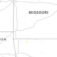
Kansas
| Local Time | Report Details |
|---|---|
| 7:40 AM CDT | Quarter sized hail reported near Lucas, KS, 44.6 miles ENE of Hays, KS, delayed report...brief quarter size hail and then mostly dime size hail for about 3 minutes. |
| 10:15 AM CDT | Quarter sized hail reported near Jewell, KS, 75.7 miles NE of Hays, KS |
| 12:50 PM CDT | Ping Pong Ball sized hail reported near Lincoln, KS, 64.2 miles E of Hays, KS, a lot of ping pong ball size hail at iron drive south of lincoln. |
| 12:55 PM CDT | Ping Pong Ball sized hail reported near Sylvan Grove, KS, 51.5 miles E of Hays, KS, large amount of ping pong ball size hail. |
| 1:07 PM CDT | Report from mping: 1-inch tree limbs broken; shingles blown of in ellsworth county KS, 59.5 miles E of Hays, KS |
| 1:40 PM CDT | Also can see a rapidly rotating wall cloud to his northwest from this locatio in ellsworth county KS, 60.5 miles E of Hays, KS |
| 1:53 PM CDT | Ping Pong Ball sized hail reported near Oakley, KS, 32.6 miles SSE of Colby, KS, chaser reported ping pong sized hail. |
| 2:04 PM CDT | Quarter sized hail reported near Grinnell, KS, 29.3 miles SE of Colby, KS, trained spotter reported quarter sized hail falling at call time. |
| 2:04 PM CDT | Quarter sized hail reported near Grinnell, KS, 29.8 miles SE of Colby, KS, reported via social media at the ks-216 exit on i-70. |
| 2:18 PM CDT | Quarter sized hail reported near Oakley, KS, 30.6 miles SSE of Colby, KS, logan co em reported quarter sized hail ongoing. |
| 2:24 PM CDT | Ping Pong Ball sized hail reported near Grinnell, KS, 29.4 miles SE of Colby, KS, delayed report. quarter to ping pong size hail at mile marker 85. |
| 2:30 PM CDT | Ping Pong Ball sized hail reported near Wilson, KS, 46.6 miles E of Hays, KS, report via ksn of pea to ping pong ball sized hail. time is approximated from radar. |
| 2:45 PM CDT | Quarter sized hail reported near Hoxie, KS, 27.9 miles ESE of Colby, KS, reported via social media. |
| 2:46 PM CDT | Ping Pong Ball sized hail reported near Bunker Hill, KS, 34.1 miles E of Hays, KS, fire department reported to dispatch that there was golf ball to ping pong ball sized hail. |
| 2:52 PM CDT | Quarter sized hail reported near Paradise, KS, 29 miles NE of Hays, KS |
| 3:08 PM CDT | Storm damage reported in russell county KS, 27.6 miles E of Hays, KS |
| 3:15 PM CDT | Mesonet station k5sct 1 ese scott state lak in scott county KS, 49 miles N of Garden City, KS |
| 3:17 PM CDT | Half Dollar sized hail reported near Hoxie, KS, 32.5 miles E of Colby, KS, quarter to half dollar sized hail ongoing. half an inch of rain also reported. caller also reported a landspout tornado on the ground to the n of hoxie. |
| 3:28 PM CDT | Storm damage reported in russell county KS, 27.6 miles E of Hays, KS |
| 3:28 PM CDT | Corrects previous tstm wnd dmg report from russell. 4 to 6 inch diameter tree limbs down in town. via social medi in russell county KS, 26 miles E of Hays, KS |
| 3:35 PM CDT | Awos station ktqk scott cit in scott county KS, 34.5 miles N of Garden City, KS |
| 3:59 PM CDT | Quarter sized hail reported near Dighton, KS, 42.7 miles NNE of Garden City, KS |
| 4:00 PM CDT | Half Dollar sized hail reported near Norton, KS, 66.5 miles ENE of Colby, KS, hail ongoing. |
| 4:23 PM CDT | Quarter sized hail reported near Norton, KS, 68.5 miles ENE of Colby, KS, reported via social media. |
| 4:25 PM CDT | Quarter sized hail reported near Norton, KS, 67.7 miles ENE of Colby, KS |
| 4:26 PM CDT | Quarter sized hail reported near Norton, KS, 68.5 miles ENE of Colby, KS, caller reported a brief hail shower less than one minute in duration. size varied from 3/8 inch to 1 inch. |
| 4:33 PM CDT | Tea Cup sized hail reported near Holyrood, KS, 53.7 miles ESE of Hays, KS, estimated 3 1/4 inch hail between hollyrood and lorraine |
| 4:33 PM CDT | Storm damage reported in barton county KS, 45.2 miles SE of Hays, KS |
| 4:36 PM CDT | Asos station kgck garden cit in finney county KS, 9 miles ESE of Garden City, KS |
| 4:52 PM CDT | Storm damage reported in gray county KS, 25.6 miles ESE of Garden City, KS |
| 4:55 PM CDT | Mesonet station k5nes us-283 @ pawnee r. nes in hodgeman county KS, 53 miles SW of Hays, KS |
| 4:56 PM CDT | Storm damage reported in ness county KS, 50 miles SW of Hays, KS |
| 5:08 PM CDT | 4 to 6 inch diameter tree limbs down in town. via social medi in russell county KS, 26 miles E of Hays, KS |
| 5:11 PM CDT | Law enforcement reported two barns were blown dow in hodgeman county KS, 54.5 miles E of Garden City, KS |
| 5:11 PM CDT | Quarter sized hail reported near Dorrance, KS, 40.7 miles E of Hays, KS |
| 5:15 PM CDT | Golf Ball sized hail reported near Copeland, KS, 27 miles SSE of Garden City, KS, report received via social media. |
| 5:15 PM CDT | Travel trailer camper was blown over in the village square mall parking lot. time estimated from rada in ford county KS, 48.4 miles ESE of Garden City, KS |
| 5:15 PM CDT | Semi truck overturned on hwy 5 in edwards county KS, 64.5 miles SSE of Hays, KS |
| 5:19 PM CDT | Storm damage reported in hodgeman county KS, 55.9 miles SSW of Hays, KS |
| 5:20 PM CDT | Mesonet station cw9785 dodge cit in ford county KS, 49.5 miles ESE of Garden City, KS |
| 5:20 PM CDT | Storm damage reported in ford county KS, 46.7 miles ESE of Garden City, KS |
| 5:20 PM CDT | Out buildings down and irrigation system overturne in edwards county KS, 68.1 miles SSE of Hays, KS |
| 5:25 PM CDT | Grain cart overturne in stafford county KS, 65.8 miles SSE of Hays, KS |
| 5:26 PM CDT | Asos station kddc dodge city regional airpor in ford county KS, 51.2 miles ESE of Garden City, KS |
| 5:26 PM CDT | Wind gust of 69 mph on the kddc aso in ford county KS, 51.4 miles ESE of Garden City, KS |
| 5:30 PM CDT | Power pole was downe in ford county KS, 49.7 miles ESE of Garden City, KS |
| 5:40 PM CDT | Ping Pong Ball sized hail reported near Lakin, KS, 20.7 miles W of Garden City, KS |
| 5:43 PM CDT | Half Dollar sized hail reported near Moscow, KS, 47.8 miles SSW of Garden City, KS, mping. |
| 5:43 PM CDT | Half Dollar sized hail reported near Copeland, KS, 30.4 miles SSE of Garden City, KS, report from mping: half dollar (1.25 in.). |
| 5:45 PM CDT | Report received via social medi in ford county KS, 58.5 miles E of Garden City, KS |
| 5:51 PM CDT | Golf Ball sized hail reported near Lakin, KS, 21.8 miles W of Garden City, KS, hailed for 5 minutes. |
| 5:55 PM CDT | Quarter sized hail reported near Montezuma, KS, 34.4 miles SE of Garden City, KS |
| 6:00 PM CDT | Ping Pong Ball sized hail reported near Lakin, KS, 21.2 miles W of Garden City, KS, report was from social media. |
| 6:02 PM CDT | Corrected for time in barton county KS, 45.2 miles SE of Hays, KS |
| 6:03 PM CDT | 8 inch tree limbs dow in barton county KS, 45.2 miles SE of Hays, KS |
| 6:04 PM CDT | Storm damage reported in barton county KS, 45.7 miles SE of Hays, KS |
| 6:04 PM CDT | Storm damage reported in barton county KS, 45.7 miles SE of Hays, KS |
| 6:07 PM CDT | Roof was peeled from an apartment complex. via social medi in barton county KS, 45.2 miles SE of Hays, KS |
| 6:09 PM CDT | Widespread tree damage across town. lots of large trees blown over. one such tree fell on a vehicle crushing it. via social medi in barton county KS, 45.2 miles SE of Hays, KS |
| 6:15 PM CDT | Corrects previous tstm wnd dmg report from 2 e belpre. semi truck overturned on hwy 5 in edwards county KS, 64.5 miles SSE of Hays, KS |
| 6:20 PM CDT | Corrects previous tstm wnd dmg report from 4 se belpre. out buildings down and irrigation system overturne in edwards county KS, 68.1 miles SSE of Hays, KS |
| 6:20 PM CDT | Quarter sized hail reported near Sublette, KS, 33.8 miles S of Garden City, KS, quarter size hail reported in at sublette gas station. |
| 6:25 PM CDT | Corrects previous tstm wnd dmg report from macksville. corrects previous tstm wnd dmg report from macksville. grain cart overturne in stafford county KS, 65.8 miles SSE of Hays, KS |
| 6:30 PM CDT | Corrects previous tstm wnd dmg report from macksville. grain cart overturne in stafford county KS, 65.8 miles SSE of Hays, KS |
| 6:33 PM CDT | Storm damage reported in stafford county KS, 66.5 miles SSE of Hays, KS |
| 6:43 PM CDT | Corrects previous tstm wnd gst report from 4 wnw presto in pratt county KS, 71.2 miles W of Wichita, KS |
| 6:45 PM CDT | Quarter sized hail reported near Kismet, KS, 53.9 miles S of Garden City, KS |
| 6:48 PM CDT | Camper was blown over on highway 5 in pratt county KS, 86.3 miles NNE of Woodward, OK |
| 6:50 PM CDT | Storm damage reported in pratt county KS, 71.2 miles W of Wichita, KS |
| 6:50 PM CDT | Half Dollar sized hail reported near Kismet, KS, 53.3 miles S of Garden City, KS |
| 6:55 PM CDT | Wind gust reported from the pratt awo in pratt county KS, 77.5 miles W of Wichita, KS |
| 6:57 PM CDT | Four inch tree limbs reported dow in reno county KS, 61.7 miles WNW of Wichita, KS |
| 7:00 PM CDT | Storm damage reported in reno county KS, 61.7 miles WNW of Wichita, KS |
| 7:00 PM CDT | Report relayed from pratt county e in pratt county KS, 67.8 miles W of Wichita, KS |
| 7:00 PM CDT | Quarter sized hail reported near Kismet, KS, 53.9 miles S of Garden City, KS |
| 7:01 PM CDT | 60 to 70 mph winds reporte in reno county KS, 60.5 miles W of Wichita, KS |
| 7:32 PM CDT | Trained spotter reports 75 to 80 mph wind in kingman county KS, 42.5 miles W of Wichita, KS |
| 7:34 PM CDT | Storm damage reported in kingman county KS, 42.5 miles W of Wichita, KS |
| 7:45 PM CDT | Power poles knocked dow in reno county KS, 37.7 miles W of Wichita, KS |
| 8:00 PM CDT | Storm damage reported in kingman county KS, 30.5 miles W of Wichita, KS |
| 8:03 PM CDT | Power poles dow in harper county KS, 42.2 miles SW of Wichita, KS |
| 8:05 PM CDT | Farmer phoned in 50 to 60 mph wind in rice county KS, 56.1 miles NW of Wichita, KS |
Oklahoma
| Local Time | Report Details |
|---|---|
| 8:16 AM CDT | Roof blown off barn in garvin county OK, 54 miles SSE of Oklahoma City, OK |
| 8:28 AM CDT | Quarter sized hail reported near Lawton, OK, 60.2 miles N of Wichita Falls, TX, near intersection of nw wolf rd and hwy 115 |
| 10:25 AM CDT | Quarter sized hail reported near Apache, OK, 66.7 miles SW of Oklahoma City, OK |
| 11:55 AM CDT | Multiple trees down over roadway near county road 1270/ country street 2970... 298 in grady county OK, 21.9 miles SSW of Oklahoma City, OK |
| 11:55 AM CDT | Storm damage reported in comanche county OK, 45.8 miles N of Wichita Falls, TX |
| 7:22 PM CDT | Quarter sized hail reported near Forgan, OK, 69.9 miles WNW of Woodward, OK |
| 7:28 PM CDT | Ping Pong Ball sized hail reported near Beaver, OK, 63.8 miles WNW of Woodward, OK |
| 7:40 PM CDT | Storm damage reported in beaver county OK, 63.7 miles WNW of Woodward, OK |
| 7:46 PM CDT | Quarter sized hail reported near Beaver, OK, 67 miles WNW of Woodward, OK |
| 7:47 PM CDT | Hen Egg sized hail reported near Beaver, OK, 69.6 miles W of Woodward, OK |
| 7:48 PM CDT | Tea Cup sized hail reported near Beaver, OK, 69.6 miles W of Woodward, OK |
| 7:55 PM CDT | Storm damage reported in woods county OK, 43.7 miles NNE of Woodward, OK |
| 8:02 PM CDT | Baseball sized hail reported near Beaver, OK, 63.6 miles WNW of Woodward, OK, a few stones up to baseball size. |
| 8:05 PM CDT | Storm damage reported in harper county OK, 29.8 miles NNW of Woodward, OK |
| 8:45 PM CDT | Storm damage reported in woodward county OK, 25.3 miles NE of Woodward, OK |
| 9:20 PM CDT | Storm damage reported in major county OK, 32.7 miles ESE of Woodward, OK |
| 10:55 PM CDT | Storm damage reported in custer county OK, 70.5 miles W of Oklahoma City, OK |
| 11:13 PM CDT | Storm damage reported in kiowa county OK, 76.9 miles ENE of Childress, TX |
| 11:15 PM CDT | Storm damage reported in kiowa county OK, 77 miles ENE of Childress, TX |
| 11:25 PM CDT | Storm damage reported in grady county OK, 27.8 miles WSW of Oklahoma City, OK |
| 11:50 PM CDT | Tree down near country rd 1250/sara rd... winds estimated 60-70 mp in grady county OK, 20.4 miles SSW of Oklahoma City, OK |
| 12:15 AM CDT | Storm damage reported in comanche county OK, 45.8 miles N of Wichita Falls, TX |
| 12:20 AM CDT | Storm damage reported in mcclain county OK, 33.9 miles S of Oklahoma City, OK |
| 12:20 AM CDT | Storm damage reported in cotton county OK, 34.8 miles NNE of Wichita Falls, TX |
| 1:10 AM CDT | Storm damage reported in jefferson county OK, 55.8 miles ENE of Wichita Falls, TX |
Indiana
| Local Time | Report Details |
|---|---|
| 11:30 AM EDT | Dispatch reported tree damage on hwy 111 near rosewood. time estimated from rada in harrison county IN, 15 miles W of Louisville, KY |
| 3:20 PM EDT | Power lines and trees dow in rush county IN, 33.7 miles E of Indianapolis, IN |
Kentucky
| Local Time | Report Details |
|---|---|
| 11:45 AM EDT | Dispatch reported one tree across wilderness way. time estimated from rada in bullitt county KY, 2.8 miles WNW of Louisville, KY |
| 2:50 PM EDT | Large portion of a tree blown dow in laurel county KY, 39.8 miles S of Irvine, KY |
| 3:02 PM EDT | Trees down in the mcwhorter community. also power outages reported in the count in laurel county KY, 32.4 miles S of Irvine, KY |
| 3:20 PM EDT | Tree blown dow in jackson county KY, 25 miles S of Irvine, KY |
| 5:40 PM EDT | Carport toppled into electrical lines. time estimated from rada in wayne county KY, 82.9 miles SW of Irvine, KY |
Minnesota
| Local Time | Report Details |
|---|---|
| 12:04 PM CDT | Quarter sized hail reported near Aurora, MN, 48.3 miles N of Duluth, MN, mostly a lot of dime size hail a few larger to a quarter. |
| 1:03 PM CDT | Quarter sized hail reported near Duluth, MN, 10 miles N of Duluth, MN, mostly dimes... a few larger pieces. |
| 1:20 PM CDT | Quarter sized hail reported near Duluth, MN, 14.3 miles NE of Duluth, MN |
| 1:22 PM CDT | Quarter sized hail reported near Duluth, MN, 13 miles NE of Duluth, MN, dimes to quarters. |
| 4:15 PM CDT | Quarter sized hail reported near Mankato, MN, 67.1 miles SW of Minneapolis, MN, relay report from local media station. |
| 4:40 PM CDT | Tree knocked down by straight lines winds. report via social medi in nobles county MN, 57 miles E of Sioux Falls, SD |
| 5:14 PM CDT | Half Dollar sized hail reported near Blue Earth, MN, 57.9 miles NW of Mason City, IA |
| 6:40 PM CDT | Estimated sustained winds 40 mph gusting to 60 mp in mower county MN, 38.6 miles NNE of Mason City, IA |
Virginia
| Local Time | Report Details |
|---|---|
| 1:26 PM EDT | About half a dozen trees downed around the county... mostly in the area surrounding claytor lake. one tree fell on a car on wilderness road... near its intersection wit in pulaski county VA, 44.2 miles WSW of Roanoke, VA |
| 4:04 PM EDT | Tree down blocking the road. time estimated from rada in patrick county VA, 40.8 miles S of Roanoke, VA |
| 4:31 PM EDT | Tree down. time estimated from rada in henry county VA, 36.1 miles S of Roanoke, VA |
| 4:35 PM EDT | Tree down across road. time estimated from rada in henry county VA, 36 miles S of Roanoke, VA |
| 4:36 PM EDT | Tree down blocking both lanes of bassett heights road near its intersection with pine valley road. time estimated from rada in henry county VA, 35.3 miles S of Roanoke, VA |
| 4:47 PM EDT | Tree down blocking the road. time estimated from rada in henry county VA, 42.2 miles S of Roanoke, VA |
Alabama
| Local Time | Report Details |
|---|---|
| 12:47 PM CDT | *** 1 fatal *** birmingham fire and rescue responded to a call of a fatality after a tree fell onto a house received at 12:52 pm. radar data suggests this may have occu in jefferson county AL, 9.4 miles NE of Birmingham, AL |
| 2:05 PM CDT | Trees downed near the intersection of cr46 and cr160 south of skirum. time estimated from rada in dekalb county AL, 62.6 miles SW of Chattanooga, TN |
| 2:10 PM CDT | Power poles knocked down by thunderstorm wind gusts on the warrenton causewa in marshall county AL, 64.1 miles NNE of Birmingham, AL |
| 2:24 PM CDT | Quarter sized hail reported near Gurley, AL, 66.9 miles WSW of Chattanooga, TN, mping report on gray road in gurley. |
| 4:16 PM CDT | Multiple trees down... some of which have affected residences... along twin pines road. time of occurrence estimated from rada in walker county AL, 30.1 miles NW of Birmingham, AL |
| 4:21 PM CDT | Several trees down in the argo communit in walker county AL, 26.2 miles NW of Birmingham, AL |
| 4:31 PM CDT | Several trees down in the sipsey are in walker county AL, 25.8 miles NW of Birmingham, AL |
| 4:31 PM CDT | Trees and power lines downed along sipsey road. time of occurrence estimated from rada in walker county AL, 26.5 miles NW of Birmingham, AL |
| 4:35 PM CDT | Multiple trees down... some affecting houses... on lewis estate road. time of occurrence estimated from rada in walker county AL, 24.8 miles NNW of Birmingham, AL |
Iowa
| Local Time | Report Details |
|---|---|
| 1:25 PM CDT | Corn crop damaged. corn laying down in spots... and some leaves strippe in benton county IA, 29.9 miles NW of Cedar Rapids, IA |
| 1:25 PM CDT | Quarter sized hail reported near Mount Auburn, IA, 29.9 miles NW of Cedar Rapids, IA |
| 3:02 PM CDT | Quarter sized hail reported near Center Point, IA, 12.1 miles N of Cedar Rapids, IA, corrects previous hail report to correct the time from 1 wnw lafayette. spiked hail stone that is roughly quarter sized. one spike measured 1.2 inches in diameter. |
| 3:24 PM CDT | Quarter sized hail reported near Center Point, IA, 12.1 miles N of Cedar Rapids, IA, spiked hail stone that is roughly quarter sized. one spike measured 1.2 inches in diameter. |
| 3:25 PM CDT | Storm damage reported in sioux county IA, 40.2 miles SSE of Sioux Falls, SD |
| 3:48 PM CDT | 6 to 9 inch diameter tree branch down... power outages in rock valle in sioux county IA, 32.2 miles SE of Sioux Falls, SD |
| 3:55 PM CDT | Quarter sized hail reported near Springville, IA, 13.5 miles NE of Cedar Rapids, IA, hail from dime size to quarter size. |
| 3:59 PM CDT | Trees down from straight line wind in sioux county IA, 39.5 miles SE of Sioux Falls, SD |
| 4:15 PM CDT | Power pole and trees dow in osceola county IA, 50.3 miles ESE of Sioux Falls, SD |
| 4:16 PM CDT | Storm damage reported in o'brien county IA, 50.5 miles ESE of Sioux Falls, SD |
| 4:35 PM CDT | 50-60 mph gusts reporte in osceola county IA, 48.4 miles NNW of Storm Lake, IA |
| 4:37 PM CDT | Numerous 4 to 10 inches tree branches downed by straight line wind in osceola county IA, 48.4 miles NNW of Storm Lake, IA |
| 4:42 PM CDT | Branches down in lake park... reported by local law enforcemen in dickinson county IA, 55.7 miles N of Storm Lake, IA |
| 4:43 PM CDT | Quarter sized hail reported near Spirit Lake, IA, 52.1 miles N of Storm Lake, IA, up to quarter sized hail. |
| 5:02 PM CDT | A few 4-5 inch diameter tree branches dow in dickinson county IA, 55.6 miles NNE of Storm Lake, IA |
| 5:20 PM CDT | Em reports a downed power pole and downed trees across town. estimated gusts at 60 mp in emmet county IA, 57.6 miles NNE of Storm Lake, IA |
| 5:30 PM CDT | Iowa dot reported that a large tree was down blocking both lanes of highway 30 where highway 30 crosses the wapsipinicon river east of wheatland. time of the event was in clinton county IA, 45.7 miles ESE of Cedar Rapids, IA |
| 6:54 PM CDT | Quarter sized hail reported near Clear Lake, IA, 9.7 miles W of Mason City, IA, report from mping: quarter (1.00 in.). |
| 6:56 PM CDT | Storm damage reported in cerro gordo county IA, 6.6 miles W of Mason City, IA |
| 7:19 PM CDT | Quarter sized hail reported near Rockwell, IA, 8.7 miles SW of Mason City, IA, report via social media. location estimated by radar. |
| 7:20 PM CDT | Rwis site rmci4 south of mason city on interstate 3 in cerro gordo county IA, 10.2 miles SW of Mason City, IA |
| 7:40 PM CDT | Tree limbs down west of hampton. time and location estimated by rada in franklin county IA, 28.1 miles S of Mason City, IA |
| 7:40 PM CDT | Quarter sized hail reported near Clarksville, IA, 37 miles SE of Mason City, IA, mixed in with a lot of smaller hail. lasted roughly 10 minutes. |
| 7:45 PM CDT | Storm damage reported in franklin county IA, 28.1 miles S of Mason City, IA |
| 8:10 PM CDT | Multiple tree limbs and power lines down in iowa fall in hardin county IA, 43.4 miles S of Mason City, IA |
| 8:36 PM CDT | Report from mping of tree limbs broke in bremer county IA, 40.1 miles ESE of Mason City, IA |
| 8:38 PM CDT | Storm damage reported in bremer county IA, 39.6 miles ESE of Mason City, IA |
| 1:00 AM CDT | Idot reports wires and trees down along e 14th/highway 69. tree blocking southbound lanes. time estimated from rada in polk county IA, 1.1 miles NE of Des Moines, IA |
| 1:05 AM CDT | Tree down on road. time estimated from rada in polk county IA, 1.8 miles E of Des Moines, IA |
| 1:05 AM CDT | Tree damage along e douglas. time estimated from rada in polk county IA, 4 miles NE of Des Moines, IA |
| 1:30 AM CDT | Observation from personal weather station. as602 3 nnw pleasant hil in polk county IA, 5.2 miles ENE of Des Moines, IA |
| 1:52 AM CDT | Some tree damage from newton to reasnor. other tree damage in eastern jasper county. from jasper co dispatch. time estimated from rada in jasper county IA, 30.1 miles E of Des Moines, IA |
| 2:02 AM CDT | Lamoni airport aso in decatur county IA, 67.2 miles SSW of Des Moines, IA |
West Virginia
| Local Time | Report Details |
|---|---|
| 2:36 PM EDT | Multiple trees down. downed trees brought down power line in summers county WV, 51.3 miles WNW of Roanoke, VA |
| 2:41 PM EDT | Two trees blown down along west virginia routes 3 and 12. time estimated from rada in summers county WV, 51.5 miles WNW of Roanoke, VA |
| 2:52 PM EDT | One tree down along valley heights road. spotter called at time of even in summers county WV, 51.7 miles NW of Roanoke, VA |
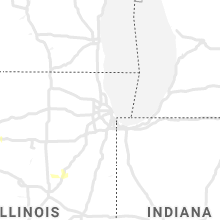
Illinois
| Local Time | Report Details |
|---|---|
| 1:48 PM CDT | Golf Ball sized hail reported near Gillespie, IL, 40.2 miles NNE of Saint Louis, MO, trained spotter at lake gillespie reported hail from dime to nickel size with a few as big as golfballs. |
| 3:04 PM CDT | Storm damage reported in adams county IL, 37.9 miles SSE of Kahoka, MO |
| 3:12 PM CDT | Quarter sized hail reported near Quincy, IL, 37.9 miles SSE of Kahoka, MO, at 8th and hampshire street. |
| 3:26 PM CDT | Storm damage reported in adams county IL, 38.1 miles SSE of Kahoka, MO |
| 4:28 PM CDT | Large tree blown dow in henry county IL, 57.4 miles NNW of Peoria, IL |
Ohio
| Local Time | Report Details |
|---|---|
| 3:06 PM EDT | An 11 inch tree branch was downe in hamilton county OH, 11.4 miles NNE of Cincinnati, OH |
| 3:29 PM EDT | Wires down in owensville. time estimated from rada in clermont county OH, 19.6 miles E of Cincinnati, OH |
| 3:36 PM EDT | A large branch was downed in batavia. time estimated from rada in clermont county OH, 17.5 miles E of Cincinnati, OH |
| 3:38 PM EDT | Tree uprooted onto ca in huron county OH, 55.6 miles WSW of Cleveland, OH |
| 4:15 PM EDT | A tree fell onto some powerlines in miami township. time estimated by rada in montgomery county OH, 38.9 miles NNE of Cincinnati, OH |
| 4:39 PM EDT | A couple trees down in the sidney area. a tree was also downed near port jefferson. time estimated by rada in shelby county OH, 65.3 miles WNW of Columbus, OH |
| 4:45 PM EDT | A small tree was snappe in champaign county OH, 40.9 miles WNW of Columbus, OH |
| 4:55 PM EDT | A tree was downed in peebles. time estimated from rada in adams county OH, 59.9 miles E of Cincinnati, OH |
| 4:56 PM EDT | Tree down. time estimated from rada in adams county OH, 65.2 miles E of Cincinnati, OH |
| 5:29 PM EDT | A tree was downed and a power pole was snapped along bethlehem-claibourne road. time estimated from rada in union county OH, 34 miles NNW of Columbus, OH |
| 5:36 PM EDT | Quarter sized hail reported near Wadsworth, OH, 30 miles S of Cleveland, OH, nickel to quarter-sized hail. also estimated 50 to 60 mph winds. |
| 5:40 PM EDT | A few trees down in western pike county... including along pine top road and also long fork road. time estimated from rada in pike county OH, 56.1 miles SSW of Columbus, OH |
| 5:45 PM EDT | Tree blocking sr-162 at burdett roa in medina county OH, 28.6 miles S of Cleveland, OH |
| 5:51 PM EDT | Tree down blocking sb lanes on 44 near barthowamill r in geauga county OH, 25.3 miles E of Cleveland, OH |
| 5:56 PM EDT | Tree down on shaw road in aubur in geauga county OH, 27.6 miles ESE of Cleveland, OH |
| 6:09 PM EDT | Tree down on hampton ridge dr at smith r in summit county OH, 25.8 miles SSE of Cleveland, OH |
| 6:38 PM EDT | Tree down along peniel road. time estimated from radar in gallia county OH, 54 miles WNW of Charleston, WV |
| 6:59 PM EDT | 2 trees down near centerbur in knox county OH, 28.3 miles NE of Columbus, OH |
| 7:35 PM EDT | Large tree branch near fredericktow in knox county OH, 43 miles NNE of Columbus, OH |
| 8:23 PM EDT | Tree down at mohican state par in ashland county OH, 59.5 miles NE of Columbus, OH |
South Dakota
| Local Time | Report Details |
|---|---|
| 1:10 PM MDT | 6 inch diameter tree branches broken off. estimate 50 mph wind in ziebach county SD, 101 miles NW of Pierre, SD |
| 2:40 PM CDT | Quarter sized hail reported near Vermillion, SD, 53.8 miles S of Sioux Falls, SD, hail up to quarter sized in diameter reported in vermillion. |
| 3:05 PM CDT | Quarter sized hail reported near Vermillion, SD, 47.8 miles S of Sioux Falls, SD |
| 3:20 PM CDT | Storm damage reported in union county SD, 38 miles S of Sioux Falls, SD |
| 3:20 PM CDT | Shingles dislodged and tossed into driveway. reported via social medi in union county SD, 36.6 miles S of Sioux Falls, SD |
| 3:30 PM CDT | Tree branches dow in union county SD, 32.2 miles S of Sioux Falls, SD |
| 2:55 PM MDT | Storm damage reported in stanley county SD, 32.7 miles W of Pierre, SD |
| 3:30 PM MDT | Quarter sized hail reported near Fort Pierre, SD, 18.2 miles WSW of Pierre, SD |
| 4:38 PM CDT | Storm damage reported in lincoln county SD, 15.7 miles SSW of Sioux Falls, SD |
| 4:39 PM CDT | Shed damaged by straight line winds. report received through social medi in lincoln county SD, 15.4 miles SSW of Sioux Falls, SD |
| 6:30 PM MDT | Storm damage reported in fall river county SD, 45.7 miles S of Rapid City, SD |
Arkansas
| Local Time | Report Details |
|---|---|
| 2:25 PM CDT | Tree limb was blown dow in drew county AR, 58.7 miles N of Bastrop, LA |
| 4:05 PM CDT | Quarter sized hail reported near Green Forest, AR, 60.5 miles S of Springfield, MO |
| 6:25 PM CDT | Powerlines downed in crossett. time estimated based on rada in ashley county AR, 24.4 miles N of Bastrop, LA |
| 9:00 PM CDT | Trees and power lines down across the count in hempstead county AR, 24.2 miles SE of Nashville, AR |
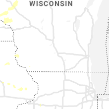
Wisconsin
| Local Time | Report Details |
|---|---|
| 2:42 PM CDT | Quarter sized hail reported near Cable, WI, 55.4 miles SE of Duluth, MN, time estimated from radar. |
| 3:12 PM CDT | Quarter sized hail reported near Hayward, WI, 62.1 miles SE of Duluth, MN, leaves striped from trees. ground covered in hail. time estimated from radar. |
| 3:25 PM CDT | Quarter sized hail reported near La Pointe, WI, 62.7 miles E of Duluth, MN, report from mping: quarter (1.00 in.) time of report adjusted based on radar. |
| 4:40 PM CDT | A dozen or more healthy trees down between griffith rd and neuberger r in ashland county WI, 61.3 miles WNW of Rhinelander, WI |
| 4:40 PM CDT | Trees down along neuberger rd and highway 1 in ashland county WI, 62.1 miles WNW of Rhinelander, WI |
Pennsylvania
| Local Time | Report Details |
|---|---|
| 3:57 PM EDT | Trees down along valley view rd. in nottingham township in washington county PA, 16.1 miles SSW of Pittsburgh, PA |
| 4:02 PM EDT | Trees and wires down south strabane twp in washington county PA, 20.3 miles SSW of Pittsburgh, PA |
| 4:06 PM EDT | Trees and wires down in washington county PA, 21.1 miles SSW of Pittsburgh, PA |
| 4:24 PM EDT | Tree down along ridge church rd. in amwell in washington county PA, 28.1 miles SSW of Pittsburgh, PA |
| 4:28 PM EDT | Trees and wires down near robinson rd. in cokeburg in washington county PA, 24.6 miles SSW of Pittsburgh, PA |
| 5:19 PM EDT | Trees reported down in hartwood acre in allegheny county PA, 10.2 miles NNE of Pittsburgh, PA |
| 5:32 PM EDT | Trees down near new castle on harbor road in lawrence county PA, 45.7 miles NNW of Pittsburgh, PA |
Tennessee
| Local Time | Report Details |
|---|---|
| 4:14 PM EDT | Trees dow in jefferson county TN, 21.9 miles ENE of Knoxville, TN |
| 4:18 PM EDT | Several trees dow in bradley county TN, 31 miles ENE of Chattanooga, TN |
| 4:32 PM EDT | Several trees dow in mcminn county TN, 41.5 miles ENE of Chattanooga, TN |
| 4:41 PM EDT | Trees down county-wid in hamblen county TN, 36.5 miles ENE of Knoxville, TN |
| 4:42 PM EDT | Trees down county-wid in hamblen county TN, 46.3 miles ENE of Knoxville, TN |
| 4:58 PM EDT | Numerous trees and power lines in the athens are in mcminn county TN, 49.3 miles NE of Chattanooga, TN |
| 5:01 PM EDT | Several trees down blocking road in grainger county TN, 44.3 miles NE of Knoxville, TN |
| 5:20 PM EDT | Numerous trees dow in hancock county TN, 57.2 miles W of Bristol, TN |
| 5:21 PM EDT | Numerous trees dow in hancock county TN, 55.1 miles W of Bristol, TN |
| 6:04 PM EDT | Several trees dow in polk county TN, 54.7 miles E of Chattanooga, TN |
| 6:41 PM EDT | Several trees dow in cocke county TN, 52.8 miles E of Knoxville, TN |
Georgia
| Local Time | Report Details |
|---|---|
| 4:25 PM EDT | 911 center reports several trees down along meadow lakes court ne of cedartow in polk county GA, 52.8 miles WNW of Atlanta, GA |
| 4:50 PM EDT | 911 center reports several trees down along meadow lakes court ne of cedartow in polk county GA, 52.8 miles WNW of Atlanta, GA |
| 5:20 PM EDT | Tree reported down near the intersection of mcintosh pkwy and greison trai in coweta county GA, 33.9 miles SW of Atlanta, GA |
| 5:49 PM EDT | Tree reported down near the intersection of shell rd and tommy lee cook r in coweta county GA, 26 miles SW of Atlanta, GA |
| 5:58 PM EDT | Tree reported down near the intersection of lester road and buckingham d in fayette county GA, 23.5 miles SSW of Atlanta, GA |
| 6:22 PM EDT | Media reports structural damage at fuel south at the corner of ga-85 and ga-109 in meriwether county GA, 54 miles S of Atlanta, GA |
| 6:47 PM EDT | Trees blown down along lankford rd southeast of lavonia... g in hart county GA, 39.4 miles SW of Greenville, SC |
| 7:00 PM EDT | 911 reports 3 trees down along wilson mount r in union county GA, 75.6 miles W of Greenville, SC |
| 10:25 PM EDT | Burke co dispatch reported trees down near botsford church rd and hwy 23. time estimate in burke county GA, 26.5 miles SSE of Augusta, GA |
Michigan
| Local Time | Report Details |
|---|---|
| 4:28 PM EDT | Numerous large trees were blown down on the north side of holly. one tree fell onto a pickup truck. no injuries have been reporte in oakland county MI, 12.9 miles SSE of Flint, MI |
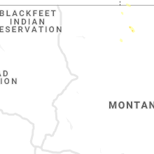
Montana
| Local Time | Report Details |
|---|---|
| 3:00 PM MDT | Quarter sized hail reported near Havre, MT, 0.2 miles SSE of Havre, MT, corrects previous hail report from 1 ene havre. half to one inch diameter hail was reported. minor street flooding and a 53 mph wind gust was also observed. a picture v |
North Carolina
| Local Time | Report Details |
|---|---|
| 5:30 PM EDT | Trees blown down just se of fines creek... n in haywood county NC, 56.3 miles ESE of Knoxville, TN |
| 6:38 PM EDT | Corrects previous tstm wnd dmg report from 1 se murphy. tree fell on top of two houses on smoke rise driv in cherokee county NC, 61 miles S of Knoxville, TN |
| 6:38 PM EDT | Tree fell on top of two houses on smoke rise driv in cherokee county NC, 61.5 miles S of Knoxville, TN |
| 8:36 PM EDT | Trees down along vein mtn rd sw of dysartsville... n in mcdowell county NC, 64.2 miles NE of Greenville, SC |
| 8:38 PM EDT | Trees blown down in the vicinity of yancey rd and hankins r in mcdowell county NC, 61.9 miles S of Bristol, TN |
| 9:14 PM EDT | One tree blown down off calico r in caldwell county NC, 61 miles NW of Charlotte, NC |
Wyoming
| Local Time | Report Details |
|---|---|
| 4:26 PM MDT | Storm damage reported in campbell county WY, 25.2 miles S of Gillette, WY |
Louisiana
| Local Time | Report Details |
|---|---|
| 5:35 PM CDT | Powerlines down & outages reported around this time in ferriday. time estimated based upon radar & outage tim in concordia county LA, 82 miles SSE of Bastrop, LA |
Mississippi
| Local Time | Report Details |
|---|---|
| 6:27 PM CDT | 2 to 3 trees downed along low water bridge road near highway 61. time estimated based on rada in sharkey county MS, 50.6 miles WNW of Jackson, MS |
| 7:00 PM CDT | Tree downed at the intersection of highway 22 and trotter road. likely sub-severe wind gust. time estimated based on rada in hinds county MS, 18.4 miles NW of Jackson, MS |
| 8:15 PM CDT | Trees and power lines down in northeast jackso in hinds county MS, 4.8 miles NNE of Jackson, MS |
Colorado
| Local Time | Report Details |
|---|---|
| 5:34 PM MDT | Awos station k1mw mike madi in logan county CO, 56.6 miles NW of Yuma, CO |
| 6:05 PM MDT | Report from mping: 1-inch tree limbs broken; shingles blown of in arapahoe county CO, 9.4 miles SE of Denver, CO |
Nebraska
| Local Time | Report Details |
|---|---|
| 6:35 PM CDT | Estimated wind with some branches down. pea to dime size hail. 1 to 2 inches of rai in sherman county NE, 30.2 miles NW of Grand Island, NE |
| 6:41 PM CDT | Quarter sized hail reported near Elwood, NE, 57.7 miles ESE of North Platte, NE |
| 6:42 PM CDT | Half Dollar sized hail reported near Elwood, NE, 56 miles ESE of North Platte, NE, social media report. |
| 8:30 PM CDT | Call from the e in phelps county NE, 67.3 miles WSW of Grand Island, NE |
| 9:10 PM CDT | Corrects previous non-tstm wnd gst report from 4 nne north platte. mesonet station ew7235 north platte 4 in lincoln county NE, 3.8 miles N of North Platte, NE |
| 9:15 PM CDT | Half Dollar sized hail reported near North Platte, NE, 6.6 miles SE of North Platte, NE |
| 9:29 PM CDT | Quarter sized hail reported near North Platte, NE, 6.6 miles SE of North Platte, NE, report with photo via soical media. largest stone the size of a quarter |
South Carolina
| Local Time | Report Details |
|---|---|
| 9:05 PM EDT | Nws employee reported tree down on river rd near batesville r in greenville county SC, 20.1 miles E of Greenville, SC |
| 9:12 PM EDT | One tree blown down along christopher s in spartanburg county SC, 27.2 miles ENE of Greenville, SC |
| 9:24 PM EDT | Trees reported down off john dodd r in spartanburg county SC, 36.6 miles ENE of Greenville, SC |
Connect with Interactive Hail Maps