

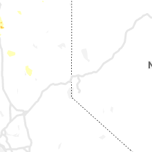
Hail Map for Friday, May 24, 2019

Number of Impacted Households on 5/24/2019
0
Impacted by 1" or Larger Hail
0
Impacted by 1.75" or Larger Hail
0
Impacted by 2.5" or Larger Hail
Square Miles of Populated Area Impacted on 5/24/2019
0
Impacted by 1" or Larger Hail
0
Impacted by 1.75" or Larger Hail
0
Impacted by 2.5" or Larger Hail


Cities Most Affected by Hail Storms of 5/24/2019
| Hail Size | Demographics of Zip Codes Affected | ||||||
|---|---|---|---|---|---|---|---|
| City | Count | Average | Largest | Pop Density | House Value | Income | Age |
| Iraan, TX | 2 | 1.88 | 2.00 | 0 | $42k | $46.3k | 37.4 |
| Lubbock, TX | 2 | 1.75 | 1.75 | 551 | $73k | $37.6k | 31.8 |
| Wolfforth, TX | 2 | 1.75 | 1.75 | 120 | $62k | $36.7k | 35.3 |
| Quanah, TX | 1 | 2.75 | 2.75 | 5 | $30k | $28.1k | 43.6 |
| Reydon, OK | 1 | 1.79 | 1.79 | 3 | $31k | $29.8k | 40.0 |
| Hopedale, IL | 1 | 1.75 | 1.75 | 30 | $91k | $47.7k | 41.8 |
| Lorenzo, TX | 1 | 1.75 | 1.75 | 6 | $37k | $29.1k | 35.4 |
| Redding, CA | 1 | 1.75 | 1.75 | 1101 | $118k | $34.5k | 37.5 |
| Shasta Lake, CA | 1 | 1.75 | 1.75 | 861 | $86k | $25.9k | 38.6 |
Hail and Wind Damage Spotted on 5/24/2019
Filter by Report Type:Hail ReportsWind Reports
States Impacted
Iowa, Illinois, Kansas, Texas, Oklahoma, North Dakota, Minnesota, Missouri, California, WisconsinIowa
| Local Time | Report Details |
|---|---|
| 7:23 AM CDT | Measured via anemomete in jasper county IA, 26.9 miles ENE of Des Moines, IA |
| 9:18 AM CDT | Three locations along e17 and 150th ave about 3 miles southeast of langworthy had trees blown down and large branches blown down. time estimated. relayed by emergency m in jones county IA, 28.4 miles ENE of Cedar Rapids, IA |
| 6:47 PM CDT | Extensive tree damage on sharon center rd... likely tornado damag in johnson county IA, 24.8 miles S of Cedar Rapids, IA |
| 11:34 PM CDT | Tree blown dow in des moines county IA, 41.8 miles NE of Kahoka, MO |
| 11:40 PM CDT | Tree blown dow in des moines county IA, 48.4 miles NE of Kahoka, MO |
Illinois
| Local Time | Report Details |
|---|---|
| 5:32 PM UTC | Emergency manager reported power out on the north side of industry. possible tornad in mcdonough county IL, 58.9 miles E of Kahoka, MO |
| 12:33 PM CDT | (possible tornado) trees and power lines down along us 67 ~ 6 south of macom in mcdonough county IL, 56.7 miles WSW of Peoria, IL |
| 12:33 PM CDT | A home damaged with debris blown across the field onto highway 67. power poles were leaning over. between road 700 and 500. possible tornado. time was estimated using r in mcdonough county IL, 57.2 miles E of Kahoka, MO |
| 1:03 PM CDT | 1-2 foot diameter trees blown down in town..including one blocking the road on the west side of tow in fulton county IL, 45.2 miles WSW of Peoria, IL |
| 6:28 PM UTC | Quarter sized hail reported near Lewistown, IL, 36.2 miles WSW of Peoria, IL |
| 6:37 PM UTC | Measured wind speed of 50 mph in fulton county IL, 37.6 miles SW of Peoria, IL |
| 6:49 PM UTC | Quarter sized hail reported near Canton, IL, 28 miles WSW of Peoria, IL |
| 2:20 PM CDT | Power lines and power poles down in tazewell county IL, 18.6 miles SSW of Peoria, IL |
| 2:33 PM CDT | Quarter sized hail reported near Hopedale, IL, 20.7 miles SSE of Peoria, IL |
| 2:35 PM CDT | Quarter sized hail reported near Mackinaw, IL, 16.4 miles SE of Peoria, IL |
| 7:39 PM UTC | Storm damage reported in tazewell county IL, 21.6 miles SSE of Peoria, IL |
| 2:44 PM CDT | Golf Ball sized hail reported near Hopedale, IL, 21.7 miles SSE of Peoria, IL |
| 2:45 PM CDT | Quarter sized hail reported near Hopedale, IL, 20.1 miles SSE of Peoria, IL |
| 2:46 PM CDT | Quarter sized hail reported near Minier, IL, 23.3 miles SE of Peoria, IL, corner of machinaw and shilo road. 2050e and 1900n. |
| 2:56 PM CDT | Power lines and power poles down in tazewell county IL, 18.6 miles SSW of Peoria, IL |
Kansas
| Local Time | Report Details |
|---|---|
| 1:42 PM CDT | Quarter sized hail reported near Clearwater, KS, 13.1 miles SSW of Wichita, KS, nickel to quarter size hail. |
| 1:50 PM CDT | Quarter sized hail reported near Wichita, KS, 6.1 miles SSW of Wichita, KS, kwch relayed report of nickel to quarter size hail at 47th and west. |
| 1:55 PM CDT | Quarter sized hail reported near Wichita, KS, 4.6 miles SSW of Wichita, KS, mping report of quarter size hail. |
| 2:00 PM CDT | Quarter sized hail reported near Wichita, KS, 1.4 miles WSW of Wichita, KS, via social media. |
| 2:07 PM CDT | Quarter sized hail reported near Wichita, KS, 1.5 miles SE of Wichita, KS |
| 7:45 PM UTC | Corrected for location in butler county KS, 20 miles E of Wichita, KS |
| 7:45 PM UTC | Storm damage reported in kingman county KS, 34.8 miles W of Wichita, KS |
| 8:43 PM UTC | Quarter sized hail reported near Anthony, KS, 52.6 miles SW of Wichita, KS |
| 4:19 PM CDT | Emergency management confirms that several tree limbs are down and amateur radio also says a few light poles are dow in butler county KS, 21.3 miles ESE of Wichita, KS |
| 4:40 PM CDT | Quarter sized hail reported near Leon, KS, 29.4 miles E of Wichita, KS, nickel to quarter size hail west of leon on hwy 400. also 40+mph winds. |
| 4:45 PM CDT | Report of shed blown over and several tree limbs down. time estimated by rada in coffey county KS, 56.2 miles NNW of Chanute, KS |
| 9:50 PM UTC | Large building sustained significant damage due to inflow storm wind in butler county KS, 31.1 miles E of Wichita, KS |
| 10:05 PM UTC | Scattered reports of minor wind damage from around goddard in sedgwick county KS, 13.5 miles W of Wichita, KS |
| 10:06 PM UTC | Power lines down from wind damage in sedgwick county KS, 7 miles WNW of Wichita, KS |
| 10:14 PM UTC | Storm damage reported in sedgwick county KS, 7 miles WNW of Wichita, KS |
| 10:18 PM UTC | Storm damage reported in sedgwick county KS, 6.2 miles WNW of Wichita, KS |
| 10:21 PM UTC | Tree damage reporte in sedgwick county KS, 6.3 miles W of Wichita, KS |
| 5:22 PM CDT | Delayed report...downed tree. time estimated based on rada in sedgwick county KS, 1.9 miles W of Wichita, KS |
| 10:23 PM UTC | Storm damage reported in sedgwick county KS, 0.3 miles NW of Wichita, KS |
| 10:41 PM UTC | Storm damage reported in anderson county KS, 42.8 miles NNE of Chanute, KS |
| 5:50 PM CDT | Report via social medi in coffey county KS, 55.3 miles NNW of Chanute, KS |
| 11:40 PM UTC | Delayed report from personal weather statio in coffey county KS, 38.6 miles NNW of Chanute, KS |
| 11:50 PM UTC | Lawrence airpor in douglas county KS, 34.3 miles W of Kansas City, MO |
| 11:50 PM UTC | Storm damage reported in douglas county KS, 30.3 miles WSW of Kansas City, MO |
| 11:50 PM UTC | Picture of a 4 to 8 inch tree limb downe in douglas county KS, 30 miles WSW of Kansas City, MO |
| 7:00 PM CDT | Quarter sized hail reported near Hiawatha, KS, 72 miles NE of Manhattan, KS |
| 12:00 AM UTC | Power pole snapped in half... time estimated by rada in leavenworth county KS, 27.7 miles WSW of Kansas City, MO |
| 7:00 PM CDT | Dispatch reports power poles blown down near the sherman townshi in leavenworth county KS, 22.5 miles WSW of Kansas City, MO |
| 7:00 PM CDT | Powerlines are dow in douglas county KS, 31.3 miles WSW of Kansas City, MO |
| 12:04 AM UTC | Many other locations across the county were reporting 50 mph wind in greenwood county KS, 43.8 miles WNW of Chanute, KS |
| 12:05 AM UTC | Arcing powerline in douglas county KS, 29.7 miles WSW of Kansas City, MO |
| 12:40 AM UTC | Storm damage reported in johnson county KS, 15.6 miles SSW of Kansas City, MO |
Texas
| Local Time | Report Details |
|---|---|
| 1:59 PM CDT | Half Dollar sized hail reported near Wolfforth, TX, 13.8 miles SW of Lubbock, TX, quarter size hail falling for 20 minutes |
| 2:06 PM CDT | Half Dollar sized hail reported near Lubbock, TX, 9.6 miles SW of Lubbock, TX |
| 2:09 PM CDT | Quarter sized hail reported near Wolfforth, TX, 10.5 miles WSW of Lubbock, TX, falling at city hall |
| 2:09 PM CDT | Golf Ball sized hail reported near Wolfforth, TX, 13.6 miles SW of Lubbock, TX, falling along the brownfield highway southwest of wolfforth |
| 2:10 PM CDT | Half Dollar sized hail reported near Lubbock, TX, 7.9 miles S of Lubbock, TX |
| 2:10 PM CDT | Half Dollar sized hail reported near Lubbock, TX, 10.1 miles W of Lubbock, TX |
| 2:18 PM CDT | Quarter sized hail reported near Lubbock, TX, 4.5 miles SSW of Lubbock, TX, falling at nws office |
| 2:25 PM CDT | Quarter sized hail reported near Lubbock, TX, 0.9 miles SSW of Lubbock, TX, reported on the texas tech campus |
| 2:31 PM CDT | Quarter sized hail reported near Lubbock, TX, 6 miles W of Lubbock, TX |
| 3:04 PM CDT | Golf Ball sized hail reported near Lorenzo, TX, 20.2 miles ENE of Lubbock, TX |
| 8:23 PM UTC | Quarter sized hail reported near Post, TX, 25.6 miles SE of Lubbock, TX |
| 3:50 PM CDT | Measured by the texas tech university west texas mesonet in motley county TX, 49.8 miles SW of Childress, TX |
| 8:50 PM UTC | Tree damage and power lines down in the cit in motley county TX, 52.1 miles SW of Childress, TX |
| 8:55 PM UTC | Reported by nssl mobile mesonet in motley county TX, 49.3 miles SW of Childress, TX |
| 3:57 PM CDT | Hen Egg sized hail reported near Iraan, TX, 67.9 miles SSE of Odessa, TX, golf ball to lime size hail a few miles from bakersfield on interstate 10. location estimated from radar. |
| 3:57 PM CDT | Hen Egg sized hail reported near , , 66.1 miles S of Odessa, TX, golf ball to lime size hail a few miles from bakersfield on interstate 10. location estimated from radar. corrected from previous report for location. |
| 4:03 PM CDT | Quarter sized hail reported near Matador, TX, 44.9 miles SW of Childress, TX |
| 4:10 PM CDT | Quarter sized hail reported near , , 66.1 miles S of Odessa, TX, video seen on snapchat of cracked windshield due to hail. exact size of largest hail unknown. |
| 9:12 PM UTC | Reported by nssl mobile mesonet in motley county TX, 38.7 miles SW of Childress, TX |
| 4:48 PM CDT | Golf Ball sized hail reported near Wolfforth, TX, 10.5 miles WSW of Lubbock, TX, reported at city hall |
| 4:49 PM CDT | Half Dollar sized hail reported near Lubbock, TX, 10.2 miles WSW of Lubbock, TX |
| 4:49 PM CDT | Ping Pong Ball sized hail reported near Lubbock, TX, 10.2 miles WSW of Lubbock, TX |
| 5:04 PM CDT | Golf Ball sized hail reported near Lubbock, TX, 8.7 miles SW of Lubbock, TX |
| 5:08 PM CDT | Half Dollar sized hail reported near Lubbock, TX, 3.7 miles W of Lubbock, TX, mostly quarter size but few half dollar mixed in. |
| 5:39 PM CDT | Quarter sized hail reported near Ralls, TX, 28.1 miles ENE of Lubbock, TX |
| 6:19 PM CDT | Quarter sized hail reported near Quanah, TX, 32.2 miles ESE of Childress, TX |
| 6:20 PM CDT | Golf Ball sized hail reported near Iraan, TX, 68.6 miles SSE of Odessa, TX, report with photograph of golf ball size hail at mile marker 307 on interstate 10. |
| 6:25 PM CDT | Baseball sized hail reported near Quanah, TX, 32.3 miles ESE of Childress, TX |
| 12:10 AM UTC | Storm damage reported in reagan county TX, 47.6 miles ESE of Odessa, TX |
| 7:15 PM CDT | Golf Ball sized hail reported near Lubbock, TX, 4.5 miles NW of Lubbock, TX, lots of hail... maximum size between 1.5 and 1.75 inch diameter |
| 7:19 PM CDT | Ping Pong Ball sized hail reported near Vernon, TX, 52.3 miles WNW of Wichita Falls, TX, 1.5 miles south of northside school. |
| 8:27 PM CDT | Quarter sized hail reported near Abernathy, TX, 15.1 miles N of Lubbock, TX |
Oklahoma
| Local Time | Report Details |
|---|---|
| 3:10 PM CDT | Golf Ball sized hail reported near Reydon, OK, 62.1 miles SSW of Woodward, OK |
| 9:32 PM UTC | Quarter sized hail reported near Woodward, OK, 9.5 miles NW of Woodward, OK |
| 5:02 PM CDT | Storm damage reported in major county OK, 64.6 miles E of Woodward, OK |
| 5:10 PM CDT | Half Dollar sized hail reported near Ringwood, OK, 64.6 miles E of Woodward, OK, time estimated from radar. |
| 10:47 PM UTC | Storm damage reported in jackson county OK, 26.9 miles ENE of Childress, TX |
| 11:07 PM UTC | Awos station kend enid vance af in garfield county OK, 62.6 miles NNW of Oklahoma City, OK |
| 6:15 PM CDT | Quarter sized hail reported near Enid, OK, 67.1 miles NNW of Oklahoma City, OK |
| 6:31 PM CDT | Max winds reported for altus was 78 mph. emergency manager and spotter measured confirme in jackson county OK, 52.3 miles ENE of Childress, TX |
| 6:33 PM CDT | High straightline winds... 70 mph+ measured... trees down... streetlights ou in jackson county OK, 52.3 miles ENE of Childress, TX |
| 11:35 PM UTC | Storm damage reported in jackson county OK, 51.6 miles ENE of Childress, TX |
| 11:35 PM UTC | 35 year old trees down. swing set tossed against house. twitter repor in kiowa county OK, 65.6 miles ENE of Childress, TX |
| 11:40 PM UTC | Storm damage reported in jackson county OK, 51.6 miles ENE of Childress, TX |
| 11:42 PM UTC | Awos station klts altus af in jackson county OK, 56.2 miles ENE of Childress, TX |
| 11:42 PM UTC | Storm damage reported in garfield county OK, 63.5 miles NNW of Oklahoma City, OK |
| 6:42 PM CDT | Debris on road in jackson county OK, 59.6 miles ENE of Childress, TX |
| 6:48 PM CDT | Storm damage reported in jackson county OK, 54.9 miles ENE of Childress, TX |
| 6:51 PM CDT | Scattered building damage...windows blown out in business at w commerce and n main. large branches dow in jackson county OK, 52.3 miles ENE of Childress, TX |
| 6:55 PM CDT | Storm damage reported in jackson county OK, 52.3 miles ENE of Childress, TX |
| 11:55 PM UTC | Storm damage reported in garfield county OK, 63.5 miles NNW of Oklahoma City, OK |
| 12:05 AM UTC | Storm damage reported in tillman county OK, 46.9 miles NW of Wichita Falls, TX |
| 12:06 AM UTC | Trailer house blown out into the road blocking the road... and a large tree is blown over on park lan in jackson county OK, 54.1 miles ENE of Childress, TX |
| 7:06 PM CDT | Trailer house blown out into the road blocking the road... and a large tree is blown over on park lan in jackson county OK, 52.3 miles ENE of Childress, TX |
| 12:16 AM UTC | Storm damage reported in kiowa county OK, 76.1 miles ENE of Childress, TX |
| 12:16 AM UTC | Asos station khbr hobar in kiowa county OK, 76.2 miles ENE of Childress, TX |
| 12:24 AM UTC | Storm damage reported in noble county OK, 64.8 miles N of Oklahoma City, OK |
| 7:29 PM CDT | Storm damage reported in kiowa county OK, 74.6 miles N of Wichita Falls, TX |
| 12:41 AM UTC | Time estimated from radar in tillman county OK, 43.2 miles NW of Wichita Falls, TX |
| 12:44 AM UTC | Storm damage reported in tillman county OK, 43.2 miles NW of Wichita Falls, TX |
| 12:44 AM UTC | Storm damage reported in caddo county OK, 66.7 miles WSW of Oklahoma City, OK |
| 12:44 AM UTC | Large tree limbs down. twitter report. time estimated from rada in kay county OK, 69.5 miles SSE of Wichita, KS |
| 12:45 AM UTC | Six inch trees down about 11 south of carnegie and 3 m west of 58 hwy in caddo county OK, 70.9 miles WSW of Oklahoma City, OK |
| 12:47 AM UTC | Peak wind of 68 mph... barn destroyed. north of mountain park and 2 miles east of 8 in kiowa county OK, 59.6 miles NNW of Wichita Falls, TX |
| 12:47 AM UTC | Peak wind of 68 mph... barn destroyed... trees down... siding pulled away from south side of house... lost another outbuilding... downed power lines on property. 6.5 mi in kiowa county OK, 64.5 miles NNW of Wichita Falls, TX |
| 1:04 AM UTC | Storm damage reported in comanche county OK, 47.9 miles N of Wichita Falls, TX |
| 1:04 AM UTC | Storm damage reported in comanche county OK, 47.9 miles N of Wichita Falls, TX |
| 9:23 PM CDT | Asos station kokc oklahoma cit in oklahoma county OK, 7.8 miles SW of Oklahoma City, OK |
| 9:27 PM CDT | Damage in area of nw 28th and nesbitt included two metal detached carports blown away... trees down... and one power pole or street light pole down with a downed power in oklahoma county OK, 4.4 miles WNW of Oklahoma City, OK |
| 9:30 PM CDT | Powerlines down at sw 80th and ma in oklahoma county OK, 6.3 miles SSW of Oklahoma City, OK |
North Dakota
| Local Time | Report Details |
|---|---|
| 6:10 PM CDT | Quarter sized hail reported near Luverne, ND, 60.8 miles WNW of Fargo, ND |
| 6:10 PM CDT | Ping Pong Ball sized hail reported near Luverne, ND, 62.2 miles WNW of Fargo, ND, picture on twitter of hail compared to a quarter with stone about 1.5 times larger |
| 6:12 PM CDT | Ping Pong Ball sized hail reported near Luverne, ND, 62.2 miles WNW of Fargo, ND, picture on twitter of hail compared to a quarter with stone about 1.5 times larger |
| 6:21 PM CDT | Images of blades bent on wind turbines west of hope with time estimated based on radar in steele county ND, 54.6 miles NW of Fargo, ND |
| 11:21 PM UTC | Images of blades bent on wind turbines west of hope with time estimated based on radar in steele county ND, 59.8 miles WNW of Fargo, ND |
| 11:30 PM UTC | Public reported personal weather station reported a wind gusts up to 71 mp in steele county ND, 56.2 miles WNW of Fargo, ND |
| 6:31 PM CDT | Quarter sized hail reported near Hope, ND, 53.5 miles NW of Fargo, ND, hail for the past 7 minutes |
Minnesota
| Local Time | Report Details |
|---|---|
| 7:36 PM CDT | Awos reported 73 mph wind gust associated with a passing thunderstor in mahnomen county MN, 47.8 miles NE of Fargo, ND |
| 8:15 PM CDT | Ping Pong Ball sized hail reported near Gary, MN, 43.2 miles NNE of Fargo, ND, report via mping with time estimated based on radar |
Missouri
| Local Time | Report Details |
|---|---|
| 7:50 PM CDT | 12 inch diameter tree down...time estimated via rada in jackson county MO, 10.7 miles SSE of Kansas City, MO |
| 8:02 PM CDT | Trees dow in cass county MO, 27.7 miles SE of Kansas City, MO |
| 8:20 PM CDT | Damage to barn...time estimated via rada in johnson county MO, 34.3 miles ESE of Kansas City, MO |
California
| Local Time | Report Details |
|---|---|
| 7:52 PM PDT | Golf Ball sized hail reported near Shasta Lake, CA, 6.8 miles NNE of Redding, CA, golf ball size hail reported in shasta lake city. picture sent via twitter. |
| 8:10 PM PDT | Golf Ball sized hail reported near Redding, CA, 4.3 miles ESE of Redding, CA, golf ball size hail reported in redding. |
| 8:12 PM PDT | Quarter sized hail reported near Redding, CA, 3 miles SE of Redding, CA, quarter size hail was reported near enterprise high school in redding. |
| 8:13 PM PDT | Ping Pong Ball sized hail reported near Redding, CA, 3.4 miles SE of Redding, CA, ping pong sized hail was reported near hartnell ave and victor ave in redding... ca. picture on twitter. |
| 8:53 PM PDT | Redding aiprot reported a 58 mph wind gus in shasta county CA, 7.6 miles SE of Redding, CA |
| 5:00 AM UTC | Concow road pg&e weather statio in butte county CA, 72.7 miles SE of Redding, CA |
| 10:24 PM PDT | Ping Pong Ball sized hail reported near Redding, CA, 3.4 miles SE of Redding, CA, ping pong sized hail was reported near hartnell ave and victor ave in redding... ca. picture on twitter. |
Wisconsin
| Local Time | Report Details |
|---|---|
| 1:45 AM CDT | Dane county dispatch reports trees and wires down in stoughton. time estimated using radar and public safety call log in dane county WI, 13.5 miles SE of Madison, WI |
Connect with Interactive Hail Maps