

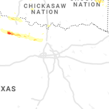
Hail Map for Thursday, May 27, 2021

Number of Impacted Households on 5/27/2021
0
Impacted by 1" or Larger Hail
0
Impacted by 1.75" or Larger Hail
0
Impacted by 2.5" or Larger Hail
Square Miles of Populated Area Impacted on 5/27/2021
0
Impacted by 1" or Larger Hail
0
Impacted by 1.75" or Larger Hail
0
Impacted by 2.5" or Larger Hail


Cities Most Affected by Hail Storms of 5/27/2021
| Hail Size | Demographics of Zip Codes Affected | ||||||
|---|---|---|---|---|---|---|---|
| City | Count | Average | Largest | Pop Density | House Value | Income | Age |
| Odessa, TX | 2 | 2.25 | 2.50 | 3083 | $44k | $29.1k | 32.0 |
| Eufaula, OK | 2 | 1.75 | 1.75 | 45 | $67k | $25.1k | 49.5 |
| Basehor, KS | 2 | 1.75 | 1.75 | 239 | $122k | $60.1k | 39.8 |
| Quanah, TX | 1 | 2.50 | 2.50 | 5 | $30k | $28.1k | 43.6 |
| Sanderson, TX | 1 | 2.00 | 2.00 | 0 | $26k | $23.9k | 44.7 |
| Rogers, AR | 1 | 2.00 | 2.00 | 297 | $93k | $37.4k | 35.4 |
| Sterling City, TX | 1 | 2.00 | 2.00 | 0 | $53k | $35.3k | 41.8 |
| Guthrie, OK | 1 | 1.75 | 1.75 | 79 | $68k | $34.3k | 38.7 |
| Springdale, AR | 1 | 1.75 | 1.75 | 893 | $86k | $34.2k | 28.8 |
| Ringwood, OK | 1 | 1.75 | 1.75 | 10 | $50k | $30.6k | 38.6 |
| Imperial, TX | 1 | 1.75 | 1.75 | 0 | $22k | $26.7k | 41.9 |
| Fort Stockton, TX | 1 | 1.75 | 1.75 | 6 | $41k | $27.4k | 36.2 |
Hail and Wind Damage Spotted on 5/27/2021
Filter by Report Type:Hail ReportsWind Reports
States Impacted
Kansas, Illinois, Missouri, Oklahoma, Washington, Texas, Arkansas, Iowa, Indiana, LouisianaKansas
| Local Time | Report Details |
|---|---|
| 7:40 AM CDT | Shed blown down time estimate in lyon county KS, 57.5 miles SSE of Manhattan, KS |
| 10:47 AM CDT | Tree limbs up to an inch in diameter were reported broken. a few shingles were blown off a hous in cherokee county KS, 61.9 miles SE of Chanute, KS |
| 5:30 PM CDT | Storm damage reported in leavenworth county KS, 19.8 miles W of Kansas City, MO |
| 5:37 PM CDT | Golf Ball sized hail reported near Basehor, KS, 19.3 miles W of Kansas City, MO, report of golf ball sized hail and 65mph winds in basehor. |
| 5:37 PM CDT | Golf Ball sized hail reported near Basehor, KS, 18.7 miles W of Kansas City, MO |
| 5:50 PM CDT | Quarter sized hail reported near Kansas City, KS, 14 miles W of Kansas City, MO, report from mping: quarter (1.00 in.). |
| 5:52 PM CDT | Quarter sized hail reported near Basehor, KS, 18.2 miles WNW of Kansas City, MO, report from mping: quarter (1.00 in.). |
| 5:52 PM CDT | Ping Pong Ball sized hail reported near Kansas City, KS, 12.5 miles WNW of Kansas City, MO |
| 5:56 PM CDT | Quarter sized hail reported near Kansas City, KS, 13.4 miles W of Kansas City, MO, 1 inch hail reported on social media... a picture verifying measurement was provided. location was near legends near kc speedway. |
Illinois
| Local Time | Report Details |
|---|---|
| 10:15 AM CDT | Power line and trees down. time estimated by radar. relayed by broadcast medi in morgan county IL, 73.7 miles SSW of Peoria, IL |
| 12:23 PM CDT | 2 inch diameter tree limb blown of in madison county IL, 23.6 miles N of Saint Louis, MO |
| 12:27 PM CDT | Numerous tree limbs and several trees blown down on the south side of godfre in madison county IL, 22.2 miles N of Saint Louis, MO |
| 12:35 PM CDT | Power lines and trees down in roadway. time estimated by rada in sangamon county IL, 63.7 miles S of Peoria, IL |
| 12:40 PM CDT | Numerous tree limbs down. time estimated by rada in sangamon county IL, 64.4 miles S of Peoria, IL |
| 12:44 PM CDT | Several large trees blown down. one large tree fell onto a pole barn causing moderate damage. tree also knocked gas meter off of the hous in macoupin county IL, 29.3 miles NNE of Saint Louis, MO |
| 12:50 PM CDT | Tree damage. time estimated by rada in sangamon county IL, 58.9 miles S of Peoria, IL |
| 12:52 PM CDT | Power pole leaning ove in sangamon county IL, 58.3 miles S of Peoria, IL |
| 2:54 PM CDT | Quarter sized hail reported near Waterloo, IL, 20.7 miles S of Saint Louis, MO |
| 3:15 PM CDT | Power line down. relayed by ema. time estimated by rada in clay county IL, 59.6 miles SSW of Mattoon, IL |
| 3:38 PM CDT | Tree fell on cars. relayed by em in clay county IL, 54.6 miles S of Mattoon, IL |
| 3:45 PM CDT | Tree damage... minor structure damag in clay county IL, 52.6 miles S of Mattoon, IL |
| 3:45 PM CDT | Trees downe in clay county IL, 51.9 miles S of Mattoon, IL |
| 4:05 PM CDT | Tree limbs about 12 inches in diameter downe in randolph county IL, 45.4 miles NNW of Cape Girardeau, MO |
| 4:30 PM CDT | Broadcast media reports underpinning of a mobile home and a trampoline were blown away. time estimate in johnson county IL, 36.3 miles E of Cape Girardeau, MO |
| 4:51 PM CDT | Tree uprooted on 27th street. time estimated. report related via twitte in jefferson county IL, 72.6 miles ESE of Saint Louis, MO |
| 4:52 PM CDT | Large oak tree fell onto the front of a home on maple street...causing damage. time estimated from rada in jefferson county IL, 73.6 miles ESE of Saint Louis, MO |
Missouri
| Local Time | Report Details |
|---|---|
| 11:10 AM CDT | Trees down by thunderstorm wind in cedar county MO, 60.8 miles NW of Springfield, MO |
| 11:30 AM CDT | Tree reported on home on grove street with water getting into the hom in st. charles county MO, 37.3 miles WNW of Saint Louis, MO |
| 11:30 AM CDT | Several branches downed... many only a couple inches acros in st. charles county MO, 35.1 miles WNW of Saint Louis, MO |
| 11:47 AM CDT | Trees and power lines dow in polk county MO, 32.8 miles NNW of Springfield, MO |
| 11:49 AM CDT | Observed tree down. time based on rada in webster county MO, 19.1 miles ENE of Springfield, MO |
| 11:51 AM CDT | Severe weather snapped power poles and lines along mo hwy 32... west of mo hwy 13. time approximate... estimated by rada in polk county MO, 29 miles NNW of Springfield, MO |
| 11:55 AM CDT | Corrects previous tstm wnd dmg report from 1 sw bolivar. multiple power lines down... trees down in sw portion of city. one building collapse... no injuries all account in polk county MO, 28 miles NNW of Springfield, MO |
| 12:00 PM CDT | Several small tree branches downe in st. charles county MO, 29.8 miles WNW of Saint Louis, MO |
| 12:00 PM CDT | A parked semi trailer overturned due to high wind in polk county MO, 24.8 miles NNW of Springfield, MO |
| 12:08 PM CDT | Tree damage and outbuilding damage occurred at this location southeast of boliva in polk county MO, 25.6 miles N of Springfield, MO |
| 12:15 PM CDT | Delayed report. awos station km17 bolivar awo in polk county MO, 27.2 miles N of Springfield, MO |
| 12:30 PM CDT | Tree blown down onto eatherton road near intersection with wild horse creek roa in st. louis county MO, 25.5 miles W of Saint Louis, MO |
| 12:49 PM CDT | I44 at phillipsburg mo. have 70-80mph winds est. pea size hail. zero visibility. all stopped traffic on 4 in laclede county MO, 36.7 miles NE of Springfield, MO |
| 1:00 PM CDT | Tree down 1 mile nw marshfield. time estimated based on rada in webster county MO, 22.7 miles ENE of Springfield, MO |
| 1:02 PM CDT | Gust to 66 mph measured from vih asos. wind direction from the n in maries county MO, 36.3 miles NNW of Salem, MO |
| 1:05 PM CDT | Via social media/reliable spotter. large limbs and trees down near the phelps county regional center/10th street. other limbs/trees reported damaged elsewhere in tow in phelps county MO, 25.7 miles NNW of Salem, MO |
| 1:09 PM CDT | Also... penny sized hai in franklin county MO, 32.3 miles W of Saint Louis, MO |
| 1:11 PM CDT | Semi truck blown over i-44 wb past exit 113 route j and y conway at mm 113 left lane close in laclede county MO, 31.1 miles NE of Springfield, MO |
| 1:12 PM CDT | Tree down on cc in marshfield at golf course blocking one lan in webster county MO, 24.2 miles ENE of Springfield, MO |
| 1:30 PM CDT | Tree uprooted... approximately 2 foot diamete in crawford county MO, 30.1 miles NNE of Salem, MO |
| 1:32 PM CDT | Storm damage reported in crawford county MO, 30 miles NNE of Salem, MO |
| 1:35 PM CDT | Storm damage reported in crawford county MO, 30 miles NNE of Salem, MO |
| 1:35 PM CDT | Several large trees and numerous tree limbs blown down in cub in crawford county MO, 30.1 miles NNE of Salem, MO |
| 1:45 PM CDT | Fence damage to property. several portions of the vinyl structure were blown awa in crawford county MO, 34.7 miles NNE of Salem, MO |
| 4:00 PM CDT | Tree down. photo relayed via twitter. time estimated from rada in carter county MO, 48.1 miles SE of Salem, MO |
| 5:04 PM CDT | Ping Pong Ball sized hail reported near Kearney, MO, 17.3 miles NE of Kansas City, MO, caller phoned into office reporting large hail while driving north on i-35 towards kearney. |
| 5:04 PM CDT | An mping report indicated that tree limbs up to three inches in diameter and power poles were broke in polk county MO, 27.7 miles N of Springfield, MO |
Oklahoma
| Local Time | Report Details |
|---|---|
| 1:30 PM CDT | Damage to a mobile hom in kingfisher county OK, 41.3 miles NNW of Oklahoma City, OK |
| 2:06 PM CDT | Estimated wind gus in logan county OK, 33.3 miles N of Oklahoma City, OK |
| 2:15 PM CDT | Large tree limbs downed over roadwa in logan county OK, 28.7 miles NNE of Oklahoma City, OK |
| 2:36 PM CDT | Golf Ball sized hail reported near Guthrie, OK, 28.7 miles NNE of Oklahoma City, OK, twitter photo. time is radar estimate. |
| 2:55 PM CDT | Storm damage reported in osage county OK, 23.8 miles N of Tulsa, OK |
| 3:03 PM CDT | Quarter sized hail reported near Tryon, OK, 38.9 miles NE of Oklahoma City, OK |
| 3:06 PM CDT | Em personnel reporting tree and sign damage and power outages in tryon... lincoln count in lincoln county OK, 41.8 miles NE of Oklahoma City, OK |
| 3:15 PM CDT | Storm damage reported in washington county OK, 21.6 miles NNE of Tulsa, OK |
| 3:18 PM CDT | Golf Ball sized hail reported near Ringwood, OK, 64.6 miles E of Woodward, OK, from nwschat. |
| 3:40 PM CDT | Storm damage reported in osage county OK, 19.6 miles NW of Tulsa, OK |
| 4:00 PM CDT | Storm damage reported in osage county OK, 9 miles N of Tulsa, OK |
| 4:07 PM CDT | Trained spotter reports trees down. time estimated from rada in tulsa county OK, 6.5 miles NNE of Tulsa, OK |
| 4:42 PM CDT | Quarter sized hail reported near Luther, OK, 22.7 miles NE of Oklahoma City, OK |
| 5:01 PM CDT | Quarter sized hail reported near Wellston, OK, 32.6 miles NE of Oklahoma City, OK |
| 5:53 PM CDT | Several power poles knocked dow in wagoner county OK, 43 miles ESE of Tulsa, OK |
| 6:32 PM CDT | Storm damage reported in seminole county OK, 50.6 miles E of Oklahoma City, OK |
| 7:09 PM CDT | Trees down just east of checota in mcintosh county OK, 54.2 miles SSE of Tulsa, OK |
| 7:11 PM CDT | Several trees down and one structure damage in mcintosh county OK, 61.7 miles S of Tulsa, OK |
| 7:32 PM CDT | Golf Ball sized hail reported near Eufaula, OK, 64.9 miles W of Fort Smith, AR, corrects previous hail report from 2 se eufaula. |
| 8:42 PM CDT | Tree reported down on boggy road in red oa in latimer county OK, 47.8 miles SW of Fort Smith, AR |
| 9:03 PM CDT | Quarter sized hail reported near Muse, OK, 54.5 miles SSW of Fort Smith, AR, report from mping: quarter (1.00 in.). |
| 9:22 PM CDT | Golf Ball sized hail reported near Eufaula, OK, 64.9 miles W of Fort Smith, AR |
Washington
| Local Time | Report Details |
|---|---|
| 12:35 PM PDT | Large cottonwood tree broken and damaged by thunderstorm wind in king county WA, 19.8 miles E of Seattle, WA |
| 12:41 PM PDT | Tree down on powerline in pierce county WA, 25.2 miles S of Seattle, WA |
Texas
| Local Time | Report Details |
|---|---|
| 4:30 PM CDT | Quarter sized hail reported near Odessa, TX, 5.4 miles ENE of Odessa, TX |
| 4:31 PM CDT | Tennis Ball sized hail reported near Odessa, TX, 0.7 miles SSE of Odessa, TX, pool ball size hail was reported. |
| 4:35 PM CDT | Half Dollar sized hail reported near Odessa, TX, 5.4 miles ENE of Odessa, TX, hail up to the size of half dollars covering the ground. |
| 4:45 PM CDT | Hen Egg sized hail reported near Odessa, TX, 2.2 miles ESE of Odessa, TX, social media photo showing 2 inch hail at south dixie in odessa. |
| 5:16 PM CDT | Quarter sized hail reported near Midland, TX, 15.9 miles NE of Odessa, TX, mping report of quarter size hail near 191 and loop 250. |
| 5:30 PM CDT | Ping Pong Ball sized hail reported near Midland, TX, 25 miles NE of Odessa, TX, ping-pong to quarters reported on 250 east loop |
| 5:50 PM CDT | Golf Ball sized hail reported near Imperial, TX, 45.7 miles SSW of Odessa, TX, golfball size hail reported on hwy 285 |
| 5:50 PM CDT | Golf Ball sized hail reported near Fort Stockton, TX, 69.4 miles ENE of Alpine, TX, golfball size hail reported on hwy 285 |
| 7:01 PM CDT | Quarter sized hail reported near Turkey, TX, 38.8 miles W of Childress, TX |
| 7:07 PM CDT | Ping Pong Ball sized hail reported near Turkey, TX, 38.9 miles W of Childress, TX |
| 7:30 PM CDT | Hen Egg sized hail reported near Sterling City, TX, 81.5 miles E of Odessa, TX, hail up to 2 inches reported in sterling city. |
| 7:30 PM CDT | Hen Egg sized hail reported near Sanderson, TX, 77.1 miles E of Alpine, TX, spotter photo of hail up to 2 inches in diameter. |
| 8:13 PM CDT | Ping Pong Ball sized hail reported near Quanah, TX, 28.4 miles ESE of Childress, TX, nwschat report. |
| 8:15 PM CDT | Tennis Ball sized hail reported near Quanah, TX, 28.4 miles ESE of Childress, TX, twitter photo. |
| 8:20 PM CDT | Ping Pong Ball sized hail reported near Sterling City, TX, 76.2 miles E of Odessa, TX |
| 8:20 PM CDT | Quarter sized hail reported near Sterling City, TX, 81.5 miles E of Odessa, TX |
| 8:28 PM CDT | Quarter sized hail reported near Quanah, TX, 32.3 miles ESE of Childress, TX, spotternetwork report. |
| 8:30 PM CDT | Quarter sized hail reported near Sterling City, TX, 81.5 miles E of Odessa, TX |
| 9:02 PM CDT | Half Dollar sized hail reported near Vernon, TX, 49.9 miles ESE of Childress, TX, report from mping. |
| 9:15 PM CDT | Storm damage reported in runnels county TX, 58.8 miles SSW of Abilene, TX |
| 10:13 PM CDT | Half Dollar sized hail reported near Burkburnett, TX, 13.7 miles NNW of Wichita Falls, TX |
| 10:19 PM CDT | Quarter sized hail reported near Burkburnett, TX, 12.3 miles NNW of Wichita Falls, TX |
| 10:25 PM CDT | Storm damage reported in wichita county TX, 4.9 miles N of Wichita Falls, TX |
| 10:36 PM CDT | Ping Pong Ball sized hail reported near Wichita Falls, TX, 3.7 miles NNW of Wichita Falls, TX, exit 3c on i-44 |
| 4:55 AM CDT | Half Dollar sized hail reported near Friona, TX, 64.6 miles SW of Amarillo, TX |
Arkansas
| Local Time | Report Details |
|---|---|
| 4:48 PM CDT | Half Dollar sized hail reported near Springdale, AR, 57.1 miles NNE of Fort Smith, AR, report from mping: half dollar (1.25 in.). |
| 5:22 PM CDT | One house on highway 463 south of trumann has a tree on it. another house of highway 214 just east of mccormick also has a tree on it. wind speeds were estimated to be in poinsett county AR, 44.6 miles NW of Memphis, TN |
| 6:19 PM CDT | Report from mping: 1-inch tree limbs broken; shingles blown of in benton county AR, 67.9 miles N of Fort Smith, AR |
| 6:20 PM CDT | Golf Ball sized hail reported near Springdale, AR, 57.7 miles NNE of Fort Smith, AR, golfball hail. relayed by broadcast media. |
| 6:22 PM CDT | One house on highway 463 south of trumann has a tree on it. another house of highway 214 just east of mccormick also has a tree on it. wind speeds were estimated to be in poinsett county AR, 44.6 miles NW of Memphis, TN |
| 9:28 PM CDT | Hen Egg sized hail reported near Rogers, AR, 69.3 miles NNE of Fort Smith, AR, report from mping: hen egg (2.00 in.). |
Iowa
| Local Time | Report Details |
|---|---|
| 7:50 PM CDT | Dispatch report of natural debris over road with one 10 to 12 inch branch and many smaller branche in davis county IA, 38.9 miles NW of Kahoka, MO |
Indiana
| Local Time | Report Details |
|---|---|
| 9:05 PM EDT | Asos station ksbn south bend international airpor in st. joseph county IN, 69 miles E of Chicago, IL |
Louisiana
| Local Time | Report Details |
|---|---|
| 2:45 AM CDT | Storm damage reported in bossier county LA, 1.8 miles N of Shreveport, LA |
| 3:40 AM CDT | Tree fell on a vehicl in union county LA, 22.5 miles W of Bastrop, LA |
| 9:15 AM UTC | Large oak tree blown over onto the highwa in union county LA, 16.1 miles WSW of Bastrop, LA |
| 4:20 AM CDT | Damage to mobile home roof. large pieces of roof ripped off by win in union county LA, 17.6 miles WSW of Bastrop, LA |
Connect with Interactive Hail Maps