

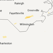
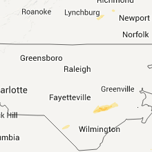
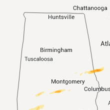
Hail Map for Friday, February 24, 2012

Number of Impacted Households on 2/24/2012
0
Impacted by 1" or Larger Hail
0
Impacted by 1.75" or Larger Hail
0
Impacted by 2.5" or Larger Hail
Square Miles of Populated Area Impacted on 2/24/2012
0
Impacted by 1" or Larger Hail
0
Impacted by 1.75" or Larger Hail
0
Impacted by 2.5" or Larger Hail


Cities Most Affected by Hail Storms of 2/24/2012
| Hail Size | Demographics of Zip Codes Affected | ||||||
|---|---|---|---|---|---|---|---|
| City | Count | Average | Largest | Pop Density | House Value | Income | Age |
| Lancaster, SC | 1 | 1.75 | 1.75 | 162 | $76k | $33.9k | 39.0 |
| Warrenton, GA | 1 | 1.75 | 1.75 | 28 | $55k | $27.3k | 41.5 |
| Lagrange, GA | 1 | 1.75 | 1.75 | 213 | $76k | $31.7k | 35.0 |
| Warrenville, SC | 1 | 1.75 | 1.75 | 347 | $59k | $28.7k | 37.5 |
| New Augusta, MS | 1 | 1.75 | 1.75 | 16 | $48k | $26.3k | 37.2 |
| Richmond, VA | 1 | 1.75 | 1.75 | 2296 | $86k | $40.5k | 33.3 |
| Columbia, SC | 1 | 1.75 | 1.75 | 2356 | $135k | $61.3k | 32.1 |
Hail and Wind Damage Spotted on 2/24/2012
Filter by Report Type:Hail ReportsWind Reports
States Impacted
Alabama, Mississippi, Georgia, Tennessee, Virginia, Florida, Ohio, North Carolina, South Carolina, Maryland, DelawareAlabama
| Local Time | Report Details |
|---|---|
| 12:49 PM UTC | A tree fell into the roadway and a vehicle ran into it. winds were estimated around 45 mp in elmore county AL, 37.8 miles W of Auburn, AL |
| 1:50 PM UTC | Several pine trees were snapped and one utility building was overturned in the city of lanet in chambers county AL, 24 miles NE of Auburn, AL |
| 3:11 PM UTC | A tree was blown down on bond road near deatsville and it blocked the roadway. winds were estimated around 40 mp in elmore county AL, 53.6 miles W of Auburn, AL |
| 3:15 PM UTC | Harper headstart school sustained roof damag in clarke county AL, 48.9 miles SW of Camden, AL |
| 3:17 PM UTC | Tree damage reported on bridalwood path roughly a half mile northeast of where harper head start school was damage in clarke county AL, 47.6 miles SW of Camden, AL |
| 3:25 PM UTC | Quarter sized hail reported near Hayneville, AL, 43.6 miles ENE of Camden, AL |
| 3:26 PM UTC | A tree was blown down near holtville and blocked the roadway. winds were estiamted around 40 mp in elmore county AL, 44.8 miles W of Auburn, AL |
| 3:30 PM UTC | Several large trees were blown in lowndes county AL, 43.6 miles ENE of Camden, AL |
| 3:30 PM UTC | A tree was blown down on redland road and blocked the roadway. the winds were estimated around 40 mp in elmore county AL, 41.9 miles W of Auburn, AL |
| 3:40 PM UTC | Large branches and a tree knocked down between wetumpka and eclectic. winds estimated around 45 mp in elmore county AL, 39 miles W of Auburn, AL |
| 3:43 PM UTC | Several trees were blown down near interstate 6 in lowndes county AL, 50.1 miles E of Camden, AL |
| 3:50 PM UTC | Quarter sized hail reported near Safford, AL, 13.6 miles N of Camden, AL, moth ball to quarter size hail was reported near the wilcox and dallas county line. some of the hail was covering the ground. |
| 4:05 PM UTC | Numerous trees reported down along i-65 near greenville in butler county AL, 40.4 miles ESE of Camden, AL |
| 4:24 PM UTC | Several trees were blown down near interstate 6 in lowndes county AL, 50.1 miles E of Camden, AL |
| 4:24 PM UTC | Quarter sized hail reported near Autaugaville, AL, 47.4 miles NE of Camden, AL, quarter size hail reported along county road 33. |
| 4:26 PM UTC | Tree down along mill pond road. crews dispatched to clear roadway. winds est at 40kt in elmore county AL, 47.8 miles W of Auburn, AL |
| 4:43 PM UTC | A few trees were blown down in far southern montgomery county near highway 231. winds were estimated around 50 mp in montgomery county AL, 51.7 miles SW of Auburn, AL |
| 4:56 PM UTC | Emergency manager reported a horse shed that was blown over and destroyed along n. goshen roa in crenshaw county AL, 66.8 miles ESE of Camden, AL |
| 5:30 PM UTC | A few trees were blown down in northern barbour county near comer. winds were estimated around 50 mp in barbour county AL, 40.2 miles S of Auburn, AL |
| 6:01 PM UTC | A few trees were blown down near eufaula. winds were estimated around 50 mp in barbour county AL, 53.1 miles SSE of Auburn, AL |
Mississippi
| Local Time | Report Details |
|---|---|
| 1:39 PM UTC | Quarter sized hail reported near Hattiesburg, MS, 76.8 miles WNW of Mobile, AL, occurred on jb horne rd along with 50 mph winds. |
| 2:00 PM UTC | Golf Ball sized hail reported near New Augusta, MS, 68.4 miles WNW of Mobile, AL |
| 2:28 PM UTC | Numerous pine trees were snapped and are blocking the roads approximately five miles south of state line...m in greene county MS, 52.6 miles NNW of Mobile, AL |
Georgia
| Local Time | Report Details |
|---|---|
| 2:05 PM UTC | Golf Ball sized hail reported near Lagrange, GA, 39.8 miles NE of Auburn, AL |
| 2:05 PM UTC | A tree was blown down near adams road and georgia highway 18 in troup count in troup county GA, 28.7 miles NE of Auburn, AL |
| 2:55 PM UTC | Several trees were blown down near u.s. highway 12 in morgan county GA, 59.6 miles ESE of Atlanta, GA |
| 3:05 PM UTC | The 911 center reported a few power lines down along willow run roa in greene county GA, 69.9 miles W of Augusta, GA |
| 3:15 PM UTC | More than a dozen trees down from around hwy 83s and clay road south to the county lin in jasper county GA, 52.1 miles SE of Atlanta, GA |
| 3:18 PM UTC | The 911 center reported a few trees and a few powerlines blown down near us hwy 27 in taliaferro county GA, 59 miles W of Augusta, GA |
| 3:20 PM UTC | 10-15 trees down in the vicinity of hwy 11 and clay tillman r in jasper county GA, 56.7 miles SE of Atlanta, GA |
| 3:36 PM UTC | 911 center reported a tree limb down in zebulo in pike county GA, 44.8 miles S of Atlanta, GA |
| 3:45 PM UTC | The putnam 911 center reported trees down along route 129 and trees down in eatonton as well as traffic lights ou in putnam county GA, 64.6 miles ESE of Atlanta, GA |
| 4:15 PM UTC | More than a dozen trees down from around hwy 83s and clay road south to the county lin in jasper county GA, 52.1 miles SE of Atlanta, GA |
| 4:20 PM UTC | 10-15 trees down in the vicinity of hwy 11 and clay tillman r in jasper county GA, 56.7 miles SE of Atlanta, GA |
| 4:20 PM UTC | One tree down on hwy 12 in putnam county GA, 62.7 miles SE of Atlanta, GA |
| 4:23 PM UTC | Power line down in the twin bridges are in putnam county GA, 65.9 miles ESE of Atlanta, GA |
| 4:27 PM UTC | A couple of trees blown down in norwoo in warren county GA, 42.5 miles W of Augusta, GA |
| 4:27 PM UTC | One tree blown down in norwoo in warren county GA, 42.5 miles W of Augusta, GA |
| 4:30 PM UTC | A few trees down in cama in warren county GA, 39 miles W of Augusta, GA |
| 4:30 PM UTC | One tree down in cama in warren county GA, 39 miles W of Augusta, GA |
| 4:54 PM UTC | Golf Ball sized hail reported near Warrenton, GA, 47.1 miles WSW of Augusta, GA, a spotter reported this event to this office. |
| 5:11 PM UTC | One tree down on grady bell roa in seminole county GA, 48.3 miles NW of Tallahassee, FL |
| 5:15 PM UTC | Trees and power lines down in dearing are in mcduffie county GA, 23.7 miles W of Augusta, GA |
| 5:15 PM UTC | Trees down on hwy 278 just north of i-20 west of thompson in mcduffie county GA, 34.4 miles W of Augusta, GA |
| 5:20 PM UTC | Law enforcement reports numerous trees and power lines down across the southern portion of the count in mcduffie county GA, 30.9 miles WSW of Augusta, GA |
| 5:25 PM UTC | Quarter sized hail reported near Harlem, GA, 20.5 miles WSW of Augusta, GA, one inch hail reported in harlem ga. |
| 5:30 PM UTC | Quarter sized hail reported near Grovetown, GA, 13.1 miles W of Augusta, GA |
| 5:40 PM UTC | Numerous trees down and dime size hail at alexander drive and washington roa in richmond county GA, 1.9 miles SW of Augusta, GA |
| 5:40 PM UTC | Wjbf reports estimated 80 to 90 mph gust along with golf ball size hai in richmond county GA, 1.9 miles SW of Augusta, GA |
| 12:40 PM EST | Half Dollar sized hail reported near Augusta, GA, 1.6 miles WSW of Augusta, GA |
| 5:41 PM UTC | Quarter sized hail reported near Augusta, GA, 1.9 miles SW of Augusta, GA, media reports estimated one inch hail in north augusta. |
| 5:58 PM UTC | Trees and telephone lines down in camill in mitchell county GA, 54.6 miles N of Tallahassee, FL |
| 6:45 PM UTC | Public report via walb-tv facebook page of bent trampoline...busted siding...and furniture blown against a fence near cotto in mitchell county GA, 51.2 miles NNE of Tallahassee, FL |
| 6:50 PM UTC | Public report on the walb-tv facebook page of a barn blown down near the tift/cook county line just off of i-7 in cook county GA, 40.5 miles WSW of Douglas, GA |
| 6:50 PM UTC | 1 tree down near county line in tift county GA, 39.3 miles WSW of Douglas, GA |
| 7:04 PM UTC | Scattered trees down in the northern part of the count in decatur county GA, 41.4 miles NNW of Tallahassee, FL |
| 7:16 PM UTC | Scattered trees down in the northern part of the count in grady county GA, 42.1 miles N of Tallahassee, FL |
| 7:59 PM UTC | The glennville post office reported trees down along georgia state road 205 between glennville and daisy. time estimated from rada in tattnall county GA, 47 miles W of Savannah, GA |
| 8:10 PM UTC | A tree in the road was reported on bennett still highwa in bacon county GA, 22.6 miles E of Douglas, GA |
| 8:20 PM UTC | Powerlines down near highway 203. time estimated by rada in appling county GA, 37.1 miles E of Douglas, GA |
| 8:30 PM UTC | 2 trees down and pea size hail on meadow roa in bacon county GA, 20.7 miles E of Douglas, GA |
| 8:42 PM UTC | Several powerlines down near the intersection of wilshire blvd and white bluff roa in chatham county GA, 7.3 miles SSW of Savannah, GA |
| 8:55 PM UTC | Tree reported down near river road by 911 call center. time estimated by rada in ware county GA, 24.3 miles ESE of Douglas, GA |
| 9:02 PM UTC | Numerous trees reported down across southern portions of chatham count in chatham county GA, 11 miles SSW of Savannah, GA |
| 9:03 PM UTC | 3 homes damaged and several oak trees down near windsor forest high school. time estimated by rada in chatham county GA, 6.6 miles SSW of Savannah, GA |
| 9:03 PM UTC | 5 homes and a few cars damaged along with a power pole snapped in half near dutchtown road and middleground road. time estimated by rada in chatham county GA, 7.5 miles SSW of Savannah, GA |
| 9:07 PM UTC | A nws damage survey team has determined the damage observed south of downtown savannah near hunter army airfield was caused by straight line winds and not a tornado. pe in chatham county GA, 7.5 miles SSW of Savannah, GA |
| 9:11 PM UTC | Tree down on powerlin in chatham county GA, 7.2 miles SSW of Savannah, GA |
| 9:11 PM UTC | Tree blown down on top of car in chatham county GA, 6.9 miles SSW of Savannah, GA |
| 9:11 PM UTC | Power lines down across yar in chatham county GA, 7.5 miles SSW of Savannah, GA |
| 9:11 PM UTC | Powerlines down down and sparking on fence near the intersection of 65th street and habersham stree in chatham county GA, 3.5 miles S of Savannah, GA |
| 9:20 PM UTC | Public report of trees down and trampolines flipped in screven. time estimated by rada in wayne county GA, 49 miles E of Douglas, GA |
| 10:06 PM UTC | A trained weather spotter reported several trees blown down across youngman road. time estimated from rada in mcintosh county GA, 37.3 miles SSW of Savannah, GA |
| 10:08 PM UTC | A trained spotter reported several large trees blown down in shelman bluff. time estimated from rada in mcintosh county GA, 37.7 miles SSW of Savannah, GA |
| 10:11 PM UTC | Tree down on powerlin in chatham county GA, 7.2 miles SSW of Savannah, GA |
Tennessee
| Local Time | Report Details |
|---|---|
| 2:38 PM UTC | Trees down near rogersvill in hawkins county TN, 45.7 miles WSW of Bristol, TN |
| 2:38 PM UTC | Quarter sized hail reported near Rogersville, TN, 45.7 miles WSW of Bristol, TN, quarter sized hail near rogersville. |
Virginia
| Local Time | Report Details |
|---|---|
| 3:05 PM UTC | One tree down on majestic driv in washington county VA, 16.2 miles ENE of Bristol, TN |
| 3:05 PM UTC | Quarter sized hail reported near Gate City, VA, 20.2 miles W of Bristol, TN |
| 6:25 PM UTC | Tree down in patrick county VA, 58.8 miles SW of Roanoke, VA |
| 6:27 PM UTC | Tree down on colonial roa in botetourt county VA, 9.4 miles NE of Roanoke, VA |
| 6:30 PM UTC | A few large tree limbs were blown down in the community of fincastl in botetourt county VA, 16.1 miles NNE of Roanoke, VA |
| 6:30 PM UTC | Tree down in pittsylvania county VA, 47.3 miles SSE of Roanoke, VA |
| 6:34 PM UTC | Power lines down on burnt chimney road in franklin county VA, 13.3 miles SSE of Roanoke, VA |
| 6:50 PM UTC | 2 large trees were blown down in the town of amhers in amherst county VA, 53.4 miles ENE of Roanoke, VA |
| 6:52 PM UTC | Trees down across shooting creek roa in floyd county VA, 30.5 miles SW of Roanoke, VA |
| 7:35 PM UTC | Tree down on power line in pittsylvania county VA, 48 miles SE of Roanoke, VA |
| 9:30 PM UTC | Quarter sized hail reported near Chesterfield, VA, 11.1 miles SSW of Richmond, VA, hail covering the ground quala and spring run |
| 9:31 PM UTC | Trees down on hitesburg church rd in halifax county VA, 56.4 miles N of Raleigh, NC |
| 9:44 PM UTC | Quarter sized hail reported near Chesterfield, VA, 11.5 miles SE of Richmond, VA, 1 inch hail reported at the chesterfield county airport |
| 9:45 PM UTC | Golf Ball sized hail reported near Richmond, VA, 9.6 miles ESE of Richmond, VA, golfball size hail reported at chippenham and rte 10 |
| 9:48 PM UTC | Ping Pong Ball sized hail reported near Henrico, VA, 17.7 miles E of Richmond, VA, 1.25 to 1.5 inch hail reported by observer |
| 10:30 PM UTC | Trees down in accomack county VA, 45 miles SW of Ocean City, MD |
| 11:25 PM UTC | Several reports of wind damage in the the davis creek and marina are in mathews county VA, 41.7 miles NNW of Virginia Beach, VA |
Florida
| Local Time | Report Details |
|---|---|
| 4:48 PM UTC | Tree down 3 miles south of malone in jackson count in jackson county FL, 61.6 miles WNW of Tallahassee, FL |
| 5:37 PM UTC | Tree down 3 miles south of malone in jackson count in jackson county FL, 61.6 miles WNW of Tallahassee, FL |
| 7:18 PM UTC | 1 tree down on capital circle and village way in leon county FL, 0 miles ENE of Tallahassee, FL |
| 7:22 PM UTC | Tree down making road impassable at centerville road near chemonie crossin in leon county FL, 13.2 miles NE of Tallahassee, FL |
| 7:22 PM UTC | Tre down on veterans memorial drive about 2 miles south of the florida/georgia state line blocking 1 lane of traffic in leon county FL, 20.4 miles NE of Tallahassee, FL |
Ohio
| Local Time | Report Details |
|---|---|
| 5:16 PM UTC | Large branches broke in washington county OH, 74 miles N of Charleston, WV |
North Carolina
| Local Time | Report Details |
|---|---|
| 5:36 PM UTC | Tin roof blown off out-buildin in wilkes county NC, 63.9 miles N of Charlotte, NC |
| 7:16 PM UTC | Quarter sized hail reported near Bladenboro, NC, 53.1 miles WNW of Wilmington, NC, nickel to quarter size hail fell for 5 minutes starting at 216 pm. |
| 7:30 PM UTC | Quarter sized hail reported near Claremont, NC, 44.9 miles NNW of Charlotte, NC, nickel to quarter hail in riverbend park. |
| 7:31 PM UTC | Quarter sized hail reported near Hickory, NC, 45.8 miles NNW of Charlotte, NC, near intersection of snow creek road and springs road. |
| 7:45 PM UTC | Ping Pong Ball sized hail reported near Tobaccoville, NC, 74.8 miles SSW of Roanoke, VA, near golf ball sized hail and numerous trees down in tobaccoville. |
| 7:45 PM UTC | Report relayed from media... public reports trees down in magnolia with hai in duplin county NC, 46.3 miles N of Wilmington, NC |
| 7:45 PM UTC | Numerous trees down in tobaccovill in forsyth county NC, 74.8 miles SSW of Roanoke, VA |
| 7:47 PM UTC | Emergency manager relayed report of powerlines down north of kenansville on williams roa in duplin county NC, 54.1 miles N of Wilmington, NC |
| 7:49 PM UTC | Trees down at the intersection of 7154 martin ferry rd. and donnaha r in forsyth county NC, 73 miles NNE of Charlotte, NC |
| 7:50 PM UTC | Half Dollar sized hail reported near Beulaville, NC, 46.3 miles NNE of Wilmington, NC, broadcast media relayed report of quarter to golf ball sized hail just south of beulaville |
| 7:55 PM UTC | Quarter sized hail reported near Beulaville, NC, 48.3 miles NNE of Wilmington, NC, broadcast media relayed public report of quarter size hail in beulaville. |
| 7:57 PM UTC | *** 1 inj *** duplin co emergency manager relayed major mobile home damage with 1 vehicle totaled and 1 injur in duplin county NC, 54.8 miles N of Wilmington, NC |
| 8:05 PM UTC | Quarter sized hail reported near Richlands, NC, 52.9 miles NNE of Wilmington, NC, spotter reported quarter size hail nw of richlands |
| 8:15 PM UTC | Quarter size hail. chicken coop and goat house both destroyed. time estimated by rada in jones county NC, 59.7 miles NNE of Wilmington, NC |
| 8:20 PM UTC | Quarter sized hail reported near Trenton, NC, 54.5 miles NNE of Wilmington, NC, quarter size hail reported on highway 41 |
| 8:23 PM UTC | Trees down at 6868 styers ferry r in forsyth county NC, 63.2 miles NNE of Charlotte, NC |
| 8:31 PM UTC | Tree down at the intersection of barney hall rd and high point r in forsyth county NC, 70.3 miles NE of Charlotte, NC |
| 8:35 PM UTC | One tree down on interstate business 4 in forsyth county NC, 68.3 miles NNE of Charlotte, NC |
| 8:49 PM UTC | Trees down at the intersection of 7154 martin ferry rd. and donnaha r in forsyth county NC, 73 miles NNE of Charlotte, NC |
| 8:56 PM UTC | Trees down in caswell county NC, 61.9 miles SSE of Roanoke, VA |
| 8:56 PM UTC | Shed roof blown of in caswell county NC, 61 miles SSE of Roanoke, VA |
| 8:59 PM UTC | Trees down at 6868 styers ferry r in forsyth county NC, 63.2 miles NNE of Charlotte, NC |
| 9:04 PM UTC | Multiple reports of trees down in northern greensbor in guilford county NC, 70.2 miles WNW of Raleigh, NC |
| 9:05 PM UTC | Tree down on westridge r in guilford county NC, 72.1 miles WNW of Raleigh, NC |
| 9:17 PM UTC | Tree down at hwy 64 at davidson randolph county line in davidson county NC, 57.4 miles NE of Charlotte, NC |
| 9:23 PM UTC | Tree down on power line at old cedar falls r in randolph county NC, 64.1 miles W of Raleigh, NC |
| 9:23 PM UTC | Tree down at cedar falls rd and henley country r in randolph county NC, 62.9 miles W of Raleigh, NC |
| 9:24 PM UTC | Tree down at south main street in denton in davidson county NC, 49.7 miles NE of Charlotte, NC |
| 9:40 PM UTC | Power pole broken and power lines down on erect r in randolph county NC, 59.3 miles WSW of Raleigh, NC |
| 9:41 PM UTC | One tree down in randolph county NC, 51 miles W of Raleigh, NC |
| 9:41 PM UTC | Several trees down from hurdle mills to the orange county line in person county NC, 40.5 miles NW of Raleigh, NC |
| 10:06 PM UTC | Scattered trees and power lines down throughout the count in durham county NC, 19.7 miles NW of Raleigh, NC |
| 10:10 PM UTC | One tree down on a power pole on walter stree in vance county NC, 38.4 miles NNE of Raleigh, NC |
| 10:13 PM UTC | One tree down at nc 87 and l and w lane in chatham county NC, 33 miles W of Raleigh, NC |
| 10:25 PM UTC | One tree down in warren county NC, 60.8 miles NNE of Raleigh, NC |
| 10:45 PM UTC | One tree down between western blvd. and hillsborough s in wake county NC, 4.9 miles W of Raleigh, NC |
South Carolina
| Local Time | Report Details |
|---|---|
| 5:40 PM UTC | Power lines and trees down on highway 2 in calhoun county SC, 54.6 miles NW of Charleston, SC |
| 5:40 PM UTC | Trees down in roadway us 321 at pinegrove road reported by sc highway patro in orangeburg county SC, 51.8 miles ENE of Augusta, GA |
| 5:40 PM UTC | Trees reported down in north august in aiken county SC, 2.1 miles NE of Augusta, GA |
| 5:40 PM UTC | Trees down on pine log road south aiken in aiken county SC, 11.4 miles E of Augusta, GA |
| 5:40 PM UTC | Tree on mobile home on bass lake road burnettetown reported by skywar in aiken county SC, 8.1 miles ESE of Augusta, GA |
| 5:40 PM UTC | Tree on mobile home on bath lake road burnettetown reported by skywar in aiken county SC, 8.1 miles ESE of Augusta, GA |
| 5:45 PM UTC | Quarter sized hail reported near North Augusta, SC, 3 miles NNE of Augusta, GA, at lanney walker blvd and gordon highway |
| 5:45 PM UTC | Shingles off building near lanney walker blvd and gordon highway estimated wind gusts to 60 mph in aiken county SC, 3 miles NNE of Augusta, GA |
| 5:48 PM UTC | Trees down in granitville. wind estimated at 70 mp in aiken county SC, 9.9 miles ENE of Augusta, GA |
| 5:48 PM UTC | Golf Ball sized hail reported near Warrenville, SC, 9.9 miles ENE of Augusta, GA, golf ball size hail reported in granitville. |
| 6:20 PM UTC | Emergency manager reported trees down along hwy 321 from woodford to north from bow echo wind in orangeburg county SC, 51.6 miles ENE of Augusta, GA |
| 6:25 PM UTC | Public reported trees down in rembert area in sumter county SC, 69.5 miles NNW of Charleston, SC |
| 6:47 PM UTC | Golf Ball sized hail reported near Lancaster, SC, 38.7 miles S of Charlotte, NC, public report of golf ball size hail |
| 6:48 PM UTC | Golf Ball sized hail reported near Columbia, SC, 76.7 miles S of Charlotte, NC, public report of golf ball size hail |
| 6:50 PM UTC | Several large limbs blown from tree tops and across pine needles rd near i-9 in florence county SC, 68.9 miles N of Charleston, SC |
| 6:50 PM UTC | 10 inch diameter oak tree snapped on tiffany d in florence county SC, 68.8 miles N of Charleston, SC |
| 6:58 PM UTC | Half Dollar sized hail reported near Sumter, SC, 55.7 miles NNW of Charleston, SC, public report half dollar size hail |
| 7:26 PM UTC | Trees down blocking twin church rd near peniel rd and matthews l in florence county SC, 62.7 miles N of Charleston, SC |
| 7:38 PM UTC | Half Dollar sized hail reported near Blythewood, SC, 69.6 miles S of Charlotte, NC, public reported half dollar size hail |
| 9:53 PM UTC | Trees down along augusta stage coach roa in hampton county SC, 44.1 miles NNW of Savannah, GA |
| 10:06 PM UTC | Trees down along hopewell roa in hampton county SC, 37.6 miles NNW of Savannah, GA |
| 10:35 PM UTC | Tree down on car on north magnolia av in georgetown county SC, 31.9 miles NE of Charleston, SC |
Maryland
| Local Time | Report Details |
|---|---|
| 7:51 PM UTC | Storm damage reported in charles county MD, 46.7 miles SSW of Baltimore, MD |
| 8:50 PM UTC | Tractor trailer blown over in talbot county MD, 54.7 miles WNW of Ocean City, MD |
| 8:51 PM UTC | Tree down at 348 radiance dr in dorchester county MD, 56.2 miles WNW of Ocean City, MD |
| 8:51 PM UTC | Tree down at 348 radiance d in dorchester county MD, 56.2 miles WNW of Ocean City, MD |
| 8:52 PM UTC | Quarter sized hail reported near Patuxent River, MD, 70.5 miles S of Baltimore, MD |
| 9:00 PM UTC | Widespread trees and power lines down across cambridge. some power poles snappe in dorchester county MD, 56.2 miles WNW of Ocean City, MD |
| 9:00 PM UTC | Widespread trees and power lines down across the area. some power poles are snappe in dorchester county MD, 56.2 miles WNW of Ocean City, MD |
| 9:00 PM UTC | Numerous trees down and poles snapped near miles circl in dorchester county MD, 45.9 miles WNW of Ocean City, MD |
Delaware
| Local Time | Report Details |
|---|---|
| 9:17 PM UTC | Roof blown off... wires down... poles down... large tree down in sussex county DE, 35 miles NW of Ocean City, MD |
| 9:17 PM UTC | Quarter sized hail reported near Seaford, DE, 35 miles NW of Ocean City, MD |
Connect with Interactive Hail Maps