

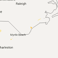
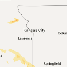
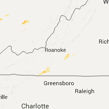
Hail Map for Thursday, July 14, 2016

Number of Impacted Households on 7/14/2016
0
Impacted by 1" or Larger Hail
0
Impacted by 1.75" or Larger Hail
0
Impacted by 2.5" or Larger Hail
Square Miles of Populated Area Impacted on 7/14/2016
0
Impacted by 1" or Larger Hail
0
Impacted by 1.75" or Larger Hail
0
Impacted by 2.5" or Larger Hail


Cities Most Affected by Hail Storms of 7/14/2016
| Hail Size | Demographics of Zip Codes Affected | ||||||
|---|---|---|---|---|---|---|---|
| City | Count | Average | Largest | Pop Density | House Value | Income | Age |
| Pueblo, CO | 3 | 1.75 | 1.75 | 125 | $95k | $33.5k | 39.6 |
| Flagler, CO | 2 | 2.13 | 2.50 | 1 | $74k | $30.4k | 46.7 |
| Colorado Springs, CO | 2 | 2.00 | 2.00 | 2179 | $112k | $39.5k | 27.4 |
| Kit Carson, CO | 2 | 1.88 | 2.00 | 0 | $45k | $28.1k | 42.2 |
| Reva, SD | 2 | 1.88 | 2.00 | 0 | $10k | $31.3k | 47.1 |
| Faith, SD | 2 | 1.88 | 2.00 | 0 | $41k | $23.9k | 39.4 |
| Wayside, TX | 2 | 1.75 | 1.75 | 0 | $0k | $0.0k | 50.2 |
| Rhame, ND | 2 | 1.75 | 1.75 | 0 | $31k | $22.9k | 47.0 |
| Bethune, CO | 1 | 2.50 | 2.50 | 1 | $54k | $30.5k | 38.2 |
| Stratton, CO | 1 | 1.75 | 1.75 | 2 | $77k | $35.0k | 37.2 |
| Groom, TX | 1 | 1.75 | 1.75 | 1 | $53k | $35.7k | 47.8 |
| Ludlow, SD | 1 | 1.75 | 1.75 | 1 | $29k | $17.5k | 38.0 |
| Model, CO | 1 | 1.75 | 1.75 | 0 | $91k | $24.2k | 34.3 |
| Skellytown, TX | 1 | 1.75 | 1.75 | 1 | $29k | $32.2k | 46.9 |
| Vona, CO | 1 | 1.75 | 1.75 | 1 | $38k | $30.3k | 47.1 |
| Peyton, CO | 1 | 1.75 | 1.75 | 127 | $173k | $54.4k | 36.2 |
| Seibert, CO | 1 | 1.75 | 1.75 | 0 | $43k | $25.8k | 49.4 |
| Elbert, CO | 1 | 1.75 | 1.75 | 23 | $220k | $76.4k | 45.1 |
Hail and Wind Damage Spotted on 7/14/2016
Filter by Report Type:Hail ReportsWind Reports
States Impacted
Kansas, Kentucky, Oklahoma, Tennessee, Missouri, South Carolina, Georgia, New York, Virginia, New Jersey, Alabama, Pennsylvania, North Carolina, West Virginia, Arkansas, Vermont, Indiana, Colorado, Maine, New Hampshire, Montana, Texas, Massachusetts, Ohio, North Dakota, Illinois, Louisiana, South Dakota, Mississippi, NebraskaKansas
| Local Time | Report Details |
|---|---|
| 7:01 AM CDT | Storm damage reported in reno county KS, 49.5 miles WNW of Wichita, KS |
| 7:32 AM CDT | Two power poles were dow in gray county KS, 35.8 miles SE of Garden City, KS |
| 7:55 AM CDT | Large tree limb was blown out of a tree. report is delayed and via social medi in sedgwick county KS, 17.6 miles WNW of Wichita, KS |
| 8:14 AM CDT | Storm damage reported in sedgwick county KS, 7.5 miles W of Wichita, KS |
| 8:15 AM CDT | Storm damage reported in sedgwick county KS, 8.7 miles NNW of Wichita, KS |
| 8:17 AM CDT | Storm damage reported in sedgwick county KS, 6 miles WSW of Wichita, KS |
| 8:17 AM CDT | Tent blown into power line in sedgwick county KS, 12.4 miles W of Wichita, KS |
| 8:22 AM CDT | Three inch tree limb dow in sedgwick county KS, 7.2 miles WNW of Wichita, KS |
| 8:36 AM CDT | Storm damage reported in sedgwick county KS, 5.2 miles W of Wichita, KS |
| 8:39 AM CDT | Storm damage reported in sedgwick county KS, 7.7 miles NE of Wichita, KS |
| 8:41 AM CDT | Estimated between 60 and 70 mp in sedgwick county KS, 6.2 miles NE of Wichita, KS |
| 8:44 AM CDT | Poles down near illinois and zoo blv in sedgwick county KS, 6.8 miles W of Wichita, KS |
| 8:46 AM CDT | Numerous poles down reported by emergency management in sedgwick county KS, 6.8 miles W of Wichita, KS |
| 8:52 AM CDT | At the augusta airpor in butler county KS, 16.8 miles E of Wichita, KS |
| 8:56 AM CDT | Estimated between 60 and 70 mp in butler county KS, 10.7 miles E of Wichita, KS |
| 10:45 AM CDT | Quarter sized hail reported near Crestline, KS, 54.4 miles SE of Chanute, KS |
| 3:29 PM CDT | Quarter sized hail reported near Sabetha, KS, 60.1 miles NE of Manhattan, KS |
Kentucky
| Local Time | Report Details |
|---|---|
| 9:05 AM CDT | Storm damage reported in mclean county KY, 26.6 miles SSE of Evansville, IN |
| 9:34 AM CDT | Tree down across road at lonesome pine in sight of highway 815. approximately 600 customers without power in area at height of stor in daviess county KY, 30 miles SE of Evansville, IN |
| 12:22 PM CDT | Tree down at stevenson and meado in simpson county KY, 46.2 miles NNE of Nashville, TN |
| 12:30 PM CDT | Tree down on roosevelt stree in simpson county KY, 40.3 miles NNE of Nashville, TN |
| 12:30 PM CDT | Tree down on roosevelt stree in simpson county KY, 40.3 miles NNE of Nashville, TN |
| 12:31 PM CDT | Tree down on truck and house at 421 hendricks stree in simpson county KY, 39.6 miles NNE of Nashville, TN |
| 12:31 PM CDT | Tree down on the 100 block of russell stree in simpson county KY, 39.8 miles NNE of Nashville, TN |
| 12:47 PM CDT | Tree down on squire lyles roa in allen county KY, 48.5 miles NNE of Nashville, TN |
| 12:47 PM CDT | Tree down on old franklin roa in allen county KY, 47.6 miles NE of Nashville, TN |
| 12:48 PM CDT | Tree down on pope road. some of the trees down in the county have also taken down power line in allen county KY, 48.5 miles NNE of Nashville, TN |
| 12:50 PM CDT | Tree down on holland roa in allen county KY, 52.6 miles NE of Nashville, TN |
| 12:52 PM CDT | Tree down on dover church roa in allen county KY, 49.7 miles NE of Nashville, TN |
| 12:53 PM CDT | Tree down on durham springs roa in allen county KY, 54.3 miles NE of Nashville, TN |
| 2:52 PM EDT | Trees were reported to have been blown down in the science hill vicinit in pulaski county KY, 51.2 miles SW of Irvine, KY |
| 3:10 PM EDT | Received several pics of trees and power lines down across the county. time approximated based on rada in boyle county KY, 49.8 miles ESE of Louisville, KY |
| 3:21 PM EDT | Trees and power lines down in tow in greenup county KY, 62.9 miles WNW of Charleston, WV |
| 3:26 PM EDT | Trees and power lines down in tow in greenup county KY, 60.6 miles WNW of Charleston, WV |
| 3:35 PM EDT | A tree was reported to have been blown down along ky 192 in the hightop vicinit in laurel county KY, 47.7 miles SSW of Irvine, KY |
| 3:40 PM EDT | Received a few pictures of trees and power lines down in garrard also. time approximated based on rada in garrard county KY, 35.4 miles W of Irvine, KY |
| 3:42 PM EDT | A tree was reported to have been blown down on us 2 in laurel county KY, 36.1 miles SSW of Irvine, KY |
| 4:06 PM EDT | Damage to concession stand at local drive in theater. also several large limb down near b in powell county KY, 12.7 miles NE of Irvine, KY |
| 4:25 PM EDT | Large tree with power lines down in roadway in boyd county KY, 58.3 miles W of Charleston, WV |
| 4:28 PM EDT | Estimated 60 mph winds at the kyova mall with lamp posts knocked down in the parking lo in boyd county KY, 58.3 miles W of Charleston, WV |
| 5:53 PM EDT | Small tree down at the corner of sparta pike and johnson road in gallatin county KY, 31.5 miles SW of Cincinnati, OH |
| 5:54 PM EDT | Small tree down in radcliff. time estimated from radar. in hardin county KY, 16.4 miles SW of Louisville, KY |
| 6:00 PM EDT | Wires down at ockerman middle school in boone county KY, 11.7 miles SW of Cincinnati, OH |
| 6:07 PM EDT | Tree down blocking richmond road by state road 42 in boone county KY, 20.3 miles SSW of Cincinnati, OH |
| 6:07 PM EDT | Small trees down at hands pike and crystal lake drive in kenton county KY, 8.8 miles S of Cincinnati, OH |
| 6:27 PM EDT | Photo shows one smaller tree down. time estimated based on rada in grant county KY, 29.9 miles S of Cincinnati, OH |
| 6:27 PM EDT | Small trees down at decoursey pike and creektrace road in kenton county KY, 13.2 miles SSE of Cincinnati, OH |
| 6:35 PM EDT | Small tree down at us 27 and bitter sweet in pendleton county KY, 21.9 miles SSE of Cincinnati, OH |
Oklahoma
| Local Time | Report Details |
|---|---|
| 10:28 AM CDT | Quarter sized hail reported near Blackwell, OK, 61.2 miles S of Wichita, KS, dime to quarter hail. |
| 10:28 AM CDT | Storm damage reported in kay county OK, 61.2 miles S of Wichita, KS |
| 10:41 AM CDT | Estimated 60 to 70 mp in kay county OK, 52.9 miles S of Wichita, KS |
| 10:42 AM CDT | Estimated 60 to 70 mph gus in kay county OK, 52.2 miles S of Wichita, KS |
| 10:52 AM CDT | Storm damage reported in kay county OK, 67.8 miles S of Wichita, KS |
| 10:59 AM CDT | Kfor storm chaser in kay county OK, 69.5 miles SSE of Wichita, KS |
| 11:00 AM CDT | Storm damage reported in kay county OK, 67.8 miles S of Wichita, KS |
| 12:04 PM CDT | Numerous trees down. time estimated from rada in creek county OK, 20 miles W of Tulsa, OK |
| 12:15 PM CDT | Significant wind damage to trees including at least one laying on a house. photos received via social media and additional reports from broadcast media. time estimate in creek county OK, 12.2 miles SSW of Tulsa, OK |
| 12:22 PM CDT | Roof damage to large barn angus valley in sand springs. via social media. time estimated from rada in tulsa county OK, 6.6 miles W of Tulsa, OK |
| 12:30 PM CDT | Tree down blocking riverside dr. at 91st via social media. time estimated from rada in tulsa county OK, 7.7 miles S of Tulsa, OK |
| 12:35 PM CDT | Power lines and multiple tree limbs down near memorial and 71st stree in tulsa county OK, 4.3 miles ESE of Tulsa, OK |
| 12:36 PM CDT | Large tree limb broken at baptist village in owasso. time estimated from rada in tulsa county OK, 11.9 miles NE of Tulsa, OK |
| 12:38 PM CDT | Small trees snapped on the se side of tuls in tulsa county OK, 4.3 miles ESE of Tulsa, OK |
| 12:40 PM CDT | Storm damage reported in okmulgee county OK, 21.4 miles S of Tulsa, OK |
| 12:40 PM CDT | Ping Pong Ball sized hail reported near Bixby, OK, 13.9 miles SSE of Tulsa, OK, 1.5 inch hail near 151st street and yale. |
| 12:40 PM CDT | Snapped tree and lots of small branches dow in tulsa county OK, 11 miles SE of Tulsa, OK |
| 12:40 PM CDT | Tree branches and roofing material blown around near 151st and yal in tulsa county OK, 13.9 miles SSE of Tulsa, OK |
| 12:40 PM CDT | Tree snapped. relayed by off duty nws employee. time estimated by rada in rogers county OK, 13.9 miles ENE of Tulsa, OK |
| 12:45 PM CDT | Tree... shingle... fence damage. tranpoline flipped. near 91st and lynn in tulsa county OK, 13.7 miles ESE of Tulsa, OK |
| 12:50 PM CDT | Storm damage reported in tulsa county OK, 15.8 miles SSE of Tulsa, OK |
| 1:10 PM CDT | Storm damage reported in mayes county OK, 35.5 miles E of Tulsa, OK |
| 1:10 PM CDT | Fox 23 stormtracker report at us-6 in muskogee county OK, 44.5 miles SE of Tulsa, OK |
| 1:12 PM CDT | Mobile home rolled in mayes county OK, 35.7 miles E of Tulsa, OK |
| 1:13 PM CDT | Power poles downed in wagoner. photos received via social media. time estimate in wagoner county OK, 37.3 miles ESE of Tulsa, OK |
| 1:15 PM CDT | One mobile home destroyed and others blown off their foundations. relayed by rogers county emergency management. time estimate in rogers county OK, 27 miles E of Tulsa, OK |
| 1:21 PM CDT | Trees blown down south of chouteau in mayes county OK, 36.5 miles E of Tulsa, OK |
| 1:28 PM CDT | Tree damage in glenpoo in tulsa county OK, 13.1 miles S of Tulsa, OK |
| 1:30 PM CDT | Tractor trailer blown over in muskogee county OK, 42.8 miles SE of Tulsa, OK |
| 1:30 PM CDT | Roof damage to buildings at glenpool middle school. time estimated via rada in tulsa county OK, 13.1 miles S of Tulsa, OK |
| 1:34 PM CDT | Roof blown off building west of maize on us-6 in mayes county OK, 35.5 miles E of Tulsa, OK |
| 1:43 PM CDT | Tree limbs and branches down in henryett in okmulgee county OK, 48.9 miles S of Tulsa, OK |
| 1:46 PM CDT | Storm damage reported in mcintosh county OK, 63.7 miles SSE of Tulsa, OK |
| 1:50 PM CDT | Storm damage reported in cherokee county OK, 48.1 miles NW of Fort Smith, AR |
| 1:57 PM CDT | Tree down on house in cherokee county OK, 48.1 miles NW of Fort Smith, AR |
| 1:59 PM CDT | Tree down on car in cherokee county OK, 48.1 miles NW of Fort Smith, AR |
| 2:15 PM CDT | Measured at the tahlequah municipal airpor in cherokee county OK, 48.1 miles NW of Fort Smith, AR |
| 2:15 PM CDT | Large tree downed. photo received via social media. time estimated via rada in pittsburg county OK, 42.7 miles NNE of Atoka, OK |
| 2:20 PM CDT | Estimated by a spotter. relayed by medi in cherokee county OK, 36 miles NW of Fort Smith, AR |
| 2:23 PM CDT | Roof off business. relayed via social medi in sequoyah county OK, 21.4 miles WNW of Fort Smith, AR |
| 2:35 PM CDT | At least 60 mph winds estimated in hartshorne. relayed by le flore county emergency managemen in pittsburg county OK, 45.5 miles NE of Atoka, OK |
| 2:55 PM CDT | Storm damage reported in le flore county OK, 56.9 miles SW of Fort Smith, AR |
| 3:03 PM CDT | Tree down in le flore county OK, 43 miles SW of Fort Smith, AR |
| 3:09 PM CDT | Trees and powerlines down near intersection of highway 271 and cutoff road just north of talihina. relayed by emergency managemen in le flore county OK, 56.4 miles SW of Fort Smith, AR |
| 3:15 PM CDT | Powerlines down along williams roa in le flore county OK, 17.9 miles SW of Fort Smith, AR |
| 3:40 PM CDT | Minor wind damage to a barn and chicken house in the haw creek area. time estimate in le flore county OK, 44.1 miles S of Fort Smith, AR |
| 3:55 PM CDT | Numerous trees down on beachton road east side of smithville in mccurtain county OK, 58.4 miles NW of Nashville, AR |
| 12:10 AM CDT | Storm damage reported in beckham county OK, 76.1 miles S of Woodward, OK |
| 12:48 AM CDT | Storm damage reported in canadian county OK, 24.3 miles WSW of Oklahoma City, OK |
| 12:50 AM CDT | Storm damage reported in grady county OK, 27.8 miles WSW of Oklahoma City, OK |
| 12:55 AM CDT | Storm damage reported in grady county OK, 27.8 miles WSW of Oklahoma City, OK |
| 1:00 AM CDT | Storm damage reported in grady county OK, 27.8 miles WSW of Oklahoma City, OK |
| 1:10 AM CDT | Storm damage reported in grady county OK, 27.8 miles WSW of Oklahoma City, OK |
| 1:15 AM CDT | Storm damage reported in grady county OK, 27.8 miles WSW of Oklahoma City, OK |
| 1:23 AM CDT | Quarter sized hail reported near Yale, OK, 43.6 miles W of Tulsa, OK, near intersection of highway 18 and highway 51. |
| 2:55 AM CDT | Storm damage reported in pottawatomie county OK, 33.4 miles E of Oklahoma City, OK |
Tennessee
| Local Time | Report Details |
|---|---|
| 10:45 AM CDT | One tree reported down on weaks cemetary road and freeman fielders road. the tree is blocking the roa in stewart county TN, 41.1 miles ENE of Mc Kenzie, TN |
| 11:30 AM CDT | A tree down reported in adam in robertson county TN, 32.7 miles NNW of Nashville, TN |
| 11:40 AM CDT | Fire chief reports at least 3 trees down on hwy 22 in mcnairy county TN, 46.4 miles WNW of Florence, AL |
| 12:17 PM CDT | A picture of a fallen tree was posted to office facebook pag in davidson county TN, 11.1 miles NNW of Nashville, TN |
| 2:00 PM CDT | Quarter sized hail reported near Mount Juliet, TN, 17.5 miles E of Nashville, TN, one inch hail near 109 just south of i-40 |
| 3:15 PM CDT | A few trees down across the county from 4 to 420pm in marion county TN, 18.2 miles W of Chattanooga, TN |
| 4:26 PM EDT | Quarter sized hail reported near Knoxville, TN, 15.8 miles WSW of Knoxville, TN |
| 3:30 PM CDT | Multiple trees down across southern portions of the county in bledsoe county TN, 30.1 miles NNE of Chattanooga, TN |
| 4:31 PM EDT | A couple of large limbs dow in knox county TN, 15.8 miles WSW of Knoxville, TN |
| 4:40 PM EDT | Ping Pong Ball sized hail reported near Knoxville, TN, 12.2 miles WSW of Knoxville, TN |
| 4:40 PM EDT | Tree on car in knox county TN, 5 miles W of Knoxville, TN |
| 4:45 PM EDT | A couple of tree reported down in monroe county in monroe county TN, 46 miles SSW of Knoxville, TN |
| 4:56 PM EDT | Tree down on a home via social medi in knox county TN, 2.1 miles NNW of Knoxville, TN |
| 5:00 PM EDT | Multiple large limbs down along edgewood avenue with estimated winds of 60 mp in knox county TN, 3.4 miles N of Knoxville, TN |
| 5:04 PM EDT | Multiple trees reported down across the county in mcminn county TN, 48.7 miles NE of Chattanooga, TN |
| 6:54 PM EDT | One tree down in greeneville in greene county TN, 44.3 miles SW of Bristol, TN |
| 7:05 PM EDT | A tree down near tusculu in greene county TN, 40.9 miles SW of Bristol, TN |
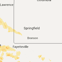
Missouri
| Local Time | Report Details |
|---|---|
| 10:55 AM CDT | Large tree snapped along highway 171 in jasper county MO, 57.6 miles ESE of Chanute, KS |
| 11:29 AM CDT | Severe thunderstorm wind gusts downed a large limb near centergas fuel in jasper county MO, 47.4 miles WSW of Springfield, MO |
| 6:12 PM CDT | Hail from one half to three quarter inch along with small tree limbs dow in st. louis county MO, 10.2 miles WNW of Saint Louis, MO |
South Carolina
| Local Time | Report Details |
|---|---|
| 12:26 PM EDT | Reported two trees down in the yard between leesburg road and hwy. 37 in richland county SC, 69.5 miles NW of Charleston, SC |
| 12:30 PM EDT | Calhoun co. dispatch reported trees down on thomas rd. at a z road. time estimated on radar. in calhoun county SC, 58.6 miles ENE of Augusta, GA |
| 12:30 PM EDT | Calhoun co. dispatch reported trees down on thomas rd. at a z road. time estimated on radar. in calhoun county SC, 58.6 miles ENE of Augusta, GA |
| 12:34 PM EDT | Highway patrol reported trees down near the intersection of leesburg road and hwy. 601. in richland county SC, 68.7 miles NW of Charleston, SC |
| 1:38 PM EDT | Several trees down along spring hill road near rambert church roa in lee county SC, 68.9 miles NNW of Charleston, SC |
| 1:46 PM EDT | State highway patrol headquarters had two trees and multiple large limbs down on their property at 10311 wilson blvd in blythewood s in richland county SC, 72.3 miles S of Charlotte, NC |
| 1:54 PM EDT | Lee county dispatch reports multiple trees down and power lines down on several roads near bishopville. multiple trees down on light wood knot road...dogwood road and s in lee county SC, 69.2 miles NNW of Charleston, SC |
| 1:54 PM EDT | Lee county dispatch reports a tree down on a car on spring hill road near bishopville sc. there were no injurie in lee county SC, 68.7 miles NNW of Charleston, SC |
| 2:27 PM EDT | Facebook report shows tree down in park west subdivision in charleston county SC, 24.2 miles SSE of Charleston, SC |
| 3:20 PM EDT | Quarter sized hail reported near Okatie, SC, 23.3 miles NE of Savannah, GA, quarter size hail reported near the intersection of okatie hwy and snake rd. time estimated from radar |
| 3:29 PM EDT | Multiple trees down on sc hwy 61 near magnolia plantation in charleston county SC, 22.9 miles S of Charleston, SC |
| 3:31 PM EDT | Tree down near the intersection of sc hwy 61 and bees ferry rd in charleston county SC, 24.7 miles S of Charleston, SC |
| 3:52 PM EDT | Twitter report shows large tree split and on house on murray ave. time estiamted from radar in berkeley county SC, 19.8 miles S of Charleston, SC |
| 5:45 PM EDT | Town of summerville reports a tree down in the roadway on berlin myers pkwy between e carolina ave and ashely dr in dorchester county SC, 16.7 miles SW of Charleston, SC |
Georgia
| Local Time | Report Details |
|---|---|
| 1:08 PM EDT | Liberty co warning point reports a tree down across mary todd rd near the intersection of ray rd. time estimated from radar in liberty county GA, 38.9 miles WSW of Savannah, GA |
| 3:15 PM EDT | Chatham co em reports a tree down on power line in the 8500 block of lyn ave. also nearby a tree fell on power lines near the intersection of coffee bluff rd and vernon in chatham county GA, 6.4 miles S of Savannah, GA |
| 3:15 PM EDT | Chatham co em reports a tree down on power line in the 8500 block of lyn ave. also nearby a tree fell on power lines near the intersection of coffee bluff rd and vernon in chatham county GA, 6.4 miles S of Savannah, GA |
| 4:05 PM EDT | Camden county 911/dispatch reports a tree downed by strong thunderstorm winds across north camden street in kingsland. time of damage based on radar dat in camden county GA, 33 miles N of Jacksonville, FL |
New York
| Local Time | Report Details |
|---|---|
| 1:12 PM EDT | Large tree uprooted crushing car in schenectady county NY, 1.6 miles E of Schenectady, NY |
| 2:00 PM EDT | Localized area of numerous uprooted trees. some snapped. radar estimated tim in delaware county NY, 59.8 miles NNE of Scranton, PA |
| 2:54 PM EDT | Trees down in moriah and port henry in essex county NY, 32.9 miles SSW of Burlington, VT |
| 4:05 PM EDT | Downed tree on i-87 southbound blocking two lanes in saratoga county NY, 27.3 miles NNE of Schenectady, NY |
| 4:37 PM EDT | 147th avenue closed between 232nd street and 235th street due to trees down on top of primary wires in queens county NY, 12.8 miles E of Brooklyn, NY |
| 4:40 PM EDT | Multiple reports of power lines down more than 5000 power outages reported in nassau county NY, 22.1 miles NE of Brooklyn, NY |
| 4:40 PM EDT | Trees and tree branches down with power lines at intersection of upland avenue and woodcrest in westchester county NY, 25.6 miles NNE of Brooklyn, NY |
| 9:37 PM EDT | 6 trees down in westmoreland... trees and wires down verona and utica in oneida county NY, 37.1 miles E of Syracuse, NY |
Virginia
| Local Time | Report Details |
|---|---|
| 2:05 PM EDT | Tree down in albemarle county VA, 52.7 miles NW of Richmond, VA |
| 2:10 PM EDT | Tree down on zion hill road in albemarle county VA, 52.3 miles NW of Richmond, VA |
| 3:19 PM EDT | Trees and power lines down in henry county VA, 34.7 miles S of Roanoke, VA |
| 3:22 PM EDT | Thunderstorm winds caused numerous trees down across the community of union hall in franklin county... v in franklin county VA, 21.1 miles SE of Roanoke, VA |
| 3:27 PM EDT | Large tree limbs down in carroll county VA, 51.3 miles SW of Roanoke, VA |
| 3:34 PM EDT | Thunderstorm winds brought down several trees in and around woolwine temporarily closing roadway in patrick county VA, 38.7 miles SSW of Roanoke, VA |
| 3:44 PM EDT | Trees and power lines down in henry county VA, 38.1 miles S of Roanoke, VA |
| 3:51 PM EDT | 2 trees down in campbell county VA, 46.3 miles E of Roanoke, VA |
| 4:00 PM EDT | Thunderstorm winds brought down at least two trees along route 58 on the north side of stuart... v in patrick county VA, 46.2 miles SSW of Roanoke, VA |
| 4:08 PM EDT | Thunderstorm winds brought down numerous trees across the community of critz in patrick county... v in patrick county VA, 45.7 miles SSW of Roanoke, VA |
| 4:10 PM EDT | Thunderstorm winds brought down trees along route 57 in patrick county... va in patrick county VA, 35.6 miles SSW of Roanoke, VA |
| 4:11 PM EDT | Tree down in henry county VA, 40.6 miles S of Roanoke, VA |
| 4:47 PM EDT | Trees down in henry county VA, 43.2 miles SSE of Roanoke, VA |
| 4:56 PM EDT | Tree down in pittsylvania county VA, 38.5 miles SE of Roanoke, VA |
| 7:44 PM EDT | Pair of trees into houses and one tree blocking roadway near 186 ashby ct in rockingham county VA, 69.6 miles ESE of Elkins, WV |
New Jersey
| Local Time | Report Details |
|---|---|
| 2:40 PM EDT | Several buildings damage in warren county NJ, 53.1 miles SSE of Scranton, PA |
| 2:48 PM EDT | Several buildings damage in warren county NJ, 53.1 miles SSE of Scranton, PA |
| 2:48 PM EDT | A barn was destroyed along with wires and poles down on route 51 in warren county NJ, 51.8 miles SE of Scranton, PA |
| 2:55 PM EDT | Several large limbs blown down onto vehicle. time estimated from rada in warren county NJ, 52.2 miles W of Brooklyn, NY |
| 3:38 PM EDT | Downed and uprooted trees on woodland ave in morris county NJ, 26.1 miles W of Brooklyn, NY |
| 3:45 PM EDT | Tree down blocking north avenue in union county NJ, 18.6 miles W of Brooklyn, NY |
| 3:46 PM EDT | Tree down on a house on mohawk drive in essex county NJ, 19.1 miles WNW of Brooklyn, NY |
| 3:46 PM EDT | Large tree snapped and down on a car at maple street in essex county NJ, 15.7 miles WNW of Brooklyn, NY |
| 3:46 PM EDT | Tree fell on power line and house with some structural damage on berkeley place in union county NJ, 16.4 miles W of Brooklyn, NY |
| 3:48 PM EDT | Tree down at intersection of woodland and randolph avenue in union county NJ, 23.1 miles WSW of Brooklyn, NY |
| 3:49 PM EDT | Large tree snapped and fell on fence in essex county NJ, 13.2 miles NW of Brooklyn, NY |
| 3:58 PM EDT | Tree fell on a car at branchbrook drive in essex county NJ, 9.6 miles WNW of Brooklyn, NY |
Alabama
| Local Time | Report Details |
|---|---|
| 1:40 PM CDT | Power lines reported dow in limestone county AL, 38.8 miles E of Florence, AL |
| 3:06 PM CDT | A microburst was reported... with power outages and tree limbs down across the are in walker county AL, 27.3 miles WNW of Birmingham, AL |
| 3:58 PM CDT | Two trees reported down from thunderstorm outflow wind in jefferson county AL, 6.4 miles NNE of Birmingham, AL |
| 4:26 PM CDT | A few trees down in the bessemer are in jefferson county AL, 12.9 miles SW of Birmingham, AL |
| 4:28 PM CDT | A few downed tree in jefferson county AL, 17.6 miles NE of Birmingham, AL |
| 4:28 PM CDT | A very large oak tree crashed into and destroyed a hom in jefferson county AL, 17.4 miles NE of Birmingham, AL |
| 4:41 PM CDT | A large tree is down and blocking blue ridge blv in jefferson county AL, 6.3 miles S of Birmingham, AL |
| 5:51 PM CDT | A few trees reported down along hanging rock roa in clay county AL, 53.6 miles ESE of Birmingham, AL |
| 5:55 PM CDT | Trees reported down along skyview driv in clay county AL, 51.4 miles NNW of Auburn, AL |
| 5:55 PM CDT | Trees reported down along mountain view roa in clay county AL, 53.7 miles NNW of Auburn, AL |
| 5:59 PM CDT | Tree down along corinth roa in clay county AL, 44.6 miles NNW of Auburn, AL |
| 6:18 PM CDT | Tree down along corinth roa in clay county AL, 44.6 miles NNW of Auburn, AL |
Pennsylvania
| Local Time | Report Details |
|---|---|
| 2:44 PM EDT | Numerous trees and wires dow in northampton county PA, 45.4 miles SE of Scranton, PA |
| 7:30 PM EDT | 8 to 10 power poles dow in allegheny county PA, 11.6 miles SE of Pittsburgh, PA |
| 7:40 PM EDT | Trees down in allegheny county PA, 10.9 miles SE of Pittsburgh, PA |
| 8:00 PM EDT | Tree down in allegheny county PA, 5.9 miles NNW of Pittsburgh, PA |
| 8:10 PM EDT | Tree down in allegheny county PA, 6.4 miles N of Pittsburgh, PA |
| 9:05 PM EDT | Two utility poles and wires dow in greene county PA, 34.4 miles S of Pittsburgh, PA |
| 9:10 PM EDT | Tree down on albany road. time estimated by rada in fayette county PA, 29.4 miles S of Pittsburgh, PA |
| 9:10 PM EDT | Trees down in fayette county PA, 33.3 miles S of Pittsburgh, PA |
| 9:40 PM EDT | Trees down in fayette county PA, 36 miles SE of Pittsburgh, PA |
North Carolina
| Local Time | Report Details |
|---|---|
| 3:02 PM EDT | Thunderstorm winds severely damaged a garage... downed trees... and took a roof off a barn on laurel spring church roa in surry county NC, 69.9 miles SW of Roanoke, VA |
| 3:05 PM EDT | Thunderstorm wind damage resulted in a roof blown off a business within the city of elkin. unknown original structural integrity of the busines in surry county NC, 71.5 miles N of Charlotte, NC |
| 3:15 PM EDT | 5-6 trees of 2-3 ft. diameter down in downtown elkin. several metal light poles broken and a wooden fence blown down. power outages in tow in surry county NC, 71.5 miles N of Charlotte, NC |
| 3:58 PM EDT | Tree and limbs down in plantation landing in pender county NC, 11 miles ENE of Wilmington, NC |
| 4:10 PM EDT | Quarter sized hail reported near Wilmington, NC, 11.7 miles ENE of Wilmington, NC, several minutes of hail varying from pea to quarter size |
| 6:00 PM EDT | Strong winds blew down a sourwood tree onto a car. time estimated by radar dat in buncombe county NC, 60 miles N of Greenville, SC |
| 7:35 PM EDT | Storm blew down a few trees on fairway knoll drive located just north of cummings cove golf and country clu in henderson county NC, 33.1 miles N of Greenville, SC |
West Virginia
| Local Time | Report Details |
|---|---|
| 3:42 PM EDT | Multiple branches down and a few power outages in the town of cla in clay county WV, 31.3 miles ENE of Charleston, WV |
| 4:00 PM EDT | Trees down on winfield road near the kanawha-putnam county lin in putnam county WV, 13.5 miles WNW of Charleston, WV |
| 4:03 PM EDT | Trees reported down near log gardens in kanawha county WV, 11.4 miles WNW of Charleston, WV |
| 5:37 PM EDT | One tree down on creek road in danvill in boone county WV, 21.3 miles SSW of Charleston, WV |
| 5:38 PM EDT | Branches down along route 85 between madison and danvill in boone county WV, 21.4 miles SSW of Charleston, WV |
Arkansas
| Local Time | Report Details |
|---|---|
| 3:00 PM CDT | Tree down in sebastian county AR, 1.3 miles ENE of Fort Smith, AR |
| 3:05 PM CDT | Power lines down all over the city. time estimate in sebastian county AR, 1.3 miles ENE of Fort Smith, AR |
| 3:15 PM CDT | Significant roof damage to a log home business. time estimated via radar. photo relayed via broadcast media social media accoun in crawford county AR, 5.5 miles NE of Fort Smith, AR |
| 3:17 PM CDT | Large tree downed. photo received via social medi in sebastian county AR, 14.6 miles SE of Fort Smith, AR |
| 3:17 PM CDT | Multiple large tree branches downed. power out in town. estimated to be at least 60 to 70 mph winds. report relayed via social medi in crawford county AR, 22.6 miles NE of Fort Smith, AR |
| 3:30 PM CDT | Large trees down across wire road. time estimate in franklin county AR, 30.1 miles ENE of Fort Smith, AR |
| 3:30 PM CDT | Large tree downed. power out. other widespread tree limb damage. photo received via social media. relayed by broadcast media. time estimate in crawford county AR, 11.2 miles ENE of Fort Smith, AR |
| 3:40 PM CDT | Trees down. time estimated via rada in franklin county AR, 35.7 miles ENE of Fort Smith, AR |
| 3:40 PM CDT | 8 inch diameter pine laying across pilot grove loop off of highway 309 south. time estimated via rada in franklin county AR, 33.6 miles E of Fort Smith, AR |
| 3:40 PM CDT | Large tree fell on a mobile home...severely damaging it. time estimated via radar. photo relayed via broadcast media social media accoun in franklin county AR, 34.1 miles ENE of Fort Smith, AR |
| 3:42 PM CDT | Tree damage in franklin county AR, 34.1 miles ENE of Fort Smith, AR |
| 3:50 PM CDT | Large trees were blown dow in logan county AR, 32.2 miles E of Fort Smith, AR |
| 3:50 PM CDT | West creek road completely blocked by downed trees and power lines. time estimated via rada in franklin county AR, 35.2 miles E of Fort Smith, AR |
| 3:59 PM CDT | Damage to trees was reported...and some shingles were blown off of roof in logan county AR, 39.6 miles E of Fort Smith, AR |
| 4:05 PM CDT | *** 1 inj *** a tree fell on a truck...injuring one perso in polk county AR, 49.6 miles NNW of Nashville, AR |
| 4:05 PM CDT | Trees were blown down near waldron and in other areas of northern scott count in scott county AR, 38.3 miles SSE of Fort Smith, AR |
| 4:05 PM CDT | Power lines were blown down in booneville across highway 109 and grove street. the fire department was responding due to a fire in the tree in logan county AR, 33 miles ESE of Fort Smith, AR |
| 4:05 PM CDT | Power lines were blown dow in logan county AR, 38.2 miles ESE of Fort Smith, AR |
| 4:10 PM CDT | A portion of a deck was blown over. numerous large limbs were dow in polk county AR, 48 miles NNW of Nashville, AR |
| 4:15 PM CDT | Trees were downed across highway 28 near park in scott county AR, 48 miles SSE of Fort Smith, AR |
| 4:20 PM CDT | Trees and power lines were blown down over the southern half of the count in johnson county AR, 54 miles E of Fort Smith, AR |
| 4:20 PM CDT | Widespread large trees down. damage to homeowner roof. power outage in boone county AR, 52.3 miles SSE of Springfield, MO |
| 4:20 PM CDT | Widespread large trees down. damage to homeowner roof. power outage in yell county AR, 61.6 miles ESE of Fort Smith, AR |
| 4:35 PM CDT | Numerous trees and power lines were blown down between danville and dardanell in yell county AR, 62.7 miles ESE of Fort Smith, AR |
| 4:40 PM CDT | Trees were blown down on highway 27 in montgomery county AR, 46.9 miles N of Nashville, AR |
| 4:40 PM CDT | Significant wind damage in mt ida. numerous trees down across town with several homes receiving damage by falling trees. some roofs were peeled back by the win in montgomery county AR, 43.3 miles NNE of Nashville, AR |
| 4:43 PM CDT | Storm damage reported in pope county AR, 60.8 miles NW of Little Rock, AR |
| 4:43 PM CDT | A tree was snapped off near its bas in pope county AR, 65.9 miles NW of Little Rock, AR |
| 4:45 PM CDT | Several trees down in city... strong winds estimated at 70 mph in sevier county AR, 29 miles WNW of Nashville, AR |
| 5:00 PM CDT | A tree was blown down on a hous in yell county AR, 59.8 miles WNW of Little Rock, AR |
| 5:00 PM CDT | Trees were blown down...and some were on house in pike county AR, 31.4 miles NNE of Nashville, AR |
| 5:01 PM CDT | Trees were blown dow in garland county AR, 49 miles NE of Nashville, AR |
| 5:05 PM CDT | Trees and power lines down across county but heaviest damage in horatio and locksburg area in sevier county AR, 29.5 miles W of Nashville, AR |
| 5:08 PM CDT | E 60 mph winds with numerous tree limbs down. tree down at amity / harris rd caused power outag in hot spring county AR, 43.7 miles NE of Nashville, AR |
| 5:10 PM CDT | Trees were blown down...and some were on house in pike county AR, 24 miles NNE of Nashville, AR |
| 5:15 PM CDT | Trees down north and west of nashville... as well as county wide in howard county AR, 2.1 miles WNW of Nashville, AR |
| 5:20 PM CDT | Widespread damage. at least 3 large oak trees down. two outbuildings destroye in hot spring county AR, 46.5 miles NE of Nashville, AR |
| 5:25 PM CDT | Trees were blown dow in perry county AR, 37.7 miles WNW of Little Rock, AR |
| 5:25 PM CDT | Trees were blown down on brady mountain roa in garland county AR, 50.3 miles WSW of Little Rock, AR |
| 5:40 PM CDT | Power lines reported down on jacks isle road and highway 32 near millwood lake in little river county AR, 23 miles SW of Nashville, AR |
| 5:45 PM CDT | Trees were blown down on the campus of ouachita baptist universit in clark county AR, 47.2 miles ENE of Nashville, AR |
| 5:50 PM CDT | Trees and power lines were blown down at lawson and sparks roa in saline county AR, 14.2 miles WSW of Little Rock, AR |
| 5:55 PM CDT | Some shingles were blown off of the roof of a home on rivercrest driv in pulaski county AR, 0.9 miles W of Little Rock, AR |
| 5:55 PM CDT | 50 to 60 mph gusts measured in redland community 4 miles east of prescott. numerous large limbs and some trees snapped off in nevada county AR, 32 miles ESE of Nashville, AR |
| 6:00 PM CDT | Trees were blown down on markham stree in pulaski county AR, 0.9 miles W of Little Rock, AR |
| 6:01 PM CDT | Trees were blown down on colonel glenn road...west of i-430...with the road impassabl in pulaski county AR, 10 miles WSW of Little Rock, AR |
| 6:01 PM CDT | Trees were blown down across highway 53 south...taking power lines with the in clark county AR, 42 miles E of Nashville, AR |
| 6:05 PM CDT | Three large trees were uprooted at dickey-stephens park in downtown north little roc in pulaski county AR, 1.5 miles N of Little Rock, AR |
| 6:13 PM CDT | Storm damage reported in pulaski county AR, 3.4 miles ESE of Little Rock, AR |
| 6:15 PM CDT | Trees and power lines reported down in hope and outside the city limits as well in hempstead county AR, 24.2 miles SE of Nashville, AR |
| 6:15 PM CDT | Trees and power lines reported down all over the county in nevada county AR, 40.9 miles SE of Nashville, AR |
| 6:15 PM CDT | Trees were blown down in sheridan and all over the count in grant county AR, 31.1 miles SSW of Little Rock, AR |
| 6:20 PM CDT | Large tree and power lines down on spruce street... also trees and powerlines down on 29 south of town in lafayette county AR, 43.3 miles SSE of Nashville, AR |
| 6:26 PM CDT | Storm damage reported in pulaski county AR, 3.4 miles ESE of Little Rock, AR |
| 6:40 PM CDT | Numerous trees were blown down in the count in ouachita county AR, 63.8 miles ESE of Nashville, AR |
| 6:40 PM CDT | E 70 mph win in lonoke county AR, 22 miles ENE of Little Rock, AR |
| 6:40 PM CDT | Numerous chicken houses damaged in the rison are in cleveland county AR, 54.6 miles S of Little Rock, AR |
| 6:40 PM CDT | Numerous chicken houses damaged in the rison are in cleveland county AR, 54.6 miles S of Little Rock, AR |
| 6:50 PM CDT | Winds gusted to 64 mph at pine bluff grider field airpor in jefferson county AR, 39 miles SSE of Little Rock, AR |
| 6:50 PM CDT | Large tree down in smackover on vehicle in union county AR, 62 miles NW of Bastrop, LA |
| 6:50 PM CDT | Tree reported dow in lonoke county AR, 18.2 miles SE of Little Rock, AR |
| 6:50 PM CDT | Trees and power lines down county wide. out building in pine bluff destroyed by a falling tre in jefferson county AR, 39.9 miles SSE of Little Rock, AR |
| 6:54 PM CDT | 59 mph gust eld asos in union county AR, 52.9 miles NW of Bastrop, LA |
| 7:00 PM CDT | Trees and power lines reported down county wide in union county AR, 52.9 miles NW of Bastrop, LA |
| 7:05 PM CDT | Trees were blown dow in bradley county AR, 57.9 miles N of Bastrop, LA |
| 7:10 PM CDT | Several trees down in town. one building on the square lost half the roof. power lines dow in lincoln county AR, 61 miles SSE of Little Rock, AR |
| 7:15 PM CDT | A tree fell on a hous in drew county AR, 58.7 miles N of Bastrop, LA |
| 7:25 PM CDT | Trees and signs were blown dow in drew county AR, 59.1 miles N of Bastrop, LA |
| 7:28 PM CDT | The roof was blown off of three businesses in tow in drew county AR, 59.1 miles N of Bastrop, LA |
| 7:35 PM CDT | Large tree snapped on timberlane at the old high... west side of el dorado in union county AR, 53.8 miles NW of Bastrop, LA |
| 7:45 PM CDT | Trees were downed due to strong straight line wind in ashley county AR, 24.4 miles N of Bastrop, LA |
| 7:55 PM CDT | Trees and powerlines downed all through the cit in chicot county AR, 58.7 miles NNE of Bastrop, LA |
Vermont
| Local Time | Report Details |
|---|---|
| 4:05 PM EDT | Numerous trees down in washington county VT, 34.1 miles ESE of Burlington, VT |
| 4:18 PM EDT | Trees down...power lines down...sparking fire on power lin in washington county VT, 38.5 miles E of Burlington, VT |
| 4:48 PM EDT | Trees down in caledonia county VT, 59.1 miles E of Burlington, VT |
| 4:50 PM EDT | Trees down in caledonia county VT, 58.7 miles E of Burlington, VT |
Indiana
| Local Time | Report Details |
|---|---|
| 3:30 PM CDT | Storm damage reported in spencer county IN, 36 miles ENE of Evansville, IN |
| 3:30 PM CDT | Storm damage reported in spencer county IN, 36 miles ENE of Evansville, IN |
| 5:53 PM EDT | Large tree blocking atkinson hill road near markland pike in switzerland county IN, 34.1 miles SW of Cincinnati, OH |
Colorado
| Local Time | Report Details |
|---|---|
| 2:46 PM MDT | Golf Ball sized hail reported near Pueblo, CO, 10.8 miles N of Pueblo, CO, . |
| 2:50 PM MDT | Ping Pong Ball sized hail reported near Pueblo, CO, 10.1 miles N of Pueblo, CO, . |
| 2:55 PM MDT | Hen Egg sized hail reported near Colorado Springs, CO, 39.3 miles N of Pueblo, CO, . |
| 3:06 PM MDT | Hen Egg sized hail reported near Colorado Springs, CO, 38 miles N of Pueblo, CO, observed by the contract observer at the airport. |
| 3:28 PM MDT | Golf Ball sized hail reported near Kit Carson, CO, 81.4 miles S of Yuma, CO, pea to golfball size hail. ended at time of event. |
| 3:28 PM MDT | Hen Egg sized hail reported near Kit Carson, CO, 81.4 miles S of Yuma, CO, relayed via social media. |
| 4:07 PM MDT | Quarter sized hail reported near Colorado Springs, CO, 40.4 miles NNW of Pueblo, CO, . |
| 4:55 PM MDT | Quarter sized hail reported near Colorado Springs, CO, 44.6 miles NNW of Pueblo, CO, . |
| 4:55 PM MDT | Golf Ball sized hail reported near Pueblo, CO, 7.3 miles SW of Pueblo, CO, . |
| 4:56 PM MDT | Quarter sized hail reported near Colorado Springs, CO, 44.1 miles NNW of Pueblo, CO, . |
| 5:03 PM MDT | Half Dollar sized hail reported near Pueblo, CO, 9.5 miles SW of Pueblo, CO, . |
| 5:10 PM MDT | Quarter sized hail reported near Colorado Springs, CO, 44.3 miles N of Pueblo, CO, . |
| 5:15 PM MDT | Golf Ball sized hail reported near Pueblo, CO, 10.4 miles SSW of Pueblo, CO, . |
| 5:30 PM MDT | Quarter sized hail reported near Pueblo, CO, 13.6 miles S of Pueblo, CO, . |
| 5:50 PM MDT | Quarter sized hail reported near Colorado Springs, CO, 46.4 miles NNW of Pueblo, CO, . |
| 5:52 PM MDT | Tennis Ball sized hail reported near Flagler, CO, 60.1 miles SSW of Yuma, CO, passed to em by law enforcement. time estimated by radar. |
| 5:55 PM MDT | Golf Ball sized hail reported near Flagler, CO, 60.6 miles SSW of Yuma, CO, golfball size hail report at mile marker 393 on i-70. |
| 5:56 PM MDT | Half Dollar sized hail reported near Colorado Springs, CO, 46.1 miles N of Pueblo, CO, . |
| 6:10 PM MDT | Golf Ball sized hail reported near Seibert, CO, 60.4 miles S of Yuma, CO, time estimated by radar. |
| 6:11 PM MDT | Quarter sized hail reported near Seibert, CO, 57 miles S of Yuma, CO, on i70 between mile markers 405 and 410. |
| 6:20 PM MDT | Golf Ball sized hail reported near Elbert, CO, 45.3 miles SSE of Denver, CO, quarter to golf ball size hail. |
| 6:23 PM MDT | Golf Ball sized hail reported near Vona, CO, 56.5 miles S of Yuma, CO, report given to em by law enforcement. time estimated by radar. |
| 6:26 PM MDT | Quarter sized hail reported near Model, CO, 65.4 miles SSE of Pueblo, CO, observer had a window broken by the hail. |
| 6:28 PM MDT | Golf Ball sized hail reported near Model, CO, 65.8 miles SSE of Pueblo, CO, . |
| 6:30 PM MDT | Golf Ball sized hail reported near Peyton, CO, 51.5 miles SE of Denver, CO |
| 6:38 PM MDT | Golf Ball sized hail reported near Stratton, CO, 49.8 miles S of Yuma, CO, time estimated by radar. hail covered ground. |
| 7:35 PM MDT | Tennis Ball sized hail reported near Bethune, CO, 43 miles SSE of Yuma, CO, relayed via twitter from denver7 |
Maine
| Local Time | Report Details |
|---|---|
| 5:00 PM EDT | Trees down on cline road. time is estimate in aroostook county ME, 38.9 miles NW of Caribou, ME |
| 5:19 PM EDT | Several trees down on gagnon road in aroostook county ME, 35.9 miles NNW of Caribou, ME |
| 5:20 PM EDT | Large tree uprooted in st david cemetery in aroostook county ME, 36.2 miles NNW of Caribou, ME |
| 5:20 PM EDT | Large storage shed flattened and vegetable stand picked up and turned ove in aroostook county ME, 36 miles NNW of Caribou, ME |
| 5:20 PM EDT | Large barn flattened and vegetable stand picked up and turned ove in aroostook county ME, 31.1 miles NNW of Caribou, ME |
| 6:20 PM EDT | Large tree dow in aroostook county ME, 17.9 miles NE of Caribou, ME |
New Hampshire
| Local Time | Report Details |
|---|---|
| 5:05 PM EDT | Multiple trees and wires down in grafton county NH, 67.1 miles ESE of Burlington, VT |
| 5:15 PM EDT | Multiple trees and wires down in grafton county NH, 72.4 miles E of Burlington, VT |
| 5:20 PM EDT | Numerous trees and wires down in grafton county NH, 76.6 miles E of Burlington, VT |
| 5:45 PM EDT | Branches and power lines down causing power outages in grafton county NH, 60.8 miles ESE of Burlington, VT |
| 5:45 PM EDT | Branches and power lines down causing power outages in grafton county NH, 66.5 miles ESE of Burlington, VT |
| 6:00 PM EDT | Tree down near the airport in coos county NH, 78.2 miles NW of Portland, ME |
Montana
| Local Time | Report Details |
|---|---|
| 3:35 PM MDT | Quarter sized hail reported near Glendive, MT, 72 miles NE of Miles City, MT |
| 3:38 PM MDT | Quarter sized hail reported near Glendive, MT, 72.7 miles NE of Miles City, MT, quarter sized hail reported with photo from the general public via social media |
| 3:45 PM MDT | Ping Pong Ball sized hail reported near Glendive, MT, 72.7 miles NE of Miles City, MT |
| 3:45 PM MDT | Half Dollar sized hail reported near Glendive, MT, 70.9 miles NE of Miles City, MT |
| 3:47 PM MDT | Quarter sized hail reported near Glendive, MT, 72.3 miles NE of Miles City, MT |
| 4:00 PM MDT | Quarter sized hail reported near Glendive, MT, 72.7 miles NE of Miles City, MT, quarter sized hail reported by the public through social media. |
Texas
| Local Time | Report Details |
|---|---|
| 5:24 PM CDT | Straight line wind damage to several buildings. flipped camper or trailer destroye in lubbock county TX, 3 miles SE of Lubbock, TX |
| 6:50 PM CDT | Golf Ball sized hail reported near Skellytown, TX, 44.6 miles NE of Amarillo, TX |
| 7:24 PM CDT | Golf Ball sized hail reported near Wayside, TX, 31.5 miles SE of Amarillo, TX |
| 7:25 PM CDT | Golf Ball sized hail reported near Groom, TX, 40.4 miles E of Amarillo, TX |
| 7:29 PM CDT | Storm damage reported in carson county TX, 37 miles E of Amarillo, TX |
| 7:31 PM CDT | Quarter sized hail reported near Groom, TX, 40.4 miles E of Amarillo, TX |
| 7:35 PM CDT | Storm damage reported in carson county TX, 33 miles E of Amarillo, TX |
| 7:35 PM CDT | Quarter sized hail reported near Groom, TX, 33 miles E of Amarillo, TX |
| 7:37 PM CDT | Storm damage reported in martin county TX, 38.9 miles NNE of Odessa, TX |
| 7:43 PM CDT | Golf Ball sized hail reported near Wayside, TX, 31.5 miles SE of Amarillo, TX |
| 7:45 PM CDT | Reported by west texas mesonet station in cottle county TX, 38.7 miles SSW of Childress, TX |
| 8:00 PM CDT | Quarter sized hail reported near Clarendon, TX, 38.5 miles ESE of Amarillo, TX |
| 8:00 PM CDT | Wind gust reported by west texas mesonet site 10 wsw guthrie in king county TX, 61.2 miles SSW of Childress, TX |
| 8:05 PM CDT | Storm damage reported in andrews county TX, 33.4 miles NNW of Odessa, TX |
| 8:26 PM CDT | Reported by west texas mesonet station in dickens county TX, 56.9 miles E of Lubbock, TX |
| 8:36 PM CDT | Half Dollar sized hail reported near Amarillo, TX, 9.8 miles SSE of Amarillo, TX |
Massachusetts
| Local Time | Report Details |
|---|---|
| 6:30 PM EDT | Large tree down on wires on turners falls road in franklin county MA, 70 miles ESE of Schenectady, NY |
| 6:40 PM EDT | Wires down on south street...400 block in hampshire county MA, 72.4 miles ESE of Schenectady, NY |
| 6:45 PM EDT | Tree and wires down on anderson avenue in hampden county MA, 68.6 miles WNW of Providence, RI |
| 6:45 PM EDT | Tree and wires down on anderson avenue in hampden county MA, 68.6 miles WNW of Providence, RI |
| 6:48 PM EDT | Tree down at the intersection of burlingame and warregan street...blocking burlingame in hampden county MA, 64.5 miles WNW of Providence, RI |
Ohio
| Local Time | Report Details |
|---|---|
| 7:12 PM EDT | Tree fell on wires. wires dow in brown county OH, 36.7 miles ESE of Cincinnati, OH |
| 7:39 PM EDT | 8 trees 2-3 feet in diameter fell. house sustained roof damag in scioto county OH, 68 miles E of Cincinnati, OH |
North Dakota
| Local Time | Report Details |
|---|---|
| 5:18 PM MDT | Quarter sized hail reported near Bowman, ND, 118.3 miles E of Miles City, MT, nickel to quarter size hail gave way to pea to dime size hail. ground is covered. |
| 5:26 PM MDT | Quarter sized hail reported near Bowman, ND, 118.4 miles E of Miles City, MT, some quarters... hail covering the ground. |
| 5:45 PM MDT | Golf Ball sized hail reported near Rhame, ND, 98.9 miles ESE of Miles City, MT, hail bigger than ping pong balls. |
| 5:50 PM MDT | Golf Ball sized hail reported near Rhame, ND, 102.5 miles ESE of Miles City, MT, . |
Illinois
| Local Time | Report Details |
|---|---|
| 6:25 PM CDT | Wind gusts estimated at 40 to 45 mph blew some highway constructions signs over on i-25 in madison county IL, 9.4 miles ENE of Saint Louis, MO |
| 6:58 PM CDT | Storm damage reported in st. clair county IL, 19.7 miles ESE of Saint Louis, MO |
Louisiana
| Local Time | Report Details |
|---|---|
| 7:10 PM CDT | Numerous trees down and transformer damage reported in northern part of the parish in webster county LA, 40 miles NNE of Shreveport, LA |
| 7:25 PM CDT | 15 trees down mainly near hwy 79 as well as power lines down started fires on alt 2 and oil center road in haynesville... and another fire on stand pipe and camp road in claiborne county LA, 46.4 miles NE of Shreveport, LA |
| 7:30 PM CDT | Trees reported down all over the parish in union county LA, 41.4 miles WNW of Bastrop, LA |
| 7:40 PM CDT | Trees reported down all over the northern part of the parish in webster county LA, 27.9 miles NE of Shreveport, LA |
| 7:45 PM CDT | Damage to roof at sheriffs office in farmerville in union county LA, 28.2 miles W of Bastrop, LA |
| 7:50 PM CDT | Roof blown off car wash in marion in union county LA, 20.7 miles WNW of Bastrop, LA |
| 8:00 PM CDT | 20 trees down across the parish in lincoln county LA, 45.6 miles WSW of Bastrop, LA |
| 8:05 PM CDT | Trees downed all through the northern portions of the paris in morehouse county LA, 17.3 miles NE of Bastrop, LA |
| 8:10 PM CDT | Power out due to transformers reported damaged due to storms in webster county LA, 28.2 miles ENE of Shreveport, LA |
| 8:10 PM CDT | Large tree uprooted whites ferry rd in west monroe in ouachita county LA, 23 miles SW of Bastrop, LA |
| 8:20 PM CDT | Trees reported down parish wide...and several power lines brought down by fallen trees in ouachita county LA, 20.8 miles SSW of Bastrop, LA |
| 8:25 PM CDT | Trees downed all throughout the paris in west carroll county LA, 31.1 miles E of Bastrop, LA |
| 8:30 PM CDT | Trees and power lines down across the paris in east carroll county LA, 43 miles ENE of Bastrop, LA |
| 8:38 PM CDT | Trees and power lines reported down all over the parish in jackson county LA, 44.9 miles SW of Bastrop, LA |
| 8:40 PM CDT | Trees and powerlines downed throughout the paris in richland county LA, 27.6 miles SSE of Bastrop, LA |
| 9:00 PM CDT | Tree downed at pill green road near hwy 577. one tree fell on powerline on hwy 57 in madison county LA, 42.2 miles SE of Bastrop, LA |
| 9:00 PM CDT | Trees and power lines down across the paris in east carroll county LA, 43 miles ENE of Bastrop, LA |
| 9:05 PM CDT | Tree downed on powerline on moss roa in franklin county LA, 42.4 miles S of Bastrop, LA |
| 9:10 PM CDT | Tree down 1 north of olla in la salle county LA, 62.8 miles SSW of Bastrop, LA |
| 9:25 PM CDT | Two trees downed on highway 875 in wisne in franklin county LA, 57 miles SSE of Bastrop, LA |
| 9:55 PM CDT | Tree downed across a road in harrisonburg in catahoula county LA, 69.7 miles S of Bastrop, LA |
South Dakota
| Local Time | Report Details |
|---|---|
| 6:40 PM MDT | Golf Ball sized hail reported near Ludlow, SD, 120.3 miles N of Rapid City, SD |
| 6:50 PM MDT | Quarter sized hail reported near Lodgepole, SD, 112.9 miles SW of Bismarck, ND |
| 7:10 PM MDT | Hen Egg sized hail reported near Reva, SD, 101.7 miles N of Rapid City, SD, hail was still falling at 0715 pm |
| 7:20 PM MDT | Ping Pong Ball sized hail reported near Prairie City, SD, 102.4 miles N of Rapid City, SD |
| 7:20 PM MDT | Golf Ball sized hail reported near Reva, SD, 102 miles N of Rapid City, SD |
| 7:55 PM MDT | Quarter sized hail reported near Bison, SD, 90.5 miles NNE of Rapid City, SD |
| 8:00 PM MDT | Storm damage reported in perkins county SD, 107.4 miles NNE of Rapid City, SD |
| 8:10 PM MDT | Hen Egg sized hail reported near Faith, SD, 80.1 miles NNE of Rapid City, SD |
| 8:22 PM MDT | Golf Ball sized hail reported near Faith, SD, 78.1 miles NNE of Rapid City, SD |
| 8:44 PM MDT | Quarter sized hail reported near Faith, SD, 77.9 miles NE of Rapid City, SD |
| 8:54 PM MDT | Half Dollar sized hail reported near Faith, SD, 75.3 miles NE of Rapid City, SD |
| 9:00 PM MDT | Quarter sized hail reported near Faith, SD, 71.4 miles NE of Rapid City, SD |
| 9:15 PM MDT | Storm damage reported in meade county SD, 72.8 miles NE of Rapid City, SD |
| 9:20 PM MDT | Half Dollar sized hail reported near Howes, SD, 74.9 miles ENE of Rapid City, SD, many broken branches |
| 9:20 PM MDT | Many broken branches in ziebach county SD, 74.9 miles ENE of Rapid City, SD |
| 9:30 PM MDT | Storm damage reported in ziebach county SD, 71.6 miles ENE of Rapid City, SD |
| 2:25 AM MDT | Time estimated based on radar in oglala lakota county SD, 72.8 miles SE of Rapid City, SD |
Mississippi
| Local Time | Report Details |
|---|---|
| 8:25 PM CDT | Trees were down across the count in bolivar county MS, 95.4 miles NE of Bastrop, LA |
| 8:30 PM CDT | Numerous trees downed across the southern parts of the county...mainly south of highway 43 in washington county MS, 60.6 miles ENE of Bastrop, LA |
| 8:40 PM CDT | Tree downed across grant roa in issaquena county MS, 53 miles E of Bastrop, LA |
| 8:45 PM CDT | Trees and power lines around the intersection of luther ray cobb rd and raymond cobb rd in lauderdale county MS, 71 miles SSE of Starkville, MS |
| 8:45 PM CDT | Trees were down across the count in sunflower county MS, 83.7 miles NNW of Jackson, MS |
| 8:55 PM CDT | A few trees and power lines downed along valley rd in lauderdale county MS, 79.1 miles S of Starkville, MS |
| 9:10 PM CDT | Trees downed on clinton-raymond roa in hinds county MS, 10.6 miles W of Jackson, MS |
| 9:25 PM CDT | Trees downed at the intersection of hwy 16 and hwy 17. tree fell on a powerline at this location. a tree also fell on the natchez trace nearb in madison county MS, 33.9 miles NE of Jackson, MS |
| 9:30 PM CDT | Scattered trees and power lines down in the count in yazoo county MS, 40.9 miles NNW of Jackson, MS |
| 9:35 PM CDT | Trees and powerlines downed throughout the city and county. numerous trees were downed on i-20 near vicksbur in warren county MS, 40.4 miles W of Jackson, MS |
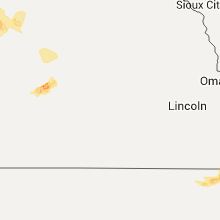
Nebraska
| Local Time | Report Details |
|---|---|
| 6:52 AM CDT | Quarter sized hail reported near Broken Bow, NE, 61.4 miles ENE of North Platte, NE |
Connect with Interactive Hail Maps