

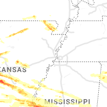
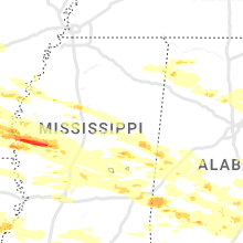
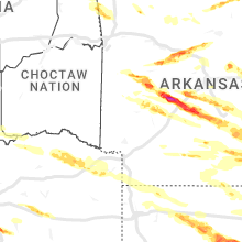
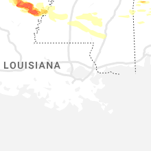
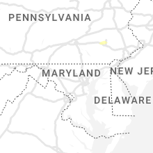
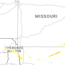
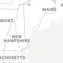
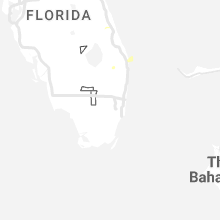
Hail Map for Wednesday, June 14, 2023

Number of Impacted Households on 6/14/2023
0
Impacted by 1" or Larger Hail
0
Impacted by 1.75" or Larger Hail
0
Impacted by 2.5" or Larger Hail
Square Miles of Populated Area Impacted on 6/14/2023
0
Impacted by 1" or Larger Hail
0
Impacted by 1.75" or Larger Hail
0
Impacted by 2.5" or Larger Hail


Cities Most Affected by Hail Storms of 6/14/2023
| Hail Size | Demographics of Zip Codes Affected | ||||||
|---|---|---|---|---|---|---|---|
| City | Count | Average | Largest | Pop Density | House Value | Income | Age |
| Royal, AR | 4 | 3.38 | 4.00 | 44 | $69k | $36.5k | 42.3 |
| Van, TX | 5 | 2.50 | 3.50 | 88 | $67k | $37.0k | 36.3 |
| Waxahachie, TX | 5 | 2.35 | 3.00 | 348 | $90k | $48.1k | 33.7 |
| Hot Springs National Park, AR | 5 | 2.30 | 3.00 | 380 | $82k | $30.9k | 43.4 |
| Albany, GA | 4 | 2.81 | 3.75 | 196 | $44k | $18.6k | 33.3 |
| Ennis, TX | 4 | 2.25 | 3.00 | 104 | $73k | $41.1k | 33.7 |
| Sarepta, LA | 4 | 2.06 | 2.75 | 48 | $58k | $28.8k | 39.0 |
| Star City, AR | 3 | 2.67 | 3.50 | 26 | $53k | $31.0k | 39.1 |
| Brooksville, MS | 2 | 3.75 | 5.00 | 9 | $46k | $21.7k | 36.6 |
| Louisville, MS | 3 | 1.92 | 2.00 | 41 | $57k | $28.7k | 38.9 |
| Malvern, AR | 2 | 2.88 | 3.00 | 73 | $61k | $31.1k | 39.3 |
| Quitman, LA | 2 | 2.25 | 2.50 | 21 | $79k | $37.6k | 40.0 |
| Blakely, GA | 2 | 2.13 | 2.50 | 25 | $0k | $0.0k | 38.9 |
| Dumas, AR | 2 | 2.13 | 2.50 | 36 | $48k | $26.1k | 37.5 |
| Sheridan, AR | 1 | 4.00 | 4.00 | 41 | $74k | $39.0k | 40.1 |
| Doerun, GA | 1 | 4.00 | 4.00 | 20 | $58k | $30.0k | 40.8 |
| Lindale, TX | 2 | 2.00 | 2.00 | 126 | $91k | $39.6k | 40.4 |
| Damascus, AR | 2 | 1.88 | 2.00 | 37 | $62k | $28.9k | 39.5 |
| Greenville, MS | 2 | 1.75 | 1.75 | 313 | $61k | $26.5k | 35.2 |
| Ocilla, GA | 2 | 1.75 | 1.75 | 36 | $56k | $27.3k | 37.2 |
| Russellville, AL | 1 | 3.00 | 3.00 | 76 | $66k | $26.7k | 35.5 |
| Columbia, AL | 1 | 2.75 | 2.75 | 21 | $69k | $26.9k | 44.5 |
| Springfield, AR | 1 | 2.50 | 2.50 | 27 | $44k | $33.0k | 41.5 |
| Pearcy, AR | 1 | 2.50 | 2.50 | 112 | $83k | $37.1k | 39.5 |
| Blountsville, AL | 1 | 2.00 | 2.00 | 57 | $78k | $31.5k | 38.5 |
| Naples, TX | 1 | 2.00 | 2.00 | 18 | $41k | $24.0k | 43.9 |
| Newbern, AL | 1 | 2.00 | 2.00 | 14 | $56k | $21.1k | 42.5 |
| Lincoln, AR | 1 | 2.00 | 2.00 | 52 | $72k | $29.6k | 37.3 |
| Canehill, AR | 1 | 1.75 | 1.75 | 18 | $54k | $28.9k | 42.4 |
| Hogansville, GA | 1 | 1.75 | 1.75 | 66 | $66k | $31.7k | 38.3 |
| Homer, LA | 1 | 1.75 | 1.75 | 28 | $60k | $25.7k | 39.6 |
| Clarksdale, MS | 1 | 1.75 | 1.75 | 83 | $54k | $23.1k | 32.4 |
| Arcola, MS | 1 | 1.75 | 1.75 | 0 | $35k | $17.0k | 36.6 |
| Lonsdale, AR | 1 | 1.75 | 1.75 | 19 | $89k | $38.5k | 50.6 |
| Doniphan, MO | 1 | 1.75 | 1.75 | 21 | $50k | $22.3k | 41.7 |
| Honey Grove, TX | 1 | 1.75 | 1.75 | 19 | $53k | $30.8k | 42.6 |
| Simsboro, LA | 1 | 1.75 | 1.75 | 22 | $61k | $32.0k | 38.6 |
| Midlothian, TX | 1 | 1.75 | 1.75 | 318 | $112k | $60.9k | 35.6 |
| Leola, AR | 1 | 1.75 | 1.75 | 5 | $38k | $29.6k | 40.1 |
| Adel, GA | 1 | 1.75 | 1.75 | 82 | $62k | $27.7k | 35.9 |
| Little Rock, MS | 1 | 1.75 | 1.75 | 30 | $52k | $31.0k | 41.9 |
| Caddo Gap, AR | 1 | 1.75 | 1.75 | 6 | $41k | $33.6k | 42.1 |
| Deport, TX | 1 | 1.75 | 1.75 | 12 | $47k | $27.2k | 42.9 |
| Grantville, GA | 1 | 1.75 | 1.75 | 92 | $81k | $34.9k | 33.0 |
| Emelle, AL | 1 | 1.75 | 1.75 | 6 | $57k | $28.0k | 45.6 |
| Leighton, AL | 1 | 1.75 | 1.75 | 44 | $60k | $27.3k | 43.2 |
| Decatur, MS | 1 | 1.75 | 1.75 | 31 | $55k | $29.8k | 33.4 |
Hail and Wind Damage Spotted on 6/14/2023
Filter by Report Type:Hail ReportsWind Reports
States Impacted
Oklahoma, Georgia, Arkansas, Mississippi, Alabama, Texas, New Jersey, Missouri, Louisiana, Pennsylvania, Massachusetts, New Hampshire, South Carolina, Florida, Montana, ColoradoOklahoma
| Local Time | Report Details |
|---|---|
| 7:10 AM CDT | Quarter sized hail reported near Chelsea, OK, 36.4 miles ENE of Tulsa, OK, measured 65 mph wind with quarter size hail. |
| 7:10 AM CDT | Measured 65 mph wind at w 430 and n 426 roa in mayes county OK, 36.4 miles ENE of Tulsa, OK |
| 7:24 AM CDT | Power poles snapped at n429 and w440 r in mayes county OK, 38.8 miles ENE of Tulsa, OK |
| 7:25 AM CDT | Trees down in area of w 440 and n 430-431 rd west of pryo in mayes county OK, 39.5 miles ENE of Tulsa, OK |
| 7:45 AM CDT | Large tree branch snapped at base...seen from broadcast media. time estimated from rada in mayes county OK, 46.1 miles E of Tulsa, OK |
| 7:49 AM CDT | Multiple tree limbs down 3-6 inches diamete in delaware county OK, 60.7 miles E of Tulsa, OK |
| 8:20 AM CDT | Mesured at westville mesonet sit in adair county OK, 45.7 miles NNW of Fort Smith, AR |
| 8:27 AM CDT | 60 mph gusts reported by broadcast media storm tracker in westvill in adair county OK, 42.6 miles N of Fort Smith, AR |
Georgia
| Local Time | Report Details |
|---|---|
| 8:30 AM EDT | Tree down on hwy 41 near brantley roa in marion county GA, 57.4 miles ESE of Auburn, AL |
| 8:44 AM EDT | Tree and power lines down on abbeville highway near piney grove churc in dodge county GA, 48.9 miles NNW of Douglas, GA |
| 8:45 AM EDT | Tree down on jerry farmer rd near intersection with abbeville hw in dodge county GA, 47.6 miles NNW of Douglas, GA |
| 8:47 AM EDT | Tree down on jim ross rd near the intersection with fair haven r in dodge county GA, 43.7 miles NNW of Douglas, GA |
| 8:52 AM EDT | Power lines down and transformer blown on woodleaf rd in dodge county GA, 40.8 miles NNW of Douglas, GA |
| 9:03 AM EDT | Downed trees in the area east off of highway 158 east of chatterton church rd due to wind in coffee county GA, 6.4 miles ESE of Douglas, GA |
| 9:10 AM EDT | Corrects previous tstm wnd dmg report from 3 sw helena. tree down at hwy 280 and ken white roa in telfair county GA, 37.4 miles N of Douglas, GA |
| 9:13 AM EDT | Multiple trees down across road at hwy 441 and old prison camp roa in telfair county GA, 33 miles N of Douglas, GA |
| 9:28 AM EDT | Tree down on i-16 eb between mile marker 69 and mile marker 7 in treutlen county GA, 64.9 miles N of Douglas, GA |
| 10:23 AM EDT | Claxton sheriff reported 1 tree down on stewart st in claxto in evans county GA, 47.8 miles W of Savannah, GA |
| 11:16 AM EDT | Tree down at hwy 280 and ken white roa in telfair county GA, 37.4 miles N of Douglas, GA |
| 1:20 PM EDT | Tree downed across chattsworth road near technology parkwa in muscogee county GA, 38.4 miles E of Auburn, AL |
| 2:05 PM EDT | Golf Ball sized hail reported near Blakely, GA, 75.7 miles NNW of Tallahassee, FL, hail estimated around golf ball size in blakely. |
| 2:05 PM EDT | Tennis Ball sized hail reported near Blakely, GA, 75.4 miles NNW of Tallahassee, FL |
| 2:15 PM EDT | Quarter sized hail reported near Hogansville, GA, 49.4 miles NE of Auburn, AL, quarter sized hail reported on hammett road near hwy 54. |
| 2:15 PM EDT | Tree down on hammett road near highway 5 in troup county GA, 49.4 miles NE of Auburn, AL |
| 2:15 PM EDT | Quarter sized hail reported near Grantville, GA, 43.8 miles SW of Atlanta, GA, 1 inch hail reported by public near hwy 29 in grantville. |
| 2:15 PM EDT | Corrects previous tstm wnd dmg report from 2 wnw hogansville. 20+ reports of trees down along and near roads in the area of hwy 54 west of hogansvill in troup county GA, 50.4 miles SW of Atlanta, GA |
| 2:19 PM EDT | Tree reported down near the intersection of w grantville rd and arnold s in coweta county GA, 43.6 miles SW of Atlanta, GA |
| 2:25 PM EDT | Quarter sized hail reported near Hogansville, GA, 49.9 miles SW of Atlanta, GA, quarter sized hail reported by emergency manager in hogansville. |
| 2:25 PM EDT | Golf Ball sized hail reported near Hogansville, GA, 49.9 miles SW of Atlanta, GA, public report with picture via social media of golf ball sized hail in hoganville. |
| 2:30 PM EDT | Reports of trees down in lee count in lee county GA, 79.4 miles WNW of Douglas, GA |
| 2:35 PM EDT | Quarter sized hail reported near Senoia, GA, 32.1 miles SSW of Atlanta, GA, 1 inch hail reported at intersection of seavy street and werner way. |
| 2:35 PM EDT | Golf Ball sized hail reported near Grantville, GA, 43.2 miles SW of Atlanta, GA, social media picture of at least golf ball sized hail in grantville. |
| 2:35 PM EDT | Tree down on donald lamb roa in coweta county GA, 40.7 miles SSW of Atlanta, GA |
| 2:37 PM EDT | Tree reported down on standing rock rd between hugh brown rd and toonerville r in coweta county GA, 31.9 miles SSW of Atlanta, GA |
| 2:38 PM EDT | Tree down at the 600 block of seavy s in coweta county GA, 32.1 miles SSW of Atlanta, GA |
| 2:46 PM EDT | Tree down along seavy s in coweta county GA, 32.1 miles SSW of Atlanta, GA |
| 3:10 PM EDT | Henry county eoc reports winds up to 65 mph and several thousand without power throughout the count in henry county GA, 26 miles SSE of Atlanta, GA |
| 3:10 PM EDT | Quarter sized hail reported near Loganville, GA, 30.6 miles E of Atlanta, GA, report from mping: quarter (1.00 in.). |
| 3:11 PM EDT | Baseball sized hail reported near Albany, GA, 69.7 miles N of Tallahassee, FL, baseball sized hail reported on calvary road. |
| 3:20 PM EDT | Tree down on powerlines at intersection of hwy 155 and hwy 42. lanes blocke in henry county GA, 26.3 miles SSE of Atlanta, GA |
| 3:49 PM EDT | Quarter sized hail reported near Georgetown, GA, 61.7 miles SSE of Auburn, AL, report from mping: quarter (1.00 in.). |
| 3:57 PM EDT | Quarter sized hail reported near Cuthbert, GA, 65.9 miles SSE of Auburn, AL, report from mping: quarter (1.00 in.). |
| 4:45 PM EDT | Golf Ball sized hail reported near Ocilla, GA, 31.7 miles WNW of Douglas, GA, corrects time of previous hail report from 2 sse irwinville. report of golf ball sized hail south of irwinville. |
| 5:00 PM EDT | Tea Cup sized hail reported near Albany, GA, 71.5 miles W of Douglas, GA, 2-3 inch hail stones falling on the albany marine corps logistic base. |
| 5:00 PM EDT | Golf Ball sized hail reported near Albany, GA, 78.1 miles W of Douglas, GA, report of golf ball sized hail in albany. |
| 5:10 PM EDT | Quarter sized hail reported near Byron, GA, 85.3 miles SSE of Atlanta, GA, trained spotter reports 1 inch hail. |
| 5:20 PM EDT | Golf Ball sized hail reported near Ocilla, GA, 31.7 miles WNW of Douglas, GA, report of golf ball sized hail south of irwinville. |
| 5:37 PM EDT | Half Dollar sized hail reported near Albany, GA, 72.2 miles N of Tallahassee, FL, report from mping: half dollar (1.25 in.). |
| 5:40 PM EDT | Tea Cup sized hail reported near Albany, GA, 72.3 miles N of Tallahassee, FL, public reported a picture of a 3.75 inch hail stone next to a measuring tape. |
| 5:45 PM EDT | Reports of trees and powerlines down across randolph count in randolph county GA, 70.3 miles SE of Auburn, AL |
| 6:00 PM EDT | Trees and powerlines down on home in the 1300 block of jp perry rd in northern colquitt count in colquitt county GA, 50.1 miles WSW of Douglas, GA |
| 6:05 PM EDT | Reports of numerous trees and powerlines down across terrell count in terrell county GA, 83.6 miles SE of Auburn, AL |
| 6:15 PM EDT | Tree limbs on sr 50 at peavy rd. all lanes close in randolph county GA, 77.1 miles SE of Auburn, AL |
| 6:30 PM EDT | Tree limbs on sr 37 eastbound at powell dairy rd. all lanes close in clay county GA, 75.8 miles SSE of Auburn, AL |
| 6:32 PM EDT | Dozens of trees were downed along i-16 starting at the ga257 interchange... closing the eastbound lane of i-16 for 20 minutes. no trees on structures but a few roads we in laurens county GA, 68.4 miles N of Douglas, GA |
| 6:45 PM EDT | Mesonet station uga09 camill in mitchell county GA, 57.9 miles N of Tallahassee, FL |
| 6:54 PM EDT | A 911 call center reported a tree down near the intersection of s college st and w jones ave. time was estimated via radar dat in bulloch county GA, 47.8 miles WNW of Savannah, GA |
| 6:56 PM EDT | Tree down on a house at 175 n butler stree in mitchell county GA, 55.3 miles N of Tallahassee, FL |
| 6:57 PM EDT | Grapefruit sized hail reported near Doerun, GA, 64.3 miles NNE of Tallahassee, FL, softball sized hail reported by doerun city manager. |
| 6:58 PM EDT | A 911 call center reported a tree down along hwy 67 near stambuk lane. time was estimated via radar dat in bulloch county GA, 45.3 miles WNW of Savannah, GA |
| 7:00 PM EDT | Emergency manager reports power outage in willacoochee due to thunderstorm wind in atkinson county GA, 16.4 miles SW of Douglas, GA |
| 7:00 PM EDT | Golf Ball sized hail reported near Adel, GA, 42.1 miles SW of Douglas, GA |
| 7:06 PM EDT | 911 call center reported a tree down near the intersection of clito rd and magnolia church rd. time was estimated via radar dat in bulloch county GA, 40.2 miles NW of Savannah, GA |
| 7:10 PM EDT | A 911 call center reported a tree and power lines down along leefield rd near holloway rd. time was estimated via radar dat in bulloch county GA, 36.6 miles NW of Savannah, GA |
| 7:16 PM EDT | Ping Pong Ball sized hail reported near Moultrie, GA, 58.7 miles NNE of Tallahassee, FL, report from mping: ping pong ball (1.50 in.). |
| 7:28 PM EDT | Emergency manager relayed a report of a tree on top of a roof along the 500 block of magnolia st. roof damage reported... but extent of damage is unknown. time was esti in effingham county GA, 25 miles NW of Savannah, GA |
| 7:28 PM EDT | Emergency manager reported a tree down along the 500 block of w central blvd. time was estimated via radar dat in effingham county GA, 25.4 miles NW of Savannah, GA |
| 7:28 PM EDT | Emergency manager reported a tree down along hwy 17 near sunrise dr possibly due to a tornado. time was estimated via radar dat in effingham county GA, 26.3 miles NW of Savannah, GA |
| 7:30 PM EDT | Emergency manager reports a tree down near the 300 block of 6th ave possibly due to a tornado. time was estimated via radar dat in effingham county GA, 25 miles NW of Savannah, GA |
| 7:34 PM EDT | Emergency manager reported a tree down near little mccall rd and courthouse rd due to a possible tornado. time was estimated via radar dat in effingham county GA, 21.3 miles NW of Savannah, GA |
| 7:34 PM EDT | Emergency manager reported a tree down along hwy 119 near forest rd possibly due to a tornado. time was estimated via radar dat in effingham county GA, 23.2 miles NW of Savannah, GA |
| 7:39 PM EDT | Emergency manager reported a tree on power lines along hester rd near brittany ln. time was estimated via radar dat in effingham county GA, 16.3 miles WNW of Savannah, GA |
| 7:40 PM EDT | Multiple trees and power lines reported down near the intersection of pine st and nichols s in clinch county GA, 35.5 miles S of Douglas, GA |
| 7:42 PM EDT | Emergency manager reported a tree down along the 100 block of st matthews rd. time was estimated via radar dat in effingham county GA, 16.3 miles WNW of Savannah, GA |
| 7:43 PM EDT | Report of a tree down with roof damage at the 100 block of henry ct. extent of damage is unknow in effingham county GA, 20.3 miles NNW of Savannah, GA |
| 7:49 PM EDT | Emergency manager reported a tree down on power lines near the intersection of sheftall and tietgen st. time was estimated via radar dat in chatham county GA, 9.6 miles WNW of Savannah, GA |
| 8:00 PM EDT | Report from mping: 3-inch tree limbs broken; power poles broke in lowndes county GA, 45.7 miles SW of Douglas, GA |
| 8:00 PM EDT | Got report from a storm spotter and confirmed by emer. mgr of damage to a carport and a porch at a home located off of berry patch rd... nw of homerville ap. time is es in clinch county GA, 29.5 miles S of Douglas, GA |
| 8:05 PM EDT | Trees and powerlines reported down across lowndes count in lowndes county GA, 53.1 miles SSW of Douglas, GA |
| 8:15 PM EDT | Power pole reported inside a home in sw lowndes count in lowndes county GA, 60.6 miles ENE of Tallahassee, FL |
| 8:19 PM EDT | Ambient mesonet observation. 58mph gus in seminole county GA, 54.6 miles NW of Tallahassee, FL |
| 8:25 PM EDT | Trees and power lines reported down across miller count in miller county GA, 57 miles NNW of Tallahassee, FL |
| 8:27 PM EDT | 20+ reports of trees down along and near roads in the area of hwy 54 west of hogansvill in troup county GA, 50.4 miles SW of Atlanta, GA |
| 8:35 PM EDT | Awos station kbge bainbridg in decatur county GA, 42 miles NNW of Tallahassee, FL |
| 8:39 PM EDT | City of bainbridge boat basin weatherstem gusted to 71 mp in decatur county GA, 36.7 miles NNW of Tallahassee, FL |
| 8:40 PM EDT | Trees down along river roa in mitchell county GA, 57.3 miles N of Tallahassee, FL |
| 8:40 PM EDT | Mesonet station tt665 bainbridge near the decatur county airpor in decatur county GA, 42 miles NNW of Tallahassee, FL |
| 9:13 PM EDT | Trees and power lines down in thomas count in thomas county GA, 32.9 miles NNE of Tallahassee, FL |
| 9:15 PM EDT | Reported power lines down... trees down (2 oaks... large pine) over road... skirting down from homes... access to ga-121 blocked. location: 2 miles north of saint georg in charlton county GA, 27.4 miles WNW of Jacksonville, FL |
| 9:36 PM EDT | Trees and power lines down in brooks count in brooks county GA, 49.2 miles ENE of Tallahassee, FL |
| 9:50 PM EDT | 4 inch diameter tree branches down with numerous smaller branches down as wel in lowndes county GA, 58.6 miles SSW of Douglas, GA |
Arkansas
| Local Time | Report Details |
|---|---|
| 8:15 AM CDT | Tree uprooted. picture relayed by broadcast media via twitter. time estimated from rada in benton county AR, 55.9 miles N of Fort Smith, AR |
| 8:34 AM CDT | Ping Pong Ball sized hail reported near Summers, AR, 39.9 miles N of Fort Smith, AR, picture via twitter. time estimated from radar. |
| 8:37 AM CDT | Hen Egg sized hail reported near Lincoln, AR, 36.3 miles N of Fort Smith, AR, pic and video via twitter. time estimated from radar. many golfball size with a few larger stones. |
| 8:40 AM CDT | Trees blown down in valley view estates in farmington. time estimated from rada in washington county AR, 43.9 miles N of Fort Smith, AR |
| 8:40 AM CDT | Golf Ball sized hail reported near Canehill, AR, 35.6 miles N of Fort Smith, AR, picture via twitter. time estimated from radar. |
| 8:41 AM CDT | Tree blown down in back yard... pic via twitter. time estimated from rada in washington county AR, 57.6 miles NNE of Fort Smith, AR |
| 8:41 AM CDT | Tree blown down...time estimated from rada in washington county AR, 56.3 miles NNE of Fort Smith, AR |
| 8:42 AM CDT | Large tree uprooted and lying on top of house. pic via twitter... time estimated from rada in washington county AR, 55.2 miles NNE of Fort Smith, AR |
| 8:55 AM CDT | Large tent blown down in northwest arkansas mall parking lo in washington county AR, 53.6 miles NNE of Fort Smith, AR |
| 12:55 PM CDT | Several trees down along miller county road 75... about a mile or so east of bloomburg... t in miller county AR, 47 miles NNW of Shreveport, LA |
| 1:00 PM CDT | Reports of trees down along ar 16 in lafayette county AR, 40.6 miles N of Shreveport, LA |
| 1:00 PM CDT | Reports of power outage in miller county AR, 40.5 miles S of Nashville, AR |
| 1:15 PM CDT | Reports of power outage in miller county AR, 48.9 miles S of Nashville, AR |
| 1:15 PM CDT | Reports of powerlines down on main stree in miller county AR, 47.5 miles S of Nashville, AR |
| 1:19 PM CDT | Quarter sized hail reported near Doddridge, AR, 43.2 miles N of Shreveport, LA, on i-49 between fouke ar and ida la. |
| 1:24 PM CDT | Reports of trees down on county roads 47 and 5 in lafayette county AR, 38.4 miles N of Shreveport, LA |
| 1:40 PM CDT | Several trees snapped from along a path from lake erling to near taylor... arkansa in lafayette county AR, 40.5 miles NNE of Shreveport, LA |
| 2:39 PM CDT | Storm damage reported in union county AR, 51.7 miles WNW of Bastrop, LA |
| 4:30 PM CDT | Picture of trees downed in waldron shared to the broadcast media from scott county emergency management. time is estimated from rada in scott county AR, 38.3 miles SSE of Fort Smith, AR |
| 4:57 PM CDT | Quarter sized hail reported near Benton, AR, 27.7 miles WSW of Little Rock, AR, report from mping: quarter (1.00 in.). |
| 4:58 PM CDT | Quarter sized hail reported near Benton, AR, 26.7 miles WSW of Little Rock, AR, report from mping: quarter (1.00 in.). |
| 5:02 PM CDT | Golf Ball sized hail reported near Lonsdale, AR, 33.7 miles WSW of Little Rock, AR, picture of golfball sized hail shared on twitter. |
| 5:03 PM CDT | Quarter sized hail reported near Benton, AR, 21.8 miles SW of Little Rock, AR, shared with nws forecasters via cell phone picture. |
| 5:10 PM CDT | Grapefruit sized hail reported near , , 52 miles N of Nashville, AR, numerous large hailstones shown in pictures via social media. |
| 5:24 PM CDT | Ping Pong Ball sized hail reported near Pencil Bluff, AR, 47.5 miles N of Nashville, AR, trees also reportedly blown down in the area. |
| 5:33 PM CDT | The mount ida nws little rock cooperative weather observer reported many trees blown down at the intersection of 188 and 27n... and then all along lake ouachita in mont in montgomery county AR, 51.7 miles NNE of Nashville, AR |
| 5:33 PM CDT | Half Dollar sized hail reported near Danville, AR, 62.7 miles ESE of Fort Smith, AR, report from mping: half dollar (1.25 in.). |
| 5:50 PM CDT | Grapefruit sized hail reported near Royal, AR, 52 miles NE of Nashville, AR, several hailstones 3-4 inches in diameter shown in pictures next to tape measure for reference. |
| 5:50 PM CDT | Baseball sized hail reported near Royal, AR, 52 miles NE of Nashville, AR, baseball sized hail reported to ham radio net control on brady mountain road. |
| 5:51 PM CDT | Quarter sized hail reported near Redfield, AR, 20.8 miles SSE of Little Rock, AR, report from mping: quarter (1.00 in.). |
| 5:55 PM CDT | Baseball sized hail reported near Royal, AR, 51.4 miles NE of Nashville, AR, report from mping: baseball (2.75 in.). |
| 5:55 PM CDT | Tennis Ball sized hail reported near Pearcy, AR, 46.1 miles NE of Nashville, AR, reported tennis ball sized hail in pearcy... on fair park and chariot streets. |
| 5:55 PM CDT | Tennis Ball sized hail reported near Hot Springs National Park, AR, 53.2 miles WSW of Little Rock, AR, report from mping: tennis ball (2.50 in.). |
| 6:00 PM CDT | Grapefruit sized hail reported near Royal, AR, 50 miles NNE of Nashville, AR, baseball to softball sized hail was reported at the crystal springs campground northwest of royal on lake ouachita. significant damage to vehicles and campground equipm |
| 6:01 PM CDT | Golf Ball sized hail reported near Hot Springs National Park, AR, 51.1 miles WSW of Little Rock, AR, report from mping: golf ball (1.75 in.). |
| 6:05 PM CDT | Quarter sized hail reported near White Hall, AR, 30.5 miles SSE of Little Rock, AR |
| 6:06 PM CDT | Tennis Ball sized hail reported near Hot Springs National Park, AR, 48.2 miles WSW of Little Rock, AR, tennis ball sized hail and 65 mph winds reported near red oak... intersection of far shores and red oak roads. |
| 6:11 PM CDT | Tea Cup sized hail reported near Hot Springs National Park, AR, 49.3 miles WSW of Little Rock, AR, tea cup sized hail was reported on lake shore and easy terrace (exact location/lat...lon may need to be adjusted after event is over). |
| 6:12 PM CDT | Golf Ball sized hail reported near Hot Springs National Park, AR, 43.3 miles WSW of Little Rock, AR, report from mping: golf ball (1.75 in.). |
| 6:16 PM CDT | Quarter sized hail reported near Malvern, AR, 40.6 miles SW of Little Rock, AR, measured 1 inch hail in malvern. |
| 6:20 PM CDT | Tea Cup sized hail reported near Malvern, AR, 40.6 miles SW of Little Rock, AR, broadcast media shared a measured 3 inch hail stone from the malvern area when the supercell pass through approximately an hour ago. exact location and time are estimat |
| 6:21 PM CDT | Quarter sized hail reported near Camden, AR, 62.1 miles ESE of Nashville, AR, report of quarter sized hail sent to the office via twitter. |
| 6:38 PM CDT | Half Dollar sized hail reported near Poyen, AR, 35.8 miles SW of Little Rock, AR, report from mping: half dollar (1.25 in.). |
| 6:38 PM CDT | Baseball sized hail reported near Malvern, AR, 44.2 miles SW of Little Rock, AR, about 7 miles south of malvern baseball sized hail was reported with windows broken by the hail at the residence. |
| 6:45 PM CDT | Tennis Ball sized hail reported near Springfield, AR, 39.8 miles NNW of Little Rock, AR |
| 6:49 PM CDT | Ping Pong Ball sized hail reported near Springfield, AR, 41.3 miles NNW of Little Rock, AR, report from mping: ping pong ball (1.50 in.). |
| 6:50 PM CDT | Ping Pong Ball sized hail reported near Center Ridge, AR, 43.4 miles NNW of Little Rock, AR, report from mping: ping pong ball (1.50 in.). |
| 6:50 PM CDT | Golf Ball sized hail reported near Leola, AR, 43.1 miles SSW of Little Rock, AR, report from mping: golf ball (1.75 in.). |
| 6:52 PM CDT | Quarter sized hail reported near Sheridan, AR, 36.6 miles SSW of Little Rock, AR, reports of quarter sized hail 6 miles south of sheridan. |
| 6:55 PM CDT | Grapefruit sized hail reported near Sheridan, AR, 33.8 miles SSW of Little Rock, AR, baseball to softball sized hail reported by trained storm spotter 5 miles east of landers on country club rd in grant county. |
| 7:06 PM CDT | Golf Ball sized hail reported near Damascus, AR, 43.5 miles N of Little Rock, AR, initially... a large amount of half-dollar sized hail was falling... covering portions of highway 65. hail was up to the size of golfballs at the time of the phone call |
| 7:13 PM CDT | Hen Egg sized hail reported near Damascus, AR, 43.4 miles N of Little Rock, AR, public shared a picture of hail next to a quarter... fairly easy to see that it is at least two quarters wide. two inch hail measured in damascus. |
| 7:50 PM CDT | Tennis Ball sized hail reported near Star City, AR, 62.7 miles SSE of Little Rock, AR |
| 7:58 PM CDT | Tea Cup sized hail reported near Star City, AR, 61 miles SSE of Little Rock, AR, broadcast media shared a picture of 3.5 inch diameter hail via twitter. time is estimated. |
| 7:58 PM CDT | Hen Egg sized hail reported near Star City, AR, 61.7 miles SSE of Little Rock, AR, picture of hen egg sized hail shared with the office on twitter. time estimated. |
| 8:05 PM CDT | Tennis Ball sized hail reported near Dumas, AR, 70.8 miles SSE of Little Rock, AR |
| 8:09 PM CDT | Ping Pong Ball sized hail reported near Rector, AR, 78.4 miles N of Memphis, TN, corrects previous hail report from rector. public report of 1.5 inch hail... from kait. |
| 8:09 PM CDT | Quarter sized hail reported near Rector, AR, 78.4 miles N of Memphis, TN, public report of quarter sized hail. |
| 8:16 PM CDT | Golf Ball sized hail reported near Dumas, AR, 70.3 miles SSE of Little Rock, AR, reported ping pong ball to golfball sized hail. location estimated... mobile spotter. |
| 8:20 PM CDT | Quarter sized hail reported near Corning, AR, 88.1 miles SW of Cape Girardeau, MO, public report of quarter sized hail along county road 110. |
| 8:30 PM CDT | Golf Ball sized hail reported near Caddo Gap, AR, 30.2 miles NNE of Nashville, AR, the mount ida coop observer reported golf ball sized hail falling in the community of hopper at this time. |
| 8:30 PM CDT | Half Dollar sized hail reported near Fayetteville, AR, 54.1 miles NNE of Fort Smith, AR, report via social media from local broadcast media outlet. several hail stones from near 1 inch to around 1.5 inches. |
| 8:30 PM CDT | Quarter sized hail reported near Corning, AR, 85.8 miles SW of Cape Girardeau, MO, public estimates quarter sized hail along county road 325. |
| 8:32 PM CDT | Report of two trees downe in chicot county AR, 59.8 miles NNE of Bastrop, LA |
| 9:03 PM CDT | Half Dollar sized hail reported near Marmaduke, AR, 74.5 miles NNW of Memphis, TN, video from public on twitter driving on highway 34 west of marmaduke. |
| 9:04 PM CDT | Ping Pong Ball sized hail reported near Marmaduke, AR, 74.2 miles NNW of Memphis, TN, public report video on twitter of hail in marmaduke. |
| 9:30 PM CDT | Quarter sized hail reported near Arkadelphia, AR, 46.1 miles ENE of Nashville, AR |
| 9:47 PM CDT | Half Dollar sized hail reported near Paragould, AR, 72.4 miles NNW of Memphis, TN, public reports half dollar size hail. |
Mississippi
| Local Time | Report Details |
|---|---|
| 8:24 AM CDT | A couple trees down between duncan and alligato in bolivar county MS, 83.9 miles SSW of Memphis, TN |
| 9:20 AM CDT | Golf Ball sized hail reported near Clarksdale, MS, 81.3 miles SSW of Memphis, TN |
| 9:23 AM CDT | Local air service facility had water tank moved into a car. unofficial anemometer reading of 81 mph. power is also out in the are in bolivar county MS, 81.3 miles SSW of Memphis, TN |
| 9:24 AM CDT | Corrects time of previous tstm wnd dmg report from 1 ssw alligator. a couple trees were blown down between duncan and alligato in bolivar county MS, 83.9 miles SSW of Memphis, TN |
| 9:26 AM CDT | Corrects previous tstm wnd dmg report from 5 se bobo. powerlines down near the intersection of fava and palmer roads and reinhart road and new africa road. time is rada in coahoma county MS, 80.2 miles SSW of Memphis, TN |
| 9:40 AM CDT | Half Dollar sized hail reported near Golden, MS, 36.3 miles SW of Florence, AL, half dollar size hail reported in golden. |
| 10:00 AM CDT | Multiple trees down on jenkins road near town of sumner. time is radar estimate in tallahatchie county MS, 82.7 miles SSW of Memphis, TN |
| 10:12 AM CDT | Power poles taken down in the city limits of sumner... a tree uprooted... and a mobile home lost its tin roof in the sumner area. time is radar estimate in tallahatchie county MS, 83.4 miles SSW of Memphis, TN |
| 10:15 AM CDT | A home in between webb and sumner had damage to their pickup truck as large branches and debris fell on the vehicl in tallahatchie county MS, 83.1 miles SSW of Memphis, TN |
| 10:18 AM CDT | A vacant mobile home damaged by winds and debri in tallahatchie county MS, 83.7 miles S of Memphis, TN |
| 11:02 AM CDT | A couple trees down around the golf cours in grenada county MS, 57.7 miles WNW of Starkville, MS |
| 12:13 PM CDT | Large trees down. time estimated by rada in itawamba county MS, 51.6 miles SW of Florence, AL |
| 12:56 PM CDT | Ping Pong Ball sized hail reported near Brooksville, MS, 20.6 miles SE of Starkville, MS, twitter user posted a video from porch showing ping pong ball sized hail. |
| 12:56 PM CDT | Tennis Ball sized hail reported near Brooksville, MS, 21.1 miles SE of Starkville, MS |
| 1:00 PM CDT | Softball sized hail reported near Brooksville, MS, 21.1 miles SE of Starkville, MS, 5+in hail reported in brooksville. |
| 1:20 PM CDT | Half Dollar sized hail reported near Macon, MS, 30.4 miles SE of Starkville, MS |
| 2:06 PM CDT | Hen Egg sized hail reported near Louisville, MS, 25.1 miles SSW of Starkville, MS, on brooksville rd. |
| 2:07 PM CDT | Quarter sized hail reported near Louisville, MS, 29.6 miles SSW of Starkville, MS, reported on smyth lake rd... report via social media. |
| 2:08 PM CDT | A few large sections of the corn crop was blown down off hwy 438 and then down off hwy 6 in washington county MS, 68 miles ENE of Bastrop, LA |
| 2:13 PM CDT | Golf Ball sized hail reported near Louisville, MS, 29.6 miles SSW of Starkville, MS, along ms highway 397... report via social media. |
| 2:20 PM CDT | Hen Egg sized hail reported near Louisville, MS, 28.1 miles SSW of Starkville, MS, report from along crystal ridge rd. report via social media picture. |
| 2:31 PM CDT | Major damage to the roof of the jaketown museu in humphreys county MS, 63.3 miles NNW of Jackson, MS |
| 2:31 PM CDT | Utility poles and lines downed around us 49w and w jackson s in humphreys county MS, 63.5 miles NNW of Jackson, MS |
| 2:32 PM CDT | Multiple trees and powerlines were found down throughout belzon in humphreys county MS, 63.3 miles NNW of Jackson, MS |
| 2:33 PM CDT | Reports of trees down across the city of belzon in humphreys county MS, 63.3 miles NNW of Jackson, MS |
| 2:58 PM CDT | Tree downed on downed on powerline hitting a home and starting a fir in holmes county MS, 54.9 miles N of Jackson, MS |
| 2:58 PM CDT | Trees downe in holmes county MS, 55 miles N of Jackson, MS |
| 2:58 PM CDT | Trees and powerlines downe in holmes county MS, 57.1 miles N of Jackson, MS |
| 3:00 PM CDT | Reports of trees down along interstate 55... with the interstate down to one lane. main focus is between mile marker 150 to the southwest of durant to mile marker 164 j in holmes county MS, 51.6 miles NNE of Jackson, MS |
| 3:03 PM CDT | Yazoo valley epa reported major utility damage in the lexington... pickens... vaughan and ebenezer area in holmes county MS, 42.6 miles NNE of Jackson, MS |
| 3:04 PM CDT | Power lines downed along s carol s in holmes county MS, 56.1 miles NNE of Jackson, MS |
| 3:04 PM CDT | Trees downed on i-5 in holmes county MS, 58.4 miles NNE of Jackson, MS |
| 3:16 PM CDT | Reports of trees down on west jefferson street in the kosciusko city limit in attala county MS, 54.3 miles WSW of Starkville, MS |
| 3:16 PM CDT | Reports of numerous trees down on highway 35 north of kosciusk in attala county MS, 52.4 miles WSW of Starkville, MS |
| 3:19 PM CDT | Trees downed on vehicl in attala county MS, 52.6 miles NNE of Jackson, MS |
| 3:20 PM CDT | Reports of numerous trees down on highway 35 south of kosciusk in attala county MS, 55.1 miles SW of Starkville, MS |
| 3:22 PM CDT | Reported trees downe in attala county MS, 54.6 miles WSW of Starkville, MS |
| 3:35 PM CDT | Numerous trees down along hwy 16... road is blocke in leake county MS, 54.9 miles NE of Jackson, MS |
| 3:40 PM CDT | Quarter sized hail reported near Philadelphia, MS, 43.3 miles SW of Starkville, MS, quarter hail... mars hill community. |
| 3:40 PM CDT | Mars hill communit in winston county MS, 43.9 miles SW of Starkville, MS |
| 3:45 PM CDT | Trees down across several county roads in the s part of the count in winston county MS, 37.5 miles SSW of Starkville, MS |
| 3:51 PM CDT | Corn stalks flattened by high winds in the bond communit in neshoba county MS, 43 miles SSW of Starkville, MS |
| 3:54 PM CDT | Reports of trees down in the mars hill communit in winston county MS, 43.6 miles SSW of Starkville, MS |
| 3:55 PM CDT | Trees and powerlines down across neshoba and kemper county. 25 reports of trees and 12 powerlines down... combined between neshoba and kemper count in lincoln county MS, 61.3 miles SSW of Jackson, MS |
| 3:55 PM CDT | Corrects location of previous tstm wnd dmg report from bogue chitto. trees and powerlines down across neshoba and kemper county. 25 reports of trees and 12 powerlines d in neshoba county MS, 43.8 miles S of Starkville, MS |
| 3:55 PM CDT | Roof blown off an outbuilding in the coy community and large trees downed in the are in kemper county MS, 39.4 miles S of Starkville, MS |
| 4:04 PM CDT | Measured 82 mph gust at knj in kemper county MS, 45.9 miles S of Starkville, MS |
| 4:07 PM CDT | Tree fell on a residence in the area and other trees down around the count in kemper county MS, 48.9 miles S of Starkville, MS |
| 4:13 PM CDT | Trees down in the area and other trees down around the count in kemper county MS, 47.9 miles SSE of Starkville, MS |
| 4:20 PM CDT | Tree fell on the house on midway road. likely due to outflow wind in newton county MS, 61.8 miles E of Jackson, MS |
| 5:01 PM CDT | Half Dollar sized hail reported near Prentiss, MS, 47.1 miles SSE of Jackson, MS, hail up to the size of half dollars fell along neil magee road. |
| 5:01 PM CDT | Trees were blown down along alcorn road and other parts of the county as wel in claiborne county MS, 63 miles WSW of Jackson, MS |
| 5:10 PM CDT | Trees were blown down along ms highway 3 in jefferson county MS, 67.4 miles SW of Jackson, MS |
| 5:47 PM CDT | Ping Pong Ball sized hail reported near Collins, MS, 58.2 miles SE of Jackson, MS, ping pong size hail reported via twitter. |
| 5:53 PM CDT | Multiple trees down across the w side of the count in lincoln county MS, 53.1 miles SSW of Jackson, MS |
| 5:58 PM CDT | Report of multiple trees downed on hwy 2 in copiah county MS, 33.6 miles SSW of Jackson, MS |
| 5:58 PM CDT | Report of multiple trees and power lines downe in copiah county MS, 38.2 miles SSW of Jackson, MS |
| 6:00 PM CDT | Trees down around town... one tree on a truck... driver not injured. power is out in the area as wel in lincoln county MS, 52 miles SSW of Jackson, MS |
| 6:02 PM CDT | Trees down across hwy 51 near the lincoln/copiah line... vehicles stranded between the downed tree in lincoln county MS, 44.7 miles SSW of Jackson, MS |
| 6:12 PM CDT | Tree downed on hous in lincoln county MS, 60.1 miles SSW of Jackson, MS |
| 6:16 PM CDT | Trees and power lines were blown down in the 500 block of lower brookhaven road... and the lines had caught fir in lawrence county MS, 53.7 miles S of Jackson, MS |
| 6:17 PM CDT | A house in the 1100 block of carmel-new hope road was damaged... with possible major damage to the house. additional trees and power lines were blown down in the surrou in lawrence county MS, 53.7 miles S of Jackson, MS |
| 6:20 PM CDT | Trees and power lines were blown down along portions of ms highway 27 sout in lawrence county MS, 58.5 miles S of Jackson, MS |
| 6:27 PM CDT | Tree limbs were blown down in the road on ms highway 42 outside of new hebro in jefferson davis county MS, 41.3 miles SSE of Jackson, MS |
| 6:28 PM CDT | Tree limbs were blown down into the road near the intersection of mt. zion road and us highway 8 in jefferson davis county MS, 50.9 miles SSE of Jackson, MS |
| 6:38 PM CDT | Tree downed along jimmy williams r in hinds county MS, 14.5 miles WNW of Jackson, MS |
| 6:38 PM CDT | Tree limbs and power lines were blown down in the bassfield are in jefferson davis county MS, 60.8 miles SSE of Jackson, MS |
| 6:43 PM CDT | Quarter sized hail reported near Raymond, MS, 11.4 miles WSW of Jackson, MS, quarter size hail reported at midway road and highway 18. |
| 6:47 PM CDT | Multiple trees downed in marion count in marion county MS, 75.1 miles SSE of Jackson, MS |
| 6:50 PM CDT | Multiple trees and powerlines down across southwest covington count in covington county MS, 69.3 miles SSE of Jackson, MS |
| 6:50 PM CDT | Tree down on higgins road and highway 4 in lamar county MS, 69.8 miles SSE of Jackson, MS |
| 6:55 PM CDT | Tree down on highway 589 and scruggs roa in lamar county MS, 75.2 miles SSE of Jackson, MS |
| 6:57 PM CDT | Trees and powerlines down at the 1400 block of old highway 24. powerline was down across a trailer... which was unoccupie in lamar county MS, 81.4 miles SSE of Jackson, MS |
| 6:57 PM CDT | Tree down on highway 589 and j.m. burge roa in lamar county MS, 81.1 miles SSE of Jackson, MS |
| 7:03 PM CDT | Tree downed on moselle seminary r in jones county MS, 75 miles SE of Jackson, MS |
| 7:07 PM CDT | Multiple trees and powerlines down in areas of northern forrest county and the cities of hattiesburg and peta in forrest county MS, 84.9 miles SE of Jackson, MS |
| 7:08 PM CDT | Quarter sized hail reported near Jackson, MS, 0.8 miles N of Jackson, MS, near state st and fortification st. |
| 7:11 PM CDT | A large pine tree in downtown hattiesburg fell onto and collapsed a carport... damaging two vehicles under it. picture relayed via twitte in forrest county MS, 84.8 miles SE of Jackson, MS |
| 7:15 PM CDT | Khbg asos measured a 55kt or 63mph gust at 715p in forrest county MS, 82.1 miles WNW of Mobile, AL |
| 7:26 PM CDT | Tree blocking hwy 42 close to buck creek rd. time using rada in perry county MS, 74.7 miles NW of Mobile, AL |
| 7:31 PM CDT | Numerous trees reported down along wingate road. (nbound @ 15 & sbound @ riverlot). time using rada in perry county MS, 68.4 miles NW of Mobile, AL |
| 7:50 PM CDT | Half Dollar sized hail reported near Flowood, MS, 1.4 miles SSE of Jackson, MS, at the stack. |
| 7:55 PM CDT | Tree downed at darden rd and brodie r in hinds county MS, 12 miles NNW of Jackson, MS |
| 8:04 PM CDT | Quarter sized hail reported near Jackson, MS, 3.8 miles WNW of Jackson, MS, social media picture of quarter size hail in west jackson. |
| 8:08 PM CDT | Quarter sized hail reported near Jackson, MS, 0.8 miles N of Jackson, MS, corrects time of previous hail report from 1 nne jackson. near state st and fortification st. |
| 8:12 PM CDT | Golf Ball sized hail reported near Greenville, MS, 63 miles NE of Bastrop, LA |
| 8:16 PM CDT | Half Dollar sized hail reported near Clinton, MS, 8.9 miles W of Jackson, MS |
| 8:20 PM CDT | Golf Ball sized hail reported near Greenville, MS, 64.5 miles ENE of Bastrop, LA |
| 8:23 PM CDT | Golf Ball sized hail reported near Arcola, MS, 69 miles ENE of Bastrop, LA |
| 8:45 PM CDT | Quarter sized hail reported near Belzoni, MS, 67 miles NNW of Jackson, MS |
| 9:16 PM CDT | Quarter sized hail reported near Madison, MS, 12.2 miles NNE of Jackson, MS |
| 9:21 PM CDT | Half Dollar sized hail reported near Madison, MS, 13.5 miles NNE of Jackson, MS, hail up to half dollar size near hoy rd and n old canton. |
| 11:27 PM CDT | Golf Ball sized hail reported near Decatur, MS, 63 miles ENE of Jackson, MS |
| 11:37 PM CDT | Quarter sized hail reported near Little Rock, MS, 65.8 miles SSW of Starkville, MS, report via social media. |
| 11:45 PM CDT | Golf Ball sized hail reported near Little Rock, MS, 66.9 miles S of Starkville, MS, reported near ms 494 and chunky duffee rd... report via social media. |
| 12:59 AM CDT | Quarter sized hail reported near Greenville, MS, 63.3 miles NE of Bastrop, LA, mping report of quarter size hail on the south side of greenville. |
Alabama
| Local Time | Report Details |
|---|---|
| 9:51 AM CDT | Trees and power lines were blown down along hwy. 19 outside of red ba in franklin county AL, 37.5 miles SW of Florence, AL |
| 10:00 AM CDT | Tea Cup sized hail reported near Russellville, AL, 27 miles SSW of Florence, AL, public report of 3 inch diameter hail and 70-80 mph winds. |
| 10:07 AM CDT | Golf Ball sized hail reported near Leighton, AL, 13.3 miles SE of Florence, AL, a law enforcement officer for colbert county... al reported golf ball size hail at the white oak market along hwy. 157. |
| 10:29 AM CDT | Trees and power lines were blown down along jack rd. outside of phil campbel in franklin county AL, 33.2 miles S of Florence, AL |
| 10:29 AM CDT | Trees and power lines were blown down at the intersection of edgar chapel rd. and cook rd. outside of phil campbel in franklin county AL, 32.3 miles SSW of Florence, AL |
| 12:24 PM CDT | Baseball sized hail reported near Columbia, AL, 83.6 miles NW of Tallahassee, FL, tennis ball to baseball sized hail reported in haleburg. |
| 12:25 PM CDT | Quarter sized hail reported near Oneonta, AL, 41.6 miles NE of Birmingham, AL |
| 12:30 PM CDT | Hen Egg sized hail reported near Blountsville, AL, 48.3 miles NNE of Birmingham, AL |
| 12:35 PM CDT | Trees down on covered bridge circl in blount county AL, 39.4 miles NNE of Birmingham, AL |
| 12:43 PM CDT | Quarter sized hail reported near Altoona, AL, 45.2 miles NE of Birmingham, AL |
| 12:45 PM CDT | Trees and power lines down on crawford cove r in st. clair county AL, 37.7 miles NE of Birmingham, AL |
| 12:52 PM CDT | Quarter sized hail reported near Haleyville, AL, 37.5 miles SSE of Florence, AL |
| 12:53 PM CDT | Tree down on cr 2 in winston county AL, 50.6 miles S of Florence, AL |
| 1:18 PM CDT | Half Dollar sized hail reported near Piedmont, AL, 70.4 miles ENE of Birmingham, AL |
| 1:24 PM CDT | Trees down on walston bridge r in walker county AL, 34.9 miles NW of Birmingham, AL |
| 1:28 PM CDT | Tree on vehicle on red valley lan in blount county AL, 21.3 miles NNE of Birmingham, AL |
| 1:29 PM CDT | Trees down along hwy 3 in blount county AL, 26.9 miles N of Birmingham, AL |
| 1:30 PM CDT | Rv overturned on hallmark r in blount county AL, 26.2 miles N of Birmingham, AL |
| 1:31 PM CDT | Trees and powerlines down on rock springs r in blount county AL, 25.5 miles N of Birmingham, AL |
| 1:36 PM CDT | Half Dollar sized hail reported near Aliceville, AL, 42.5 miles SE of Starkville, MS |
| 1:36 PM CDT | Trees down on warrior trafford r in jefferson county AL, 21.4 miles N of Birmingham, AL |
| 1:45 PM CDT | Tree on a house on dewey heights r in jefferson county AL, 15.7 miles NE of Birmingham, AL |
| 1:58 PM CDT | Tree and power line down on highway 23 near springvill in st. clair county AL, 28.4 miles NE of Birmingham, AL |
| 1:58 PM CDT | Tree blocking road on briar ridge circl in st. clair county AL, 21.4 miles ENE of Birmingham, AL |
| 2:11 PM CDT | Trees down across roadways in pell cit in st. clair county AL, 31 miles E of Birmingham, AL |
| 2:12 PM CDT | A few trees were blown down. one home suffered significant damage from the fallen tree in greene county AL, 67.8 miles NNW of Camden, AL |
| 2:20 PM CDT | Quarter sized hail reported near Pell City, AL, 30.5 miles E of Birmingham, AL |
| 2:21 PM CDT | Tree down on power lines and roadway on joe gamble r in talladega county AL, 32.5 miles E of Birmingham, AL |
| 2:30 PM CDT | Quarter sized hail reported near Millbrook, AL, 52.4 miles W of Auburn, AL, quarter-size hail in millbrook. |
| 2:30 PM CDT | Several trees were blown down in greensboro and some were blocking roadway in hale county AL, 52 miles NNW of Camden, AL |
| 2:48 PM CDT | Hen Egg sized hail reported near Newbern, AL, 40.7 miles NNW of Camden, AL |
| 3:03 PM CDT | Quarter sized hail reported near Montgomery, AL, 50.7 miles WSW of Auburn, AL, report from mping: quarter (1.00 in.). |
| 3:06 PM CDT | Several trees were blown down around montgomer in montgomery county AL, 47.7 miles WSW of Auburn, AL |
| 3:10 PM CDT | Storm damage reported in montgomery county AL, 38 miles WSW of Auburn, AL |
| 3:18 PM CDT | Several trees were blown down and blocking us 8 in dallas county AL, 30.9 miles N of Camden, AL |
| 3:20 PM CDT | Golf Ball sized hail reported near Emelle, AL, 56.1 miles SE of Starkville, MS |
| 3:20 PM CDT | Several trees were blown down along al 11 in sumter county AL, 56.4 miles SE of Starkville, MS |
| 3:30 PM CDT | Quarter sized hail reported near Selma, AL, 32.8 miles NNE of Camden, AL |
| 3:35 PM CDT | A few trees were blown down near david driv in montgomery county AL, 44.1 miles WSW of Auburn, AL |
| 3:48 PM CDT | Quarter sized hail reported near Tyler, AL, 33.4 miles NE of Camden, AL, report from mping: quarter (1.00 in.). |
| 3:56 PM CDT | Several trees were blown down in southeastern bullock count in bullock county AL, 39.9 miles S of Auburn, AL |
| 4:04 PM CDT | Trees were blown down on wasden roa in montgomery county AL, 55.9 miles ENE of Camden, AL |
| 4:11 PM CDT | Several trees were blown down on hobbie roa in montgomery county AL, 55.6 miles SW of Auburn, AL |
| 4:12 PM CDT | Trees blown down around jefferso in marengo county AL, 45 miles NW of Camden, AL |
| 4:13 PM CDT | Numerous trees were blown down across central montgomery count in montgomery county AL, 54.8 miles WSW of Auburn, AL |
| 4:15 PM CDT | Corrects previous hail report from coatopa. several trees were blown down near al 2 in sumter county AL, 57.1 miles NW of Camden, AL |
| 4:15 PM CDT | Quarter sized hail reported near Livingston, AL, 57.1 miles NW of Camden, AL, several trees were blown down near al 28. |
| 4:16 PM CDT | A few trees were uprooted and several large branches dow in montgomery county AL, 54.1 miles WSW of Auburn, AL |
| 4:22 PM CDT | Numerous trees were blown down across southern montgomery count in montgomery county AL, 51.1 miles SW of Auburn, AL |
| 4:22 PM CDT | Numerous trees reported down on meriwether trai in montgomery county AL, 57.6 miles SW of Auburn, AL |
| 4:30 PM CDT | Trees were blown down in thomasto in marengo county AL, 27.6 miles NW of Camden, AL |
| 4:35 PM CDT | Trees were blown dow in marengo county AL, 25.5 miles NW of Camden, AL |
| 4:38 PM CDT | Several trees were blown down in southern bullock count in bullock county AL, 47.3 miles SSW of Auburn, AL |
| 4:40 PM CDT | Numerous trees were blown down across north and northeast pike count in pike county AL, 56 miles SSW of Auburn, AL |
| 4:50 PM CDT | Trees were blown down onto power lines on cr 4 in barbour county AL, 41.4 miles S of Auburn, AL |
| 4:50 PM CDT | Several trees were blown down in valley gran in dallas county AL, 41.2 miles NNE of Camden, AL |
| 5:22 PM CDT | Storm damage reported in montgomery county AL, 56.9 miles ENE of Camden, AL |
| 5:26 PM CDT | Report of tree down blocking road around 5000 block of tallahatta springs rd. time estimated from rada in clarke county AL, 29.9 miles W of Camden, AL |
| 5:29 PM CDT | Report of tree blocking both lanes of tallahatta springs rd around the 10000 block. time estimated using rada in clarke county AL, 35.7 miles W of Camden, AL |
| 5:36 PM CDT | Police chief reported via social media that there are numerous trees down across greenville and many more within butler county outside of greenville limits. photo provi in butler county AL, 40.4 miles ESE of Camden, AL |
| 5:38 PM CDT | Algo reports storm debris on us331 blocking both directions near sardis rd. time using rada in crenshaw county AL, 58 miles E of Camden, AL |
| 5:40 PM CDT | Storm damage reported in montgomery county AL, 38 miles WSW of Auburn, AL |
| 5:48 PM CDT | Algo reports storm debris blocking roads in both directions @ 3rd ave. time using rada in crenshaw county AL, 60.4 miles ESE of Camden, AL |
| 5:50 PM CDT | Algo reports storm debris on al 10 @ n goshen rd blocking traffic in all direction in crenshaw county AL, 67.2 miles ESE of Camden, AL |
| 5:51 PM CDT | Photo provided by em of very large healthy tree snapped partially on top of a house on s grove ave. time estimated on radar. em also reports widespread damage across th in crenshaw county AL, 63.1 miles ESE of Camden, AL |
| 6:00 PM CDT | Multiple trees and power lines blown down in the southern part of the count in pike county AL, 74.1 miles SSW of Auburn, AL |
| 6:02 PM CDT | Quarter sized hail reported near Evergreen, AL, 41.3 miles SSE of Camden, AL, bm relayed report of quarter hail in evergreen near i-65 corridor. |
| 6:05 PM CDT | Trees blocking both lanes near allan rd & trogdon ln in grove hill. also multiple power outages in area. time estimated using rada in clarke county AL, 36.8 miles SW of Camden, AL |
| 6:15 PM CDT | A few trees were blown dow in pike county AL, 64.1 miles SSW of Auburn, AL |
| 6:18 PM CDT | Numerous reports of widespread tree and power line damage from from river falls up through dozier between the hours of 6-7pm. em and 911 center reports. time using rada in covington county AL, 64.2 miles SE of Camden, AL |
| 6:22 PM CDT | Storm damage reported in dale county AL, 72.1 miles SSW of Auburn, AL |
| 6:22 PM CDT | A few trees were blown down onto the roadway near lury walker road and spivey pitt roa in barbour county AL, 66.7 miles S of Auburn, AL |
| 6:26 PM CDT | 911 call center reports numerous trees down around the river falls area and other surrounding locations. time using rada in covington county AL, 63.5 miles SE of Camden, AL |
| 6:28 PM CDT | Numerous trees and power lines down across coffee count in coffee county AL, 73.9 miles NNE of Miramar Beach, FL |
| 6:30 PM CDT | Numerous trees and power lines down across dale count in dale county AL, 79.6 miles S of Auburn, AL |
| 6:30 PM CDT | Trees reported down across henry count in henry county AL, 72.8 miles S of Auburn, AL |
| 6:43 PM CDT | Asos station kdhn dothan reported a wind gust of 66 mp in dale county AL, 84.7 miles NE of Miramar Beach, FL |
| 6:45 PM CDT | Several trees and power lines down across the count in henry county AL, 72.8 miles S of Auburn, AL |
| 6:54 PM CDT | Trees and powerlines reported down across geneva count in geneva county AL, 63.6 miles NE of Miramar Beach, FL |
| 8:05 PM CDT | 911 call center reports multiple trees down in epworth area. time using rada in washington county AL, 45.1 miles NNW of Mobile, AL |
| 8:11 PM CDT | Numerous reports of trees and power lines down stretching from deer park to fairford al. time using rada in washington county AL, 35.9 miles N of Mobile, AL |
| 8:26 PM CDT | 911 call center reports trees down along us331 in between onycha... al and florala... al. time using rada in covington county AL, 52.9 miles N of Miramar Beach, FL |
| 8:41 PM CDT | Law enforcement reports tree down at intersection of 14th and hand ave. time using rada in baldwin county AL, 21.9 miles NE of Mobile, AL |
| 8:41 PM CDT | Law enforcement reports tree blocking rd at intersection of jaycee and mcmeans. time using rada in baldwin county AL, 21.5 miles NE of Mobile, AL |
| 9:00 PM CDT | Spotter reports winds estimated between 60-65mph. time using rada in escambia county AL, 51.6 miles ENE of Mobile, AL |
| 9:56 PM CDT | Trees reported down in florala by law enforcement. time using rada in covington county AL, 44.5 miles N of Miramar Beach, FL |
| 10:14 PM CDT | Trees down in the samson are in geneva county AL, 53.9 miles NNE of Miramar Beach, FL |
| 10:20 PM CDT | Several trees down in the geneva are in geneva county AL, 54 miles NNE of Miramar Beach, FL |
| 10:35 PM CDT | Trees down in the hartford are in geneva county AL, 64.5 miles NE of Miramar Beach, FL |
| 10:40 PM CDT | A spotter reported that a large pine tree blew down around 1040 pm ct along with several branches dow in houston county AL, 80.5 miles NE of Miramar Beach, FL |
| 3:48 AM CDT | Dispatch received a call of trees and powerlines dow in dale county AL, 72.1 miles SSW of Auburn, AL |
| 4:02 AM CDT | Ping Pong Ball sized hail reported near Atmore, AL, 46.8 miles S of Camden, AL, photos relayed on social media of quarter to ping pong sized hail near the goodway community. |
Texas
| Local Time | Report Details |
|---|---|
| 10:56 AM CDT | Quarter sized hail reported near Honey Grove, TX, 52.9 miles SSE of Atoka, OK, quarter hail reported 4 n of honey grove. |
| 10:58 AM CDT | Golf Ball sized hail reported near Honey Grove, TX, 52.9 miles SSE of Atoka, OK, golf ball size hail reported 4 n of honey grove. |
| 11:37 AM CDT | Golf Ball sized hail reported near Deport, TX, 75 miles SE of Atoka, OK, report of golf ball (1.75 in.) size hail in deport... tx. |
| 11:38 AM CDT | Trees and power lines down across bogat in red river county TX, 82.6 miles SE of Atoka, OK |
| 12:00 PM CDT | Half Dollar sized hail reported near Mount Pleasant, TX, 76.4 miles WSW of Nashville, AR |
| 12:28 PM CDT | Hen Egg sized hail reported near Naples, TX, 69.6 miles SW of Nashville, AR, report of 2 inch hail in naples... tx. |
| 12:41 PM CDT | *** 1 inj *** large tree down on a rv in atlanta state park. one person injure in cass county TX, 54.7 miles SSW of Nashville, AR |
| 12:50 PM CDT | Storm damage reported in cass county TX, 48.1 miles NNW of Shreveport, LA |
| 12:50 PM CDT | Reports of damaged structures and several vehicles thrown off the road. tornado possibl in cass county TX, 53.1 miles SSW of Nashville, AR |
| 5:04 PM CDT | Quarter sized hail reported near Midlothian, TX, 24.1 miles SSW of Dallas, TX |
| 5:14 PM CDT | Quarter sized hail reported near Midlothian, TX, 23.3 miles SSW of Dallas, TX, report from mping: quarter (1.00 in.). |
| 5:16 PM CDT | Ping Pong Ball sized hail reported near Midlothian, TX, 22.6 miles SSW of Dallas, TX |
| 5:23 PM CDT | Half Dollar sized hail reported near Midlothian, TX, 24.4 miles SSW of Dallas, TX, report from mping: half dollar (1.25 in.). |
| 5:25 PM CDT | Quarter sized hail reported near Waxahachie, TX, 24.8 miles S of Dallas, TX |
| 5:27 PM CDT | Quarter sized hail reported near Waxahachie, TX, 19.9 miles SSW of Dallas, TX |
| 5:27 PM CDT | Quarter sized hail reported near Waxahachie, TX, 24 miles S of Dallas, TX, report from mping: quarter (1.00 in.). |
| 5:29 PM CDT | Ping Pong Ball sized hail reported near Waxahachie, TX, 24.8 miles S of Dallas, TX, report from mping: ping pong ball (1.50 in.). |
| 5:33 PM CDT | Golf Ball sized hail reported near Midlothian, TX, 23.5 miles SSW of Dallas, TX |
| 5:36 PM CDT | Tennis Ball sized hail reported near Waxahachie, TX, 27.6 miles S of Dallas, TX |
| 5:39 PM CDT | Golf Ball sized hail reported near Waxahachie, TX, 26.8 miles S of Dallas, TX |
| 5:45 PM CDT | Tea Cup sized hail reported near Waxahachie, TX, 24.1 miles S of Dallas, TX, 3.75 inch hail measured on a photo. |
| 5:45 PM CDT | Tennis Ball sized hail reported near Waxahachie, TX, 26.9 miles S of Dallas, TX, ping pong ball to tennis ball sized hail in waxahachie. |
| 5:47 PM CDT | Hen Egg sized hail reported near Waxahachie, TX, 24.8 miles S of Dallas, TX, report from mping: hen egg (2.00 in.). |
| 6:00 PM CDT | Golf Ball sized hail reported near Van, TX, 67.5 miles ESE of Dallas, TX, corrects previous hail report from 3 nw van. |
| 6:05 PM CDT | Baseball sized hail reported near Van, TX, 68 miles ESE of Dallas, TX |
| 6:10 PM CDT | Golf Ball sized hail reported near Ennis, TX, 32 miles SSE of Dallas, TX, report from mping: golf ball (1.75 in.). |
| 6:11 PM CDT | Golf Ball sized hail reported near Van, TX, 67.5 miles ESE of Dallas, TX |
| 6:13 PM CDT | Baseball sized hail reported near Van, TX, 68.9 miles ESE of Dallas, TX |
| 6:15 PM CDT | Tea Cup sized hail reported near Van, TX, 71.8 miles ESE of Dallas, TX, facebook photos from broadcast media. time estimated from radar. |
| 6:18 PM CDT | Golf Ball sized hail reported near Ennis, TX, 38.1 miles SSE of Dallas, TX |
| 6:19 PM CDT | Hen Egg sized hail reported near Lindale, TX, 72.9 miles ESE of Dallas, TX |
| 6:20 PM CDT | Hen Egg sized hail reported near Lindale, TX, 74 miles ESE of Dallas, TX, large hail reported in the stallion park place and stallion lake ranch areas in nw smith county. |
| 6:20 PM CDT | Tennis Ball sized hail reported near Ennis, TX, 36.1 miles SSE of Dallas, TX, tennis ball sized hail about a mile west of i-45 in alma. |
| 6:24 PM CDT | Tea Cup sized hail reported near Ennis, TX, 37.2 miles SSE of Dallas, TX, 3-inch diameter hail measured 1 mile south of alma. |
| 6:29 PM CDT | Quarter sized hail reported near Lindale, TX, 80.7 miles ESE of Dallas, TX, public reports quarter size hail near hideaway via social media. |
New Jersey
| Local Time | Report Details |
|---|---|
| 12:30 PM EDT | 2 trees down that closed roa in union county NJ, 20.5 miles W of Brooklyn, NY |
Missouri
| Local Time | Report Details |
|---|---|
| 12:35 PM CDT | Golf Ball sized hail reported near Doniphan, MO, 70.5 miles SSE of Salem, MO |
| 7:50 PM CDT | Ping Pong Ball sized hail reported near Doniphan, MO, 87.3 miles SSE of Salem, MO, time estimated via radar. |
Louisiana
| Local Time | Report Details |
|---|---|
| 1:28 PM CDT | Trees and poer lines down north of hwy 2. damage to a mobile hom in bossier county LA, 27.5 miles N of Shreveport, LA |
| 1:30 PM CDT | Reports of several trees down throughout bossier paris in bossier county LA, 27.4 miles N of Shreveport, LA |
| 1:30 PM CDT | Report of a tree down on top of a mobile home on wise roa in bossier county LA, 31.6 miles N of Shreveport, LA |
| 1:35 PM CDT | Hen Egg sized hail reported near Sarepta, LA, 31.7 miles NNE of Shreveport, LA, from pubic via nws shreveport social media. |
| 1:40 PM CDT | Baseball sized hail reported near Sarepta, LA, 30.8 miles NNE of Shreveport, LA, report from mping: baseball (2.75 in.). |
| 1:47 PM CDT | Golf Ball sized hail reported near Sarepta, LA, 31.7 miles NNE of Shreveport, LA |
| 1:50 PM CDT | Golf Ball sized hail reported near Sarepta, LA, 31.1 miles NNE of Shreveport, LA, report of golf ball sized hail. |
| 1:50 PM CDT | Multiple trees down on hwy 37 in webster county LA, 27.9 miles NE of Shreveport, LA |
| 2:14 PM CDT | Golf Ball sized hail reported near Homer, LA, 41.7 miles ENE of Shreveport, LA |
| 2:15 PM CDT | Quarter sized hail reported near Haughton, LA, 18.8 miles NE of Shreveport, LA, report from mping: quarter (1.00 in.). |
| 3:00 PM CDT | Report of trees and powerlines down on highway in bienville county LA, 46.6 miles E of Shreveport, LA |
| 3:03 PM CDT | Numerous trees down in the vicinity of mitcham farms. time estimated by rada in lincoln county LA, 46.8 miles WSW of Bastrop, LA |
| 3:05 PM CDT | Thunderstorm winds bliew out a window in an office building in town and downed trees on west kentucky ave between tarbutton road and cooktown roa in lincoln county LA, 45.6 miles WSW of Bastrop, LA |
| 3:09 PM CDT | Golf Ball sized hail reported near Simsboro, LA, 53.2 miles WSW of Bastrop, LA, public report via knoe-tv social media. |
| 3:10 PM CDT | Tennis Ball sized hail reported near Quitman, LA, 55.7 miles E of Shreveport, LA, reported along highway 147. stone was partially melted when size recorded. time estimated by radar. |
| 3:13 PM CDT | Quarter sized hail reported near Grambling, LA, 50.2 miles WSW of Bastrop, LA, report of 1 inch hail at grambling state university. |
| 3:17 PM CDT | Report from mping: 3-inch tree limbs broken; power poles broke in lincoln county LA, 38.7 miles WSW of Bastrop, LA |
| 3:20 PM CDT | Hen Egg sized hail reported near Quitman, LA, 53.6 miles WSW of Bastrop, LA, public report. time estimated by radar. |
| 3:53 PM CDT | Trees down along us hwy 165 near davis lake... north of columbi in caldwell county LA, 44.8 miles S of Bastrop, LA |
| 3:56 PM CDT | Half Dollar sized hail reported near Columbia, LA, 47.7 miles SSW of Bastrop, LA, public report of hail via knoe-tv social media. |
| 3:57 PM CDT | Quarter sized hail reported near Columbia, LA, 51.5 miles SSW of Bastrop, LA, public report of hail via knoe-tv social media. |
| 4:19 PM CDT | Widespread trees were blown down in parts of franklin parish. time and location estimate in franklin county LA, 52.5 miles S of Bastrop, LA |
| 4:22 PM CDT | Several trees and power lines down across the s part of the parish with more of the damage focused around wisne in franklin county LA, 57 miles SSE of Bastrop, LA |
| 4:28 PM CDT | A number of poles were broken and lines downed from leland to foule in catahoula county LA, 66.5 miles SSE of Bastrop, LA |
Pennsylvania
| Local Time | Report Details |
|---|---|
| 3:06 PM EDT | Picture of a small tree down on mountain road with town crews on sit in berks county PA, 63.5 miles S of Scranton, PA |
Massachusetts
| Local Time | Report Details |
|---|---|
| 4:10 PM EDT | Large tree branch and wires were downed on sunderland r in hampshire county MA, 70.7 miles NW of Providence, RI |
| 4:15 PM EDT | Tree down near the intersection of haydenville and webber road. time estimated by rada in franklin county MA, 70.2 miles ESE of Schenectady, NY |
| 4:17 PM EDT | Trees and wires downed on shutesbury road. time estimated by rada in franklin county MA, 70.2 miles NW of Providence, RI |
| 4:19 PM EDT | Tree knocked down on main road. time estimated from rada in franklin county MA, 74.3 miles E of Schenectady, NY |
| 4:30 PM EDT | Trees knocked down on warwick and strowbridge roads in northfield. time estimated by rada in franklin county MA, 77.2 miles E of Schenectady, NY |
| 7:20 PM EDT | Tree down blocking rte 140 north bound near exit in bristol county MA, 26.9 miles ESE of Providence, RI |
| 7:45 PM EDT | Tree down on avalon dr relayed by amateur radi in plymouth county MA, 41.7 miles NE of Providence, RI |
| 7:45 PM EDT | Trees and multiple powerline wires downed relayed by amateur radi in plymouth county MA, 42.9 miles NE of Providence, RI |
| 8:43 PM EDT | Wires down on great neck road nort in barnstable county MA, 49.6 miles ESE of Providence, RI |
| 8:45 PM EDT | Wires down on crooked meadow roa in barnstable county MA, 45.6 miles ESE of Providence, RI |
New Hampshire
| Local Time | Report Details |
|---|---|
| 4:58 PM EDT | Storm chaser reports tree branches and a 6 inch diameter tree down in fitzwilliam... about 1.5 miles north of the nh/ma border. time estimated by rada in cheshire county NH, 71.8 miles NNW of Providence, RI |
| 5:05 PM EDT | Trained spotter reported a few trees down on nh route 137 and johansen drive. time estimated by rada in cheshire county NH, 77.2 miles NNW of Providence, RI |
| 5:15 PM EDT | At 5:15pm edt... a trained spotter reported a 10 inch-diameter tree down along nh route 119 in fitzwillia in cheshire county NH, 76.1 miles NNW of Providence, RI |
| 5:20 PM EDT | Storm chaser reports 6 inch diameter tree down in jaffrey with small hail. time estimated by rada in cheshire county NH, 73.8 miles NNW of Providence, RI |
South Carolina
| Local Time | Report Details |
|---|---|
| 7:36 PM EDT | Emergency manager reports tree down on the 100 block of tabor rd blocking both lanes. time was estimated via radar dat in colleton county SC, 47.7 miles WSW of Charleston, SC |
| 7:49 PM EDT | Emergency manager reports a tree down blocking both lanes along the 7700 block of pleasant grove rd. time was estimated via radar dat in colleton county SC, 35.1 miles WSW of Charleston, SC |
| 7:51 PM EDT | Media reports power lines down across i-95 in hardeeville. both southbound and northbound lanes are closed near exit 5. time was estimated via radar dat in jasper county SC, 13.1 miles N of Savannah, GA |
| 7:54 PM EDT | A 911 call center reported numerous downed trees and power lines in the hardeeville area. time was estimated via radar dat in jasper county SC, 14.4 miles N of Savannah, GA |
| 7:55 PM EDT | A 911 call center reported a downed tree on an apartment building near the 100 block of walsh dr. structural damage was reported... but the extent is unknown. time was in jasper county SC, 13.8 miles N of Savannah, GA |
| 7:58 PM EDT | Tree blown down on an apartment comple in beaufort county SC, 15.2 miles NNE of Savannah, GA |
| 7:59 PM EDT | 1 tree down at the intersection of mayriver road and stillwel in beaufort county SC, 13.1 miles NNE of Savannah, GA |
| 7:59 PM EDT | A 911 call center reported trees and power lines down along the 1500 block of brick yard rd. time was estimated via radar dat in jasper county SC, 15.5 miles NNE of Savannah, GA |
| 8:02 PM EDT | 1 tree down at the intersection of bluffton parkway and hampton parkwa in beaufort county SC, 15.7 miles NE of Savannah, GA |
| 8:02 PM EDT | 3 trees blown down along del webb blvd and oaktie highwa in beaufort county SC, 16.9 miles NNE of Savannah, GA |
| 8:07 PM EDT | Tree on house at 40 wilkerson wa in beaufort county SC, 17.9 miles NE of Savannah, GA |
| 8:08 PM EDT | Tree down at 24 kirk bluff roa in beaufort county SC, 16.6 miles NE of Savannah, GA |
| 8:08 PM EDT | Report of a tree down near buckwalter parkway and lake point dr. time was estimated via radar dat in beaufort county SC, 16.8 miles NE of Savannah, GA |
| 8:10 PM EDT | Report of a tree down near may river rd and linden park dr. time was estimated via radar dat in beaufort county SC, 16.1 miles NE of Savannah, GA |
| 8:11 PM EDT | Tree down at 1302 jericho roa in beaufort county SC, 31.9 miles NE of Savannah, GA |
Florida
| Local Time | Report Details |
|---|---|
| 7:42 PM CDT | Numerous trees and power lines down across jackson count in jackson county FL, 61.8 miles WNW of Tallahassee, FL |
| 9:00 PM EDT | Report from mping: 1-inch tree limbs broken; shingles blown of in madison county FL, 39.2 miles E of Tallahassee, FL |
| 9:15 PM EDT | Tree down on house on caracus c in leon county FL, 5.5 miles NW of Tallahassee, FL |
| 9:16 PM EDT | Tree down on road... old bainbridge rd / westbury d in leon county FL, 6 miles NW of Tallahassee, FL |
| 9:19 PM EDT | Tree down on road in southbound lanes... thomasville rd / horseshoe plantation r in leon county FL, 13.3 miles NNE of Tallahassee, FL |
| 9:19 PM EDT | Tree down on road... swatts rd / n monroe s in leon county FL, 5.1 miles NW of Tallahassee, FL |
| 9:20 PM EDT | Tree down on roadway with powerlines... springhill rd / cox r in leon county FL, 9.5 miles SW of Tallahassee, FL |
| 9:20 PM EDT | Tree down on house on pimlico d in leon county FL, 8.4 miles NE of Tallahassee, FL |
| 9:20 PM EDT | Tree down on road... jackson bluff rd near jacqueline l in leon county FL, 2.4 miles WSW of Tallahassee, FL |
| 9:20 PM EDT | Tree down on house on paula d in leon county FL, 4.2 miles NW of Tallahassee, FL |
| 9:23 PM EDT | Trees down affecting power lines... e call st and belmont r in leon county FL, 1.4 miles ENE of Tallahassee, FL |
| 9:25 PM EDT | Tree down on road... woodville hwy northbound / longevity l in leon county FL, 6.3 miles S of Tallahassee, FL |
| 9:26 PM EDT | Jefferson county dispatch reported tree down 5370 lake r in jefferson county FL, 24.8 miles ENE of Tallahassee, FL |
| 9:26 PM EDT | Report from mping: 3-inch tree limbs broken; power poles broke in wakulla county FL, 11.1 miles SSW of Tallahassee, FL |
| 9:29 PM EDT | Two more trees blocking the road at 2762 fulford r in jefferson county FL, 30.7 miles ENE of Tallahassee, FL |
| 9:32 PM EDT | Tree on road... southern park dr / oak ridge r in leon county FL, 7.6 miles S of Tallahassee, FL |
| 9:33 PM EDT | Report of tree down on residence on jacksonville northsid in duval county FL, 6.8 miles N of Jacksonville, FL |
| 9:35 PM EDT | Resident in jefferson reported tree fell hit power pole ripped powerline from house 3396 thompson valley r in jefferson county FL, 27 miles E of Tallahassee, FL |
| 9:35 PM EDT | Tree down at tally hills and highway 9 in jefferson county FL, 20.5 miles ENE of Tallahassee, FL |
| 9:37 PM EDT | Tree down on road with powerlines down... old plank rd / natural bridge r in leon county FL, 12.6 miles SE of Tallahassee, FL |
| 9:37 PM EDT | Tree down on barns roa in jefferson county FL, 27.7 miles ENE of Tallahassee, FL |
| 9:40 PM EDT | Asos station kjax jacksonville intl airpor in duval county FL, 11.7 miles N of Jacksonville, FL |
| 9:43 PM EDT | Two trees down across south salt rd and ed bisho in jefferson county FL, 29.9 miles E of Tallahassee, FL |
| 9:45 PM EDT | Multiple trees and power lines down across the count in wakulla county FL, 18.7 miles SSW of Tallahassee, FL |
| 9:51 PM EDT | Fence blown down and a number of trees were blown down in the arlington are in duval county FL, 4 miles E of Jacksonville, FL |
| 10:03 PM EDT | Thunderstorm wind gust of 60 mph was measured with a handheld instrument near i-295 and baymeadows r in duval county FL, 11.6 miles SE of Jacksonville, FL |
| 10:04 PM EDT | Tree down on n reddick roa in taylor county FL, 45.4 miles ESE of Tallahassee, FL |
| 10:09 PM EDT | Awos station knrb mayport naval statio in duval county FL, 14.5 miles ENE of Jacksonville, FL |
| 10:20 PM EDT | Tree down on courtney grade roa in taylor county FL, 46.6 miles SE of Tallahassee, FL |
| 10:35 PM EDT | Suwannee county 911/dispatch reports trees and powerlines downed by strong winds across the county... with several roads currently blocked by fallen trees. time of dama in suwannee county FL, 69.7 miles ESE of Tallahassee, FL |
| 9:36 PM CDT | Social media report of multiple trees down and widespread power outages in baker... f in okaloosa county FL, 34.9 miles NNW of Miramar Beach, FL |
| 9:48 PM CDT | Multiple trees and powerlines down in laurel hill. time using rada in okaloosa county FL, 41.4 miles N of Miramar Beach, FL |
| 10:50 PM EDT | Gilchrist county 911/dispatch reports trees and powerlines downed by strong winds scattered across northwestern portions of the county. time of damage based on radar da in gilchrist county FL, 82.2 miles WSW of Jacksonville, FL |
| 9:56 PM CDT | Multiple downed trees and power lines reported in crestview. time using rada in okaloosa county FL, 29.3 miles NNW of Miramar Beach, FL |
| 10:06 PM CDT | Several trees down in walton count in walton county FL, 33 miles NNE of Miramar Beach, FL |
| 11:12 PM EDT | Trees down in the old town are in dixie county FL, 94 miles WSW of Jacksonville, FL |
| 11:15 PM EDT | Trained weather spotter with hand held anemometer reported thunderstorm wind gusts of 70 to 75 mph 2 miles southwest of newberr in alachua county FL, 76.3 miles SW of Jacksonville, FL |
| 11:15 PM EDT | Gilchrist county 911/dispatch reports trees and powerlines downed by strong winds scattered across southeastern portions of the county. time of damage based on radar da in gilchrist county FL, 85.3 miles SW of Jacksonville, FL |
| 12:05 AM EDT | Marion county 911/dispatch reports a tree downed by strong wind gusts just north of sw 103rd street road. time of damage based on radar dat in marion county FL, 65.3 miles NW of Orlando, FL |
| 12:25 AM EDT | Marion county 911/dispatch reports a tree downed over a powerline near southeast highway 484. time of damage based on radar dat in marion county FL, 54.9 miles NW of Orlando, FL |
| 11:30 PM CDT | Jackson county continues to receive numerous reports of trees and power lines dow in jackson county FL, 42.1 miles WNW of Tallahassee, FL |
| 12:45 AM EDT | Several trees down in gadsden count in gadsden county FL, 19.5 miles WNW of Tallahassee, FL |
Montana
| Local Time | Report Details |
|---|---|
| 8:54 PM MDT | Storm damage reported in carter county MT, 78.4 miles ESE of Miles City, MT |
Colorado
| Local Time | Report Details |
|---|---|
| 9:33 PM MDT | Corrects previous tstm wnd gst report from 3 sw oxfor in la plata county CO, 37.6 miles NE of Farmington, NM |
| 11:07 PM MDT | Storm damage reported in la plata county CO, 37.6 miles NE of Farmington, NM |
Connect with Interactive Hail Maps