

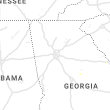
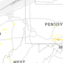
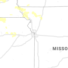
Hail Map for Thursday, June 4, 2020

Number of Impacted Households on 6/4/2020
0
Impacted by 1" or Larger Hail
0
Impacted by 1.75" or Larger Hail
0
Impacted by 2.5" or Larger Hail
Square Miles of Populated Area Impacted on 6/4/2020
0
Impacted by 1" or Larger Hail
0
Impacted by 1.75" or Larger Hail
0
Impacted by 2.5" or Larger Hail


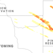


Cities Most Affected by Hail Storms of 6/4/2020
| Hail Size | Demographics of Zip Codes Affected | ||||||
|---|---|---|---|---|---|---|---|
| City | Count | Average | Largest | Pop Density | House Value | Income | Age |
| Faith, SD | 5 | 2.34 | 3.20 | 0 | $41k | $23.9k | 39.4 |
| Rapid City, SD | 3 | 2.33 | 2.50 | 583 | $75k | $30.9k | 32.9 |
| Black Hawk, SD | 3 | 2.25 | 2.50 | 282 | $89k | $44.6k | 36.6 |
| Spearfish, SD | 3 | 2.17 | 2.50 | 62 | $98k | $30.2k | 38.6 |
| Piedmont, SD | 2 | 2.25 | 2.75 | 23 | $88k | $41.5k | 41.4 |
| Martin, SD | 2 | 2.25 | 2.50 | 1 | $41k | $27.3k | 31.6 |
| Petersburg, TX | 2 | 1.88 | 2.00 | 2 | $35k | $30.6k | 38.7 |
| Milford Center, OH | 1 | 2.00 | 2.00 | 43 | $96k | $53.0k | 38.3 |
| Milesville, SD | 1 | 1.75 | 1.75 | 1 | $33k | $27.9k | 37.5 |
| Floydada, TX | 1 | 1.75 | 1.75 | 7 | $35k | $25.8k | 38.1 |
| Duncombe, IA | 1 | 1.75 | 1.75 | 8 | $59k | $38.4k | 43.8 |
| Ralls, TX | 1 | 1.75 | 1.75 | 3 | $34k | $24.9k | 35.4 |
| Marysville, OH | 1 | 1.75 | 1.75 | 183 | $135k | $51.6k | 35.1 |
| Ida Grove, IA | 1 | 1.75 | 1.75 | 22 | $65k | $38.1k | 46.1 |
| Gillette, WY | 1 | 1.75 | 1.75 | 17 | $94k | $42.4k | 32.2 |
Hail and Wind Damage Spotted on 6/4/2020
Filter by Report Type:Hail ReportsWind Reports
States Impacted
Missouri, Ohio, Texas, Arkansas, Virginia, Kentucky, Georgia, Pennsylvania, Colorado, Oklahoma, West Virginia, Iowa, Tennessee, South Dakota, Indiana, Montana, Nebraska, Wyoming, Kansas, District of Columbia, North Carolina, Maryland, Delaware, New Jersey, MinnesotaMissouri
| Local Time | Report Details |
|---|---|
| 7:57 AM CDT | The mesonet station mo004 on i44 at the 47 mile marker measured a 68 mph wind gus in lawrence county MO, 29.8 miles WSW of Springfield, MO |
| 2:23 AM CDT | Public report via twitter of numerous tree branches down in maryville and trash cans blown around street in nodaway county MO, 84.3 miles SE of Omaha, NE |
| 2:57 AM CDT | St. joseph airport measured 64 mph wind gus in buchanan county MO, 49.2 miles NNW of Kansas City, MO |
| 3:38 AM CDT | Spotter reports several tree limbs down and power outage near weatherby lak in platte county MO, 11.3 miles NNW of Kansas City, MO |
| 3:38 AM CDT | Nws employee estimated 60 mph wind gust and power outage in waldo (kcmo in jackson county MO, 7.8 miles S of Kansas City, MO |
| 3:48 AM CDT | Kmbc news 9 reports via twitter of a very large tree snapped high in south kcmo. time estimated via rada in jackson county MO, 9.2 miles S of Kansas City, MO |
| 3:48 AM CDT | Spotter reported he measured a 72 mph wind gust in cleveland... mo when the gust front passed throug in cass county MO, 29.2 miles S of Kansas City, MO |
| 3:51 AM CDT | Kcfd reports of two large trees down damaging homes... no exact locations but one along 75th and another along 85th street. time estimated from rada in jackson county MO, 8.5 miles S of Kansas City, MO |
| 4:05 AM CDT | Coop observer/spotter reported via twitter of a large tree limb... greater than 10 inch diamete in jackson county MO, 18.3 miles ESE of Kansas City, MO |
| 4:10 AM CDT | Nws employee reports snapped tree and estimated 60 mph gus in jackson county MO, 21.5 miles SSE of Kansas City, MO |
| 4:13 AM CDT | Estimated 60 mph winds at the nws offic in cass county MO, 26.7 miles SE of Kansas City, MO |
| 4:45 AM CDT | Storm spotter reported 67 mph wind gust with stationary truck mounted wind anemometer in warrensbur in johnson county MO, 51.2 miles ESE of Kansas City, MO |
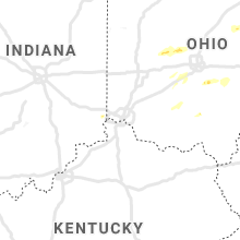
Ohio
| Local Time | Report Details |
|---|---|
| 11:44 AM EDT | Half Dollar sized hail reported near Urbana, OH, 41 miles WNW of Columbus, OH |
| 12:19 PM EDT | Powerlines down and localized floodin in union county OH, 27.6 miles WNW of Columbus, OH |
| 12:19 PM EDT | Ping Pong Ball sized hail reported near Milford Center, OH, 27.6 miles WNW of Columbus, OH |
| 12:26 PM EDT | Quarter sized hail reported near Marysville, OH, 26.4 miles NW of Columbus, OH |
| 12:26 PM EDT | Golf Ball sized hail reported near Marysville, OH, 27.3 miles NW of Columbus, OH |
| 12:28 PM EDT | Hen Egg sized hail reported near Milford Center, OH, 26.4 miles WNW of Columbus, OH |
| 1:00 PM EDT | Large tree limb dow in delaware county OH, 27.2 miles NNE of Columbus, OH |
| 1:15 PM EDT | Telephone poles and trees reported down. small section of a barn roof torn off. time estimated from rada in madison county OH, 17 miles W of Columbus, OH |
| 1:20 PM EDT | Numerous healthy trees down near short and north road. photo posted on social media. time estimated from rada in delaware county OH, 16.4 miles N of Columbus, OH |
| 1:24 PM EDT | Several reports of downed trees and power lines in south-central knox count in knox county OH, 40.1 miles NE of Columbus, OH |
| 1:32 PM EDT | Half of a barn taken ou in madison county OH, 16 miles WSW of Columbus, OH |
| 1:45 PM EDT | Numerous trees dow in holmes county OH, 61.3 miles NE of Columbus, OH |
| 1:58 PM EDT | Small tree limbs down across roa in fayette county OH, 24.1 miles SW of Columbus, OH |
| 2:00 PM EDT | Several trees down along state route 62 south of state route 83 and also along county road 3 in holmes county OH, 66.5 miles ENE of Columbus, OH |
| 2:07 PM EDT | Quarter sized hail reported near Millersburg, OH, 66.1 miles SSW of Cleveland, OH |
| 2:09 PM EDT | Cochocton sheriff office reports multiple trees down around the count in coshocton county OH, 67.1 miles ENE of Columbus, OH |
| 2:10 PM EDT | 2-5 inch tree limbs down. photos posted to social media. time estimated from rada in fairfield county OH, 25.7 miles SE of Columbus, OH |
| 2:30 PM EDT | Quarter sized hail reported near Canton, OH, 49.1 miles SSE of Cleveland, OH, quarter size hail. |
| 2:39 PM EDT | Multiple trees and power lines down around strasburg bolivar rd and ridge road in tuscarawas county OH, 61.2 miles S of Cleveland, OH |
| 2:41 PM EDT | Barn collapsed. photo verified. time estimated from rada in fairfield county OH, 33.7 miles ESE of Columbus, OH |
| 2:42 PM EDT | Poles and wires dow in stark county OH, 52.1 miles SSE of Cleveland, OH |
| 2:45 PM EDT | Ping Pong Ball sized hail reported near Lancaster, OH, 23.4 miles SE of Columbus, OH, photo posted on social media. time estimated from person who shared. |
| 3:07 PM EDT | Muskingum county dispatch reports trees and power lines down around the new concord are in muskingum county OH, 67.1 miles E of Columbus, OH |
| 3:10 PM EDT | Carroll county dispatch reports multiple trees down in the count in carroll county OH, 58.4 miles W of Pittsburgh, PA |
| 3:10 PM EDT | Dispatch reports trees down at state route 800 and movarian trail rd in tuscarawas county OH, 68.4 miles W of Pittsburgh, PA |
| 3:51 PM EDT | Trees down in wellsville in columbiana county OH, 36.6 miles WNW of Pittsburgh, PA |
| 3:57 PM EDT | Report of trees down along river rd in east liverpool in columbiana county OH, 32.6 miles WNW of Pittsburgh, PA |
Texas
| Local Time | Report Details |
|---|---|
| 11:15 AM CDT | Home roof damage in borden county TX, 61.4 miles SSE of Lubbock, TX |
| 3:11 PM CDT | Quarter sized hail reported near Amarillo, TX, 9.4 miles E of Amarillo, TX, mostly dime to nickel size hail with a few quarter size stones. lasted about 5 minutes. |
| 3:17 PM CDT | Quarter sized hail reported near , , 16.3 miles ENE of Amarillo, TX, dime to quarter size hail falling at time of observation. |
| 4:15 PM CDT | Quarter sized hail reported near Darrouzett, TX, 51.9 miles W of Woodward, OK, quarter size hail lasted a few minutes. |
| 4:45 PM CDT | Quarter sized hail reported near Perryton, TX, 84.8 miles NE of Amarillo, TX, mostly pea to dime size hail with a few up to the size of quarters. hail lasted about 10 minutes. |
| 5:07 PM CDT | Quarter sized hail reported near Perryton, TX, 81.2 miles WSW of Woodward, OK, mostly pea to dime size hail with a few as large as quarters. |
| 5:10 PM CDT | Winds gust of 72 mph at silverton mesone in briscoe county TX, 55.9 miles W of Childress, TX |
| 5:24 PM CDT | Storm damage reported in briscoe county TX, 48.5 miles W of Childress, TX |
| 5:32 PM CDT | Quarter sized hail reported near Canadian, TX, 66.9 miles SW of Woodward, OK, quarter size hail lasted a few minutes. |
| 6:38 PM CDT | Storm damage reported in childress county TX, 3.9 miles W of Childress, TX |
| 6:42 PM CDT | Quarter sized hail reported near Mobeetie, TX, 78.4 miles SW of Woodward, OK |
| 6:50 PM CDT | Golf Ball sized hail reported near Floydada, TX, 34.4 miles NE of Lubbock, TX |
| 7:00 PM CDT | Golf Ball sized hail reported near Petersburg, TX, 22.4 miles ENE of Lubbock, TX |
| 7:28 PM CDT | Hen Egg sized hail reported near Petersburg, TX, 29.5 miles NE of Lubbock, TX |
| 7:30 PM CDT | Fire / rescue called and advised multiple powerpoles blown down and a tractor trailer blown ove in crosby county TX, 28.1 miles ENE of Lubbock, TX |
| 7:35 PM CDT | Storm damage reported in crosby county TX, 28 miles E of Lubbock, TX |
| 7:45 PM CDT | Golf Ball sized hail reported near Ralls, TX, 28.1 miles ENE of Lubbock, TX, time from radar |
| 7:56 PM CDT | Storm damage reported in foard county TX, 42.2 miles SE of Childress, TX |
| 8:35 PM CDT | Roof damaged in crosby county TX, 20.7 miles E of Lubbock, TX |
| 9:20 PM CDT | Storm damage reported in lubbock county TX, 5.7 miles NNE of Lubbock, TX |
| 9:27 PM CDT | Storm damage reported in lubbock county TX, 11.3 miles W of Lubbock, TX |
| 9:28 PM CDT | Storm damage reported in wichita county TX, 10.7 miles NNW of Wichita Falls, TX |
| 9:30 PM CDT | Storm damage reported in lubbock county TX, 2.6 miles WNW of Lubbock, TX |
| 9:35 PM CDT | Multiple powerpoles down in the city of lubboc in lubbock county TX, 1.6 miles WSW of Lubbock, TX |
| 9:35 PM CDT | Storm damage reported in wichita county TX, 4.9 miles N of Wichita Falls, TX |
| 9:38 PM CDT | Storm damage reported in lubbock county TX, 8.7 miles SSW of Lubbock, TX |
| 9:40 PM CDT | Storm damage reported in lubbock county TX, 16.4 miles SE of Lubbock, TX |
| 9:45 PM CDT | Storm damage reported in wichita county TX, 1.4 miles SSW of Wichita Falls, TX |
| 9:50 PM CDT | Measured 1 mi s of archer wichita county line on hwy 28 in archer county TX, 5.4 miles S of Wichita Falls, TX |
| 10:04 PM CDT | Storm damage reported in lynn county TX, 26.7 miles S of Lubbock, TX |
| 10:10 PM CDT | Storm damage reported in garza county TX, 39 miles SE of Lubbock, TX |
| 10:20 PM CDT | Storm damage reported in garza county TX, 39 miles SE of Lubbock, TX |
| 10:30 PM CDT | Storm damage reported in garza county TX, 40.3 miles SSE of Lubbock, TX |
| 10:32 PM CDT | Metal carport blown into street near nocona high school. damage reported by nocona p in montague county TX, 45 miles E of Wichita Falls, TX |
| 10:35 PM CDT | Storm damage reported in garza county TX, 40.3 miles SSE of Lubbock, TX |
| 11:06 PM CDT | Storm damage reported in borden county TX, 61.4 miles SSE of Lubbock, TX |
| 11:15 PM CDT | Storm damage reported in borden county TX, 62.7 miles SSE of Lubbock, TX |
Arkansas
| Local Time | Report Details |
|---|---|
| 12:08 PM CDT | A tree was blown down across the westbound lane of highway 8 just east of men in polk county AR, 49 miles NNW of Nashville, AR |
Virginia
| Local Time | Report Details |
|---|---|
| 2:08 PM EDT | Quarter sized hail reported near Ferrum, VA, 22.5 miles SSW of Roanoke, VA, hail fell on running brook road. |
| 2:17 PM EDT | Corrects previous tstm wnd dmg report from 1 s christiansburg. large tree uprooted and fell onto a building... creating minor damage to the roof. moist soil contributed in montgomery county VA, 27.2 miles WSW of Roanoke, VA |
| 2:20 PM EDT | Roof of a mobile home completely blown off. time estimated from rada in franklin county VA, 8.4 miles SSE of Roanoke, VA |
| 2:55 PM EDT | Two trees down in the 1000 block of lithia road. time estimated from rada in botetourt county VA, 16.4 miles NE of Roanoke, VA |
| 3:15 PM EDT | Tree down on arcadia road near the crossing over jennings creek. time estimated from rada in botetourt county VA, 25.7 miles NE of Roanoke, VA |
| 3:32 PM EDT | Tree down near the bank of botetourt in natural bridge station. time estimated from rada in rockbridge county VA, 34.1 miles NE of Roanoke, VA |
| 3:32 PM EDT | Two trees down partially blocking arnolds valley road near ball park lane. time estimated from rada in rockbridge county VA, 34.5 miles NE of Roanoke, VA |
| 4:18 PM EDT | Tree blown down onto playground equipment near raphine... causing minor damage. report via social media... time estimated from rada in rockbridge county VA, 60.4 miles NE of Roanoke, VA |
| 4:31 PM EDT | Multiple trees downed along laurel springs road near laurel springs united methodist church. time estimated from rada in smyth county VA, 39.4 miles ENE of Bristol, TN |
| 4:35 PM EDT | Numerous trees down in nellysford... va in nelson county VA, 71.9 miles WNW of Richmond, VA |
| 4:40 PM EDT | A tree was down along lee highway between the 800 block and the 200 bloc in augusta county VA, 70.7 miles SE of Elkins, WV |
| 4:42 PM EDT | Numerous trees down in the greenville area along hwy 11 in augusta county VA, 66.9 miles NE of Roanoke, VA |
| 5:10 PM EDT | Large branches and a tree were down along timberwood boulevard between pavilion circle and the timberwood parkwa in albemarle county VA, 60.6 miles NW of Richmond, VA |
| 5:11 PM EDT | Tree down in the 3100 block of seminole trail. power lines down across all lanes of traffi in albemarle county VA, 61 miles NW of Richmond, VA |
| 5:24 PM EDT | 5-6 oak trees down at the intersection of ivy farm drive and wing field r in albemarle county VA, 62.4 miles NW of Richmond, VA |
| 5:28 PM EDT | Two trees were down from thunderstorm winds in lura in page county VA, 76.9 miles ESE of Elkins, WV |
| 6:31 PM EDT | Tree down in the 13500 block of hume rd in fauquier county VA, 84.5 miles WSW of Baltimore, MD |
| 6:44 PM EDT | A couple of reports of trees down east of marshall... v in fauquier county VA, 71.3 miles WSW of Baltimore, MD |
| 6:47 PM EDT | Tree down in the 8300 block of john mosby hw in fauquier county VA, 68.7 miles WSW of Baltimore, MD |
| 6:51 PM EDT | Multiple trees down on property... one that fell onto resident's garage in fauquier county VA, 76.2 miles WSW of Baltimore, MD |
| 7:05 PM EDT | Tree down at intersection of of wellington and dumfrie in city of manassas county VA, 59.9 miles SW of Baltimore, MD |
| 7:09 PM EDT | Multiple reports of trees down north of haymarket in prince william county VA, 62.2 miles WSW of Baltimore, MD |
| 7:25 PM EDT | Numerous trees down and power lines down near pickett st. a small fire has resulted from the downed power line in fauquier county VA, 69.6 miles WSW of Baltimore, MD |
| 7:29 PM EDT | Multiple trees/wires down throughout the city and county wid in fairfax county VA, 50.9 miles SW of Baltimore, MD |
| 7:57 PM EDT | Tree reported down on the 4800 block of 26th street in arlington county VA, 38.8 miles SW of Baltimore, MD |
| 8:01 PM EDT | Multiple trees/wires down throughout the city/county wide in fairfax county VA, 46.7 miles SW of Baltimore, MD |
| 8:06 PM EDT | Tree reported down on exit 7a of i-395 near glebe roa in arlington county VA, 39.5 miles SW of Baltimore, MD |
| 8:10 PM EDT | Large branch fell on house at the intersection of wessex lane and kerrybrooke dr in rose hill... va in fairfax county VA, 43.8 miles SW of Baltimore, MD |
| 9:03 PM EDT | Multiple trees/wires down throughout the city/county wide in fairfax county VA, 51.5 miles WSW of Baltimore, MD |
Kentucky
| Local Time | Report Details |
|---|---|
| 2:34 PM EDT | A few trees down at callies lake and campground. one tree fell on and damaged a structur in powell county KY, 14.4 miles NE of Irvine, KY |
| 8:24 PM EDT | Tree down along right branch spencer r in perry county KY, 42.4 miles SE of Irvine, KY |
Georgia
| Local Time | Report Details |
|---|---|
| 3:09 PM EDT | 2 trees reported down near the intersection of ga-49 and county line church rd sw in baldwin county GA, 78.8 miles SE of Atlanta, GA |
| 7:30 PM EDT | Large tree snapped into three pieces near the intersection of suwanee dam rd and price d in gwinnett county GA, 29.9 miles NE of Atlanta, GA |
Pennsylvania
| Local Time | Report Details |
|---|---|
| 3:22 PM EDT | Quarter sized hail reported near Harrisonville, PA, 56.4 miles S of State College, PA, quarter size hail covered the ground in harrissonville. |
| 3:30 PM EDT | Quarter sized hail reported near Mc Connellsburg, PA, 60 miles S of State College, PA, quarter size hail covered the ground like snow around the post office. |
| 4:34 PM EDT | Numerous trees down across trout roa in perry county PA, 43.2 miles ESE of State College, PA |
| 4:36 PM EDT | Numerous trees completely blocking juniata parkway. car trappe in perry county PA, 44.1 miles ESE of State College, PA |
| 4:36 PM EDT | Numerous trees and wires down completely across north 4th st and creek roa in perry county PA, 43.3 miles ESE of State College, PA |
| 4:38 PM EDT | Trees and wires completely blocking red hill roa in perry county PA, 44.7 miles ESE of State College, PA |
| 4:38 PM EDT | Trees down on wire in franklin county PA, 63.3 miles SSE of State College, PA |
| 4:39 PM EDT | Tree down blocking the roadway at 5th and penn alley in mckees rocks in allegheny county PA, 4.4 miles WNW of Pittsburgh, PA |
| 4:45 PM EDT | 911 center reports tree and wires down on roadway at hilltop road and walkers mill r in allegheny county PA, 7.7 miles WSW of Pittsburgh, PA |
| 4:45 PM EDT | Trees and wires down on a vehcile at vanadium rd and insurrection av in allegheny county PA, 6.8 miles SW of Pittsburgh, PA |
| 4:45 PM EDT | Tree down blocking all lanes on bower hill rd by painters run r in allegheny county PA, 7.3 miles SW of Pittsburgh, PA |
| 4:48 PM EDT | Numerous trees down. tree on hous in perry county PA, 47.8 miles ESE of State College, PA |
| 4:50 PM EDT | Photo on social media of a large tree down across the road in mcmurray along with large branches of the surrounding trees in washington county PA, 12 miles SSW of Pittsburgh, PA |
| 4:51 PM EDT | Allegheny county 911 reports tree down at scott road and jonquil place in allegheny county PA, 4.6 miles SSW of Pittsburgh, PA |
| 4:54 PM EDT | Trees down on wires with outag in adams county PA, 60.7 miles NW of Baltimore, MD |
| 4:54 PM EDT | Numerous trees and wires dow in perry county PA, 51.4 miles ESE of State College, PA |
| 4:55 PM EDT | Tree down on roadway at allegheny river blvd and washington blv in allegheny county PA, 5.4 miles ENE of Pittsburgh, PA |
| 4:56 PM EDT | Tree reported to be down blocking entire roadwa in allegheny county PA, 6.6 miles ESE of Pittsburgh, PA |
| 4:59 PM EDT | Tree down blocking a lane of trave in allegheny county PA, 8.7 miles SSE of Pittsburgh, PA |
| 5:00 PM EDT | Multiple trees down. part of garage roof blown of in adams county PA, 60.9 miles NW of Baltimore, MD |
| 5:02 PM EDT | Trees down on wire in dauphin county PA, 56.5 miles ESE of State College, PA |
| 5:08 PM EDT | Multiple trees down in wayne township. time estimated from rada in dauphin county PA, 58.4 miles ESE of State College, PA |
| 5:09 PM EDT | Tree down blocking entire roadway in allegheny county PA, 12 miles ENE of Pittsburgh, PA |
| 5:10 PM EDT | Multiple trees and wires down across route 44 in dauphin county PA, 67.1 miles ESE of State College, PA |
| 5:13 PM EDT | Trees down on wire in dauphin county PA, 59.9 miles ESE of State College, PA |
| 5:17 PM EDT | Multiple trees down on wires. time estimated from rada in dauphin county PA, 56.6 miles ESE of State College, PA |
| 5:19 PM EDT | Trees and wires down in the roadway in allegheny county PA, 14.1 miles SE of Pittsburgh, PA |
| 5:24 PM EDT | Tree came down on wires in the area. state route 88 was closed in both directions between grandview way and i70 wb ram in washington county PA, 22 miles SSE of Pittsburgh, PA |
| 5:27 PM EDT | Tree down on wires in arendtsvill in adams county PA, 56.9 miles NW of Baltimore, MD |
| 5:40 PM EDT | Downed wires near kline road and route 419. time estimated from rada in berks county PA, 70.1 miles SSW of Scranton, PA |
| 5:48 PM EDT | Trees and wires down on lemar roa in franklin county PA, 64.4 miles S of State College, PA |
| 5:55 PM EDT | Trees down along great cove roa in fulton county PA, 71.5 miles SSW of State College, PA |
| 5:56 PM EDT | Downed wires near schubert road. time estimated from rada in berks county PA, 68.6 miles SSW of Scranton, PA |
| 6:00 PM EDT | Trees down on wires in north philipsbur in centre county PA, 20 miles WNW of State College, PA |
| 6:01 PM EDT | Trees and wires down on marion roa in franklin county PA, 65.9 miles S of State College, PA |
| 6:02 PM EDT | Tree down on wire in lebanon county PA, 76.2 miles N of Baltimore, MD |
| 6:03 PM EDT | Trees and wires down on south 3rd s in franklin county PA, 60.5 miles S of State College, PA |
| 6:03 PM EDT | Trees and wires down near needmor in fulton county PA, 66.8 miles SSW of State College, PA |
| 6:09 PM EDT | Trees down on wires west of scotlan in franklin county PA, 57.3 miles SSE of State College, PA |
| 6:17 PM EDT | Tree down in jackson townshi in lebanon county PA, 75.9 miles N of Baltimore, MD |
| 6:30 PM EDT | A few trees reported down in bernville. also a couple of sporadic downed tree reports in nearby areas. time estimated from rada in berks county PA, 71.6 miles SSW of Scranton, PA |
| 6:33 PM EDT | Tree on house and numerous trees down throughout east berli in york county PA, 47.9 miles NNW of Baltimore, MD |
| 6:34 PM EDT | Tree down on house. time estimated from rada in york county PA, 46 miles NNW of Baltimore, MD |
| 6:38 PM EDT | Trees down across hill roa in franklin county PA, 47.4 miles S of State College, PA |
| 6:47 PM EDT | Tree down on a hous in york county PA, 45.1 miles NNW of Baltimore, MD |
| 6:48 PM EDT | Trees across route 11. road close in cumberland county PA, 52.8 miles SE of State College, PA |
| 6:50 PM EDT | Tree and wires dow in york county PA, 44.1 miles NNW of Baltimore, MD |
| 6:52 PM EDT | Large tree down on a hous in cumberland county PA, 51.4 miles SE of State College, PA |
| 7:00 PM EDT | Cwop sit in berks county PA, 69.6 miles S of Scranton, PA |
| 7:02 PM EDT | Trees and wires dow in cumberland county PA, 52.9 miles SE of State College, PA |
| 7:02 PM EDT | Trees and wires dow in york county PA, 41.8 miles NNW of Baltimore, MD |
| 7:03 PM EDT | Multiple trees and branches dow in york county PA, 42.5 miles NNW of Baltimore, MD |
| 7:15 PM EDT | Trees and wires down in wayne townshi in mifflin county PA, 27.2 miles S of State College, PA |
| 7:24 PM EDT | Quarter sized hail reported near Dallastown, PA, 42.1 miles N of Baltimore, MD |
| 7:25 PM EDT | Multiple trees down in loganvill in york county PA, 39.6 miles N of Baltimore, MD |
| 7:25 PM EDT | Quarter sized hail reported near Seven Valleys, PA, 39.6 miles N of Baltimore, MD |
| 7:32 PM EDT | Trees down on wire in dauphin county PA, 63.1 miles SE of State College, PA |
| 7:32 PM EDT | Trees down on wire in clearfield county PA, 33 miles WNW of State College, PA |
| 8:21 PM EDT | Trees down on wire in dauphin county PA, 65.4 miles ESE of State College, PA |
| 8:31 PM EDT | Trees down on wires on marietta avenu in lancaster county PA, 54.1 miles N of Baltimore, MD |
| 9:40 PM EDT | Wires down on schoolhouse ln. time estimated from rada in delaware county PA, 76.4 miles ENE of Baltimore, MD |
| 9:40 PM EDT | Wires down on yale ave. time estimated from rada in delaware county PA, 79.3 miles ENE of Baltimore, MD |
| 9:47 PM EDT | Wires down on n ridley creek rd. time estimated from rada in delaware county PA, 77.8 miles NE of Baltimore, MD |
| 10:40 PM EDT | Corrects time of previous tstm wnd dmg report from parkside. wires down on schoolhouse ln. time estimated from rada in delaware county PA, 76.4 miles ENE of Baltimore, MD |
| 10:40 PM EDT | Corrects time of previous tstm wnd dmg report from swarthmore. wires down on yale ave. time estimated from rada in delaware county PA, 79.3 miles ENE of Baltimore, MD |
| 10:45 PM EDT | Wires down on country village way. time estimated from rada in delaware county PA, 76 miles NE of Baltimore, MD |
| 10:47 PM EDT | Corrects time of previous tstm wnd dmg report from 1 wnw media. wires down on n ridley creek rd. time estimated from rada in delaware county PA, 77.8 miles NE of Baltimore, MD |
| 10:55 PM EDT | Wires were downed on golf blvd. time estimated from rada in delaware county PA, 84 miles ENE of Baltimore, MD |
Colorado
| Local Time | Report Details |
|---|---|
| 2:03 PM MDT | Report from mping: 1-inch tree limbs broken; shingles blown of in jefferson county CO, 7.1 miles NW of Denver, CO |
| 2:14 PM MDT | Report from mping: 3-inch tree limbs broken; power poles broke in jefferson county CO, 9.5 miles NW of Denver, CO |
| 2:22 PM MDT | Asos station kden denve in denver county CO, 19.7 miles ENE of Denver, CO |
| 2:35 PM MDT | Awos station kfmm fort morga in morgan county CO, 58.8 miles WNW of Yuma, CO |
| 3:12 PM MDT | Mesonet station co072 070w304 bennet in adams county CO, 29.9 miles E of Denver, CO |
| 3:20 PM MDT | Asos station kako akro in washington county CO, 26.6 miles W of Yuma, CO |
| 3:58 PM MDT | Awos station kstk sterlin in logan county CO, 45.1 miles NW of Yuma, CO |
| 4:00 PM MDT | Mesonet station fw2420 arapaho in cheyenne county CO, 75.4 miles WSW of Colby, KS |
| 4:13 PM MDT | Storm damage reported in yuma county CO, 22 miles SE of Yuma, CO |
| 4:20 PM MDT | Zero vis and car in the ditch reported by the county e in yuma county CO, 5.6 miles N of Yuma, CO |
| 4:23 PM MDT | Storm damage reported in yuma county CO, 25.2 miles E of Yuma, CO |
| 4:48 PM MDT | Awos station k20v kremmling awo in grand county CO, 70 miles ESE of Craig, CO |
Oklahoma
| Local Time | Report Details |
|---|---|
| 3:22 PM CDT | Ping Pong Ball sized hail reported near Hardesty, OK, 95.3 miles S of Garden City, KS, ping pong ball size hail falling at time of observation. |
| 5:39 PM CDT | Nwschat report... blowing dust in roger mills county OK, 47 miles SSW of Woodward, OK |
| 5:40 PM CDT | Nwschat report... blowing dust as well in roger mills county OK, 48.3 miles SSW of Woodward, OK |
| 5:40 PM CDT | Reports of trees blown dow in roger mills county OK, 47.3 miles SSW of Woodward, OK |
| 5:47 PM CDT | Signs also blown down at highway 47 and 283 in roger mills county OK, 48.3 miles SSW of Woodward, OK |
| 5:55 PM CDT | Storm damage reported in dewey county OK, 27.3 miles S of Woodward, OK |
| 5:57 PM CDT | Quarter sized hail reported near Cheyenne, OK, 48.3 miles SSW of Woodward, OK, em relayed through nwschat... at the intersection of highways 47 and 283 |
| 6:01 PM CDT | Em relayed through nwscha in roger mills county OK, 58.9 miles SSW of Woodward, OK |
| 6:04 PM CDT | Also reported lots of tree damage on the south side of town... and power flashes on the north side of tow in roger mills county OK, 58.9 miles SSW of Woodward, OK |
| 6:05 PM CDT | Two large doors blown in on county bar in roger mills county OK, 57.6 miles SSW of Woodward, OK |
| 6:15 PM CDT | Storm damage reported in roger mills county OK, 58.9 miles SSW of Woodward, OK |
| 6:20 PM CDT | Storm damage reported in custer county OK, 59.4 miles S of Woodward, OK |
| 6:20 PM CDT | Storm damage reported in roger mills county OK, 64 miles SSW of Woodward, OK |
| 6:24 PM CDT | Storm damage reported in beckham county OK, 69.9 miles S of Woodward, OK |
| 6:25 PM CDT | Storm damage reported in custer county OK, 59.4 miles S of Woodward, OK |
| 6:28 PM CDT | Storm damage reported in beckham county OK, 69.9 miles S of Woodward, OK |
| 6:30 PM CDT | Storm damage reported in custer county OK, 59.4 miles S of Woodward, OK |
| 6:30 PM CDT | Storm damage reported in dewey county OK, 43.9 miles SSE of Woodward, OK |
| 6:35 PM CDT | Storm damage reported in beckham county OK, 69.9 miles S of Woodward, OK |
| 6:35 PM CDT | Storm damage reported in custer county OK, 59.4 miles S of Woodward, OK |
| 6:49 PM CDT | Storm damage reported in washita county OK, 76.9 miles S of Woodward, OK |
| 6:50 PM CDT | Storm damage reported in beckham county OK, 57.4 miles NNE of Childress, TX |
| 6:55 PM CDT | Storm damage reported in washita county OK, 73.2 miles SSE of Woodward, OK |
| 6:55 PM CDT | Storm damage reported in beckham county OK, 57.4 miles NNE of Childress, TX |
| 7:00 PM CDT | Storm damage reported in beckham county OK, 57.4 miles NNE of Childress, TX |
| 7:00 PM CDT | Storm damage reported in washita county OK, 73.2 miles SSE of Woodward, OK |
| 7:00 PM CDT | Storm damage reported in custer county OK, 66.8 miles W of Oklahoma City, OK |
| 7:02 PM CDT | Storm damage reported in custer county OK, 67.3 miles W of Oklahoma City, OK |
| 7:09 PM CDT | Barn destroyed. some roof damage to hous in blaine county OK, 59.1 miles W of Oklahoma City, OK |
| 7:11 PM CDT | Storm damage reported in blaine county OK, 56.4 miles WNW of Oklahoma City, OK |
| 7:15 PM CDT | Storm damage reported in custer county OK, 70.5 miles W of Oklahoma City, OK |
| 7:15 PM CDT | Storm damage reported in caddo county OK, 54.1 miles W of Oklahoma City, OK |
| 7:45 PM CDT | Storm damage reported in canadian county OK, 29.9 miles WNW of Oklahoma City, OK |
| 7:46 PM CDT | Storm damage reported in canadian county OK, 29.6 miles W of Oklahoma City, OK |
| 8:06 PM CDT | Storm damage reported in jackson county OK, 54.9 miles ENE of Childress, TX |
| 8:09 PM CDT | Storm damage reported in comanche county OK, 60.2 miles N of Wichita Falls, TX |
| 8:24 PM CDT | Storm damage reported in jackson county OK, 54.9 miles ENE of Childress, TX |
| 8:30 PM CDT | Storm damage reported in tillman county OK, 51.8 miles NW of Wichita Falls, TX |
| 8:35 PM CDT | Storm damage reported in tillman county OK, 51.8 miles NW of Wichita Falls, TX |
| 8:40 PM CDT | Storm damage reported in tillman county OK, 51.8 miles NW of Wichita Falls, TX |
| 8:53 PM CDT | Storm damage reported in tillman county OK, 41.1 miles NW of Wichita Falls, TX |
| 9:00 PM CDT | Storm damage reported in tillman county OK, 26.1 miles NNW of Wichita Falls, TX |
| 9:10 PM CDT | Storm damage reported in tillman county OK, 26.1 miles NNW of Wichita Falls, TX |
| 9:30 PM CDT | Small tree limbs dow in jefferson county OK, 33.9 miles ENE of Wichita Falls, TX |
West Virginia
| Local Time | Report Details |
|---|---|
| 4:27 PM EDT | The top of a large tree was dow in hardy county WV, 51.5 miles ENE of Elkins, WV |
| 4:45 PM EDT | Numerous trees down in the trinity road vicinity south of junction... w in hampshire county WV, 58.9 miles ENE of Elkins, WV |
| 4:45 PM EDT | Numerous trees down along south branch river road in romney...wv in hampshire county WV, 63.7 miles ENE of Elkins, WV |
| 4:46 PM EDT | Tree down at the intersection of rada rd and patterson creek r in mineral county WV, 52.1 miles ENE of Elkins, WV |
| 5:20 PM EDT | Tree down near 17094 cacapon road in morgan county WV, 87.5 miles ENE of Elkins, WV |
| 5:20 PM EDT | Tree down in the 1800 block of constant run road in morgan county WV, 89.6 miles ENE of Elkins, WV |
| 5:33 PM EDT | 2 separate trees fell down into 2 separate houses... one on onondaga trail and the other on tuckahoe trai in berkeley county WV, 82 miles WNW of Baltimore, MD |
| 5:58 PM EDT | Tree down in westover in monongalia county WV, 49.9 miles N of Elkins, WV |
| 6:30 PM EDT | Multiple trees down along route in boone county WV, 14.7 miles S of Charleston, WV |
| 6:36 PM EDT | 2 power poles down along tonys branch rd. wind estimated from radar of 40 to 50 mp in boone county WV, 13.8 miles S of Charleston, WV |
Iowa
| Local Time | Report Details |
|---|---|
| 3:30 PM CDT | Large tree down. via kwwl tv viewer. time estimate in black hawk county IA, 45.6 miles NW of Cedar Rapids, IA |
| 4:00 PM CDT | Up to 6 inch diameter tree limbs dow in black hawk county IA, 46.3 miles NW of Cedar Rapids, IA |
| 4:00 PM CDT | 6 inch diameter tree limbs down in lafayette par in black hawk county IA, 48.5 miles NW of Cedar Rapids, IA |
| 4:50 PM CDT | Hardin county emergency management noted multiple large trees down. power out. time estimated from rada in hardin county IA, 43.4 miles S of Mason City, IA |
| 4:54 PM CDT | Roof blown off cattle shed. report via social media. time estimated by rada in humboldt county IA, 42.5 miles E of Storm Lake, IA |
| 5:07 PM CDT | Storm damage reported in humboldt county IA, 50.2 miles E of Storm Lake, IA |
| 5:10 PM CDT | Large tree down. bunch of dime size hail also occurred with stor in humboldt county IA, 50.7 miles E of Storm Lake, IA |
| 6:45 PM CDT | Large tree branch blown through a roof on a she in benton county IA, 21.9 miles NW of Cedar Rapids, IA |
| 7:20 PM CDT | Delayed report - some power lines and trees downed. time estimated from rada in fayette county IA, 59.6 miles N of Cedar Rapids, IA |
| 7:42 PM CDT | Estimated 60-65 mph. tree branches dow in grundy county IA, 53.6 miles WNW of Cedar Rapids, IA |
| 8:14 PM CDT | Golf Ball sized hail reported near Duncombe, IA, 62.6 miles NNW of Des Moines, IA |
| 9:05 PM CDT | Reports of a few trees blown down across roads in tow in cedar county IA, 31.5 miles ESE of Cedar Rapids, IA |
| 9:45 PM CDT | Estimated high wind gust. heavy rain reported to be blowing sideway in scott county IA, 54.7 miles ESE of Cedar Rapids, IA |
| 9:58 PM CDT | 61 mph gust measured on asos. 45 mph sustaine in scott county IA, 61.9 miles ESE of Cedar Rapids, IA |
| 10:03 PM CDT | Large tree down over the road at arlington avenue and e 15th st davenpor in scott county IA, 65 miles ESE of Cedar Rapids, IA |
| 10:15 PM CDT | Torrential rainfall also reporte in scott county IA, 61.7 miles ESE of Cedar Rapids, IA |
| 10:15 PM CDT | Report of trees blown dow in scott county IA, 62.5 miles ESE of Cedar Rapids, IA |
| 11:18 PM CDT | Quarter sized hail reported near Sanborn, IA, 43.2 miles NNW of Storm Lake, IA |
| 11:20 PM CDT | Quarter sized hail reported near Sanborn, IA, 43.5 miles NNW of Storm Lake, IA, report via social media. |
| 11:52 PM CDT | Quarter sized hail reported near Milford, IA, 47.2 miles N of Storm Lake, IA, report via social media. |
| 11:52 PM CDT | 2.5 ft diameter tree blocking most of county rd m49 on northwest side of big spirit lak in dickinson county IA, 58.3 miles N of Storm Lake, IA |
| 11:57 PM CDT | Crop damage 3-4 miles east of milfor in dickinson county IA, 47.6 miles N of Storm Lake, IA |
| 12:21 AM CDT | Kest estherville aso in emmet county IA, 57.4 miles NNE of Storm Lake, IA |
| 12:25 AM CDT | Kest estherville aso in emmet county IA, 57.4 miles NNE of Storm Lake, IA |
| 1:45 AM CDT | Corrects previous tstm wnd dmg report from manchester. part of a roof torn off a storage shed. the roof debris was blown from east to west... and also snapped a power p in delaware county IA, 37.1 miles NNE of Cedar Rapids, IA |
| 1:53 AM CDT | Quarter sized hail reported near Ida Grove, IA, 25.8 miles SW of Storm Lake, IA, half inch to one inch hail reported... lasting for around 15 minutes. |
| 1:57 AM CDT | Golf Ball sized hail reported near Ida Grove, IA, 25.3 miles SSW of Storm Lake, IA, report via social media. time estimated from radar. |
| 2:04 AM CDT | Half Dollar sized hail reported near Alta, IA, 3.6 miles WNW of Storm Lake, IA, report via social media. time estimated from radar. |
| 2:27 AM CDT | Ping Pong Ball sized hail reported near Humboldt, IA, 50.3 miles E of Storm Lake, IA, small limbs also down. |
| 2:40 AM CDT | Half Dollar sized hail reported near Dakota City, IA, 51.2 miles E of Storm Lake, IA, report from who-tv weather. |
| 3:30 AM CDT | Williams rwi in wright county IA, 41.9 miles SSW of Mason City, IA |
| 4:00 AM CDT | Report of trees and power lines down in jefferso in greene county IA, 49.4 miles NW of Des Moines, IA |
| 4:10 AM CDT | 60+ mph winds reported in bagle in guthrie county IA, 45.8 miles WNW of Des Moines, IA |
| 4:20 AM CDT | Bayard fire dept reports 70+ mph wind gusts and down tree limb in guthrie county IA, 52 miles WNW of Des Moines, IA |
| 4:25 AM CDT | Storm damage reported in dallas county IA, 25.5 miles WNW of Des Moines, IA |
| 4:33 AM CDT | Quarter sized hail reported near Murray, IA, 42.4 miles SSW of Des Moines, IA |
| 4:34 AM CDT | Estimated winds of 60 to 70mp in dallas county IA, 18.9 miles WNW of Des Moines, IA |
| 4:39 AM CDT | Winds of at least 60 mph between 436a and 439 in polk county IA, 11.8 miles NW of Des Moines, IA |
| 4:44 AM CDT | Storm damage reported in dallas county IA, 11.1 miles W of Des Moines, IA |
| 4:50 AM CDT | Storm damage reported in polk county IA, 9.3 miles NW of Des Moines, IA |
| 4:55 AM CDT | 6 inch diameter tree branch down. time estimate in polk county IA, 4.6 miles WNW of Des Moines, IA |
| 4:58 AM CDT | Tree branches and power lines down near se 5th street and hart avenue. time estimate in polk county IA, 4.1 miles S of Des Moines, IA |
| 5:00 AM CDT | Des moines aso in polk county IA, 4.7 miles SSW of Des Moines, IA |
Tennessee
| Local Time | Report Details |
|---|---|
| 4:47 PM EDT | Quarter sized hail reported near Greeneville, TN, 45.7 miles SW of Bristol, TN |
| 11:00 PM EDT | Corrects time of previous tstm wnd dmg report from 5 se morristown. tree down on st. paul r in hamblen county TN, 41.1 miles ENE of Knoxville, TN |
| 11:05 PM EDT | Tree down on st. paul r in hamblen county TN, 41.1 miles ENE of Knoxville, TN |
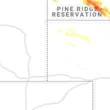
South Dakota
| Local Time | Report Details |
|---|---|
| 3:24 PM MDT | Ping Pong Ball sized hail reported near Prairie City, SD, 93 miles N of Rapid City, SD, ground covered with hail. |
| 3:24 PM MDT | Storm damage reported in perkins county SD, 93 miles N of Rapid City, SD |
| 4:15 PM MDT | Half Dollar sized hail reported near Faith, SD, 88 miles NE of Rapid City, SD |
| 4:25 PM MDT | Baseball sized hail reported near Faith, SD, 82.4 miles NE of Rapid City, SD |
| 4:30 PM MDT | Hen Egg sized hail reported near Faith, SD, 82.7 miles NE of Rapid City, SD |
| 4:44 PM MDT | Tea Cup sized hail reported near Faith, SD, 81.1 miles NE of Rapid City, SD |
| 5:03 PM MDT | Golf Ball sized hail reported near Faith, SD, 79.5 miles WNW of Pierre, SD |
| 5:10 PM MDT | Hen Egg sized hail reported near Faith, SD, 85.9 miles NE of Rapid City, SD |
| 5:26 PM MDT | Partial roof blown from house... broken windows... tree damage. time estimated from report and rada in lawrence county SD, 50.4 miles NW of Rapid City, SD |
| 5:33 PM MDT | Golf Ball sized hail reported near Milesville, SD, 60.6 miles WNW of Pierre, SD, wind gusts to 50 mph. |
| 5:38 PM MDT | Hen Egg sized hail reported near Spearfish, SD, 44.1 miles NW of Rapid City, SD, hail lasted 5 minutes |
| 5:39 PM MDT | Tennis Ball sized hail reported near Spearfish, SD, 44.8 miles NW of Rapid City, SD |
| 6:45 PM CDT | Corrects previous non-tstm wnd gst report from 5 ssw richmond lake rec area. mesonet station ew5307 aberdee in brown county SD, 7.5 miles W of Aberdeen, SD |
| 5:47 PM MDT | Hen Egg sized hail reported near Spearfish, SD, 43.3 miles NW of Rapid City, SD |
| 5:54 PM MDT | Half Dollar sized hail reported near Deadwood, SD, 32.2 miles NW of Rapid City, SD |
| 5:55 PM MDT | Storm damage reported in lawrence county SD, 31.8 miles NW of Rapid City, SD |
| 5:55 PM MDT | Storm damage reported in stanley county SD, 38.6 miles W of Pierre, SD |
| 6:59 PM CDT | Pea sized hail also reporte in brown county SD, 0.6 miles W of Aberdeen, SD |
| 5:59 PM MDT | Quarter sized hail reported near Spearfish, SD, 37.4 miles NW of Rapid City, SD |
| 6:59 PM CDT | Quarter sized hail reported near Aberdeen, SD, 0.4 miles E of Aberdeen, SD |
| 6:02 PM MDT | Storm damage reported in meade county SD, 8.5 miles NE of Rapid City, SD |
| 7:03 PM CDT | Storm damage reported in brown county SD, 4.3 miles ESE of Aberdeen, SD |
| 6:09 PM MDT | Golf Ball sized hail reported near Piedmont, SD, 18.1 miles NNW of Rapid City, SD, still ongoing |
| 6:15 PM MDT | Wind gusts of 60 to 70 mph blew over at least 3 pole barns in the neighborhood. wind lasted about 10 minute in meade county SD, 14 miles NE of Rapid City, SD |
| 6:17 PM MDT | Baseball sized hail reported near Piedmont, SD, 13.8 miles NW of Rapid City, SD |
| 7:19 PM CDT | 60 to 70 mph winds reporte in brown county SD, 18.8 miles E of Aberdeen, SD |
| 7:19 PM CDT | Several power poles leaning or broken... and trees dow in brown county SD, 19 miles E of Aberdeen, SD |
| 6:25 PM MDT | Golf Ball sized hail reported near Black Hawk, SD, 8.7 miles NW of Rapid City, SD, still ongoing |
| 6:27 PM MDT | Tennis Ball sized hail reported near Black Hawk, SD, 7.6 miles NW of Rapid City, SD |
| 6:27 PM MDT | Quarter sized hail reported near Rapid City, SD, 10.5 miles WNW of Rapid City, SD |
| 6:28 PM MDT | Tennis Ball sized hail reported near Black Hawk, SD, 6.5 miles NW of Rapid City, SD, hail is dime to tennis ball size. |
| 7:30 PM CDT | Machine shop destroyed. time estimated from rada in day county SD, 31.4 miles ESE of Aberdeen, SD |
| 6:37 PM MDT | Tennis Ball sized hail reported near Rapid City, SD, 0.8 miles NE of Rapid City, SD |
| 6:38 PM MDT | Hen Egg sized hail reported near Rapid City, SD, 2.1 miles NNE of Rapid City, SD, several broken windshields in lowes parking lot. |
| 7:39 PM CDT | Mesonet station 45 andover (sddot in day county SD, 28.8 miles E of Aberdeen, SD |
| 6:41 PM MDT | Tennis Ball sized hail reported near Rapid City, SD, 2.7 miles NNE of Rapid City, SD |
| 6:42 PM MDT | Ping Pong Ball sized hail reported near Rapid City, SD, 3.4 miles N of Rapid City, SD |
| 7:43 PM CDT | Several trees and power lines dow in day county SD, 36.7 miles ESE of Aberdeen, SD |
| 6:47 PM MDT | Half Dollar sized hail reported near Rapid City, SD, 3.5 miles NNE of Rapid City, SD, multiple broken windows on house |
| 6:48 PM MDT | Quarter sized hail reported near Rapid City, SD, 3.4 miles ESE of Rapid City, SD |
| 6:51 PM MDT | Storm damage reported in pennington county SD, 9.3 miles ESE of Rapid City, SD |
| 6:52 PM MDT | Ping Pong Ball sized hail reported near Rapid City, SD, 3.2 miles SSE of Rapid City, SD |
| 8:00 PM CDT | Storm damage reported in day county SD, 52.5 miles ESE of Aberdeen, SD |
| 8:00 PM CDT | Mesonet station webs2 webster 3 s (sd mesonet in day county SD, 48.5 miles ESE of Aberdeen, SD |
| 8:05 PM CDT | Storm damage reported in day county SD, 48.5 miles ESE of Aberdeen, SD |
| 8:22 PM CDT | 50 to 60 mph winds reporte in day county SD, 50.7 miles ESE of Aberdeen, SD |
| 8:22 PM CDT | Several trees down across the northwestern portions of codington count in codington county SD, 68.3 miles ESE of Aberdeen, SD |
| 7:24 PM MDT | Storm damage reported in pennington county SD, 37.1 miles ESE of Rapid City, SD |
| 7:29 PM MDT | Storm damage reported in pennington county SD, 37.1 miles ESE of Rapid City, SD |
| 8:30 PM CDT | A lot of trees down... including cottonwood and evergreens. time estimated by rada in codington county SD, 71.4 miles ESE of Aberdeen, SD |
| 8:31 PM CDT | Semi with back trailer blown over on interstat in grant county SD, 69 miles WNW of Montevideo, MN |
| 7:34 PM MDT | Storm damage reported in pennington county SD, 37.1 miles ESE of Rapid City, SD |
| 8:38 PM CDT | Trees uprooted. fencing torn up. attached garage pushed off foundation. machine shop roof blown awa in codington county SD, 73.8 miles W of Montevideo, MN |
| 8:40 PM CDT | Corrects previous non-tstm wnd gst report from 1 wnw summit. mesonet station 55 summit (sddot in roberts county SD, 69.7 miles WNW of Montevideo, MN |
| 8:44 PM CDT | Asos station katy watertown muni a in codington county SD, 70.4 miles W of Montevideo, MN |
| 7:50 PM MDT | Quarter sized hail reported near Scenic, SD, 52.3 miles ESE of Rapid City, SD |
| 8:56 PM CDT | Quarter sized hail reported near Wolsey, SD, 76 miles S of Aberdeen, SD, dime to quarter sized hail near wolsey mn. |
| 8:18 PM MDT | Quarter sized hail reported near Rapid City, SD, 8.7 miles WSW of Rapid City, SD |
| 8:18 PM MDT | Quarter sized hail reported near Kyle, SD, 72.8 miles ESE of Rapid City, SD |
| 9:21 PM CDT | Storm damage reported in deuel county SD, 57.8 miles WSW of Montevideo, MN |
| 8:25 PM MDT | Quarter sized hail reported near Interior, SD, 75.5 miles SE of Rapid City, SD |
| 8:30 PM MDT | Quarter sized hail reported near Rapid City, SD, 7.6 miles SSE of Rapid City, SD |
| 9:31 PM CDT | 51 mph reported in toront in deuel county SD, 53.1 miles WSW of Montevideo, MN |
| 9:39 PM CDT | Leaves from trees splattered on windows and siding of hous in brookings county SD, 52.7 miles SW of Montevideo, MN |
| 9:05 PM MDT | Hen Egg sized hail reported near Martin, SD, 58.9 miles WNW of Valentine, NE |
| 9:05 PM MDT | Tennis Ball sized hail reported near Martin, SD, 58.9 miles WNW of Valentine, NE |
| 11:23 PM MDT | Partial roof blown from house... broken windows... tree damag in lawrence county SD, 50.4 miles NW of Rapid City, SD |
Indiana
| Local Time | Report Details |
|---|---|
| 5:30 PM EDT | Tree down on brownstown rd near the golf cours in crawford county IN, 47.7 miles WNW of Louisville, KY |
Montana
| Local Time | Report Details |
|---|---|
| 3:40 PM MDT | Quarter sized hail reported near Broadus, MT, 66.7 miles N of Gillette, WY |
| 4:08 PM MDT | Quarter sized hail reported near Alzada, MT, 60.8 miles NNE of Gillette, WY, quarter size hail and heavy rain northeast of ridge. |
Nebraska
| Local Time | Report Details |
|---|---|
| 5:05 PM CDT | 1/4 mile visibility and 70 mph winds in lincoln county NE, 5.2 miles WSW of North Platte, NE |
| 4:05 PM MDT | Ping Pong Ball sized hail reported near Hay Springs, NE, 64.4 miles NE of Scottsbluff, NE, estimated between 1 and 1.5 inch hail along with 30 to 35 mph winds. |
| 6:13 PM CDT | Several large trees down. time estimated from rada in lincoln county NE, 3.2 miles S of North Platte, NE |
| 6:17 PM CDT | Storm damage reported in lincoln county NE, 0.6 miles SW of North Platte, NE |
| 6:18 PM CDT | Storm damage reported in lincoln county NE, 2.4 miles ENE of North Platte, NE |
| 6:22 PM CDT | Storm damage reported in lincoln county NE, 10.1 miles S of North Platte, NE |
| 6:28 PM CDT | Emergency manager reported a semi rollover caused by wind. semi was empty at time of rollove in lincoln county NE, 5.3 miles S of North Platte, NE |
| 6:30 PM CDT | 4 to 6 inch diameter branches down als in cherry county NE, 36.1 miles SSW of Valentine, NE |
| 6:42 PM CDT | Storm damage reported in cherry county NE, 29.9 miles S of Valentine, NE |
| 7:18 PM CDT | 2 foot in diameter tree branch down. time estimated from rada in blaine county NE, 60.1 miles SSE of Valentine, NE |
| 8:21 PM CDT | Dime size hail and 60 mph thunderstorm wind gust in custer county NE, 70.5 miles ENE of North Platte, NE |
| 8:30 PM CDT | Storm damage reported in garfield county NE, 52.9 miles SSW of Oneill, NE |
| 8:43 PM CDT | Corrects previous tstm wnd gst report from ord airpor in valley county NE, 57.5 miles NNW of Grand Island, NE |
| 8:45 PM CDT | Storm damage reported in valley county NE, 57.5 miles NNW of Grand Island, NE |
| 10:11 PM CDT | Quarter sized hail reported near Sutton, NE, 33.6 miles SE of Grand Island, NE, relayed by em. |
| 10:11 PM CDT | Quarter sized hail reported near Sutton, NE, 33.2 miles SE of Grand Island, NE |
| 10:40 PM CDT | Estimated winds of 50 to 60 mp in polk county NE, 51.4 miles ENE of Grand Island, NE |
| 11:07 PM CDT | Davis weatherlink statio in york county NE, 46.1 miles E of Grand Island, NE |
| 11:20 PM CDT | Pea size hail as wel in seward county NE, 64 miles WSW of Omaha, NE |
| 11:31 PM CDT | Personal weather statio in lancaster county NE, 45.7 miles WSW of Omaha, NE |
| 11:33 PM CDT | Storm damage reported in lancaster county NE, 49.6 miles SW of Omaha, NE |
| 11:34 PM CDT | Personal weather statio in lancaster county NE, 47.1 miles SW of Omaha, NE |
| 11:36 PM CDT | Personal weather statio in lancaster county NE, 55.1 miles SW of Omaha, NE |
| 11:40 PM CDT | Report from mping: 3-inch tree limbs broken; power poles broke in lancaster county NE, 48.4 miles SW of Omaha, NE |
| 11:43 PM CDT | Report from mping: 1-inch tree limbs broken; shingles blown of in lancaster county NE, 46.7 miles SW of Omaha, NE |
| 11:52 PM CDT | Quarter sized hail reported near Malmo, NE, 40.6 miles W of Omaha, NE |
| 12:05 AM CDT | Tree limbs blown dow in otoe county NE, 45.3 miles SSW of Omaha, NE |
| 12:39 AM CDT | Quarter sized hail reported near Gretna, NE, 17.7 miles WSW of Omaha, NE |
Wyoming
| Local Time | Report Details |
|---|---|
| 4:44 PM MDT | Quarter sized hail reported near Hulett, WY, 62.7 miles NE of Gillette, WY, lots of marble to quarter size hail. ground covered with hail |
| 5:10 PM MDT | Quarter sized hail reported near Aladdin, WY, 62.9 miles NW of Rapid City, SD |
| 6:38 PM MDT | Quarter sized hail reported near Moorcroft, WY, 35.5 miles NE of Gillette, WY |
| 6:56 PM MDT | Golf Ball sized hail reported near Gillette, WY, 8.1 miles WNW of Gillette, WY |
| 7:12 PM MDT | Half Dollar sized hail reported near Gillette, WY, 5.5 miles SSE of Gillette, WY, wind gusts to 45 mph. |
| 7:15 PM MDT | Half Dollar sized hail reported near Sundance, WY, 56.8 miles E of Gillette, WY |
| 7:15 PM MDT | Quarter sized hail reported near Gillette, WY, 9.6 miles SSE of Gillette, WY |
Kansas
| Local Time | Report Details |
|---|---|
| 6:25 PM CDT | Storm damage reported in cheyenne county KS, 43.4 miles NW of Colby, KS |
| 5:31 PM MDT | Storm damage reported in sherman county KS, 32.1 miles WNW of Colby, KS |
| 6:36 PM CDT | Vis reduced to 20 to 30 ft due to blowing dust. winds est 50 to 60 mp in rawlins county KS, 32.2 miles NNW of Colby, KS |
| 7:00 PM CDT | Delayed report. spotter reported blowing dirt reducing visibility to around one quarter mile. wind gusts were estimated to be around 63 mp in rawlins county KS, 39 miles N of Colby, KS |
| 7:05 PM CDT | Mesonet station k5adt us-36 - 9 mi. w of atwoo in rawlins county KS, 27.5 miles NNW of Colby, KS |
| 7:10 PM CDT | Fire official reported near zero visibility due to blowing dirt. conditions are ongoing with estimated 60 mph wind gust in rawlins county KS, 37.9 miles NNE of Colby, KS |
| 7:15 PM CDT | Mesonet station k5adt 3.0 se beardsley (kskta in rawlins county KS, 27.5 miles NNW of Colby, KS |
| 7:44 PM CDT | Large tree branch down. wind estimated at 60 mp in finney county KS, 1 miles NE of Garden City, KS |
| 8:01 PM CDT | 65 mph wind gusts broke a few tree limbs. heavy horizontal rain occurrin in decatur county KS, 40.4 miles NE of Colby, KS |
| 8:03 PM CDT | Quarter sized hail reported near Ulysses, KS, 34.2 miles SW of Garden City, KS |
| 8:10 PM CDT | Spotter estimated 60-70 mph wind gust in decatur county KS, 44.3 miles ENE of Colby, KS |
| 8:20 PM CDT | Quarter sized hail reported near Ulysses, KS, 34.5 miles SSW of Garden City, KS |
| 8:22 PM CDT | Spotter reported estimated sustained winds of 40-50 mph with gusts of 60-70 mp in decatur county KS, 44.8 miles ENE of Colby, KS |
| 8:58 PM CDT | Asos station kgck garden cit in finney county KS, 9 miles ESE of Garden City, KS |
| 9:03 PM CDT | Asos station khlc hill cit in graham county KS, 43.6 miles NW of Hays, KS |
| 9:27 PM CDT | Quarter sized hail reported near Moscow, KS, 52.3 miles SSW of Garden City, KS |
| 12:41 AM CDT | Power line down in hanove in washington county KS, 51.8 miles NNW of Manhattan, KS |
| 1:26 AM CDT | At least 60 mph gust in nemaha county KS, 46.2 miles NNE of Manhattan, KS |
| 1:29 AM CDT | Quarter sized hail reported near Olsburg, KS, 17.8 miles NNW of Manhattan, KS |
| 1:37 AM CDT | Reported some downed tree limbs of unknown siz in nemaha county KS, 46.2 miles NNE of Manhattan, KS |
| 2:33 AM CDT | Storm damage reported in shawnee county KS, 50.5 miles ESE of Manhattan, KS |
District of Columbia
| Local Time | Report Details |
|---|---|
| 7:57 PM EDT | Multiple reports of trees down across d. in district of columb county DC, 33 miles SW of Baltimore, MD |
| 8:03 PM EDT | Multiple reports of trees/branches damaged across d. in district of columb county DC, 35.8 miles SW of Baltimore, MD |
North Carolina
| Local Time | Report Details |
|---|---|
| 8:15 PM EDT | Trees down off east court st in marion... n in mcdowell county NC, 63.4 miles SSE of Bristol, TN |
Maryland
| Local Time | Report Details |
|---|---|
| 9:25 PM EDT | Trees and wires down at the intersection of clarke ln and bainbridge rd. time estimated from rada in cecil county MD, 35.5 miles NE of Baltimore, MD |
| 9:40 PM EDT | Tree down at the intersection of pekins hill rd and wallis rd. time estimated from rada in kent county MD, 32.2 miles E of Baltimore, MD |
| 9:45 PM EDT | Tree down at the intersection of crothers rd and england creamery rd. time estimated from rada in cecil county MD, 42.6 miles NE of Baltimore, MD |
| 10:15 PM EDT | Md-313 northbound north of md-314 was closed due to storm debris. time estimated from rada in caroline county MD, 48.8 miles ESE of Baltimore, MD |
Delaware
| Local Time | Report Details |
|---|---|
| 10:10 PM EDT | Storm damage reported in new castle county DE, 48.9 miles ENE of Baltimore, MD |
| 10:10 PM EDT | A few trees downed in marydel. also some power outages in the area. time estimated from rada in kent county DE, 48.3 miles ESE of Baltimore, MD |
New Jersey
| Local Time | Report Details |
|---|---|
| 10:20 PM EDT | Njwxnet site nj7 in salem county NJ, 58.7 miles ENE of Baltimore, MD |
| 10:33 PM EDT | Trees and wires were downed in alloway. time estimated from rada in salem county NJ, 69.9 miles ENE of Baltimore, MD |
| 10:38 PM EDT | Trees and wires were downed in penns grove. time estimated from rada in salem county NJ, 68 miles ENE of Baltimore, MD |
| 10:55 PM EDT | A tree fell onto two mobile home trailers. time estimated from rada in gloucester county NJ, 81.8 miles ENE of Baltimore, MD |
| 10:56 PM EDT | Downed tree and wires on us 322 both directions west of harvard rd. all lanes closed. time estimated from rada in gloucester county NJ, 84.2 miles ENE of Baltimore, MD |
| 11:08 PM EDT | Downed tree on i-295 southbound at exit 30... partially blocking the ramp. time estimated from rada in camden county NJ, 79.4 miles SW of Brooklyn, NY |
| 11:10 PM EDT | Power lines were downed in oaklyn. time estimated from rada in camden county NJ, 78.9 miles SW of Brooklyn, NY |
| 11:14 PM EDT | Wires down in the voorhees area. time estimated from rada in camden county NJ, 78.2 miles SW of Brooklyn, NY |
| 11:15 PM EDT | Several reports of downed trees and wires in cherry hill. time estimated from rada in camden county NJ, 76 miles SW of Brooklyn, NY |
| 11:25 PM EDT | Multiple reports of downed trees and wires in the area. time estimated from rada in burlington county NJ, 73.6 miles SSW of Brooklyn, NY |
| 11:25 PM EDT | Several reports of downed wires in willingboro. time estimated from rada in burlington county NJ, 65.9 miles SW of Brooklyn, NY |
Minnesota
| Local Time | Report Details |
|---|---|
| 9:41 PM CDT | Pea sized hail and brief heavy rain followed the strong wind in lincoln county MN, 46.5 miles SW of Montevideo, MN |
| 9:45 PM CDT | 70 mph peak wind gust reported at mn030 mesonet sit in lincoln county MN, 49.2 miles SW of Montevideo, MN |
| 10:00 PM CDT | Flag pole snapped off by strong winds. lawn furniture blown all over yard. power is out. marble sized hail and 0.33 inch of rainfall followed win in lincoln county MN, 45.2 miles SSW of Montevideo, MN |
| 11:04 PM CDT | Mesonet station mn038 dovray mn-30 mile post 4 in murray county MN, 61.8 miles S of Montevideo, MN |
| 11:05 PM CDT | There was also some pea sized hail... and about 1 inch of torrential rainfall. small tree limbs broke in murray county MN, 60.9 miles ENE of Sioux Falls, SD |
| 11:32 PM CDT | Mesonet station mn071 mn-71 mile post 4 in cottonwood county MN, 67 miles SSE of Montevideo, MN |
| 11:43 PM CDT | Awos station kmwm windom municipal airpor in cottonwood county MN, 78.8 miles SSE of Montevideo, MN |
Connect with Interactive Hail Maps