

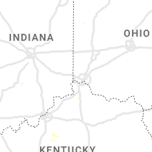
Hail Map for Friday, May 6, 2022

Number of Impacted Households on 5/6/2022
0
Impacted by 1" or Larger Hail
0
Impacted by 1.75" or Larger Hail
0
Impacted by 2.5" or Larger Hail
Square Miles of Populated Area Impacted on 5/6/2022
0
Impacted by 1" or Larger Hail
0
Impacted by 1.75" or Larger Hail
0
Impacted by 2.5" or Larger Hail


Cities Most Affected by Hail Storms of 5/6/2022
| Hail Size | Demographics of Zip Codes Affected | ||||||
|---|---|---|---|---|---|---|---|
| City | Count | Average | Largest | Pop Density | House Value | Income | Age |
| Augusta, GA | 6 | 1.88 | 2.00 | 1928 | $78k | $28.6k | 32.2 |
| Pelham, NC | 3 | 2.00 | 2.50 | 81 | $86k | $38.8k | 44.4 |
| Crossville, TN | 2 | 2.13 | 2.25 | 128 | $43k | $14.3k | 45.5 |
| Mooresboro, NC | 2 | 1.75 | 1.75 | 98 | $71k | $32.3k | 41.1 |
| Shelby, NC | 1 | 2.50 | 2.50 | 300 | $81k | $36.6k | 38.4 |
| Ruffin, NC | 1 | 2.00 | 2.00 | 56 | $83k | $37.2k | 41.7 |
| Prosperity, SC | 1 | 2.00 | 2.00 | 89 | $109k | $39.3k | 46.2 |
| Kings Mountain, NC | 1 | 1.75 | 1.75 | 308 | $89k | $37.6k | 41.3 |
| Wadesboro, NC | 1 | 1.75 | 1.75 | 58 | $66k | $28.7k | 40.4 |
| Eagle Springs, NC | 1 | 1.75 | 1.75 | 26 | $102k | $29.8k | 38.6 |
| Crouse, NC | 1 | 1.75 | 1.75 | 160 | $84k | $39.7k | 39.0 |
| Ellenboro, NC | 1 | 1.75 | 1.75 | 88 | $78k | $32.3k | 39.7 |
| Tennille, GA | 1 | 1.75 | 1.75 | 30 | $64k | $28.9k | 35.9 |
| Ringgold, VA | 1 | 1.75 | 1.75 | 105 | $82k | $37.6k | 42.0 |
| Mc Connells, SC | 1 | 1.75 | 1.75 | 42 | $92k | $42.1k | 40.8 |
| North Augusta, SC | 1 | 1.75 | 1.75 | 1046 | $84k | $39.2k | 37.4 |
| Lilesville, NC | 1 | 1.75 | 1.75 | 16 | $63k | $28.3k | 43.7 |
| Marion, VA | 1 | 1.75 | 1.75 | 137 | $70k | $30.2k | 43.3 |
Hail and Wind Damage Spotted on 5/6/2022
Filter by Report Type:Hail ReportsWind Reports
States Impacted
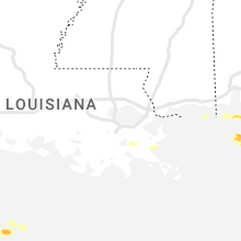
Florida, Louisiana, West Virginia, Tennessee, Georgia, Kentucky, Alabama, North Carolina, South Carolina, Virginia, Idaho, Oregon, WashingtonFlorida
| Local Time | Report Details |
|---|---|
| 9:27 AM CDT | Quarter sized hail reported near Destin, FL, 7.3 miles WNW of Miramar Beach, FL, quarter size hail and three trees snapped at the destin fire department. several reports of dime to quarter size hail reported via social media... too. |
| 3:45 PM EDT | Tree down at 7207 hosford hw in gadsden county FL, 25 miles WNW of Tallahassee, FL |
| 4:43 PM EDT | Report of a tree down on bloxham cutoff between fr360 and fr34 in leon county FL, 16.8 miles WSW of Tallahassee, FL |
| 5:05 PM EDT | Tree reported down on roadway near old bainbridge rd and fred george r in leon county FL, 5.1 miles NW of Tallahassee, FL |
| 5:05 PM EDT | Tree reported down on road near homewood rd and old bainbridge r in leon county FL, 4.5 miles NW of Tallahassee, FL |
| 7:03 PM EDT | Taylor county em reports structural and tree damage in perry near 221 and 27 intersectio in taylor county FL, 47.7 miles ESE of Tallahassee, FL |
Louisiana
| Local Time | Report Details |
|---|---|
| 9:29 AM CDT | Emergency management reported a flipped over trailer in lafitte in the 5300 block of jean lafitte blv in jefferson county LA, 19.6 miles S of New Orleans, LA |
| 1:55 PM CDT | Awos station kmis main pass 140 in gmz555 county LA, 86.5 miles ESE of New Orleans, LA |
West Virginia
| Local Time | Report Details |
|---|---|
| 1:15 PM EDT | Several trees and power lines down in the quinwood are in greenbrier county WV, 54.9 miles ESE of Charleston, WV |
Tennessee
| Local Time | Report Details |
|---|---|
| 1:25 PM EDT | Beverley road/anderson road in n. knoxville... tree down... 3 diameter total... multi trunk... beverly road partially blocke in knox county TN, 2.1 miles NW of Knoxville, TN |
| 1:30 PM EDT | Large tree dow in blount county TN, 14.1 miles S of Knoxville, TN |
| 1:30 PM EDT | Quarter sized hail reported near Maryville, TN, 14.1 miles S of Knoxville, TN |
| 2:10 PM EDT | Few trees dow in sevier county TN, 16.3 miles E of Knoxville, TN |
| 1:10 PM CDT | Hen Egg sized hail reported near Crossville, TN, 58.4 miles NNE of Chattanooga, TN, lake tansi. |
| 1:14 PM CDT | A few trees dow in marion county TN, 16 miles NW of Chattanooga, TN |
| 2:15 PM EDT | Few trees dow in grainger county TN, 31.4 miles NE of Knoxville, TN |
| 2:17 PM EDT | Trees and power lines down across the count in loudon county TN, 23.5 miles WSW of Knoxville, TN |
| 1:23 PM CDT | Hen Egg sized hail reported near Crossville, TN, 62.7 miles W of Knoxville, TN, twitter report and photos showed hen egg size hail near crossville. |
| 2:30 PM EDT | Several trees dow in mcminn county TN, 47 miles SW of Knoxville, TN |
| 2:30 PM EDT | Half Dollar sized hail reported near Pioneer, TN, 39.9 miles NW of Knoxville, TN, trees and power lines down. |
| 2:42 PM EDT | Large tree down in victor ashe par in knox county TN, 4.6 miles WNW of Knoxville, TN |
| 2:50 PM EDT | Recorded on home weather statio in hancock county TN, 49.9 miles NE of Knoxville, TN |
| 2:50 PM EDT | Quarter sized hail reported near Thorn Hill, TN, 49.9 miles NE of Knoxville, TN |
| 2:50 PM EDT | Ping Pong Ball sized hail reported near Vonore, TN, 35.8 miles SSW of Knoxville, TN, several trees down. |
| 2:00 PM CDT | 5 inch dia / 25 feet tree down along i-4 in putnam county TN, 65.9 miles E of Nashville, TN |
| 3:10 PM EDT | Trees dow in rhea county TN, 40.5 miles NNE of Chattanooga, TN |
| 2:10 PM CDT | Large tree branch on power line causing power outag in davidson county TN, 9.6 miles SE of Nashville, TN |
| 2:27 PM CDT | Large tree down at hwy 70 and bethlehem roa in wilson county TN, 23.8 miles E of Nashville, TN |
| 3:30 PM EDT | Half Dollar sized hail reported near Talbott, TN, 29.7 miles ENE of Knoxville, TN |
| 3:30 PM EDT | Half Dollar sized hail reported near Pioneer, TN, 39.9 miles NW of Knoxville, TN, corrects previous hail report from 1 nnw pioneer. trees and power lines down. |
| 3:33 PM EDT | Tree down on vehicle east 8th street near douglas stree in hamilton county TN, 3.2 miles ENE of Chattanooga, TN |
| 3:45 PM EDT | Reports of trees and power lines down across the cit in hamilton county TN, 3.2 miles ENE of Chattanooga, TN |
| 3:50 PM EDT | Quarter sized hail reported near Riceville, TN, 37.3 miles NE of Chattanooga, TN |
| 3:50 PM EDT | Trees dow in mcminn county TN, 37.3 miles NE of Chattanooga, TN |
| 3:50 PM EDT | Ping Pong Ball sized hail reported near Vonore, TN, 35.8 miles SSW of Knoxville, TN, corrects previous hail report from 1 wnw tariffville. several trees down. |
| 3:53 PM EDT | Asos station kcha chattanooga airpor in hamilton county TN, 6.3 miles E of Chattanooga, TN |
| 4:10 PM EDT | Trees down. browder hollow rd and loudon ridge rd and 1.25 mil south of loudon ridge rd/ old hwy 95.harrison r in loudon county TN, 23.7 miles WSW of Knoxville, TN |
| 4:10 PM EDT | Trees down. shed destroye in loudon county TN, 22.5 miles WSW of Knoxville, TN |
| 4:20 PM EDT | Half Dollar sized hail reported near Mosheim, TN, 48.8 miles WSW of Bristol, TN |
| 4:20 PM EDT | A few trees dow in campbell county TN, 26.4 miles NW of Knoxville, TN |
| 4:25 PM EDT | Multiple trees and power lines down in and around the city of maryvill in blount county TN, 14.8 miles S of Knoxville, TN |
| 4:25 PM EDT | Multiple reports of trees and power lines down west of knoxvill in knox county TN, 15.8 miles WSW of Knoxville, TN |
| 4:30 PM EDT | Trees and power lines down between pigeon forge and seviervill in sevier county TN, 21.4 miles ESE of Knoxville, TN |
| 4:31 PM EDT | Asos station ktys knoxville mcghee tyso in blount county TN, 10.2 miles SSW of Knoxville, TN |
| 4:48 PM EDT | Half Dollar sized hail reported near Greeneville, TN, 43.8 miles SW of Bristol, TN |
| 5:05 PM EDT | Quarter sized hail reported near Dandridge, TN, 32.6 miles E of Knoxville, TN |
| 5:05 PM EDT | Trees and power lines dow in union county TN, 20.9 miles NNE of Knoxville, TN |
| 5:05 PM EDT | Trees and power lines dow in union county TN, 26.9 miles NNE of Knoxville, TN |
| 5:05 PM EDT | Trees and power lines dow in union county TN, 19.7 miles NNE of Knoxville, TN |
| 5:10 PM EDT | Half Dollar sized hail reported near Kingsport, TN, 13.8 miles WSW of Bristol, TN |
| 5:42 PM EDT | Quarter sized hail reported near Greeneville, TN, 44.7 miles SW of Bristol, TN, quarter size hail reported 1 mile south of greenville. |
| 6:04 PM EDT | Several trees and power lines dow in claiborne county TN, 44.9 miles NNE of Knoxville, TN |
| 6:08 PM EDT | Trees and power lines down several locations across the count in hawkins county TN, 47.1 miles WSW of Bristol, TN |
| 6:12 PM EDT | Two trees blown down and 58 mph wind gust recorded on home weather statio in hawkins county TN, 28.6 miles W of Bristol, TN |
| 6:12 PM EDT | Quarter sized hail reported near Church Hill, TN, 28.6 miles W of Bristol, TN, quarter size hail reported. |
| 6:25 PM EDT | Trees and power lines down across the entire count in washington county TN, 18.2 miles SSW of Bristol, TN |
| 7:00 PM EDT | Some trees and power lines dow in sullivan county TN, 12.3 miles ESE of Bristol, TN |
Georgia
| Local Time | Report Details |
|---|---|
| 1:40 PM EDT | Tree down blocking pleasant hill roa in terrell county GA, 81.7 miles SE of Auburn, AL |
| 2:30 PM EDT | Quarter sized hail reported near Wray, GA, 13.9 miles WNW of Douglas, GA |
| 2:30 PM EDT | Tree down on althea rd between begonia and plu in irwin county GA, 22.5 miles W of Douglas, GA |
| 2:30 PM EDT | Tree down on pansey r in irwin county GA, 20.1 miles W of Douglas, GA |
| 2:30 PM EDT | Tree down at satilla church rd near lotus r in irwin county GA, 15.1 miles WNW of Douglas, GA |
| 2:34 PM EDT | Tree reported down on bowen rd near the intersection with calhoun r in dooly county GA, 70.4 miles NW of Douglas, GA |
| 2:35 PM EDT | Trees at sr37 west and summerlin road down tree on vehicle in norman par in colquitt county GA, 56.2 miles NNE of Tallahassee, FL |
| 2:35 PM EDT | Tree on car at serena d in colquitt county GA, 51.7 miles WSW of Douglas, GA |
| 2:38 PM EDT | Tree down near the intersection of ga-112 and christian hill rd in wilcox county GA, 49.5 miles NW of Douglas, GA |
| 2:45 PM EDT | Powerline down at harris st and hwy 8 in berrien county GA, 29.1 miles WSW of Douglas, GA |
| 2:45 PM EDT | Tree and powerlines down at 255 whitley r in berrien county GA, 32.2 miles WSW of Douglas, GA |
| 2:45 PM EDT | Tree down at north hwy 125 at vancevill in berrien county GA, 35.7 miles WSW of Douglas, GA |
| 2:45 PM EDT | Tree reported down on sweet gum r in telfair county GA, 38.4 miles N of Douglas, GA |
| 2:45 PM EDT | Tree reported down on poplar st near intersection with 3rd av in telfair county GA, 38.3 miles N of Douglas, GA |
| 2:50 PM EDT | Multiple trees reported down near intersection of ga-26 and loggins rd in houston county GA, 71.9 miles NW of Douglas, GA |
| 2:50 PM EDT | Multiple trees down near the intersection of county line rd and poke rd in houston county GA, 71 miles NW of Douglas, GA |
| 2:50 PM EDT | 4 inch in diameter tree branch down on highway 8 in berrien county GA, 29.1 miles WSW of Douglas, GA |
| 2:50 PM EDT | Corrects time of previous tstm wnd dmg report from 1 ene norman park. tree on car at serena d in colquitt county GA, 51.7 miles WSW of Douglas, GA |
| 2:55 PM EDT | Roof damage at rebels rd and bobby rd (2 homes damaged) and some pecan trees dow in cook county GA, 39.6 miles WSW of Douglas, GA |
| 3:06 PM EDT | Tree down across road on ga-247 near waste treatment plan in houston county GA, 74.4 miles NW of Douglas, GA |
| 3:07 PM EDT | Multiple trees reported down on macedonia church r in dodge county GA, 65.3 miles NNW of Douglas, GA |
| 3:13 PM EDT | Tree and powerlines down near intersection of klondike rd and barrett rd in houston county GA, 72.8 miles NW of Douglas, GA |
| 3:13 PM EDT | Tree and powerlines down near intersection of bear branch rd and ivory dr in houston county GA, 82.8 miles NW of Douglas, GA |
| 3:18 PM EDT | Half Dollar sized hail reported near Vidalia, GA, 57.4 miles NNE of Douglas, GA, half-dollar sized hail reported in kibbee... ga. |
| 3:30 PM EDT | Tree down near the intersection of hwy 199 and mercer creek r in treutlen county GA, 61.5 miles N of Douglas, GA |
| 3:36 PM EDT | Roof removed from a manufactued home on the 100 block of columbia s in johnson county GA, 72.7 miles N of Douglas, GA |
| 3:36 PM EDT | Tree reported down on hwy 29 near the intersection of brick mill r in treutlen county GA, 63.5 miles N of Douglas, GA |
| 3:38 PM EDT | Golf Ball sized hail reported near Tennille, GA, 72.1 miles SW of Augusta, GA, golf ball sized hail at the intersection of watermelon rd and hwy 157. |
| 3:39 PM EDT | Emergency manager relayed report of powerlines down along macwac lake road. time estimated from rada in candler county GA, 62.9 miles WNW of Savannah, GA |
| 3:40 PM EDT | Roof removed from a manufactured home on ralph young r in johnson county GA, 69.9 miles SW of Augusta, GA |
| 3:53 PM EDT | Quarter sized hail reported near Metter, GA, 63.5 miles WNW of Savannah, GA, candler county sheriff reported quarter sized hail along route 23 about 3 miles north of metter. corrected time of event based on radar data. |
| 3:53 PM EDT | Emergency manager relayed report of trees down along olifftown road. time estimated from rada in candler county GA, 65.8 miles WNW of Savannah, GA |
| 3:56 PM EDT | Half Dollar sized hail reported near Metter, GA, 65.8 miles WNW of Savannah, GA, law enforcement relayed a photo of ping pong ball sized hail which fell along olifftown road. time was estimated from radar data. |
| 3:58 PM EDT | Multiple trees and powerlines down in the town of davisboro in washington county GA, 49.9 miles SW of Augusta, GA |
| 3:58 PM EDT | Tree reported down on a home on the 200 block of n central st in swainsbor in emanuel county GA, 64.2 miles SSW of Augusta, GA |
| 4:00 PM EDT | Quarter sized hail reported near Metter, GA, 63.5 miles WNW of Savannah, GA, candler county sheriff reported quarter sized hail along route 23 about 3 miles north of metter. |
| 4:01 PM EDT | Tree down at the intersection of huckleberry rd and oak grove church r in emanuel county GA, 61 miles SSW of Augusta, GA |
| 4:03 PM EDT | A few trees... along with powerlines... reported down near the intersection of hwy 56 n and hwy 192 n in emanuel county GA, 53.7 miles SSW of Augusta, GA |
| 4:18 PM EDT | Screven county warning point reported trees down along scarboro highway. time estimated from rada in screven county GA, 56.7 miles NW of Savannah, GA |
| 4:19 PM EDT | Multiple trees reported down along hwy 221 n between airport rd and ellis cemetary r in jefferson county GA, 29 miles SW of Augusta, GA |
| 4:24 PM EDT | Several trees down on hwy 221 n near the jefferson/mcduffie county lin in jefferson county GA, 26.1 miles WSW of Augusta, GA |
| 4:27 PM EDT | Burke county dispatch reported widespread trees and powerlines down across the county. time estimated on rada in burke county GA, 26.9 miles S of Augusta, GA |
| 4:27 PM EDT | Public reported numerous trees and power lines down on hwy 22 in mcduffie county GA, 22.9 miles WSW of Augusta, GA |
| 4:36 PM EDT | Reported trees down at the intersection of horizon south pkwy. and gateway blv in columbia county GA, 13 miles W of Augusta, GA |
| 4:36 PM EDT | City of grovetown reports trees and power lines down in several areas of the city. some impacted locations include railroad ave.... harlem grovetown rd in the area of f in columbia county GA, 13.1 miles W of Augusta, GA |
| 4:41 PM EDT | Half Dollar sized hail reported near Augusta, GA, 10 miles WSW of Augusta, GA, reported half dollar size hail at fort gordon. |
| 4:43 PM EDT | Hen Egg sized hail reported near Augusta, GA, 5.5 miles W of Augusta, GA, report from media of hail just larger than 2 inches at the first baptist church at wheeler road and jackson road. |
| 4:44 PM EDT | Golf Ball sized hail reported near Augusta, GA, 3.8 miles W of Augusta, GA, reported golf ball size hail at daniel field. |
| 4:45 PM EDT | Golf Ball sized hail reported near Augusta, GA, 3 miles WNW of Augusta, GA, golf ball sized hail and 50 mph wind gusts reported near augusta national golf course. |
| 4:45 PM EDT | Hen Egg sized hail reported near Augusta, GA, 3.4 miles WSW of Augusta, GA, public reported through social media of large hail that ranged from 1 inch up to just over 2 inches along pennsylvania avenue near clifton street. |
| 4:45 PM EDT | Reported a large tree down across river north driver in north august in aiken county SC, 1.6 miles ESE of Augusta, GA |
| 4:46 PM EDT | Golf Ball sized hail reported near Augusta, GA, 2.1 miles WSW of Augusta, GA, reported golf ball size hail along summer ridge drive in augusta. |
| 4:47 PM EDT | Quarter sized hail reported near Augusta, GA, 3.2 miles W of Augusta, GA, reported quarter size hail at augusta university. |
| 4:47 PM EDT | Hen Egg sized hail reported near Augusta, GA, 1.1 miles SW of Augusta, GA, public reported through social media of egg size hail neaer the university hospital and wrightsboro road. |
| 4:55 PM EDT | Ping Pong Ball sized hail reported near Grovetown, GA, 15.3 miles W of Augusta, GA, report from mping: ping pong ball sized hail (1.50 in.). |
| 5:22 PM EDT | Multiple trees down along upper and lower river rd in hartford in pulaski county GA, 63.9 miles NNW of Douglas, GA |
| 6:30 PM EDT | Public caller reports of tree down from thunderstorm winds near pine st / nichols st. one lane blocke in clinch county GA, 35.5 miles S of Douglas, GA |
Kentucky
| Local Time | Report Details |
|---|---|
| 1:52 PM EDT | *** 1 inj *** in pulaski county KY, 59.9 miles SW of Irvine, KY |
| 2:30 PM EDT | Large trees down. tree fell on mobile home causing structural damage near harris-linville r in jackson county KY, 16.4 miles SSW of Irvine, KY |
| 2:46 PM EDT | Multiple trees down between the 5000-5200 block of us 25. house damaged by tree. rv awning flipped ove in laurel county KY, 36.1 miles SSW of Irvine, KY |
| 3:10 PM EDT | Trees were down and an outbuilding was damage in jackson county KY, 26.5 miles S of Irvine, KY |
| 3:15 PM EDT | Tee down on union church rd. near bumcom in jackson county KY, 24.1 miles SSE of Irvine, KY |
| 3:50 PM EDT | Trees were blown down and a camper was overturned in the turkey community and the turkey creek vicinity. the time of the event is radar estimate in breathitt county KY, 30.5 miles ESE of Irvine, KY |
| 3:22 PM CDT | Tree down on reedyville road south of roundhill. time estimated by rada in butler county KY, 68.3 miles SW of Louisville, KY |
| 4:50 PM EDT | A large tree was blown down onto ky 1427 and a vfd was called to remove the tree from the roadway. time of event is radar estimate in floyd county KY, 60.5 miles E of Irvine, KY |
| 7:04 PM EDT | A large tree blew down on state road 55... bloomfield road... near shay lane. time based on rada in washington county KY, 31.9 miles SE of Louisville, KY |
Alabama
| Local Time | Report Details |
|---|---|
| 1:10 PM CDT | Tree down blocking balch road in front of columbia elementar in madison county AL, 51.7 miles E of Florence, AL |
| 1:15 PM CDT | Large maple tree down in medical distric in madison county AL, 62.6 miles E of Florence, AL |
| 1:15 PM CDT | Tree down on laverne d in madison county AL, 60.1 miles E of Florence, AL |
| 1:15 PM CDT | Power lines down on the 700 block of andrew jackson wa in madison county AL, 62.4 miles E of Florence, AL |
| 1:20 PM CDT | Tree down on 9900 block of n. memorial prkw in madison county AL, 62.8 miles E of Florence, AL |
| 1:44 PM CDT | Corrects previous tstm wnd dmg report from 4 ssw skyline. trees were reported snapped or uprooted at this locatio in jackson county AL, 52.4 miles WSW of Chattanooga, TN |
| 1:44 PM CDT | Trees were reported snapped or uprooted at this locatio in jackson county AL, 52.4 miles WSW of Chattanooga, TN |
| 1:55 PM CDT | Tree down near scottsboro off garden d in jackson county AL, 49.3 miles WSW of Chattanooga, TN |
| 1:56 PM CDT | Trees were snapped or uprooted at this locatio in jackson county AL, 43.7 miles WSW of Chattanooga, TN |
| 2:02 PM CDT | Trees were snapped or uprooted at this locatio in jackson county AL, 32.5 miles WSW of Chattanooga, TN |
| 2:13 PM CDT | Trees were snapped or uprooted on cr 17 in jackson county AL, 28.1 miles WSW of Chattanooga, TN |
| 2:13 PM CDT | Trees snapped or uprooted at 3597 cr 17 in jackson county AL, 37.6 miles SW of Chattanooga, TN |
| 2:13 PM CDT | Trees were snapped or uprooted near the intersection of cr 744 and cr 68 in jackson county AL, 29.3 miles SW of Chattanooga, TN |
| 2:14 PM CDT | Trees were snapped or uprooted near highway 71 and cr 12 in jackson county AL, 30.1 miles SW of Chattanooga, TN |
| 2:14 PM CDT | Trees were uprooted or snapped at 9714 cr 1 in jackson county AL, 27.1 miles SW of Chattanooga, TN |
| 2:16 PM CDT | Trees were snapped or uprooted on cr 32 in jackson county AL, 23.5 miles SW of Chattanooga, TN |
| 2:16 PM CDT | Multiple trees were reported down on powerline in jackson county AL, 19.3 miles WSW of Chattanooga, TN |
North Carolina
| Local Time | Report Details |
|---|---|
| 2:20 PM EDT | Half Dollar sized hail reported near Andrews, NC, 52.7 miles S of Knoxville, TN |
| 2:39 PM EDT | Kgsb measured 52kt wind gust at 1839 in wayne county NC, 49.7 miles SE of Raleigh, NC |
| 2:45 PM EDT | Multiple trees down in the vicinity of central heights road and e new hope road east of goldsbor in wayne county NC, 50.8 miles ESE of Raleigh, NC |
| 3:10 PM EDT | 1 inch tree limbs broken and shingles blown of in lincoln county NC, 18.2 miles NNW of Charlotte, NC |
| 3:20 PM EDT | Corrects previous tstm wnd gst report from 4 w pitt-greenville airport. trained spotter reported estimated 70 mph winds near oakwood schoo in pitt county NC, 68 miles E of Raleigh, NC |
| 3:28 PM EDT | Half Dollar sized hail reported near Stokes, NC, 80.1 miles E of Raleigh, NC, public reports quarter to half dollar size hail along sheppard mill road at heartland estate equestrian farm. time estimated by radar. |
| 3:30 PM EDT | Trained spotter reported estimated 70 mph winds near oakwood schoo in pitt county NC, 68 miles E of Raleigh, NC |
| 3:30 PM EDT | Extensive tree damage centered around lake tillery including trees on residences. time estimated by rada in stanly county NC, 41.3 miles E of Charlotte, NC |
| 3:35 PM EDT | Quarter sized hail reported near Oak City, NC, 76.4 miles E of Raleigh, NC, public observed high winds and heavy rain with hail size approximate quarter. |
| 3:46 PM EDT | Krdu measured a peak wind of 55kts at 3:46p in wake county NC, 10.5 miles NW of Raleigh, NC |
| 3:46 PM EDT | Quarter sized hail reported near Morrisville, NC, 11.5 miles WNW of Raleigh, NC, multiple reports of quarter sized hail in morrisville. |
| 3:50 PM EDT | Half Dollar sized hail reported near Cary, NC, 8.8 miles W of Raleigh, NC, trained spotter measured half dollar sized hail near cary... nc. time given with report. |
| 3:56 PM EDT | Half Dollar sized hail reported near Morrisville, NC, 10.6 miles WNW of Raleigh, NC, trained spotter estimated half dollar sized hail near the airport. time estimated by radar. |
| 3:56 PM EDT | Large tree down near the airport blocking the roa in wake county NC, 10.6 miles WNW of Raleigh, NC |
| 4:02 PM EDT | Power outage caused by downed objects. time estimated by rada in guilford county NC, 72.1 miles W of Raleigh, NC |
| 4:05 PM EDT | Quarter sized hail reported near Greensboro, NC, 67.8 miles W of Raleigh, NC, local broadcast media passed along report of quarter sized hail. time estimated by radar. |
| 4:07 PM EDT | Quarter sized hail reported near Greenville, NC, 76.8 miles E of Raleigh, NC |
| 4:10 PM EDT | Multiple trees down in the area of six forks road. time estimated by rada in wake county NC, 10 miles N of Raleigh, NC |
| 4:14 PM EDT | Half Dollar sized hail reported near Ahoskie, NC, 60.1 miles WSW of Virginia Beach, VA, report/video via social media near ahoskie. |
| 4:25 PM EDT | Quarter sized hail reported near Rich Square, NC, 76 miles WSW of Virginia Beach, VA |
| 4:30 PM EDT | Half Dollar sized hail reported near Woodland, NC, 73.9 miles WSW of Virginia Beach, VA |
| 5:00 PM EDT | Tree down along highway 62s in anderson... n in caswell county NC, 51.8 miles NW of Raleigh, NC |
| 5:13 PM EDT | Ping Pong Ball sized hail reported near Leasburg, NC, 51.5 miles NW of Raleigh, NC |
| 5:30 PM EDT | Golf Ball sized hail reported near Mooresboro, NC, 51.8 miles W of Charlotte, NC |
| 5:30 PM EDT | Structure damage on deep creek r in swain county NC, 44.4 miles SE of Knoxville, TN |
| 5:35 PM EDT | Shingles blown off of a roof on a hous in madison county NC, 59.1 miles SW of Bristol, TN |
| 5:35 PM EDT | Golf Ball sized hail reported near Mooresboro, NC, 49.1 miles W of Charlotte, NC |
| 5:37 PM EDT | Golf Ball sized hail reported near Ellenboro, NC, 52.7 miles W of Charlotte, NC, in ellenboro near highway 74. |
| 5:50 PM EDT | Golf Ball sized hail reported near Kings Mountain, NC, 28.4 miles W of Charlotte, NC |
| 5:55 PM EDT | Quarter sized hail reported near Lincolnton, NC, 32.8 miles NW of Charlotte, NC |
| 5:55 PM EDT | Golf Ball sized hail reported near Crouse, NC, 30 miles WNW of Charlotte, NC |
| 5:56 PM EDT | Quarter sized hail reported near Gastonia, NC, 22.5 miles W of Charlotte, NC |
| 6:05 PM EDT | Large tree fell on vehicle. time estimated from rada in gaston county NC, 18.3 miles W of Charlotte, NC |
| 6:17 PM EDT | 911 call center reports many trees down near the jones creek fish camp. time estimated by rada in anson county NC, 49.8 miles ESE of Charlotte, NC |
| 6:22 PM EDT | Tree fell on vehicle causing further accidents near the city of wadesbor in anson county NC, 46.6 miles ESE of Charlotte, NC |
| 6:25 PM EDT | Golf Ball sized hail reported near Lilesville, NC, 51.3 miles ESE of Charlotte, NC, public report of golf ball sized hail near lilesville. |
| 6:25 PM EDT | Golf Ball sized hail reported near Wadesboro, NC, 46.6 miles ESE of Charlotte, NC, estimated golf ball sized hail near wadesboro... time estimated by radar. |
| 6:29 PM EDT | Roof partially blown off house. no injuries reported at this tim in anson county NC, 39.9 miles SE of Charlotte, NC |
| 6:30 PM EDT | Trees down across the county. time estimated from rada in avery county NC, 38.2 miles SSE of Bristol, TN |
| 6:40 PM EDT | Quarter sized hail reported near Monroe, NC, 32.8 miles SSE of Charlotte, NC, reported quarter size hail and estimated wind gusts of 60 mph near the intersection of landsford road and sc hwy. 207. |
| 6:50 PM EDT | Numerous reports of trees down in the waxhaw to monroe areas. time estimated from rada in union county NC, 21.6 miles SSE of Charlotte, NC |
| 6:51 PM EDT | Quarter sized hail reported near Stantonsburg, NC, 50.3 miles E of Raleigh, NC, quarter size hail reported just north of saratoga via twitter picture. |
| 6:55 PM EDT | Quarter sized hail reported near Fountain, NC, 54.8 miles E of Raleigh, NC, corrects previous hail report from 2 wsw fountain. trained spotter reported quarter size hail along highway 222 in pitt county. |
| 6:58 PM EDT | Golf Ball sized hail reported near Eagle Springs, NC, 65.8 miles WSW of Raleigh, NC, moore county deputy encountered golf ball sized hail near eagle springs. time estimated by radar. |
| 7:09 PM EDT | Multiple trees down centered around koonce road and phillipi church road. time estimated by rada in hoke county NC, 60.8 miles SSW of Raleigh, NC |
| 7:18 PM EDT | Partial roof collapse and tree on house in western fayettevill in cumberland county NC, 54.1 miles SSW of Raleigh, NC |
| 7:18 PM EDT | Quarter sized hail reported near Pine Hall, NC, 64.5 miles S of Roanoke, VA, report from mping: quarter (1.00 in.). |
| 7:18 PM EDT | Report from mping: 3-inch tree limbs broken; power poles broke in stokes county NC, 63.8 miles S of Roanoke, VA |
| 7:20 PM EDT | Quarter sized hail reported near Madison, NC, 61.9 miles S of Roanoke, VA |
| 7:22 PM EDT | Golf Ball sized hail reported near Pelham, NC, 62.8 miles NW of Raleigh, NC, golf ball size hail reported at the intersection of allison road and lake road. |
| 7:26 PM EDT | Multiple trees down across the city of fayettevill in cumberland county NC, 51.6 miles SSW of Raleigh, NC |
| 7:26 PM EDT | Ping Pong Ball sized hail reported near Madison, NC, 60.8 miles S of Roanoke, VA |
| 7:28 PM EDT | Ping Pong Ball sized hail reported near Mayodan, NC, 59.4 miles S of Roanoke, VA |
| 7:30 PM EDT | Reports of trees down in eastern part of count in avery county NC, 41 miles SSE of Bristol, TN |
| 7:31 PM EDT | Quarter sized hail reported near Madison, NC, 61.5 miles S of Roanoke, VA, report from mping: quarter (1.00 in.). |
| 7:44 PM EDT | Tree on home in seagrov in randolph county NC, 63.6 miles ENE of Charlotte, NC |
| 7:45 PM EDT | Ping Pong Ball sized hail reported near Reidsville, NC, 59.5 miles S of Roanoke, VA |
| 7:49 PM EDT | Thunderstorm winds blew down at least ten trees and multiple power lines. several roads are blocked due to the downed trees and power line in wilkes county NC, 62.8 miles NNW of Charlotte, NC |
| 7:58 PM EDT | Many trees down in the area from asheboro to randleman and ramseur. time estimated from rada in randolph county NC, 62.2 miles W of Raleigh, NC |
| 8:07 PM EDT | Hen Egg sized hail reported near Ruffin, NC, 59.8 miles SSE of Roanoke, VA |
| 8:10 PM EDT | Power lines were blown by thunderstorm winds along quick roa in caswell county NC, 64.2 miles SSE of Roanoke, VA |
| 8:10 PM EDT | Tennis Ball sized hail reported near Shelby, NC, 48.8 miles W of Charlotte, NC, measured hailstones shown on facebook. |
| 8:12 PM EDT | Quarter sized hail reported near Reidsville, NC, 62.8 miles SSE of Roanoke, VA |
| 8:13 PM EDT | Tennis Ball sized hail reported near Pelham, NC, 59.5 miles SSE of Roanoke, VA, social media photo showing multiple large hail stones in pelham. |
| 8:13 PM EDT | Golf Ball sized hail reported near Pelham, NC, 58.6 miles SSE of Roanoke, VA |
| 8:13 PM EDT | Power outages east of angier caused by fallen trees damaging equipmen in harnett county NC, 19.9 miles S of Raleigh, NC |
| 8:25 PM EDT | Half Dollar sized hail reported near Yanceyville, NC, 62.5 miles NW of Raleigh, NC |
| 8:40 PM EDT | Second wind gust of 60+ mph hitting krdu asos toda in wake county NC, 10.5 miles NW of Raleigh, NC |
| 9:04 PM EDT | Gsb asos reports gust of 51.0 knot in wayne county NC, 48.8 miles SE of Raleigh, NC |
| 9:30 PM EDT | Multiple trees down across edgecombe count in edgecombe county NC, 57.4 miles E of Raleigh, NC |
| 9:30 PM EDT | Report from mping: trees uprooted or snapped; roof blown of in rockingham county NC, 63 miles SSE of Roanoke, VA |
| 9:42 PM EDT | Multiple trees blown down along highway 97 in hobgood. time estimated by rada in halifax county NC, 71 miles ENE of Raleigh, NC |
South Carolina
| Local Time | Report Details |
|---|---|
| 4:12 PM EDT | Trees dow in pickens county SC, 9.6 miles NW of Greenville, SC |
| 4:13 PM EDT | Trees down along porter rd near highway 17 in pickens county SC, 10.7 miles NW of Greenville, SC |
| 4:13 PM EDT | Corrects previous tstm wnd dmg report from 4 nw pickens. several trees knocked down on power line in pickens county SC, 11 miles NW of Greenville, SC |
| 4:13 PM EDT | Corrects previous tstm wnd dmg report from 5 ene nine times. roof damage to a structur in pickens county SC, 12.7 miles NW of Greenville, SC |
| 4:45 PM EDT | Ping Pong Ball sized hail reported near North Augusta, SC, 0.8 miles NNW of Augusta, GA, nearby county em sent picture of ping pong ball size hail from railroad avenue in north augusta. time estimated. |
| 4:52 PM EDT | Allendale county 911 center reported multiple trees blown down in the martin area. time was estimated from radar dat in allendale county SC, 40.2 miles SE of Augusta, GA |
| 4:52 PM EDT | Golf Ball sized hail reported near North Augusta, SC, 6.2 miles NNE of Augusta, GA, social media report of golf ball size hail near the intersection of hwy. 25 and i-20. |
| 4:53 PM EDT | Highway patrol reported trees down near the intersection of sc hwy. 421 and storm branch roa in aiken county SC, 3.3 miles ENE of Augusta, GA |
| 4:53 PM EDT | Quarter sized hail reported near North Augusta, SC, 4.7 miles NNE of Augusta, GA, public reports 1 inch diameter hail in belvedere. |
| 4:55 PM EDT | Trees reported down on sc-125 at appleton road. time estimated from rada in allendale county SC, 46.7 miles SE of Augusta, GA |
| 4:58 PM EDT | Em reports multiple large trees down in the vicinity of robin rd and oriole st. one tree down on a house and another on a vehicle in a carpor in barnwell county SC, 38.4 miles ESE of Augusta, GA |
| 5:00 PM EDT | Highway patrol reported a tree in the roadway. time estimated from rada in aiken county SC, 11 miles ESE of Augusta, GA |
| 5:00 PM EDT | Barnwell county dispatch reported widespread trees and powerlines down across the count in barnwell county SC, 37.9 miles ESE of Augusta, GA |
| 5:00 PM EDT | Em reports multiple trees down on highway 64 in barnwell heading towards ola in barnwell county SC, 40 miles ESE of Augusta, GA |
| 5:02 PM EDT | Highway patrol reported a tree in the roadway. time estimated from rada in aiken county SC, 12.3 miles ENE of Augusta, GA |
| 5:05 PM EDT | Public through social media reported trees blocking the roadway along blanchard road between ascauga lake road and old sudlow lake roa in aiken county SC, 6.2 miles NE of Augusta, GA |
| 5:06 PM EDT | Highway patrol reported a tree in the roadway. time estimated from rada in bamberg county SC, 51.2 miles ESE of Augusta, GA |
| 5:07 PM EDT | Quarter sized hail reported near Johnston, SC, 24.3 miles NNE of Augusta, GA, report from mping: quarter sized hail (1.00 in.). |
| 5:11 PM EDT | Reported through social media of several large pines snapped off and one blocking the highway at the intersection of jones rd and hwy 283. lots of wind debri in edgefield county SC, 24.6 miles N of Augusta, GA |
| 5:13 PM EDT | Roof damage to a structur in pickens county SC, 12.7 miles NW of Greenville, SC |
| 5:13 PM EDT | Several trees knocked down on power line in pickens county SC, 11 miles NW of Greenville, SC |
| 5:17 PM EDT | Schp reports tree in roadway near palomino rd and haven r in lexington county SC, 35.7 miles NE of Augusta, GA |
| 5:18 PM EDT | Reported power lines down in the road along north street in the town of bamber in bamberg county SC, 56 miles ESE of Augusta, GA |
| 5:22 PM EDT | Corrects previous tstm wnd dmg report from 4 wsw branchville. highway patrol reported a tree in the roadway. time estimated from rada in bamberg county SC, 50.9 miles W of Charleston, SC |
| 5:25 PM EDT | Highway patrol reported a tree in the roadway. time estimated from rada in bamberg county SC, 50.9 miles W of Charleston, SC |
| 5:28 PM EDT | Highway patrol reported trees down near the intersection of hwy. 21 and fox paw court between rowesville and branchvill in orangeburg county SC, 48.1 miles W of Charleston, SC |
| 5:31 PM EDT | Quarter sized hail reported near Saluda, SC, 37.8 miles NNE of Augusta, GA, sheriff dispatch reported quarter size hail near the town of saluda. |
| 5:32 PM EDT | Sheriff dispatch reported lots of hail and numerous trees down across the count in saluda county SC, 36.7 miles NNE of Augusta, GA |
| 5:32 PM EDT | Quarter sized hail reported near Ridgeway, SC, 63.3 miles S of Charlotte, NC, reported 1 inch hail near the town of ridgeway. |
| 5:34 PM EDT | Highway patrol reported a tree in the roadway. time estimated from rada in orangeburg county SC, 58.1 miles E of Augusta, GA |
| 5:35 PM EDT | Schp reports tree in roadway along i-26 eb at mile marker 14 in orangeburg county SC, 53.8 miles WNW of Charleston, SC |
| 5:35 PM EDT | Highway patrol reported a tree in the roadway. time estimated from rada in newberry county SC, 50.2 miles NNE of Augusta, GA |
| 5:37 PM EDT | Highway patrol reported a tree blocking the roadway. time estimated from rada in newberry county SC, 64.7 miles ESE of Greenville, SC |
| 5:37 PM EDT | Department of highways reported a tree in the roadway. time estimated from rada in lexington county SC, 54.2 miles NE of Augusta, GA |
| 5:38 PM EDT | Highway patrol reported a tree in the roadway. time estimated from rada in lexington county SC, 55.5 miles NE of Augusta, GA |
| 5:40 PM EDT | Schp reports tree in roadway along i-26 eb at mile marker 16 in orangeburg county SC, 40.2 miles WNW of Charleston, SC |
| 5:43 PM EDT | Highway patrol reported tree down along i-26 near the 130 mile marker east bound lan in lexington county SC, 62.5 miles ENE of Augusta, GA |
| 5:43 PM EDT | Highway patrol reported roadway blocked by tree near the intersection of rawl road and clear springs trai in lexington county SC, 52.4 miles NE of Augusta, GA |
| 5:44 PM EDT | Highway patrol reported tree in the roadway at the intersection of monticello road and dipsy do roa in richland county SC, 67 miles NE of Augusta, GA |
| 5:45 PM EDT | Highway patrol reported a tree blocking the roadway. time estimated from rada in newberry county SC, 57.9 miles NNE of Augusta, GA |
| 5:46 PM EDT | Kershaw county dispatch reported a tree down along bishopville highway and lucknow rd. time estimated from rada in kershaw county SC, 70.2 miles SSE of Charlotte, NC |
| 5:46 PM EDT | Lancaster county dispatch reported trees down aound zion rd and shiloh unity rd. time estimated from rada in lancaster county SC, 31.8 miles SSE of Charlotte, NC |
| 5:48 PM EDT | Highway patrol reported the roadway blocked by tree along monticello road near i-2 in richland county SC, 66.6 miles NE of Augusta, GA |
| 5:49 PM EDT | The south carolina highway patrol reported a tree down on i-26 at exit 170 eastbound. time estimated based on rada in dorchester county SC, 30.8 miles WNW of Charleston, SC |
| 5:49 PM EDT | Hen Egg sized hail reported near Prosperity, SC, 54.1 miles NNE of Augusta, GA, public reported 2 inch diameter hail and small limbs down near prosperity... sc. |
| 5:49 PM EDT | Tree reported down on i-26 at 172eb. time estimated from rada in dorchester county SC, 29.4 miles WNW of Charleston, SC |
| 5:50 PM EDT | Golf Ball sized hail reported near Mc Connells, SC, 31.2 miles SW of Charlotte, NC |
| 5:51 PM EDT | Highway patrol reported a tree in the roadway. time estimated from rada in richland county SC, 67 miles NE of Augusta, GA |
| 5:56 PM EDT | Colleton county 911 center reported a tree blown down along bells highway. time was estimated from radar dat in colleton county SC, 50.8 miles WSW of Charleston, SC |
| 5:59 PM EDT | Highway patrol reported a tree in the roadway. time estimated from rada in richland county SC, 67.1 miles ENE of Augusta, GA |
| 6:01 PM EDT | Highway patrol reported tree in the road near the intersection of hwy. 76 and riser roa in newberry county SC, 58 miles ESE of Greenville, SC |
| 6:03 PM EDT | Highway patrol reported a tree in the roadway. time estimated from rada in richland county SC, 66.1 miles NW of Charleston, SC |
| 6:03 PM EDT | Corrects previous tstm wnd dmg report from 4 wsw branchville. corrects previous tstm wnd dmg report from 4 wsw branchville. highway patrol reported a tree in the roadwa in bamberg county SC, 50.9 miles W of Charleston, SC |
| 6:06 PM EDT | Fairfield county dispatch reported trees down on jenkinsville rd near sc 215. time estimated on rada in fairfield county SC, 67.3 miles NE of Augusta, GA |
| 6:06 PM EDT | Highway patrol reported a tree in the roadway. time estimated from rada in orangeburg county SC, 47.5 miles W of Charleston, SC |
| 6:07 PM EDT | Fairfield county dispatch reported a tree down along highway 321. time estimated from rada in fairfield county SC, 58.6 miles SSW of Charlotte, NC |
| 6:10 PM EDT | Half Dollar sized hail reported near Bishopville, SC, 70.4 miles SSE of Charlotte, NC, corrects previous hail report from 7 n bishopville. public reported through social media of half dollar size hail along kelly bridge road west in northern lee county. |
| 6:11 PM EDT | Highway patrol reported a tree in the roadway. time estimated from rada in orangeburg county SC, 53.8 miles W of Charleston, SC |
| 6:12 PM EDT | Quarter sized hail reported near Hartsville, SC, 71.1 miles SSE of Charlotte, NC |
| 6:15 PM EDT | Quarter sized hail reported near Rock Hill, SC, 24.8 miles SSW of Charlotte, NC |
| 6:19 PM EDT | Powerlines and 4 trees blown down at the intersection of west old camden rd. and ashland r in darlington county SC, 68.2 miles SSE of Charlotte, NC |
| 6:20 PM EDT | Highway patrol reported a tree in the roadway. time estimated from rada in orangeburg county SC, 35.8 miles WNW of Charleston, SC |
| 6:20 PM EDT | Lee county dispatch reported a tree down near mayesville... sc. time estimated on rada in lee county SC, 57.6 miles NNW of Charleston, SC |
| 6:20 PM EDT | Tree blown across the road near the intersection of rainbow view rd. and kellybridge r in darlington county SC, 70.6 miles SSE of Charlotte, NC |
| 6:22 PM EDT | Highway patrol reported a tree in the roadway. time estimated from rada in sumter county SC, 50.5 miles NNW of Charleston, SC |
| 6:23 PM EDT | Quarter sized hail reported near Hartsville, SC, 73.2 miles SE of Charlotte, NC |
| 6:25 PM EDT | Lee county dispatch reported a tree across a roadway on tram rd in lynchburg. time estimated from rada in lee county SC, 59.2 miles N of Charleston, SC |
| 6:26 PM EDT | Power lines blown down along f street in darlington county SC, 72.1 miles SE of Charlotte, NC |
| 6:27 PM EDT | Tree blown down across road at north 5th street and north center r in darlington county SC, 73.9 miles SE of Charlotte, NC |
| 6:34 PM EDT | Small tree blown down in darlington county SC, 69.9 miles SE of Charlotte, NC |
| 6:35 PM EDT | Fire department reported trees down on deerwood rd near doster r in lancaster county SC, 36.7 miles SSE of Charlotte, NC |
| 6:38 PM EDT | Several trees reported down between society hill and dovesvill in darlington county SC, 77.1 miles SE of Charlotte, NC |
| 6:53 PM EDT | Quarter sized hail reported near Wallace, SC, 66.4 miles ESE of Charlotte, NC, on highway 9 in wallace |
| 7:32 PM EDT | Lancaster assistant fire chief sent a picture of a tree down. time estimated from rada in lancaster county SC, 36.7 miles SSE of Charlotte, NC |
Virginia
| Local Time | Report Details |
|---|---|
| 4:45 PM EDT | Tree down on monroe r in southampton county VA, 56 miles WSW of Virginia Beach, VA |
| 4:54 PM EDT | Power poles dow in southampton county VA, 50 miles W of Virginia Beach, VA |
| 4:55 PM EDT | Half Dollar sized hail reported near Bristol, VA, 5.2 miles NNE of Bristol, TN, several trees and power lines down as well. |
| 5:00 PM EDT | Report from mping: 3-inch tree limbs broken; power poles broke in city of franklin county VA, 50.1 miles W of Virginia Beach, VA |
| 5:02 PM EDT | Quarter sized hail reported near Franklin, VA, 48.1 miles W of Virginia Beach, VA, report of quarter size hail in franklin. |
| 5:10 PM EDT | Trees down on power line in isle of wight county VA, 43.9 miles W of Virginia Beach, VA |
| 5:17 PM EDT | Trees down on power lines. time estimated from rada in isle of wight county VA, 42.6 miles W of Virginia Beach, VA |
| 5:37 PM EDT | Roof blown off one structure along main street in chilhowie due to thunderstorm wind in smyth county VA, 33.3 miles ENE of Bristol, TN |
| 5:39 PM EDT | Multiple reports of trees down due to thunderstorm winds around chilhowi in smyth county VA, 33.3 miles ENE of Bristol, TN |
| 5:42 PM EDT | Storm damage reported in smyth county VA, 32.2 miles ENE of Bristol, TN |
| 5:47 PM EDT | Multiple trees reported down due to thunderstorm winds along interstate 81 between chilhowie and mario in smyth county VA, 39.2 miles ENE of Bristol, TN |
| 5:50 PM EDT | Golf Ball sized hail reported near Marion, VA, 36.1 miles ENE of Bristol, TN |
| 5:54 PM EDT | Multiple trees reported down due to thunderstorm winds in mario in smyth county VA, 42.3 miles ENE of Bristol, TN |
| 5:59 PM EDT | Half Dollar sized hail reported near Marion, VA, 42.3 miles ENE of Bristol, TN, quarter to half dollar size hail. |
| 6:40 PM EDT | Several trees dow in washington county VA, 7.7 miles NW of Bristol, TN |
| 6:47 PM EDT | Quarter sized hail reported near Wytheville, VA, 60 miles WSW of Roanoke, VA |
| 6:47 PM EDT | Quarter sized hail reported near Max Meadows, VA, 60.3 miles WSW of Roanoke, VA |
| 7:12 PM EDT | A few trees dow in washington county VA, 14 miles NNE of Bristol, TN |
| 7:20 PM EDT | Numerous trees reported down in and around the cana are due to thunderstorm winds. areas impacted include chantilly drive and wards gap roa in carroll county VA, 62 miles SW of Roanoke, VA |
| 8:12 PM EDT | Quarter sized hail reported near Ridgeway, VA, 48.4 miles S of Roanoke, VA |
| 8:30 PM EDT | Golf Ball sized hail reported near Ringgold, VA, 61.1 miles SE of Roanoke, VA |
| 8:40 PM EDT | Rockbridge county emergency manager reports that numerous trees were down (well over a dozen) in both rockbridge baths and fairfield. trees were down all along maury ri in rockbridge county VA, 51.9 miles NNE of Roanoke, VA |
| 8:45 PM EDT | At least two trees were blown down by thunderstorm winds along calvary roa in halifax county VA, 60.2 miles NNW of Raleigh, NC |
| 9:01 PM EDT | Multiple large trees down (up to 70 feet tall) at stoney creek resort and campgroun in augusta county VA, 66.9 miles NE of Roanoke, VA |
| 9:03 PM EDT | Tree and branches down on lake drive near deer trai in augusta county VA, 66.9 miles NE of Roanoke, VA |
| 9:04 PM EDT | Quarter sized hail reported near South Boston, VA, 60.7 miles NNW of Raleigh, NC, hail up to the size of a quarter and tree damage from thunderstorm winds occurred on link puryear road. |
| 9:06 PM EDT | Trees and wires down in the 2300 block of indian ridge roa in augusta county VA, 71.2 miles NE of Roanoke, VA |
| 9:09 PM EDT | Multiple trees and powerlines down near howardsville turnpike and china clay roa in augusta county VA, 72.3 miles NE of Roanoke, VA |
| 9:15 PM EDT | Tree fell across dye plant roa in henry county VA, 42.3 miles S of Roanoke, VA |
| 9:22 PM EDT | At least 2 trees were blown down along kingwoods road near the community of virgilin in halifax county VA, 57.4 miles N of Raleigh, NC |
| 9:24 PM EDT | Trees down on grandview driv in augusta county VA, 76.8 miles SE of Elkins, WV |
| 9:26 PM EDT | Tree down on 5th street near n delphine av in augusta county VA, 77.3 miles WNW of Richmond, VA |
| 9:35 PM EDT | A tree blew down in the 6900 block of va-636 batesville roa in albemarle county VA, 68.4 miles WNW of Richmond, VA |
| 9:50 PM EDT | A tree blew down near the intersection of va-708 red hill road and red hill depot roa in albemarle county VA, 61.2 miles WNW of Richmond, VA |
Idaho
| Local Time | Report Details |
|---|---|
| 2:52 PM PDT | Wind gust reported from corral creek raw in nez perce county ID, 38.4 miles WNW of Grangeville, ID |
| 4:06 PM PDT | Reports of trees and lines down near the intersection of caribel and glenwood in kamia in idaho county ID, 22.2 miles NNE of Grangeville, ID |
Oregon
| Local Time | Report Details |
|---|---|
| 6:15 PM PDT | Half Dollar sized hail reported near Pendleton, OR, 43.3 miles SSW of Walla Walla, WA |
| 6:30 PM PDT | Quarter sized hail reported near Pilot Rock, OR, 45.1 miles SSW of Walla Walla, WA, pouring rain. |
Washington
| Local Time | Report Details |
|---|---|
| 6:54 PM PDT | Downed tree and wires from thunderstorm winds near malloy prairie road. time estimated from rada in spokane county WA, 18.8 miles WSW of Spokane, WA |
| 7:03 PM PDT | Downed tree and wires near mission road. time estimated from rada in spokane county WA, 5.6 miles W of Spokane, WA |
| 7:12 PM PDT | Downed tree and wires from thunderstorm winds near soda road. time estimated from rada in spokane county WA, 6.4 miles WSW of Spokane, WA |
| 7:12 PM PDT | Downed tree and wires from thunderstorm winds near geiger boulevard. time estimated from rada in spokane county WA, 5.3 miles WSW of Spokane, WA |
| 7:20 PM PDT | Damage to a mobile home par in spokane county WA, 3.8 miles E of Spokane, WA |
| 7:23 PM PDT | Tree limb on a ca in spokane county WA, 3.4 miles E of Spokane, WA |
| 7:34 PM PDT | Trees down on a home. via social medi in spokane county WA, 4.8 miles E of Spokane, WA |
Connect with Interactive Hail Maps