

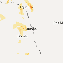
Hail Map for Friday, June 17, 2016

Number of Impacted Households on 6/17/2016
0
Impacted by 1" or Larger Hail
0
Impacted by 1.75" or Larger Hail
0
Impacted by 2.5" or Larger Hail
Square Miles of Populated Area Impacted on 6/17/2016
0
Impacted by 1" or Larger Hail
0
Impacted by 1.75" or Larger Hail
0
Impacted by 2.5" or Larger Hail


Cities Most Affected by Hail Storms of 6/17/2016
| Hail Size | Demographics of Zip Codes Affected | ||||||
|---|---|---|---|---|---|---|---|
| City | Count | Average | Largest | Pop Density | House Value | Income | Age |
| Piedmont, AL | 1 | 2.00 | 2.00 | 40 | $63k | $29.0k | 41.1 |
| Cuthbert, GA | 1 | 1.75 | 1.75 | 19 | $0k | $0.0k | 42.5 |
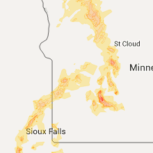
| Cold Spring, MN | 1 | 1.75 | 1.75 | 152 | $118k | $50.7k | 40.5 |
| Hill City, KS | 1 | 1.75 | 1.75 | 7 | $46k | $31.3k | 48.4 |
| Mena, AR | 1 | 1.75 | 1.75 | 24 | $61k | $25.4k | 45.5 |
| Atwood, KS | 1 | 1.75 | 1.75 | 4 | $49k | $32.6k | 50.7 |
| Ashton, NE | 1 | 1.75 | 1.75 | 2 | $31k | $31.1k | 47.6 |
| Bellvue, CO | 1 | 1.75 | 1.75 | 4 | $192k | $51.6k | 50.0 |
| Madison, SD | 1 | 1.75 | 1.75 | 38 | $76k | $32.8k | 37.9 |
| Burwell, NE | 1 | 1.75 | 1.75 | 1 | $39k | $26.8k | 50.4 |
| Litchfield, MN | 1 | 1.75 | 1.75 | 55 | $89k | $39.8k | 41.8 |
| Wheatland, WY | 1 | 1.75 | 1.75 | 3 | $89k | $35.1k | 47.3 |
| Hays, KS | 1 | 1.75 | 1.75 | 62 | $91k | $32.5k | 30.5 |
| Ord, NE | 1 | 1.75 | 1.75 | 11 | $53k | $29.3k | 46.5 |
| Parker, SD | 1 | 1.75 | 1.75 | 8 | $69k | $38.6k | 40.3 |
Hail and Wind Damage Spotted on 6/17/2016
Filter by Report Type:Hail ReportsWind Reports
States Impacted
North Dakota, Arkansas, Minnesota, Iowa, Florida, South Carolina, Georgia, Mississippi, Alabama, North Carolina, Kansas, Colorado, Nebraska, South Dakota, Wyoming, OklahomaNorth Dakota
| Local Time | Report Details |
|---|---|
| 7:02 AM CDT | Measured at ndawn 8n mchenry in eddy county ND, 32.2 miles SSE of Devils Lake, ND |
| 7:10 AM CDT | Trees down in mcville/pekin area in nelson county ND, 39.3 miles SE of Devils Lake, ND |
| 7:11 AM CDT | Measured at ndawn sit in ramsey county ND, 11.4 miles ESE of Devils Lake, ND |
| 7:11 AM CDT | Measured at pekin ndawn sit in nelson county ND, 33.8 miles SE of Devils Lake, ND |
| 7:20 AM CDT | Trailers flipped over at northern view campground on the north side of stump lake in nelson county ND, 21.4 miles ESE of Devils Lake, ND |
| 7:23 AM CDT | Trees and power lines down around town. time estimated based on rada in steele county ND, 56.9 miles SE of Devils Lake, ND |
| 7:25 AM CDT | 15 inch diameter tree down with more smaller tree branches dow in steele county ND, 63 miles SE of Devils Lake, ND |
| 7:28 AM CDT | Peak wind measured at a home weather statio in grand forks county ND, 53.6 miles ESE of Devils Lake, ND |
| 7:37 AM CDT | Measured at michigan ndawn sit in nelson county ND, 32.8 miles E of Devils Lake, ND |
| 7:40 AM CDT | Trees and power lines down all around tow in nelson county ND, 34.6 miles E of Devils Lake, ND |
| 7:40 AM CDT | Trees and power lines down all around tow in nelson county ND, 34.6 miles E of Devils Lake, ND |
| 7:43 AM CDT | Siding and panels torn off the grain elevator. time estimated based on radar. report and photo posted via social medi in nelson county ND, 40.3 miles E of Devils Lake, ND |
| 7:45 AM CDT | Reports of trees and power lines down. time estimated from rada in grand forks county ND, 46.4 miles E of Devils Lake, ND |
| 7:47 AM CDT | Tractor trailer combination blown off highway in grand forks county ND, 47.3 miles E of Devils Lake, ND |
| 7:50 AM CDT | Large trees blown down north side of hwy 2 at rest area and points west. time estimated based on rada in grand forks county ND, 57.7 miles E of Devils Lake, ND |
| 7:55 AM CDT | A steel clad pole shed was destroyed by wind. wooden poles were pulled up from the soi in nelson county ND, 42.9 miles E of Devils Lake, ND |
| 7:58 AM CDT | Measured at inkster ndawn sit in grand forks county ND, 53.1 miles E of Devils Lake, ND |
| 7:58 AM CDT | Storm damage reported in grand forks county ND, 65.1 miles ESE of Devils Lake, ND |
| 7:59 AM CDT | Peak wind of 52 knots at gfaf in grand forks county ND, 69.3 miles E of Devils Lake, ND |
| 7:59 AM CDT | Tree snapped off at the bas in walsh county ND, 49.9 miles E of Devils Lake, ND |
| 8:00 AM CDT | Trees and power lines down. report via social medi in grand forks county ND, 64.2 miles E of Devils Lake, ND |
| 8:08 AM CDT | Peak wind measured at the ndawn senso in walsh county ND, 58.5 miles E of Devils Lake, ND |
| 8:10 AM CDT | Measured at inkster ndawn sit in grand forks county ND, 53.1 miles E of Devils Lake, ND |
| 8:10 AM CDT | Four box elder trees uprooted. 2.28 inches of rain. nd arb observer report. time estimated based on rada in walsh county ND, 65.6 miles E of Devils Lake, ND |
| 8:15 AM CDT | Trees and power lines down all around town. time estimated based on rada in walsh county ND, 55 miles ENE of Devils Lake, ND |
| 8:26 AM CDT | Peak wind measured at a home weather statio in walsh county ND, 76 miles WSW of Roseau, MN |
| 8:28 AM CDT | Reports of trees dow in walsh county ND, 70.5 miles ENE of Devils Lake, ND |
| 8:29 AM CDT | Peak wind measured at the ndawn sit in walsh county ND, 71.7 miles WSW of Roseau, MN |
| 8:34 AM CDT | Peak wind measured at the ndawn sit in walsh county ND, 71.7 miles WSW of Roseau, MN |
| 8:35 AM CDT | Peak wind measured at the ndawn sit in walsh county ND, 71.7 miles WSW of Roseau, MN |
| 8:55 AM CDT | Semi blown off the interstat in pembina county ND, 68.4 miles WSW of Roseau, MN |
Arkansas
| Local Time | Report Details |
|---|---|
| 7:08 AM CDT | Tree down on hwy 125 and locust road. 2 trees down on county road 0836 in marion county AR, 59.2 miles SSE of Springfield, MO |
| 6:29 PM CDT | Half Dollar sized hail reported near Hot Springs National Park, AR, 51 miles WSW of Little Rock, AR |
| 6:50 PM CDT | Quarter sized hail reported near Mena, AR, 48 miles NNW of Nashville, AR |
| 6:55 PM CDT | Half Dollar sized hail reported near Mena, AR, 49 miles NNW of Nashville, AR |
| 6:55 PM CDT | Golf Ball sized hail reported near Mena, AR, 49 miles NNW of Nashville, AR |
| 8:10 PM CDT | Tree and power lines downed on ar hwy 208 near dermott in chicot county AR, 58 miles NNE of Bastrop, LA |
| 8:20 PM CDT | Tree downed along ar hwy 142 near the lakeport community in chicot county AR, 55 miles NE of Bastrop, LA |
| 8:25 PM CDT | Several trees downed along ar hwy 922 in chicot county AR, 53 miles NNE of Bastrop, LA |
| 8:30 PM CDT | A tree had fallen on a car. there was a power outage at the holiday in in chicot county AR, 52.5 miles NE of Bastrop, LA |
| 8:50 PM CDT | Tree downed along ar hwy 8 between pickle shed rd and marigold r in chicot county AR, 41.8 miles NE of Bastrop, LA |
| 8:50 PM CDT | Tree and powerlines downed along hwy 65 in eudora in chicot county AR, 44.8 miles ENE of Bastrop, LA |
| 8:50 PM CDT | Tree downed across peebles st in eudora in chicot county AR, 45.1 miles ENE of Bastrop, LA |
| 8:55 PM CDT | Numerous trees and powerlines down along grand lake road between eudora and grand lake. some homes sustained roof damag in chicot county AR, 46.1 miles ENE of Bastrop, LA |
| 8:55 PM CDT | In the grand lake area...tree fell on a car and a boat was partially sun in chicot county AR, 46.3 miles ENE of Bastrop, LA |
| 9:00 PM CDT | Numerous trees and powerlines down along grand lake road between eudora and grand lake. some homes sustained roof damag in chicot county AR, 44.4 miles ENE of Bastrop, LA |
Minnesota
| Local Time | Report Details |
|---|---|
| 7:56 AM CDT | Peak winds measured at a home weather statio in polk county MN, 71.3 miles SW of Roseau, MN |
| 8:51 AM CDT | Quarter sized hail reported near Trail, MN, 43.8 miles WNW of Bemidji, MN, quarter size hail in trail/gully area. time estimated from radar. |
| 9:15 AM CDT | Peak wind measured at the mn dot rwis sit in kittson county MN, 57.1 miles WSW of Roseau, MN |
| 9:15 AM CDT | Ping Pong Ball sized hail reported near Bagley, MN, 32.4 miles W of Bemidji, MN, large hail fell along the polk and clearwater county line. |
| 9:16 AM CDT | Ping Pong Ball sized hail reported near Bagley, MN, 31.6 miles W of Bemidji, MN, large hail fell along the polk and clearwater county line. |
| 9:30 AM CDT | Quarter sized hail reported near Detroit Lakes, MN, 51.7 miles E of Fargo, ND, report and photo posted via social media. time estimated based on radar. |
| 9:35 AM CDT | Half Dollar sized hail reported near Bagley, MN, 24.7 miles WSW of Bemidji, MN, a few minutes of large hail. report posted via social media. time estimated based on radar. |
| 9:50 AM CDT | Quarter sized hail reported near Warroad, MN, 20.9 miles ENE of Roseau, MN, public report and photo posted to social media. report near warroad. exact location unknown. time estimated based on radar. |
| 10:00 AM CDT | Half Dollar sized hail reported near New York Mills, MN, 66.3 miles ESE of Fargo, ND, report and photo posted via social media. time estimated based on radar. |
| 10:05 AM CDT | Quarter sized hail reported near Waskish, MN, 53.2 miles NNE of Bemidji, MN |
| 10:17 AM CDT | A few poplar and pine trees broken down by the wind along hwy 72. time estimated based on rada in lake of the woods county MN, 53.5 miles WSW of International Falls, MN |
| 10:35 AM CDT | Quarter sized hail reported near New York Mills, MN, 68.4 miles SSW of Bemidji, MN, penny to quarter sized hail. |
| 10:40 AM CDT | Half Dollar sized hail reported near Nevis, MN, 38.2 miles S of Bemidji, MN |
| 10:54 AM CDT | Quarter sized hail reported near Hewitt, MN, 82.4 miles S of Bemidji, MN, nickel to quarter size hail falling. |
| 10:55 AM CDT | Quarter sized hail reported near Wadena, MN, 76.4 miles S of Bemidji, MN |
| 11:08 AM CDT | Quarter sized hail reported near Bertha, MN, 83.5 miles S of Bemidji, MN, street flooding also reported. |
| 12:06 PM CDT | Quarter sized hail reported near Carlos, MN, 79.5 miles NNE of Montevideo, MN, mostly dime sized and very heavy rains. |
| 12:35 PM CDT | Quarter sized hail reported near Underwood, MN, 56.1 miles SE of Fargo, ND |
| 1:38 PM CDT | Quarter sized hail reported near Saint Martin, MN, 64 miles NE of Montevideo, MN, time estimated from radar. . |
| 1:42 PM CDT | Ping Pong Ball sized hail reported near Henning, MN, 81.2 miles ESE of Fargo, ND, quarter to ping pong sized hail stones |
| 1:45 PM CDT | Quarter sized hail reported near Parkers Prairie, MN, 84.4 miles ESE of Fargo, ND |
| 1:55 PM CDT | Quarter sized hail reported near Albany, MN, 68.8 miles NE of Montevideo, MN, time estimated from radar. |
| 2:07 PM CDT | Golf Ball sized hail reported near Cold Spring, MN, 65.9 miles WNW of Minneapolis, MN, occurred on west side of city. strong winds reported but no damage report. |
| 2:20 PM CDT | Quarter sized hail reported near Paynesville, MN, 58.3 miles ENE of Montevideo, MN, occurred along highway 4... south of highway 55. |
| 2:23 PM CDT | Quarter sized hail reported near Paynesville, MN, 56 miles ENE of Montevideo, MN, occurred along county road 4. |
| 2:33 PM CDT | Golf Ball sized hail reported near Litchfield, MN, 58 miles ENE of Montevideo, MN, . |
| 2:55 PM CDT | Quarter sized hail reported near Long Prairie, MN, 82.3 miles NNE of Montevideo, MN, occurred over east side of city. |
| 3:34 PM CDT | Quarter sized hail reported near Madison, MN, 25.2 miles W of Montevideo, MN, . |
| 4:05 PM CDT | Quarter sized hail reported near Dawson, MN, 21.5 miles WSW of Montevideo, MN, . |
| 4:12 PM CDT | Quarter sized hail reported near Hector, MN, 51.6 miles ESE of Montevideo, MN, . |
| 4:15 PM CDT | Quarter sized hail reported near Dawson, MN, 16.4 miles W of Montevideo, MN, . |
| 4:20 PM CDT | Quarter sized hail reported near Buffalo Lake, MN, 55.9 miles ESE of Montevideo, MN, time estimated from radar. |
| 4:20 PM CDT | Quarter sized hail reported near Hector, MN, 51.6 miles ESE of Montevideo, MN, time estimated from radar. |
| 5:00 PM CDT | Numerous trees down around town in lyon county MN, 30 miles SSW of Montevideo, MN |
| 5:14 PM CDT | Storm damage reported in lyon county MN, 34.8 miles S of Montevideo, MN |
| 5:15 PM CDT | Scattered trees and power lines toppled. power was out in town... but has since been restore in renville county MN, 50.1 miles SE of Montevideo, MN |
| 5:20 PM CDT | Storm damage reported in lyon county MN, 34.8 miles S of Montevideo, MN |
| 5:21 PM CDT | Small tree limbs dow in redwood county MN, 53.8 miles SE of Montevideo, MN |
| 5:30 PM CDT | Scattered trees and power lines down at county road 4 and country road 1 in redwood county MN, 54.2 miles SE of Montevideo, MN |
| 5:31 PM CDT | Top of a grain elevator damage in lyon county MN, 45.1 miles S of Montevideo, MN |
| 5:37 PM CDT | Measured on davis wind senso in brown county MN, 60 miles SE of Montevideo, MN |
| 5:37 PM CDT | Turkey barn damaged. numerous trees dow in brown county MN, 59.9 miles SE of Montevideo, MN |
| 5:40 PM CDT | A few trees felled... including one on a garag in brown county MN, 61.1 miles SE of Montevideo, MN |
| 5:40 PM CDT | Large tree blown dow in lyon county MN, 49.4 miles S of Montevideo, MN |
| 5:55 PM CDT | Few trees topple in brown county MN, 66.7 miles SE of Montevideo, MN |
| 6:05 PM CDT | Few trees topple in brown county MN, 66.7 miles SE of Montevideo, MN |
| 6:12 PM CDT | Large tree down across roa in cottonwood county MN, 80 miles SSE of Montevideo, MN |
| 6:25 PM CDT | Garage blown dow in brown county MN, 74.2 miles SE of Montevideo, MN |
| 6:30 PM CDT | Numerous trees down across town. in brown county MN, 74.9 miles SW of Minneapolis, MN |
| 6:45 PM CDT | Tree toppled over roa in watonwan county MN, 85.9 miles SW of Minneapolis, MN |
| 7:00 PM CDT | Numerous trees and power lines down between courtland to 4 miles east of courtlan in nicollet county MN, 72.2 miles SW of Minneapolis, MN |
| 7:00 PM CDT | Tree down across road. damage occurred in cambri in blue earth county MN, 72.5 miles SW of Minneapolis, MN |
| 7:03 PM CDT | Several trees toppled around tow in martin county MN, 80.6 miles NNE of Storm Lake, IA |
| 7:08 PM CDT | Several trees down across town. time estimated from rada in martin county MN, 78.1 miles NW of Mason City, IA |
| 7:12 PM CDT | Eighteen wheeled truck turned over on i-90 just north of town. time estimated from rada in martin county MN, 72.3 miles WNW of Mason City, IA |
| 7:15 PM CDT | Several trees down in town. time estimated from rada in martin county MN, 71.9 miles WNW of Mason City, IA |
| 7:20 PM CDT | Large tree broken in two on armstrong ave. two eight to ten inch diameter tree limbs severed. time of event estimated from rada in watonwan county MN, 86 miles SE of Montevideo, MN |
| 7:29 PM CDT | Measured at ksum radio station. relayed via social medi in martin county MN, 74.6 miles WNW of Mason City, IA |
Iowa
| Local Time | Report Details |
|---|---|
| 10:30 AM CDT | Tree down on a machine she in cherokee county IA, 31.1 miles W of Storm Lake, IA |
| 7:05 PM CDT | 8 inch diameter tree limb down on lakeshore driv in dickinson county IA, 49.3 miles N of Storm Lake, IA |
| 7:28 PM CDT | 8-12 inch tree limb dow in dickinson county IA, 53.5 miles N of Storm Lake, IA |
| 7:32 PM CDT | 51 kt wind gust reported at estherville airpor in emmet county IA, 56.8 miles NNE of Storm Lake, IA |
| 8:03 PM CDT | Trees down. also torrential rainfall. via social medi in emmet county IA, 55.4 miles NNE of Storm Lake, IA |
| 8:40 PM CDT | Emmet county law enforcement reported a large pine tree down in wallingfor in emmet county IA, 50.9 miles NNE of Storm Lake, IA |
| 8:40 PM CDT | Tree branches down and there was a power outag in sioux county IA, 32.2 miles SE of Sioux Falls, SD |
| 8:55 PM CDT | Numerous trees down across the are in sioux county IA, 39.7 miles SSE of Sioux Falls, SD |
| 9:42 PM CDT | Storm damage reported in plymouth county IA, 50.3 miles WNW of Storm Lake, IA |
| 9:45 PM CDT | Shingles blown of in plymouth county IA, 58.7 miles W of Storm Lake, IA |
| 10:12 PM CDT | Storm damage reported in woodbury county IA, 61.5 miles W of Storm Lake, IA |
| 10:13 PM CDT | Trees down in the are in plymouth county IA, 52.3 miles W of Storm Lake, IA |
| 10:28 PM CDT | Quarter sized hail reported near Kingsley, IA, 39.4 miles W of Storm Lake, IA, . |
| 10:40 PM CDT | Storm damage reported in woodbury county IA, 61.5 miles W of Storm Lake, IA |
| 10:44 PM CDT | Large tree down and damage to a bar in woodbury county IA, 50.4 miles W of Storm Lake, IA |
| 11:08 PM CDT | Several trees blown over between moville and correctionville. also reports of flash flooding. in woodbury county IA, 31.7 miles WSW of Storm Lake, IA |
| 11:16 PM CDT | Reported at sioux gateway airport by aso in woodbury county IA, 62.6 miles WSW of Storm Lake, IA |
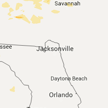
Florida
| Local Time | Report Details |
|---|---|
| 12:21 PM EDT | A wind gust of 68mph...59kts was recorded by a weatherbug site located in deerfield beach at code enforcement at 1221pm edt in broward county FL, 40.4 miles N of Miami, FL |
| 12:33 PM EDT | A tree was reported down by south federal highway ... 1 mile south of wilton manors via twitter in broward county FL, 30.6 miles NNE of Miami, FL |
| 12:55 PM EDT | Usaf tower ksc-1007 in brevard county FL, 36.9 miles E of Orlando, FL |
| 3:02 PM EDT | Wind gusted up to 63mph on sensor and pea sized hail reported in liberty county FL, 32.8 miles W of Tallahassee, FL |
| 3:20 PM EDT | Tree down across road in liberty county FL, 31.2 miles W of Tallahassee, FL |
| 5:00 PM CDT | Quarter sized hail reported near Fountain, FL, 56.5 miles E of Miramar Beach, FL |
| 5:05 PM CDT | Treee down across county road 167 near the intersection of county road 27 in calhoun county FL, 59.6 miles ENE of Miramar Beach, FL |
| 5:15 PM CDT | Trees and powerlines down along owenwood r in bay county FL, 56.3 miles E of Miramar Beach, FL |
| 5:45 PM CDT | Large tree down across owenwood road just west of highway 231 in bay county FL, 56.3 miles E of Miramar Beach, FL |
| 5:50 PM CDT | Trees down in the area in jackson county FL, 64.3 miles NE of Miramar Beach, FL |
| 6:00 PM CDT | Several trees were blown down in the northwest part of jackson county in jackson county FL, 64.3 miles NE of Miramar Beach, FL |
| 7:30 PM CDT | County 911 communications reports numerous trees down county wid in okaloosa county FL, 29.3 miles NNW of Miramar Beach, FL |
| 7:40 PM CDT | Trees down near walton springs road in walton county FL, 28.7 miles NNE of Miramar Beach, FL |
| 7:43 PM CDT | Roof blown off millers grocery store along with power lines down in holmes county FL, 54.2 miles NE of Miramar Beach, FL |
| 8:00 PM CDT | Trees down on highway 181c at morrison springs in walton county FL, 33.7 miles NE of Miramar Beach, FL |
| 8:07 PM CDT | Numerous trees down across the county in holmes county FL, 49.6 miles NE of Miramar Beach, FL |
| 8:08 PM CDT | Reports of trees down along walton way in south walton county in walton county FL, 2 miles WNW of Miramar Beach, FL |
| 8:15 PM CDT | Several trees and power lines down across washington county in washington county FL, 42.3 miles ENE of Miramar Beach, FL |
| 8:35 PM CDT | Trees and power lines down in the fountain area in bay county FL, 56.6 miles E of Miramar Beach, FL |
| 8:40 PM CDT | Trees and power lines down in the youngstown area in bay county FL, 55 miles E of Miramar Beach, FL |
| 9:15 PM CDT | Trees and power lines down in the bayou george area in bay county FL, 49.7 miles E of Miramar Beach, FL |
| 9:15 PM CDT | A few trees down near panama city in bay county FL, 43.4 miles ESE of Miramar Beach, FL |
South Carolina
| Local Time | Report Details |
|---|---|
| 12:47 PM EDT | Tree down along santuc-carlisle hwy in union county SC, 56.3 miles SW of Charlotte, NC |
| 12:53 PM EDT | Quarter sized hail reported near Carlisle, SC, 56.1 miles SW of Charlotte, NC |
| 1:30 PM EDT | Trees down on lee brice roa in fairfield county SC, 59.2 miles SSW of Charlotte, NC |
| 1:32 PM EDT | Rc-winds reported at dutch fork high schoo in richland county SC, 64.7 miles NE of Augusta, GA |
| 1:35 PM EDT | Trees down near the intersection of highway 378 and shop roa in richland county SC, 66.4 miles ENE of Augusta, GA |
| 1:35 PM EDT | Quarter sized hail reported near Columbia, SC, 59.6 miles NE of Augusta, GA, quarter size hail in irmo area. |
| 1:45 PM EDT | Quarter sized hail reported near Columbia, SC, 69.9 miles ENE of Augusta, GA, quarter sized hail reported near the intersection of leitner rd and leesburg rd. |
| 1:45 PM EDT | Quarter sized hail reported near Columbia, SC, 68.7 miles ENE of Augusta, GA, . |
| 2:00 PM EDT | Quarter sized hail reported near Columbia, SC, 66.6 miles NE of Augusta, GA, . |
| 2:05 PM EDT | Quarter sized hail reported near Lugoff, SC, 71.8 miles S of Charlotte, NC, reported by 28 ows usaf wx fcstr. |
| 2:05 PM EDT | Trees down in roadwa in richland county SC, 70.1 miles ENE of Augusta, GA |
| 2:07 PM EDT | Half Dollar sized hail reported near Columbia, SC, 69.9 miles ENE of Augusta, GA, report of half dollar sized hail near the intersection of leesburg rd and leitner rd. |
| 2:10 PM EDT | Trees down along oswego hwy. 2 trees reported down on home with no reported injuries. time estmd by rada in lee county SC, 60 miles NNW of Charleston, SC |
| 2:14 PM EDT | Quarter sized hail reported near Columbia, SC, 68.2 miles ENE of Augusta, GA, via social media. 7651 garners ferry rd. |
| 2:15 PM EDT | Multiple trees and lines down 378 and pinewood roa in richland county SC, 68.4 miles ENE of Augusta, GA |
| 2:35 PM EDT | Quarter sized hail reported near Columbia, SC, 59.6 miles NE of Augusta, GA, coldstream subdivision in irmo. |
| 2:38 PM EDT | Numerous trees down wedgefield rd and cane savannah r in sumter county SC, 54.7 miles NNW of Charleston, SC |
| 2:38 PM EDT | Trees down june burg rd. time estmd by rada in clarendon county SC, 36.5 miles NNW of Charleston, SC |
| 2:46 PM EDT | Trees down on hwy 15 in sumter county SC, 48.3 miles NNW of Charleston, SC |
| 2:48 PM EDT | Trees down hwy 261s into paxvill in clarendon county SC, 42.8 miles NNW of Charleston, SC |
| 2:54 PM EDT | Tree on home along greenwood ave in ninety si in greenwood county SC, 47.7 miles N of Augusta, GA |
| 2:59 PM EDT | Report via social media of numerous trees down in beech islan in aiken county SC, 6 miles SE of Augusta, GA |
| 3:07 PM EDT | Multiple trees and power lines down. reported by aiken county e in aiken county SC, 15.8 miles ENE of Augusta, GA |
| 3:07 PM EDT | Trees down city of aiken on vaucluse r in aiken county SC, 15 miles NE of Augusta, GA |
| 3:08 PM EDT | Sc state hwy patrol reports trees down along sc 311 near the intersections of old community rd and mudville rd in berkeley county SC, 15.7 miles WNW of Charleston, SC |
| 3:15 PM EDT | Manning santee-cooper regional airport pk wnd 34018g51k in clarendon county SC, 29.4 miles NNW of Charleston, SC |
| 3:17 PM EDT | County em reports numerous trees and power lines down in the city of orangebur in orangeburg county SC, 53.8 miles WNW of Charleston, SC |
| 3:19 PM EDT | Trees and power lines down 3047 hwy 23 west in mccormick county SC, 20.9 miles NW of Augusta, GA |
| 3:20 PM EDT | Large tree on highway 521 in williamsburg county SC, 28.4 miles NNE of Charleston, SC |
| 3:20 PM EDT | Sc state hwy patrol reports tree down in roadway at the intersection of poplar hill dr and ruffacre ln in berkeley county SC, 14.6 miles WNW of Charleston, SC |
| 3:30 PM EDT | Emergency manager reports widespread tree and power line damage along highway 261 and 521 from greeleyville to andrews. possible tornad in williamsburg county SC, 26.5 miles N of Charleston, SC |
| 3:37 PM EDT | Quarter sized hail reported near Summerville, SC, 8.2 miles SW of Charleston, SC, twitter report of quarter size hail in cane bay area |
| 3:38 PM EDT | Quarter sized hail reported near Summerville, SC, 10.4 miles SSW of Charleston, SC |
| 3:38 PM EDT | Sc state hwy patrol reports a tree down near the 1500 block of dr evans rd. time estimated from radar in berkeley county SC, 4 miles SE of Charleston, SC |
| 3:44 PM EDT | Tree down on gapway road near ethridge rd in georgetown county SC, 35.6 miles ENE of Charleston, SC |
| 3:44 PM EDT | Quarter sized hail reported near Goose Creek, SC, 11.1 miles SSW of Charleston, SC, quarter size hail reported off hwy 176 |
| 3:45 PM EDT | Tree down on highway 527 in williamsburg county SC, 33.6 miles NE of Charleston, SC |
| 3:47 PM EDT | Large tree down at cypress gardens rd and bushy park rd in berkeley county SC, 9.9 miles SSE of Charleston, SC |
| 3:47 PM EDT | Sc state hwy patrol reports a tree down on augusta hwy near sidneys rd. time estimated from radar in colleton county SC, 31.1 miles WSW of Charleston, SC |
| 3:51 PM EDT | Tree down on kent road in georgetown county SC, 33.9 miles ENE of Charleston, SC |
| 3:52 PM EDT | Allendale co warning point reports trees down on augusta hwy near washout rd...hwy 3 near beldock...and a large tree limb down at bay st e and memorial ave in allendale county SC, 47.3 miles SE of Augusta, GA |
| 3:55 PM EDT | Trees down on orange grove r in bamberg county SC, 56.8 miles ESE of Augusta, GA |
| 3:56 PM EDT | Tree down on walker road near columbus road in georgetown county SC, 30.1 miles ENE of Charleston, SC |
| 3:57 PM EDT | Large tree blown down and blocking hickory street near w. luke street. report received via twitte in dorchester county SC, 15.6 miles SW of Charleston, SC |
| 4:00 PM EDT | Quarter sized hail reported near Olar, SC, 49.9 miles ESE of Augusta, GA, 1 inch hail in the town of govan. report received through social media. time of event estimated by radar. |
| 4:00 PM EDT | Tree down on downing loop road at gapway road in georgetown county SC, 32.5 miles ENE of Charleston, SC |
| 4:01 PM EDT | Tree down on powell road near bertie avenue in georgetown county SC, 32.6 miles ENE of Charleston, SC |
| 4:02 PM EDT | Sc state highway patrol reports tree down in roadway at the intersection of halhway creek rd and sc 41. time estiamted from radar in berkeley county SC, 20.9 miles SSE of Charleston, SC |
| 4:06 PM EDT | Sc state hwy patrol reports a tree down in the roadway near the intersection of burlington rd and creekbed ln. time estimated from radar in colleton county SC, 37.7 miles WSW of Charleston, SC |
| 4:06 PM EDT | Sc state hwy patrol reports tree down on burlington rd near the intersection of pleasant grove rd. time estimated from radar in colleton county SC, 38.3 miles WSW of Charleston, SC |
| 4:10 PM EDT | Tree down on montford road near pennyroyal road in georgetown county SC, 40.6 miles ENE of Charleston, SC |
| 4:11 PM EDT | Trees blown down and snapped at northwoods mall. report via twitte in charleston county SC, 17.7 miles S of Charleston, SC |
| 4:14 PM EDT | Nws employee reports large tree down near the traffic circle at the enterance to park west subdivision in charleston county SC, 26.2 miles SSE of Charleston, SC |
| 4:16 PM EDT | Trees down at charleston national golf club. report via twitte in charleston county SC, 26.5 miles SSE of Charleston, SC |
| 4:20 PM EDT | Several reports of trees down in the isle of palms and wild dunes area. report received via twitte in charleston county SC, 30.6 miles SSE of Charleston, SC |
| 4:20 PM EDT | Trees blown down over west ashley greenway near parkdale drive. report received via twitte in charleston county SC, 28.1 miles S of Charleston, SC |
| 4:25 PM EDT | Sc state highway patrol reports tree down in roadway on sc 64 near rodeo dr. time estiamted from radar in colleton county SC, 41.3 miles WSW of Charleston, SC |
| 4:27 PM EDT | Nws employee reports numerous large pine trees down at residence in colleton county SC, 34.4 miles SW of Charleston, SC |
| 4:30 PM EDT | Sc state hwy patrol reports a tree down on hickory hill rd near two sisters ferry rd. time estimated from radar in hampton county SC, 49.6 miles N of Savannah, GA |
| 4:30 PM EDT | Sc state hwy patrol reports a tree down on pocotaligo rd near the holly st ext intersection. time estimated from radar in hampton county SC, 52.3 miles N of Savannah, GA |
| 4:33 PM EDT | Charleston county sheriff office reports a tree down at the intersection of highway 165 and ballpark roa in charleston county SC, 34.1 miles SSW of Charleston, SC |
| 4:35 PM EDT | Large trees blown down onto two cars in hampton par in charleston county SC, 28.2 miles S of Charleston, SC |
| 4:44 PM EDT | Tree down on gapway road near ethridge rd in georgetown county SC, 35.6 miles ENE of Charleston, SC |
| 4:44 PM EDT | Sc state hwy patrol reports a tree in the roadway near the intersection of cat branch rd and pine branch dr in jasper county SC, 43.7 miles N of Savannah, GA |
| 4:44 PM EDT | Sc state hwy patrol reports a tree down in the 7600 block of yemassee hwy. time estimated from radar in colleton county SC, 51.1 miles NNE of Savannah, GA |
| 4:49 PM EDT | Sc state hwy patrol reports a tree down in the 2800 block of roseville rd near bumblebee rd. time estiamted from radar in charleston county SC, 41.4 miles SSW of Charleston, SC |
| 4:50 PM EDT | Ethel post office road closed near smoak road due to tree over roa in charleston county SC, 38 miles SSW of Charleston, SC |
| 4:51 PM EDT | Tree down on kent road in georgetown county SC, 33.9 miles ENE of Charleston, SC |
| 4:51 PM EDT | Charleston county sheriff office reports a tree down and blocking roseville roa in charleston county SC, 41.4 miles SSW of Charleston, SC |
| 4:58 PM EDT | Sc state hwy patrol reports a tree down in the roadway at the corner of us 278 and morgandollar rd. time estimated from radar in jasper county SC, 36.3 miles N of Savannah, GA |
| 4:58 PM EDT | Sc state hwy patrol reports tree down on sc 174 near russell creek rd. time estiamted from radar in charleston county SC, 44.9 miles SSW of Charleston, SC |
| 5:06 PM EDT | Charleston county sheriff office reports a tree down and blocking road at intersection of smoak road and ethel post office roa in charleston county SC, 38 miles SSW of Charleston, SC |
| 5:10 PM EDT | Trees down throughout edisto islan in charleston county SC, 46.9 miles SSW of Charleston, SC |
| 5:13 PM EDT | Sc state hwy patrol reports tree down at the intersection of wood duck st and sisters ferry rd. time estimated from radar in jasper county SC, 28.1 miles NNE of Savannah, GA |
| 5:15 PM EDT | Spotter reported estimated 60 to 70 mile per hour winds and two brief waterspouts seen from the broad river bridge in beaufort county in beaufort county SC, 27.1 miles NE of Savannah, GA |
| 5:15 PM EDT | Ace basin raws in charleston county SC, 43.3 miles SSW of Charleston, SC |
| 5:17 PM EDT | Retired nws employee estimated winds 60-65 mph with a few gusts near 70 mp in charleston county SC, 46.9 miles SSW of Charleston, SC |
| 5:17 PM EDT | Retired nws employee estimated winds 60-65 mph with a few gusts near 70 mp in charleston county SC, 46.9 miles SSW of Charleston, SC |
| 5:22 PM EDT | Spotter reported wind gust of 58 mph near the north end of the beaufort mcas in beaufort county SC, 36.1 miles NE of Savannah, GA |
| 5:22 PM EDT | Spotter reports two trees down at old jericho rd and hwy 21 in beaufort county SC, 31.5 miles NE of Savannah, GA |
| 5:27 PM EDT | Tree down along old jericho road near us 2 in beaufort county SC, 31.5 miles NE of Savannah, GA |
| 5:35 PM EDT | Storm damage reported in beaufort county SC, 35.2 miles NE of Savannah, GA |
| 5:36 PM EDT | Multiple large trees down along business 278 in the northern portion of hilton head island in beaufort county SC, 24.3 miles ENE of Savannah, GA |
| 5:47 PM EDT | Sc state hwy patrol reports tree down across the road at the intersection of s okatie hwy and us 17. time estiamted from radar in jasper county SC, 5.3 miles NNE of Savannah, GA |
Georgia
| Local Time | Report Details |
|---|---|
| 1:08 PM EDT | The cherokee county emergency manager reported a tree blown down across power lines at south holly springs and blaylock driv in cherokee county GA, 27.5 miles N of Atlanta, GA |
| 1:08 PM EDT | The cherokee county emergency manager reported a tree blown down in the roadway at shelter cove and port victoria wa in cherokee county GA, 30 miles NNW of Atlanta, GA |
| 1:10 PM EDT | Quarter sized hail reported near Canton, GA, 32.8 miles NNW of Atlanta, GA, the public reported quarter size hail near canton. |
| 1:11 PM EDT | The cherokee county emergency manager reported a tree blown down in the roadway at shelter cove and port victoria wa in cherokee county GA, 30 miles NNW of Atlanta, GA |
| 1:15 PM EDT | The cherokee county emergency manager reported a tree blown down on a power line around vaughn road and little roa in cherokee county GA, 27.7 miles N of Atlanta, GA |
| 1:30 PM EDT | The paulding county 911 center reported a tree blown down around due west road and state highway 9 in paulding county GA, 25.6 miles NW of Atlanta, GA |
| 1:30 PM EDT | A report was received from the public of several large tree limbs blown down as well as a large maple tree split by high winds in the area around lower roswell road and in cobb county GA, 14.8 miles NNW of Atlanta, GA |
| 1:45 PM EDT | An amateur radio operator reported trees and power lines blown down on bethesda church road north of ronlad reagan parkwa in gwinnett county GA, 21.5 miles ENE of Atlanta, GA |
| 1:45 PM EDT | Quarter sized hail reported near Lawrenceville, GA, 28.1 miles NE of Atlanta, GA, an amateur radio operator reported quarter size hail on state highway 316 between state highway 120 and collins hill road. |
| 1:45 PM EDT | The floyd county emergency manager reported a tree down on a fence on blossom hill in rom in floyd county GA, 54.2 miles S of Chattanooga, TN |
| 2:10 PM EDT | Trees down with injuries. mistletoe state park reported by media. time estmd by rada in columbia county GA, 25.9 miles WNW of Augusta, GA |
| 2:10 PM EDT | The polk county emergency manager reported several trees blown down north of cedartow in polk county GA, 54.6 miles WNW of Atlanta, GA |
| 2:20 PM EDT | The rockdale county emergency manager reported trees and power lines blown down on state highway 138 south at ebenezer road and at flat shoals roa in rockdale county GA, 21.8 miles ESE of Atlanta, GA |
| 2:38 PM EDT | The polk county emergency manager reported several trees blown down south of cave sprin in polk county GA, 59.7 miles WNW of Atlanta, GA |
| 2:55 PM EDT | The newton county emergency manager reported numerous trees blown down around state highway 162 at state highway 3 in newton county GA, 37.6 miles SE of Atlanta, GA |
| 2:55 PM EDT | The newton county emergency manager reported numerous trees blown down around state highway 36 at state highway 21 in newton county GA, 38.1 miles SE of Atlanta, GA |
| 2:55 PM EDT | Emergency manager reported several trees down near the carroll county/douglas county lin in carroll county GA, 39.9 miles WSW of Atlanta, GA |
| 3:00 PM EDT | Emergency manager has received reports of several trees down across southern fulton count in fulton county GA, 0.8 miles N of Atlanta, GA |
| 3:00 PM EDT | Em reports several trees and powerlines down around fairplay in southern douglas county...around hwy 166 and phillips mill in douglas county GA, 18.9 miles W of Atlanta, GA |
| 3:01 PM EDT | Elijah clark state park. estmd. 20 damaged campers. 3 damaged vehicles. 1 tree down on camper. multiple trees and pwr lines down. via county e in lincoln county GA, 35.9 miles NW of Augusta, GA |
| 3:05 PM EDT | The butts county emergency manager reported several tree blown down in the northern portion of the count in butts county GA, 36.7 miles SE of Atlanta, GA |
| 3:19 PM EDT | Trees down with injuries. mistletoe state park reported by media. time estmd by rada in columbia county GA, 25.9 miles WNW of Augusta, GA |
| 3:22 PM EDT | Images of trees and power lines down on wrightsboro r in mcduffie county GA, 34.1 miles W of Augusta, GA |
| 3:25 PM EDT | The butts county emergency manager reported 7 to 8 large pine trees blown down in the southeastern portion of the count in butts county GA, 44.9 miles SE of Atlanta, GA |
| 3:55 PM EDT | 911 call center received report of numerous trees down..over 50...as well as powerlines across the eastern portion of the count in pike county GA, 44.8 miles S of Atlanta, GA |
| 3:55 PM EDT | The jones county emergency manager reported two trees blown down near round oa in jones county GA, 65.3 miles SE of Atlanta, GA |
| 4:00 PM EDT | The jones county emergency manager reported a tree blown down near haddoc in jones county GA, 74.4 miles SE of Atlanta, GA |
| 4:02 PM EDT | Screven county warning point reports tree down on burtons ferry hwy blocking roadway. time estimated from radar in screven county GA, 45.2 miles SE of Augusta, GA |
| 4:15 PM EDT | 911 call center received reports of numerous trees and powerlines down county-wid in glascock county GA, 40 miles WSW of Augusta, GA |
| 4:15 PM EDT | The heard county 911 center reported numerous trees blown down in the northern portion of the count in heard county GA, 55.4 miles WSW of Atlanta, GA |
| 4:15 PM EDT | Emergency manager reported at least 20 trees down between bowden and tyus in carroll county GA, 50.4 miles WSW of Atlanta, GA |
| 4:25 PM EDT | Quarter sized hail reported near Roopville, GA, 54.8 miles WSW of Atlanta, GA, the heard county 911 center reported quarter size hail in the northern portion of the county. |
| 4:30 PM EDT | 911 call senter has received reports of multiple trees down and power outage near toomsboro in wilkinson county GA, 78.1 miles SW of Augusta, GA |
| 4:30 PM EDT | Numerous trees down throughout the community of perkin in jenkins county GA, 39.2 miles S of Augusta, GA |
| 4:48 PM EDT | 911 call center has received reports of numerous tress down all across the count in haralson county GA, 51.8 miles W of Atlanta, GA |
| 4:50 PM EDT | Spotter reported 50 to 60 mile an hour winds with outflow boundary moving through in screven county GA, 42.8 miles NW of Savannah, GA |
| 4:50 PM EDT | Quarter sized hail reported near Musella, GA, 69.8 miles SSE of Atlanta, GA, a trained storm spotter reported quarter size hail. |
| 4:55 PM EDT | 911 call center received reports of numerous trees down...powerlines down...a trees down on houses near taylors mill not too far from crawford and peach county border in crawford county GA, 82.2 miles SSE of Atlanta, GA |
| 5:10 PM EDT | The troup county 911 center reported a tree blown down on country club roa in troup county GA, 39.5 miles NE of Auburn, AL |
| 5:15 PM EDT | Emergency manager reported numerous trees and some powerlines down across the entire county in laurens county GA, 64.9 miles N of Douglas, GA |
| 5:15 PM EDT | The troup county 911 center reported construction materials from a building site blown across the road at vernon and gordon street in troup county GA, 39.4 miles NE of Auburn, AL |
| 5:15 PM EDT | Storm damage reported in houston county GA, 83.8 miles NNW of Douglas, GA |
| 5:17 PM EDT | Effingham county warning point reports a tree down at the intersection of morgan circle and ollie morgan rd. time estimated from radar in effingham county GA, 30.7 miles NNW of Savannah, GA |
| 5:20 PM EDT | The troup county 911 center reported the steeple blown off the loyd presbyterian church on glass bridge roa in troup county GA, 33.9 miles NE of Auburn, AL |
| 5:22 PM EDT | Bulloch county warning point reports a tree down at the intersection of old river rd and 119 connector. time estimated from radar in bulloch county GA, 28.2 miles NW of Savannah, GA |
| 5:27 PM EDT | Effingham county warning point reports a tree down near the intersection of stillwell clyo rd and wilson rd. time estimated from radar in effingham county GA, 23.7 miles NNW of Savannah, GA |
| 5:30 PM EDT | The troup county 911 center reported a tree blown down on a house on givens circl in troup county GA, 27.5 miles NE of Auburn, AL |
| 5:40 PM EDT | At least 2 trees down. 400 block of alabama st and wynn st and main st intersectio in dodge county GA, 63.4 miles NNW of Douglas, GA |
| 5:41 PM EDT | Bulloch county warning point reports a tree down on lake view rd just north of clito rd. time estimated by radar in bulloch county GA, 51.7 miles NW of Savannah, GA |
| 5:50 PM EDT | Bullock county warning point reports a tree down on gw oliver rd. time estimated from radar in bulloch county GA, 40.1 miles WNW of Savannah, GA |
| 5:55 PM EDT | At least 1 tree down at cherry st and bogan st in unadilla in dooly county GA, 73.3 miles NW of Douglas, GA |
| 5:59 PM EDT | Bulloch county warning point reports a tree down near the intersection of hwy 24 and leon newsome rd. time estimated from radar in bulloch county GA, 44.7 miles NW of Savannah, GA |
| 6:00 PM EDT | *** 2 inj *** numerous trees down. 3 rvs turned over with multiple... minor injuries along i-26 just before mile marker 111. number of injuries in candler county GA, 54.7 miles WNW of Savannah, GA |
| 6:04 PM EDT | Garden city police report a tree down and blocking highway 80 near talmadge avenue and griffin avenu in chatham county GA, 5.3 miles W of Savannah, GA |
| 6:06 PM EDT | Measured at nos tide gage at fort pulask in chatham county GA, 11.7 miles ESE of Savannah, GA |
| 6:07 PM EDT | Trees down on bill sikes roa in tattnall county GA, 64.9 miles WNW of Savannah, GA |
| 6:09 PM EDT | Bulloch county warning point reports a tree down on hwy 46. time estiamted from radar in bulloch county GA, 49 miles WNW of Savannah, GA |
| 6:09 PM EDT | Highway 80 closed near chatham parkway due to a large tree dow in chatham county GA, 4.1 miles W of Savannah, GA |
| 6:09 PM EDT | Trees down on highway 15 in tattnall county GA, 63 miles WNW of Savannah, GA |
| 6:10 PM EDT | 2 trees down in back yard of a residence on long boat place on wilmington island in chatham county GA, 8.2 miles ESE of Savannah, GA |
| 6:14 PM EDT | Effingham county warning point reports tree down on ga 17 near courhouse rd. time estimated from radar in effingham county GA, 20.6 miles NW of Savannah, GA |
| 6:15 PM EDT | Golf Ball sized hail reported near Cuthbert, GA, 70.5 miles SE of Auburn, AL |
| 6:18 PM EDT | Evans county warning point reports a tree down on sims brothers rd near hwy 280. time estimated from radar in evans county GA, 46 miles W of Savannah, GA |
| 6:23 PM EDT | Trees down on church stree in tattnall county GA, 60.2 miles W of Savannah, GA |
| 6:25 PM EDT | Tree down at intersection of hwy 280 and mcgregor st in ailey. em also reports at least 40 trees down across county...1 on hom in montgomery county GA, 49.9 miles NNE of Douglas, GA |
| 6:27 PM EDT | Evans county warning point reports a tree down on charlie todd rd. time estimated from radar in evans county GA, 45.1 miles W of Savannah, GA |
| 6:30 PM EDT | Several trees down at hwy 46 and hwy 19. numerous other trees down across county in wheeler county GA, 54 miles N of Douglas, GA |
| 6:32 PM EDT | Evans country warning point reports a tree dwon near the intersection of hwy 129 and hwy 250. time estimated from radar in evans county GA, 44.5 miles W of Savannah, GA |
| 6:48 PM EDT | Trees down on railroad stree in tattnall county GA, 49.6 miles W of Savannah, GA |
| 6:50 PM EDT | Liberty county warning point reports a tree down at the corner of n coastal hwy and shavetown rd. time estimated from radar in liberty county GA, 23.7 miles SW of Savannah, GA |
| 6:55 PM EDT | Report of numerous pine trees snapped and down along freedman grove rd in liberty county GA, 25.1 miles SW of Savannah, GA |
| 6:55 PM EDT | Liberty county warning point reports a tree down across the railroad tracks near pate rodgers rd in liberty county GA, 25.1 miles SW of Savannah, GA |
| 6:55 PM EDT | Trees reported down in fort stewar in liberty county GA, 29.4 miles WSW of Savannah, GA |
| 6:57 PM EDT | Liberty county warning point reports a tree down on power lines...with lines live and sparking...near the 26 mile mark on leroy coffer hwy in liberty county GA, 24.7 miles SW of Savannah, GA |
| 7:00 PM EDT | Liberty county warning point reports a tree across the road in the 7800 block of oglethorpe hwy in liberty county GA, 29.5 miles SW of Savannah, GA |
| 7:31 PM EDT | Several trees and power lines down in ben hill county GA, 27.5 miles WNW of Douglas, GA |
| 7:41 PM EDT | Mcintosh/long county warning point reports a tree down on hwy 57 in townsend. time estimated from radar in mcintosh county GA, 45 miles SW of Savannah, GA |
| 7:43 PM EDT | 911 call center received report of several trees down in the richland are in stewart county GA, 59.8 miles SE of Auburn, AL |
| 7:46 PM EDT | Mcintosh/long county warning point reports a tree down on new river rd in darien in mcintosh county GA, 51.8 miles SSW of Savannah, GA |
| 7:50 PM EDT | Multiple trees and powerlines down near highway 27 and highway 84 in jesup and all across wayne count in wayne county GA, 57 miles E of Douglas, GA |
| 8:00 PM EDT | Tree 2-3 feet in diameter was uprooted at the interesection of nightingale lane and thornhall dr blocking the roa in glynn county GA, 56.8 miles N of Jacksonville, FL |
| 8:00 PM EDT | 911 call center reported multiple trees down in ambros in coffee county GA, 11.1 miles WNW of Douglas, GA |
| 8:00 PM EDT | 911 call center reported multiple trees down in broxto in coffee county GA, 8.2 miles NNW of Douglas, GA |
| 8:00 PM EDT | Trees down in quitman county in quitman county GA, 54.6 miles SSE of Auburn, AL |
| 8:10 PM EDT | Picture on social media of trees down in cuthbert including on a few homes in randolph county GA, 70.5 miles SE of Auburn, AL |
| 8:15 PM EDT | At least 1 tree down on big horse creek rd and cedar park rd in telfair county GA, 34.2 miles N of Douglas, GA |
| 8:15 PM EDT | A few trees and power lines down in the shellman area in randolph county GA, 77.2 miles SE of Auburn, AL |
| 8:17 PM EDT | 911 call center reported multiple trees down across the city of dougla in coffee county GA, 0.3 miles N of Douglas, GA |
| 8:28 PM EDT | Trees down on rockingham rd in alm in bacon county GA, 21.9 miles E of Douglas, GA |
| 8:30 PM EDT | At least 2 trees and power lines down at 5th st and oak st and 9th st and eastman rd. also stated many reports of trees down across eastman and surrounding are in dodge county GA, 51.6 miles NNW of Douglas, GA |
| 8:46 PM EDT | 911 call center reported powerlines down in nahunt in brantley county GA, 50.4 miles ESE of Douglas, GA |
| 8:55 PM EDT | Tree down on highway 3 in early county GA, 78.4 miles NNW of Tallahassee, FL |
| 8:58 PM EDT | 1 tree down that destroyed a mobile home at corner of crisp and church st. on the south side of cordele. also had power lines down on farmersmarket road on the east sid in crisp county GA, 63.1 miles WNW of Douglas, GA |
| 8:59 PM EDT | Multiple trees down in blackshear. one tree down on county road 121 nort in pierce county GA, 38.7 miles ESE of Douglas, GA |
| 8:59 PM EDT | Media reported and confirmed with ware county sherrifs office that two trees were down and a transformer was blown in waycross in ware county GA, 34.2 miles ESE of Douglas, GA |
| 9:00 PM EDT | Multiple trees reported down across ware count in ware county GA, 35.4 miles SE of Douglas, GA |
| 9:00 PM EDT | Tree fell on car in waycros in ware county GA, 33.5 miles ESE of Douglas, GA |
| 9:04 PM EDT | Tree down on mc dowell s in early county GA, 75.7 miles NNW of Tallahassee, FL |
| 9:05 PM EDT | Crisp county ema/law enforcement has received reports of damage to several homes and numerous vehicles. also many downed powerlines. most damage found around the crisp in crisp county GA, 63.1 miles WNW of Douglas, GA |
| 9:15 PM EDT | One tree down in donalsonville in seminole county GA, 54.6 miles NW of Tallahassee, FL |
| 9:34 PM EDT | Numerous trees and power lines down across the county in turner county GA, 49.2 miles WNW of Douglas, GA |
| 9:40 PM EDT | Numerous trees and powerlines down in and around the area in ben hill county GA, 27.5 miles WNW of Douglas, GA |
| 9:45 PM EDT | Trees down along a 10 mile stretch of hwy 32 e from ocilla to the irwin county line in irwin county GA, 24.5 miles WNW of Douglas, GA |
| 9:45 PM EDT | Trees down in ambros in coffee county GA, 12.3 miles NW of Douglas, GA |
| 10:10 PM EDT | Trees down on railroad stree in tattnall county GA, 49.6 miles W of Savannah, GA |
| 10:20 PM EDT | A few power lines down in nashville in berrien county GA, 31.7 miles SW of Douglas, GA |
| 10:20 PM EDT | A few trees down along radio station road in berrien county GA, 27.2 miles SW of Douglas, GA |
Mississippi
| Local Time | Report Details |
|---|---|
| 12:25 PM CDT | Some trees and limbs down in baldwy in lee county MS, 58.2 miles WSW of Florence, AL |
| 1:10 PM CDT | Trees and power lines down along bray and white roads north of thaxto in pontotoc county MS, 61.7 miles NNW of Starkville, MS |
| 1:15 PM CDT | Large tree down in belmon in tishomingo county MS, 36.4 miles WSW of Florence, AL |
| 1:15 PM CDT | Quarter sized hail reported near Pontotoc, MS, 55.2 miles NNW of Starkville, MS, hail nickel to quater size in pontotoc. |
| 1:19 PM CDT | Large limbs down over power lines in thaxto in pontotoc county MS, 61.7 miles NNW of Starkville, MS |
| 1:20 PM CDT | Tree and powerlines down in boonevill in prentiss county MS, 51.8 miles W of Florence, AL |
| 1:24 PM CDT | Quarter sized hail reported near Booneville, MS, 51.8 miles W of Florence, AL, two reports of quarter size and smaller hail in baldwyn. |
| 1:52 PM CDT | Large tree down in thaxton. time is radar estimate in pontotoc county MS, 61.7 miles NNW of Starkville, MS |
| 2:05 PM CDT | Large pecan tree down in amory in monroe county MS, 40.9 miles NNE of Starkville, MS |
| 2:10 PM CDT | Tree down across hwy 46 in clay county MS, 20 miles NNW of Starkville, MS |
| 2:20 PM CDT | A few trees down in the city and also in the east end of the count in grenada county MS, 61.4 miles WNW of Starkville, MS |
| 2:29 PM CDT | Tree down on house near intersection of washington and jefferson st in west point. no injuries reporte in clay county MS, 13.2 miles NE of Starkville, MS |
| 2:30 PM CDT | Tree blocking road at intersection of hwy 389 and n maben bell schoolhouse r in oktibbeha county MS, 9.8 miles NW of Starkville, MS |
| 2:30 PM CDT | Numerous trees down across the count in webster county MS, 21.5 miles WNW of Starkville, MS |
| 2:40 PM CDT | Tree down on barnett circle a few miles northwest of columbu in lowndes county MS, 18 miles ENE of Starkville, MS |
| 2:40 PM CDT | Tree blocking road near intersection of oktoc rd and hillbrook dr in oktibbeha county MS, 2.6 miles SE of Starkville, MS |
| 2:47 PM CDT | Tree down on waverly road just northwest of columbu in lowndes county MS, 21.7 miles E of Starkville, MS |
| 2:50 PM CDT | Report of trees down at the intersection of 11th st and 3rd avenue and also at 5th avenu in lowndes county MS, 24 miles E of Starkville, MS |
| 3:00 PM CDT | 1 tree down near the intersection of county road 69 and county road 10 in carroll county MS, 63.2 miles W of Starkville, MS |
| 3:05 PM CDT | Numerous trees down across the western portions of the count in webster county MS, 38.5 miles WNW of Starkville, MS |
| 3:05 PM CDT | Report of a tree down on a house 6 miles southwest of brooksville on macon lynn creek roa in noxubee county MS, 17.3 miles SSE of Starkville, MS |
| 3:10 PM CDT | Tree downed damaging a picnic table. report and picture relayed via social medi in noxubee county MS, 28.6 miles SSE of Starkville, MS |
| 3:10 PM CDT | Trees and large limbs downed in louisville...causing damage to a truck. report and picture relayed via social medi in winston county MS, 27.5 miles SSW of Starkville, MS |
| 3:10 PM CDT | Tree fell on a car on north columbus avenue near evergreen church road. no injuries reported. several power outages are also ongoing across the city as wel in winston county MS, 22.8 miles SSW of Starkville, MS |
| 3:10 PM CDT | Few trees down around the are in montgomery county MS, 44.3 miles W of Starkville, MS |
| 3:20 PM CDT | Reports of trees and powerlines down along highway 14 between the city limits and the winston county lin in noxubee county MS, 26.2 miles S of Starkville, MS |
| 3:28 PM CDT | Few trees down around the are in montgomery county MS, 49 miles W of Starkville, MS |
| 3:46 PM CDT | Reports of trees and powerlines down in the eastern side of the county along highway 16 in neshoba county MS, 49.7 miles SSW of Starkville, MS |
| 3:46 PM CDT | A couple trees down along binnsville rd in kemper county MS, 47.4 miles SSE of Starkville, MS |
| 3:46 PM CDT | Tree downed on highway 614 just ne of the city due to outflow wind in neshoba county MS, 46.5 miles SSW of Starkville, MS |
| 3:52 PM CDT | Power line down in mccool causing several outage in attala county MS, 35.6 miles WSW of Starkville, MS |
| 3:55 PM CDT | Numerous trees down across the county in kemper county MS, 48.8 miles S of Starkville, MS |
| 3:57 PM CDT | Tree down on the natchez trac in attala county MS, 48.2 miles WSW of Starkville, MS |
| 4:05 PM CDT | Trees down along hwy 14 east in attala county MS, 46.3 miles SW of Starkville, MS |
| 4:15 PM CDT | Report of multiple trees down along the intersection of gibson road and conehatta road...highway 15 and highway 494. likely associated with outflow boundar in newton county MS, 64.3 miles SSW of Starkville, MS |
| 4:18 PM CDT | Several trees down across the n portion of the count in lauderdale county MS, 67.9 miles S of Starkville, MS |
| 4:20 PM CDT | Trees down across roads around collinsvill in lauderdale county MS, 67.3 miles S of Starkville, MS |
| 4:20 PM CDT | Tree down on hwy 493 in the bailey community in lauderdale county MS, 68.9 miles S of Starkville, MS |
| 4:23 PM CDT | Power lines down on the reservation north of hwy 16 in neshoba county MS, 50.9 miles SSW of Starkville, MS |
| 4:28 PM CDT | Several trees down across teh south and southeastern parts of the count in leake county MS, 51.3 miles ENE of Jackson, MS |
| 4:31 PM CDT | 61 mph gust measured at key field asos due to outflow wind in lauderdale county MS, 78.4 miles S of Starkville, MS |
| 4:43 PM CDT | Trees down along county road 514 in the northeast part of the count in clarke county MS, 78.3 miles W of Camden, AL |
| 4:45 PM CDT | Quarter sized hail reported near Hickory, MS, 70.6 miles E of Jackson, MS, occurred between decatur and chunky |
| 4:47 PM CDT | Tree down along hwy 430 in carroll county MS, 68.1 miles W of Starkville, MS |
| 5:04 PM CDT | Trees down along county road 51 in clarke county MS, 77.5 miles W of Camden, AL |
| 5:09 PM CDT | Tree down on old jackson rd in scott county MS, 40.8 miles ENE of Jackson, MS |
| 5:13 PM CDT | Trees down along county road 29 in clarke county MS, 79.3 miles ESE of Jackson, MS |
| 5:27 PM CDT | Tree down on hwy 14 in holmes county MS, 48.9 miles NNE of Jackson, MS |
| 5:30 PM CDT | Tree downed at 162 mclin cove from outflow boundar in rankin county MS, 20.7 miles NE of Jackson, MS |
| 5:32 PM CDT | Quarter sized hail reported near Cruger, MS, 70.4 miles N of Jackson, MS |
| 5:35 PM CDT | *** 1 inj *** falling limbs caused one injury in the shady grove community in jones county. person injured was transported to the hospita in jones county MS, 71.3 miles ESE of Jackson, MS |
| 5:35 PM CDT | Trees downed at the intersection of bonner road and claiborne road. powerlines were also downed on west main stree in jones county MS, 75.6 miles ESE of Jackson, MS |
| 5:45 PM CDT | Tree downed on 7th avenue near highland churc in jones county MS, 73.4 miles ESE of Jackson, MS |
| 5:45 PM CDT | Powerlines downed in roadway on welch road off of highway 53 in jones county MS, 64.8 miles ESE of Jackson, MS |
| 5:45 PM CDT | Trees and powerlines downed at 1835 highway 184 in jones county MS, 76.7 miles ESE of Jackson, MS |
| 5:50 PM CDT | Tree down along 5th st and tree on home along 6th ave. no injurie in jones county MS, 74.1 miles SE of Jackson, MS |
| 5:50 PM CDT | Trees down on power lines and road partially blocked at 600 block of state street in jones county MS, 72.7 miles ESE of Jackson, MS |
| 5:50 PM CDT | Tree was downed along lower myrick road in laure in jones county MS, 80.5 miles ESE of Jackson, MS |
| 5:55 PM CDT | A few trees down in smith county MS, 29.7 miles ESE of Jackson, MS |
| 5:55 PM CDT | A few trees down off hwy 37 in smith county MS, 46.2 miles ESE of Jackson, MS |
| 5:55 PM CDT | Trees and lines down along highway 29 n near pleasant ridge baptist churc in jones county MS, 71.5 miles SE of Jackson, MS |
| 6:00 PM CDT | Tree was downed on spur line road causing partial road blockag in jones county MS, 77.3 miles SE of Jackson, MS |
| 6:00 PM CDT | Tree down on power lines at 163 ira g odum road. downed power line set fire to a pastur in jones county MS, 78.7 miles SE of Jackson, MS |
| 6:00 PM CDT | Trees downed on highway 590 near ellisville causing a partial road blockag in jones county MS, 74.2 miles SE of Jackson, MS |
| 6:04 PM CDT | Tree down in the 300 block of andrew chapel roa in rankin county MS, 15.2 miles E of Jackson, MS |
| 6:05 PM CDT | Trees and powerlines down blocking sandhill church roa in jones county MS, 67.5 miles SE of Jackson, MS |
| 6:05 PM CDT | Tree down on township road in ellisvill in jones county MS, 71.9 miles SE of Jackson, MS |
| 6:10 PM CDT | Tree downed along pittman road in southwest jones count in jones county MS, 75.4 miles SE of Jackson, MS |
| 6:10 PM CDT | Multiple trees downed at the intersection of augusta road and ovett-moselle roa in jones county MS, 80.6 miles SE of Jackson, MS |
| 6:15 PM CDT | Trees and powerlines down along the 5400 block on highway 11 in jones county MS, 74.2 miles SE of Jackson, MS |
| 6:17 PM CDT | Tree down across bell st in bolivar county MS, 95.4 miles NE of Bastrop, LA |
| 6:25 PM CDT | Tree down on house and vehicle on herndon rd. 5 miles west of leakesvill in greene county MS, 47.3 miles NW of Mobile, AL |
| 6:25 PM CDT | Tree and power line down on co rd 515 in leflore county MS, 89.5 miles W of Starkville, MS |
| 6:25 PM CDT | Large tree was uprooted and destroyed three church cabins at shiloh church camp on the grounds of shiloh united methodist church in pelahatchie. report and picture rela in rankin county MS, 20.9 miles E of Jackson, MS |
| 6:30 PM CDT | Tree and power line down on leeville rd in forrest county MS, 84.1 miles WNW of Mobile, AL |
| 6:37 PM CDT | Tree down on co rd 539 in leflore county MS, 85.9 miles N of Jackson, MS |
| 6:42 PM CDT | Trees and line down in town in leflore county MS, 83.2 miles N of Jackson, MS |
| 6:47 PM CDT | Trees down in the glendale community of hattiesburg in forrest county MS, 85.2 miles SE of Jackson, MS |
| 7:00 PM CDT | Few trees down along knight rd in lamar county MS, 81.2 miles SSE of Jackson, MS |
| 7:00 PM CDT | Numerous trees downed in the southern portions of the count in forrest county MS, 76.1 miles WNW of Mobile, AL |
| 7:10 PM CDT | A few trees down off purvis-olho rd near doc johnson rd in lamar county MS, 87.7 miles SSE of Jackson, MS |
| 7:15 PM CDT | Widespread powerlines and trees blown around mainly the western part of the count in holmes county MS, 70.4 miles N of Jackson, MS |
| 7:18 PM CDT | A power line and tree was blown down on lee street in the cit in humphreys county MS, 63.3 miles NNW of Jackson, MS |
| 7:20 PM CDT | A few trees down near purvis-columbia rd in lamar county MS, 85.3 miles SSE of Jackson, MS |
| 7:40 PM CDT | Scattered trees were blown down on the east side of the count in yazoo county MS, 38.8 miles N of Jackson, MS |
| 7:45 PM CDT | A few trees down in madison county MS, 36.7 miles NNE of Jackson, MS |
| 7:50 PM CDT | Many downed trees and powerlines in the greenville city limits...including south main stree in washington county MS, 65.5 miles NE of Bastrop, LA |
| 7:50 PM CDT | County 911 dispatch received several reports of trees and powerlines downed across ocean spring in jackson county MS, 48.4 miles WSW of Mobile, AL |
| 7:55 PM CDT | Trees and powerlines were downed in arcol in washington county MS, 69 miles ENE of Bastrop, LA |
| 8:05 PM CDT | Tin roof was blown off of a building and blocking watson road near the intersection of highway 1 in washington county MS, 69.8 miles NNW of Jackson, MS |
Alabama
| Local Time | Report Details |
|---|---|
| 1:05 PM CDT | 6 large trees were reported down along al county road 23 between red bay and vin in franklin county AL, 34.6 miles SW of Florence, AL |
| 1:08 PM CDT | Quarter sized hail reported near Winfield, AL, 60.4 miles S of Florence, AL, quarter sized hail and estimated winds over 60 mph reported. location approximate. time estimated by radar. |
| 1:14 PM CDT | Quarter sized hail reported near Addison, AL, 46.4 miles SE of Florence, AL, quarter sized hail reported. |
| 1:22 PM CDT | Large tree down on u.s. highway 18 west near fayette. time estimated by rada in fayette county AL, 58.8 miles ENE of Starkville, MS |
| 1:32 PM CDT | Garage door blown off from auto shop near hackleburg. time estimated by rada in marion county AL, 38.6 miles SSW of Florence, AL |
| 1:33 PM CDT | One tree was down on the railroad tracks at osborn hill road. time estimated by rada in colbert county AL, 15.2 miles S of Florence, AL |
| 1:37 PM CDT | Tree down on highway 19 near the alabama and mississippi state line. location approximate. time estimated by rada in marion county AL, 55.4 miles SSW of Florence, AL |
| 1:40 PM CDT | Six reports of trees down across the county along sr125... cr167... alabama hwy 44... goddard road in haleyville... cr60 and new hope road along with cr102 near alabama in marion county AL, 48.7 miles SSW of Florence, AL |
| 1:53 PM CDT | Tree down on house that caused fire. time estimated by rada in marion county AL, 60.5 miles S of Florence, AL |
| 2:01 PM CDT | Trees down. possible damage to a camper near the intersection of alabama highway 31 and cherokee county 22. time estimated by rada in cherokee county AL, 64.2 miles SSW of Chattanooga, TN |
| 2:15 PM CDT | Quarter sized hail reported near Winfield, AL, 60.4 miles S of Florence, AL, quarter sized hail with winds in excess of 60 mph reported. location approximate. time estimated by radar. |
| 2:25 PM CDT | Tree down on roadway. time estimated by rada in blount county AL, 35.9 miles NNE of Birmingham, AL |
| 2:39 PM CDT | Tree down on roadway. time estimated by rada in blount county AL, 26.7 miles NNE of Birmingham, AL |
| 2:39 PM CDT | Power lines down across highway 79 near locust fork. time estimated by rada in blount county AL, 27.3 miles NNE of Birmingham, AL |
| 2:43 PM CDT | Trees down near tip top one stop service station in the gallant community. time estimated by rada in st. clair county AL, 38.2 miles NE of Birmingham, AL |
| 2:43 PM CDT | Tree down in roadway. time estimated by rada in blount county AL, 33.9 miles NE of Birmingham, AL |
| 2:43 PM CDT | Tree down in roadway. time estimated by rada in blount county AL, 31.9 miles NE of Birmingham, AL |
| 2:48 PM CDT | Tree down in roadway. time estimated by rada in blount county AL, 25.8 miles NNE of Birmingham, AL |
| 2:48 PM CDT | Tree and power pole fell onto and damaged a structure. time estimated by rada in jefferson county AL, 17.6 miles WNW of Birmingham, AL |
| 2:53 PM CDT | Trees down on houses in northwood lake subdivision and reports of downed power lines near union chapel road. location approximate. time estimated by rada in tuscaloosa county AL, 45.8 miles WSW of Birmingham, AL |
| 2:53 PM CDT | Tree down on roadway. time estimated by rada in st. clair county AL, 22.9 miles NE of Birmingham, AL |
| 2:53 PM CDT | Multiple trees down near alliance road location approximate. time estimated by rada in jefferson county AL, 18.4 miles W of Birmingham, AL |
| 2:58 PM CDT | Tree down across columbiana road in homewood. location approximate. time estimated by rada in jefferson county AL, 4.2 miles S of Birmingham, AL |
| 2:58 PM CDT | Tree downed into power lines and house fire caused by lightning strike off of county highway 24. time estimated by rada in blount county AL, 30.3 miles NE of Birmingham, AL |
| 2:58 PM CDT | Tree fell onto manufactured home. time estimated by rada in blount county AL, 30.8 miles NE of Birmingham, AL |
| 2:58 PM CDT | Tree down across road with estimated wind gust to 60 mph. time estimated by rada in cherokee county AL, 68.4 miles WNW of Atlanta, GA |
| 2:58 PM CDT | Tree down and power out at residence in pleasant grove. report via social media. time estimated by rada in jefferson county AL, 9.4 miles WSW of Birmingham, AL |
| 3:00 PM CDT | Tree down along 56th street in fairfield. time estimated by rada in jefferson county AL, 7.2 miles WSW of Birmingham, AL |
| 3:01 PM CDT | Hen Egg sized hail reported near Piedmont, AL, 69.8 miles WNW of Atlanta, GA, 1.5-2.0 inch hail reported in spring garden along cr 10. picture submitted via social media. |
| 3:06 PM CDT | Trees down on u.s. highway 43 between tierece patton road and old fayette road. time estimated by radar. corrected road nam in tuscaloosa county AL, 47.4 miles WSW of Birmingham, AL |
| 3:06 PM CDT | Trees down on u.s. highway 43 between tierece patton road and old fayette road. time estimated by radar. corrected road nam in tuscaloosa county AL, 47.4 miles WSW of Birmingham, AL |
| 3:06 PM CDT | Trees down blocking intersection of 21st avenue south and cahaba road. time estimated by rada in jefferson county AL, 2.8 miles SE of Birmingham, AL |
| 3:10 PM CDT | Tree and powerlines down in coates bend community of etowah county. time estimated by rada in etowah county AL, 67.1 miles NE of Birmingham, AL |
| 3:12 PM CDT | Several trees down along chula vista mountain road. time estimated by rada in st. clair county AL, 27.5 miles ENE of Birmingham, AL |
| 3:12 PM CDT | Tree down near tuscaloosa city hall. public report via social media. time estimated by rada in tuscaloosa county AL, 48.8 miles WSW of Birmingham, AL |
| 3:18 PM CDT | Multiple trees down along interstate 59 in saint clair county at mile markers 156... 158 and 159 along with at the brompton exit. location approximate. time estimated b in st. clair county AL, 26.1 miles ENE of Birmingham, AL |
| 3:23 PM CDT | Woodland high school lunchroom roof damaged. time estimated by rada in randolph county AL, 52.8 miles N of Auburn, AL |
| 3:26 PM CDT | Wind damaged awning at a farmers market in pell city. time estimated by rada in st. clair county AL, 31.4 miles E of Birmingham, AL |
| 3:26 PM CDT | Several reports of trees down around helena. time estimated by rada in shelby county AL, 16 miles S of Birmingham, AL |
| 3:29 PM CDT | Trees down on homes along 48th street and 9th avenue north in birmingham. location approximate. time estimated by rada in jefferson county AL, 0.9 miles NE of Birmingham, AL |
| 3:32 PM CDT | Trees down along highway 52 and at intersection of brook drive and hillsboro parkway. time estimated by rada in shelby county AL, 16.2 miles SSW of Birmingham, AL |
| 3:36 PM CDT | Trees and power lines down near intersection of u.s. highway 278 and alabama highway 9. time estimated by rada in calhoun county AL, 71.2 miles W of Atlanta, GA |
| 3:46 PM CDT | Tree fell into house. time estimated by rada in randolph county AL, 42.3 miles NNE of Auburn, AL |
| 3:55 PM CDT | Several trees reported down in vincen in shelby county AL, 24.9 miles ESE of Birmingham, AL |
| 3:55 PM CDT | Tin shop damaged. more than one building with damage at local high school. power lines down in woodland. power out in wedowee. trees down across the county. location ap in randolph county AL, 52.8 miles N of Auburn, AL |
| 4:00 PM CDT | Motor vehicle damaged by falling tree. report via social media. time estimated by rada in chilton county AL, 41.4 miles S of Birmingham, AL |
| 4:00 PM CDT | Tree down across dauphin way near dauphin street in montevallo. time estimated by rada in shelby county AL, 29.8 miles S of Birmingham, AL |
| 4:10 PM CDT | Multiple trees reported down across the county. location approximate. time estimated by rada in sumter county AL, 68.7 miles WNW of Camden, AL |
| 4:15 PM CDT | Multiple trees down and power lines down on county road 25 just off of u.s. highway 80. time estimated by rada in sumter county AL, 54.5 miles NW of Camden, AL |
| 4:43 PM CDT | Trees down across interstate 85 just south of valley. time estimated by rada in chambers county AL, 18.9 miles NE of Auburn, AL |
| 4:48 PM CDT | Tree down blocking portions of roadway near the intersection of abbett drive and rock springs road. time estimated by rada in tallapoosa county AL, 27.7 miles NW of Auburn, AL |
| 4:53 PM CDT | Quarter sized hail reported near Tallassee, AL, 24.3 miles W of Auburn, AL, dime to quarter sized hail reported in tallassee. time estimated by radar. |
| 4:53 PM CDT | Tree down across east south street in dadeville. time estimated by rada in tallapoosa county AL, 22.7 miles NW of Auburn, AL |
| 4:53 PM CDT | Tree down blocking portions of cobbs ford road and another report of power lines down along cobbs ford road near premier place shopping center. time estimated by rada in autauga county AL, 57.4 miles W of Auburn, AL |
| 4:55 PM CDT | Ksem awos reports wind gust to 51 knot in dallas county AL, 33.4 miles NNE of Camden, AL |
| 5:02 PM CDT | Large tree down near highway 10 and highway 17 intersectio in choctaw county AL, 55 miles W of Camden, AL |
| 5:08 PM CDT | Numerous trees and power lines reported down. time estimated by rada in elmore county AL, 24.3 miles W of Auburn, AL |
| 5:08 PM CDT | Tree down partially blocking u.s. highway 50 near camp hill baptist church. time estimated by rada in tallapoosa county AL, 16.5 miles NW of Auburn, AL |
| 5:09 PM CDT | Large tree down on hwy-43 south of the marengo county lin in marengo county AL, 27 miles W of Camden, AL |
| 5:12 PM CDT | Numerous trees and power lines down across west and central elmore county. numerous fire departments dispatched to remove trees from roadways. one structure fire caused in elmore county AL, 42.2 miles W of Auburn, AL |
| 5:12 PM CDT | Tree down blocking portion of u.s. highway 29. public report relayed via social media. location approximate. time estimated by rada in macon county AL, 17.6 miles SW of Auburn, AL |
| 5:12 PM CDT | Tree down across le bron road in the cloverdale portion of montgomery. public report relayed via social media. time estimated by rada in montgomery county AL, 50.7 miles WSW of Auburn, AL |
| 5:13 PM CDT | Additional reports recieved of powerlines and trees down in thomasvill in clarke county AL, 27 miles WSW of Camden, AL |
| 5:15 PM CDT | Trees down hwy 84 at blandon springs r in choctaw county AL, 56.5 miles WSW of Camden, AL |
| 5:25 PM CDT | Report of trees and power lines down on hodge rd. in coffeeville and trees down west bend north od f coffeevill in clarke county AL, 49.7 miles WSW of Camden, AL |
| 5:26 PM CDT | Powerlines and several trees down in the notasulga are in macon county AL, 11.5 miles WSW of Auburn, AL |
| 5:27 PM CDT | Tree down. public report relayed via social media. time estimated by rada in montgomery county AL, 43.2 miles WSW of Auburn, AL |
| 5:27 PM CDT | Tree down blocking roadway at intersection of emerald mountain expressway and rifle range road. time estimated by rada in elmore county AL, 39 miles WSW of Auburn, AL |
| 5:27 PM CDT | Trees reported down by public via social media. time estimated by rada in lee county AL, 6.9 miles W of Auburn, AL |
| 5:32 PM CDT | Numerous reports of trees and power lines down in grove hill... a in clarke county AL, 34.3 miles SW of Camden, AL |
| 5:40 PM CDT | Trees down on brooksville rd. in dickenson... a in clarke county AL, 29.4 miles WSW of Camden, AL |
| 5:46 PM CDT | Trees down blocking road near intersection of wire road and macon county road 53. time estimated by rada in macon county AL, 12.3 miles SW of Auburn, AL |
| 5:51 PM CDT | Tree fell onto manufactured home. time estimated by rada in macon county AL, 21.9 miles WSW of Auburn, AL |
| 6:20 PM CDT | Washington ema reports estimated 60 mph wind along hwy 43 at the mobile/washington county lin in mobile county AL, 31.9 miles NNW of Mobile, AL |
| 6:35 PM CDT | Tree down in roadway on prine rd at roussert rd in mobile county AL, 30 miles NNW of Mobile, AL |
| 6:39 PM CDT | Trees and powerlines down on east jackson street in brewton... al. time estimated from rada in escambia county AL, 62.9 miles SSE of Camden, AL |
| 6:40 PM CDT | A 60 mph gust was recorded at usa mesonet site in atmor in escambia county AL, 40.6 miles NE of Mobile, AL |
| 6:40 PM CDT | County 911 reports numerus trees and power lines down beginning in rabun at 640pm continuing south through 730pm in the robertsdale are in baldwin county AL, 30.9 miles NE of Mobile, AL |
| 6:46 PM CDT | A 50 knot gust was reported by k79j asos site in andalusi in covington county AL, 64.8 miles N of Miramar Beach, FL |
| 6:50 PM CDT | Trees down across much of the county. a tree also fell on a hous in covington county AL, 64.8 miles N of Miramar Beach, FL |
| 6:55 PM CDT | Trees down on highway 167 in coffee county in coffee county AL, 80.5 miles NNE of Miramar Beach, FL |
| 6:55 PM CDT | Trees down highway 87 just north of elba in coffee county AL, 75.9 miles NNE of Miramar Beach, FL |
| 7:00 PM CDT | Numerous power lines and trees down in the ariton area. highway 51 is blocked. also roof off a building in the area in dale county AL, 70.7 miles S of Auburn, AL |
| 7:08 PM CDT | 51 knot or 59 mph gust measured at kozr in dale county AL, 73.4 miles NNE of Miramar Beach, FL |
| 7:08 PM CDT | Pole blown down in level plains in dale county AL, 72.5 miles NNE of Miramar Beach, FL |
| 7:15 PM CDT | Several trees down in henry county in henry county AL, 72.8 miles S of Auburn, AL |
| 7:15 PM CDT | Trees down in the area in geneva county AL, 62.4 miles NNE of Miramar Beach, FL |
| 7:15 PM CDT | Trees down in the area in geneva county AL, 53.9 miles NNE of Miramar Beach, FL |
| 7:25 PM CDT | Spotter estimated wind gusts of 60 mph in geneva county AL, 59.6 miles NNE of Miramar Beach, FL |
| 7:30 PM CDT | Trees down in the area in geneva county AL, 54 miles NNE of Miramar Beach, FL |
| 7:35 PM CDT | Tree down on highway 231 north of dothan blocking north bound land in houston county AL, 81.9 miles NE of Miramar Beach, FL |
| 7:40 PM CDT | Tree down county road 68 between trawick and brannon stand road in houston county AL, 76.8 miles NE of Miramar Beach, FL |
North Carolina
| Local Time | Report Details |
|---|---|
| 3:51 PM EDT | Several large limbs down near monkey junction. estimated wind speed up to 50 mp in new hanover county NC, 7.3 miles SSE of Wilmington, NC |
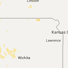
Kansas
| Local Time | Report Details |
|---|---|
| 4:13 PM CDT | Golf Ball sized hail reported near Atwood, KS, 21.2 miles N of Colby, KS |
| 4:24 PM CDT | Quarter sized hail reported near Atwood, KS, 28.5 miles N of Colby, KS, a lot of hail currently falling. |
| 4:34 PM CDT | Quarter sized hail reported near Victoria, KS, 12.8 miles NE of Hays, KS, . |
| 5:17 PM CDT | Golf Ball sized hail reported near Hays, KS, 10.1 miles NNW of Hays, KS, . |
| 5:20 PM CDT | Quarter sized hail reported near Jennings, KS, 44.8 miles ENE of Colby, KS |
| 5:30 PM CDT | Golf Ball sized hail reported near Hill City, KS, 51.1 miles NW of Hays, KS, falling for about 15 min when report received. |
| 5:30 PM CDT | Quarter sized hail reported near Hays, KS, 10.7 miles NNW of Hays, KS, . |
| 5:44 PM CDT | Ping Pong Ball sized hail reported near Ellis, KS, 13.5 miles NW of Hays, KS, . |
| 5:50 PM CDT | Also received 1.11 inches of rain and had small hai in rawlins county KS, 38.6 miles NNE of Colby, KS |
| 5:56 PM CDT | Ping Pong Ball sized hail reported near Ellis, KS, 13.2 miles WNW of Hays, KS, . |
| 6:18 PM CDT | Quarter sized hail reported near Agra, KS, 70.3 miles N of Hays, KS, trained spotter reported hail up to the size of quarters. |
| 6:30 PM CDT | Quarter sized hail reported near Ellis, KS, 13.7 miles WNW of Hays, KS, . |
| 7:55 PM CDT | Storm damage reported in ellis county KS, 3.2 miles ESE of Hays, KS |
| 8:36 PM CDT | Storm damage reported in gove county KS, 51.8 miles W of Hays, KS |
| 9:01 PM CDT | Quarter sized hail reported near Utica, KS, 47 miles WSW of Hays, KS, . |
| 10:34 PM CDT | This report was from the larned-pawnee county airport awo in pawnee county KS, 47.6 miles SSE of Hays, KS |
| 10:59 PM CDT | Mesonet station 10 ene hudson /qnrk1 in stafford county KS, 68.4 miles SE of Hays, KS |
| 12:46 AM CDT | Received via social medi in reno county KS, 35.9 miles NW of Wichita, KS |
| 12:49 AM CDT | Measured by the asos at the airpor in reno county KS, 39.4 miles NW of Wichita, KS |
| 1:01 AM CDT | Near 29th and 119th in northwest wichita. reported by an off-duty nws employe in sedgwick county KS, 7.9 miles WNW of Wichita, KS |
| 1:12 AM CDT | Estimated 55 to 60 mph near 135th and centra in sedgwick county KS, 6.8 miles W of Wichita, KS |
| 1:25 AM CDT | Delayed repor in sedgwick county KS, 5.9 miles SE of Wichita, KS |
| 1:26 AM CDT | Measured near the intersection of central and zo in sedgwick county KS, 6.8 miles W of Wichita, KS |
| 1:28 AM CDT | Near 21st and 119th. estimated by an off-duty nws employe in sedgwick county KS, 8.2 miles WNW of Wichita, KS |
| 1:39 AM CDT | Estimated near 135th and centra in sedgwick county KS, 6.8 miles W of Wichita, KS |
| 1:46 AM CDT | Power lines downed in the clearwater area. report received via social media by kfd in sedgwick county KS, 15.2 miles SW of Wichita, KS |
Colorado
| Local Time | Report Details |
|---|---|
| 3:47 PM MDT | Golf Ball sized hail reported near Bellvue, CO, 48.1 miles SSE of Laramie, WY |
| 5:46 PM MDT | Ping Pong Ball sized hail reported near Haxtun, CO, 37.1 miles NNE of Yuma, CO |
| 5:47 PM MDT | Half Dollar sized hail reported near Haxtun, CO, 36.3 miles N of Yuma, CO |
| 5:47 PM MDT | Half Dollar sized hail reported near Haxtun, CO, 37.1 miles N of Yuma, CO |
| 5:50 PM MDT | Half Dollar sized hail reported near Haxtun, CO, 36.3 miles N of Yuma, CO |
| 6:15 PM MDT | Half Dollar sized hail reported near Haxtun, CO, 28.8 miles N of Yuma, CO |
| 6:51 PM MDT | Storm damage reported in sedgwick county CO, 63.4 miles NNE of Yuma, CO |
Nebraska
| Local Time | Report Details |
|---|---|
| 5:06 PM CDT | Quarter sized hail reported near Mc Cook, NE, 59.8 miles NNE of Colby, KS, currently falling and getting bigger |
| 6:10 PM CDT | Quarter sized hail reported near Loup City, NE, 34.8 miles NW of Grand Island, NE |
| 6:10 PM CDT | Golf Ball sized hail reported near Ashton, NE, 34 miles NW of Grand Island, NE, delayed report of hail up to the size of golf balls. |
| 6:15 PM CDT | Golf Ball sized hail reported near Burwell, NE, 52.4 miles SW of Oneill, NE |
| 6:20 PM CDT | Quarter sized hail reported near Palisade, NE, 58.5 miles SSW of North Platte, NE |
| 6:21 PM CDT | Storm damage reported in red willow county NE, 59.8 miles NNE of Colby, KS |
| 7:16 PM CDT | Quarter sized hail reported near Beaver City, NE, 82.5 miles NE of Colby, KS, trained spotter reports heavy rain and hail up to the size of quarters in beaver city. |
| 7:19 PM CDT | Est 70 mph wind. part of tree fell on house. also dime size hail and torrential rai in furnas county NE, 82.5 miles NE of Colby, KS |
| 7:35 PM CDT | Emergency manager reports power lines down... trees down... blocking road out of loomi in phelps county NE, 68.7 miles WSW of Grand Island, NE |
| 7:37 PM CDT | Trained spotter reports estimated 60 mph winds and 8 to 10 inch tree limbs dow in dawson county NE, 58.9 miles ESE of North Platte, NE |
| 7:55 PM CDT | Phelps county emergency manager reports wind gust of 75 mph measured 5 miles north of loomi in phelps county NE, 66.6 miles WSW of Grand Island, NE |
| 8:38 PM CDT | Storm damage reported in kearney county NE, 36.7 miles SW of Grand Island, NE |
| 8:40 PM CDT | Quarter sized hail reported near Callaway, NE, 38.6 miles ENE of North Platte, NE |
| 8:43 PM CDT | Storm damage reported in kearney county NE, 42.3 miles WSW of Grand Island, NE |
| 9:20 PM CDT | Nws employee reports 30 ft tall... 10 inch diameter tree blown down... also flag pole dow in adams county NE, 23.2 miles S of Grand Island, NE |
| 9:30 PM CDT | Very strong winds... with tree branches breaking and low visibility due to blowing san in cedar county NE, 66.4 miles SSW of Sioux Falls, SD |
| 9:46 PM CDT | Golf Ball sized hail reported near Ord, NE, 55 miles NW of Grand Island, NE |
| 9:50 PM CDT | Ping Pong Ball sized hail reported near Ord, NE, 55.8 miles NNW of Grand Island, NE, quarter to ping pong ball sized. |
| 10:10 PM CDT | Trees down in the tow in dixon county NE, 62.2 miles S of Sioux Falls, SD |
| 10:15 PM CDT | Storm damage reported in wayne county NE, 84.7 miles E of Oneill, NE |
| 10:15 PM CDT | Large trees blown down in knox county NE, 32.6 miles ENE of Oneill, NE |
| 10:16 PM CDT | Gust recorded on weather station at niobrara state park in knox county NE, 36.1 miles NE of Oneill, NE |
| 10:40 PM CDT | Storm damage reported in thurston county NE, 67.6 miles NNW of Omaha, NE |
| 10:55 PM CDT | Storm damage reported in wayne county NE, 84.7 miles E of Oneill, NE |
| 10:55 PM CDT | Storm damage reported in holt county NE, 1.1 miles W of Oneill, NE |
| 10:55 PM CDT | Trees and powerlines down in and around oneil in holt county NE, 0.2 miles NNW of Oneill, NE |
| 10:58 PM CDT | Tree limbs down... 8 to 12 inch diameter... south and southwest of wayn in wayne county NE, 84.7 miles E of Oneill, NE |
| 11:01 PM CDT | Tree limbs down... 8 to 12 inch diameter... south and southwest of wayn in wayne county NE, 84.7 miles E of Oneill, NE |
| 11:05 PM CDT | Storm damage reported in thurston county NE, 70.7 miles WSW of Storm Lake, IA |
| 11:15 PM CDT | Storm damage reported in wayne county NE, 84.7 miles E of Oneill, NE |
| 11:15 PM CDT | Multiple power lines down... with 700 people without power. numerous 3 to 6 inch diameter tree limbs dow in stanton county NE, 81.3 miles ESE of Oneill, NE |
| 11:50 PM CDT | Several large trees down in madison county NE, 55.2 miles ESE of Oneill, NE |
| 12:20 AM CDT | Barn was destroye in boone county NE, 51.7 miles SE of Oneill, NE |
| 12:40 AM CDT | Trees reported blown down in the cit in boone county NE, 48.3 miles N of Grand Island, NE |
South Dakota
| Local Time | Report Details |
|---|---|
| 6:40 PM CDT | Quarter sized hail reported near Parker, SD, 22.9 miles WSW of Sioux Falls, SD, . |
| 6:49 PM CDT | Ping Pong Ball sized hail reported near Brookings, SD, 52.9 miles N of Sioux Falls, SD, . |
| 7:01 PM CDT | Quarter sized hail reported near Brookings, SD, 52.9 miles N of Sioux Falls, SD, report via social media. |
| 7:18 PM CDT | Quarter sized hail reported near Madison, SD, 37.3 miles NNW of Sioux Falls, SD, . |
| 7:21 PM CDT | Golf Ball sized hail reported near Madison, SD, 37.3 miles NNW of Sioux Falls, SD, . |
| 7:35 PM CDT | Large trees dow in lake county SD, 33.4 miles NNW of Sioux Falls, SD |
| 7:35 PM CDT | Several trees down around tow in minnehaha county SD, 0.4 miles S of Sioux Falls, SD |
| 8:30 PM CDT | Large tree down. report and photo posted via social medi in minnehaha county SD, 11.7 miles WNW of Sioux Falls, SD |
| 8:30 PM CDT | Trees dow in mccook county SD, 28.3 miles W of Sioux Falls, SD |
| 9:05 PM CDT | 2-3 inches tree branches down in viborg and hurle in turner county SD, 31.3 miles SW of Sioux Falls, SD |
| 9:20 PM CDT | Half Dollar sized hail reported near Menno, SD, 47.6 miles WSW of Sioux Falls, SD, trees down around town. |
| 9:25 PM CDT | Golf Ball sized hail reported near Parker, SD, 22.9 miles WSW of Sioux Falls, SD, time estimated by radar. |
Wyoming
| Local Time | Report Details |
|---|---|
| 6:57 PM MDT | Asos station greybull airport /gey in big horn county WY, 89.7 miles SSE of Billings, MT |
| 1:15 AM MDT | Golf Ball sized hail reported near Wheatland, WY, 73.2 miles WNW of Scottsbluff, NE |
Oklahoma
| Local Time | Report Details |
|---|---|
| 8:00 PM CDT | Power lines down with widespread power outages reported in mccurtain county OK, 58.4 miles NW of Nashville, AR |
| 3:05 AM CDT | Storm damage reported in woodward county OK, 25.3 miles NE of Woodward, OK |
| 3:10 AM CDT | Storm damage reported in woodward county OK, 25.3 miles NE of Woodward, OK |
| 3:15 AM CDT | Storm damage reported in woods county OK, 43.7 miles NNE of Woodward, OK |
| 3:20 AM CDT | Storm damage reported in woodward county OK, 25.3 miles NE of Woodward, OK |
| 3:55 AM CDT | Storm damage reported in woodward county OK, 25.3 miles NE of Woodward, OK |
| 3:55 AM CDT | Storm damage reported in woodward county OK, 26.1 miles SE of Woodward, OK |
| 3:56 AM CDT | Storm damage reported in woods county OK, 46.7 miles ENE of Woodward, OK |
| 4:20 AM CDT | Storm damage reported in dewey county OK, 43.9 miles SSE of Woodward, OK |
| 4:25 AM CDT | Storm damage reported in dewey county OK, 43.9 miles SSE of Woodward, OK |
Connect with Interactive Hail Maps