

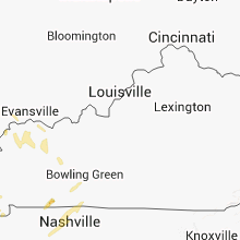
Hail Map for Sunday, April 27, 2014

Number of Impacted Households on 4/27/2014
0
Impacted by 1" or Larger Hail
0
Impacted by 1.75" or Larger Hail
0
Impacted by 2.5" or Larger Hail
Square Miles of Populated Area Impacted on 4/27/2014
0
Impacted by 1" or Larger Hail
0
Impacted by 1.75" or Larger Hail
0
Impacted by 2.5" or Larger Hail


Cities Most Affected by Hail Storms of 4/27/2014
| Hail Size | Demographics of Zip Codes Affected | ||||||
|---|---|---|---|---|---|---|---|
| City | Count | Average | Largest | Pop Density | House Value | Income | Age |
| Atlanta, TX | 3 | 2.92 | 4.50 | 67 | $59k | $29.6k | 42.3 |
| Willow Springs, MO | 2 | 1.88 | 2.00 | 24 | $52k | $22.5k | 40.8 |
| Overland Park, KS | 2 | 1.75 | 1.75 | 3491 | $202k | $77.8k | 37.6 |
| Giddings, TX | 1 | 2.75 | 2.75 | 40 | $73k | $35.4k | 35.6 |
| Wills Point, TX | 1 | 2.75 | 2.75 | 70 | $62k | $37.2k | 42.7 |
| Edgewood, TX | 1 | 2.75 | 2.75 | 66 | $73k | $35.4k | 43.2 |
| Hughes Springs, TX | 1 | 2.50 | 2.50 | 34 | $51k | $30.8k | 39.8 |
| Mountain Home, AR | 1 | 2.50 | 2.50 | 133 | $87k | $29.7k | 50.4 |
| Quitman, TX | 1 | 1.75 | 1.75 | 54 | $72k | $33.2k | 48.1 |
| Ravia, OK | 1 | 1.75 | 1.75 | 0 | $29k | $20.4k | 36.6 |
| Alba, TX | 1 | 1.75 | 1.75 | 49 | $85k | $31.8k | 46.7 |
| Lone Star, TX | 1 | 1.75 | 1.75 | 40 | $49k | $23.9k | 39.3 |
| Burton, TX | 1 | 1.75 | 1.75 | 17 | $86k | $32.4k | 47.5 |
| Henderson, AR | 1 | 1.75 | 1.75 | 26 | $85k | $26.6k | 52.8 |
| Waldron, AR | 1 | 1.75 | 1.75 | 18 | $48k | $26.3k | 38.3 |
| Davenport, NE | 1 | 1.75 | 1.75 | 4 | $36k | $30.1k | 50.6 |
| Sutton, NE | 1 | 1.75 | 1.75 | 8 | $62k | $35.2k | 43.4 |
| Wilburton, OK | 1 | 1.75 | 1.75 | 17 | $47k | $22.9k | 37.5 |
| Kemp, TX | 1 | 1.75 | 1.75 | 83 | $73k | $35.2k | 45.0 |
| Trimble, MO | 1 | 1.75 | 1.75 | 54 | $91k | $41.7k | 42.2 |
Hail and Wind Damage Spotted on 4/27/2014
Filter by Report Type:Hail ReportsWind Reports
States Impacted
Mississippi, Oklahoma, Arkansas, Texas, Kansas, Colorado, Iowa, Missouri, Nebraska, Illinois, Tennessee, KentuckyMississippi
| Local Time | Report Details |
|---|---|
| 7:03 AM CDT | Quarter sized hail reported near Leland, MS, 72.8 miles NE of Bastrop, LA, quarter size hail reported in leland. |
| 7:25 AM CDT | Tree downed on adams lake roa in hinds county MS, 23.9 miles WSW of Jackson, MS |
| 7:39 AM CDT | Quarter sized hail reported near Benton, MS, 41.5 miles N of Jackson, MS, nickel to quarter size hail along saxton road. |
| 9:44 AM CDT | Quarter sized hail reported near Benton, MS, 41.5 miles N of Jackson, MS, nickel to quarter size hail along saxton road. |
| 2:36 PM CDT | Quarter sized hail reported near Houston, MS, 36.6 miles NNW of Starkville, MS |
| 5:31 PM CDT | Quarter sized hail reported near Clarksdale, MS, 72.1 miles SSW of Memphis, TN, quarter size hail reported in city of clarksdale. |
| 5:37 PM CDT | Power line and tree down at riverside rd in mark in quitman county MS, 63.3 miles SSW of Memphis, TN |
| 7:37 PM CDT | Quarter sized hail reported near Hernando, MS, 22.3 miles S of Memphis, TN, quarter size hail at intersection of macenvile and middlebuster. |
Oklahoma
| Local Time | Report Details |
|---|---|
| 7:15 AM CDT | Quarter sized hail reported near Ardmore, OK, 67.3 miles WSW of Atoka, OK |
| 7:18 AM CDT | Seward and coaltrane. home damaged. time estimated by rada in logan county OK, 24.6 miles NNE of Oklahoma City, OK |
| 7:19 AM CDT | Quarter sized hail reported near Edmond, OK, 12.9 miles NNW of Oklahoma City, OK, 164th and macarthur |
| 8:00 AM CDT | Golf Ball sized hail reported near Ravia, OK, 37.5 miles WSW of Atoka, OK |
| 8:03 AM CDT | Quarter sized hail reported near Oklahoma City, OK, 4.8 miles ESE of Oklahoma City, OK, 59th and sunnylane |
| 8:09 AM CDT | Quarter sized hail reported near Duncan, OK, 60.6 miles NE of Wichita Falls, TX |
| 10:45 AM CDT | Storm damage reported in tulsa county OK, 14.7 miles SSE of Tulsa, OK |
| 11:10 AM CDT | Metal roof of barn taken off and damaged powerline in craig county OK, 53.6 miles SSE of Chanute, KS |
| 3:26 PM CDT | Quarter sized hail reported near Boswell, OK, 36 miles SSE of Atoka, OK |
| 3:53 PM CDT | Quarter sized hail reported near Soper, OK, 34.7 miles SE of Atoka, OK |
| 4:18 PM CDT | Ping Pong Ball sized hail reported near Rattan, OK, 43 miles ESE of Atoka, OK, covered the ground...mostly nickel to quarter size. |
| 4:44 PM CDT | Golf Ball sized hail reported near Wilburton, OK, 55 miles ENE of Atoka, OK |
| 9:32 PM CDT | Quarter sized hail reported near Talihina, OK, 56.4 miles SW of Fort Smith, AR |
| 9:39 PM CDT | Quarter sized hail reported near Talihina, OK, 56.4 miles SW of Fort Smith, AR, 50-60 mph winds. |
| 10:18 PM CDT | Quarter sized hail reported near Battiest, OK, 68.4 miles E of Atoka, OK, report of 1.00 in hail from grocery store in battiest. |
Arkansas
| Local Time | Report Details |
|---|---|
| 7:25 AM CDT | Quarter sized hail reported near Jacksonville, AR, 11.7 miles NE of Little Rock, AR |
| 8:42 AM CDT | Quarter sized hail reported near Ward, AR, 26.8 miles NE of Little Rock, AR |
| 4:22 PM CDT | Ping Pong Ball sized hail reported near Mountain Home, AR, 81.7 miles SE of Springfield, MO |
| 4:23 PM CDT | Tennis Ball sized hail reported near Mountain Home, AR, 82.2 miles SE of Springfield, MO, relayed by ky3 in springfield. |
| 4:24 PM CDT | Golf Ball sized hail reported near Henderson, AR, 82.5 miles SE of Springfield, MO, golf ball size hail...plus a few bigger hailstones... covered the ground at panther bay marina. |
| 6:15 PM CDT | Road sign blown dow in stone county AR, 77.4 miles N of Little Rock, AR |
| 6:30 PM CDT | Ping Pong Ball sized hail reported near Dover, AR, 65.3 miles NW of Little Rock, AR |
| 6:40 PM CDT | Ping Pong Ball sized hail reported near Marshall, AR, 76.7 miles NNW of Little Rock, AR |
| 6:40 PM CDT | Golf Ball sized hail reported near Waldron, AR, 40.2 miles SSE of Fort Smith, AR, reported along ross creek road. |
| 8:20 PM CDT | Quarter sized hail reported near Pangburn, AR, 52.7 miles NNE of Little Rock, AR |
| 10:14 PM CDT | Trees down over road. highway 45 south of fort smit in sebastian county AR, 1.3 miles ENE of Fort Smith, AR |
| 10:34 PM CDT | Large tree limbs broken and downed by win in washington county AR, 48.3 miles NNE of Fort Smith, AR |
| 10:48 PM CDT | Trees fallen on two homes... fire dept responded. multiple trres down in near bye neighborhood in sebastian county AR, 14.6 miles SE of Fort Smith, AR |
| 11:07 PM CDT | Limbs were blown dow in scott county AR, 38.3 miles SSE of Fort Smith, AR |
| 1:50 AM CDT | Half Dollar sized hail reported near Texarkana, AR, 35.4 miles SSW of Nashville, AR, hail report on hwy 82 just east of texarkana ar. |
| 1:55 AM CDT | Quarter sized hail reported near Adona, AR, 40.8 miles WNW of Little Rock, AR |
| 2:07 AM CDT | Quarter sized hail reported near Hope, AR, 24.2 miles SE of Nashville, AR, public report relayed to broadcast media. |
| 2:30 AM CDT | Powerlines downed along hwy. 71 south of cr. 1 in miller county AR, 42.7 miles S of Nashville, AR |
| 2:30 AM CDT | Trees are down at gurdo in clark county AR, 40.1 miles E of Nashville, AR |
| 3:25 AM CDT | Trees were downe in grant county AR, 41.3 miles S of Little Rock, AR |
Texas
| Local Time | Report Details |
|---|---|
| 7:56 AM CDT | Quarter sized hail reported near Decatur, TX, 55.7 miles WNW of Dallas, TX |
| 8:04 AM CDT | Quarter sized hail reported near Decatur, TX, 55.4 miles NW of Dallas, TX |
| 8:45 AM CDT | Quarter sized hail reported near Grand Prairie, TX, 10.9 miles W of Dallas, TX, spotter reported hail as large as quarter size... but ranging in size (mostly smaller) |
| 9:15 AM CDT | Half Dollar sized hail reported near Plano, TX, 19.5 miles NNE of Dallas, TX |
| 9:17 AM CDT | Half Dollar sized hail reported near Wylie, TX, 21.9 miles NE of Dallas, TX, near parker road and st. paul |
| 9:19 AM CDT | Quarter sized hail reported near Wylie, TX, 21.9 miles NE of Dallas, TX, in wylie |
| 4:45 PM CDT | Quarter sized hail reported near Ennis, TX, 32.4 miles SSE of Dallas, TX, ennis pd reported penny to quarter size hail in the city. |
| 5:13 PM CDT | Golf Ball sized hail reported near Kemp, TX, 36.9 miles SE of Dallas, TX, golfball size hail reported along hwy 175 between kemp and kaufman. |
| 5:58 PM CDT | Baseball sized hail reported near Wills Point, TX, 49.3 miles ESE of Dallas, TX, baseball size hail was smashing windows out of vehicales west of canton. |
| 6:02 PM CDT | Baseball sized hail reported near Edgewood, TX, 53.6 miles E of Dallas, TX |
| 6:18 PM CDT | Half Dollar sized hail reported near Del Valle, TX, 67.8 miles S of Killeen, TX, hail damaged plastic patio cover. |
| 6:26 PM CDT | Golf Ball sized hail reported near Alba, TX, 67.3 miles E of Dallas, TX |
| 6:41 PM CDT | Half Dollar sized hail reported near Quitman, TX, 78.9 miles E of Dallas, TX, photos from kltv facebook verified hail reports |
| 6:43 PM CDT | Golf Ball sized hail reported near Quitman, TX, 78.9 miles E of Dallas, TX, hail damaged vehicles |
| 7:18 PM CDT | Quarter sized hail reported near Bastrop, TX, 68.4 miles SSE of Killeen, TX |
| 7:30 PM CDT | Quarter sized hail reported near Paige, TX, 71 miles SSE of Killeen, TX |
| 7:35 PM CDT | Quarter sized hail reported near Mount Pleasant, TX, 82.5 miles WNW of Shreveport, LA, photos from mark scirtos kltv facebook page confirm 1.00 in hail. |
| 8:00 PM CDT | Quarter sized hail reported near Omaha, TX, 74.3 miles NW of Shreveport, LA, photo from mark scirto kltv facebook page confirm 1.00 hail near omaha tx |
| 8:09 PM CDT | Baseball sized hail reported near Giddings, TX, 78.5 miles SE of Killeen, TX |
| 8:10 PM CDT | Half Dollar sized hail reported near Giddings, TX, 77.4 miles SE of Killeen, TX |
| 8:34 PM CDT | Quarter sized hail reported near Burton, TX, 79.2 miles WNW of Houston, TX, texas aandm storm chaser reported quarter size hail in burton via twitter. |
| 8:42 PM CDT | Golf Ball sized hail reported near Burton, TX, 79.8 miles WNW of Houston, TX, local police in burton reported golf ball size hail on west side of town. |
| 12:02 AM CDT | Quarter sized hail reported near Alba, TX, 67.3 miles E of Dallas, TX |
| 12:57 AM CDT | Quarter sized hail reported near Teague, TX, 86 miles SSE of Dallas, TX |
| 1:45 AM CDT | Quarter sized hail reported near Lone Star, TX, 63.3 miles WNW of Shreveport, LA |
| 1:48 AM CDT | Golf Ball sized hail reported near Lone Star, TX, 63.3 miles WNW of Shreveport, LA |
| 1:50 AM CDT | Half Dollar sized hail reported near Elkhart, TX, 58.2 miles WNW of Lufkin, TX, sh 294 fm 1990 |
| 1:55 AM CDT | Tennis Ball sized hail reported near Hughes Springs, TX, 61.3 miles WNW of Shreveport, LA |
| 1:57 AM CDT | Quarter sized hail reported near Hughes Springs, TX, 62.5 miles NW of Shreveport, LA |
| 2:17 AM CDT | Ping Pong Ball sized hail reported near Linden, TX, 49.4 miles NW of Shreveport, LA, from linden pd |
| 2:29 AM CDT | Tennis Ball sized hail reported near Atlanta, TX, 48.1 miles NNW of Shreveport, LA |
| 2:29 AM CDT | Softball sized hail reported near Atlanta, TX, 48.1 miles NNW of Shreveport, LA, public sent in a picture to local media outlet of softball sized hail in atlanta texas. |
| 2:33 AM CDT | Golf Ball sized hail reported near Atlanta, TX, 48.1 miles NNW of Shreveport, LA |
| 3:14 AM CDT | Quarter sized hail reported near Mount Enterprise, TX, 41.9 miles N of Lufkin, TX |
| 3:22 AM CDT | Tree across fm315 in rusk county TX, 42.2 miles N of Lufkin, TX |
| 3:35 AM CDT | Tree down on fm315 across roadway in rusk county TX, 42.2 miles N of Lufkin, TX |
| 3:40 AM CDT | Quarter sized hail reported near Carthage, TX, 42.8 miles SW of Shreveport, LA, 1/4 mile south of carthage on us 69 and hwy 2517 |
| 3:43 AM CDT | Trees down off fm 699 and fire reported in panola county TX, 42.3 miles SW of Shreveport, LA |
| 3:50 AM CDT | Tree down near wood along cr430 in panola county TX, 44.1 miles SW of Shreveport, LA |
Kansas
| Local Time | Report Details |
|---|---|
| 9:50 AM CDT | 4 to 6 inch limbs down near gridley. delayed report. time estimated from rada in coffey county KS, 37.1 miles NW of Chanute, KS |
| 10:45 AM CDT | Eight inch diameter tree limbs down at 10th and fillmore in topeka. lightning strike to home on nw lyman road. evacuations underway at residenc in shawnee county KS, 48.2 miles E of Manhattan, KS |
| 10:45 AM CDT | Large tree limb snapped off at montara park next to forbes fiel in shawnee county KS, 50.3 miles ESE of Manhattan, KS |
| 11:10 AM CDT | Metal roof of barn taken off and damaged powerline in labette county KS, 49.8 miles SSE of Chanute, KS |
| 11:25 AM CDT | Golf Ball sized hail reported near Overland Park, KS, 14.3 miles SSW of Kansas City, MO, relayed via media |
| 11:28 AM CDT | Golf Ball sized hail reported near Overland Park, KS, 14 miles SSW of Kansas City, MO |
| 11:30 AM CDT | Ping Pong Ball sized hail reported near Shawnee, KS, 13 miles WSW of Kansas City, MO |
| 11:36 AM CDT | Half Dollar sized hail reported near Shawnee, KS, 13 miles WSW of Kansas City, MO |
| 4:45 PM CDT | Ping Pong Ball sized hail reported near Walnut, KS, 18.5 miles ESE of Chanute, KS, 60 mph winds were also reported. |
| 5:39 PM CDT | Heavy damage to several home in cherokee county KS, 60.2 miles SE of Chanute, KS |
| 6:31 PM CDT | Quarter sized hail reported near Olathe, KS, 17 miles SW of Kansas City, MO |
Colorado
| Local Time | Report Details |
|---|---|
| 10:10 AM MDT | Storm damage reported in prowers county CO, 99.4 miles W of Garden City, KS |
Iowa
| Local Time | Report Details |
|---|---|
| 11:15 AM CDT | Awos station shenandoah airport /sda/ in fremont county IA, 43.8 miles SE of Omaha, NE |
| 2:35 PM CDT | Roofs blown off farm outbuildings. several windows blown of cars. delayed repor in appanoose county IA, 64.2 miles WNW of Kahoka, MO |
| 2:56 PM CDT | Spotterreport.org network report of 70 mph winds and large tree limbs dow in davis county IA, 51.8 miles WNW of Kahoka, MO |
| 3:06 PM CDT | Major structural damage to at least one farmstead. roofs blown off outbuildings. roof damage to the house and the porch on the house destroyed. many 12-18 inch trees sn in wapello county IA, 57.5 miles NW of Kahoka, MO |
| 3:08 PM CDT | Reported by blakesburg fire dept. relayed by fairfield warning point on nawa in wapello county IA, 61 miles NW of Kahoka, MO |
| 3:10 PM CDT | Thunderstorm wind damage in the 1000 block of west mary st. in ottumwa. two feet diameter trees blown over... flag poles bent in half... and a grain bin roof removed and in wapello county IA, 53.8 miles NW of Kahoka, MO |
| 3:10 PM CDT | Several outbuildings damaged or destroyed. carports overturned. several trees of 12-15 inches in diameter snapped off at or near ground. power lines down. cattle trappe in appanoose county IA, 57.8 miles WNW of Kahoka, MO |
| 3:10 PM CDT | *** 1 inj *** time estimated from radar in appanoose county IA, 60.1 miles WNW of Kahoka, MO |
| 3:12 PM CDT | Storm damage reported in wapello county IA, 55.2 miles NW of Kahoka, MO |
| 3:16 PM CDT | Storm damage reported in davis county IA, 42.3 miles NW of Kahoka, MO |
| 3:20 PM CDT | Reported at ottumwa regional airpor in wapello county IA, 61.1 miles NW of Kahoka, MO |
| 3:20 PM CDT | Many trees down. diameter up to 24 inches. delayed repor in mahaska county IA, 54.7 miles ESE of Des Moines, IA |
| 3:30 PM CDT | Roof taken off of oskaloosa family medical center. time estimate in mahaska county IA, 55 miles ESE of Des Moines, IA |
| 3:30 PM CDT | *** 1 inj *** barn blown down. time estimate in keokuk county IA, 59.8 miles NNW of Kahoka, MO |
| 3:37 PM CDT | Delayed report of a large tree split in half by straight line winds. relayed by kcci. time estimated from rada in poweshiek county IA, 47.5 miles ENE of Des Moines, IA |
| 3:45 PM CDT | Quarter sized hail reported near Ottumwa, IA, 55.5 miles NW of Kahoka, MO, also reported wind damage with branches down. new storm damage submission form. |
| 3:45 PM CDT | Large power poles blown down across roa in keokuk county IA, 53.9 miles SW of Cedar Rapids, IA |
| 3:55 PM CDT | Small branches down. gutter blown off house. 0.70 inch of rain in 15 minute in iowa county IA, 32.4 miles SSW of Cedar Rapids, IA |
| 4:00 PM CDT | Storm damage reported in iowa county IA, 30.5 miles WSW of Cedar Rapids, IA |
| 4:00 PM CDT | Storm damage reported in iowa county IA, 30.5 miles WSW of Cedar Rapids, IA |
| 4:09 PM CDT | Wind gusts estimated to be 60 to 70 mph. small branches coming dow in iowa county IA, 22.2 miles WSW of Cedar Rapids, IA |
| 4:10 PM CDT | Power lines down. public report relayed by medi in iowa county IA, 36.1 miles WSW of Cedar Rapids, IA |
| 4:11 PM CDT | On interstate 80 west of coralville near tiffi in johnson county IA, 18.4 miles S of Cedar Rapids, IA |
| 4:20 PM CDT | Two buildings damaged. wind measured at 89 mph from a davis instrument syste in benton county IA, 13.7 miles WSW of Cedar Rapids, IA |
| 4:22 PM CDT | Several trees snapped or uprooted. ten inch diameter tree snapped. several medium size branches down. winds estimated at 60 mp in linn county IA, 4.7 miles WSW of Cedar Rapids, IA |
| 4:25 PM CDT | Building blown down. power lines down. semi jacknifed on highway 3 in benton county IA, 21.4 miles WSW of Cedar Rapids, IA |
| 4:33 PM CDT | Storm damage reported in johnson county IA, 22.9 miles SSE of Cedar Rapids, IA |
| 4:43 PM CDT | Winds estimated at 55 to 65 mp in lee county IA, 33 miles NE of Kahoka, MO |
| 5:00 PM CDT | Shingles off a house. power lines down blocking highway 30 between 218 and 21st avenue. traffic being re-routed.report relayed by kwwl-t in benton county IA, 9.7 miles W of Cedar Rapids, IA |
| 5:24 PM CDT | Tree down in baldwin. time estimate in jackson county IA, 43.4 miles E of Cedar Rapids, IA |
Missouri
| Local Time | Report Details |
|---|---|
| 11:40 AM CDT | Quarter sized hail reported near Kansas City, MO, 8.5 miles NW of Kansas City, MO, 72nd and nevada nr 45 highway |
| 11:45 AM CDT | Quarter sized hail reported near Savannah, MO, 59.2 miles NNW of Kansas City, MO |
| 11:54 AM CDT | Storm damage reported in platte county MO, 15.4 miles NNW of Kansas City, MO |
| 12:10 PM CDT | Golf Ball sized hail reported near Trimble, MO, 25.3 miles N of Kansas City, MO, golfball hail via facebook |
| 12:11 PM CDT | Half Dollar sized hail reported near Trimble, MO, 25.3 miles N of Kansas City, MO, also 70 mph wind reported by public |
| 12:15 PM CDT | Annemometer measured 58 mph wind before it blew away in clinton county MO, 32.2 miles NNE of Kansas City, MO |
| 12:15 PM CDT | One large tree snapped and one large tree uprooted. diameter estimated at two feet for both tree in bates county MO, 66.3 miles ENE of Chanute, KS |
| 12:20 PM CDT | Quarter sized hail reported near Richards, MO, 62.5 miles ENE of Chanute, KS |
| 12:20 PM CDT | Ping Pong Ball sized hail reported near Smithville, MO, 19.1 miles N of Kansas City, MO, with estimated 60 to 65 mph winds. paint stripped off porch supports and roof damaged. |
| 12:20 PM CDT | Estimated 60 to 65 mph winds with ping pong sized hai in clay county MO, 19.1 miles N of Kansas City, MO |
| 12:21 PM CDT | Large tree fell onto two vehicles causing damage. delayed repor in clinton county MO, 32.2 miles NNE of Kansas City, MO |
| 12:34 PM CDT | 8-10 inch diameter tree down on the hood of a truck in dekalb county MO, 52.8 miles NNE of Kansas City, MO |
| 12:36 PM CDT | 8-10 inch diameter tree down on the hood of a truck in dekalb county MO, 52.8 miles NNE of Kansas City, MO |
| 12:50 PM CDT | Quarter sized hail reported near Winston, MO, 59.9 miles NNE of Kansas City, MO, at intersection of interstate 35 and hwy 69. |
| 12:51 PM CDT | Also shingle damage reported in lafayette county MO, 34.8 miles ESE of Kansas City, MO |
| 12:55 PM CDT | Power lines down... roofs off storage units... and 8 inch diameter trees uprooted. time estimated from rada in lafayette county MO, 34.8 miles ESE of Kansas City, MO |
| 12:55 PM CDT | Trees blown down in warrensburg in johnson county MO, 51.7 miles ESE of Kansas City, MO |
| 1:02 PM CDT | Storm damage reported in lafayette county MO, 46 miles E of Kansas City, MO |
| 1:07 PM CDT | Quarter sized hail reported near Warrensburg, MO, 51.7 miles ESE of Kansas City, MO |
| 1:12 PM CDT | Quarter sized hail reported near Whiteman Air Force Base, MO, 61.3 miles ESE of Kansas City, MO, also reported measured 47 kt wind gust |
| 1:12 PM CDT | Quarter sized hail reported near Leeton, MO, 62.4 miles SE of Kansas City, MO |
| 1:30 PM CDT | Multiple trees down or split. one barn leaning and one barn destroyed. two day old calf missing. delayed report via social media. time estimate in lafayette county MO, 27.6 miles E of Kansas City, MO |
| 1:35 PM CDT | Trees blown onto powerlines and buildings damaged in town. quarter sized hail also reporte in carroll county MO, 60.8 miles ENE of Kansas City, MO |
| 1:35 PM CDT | Quarter sized hail reported near Carrollton, MO, 60.8 miles ENE of Kansas City, MO, wind damage also reported. |
| 1:35 PM CDT | A number of farm outbuildings heavily damaged. delayed report. time estimate in carroll county MO, 49.6 miles ENE of Kansas City, MO |
| 1:44 PM CDT | Storm damage reported in livingston county MO, 72.8 miles NE of Kansas City, MO |
| 1:55 PM CDT | Quarter sized hail reported near Chillicothe, MO, 72.8 miles NE of Kansas City, MO, strong winds also reported. |
| 1:55 PM CDT | Tree limbs down. quarter sized hail also reporte in livingston county MO, 72.8 miles NE of Kansas City, MO |
| 1:56 PM CDT | 8-10 inch diameter tree limbs down in linn county MO, 77.6 miles NW of Columbia, MO |
| 1:59 PM CDT | Road signs blown down and a tin roof blown from shed in linn county MO, 77.6 miles NW of Columbia, MO |
| 1:59 PM CDT | 10 inch diameter limbs down in grundy county MO, 88 miles NE of Kansas City, MO |
| 2:12 PM CDT | Powerlines down in linn county MO, 64.4 miles NNW of Columbia, MO |
| 2:20 PM CDT | Storm damage large hog barn blown apart. pea size hail. 6 to 12 inche trees down. estimated 70 mph win in putnam county MO, 67.6 miles W of Kahoka, MO |
| 2:20 PM CDT | Roofing material removed from outbuilding in vernon county MO, 61.8 miles ENE of Chanute, KS |
| 2:20 PM CDT | Anchored aluminum carport uplifted and destroyed in moniteau county MO, 23.8 miles SSW of Columbia, MO |
| 2:57 PM CDT | Delayed report... marble sized hail also reported. time estimated via rada in macon county MO, 54.4 miles N of Columbia, MO |
| 3:04 PM CDT | Weather station n0pb in monroe county MO, 38.7 miles NNE of Columbia, MO |
| 3:09 PM CDT | Along rt 408....pea sized hail also observed in shelby county MO, 51.1 miles N of Columbia, MO |
| 3:30 PM CDT | Outbuildings and trees damaged. delayed report via social media. location estimate in chariton county MO, 58.6 miles NW of Columbia, MO |
| 4:35 PM CDT | Quarter sized hail reported near Bakersfield, MO, 79.6 miles SE of Springfield, MO |
| 5:05 PM CDT | Quarter sized hail reported near Willow Springs, MO, 50.6 miles SSW of Salem, MO |
| 5:05 PM CDT | Hen Egg sized hail reported near Willow Springs, MO, 50.6 miles SSW of Salem, MO |
| 5:14 PM CDT | Quarter sized hail reported near Licking, MO, 20.2 miles WSW of Salem, MO |
| 5:15 PM CDT | Golf Ball sized hail reported near Willow Springs, MO, 40.9 miles SSW of Salem, MO |
| 6:26 PM CDT | Quarter sized hail reported near Henley, MO, 38.1 miles S of Columbia, MO |
| 6:40 PM CDT | Tin observed in trees in barton county MO, 59.2 miles ESE of Chanute, KS |
| 6:40 PM CDT | Quarter sized hail reported near Lamar, MO, 60.9 miles WNW of Springfield, MO |
| 6:43 PM CDT | Quarter sized hail reported near New Haven, MO, 55.2 miles W of Saint Louis, MO, hail covering the ground...report relayed via fox2 |
| 6:51 PM CDT | Quarter sized hail reported near Jefferson City, MO, 27.5 miles SSE of Columbia, MO, began at 645pm...lasted 3 to 5 minutes |
| 6:52 PM CDT | Quarter sized hail reported near Kansas City, MO, 9.2 miles NW of Kansas City, MO |
| 6:52 PM CDT | Half Dollar sized hail reported near Jefferson City, MO, 27.5 miles SSE of Columbia, MO, east side of jefferson city |
| 6:55 PM CDT | Quarter sized hail reported near Holts Summit, MO, 24.4 miles SSE of Columbia, MO, dime to quarter size...lasted 4 minutes |
| 7:18 PM CDT | Quarter sized hail reported near Thompson, MO, 25.1 miles NE of Columbia, MO, time estimated from radar. report via kxeo |
| 10:25 PM CDT | Damage at rv park approx 1 mile north of the cape girardeau regional airport. at least 7 rvs damaged...and 1 rolled approx 25 yds. pole barn next to rv park destroye in cape girardeau county MO, 3 miles S of Cape Girardeau, MO |
| 10:50 PM CDT | Tree was blown down on state route y near county road 37 in callaway county MO, 19.2 miles SE of Columbia, MO |
| 11:40 PM CDT | Tree limbs dow in christian county MO, 19.7 miles SSE of Springfield, MO |
| 11:50 PM CDT | Windows blown out of a home on highway 7 in douglas county MO, 33.7 miles SE of Springfield, MO |
| 12:03 AM CDT | Power pole snapped with trees dow in douglas county MO, 39.2 miles ESE of Springfield, MO |
| 3:04 AM CDT | Deputy reports large shop building destroyed just north of cardwel in dunklin county MO, 63.5 miles NNW of Memphis, TN |
Nebraska
| Local Time | Report Details |
|---|---|
| 12:08 PM CDT | Half Dollar sized hail reported near Oconto, NE, 50.8 miles E of North Platte, NE |
| 12:55 PM CDT | Quarter sized hail reported near Stapleton, NE, 26.1 miles NE of North Platte, NE |
| 1:10 PM CDT | Quarter sized hail reported near North Platte, NE, 22.1 miles NNW of North Platte, NE |
| 1:57 PM CDT | Quarter sized hail reported near Franklin, NE, 60.5 miles SSW of Grand Island, NE |
| 3:15 PM CDT | Golf Ball sized hail reported near Davenport, NE, 48.5 miles SE of Grand Island, NE |
| 3:23 PM CDT | Quarter sized hail reported near Ong, NE, 44.7 miles SE of Grand Island, NE, twitter report |
| 3:44 PM CDT | Quarter sized hail reported near Juniata, NE, 25.3 miles SSW of Grand Island, NE, at adams central high school. |
| 3:47 PM CDT | Quarter sized hail reported near Juniata, NE, 21.6 miles SSW of Grand Island, NE, hail ongoing. |
| 4:03 PM CDT | Golf Ball sized hail reported near Sutton, NE, 33.8 miles ESE of Grand Island, NE, report and picture came in via twitter |
| 4:04 PM CDT | Quarter sized hail reported near Alda, NE, 8.1 miles WSW of Grand Island, NE, quarter to walnut sized hail near i-80 exit. report/pic via twitter. |
| 4:15 PM CDT | Storm damage reported in hall county NE, 15.8 miles WSW of Grand Island, NE |
| 4:19 PM CDT | Quarter sized hail reported near Bradshaw, NE, 31 miles E of Grand Island, NE |
| 4:23 PM CDT | Storm damage reported in hall county NE, 15.1 miles WNW of Grand Island, NE |
| 4:45 PM CDT | Quarter sized hail reported near Loup City, NE, 44.1 miles NW of Grand Island, NE, grape sized hail reported by spotter near sherman/valley county lines. |
| 4:59 PM CDT | Heavy pea sized hail and 60 mph winds at mile marker 359 on i8 in york county NE, 45.2 miles E of Grand Island, NE |
| 5:58 PM CDT | Quarter sized hail reported near Atkinson, NE, 14.9 miles W of Oneill, NE |
| 6:16 PM CDT | Quarter sized hail reported near Bassett, NE, 45.1 miles W of Oneill, NE |
| 6:27 PM CDT | Half Dollar sized hail reported near Lindsay, NE, 64.4 miles NNE of Grand Island, NE, also 60 mph wind. |
| 6:40 PM CDT | Quarter sized hail reported near Madison, NE, 74.9 miles SE of Oneill, NE, also 50 to 60 mph winds. |
| 6:40 PM CDT | Quarter sized hail reported near Madison, NE, 74.5 miles SE of Oneill, NE, also 50 to 60 mph winds. |
| 7:40 PM CDT | Quarter sized hail reported near Lindsay, NE, 61.6 miles NNE of Grand Island, NE |
| 8:25 PM CDT | Quarter sized hail reported near Pierce, NE, 60 miles ESE of Oneill, NE, ground covered with pea size hail... a few up to the size of quarters. |
| 8:30 PM CDT | Half Dollar sized hail reported near Pierce, NE, 58.9 miles ESE of Oneill, NE, ground was white from hail. |
| 8:55 PM CDT | Ping Pong Ball sized hail reported near Osmond, NE, 57.9 miles E of Oneill, NE, also 1.70 inches of rain. |
| 9:44 PM CDT | Quarter sized hail reported near Plainview, NE, 44.6 miles E of Oneill, NE |
Illinois
| Local Time | Report Details |
|---|---|
| 12:42 PM CDT | Several large trees and two outbuildings were blown down near route 148. late repor in jefferson county IL, 71.7 miles ESE of Saint Louis, MO |
| 4:55 PM CDT | Quarter sized hail reported near Bowen, IL, 37.2 miles ESE of Kahoka, MO, hail measured slightly larger than a quarter. |
| 4:55 PM CDT | A power pole was snapped off and 2 sheds were flipped ove in henderson county IL, 48.7 miles ENE of Kahoka, MO |
| 4:57 PM CDT | A power pole was snapped off and 2 sheds were flipped ove in henderson county IL, 48.7 miles ENE of Kahoka, MO |
| 11:10 PM CDT | Several 8 to 12 inch diameter trees dow in pulaski county IL, 31.1 miles E of Cape Girardeau, MO |
Tennessee
| Local Time | Report Details |
|---|---|
| 1:58 PM CDT | Minor structure damage to barns was reported on jacobs road. winds were estimated at 50 mp in rutherford county TN, 38.7 miles SE of Nashville, TN |
Kentucky
| Local Time | Report Details |
|---|---|
| 2:05 PM CDT | Storm damage reported in mclean county KY, 26.6 miles SSE of Evansville, IN |
| 3:04 PM CDT | Dispatch reported a tree down on woodbury loop just outside of morgantown in butler county KY, 71.3 miles SE of Evansville, IN |
| 4:00 PM CDT | Report via twitter of tree down on power lines on nutwood street near t.c. cherry school in warren county KY, 58.9 miles NNE of Nashville, TN |
| 4:03 PM CDT | Report via twitter of large tree down on massey road near detour road just outside of bowling green in warren county KY, 64.2 miles NNE of Nashville, TN |
| 4:03 PM CDT | Snapped trees on beech bend road just outside of bowling green. report via twitte in warren county KY, 62.4 miles NNE of Nashville, TN |
| 4:03 PM CDT | Dispatch reported power lines down on east 14th avenu in warren county KY, 59.1 miles NNE of Nashville, TN |
| 4:07 PM CDT | Power lines and tree branches down on detour road near witt road in warren county KY, 64.2 miles NNE of Nashville, TN |
| 4:07 PM CDT | Report via twitter of a roof blown off of an out building near the intersection of ky-185 and day road in warren county KY, 63 miles NNE of Nashville, TN |
| 7:46 PM EDT | Dispatch reported trees down on s. kennett ave.... barton rd.... and edelen ave. in bardstown in nelson county KY, 18.2 miles SE of Louisville, KY |
| 8:38 PM EDT | Spotter reported large tree down on shefford lane near brownsboro road in jefferson county KY, 21.6 miles NNE of Louisville, KY |
| 10:31 PM CDT | Numerous trees and powerlines down. quarter size hail reported. the trees are down on cars and house in todd county KY, 40.3 miles NNW of Nashville, TN |
Connect with Interactive Hail Maps