

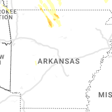
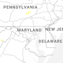
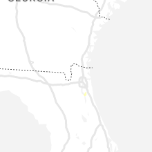
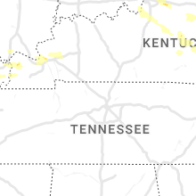
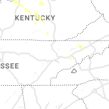
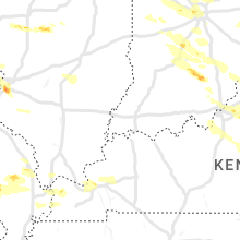
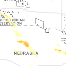
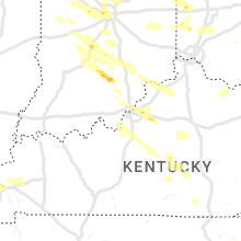
Hail Map for Monday, July 17, 2023

Number of Impacted Households on 7/17/2023
0
Impacted by 1" or Larger Hail
0
Impacted by 1.75" or Larger Hail
0
Impacted by 2.5" or Larger Hail
Square Miles of Populated Area Impacted on 7/17/2023
0
Impacted by 1" or Larger Hail
0
Impacted by 1.75" or Larger Hail
0
Impacted by 2.5" or Larger Hail


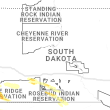


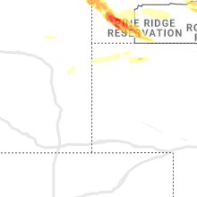

Cities Most Affected by Hail Storms of 7/17/2023
| Hail Size | Demographics of Zip Codes Affected | ||||||
|---|---|---|---|---|---|---|---|
| City | Count | Average | Largest | Pop Density | House Value | Income | Age |
| Hot Springs, SD | 6 | 2.25 | 2.75 | 11 | $63k | $30.3k | 50.7 |
| Garden City, MO | 3 | 3.92 | 5.00 | 29 | $84k | $41.3k | 38.9 |
| Harrisonville, MO | 3 | 3.25 | 4.00 | 122 | $91k | $44.7k | 38.7 |
| Kinsley, KS | 4 | 2.19 | 2.50 | 6 | $38k | $29.5k | 45.5 |
| Belleville, IL | 4 | 2.06 | 2.50 | 682 | $86k | $47.6k | 42.9 |
| Gillette, WY | 3 | 2.17 | 3.00 | 14 | $106k | $51.0k | 31.5 |
| Preston, MO | 2 | 2.50 | 3.00 | 14 | $66k | $29.1k | 45.4 |
| Phillipsburg, MO | 2 | 2.13 | 2.50 | 33 | $64k | $30.3k | 40.6 |
| Howard, KS | 2 | 1.88 | 2.00 | 3 | $27k | $28.6k | 50.1 |
| Spearville, KS | 1 | 3.00 | 3.00 | 3 | $66k | $40.3k | 41.7 |
| Pleasant Hill, MO | 1 | 3.00 | 3.00 | 106 | $102k | $52.4k | 38.0 |
| Peculiar, MO | 1 | 3.00 | 3.00 | 154 | $119k | $54.2k | 39.1 |
| Flemington, MO | 1 | 2.50 | 2.50 | 22 | $62k | $28.5k | 52.0 |
| Oral, SD | 1 | 2.50 | 2.50 | 2 | $60k | $29.5k | 50.5 |
| Weaubleau, MO | 1 | 2.50 | 2.50 | 16 | $48k | $21.3k | 46.7 |
| Offerle, KS | 1 | 2.50 | 2.50 | 4 | $32k | $40.3k | 45.9 |
| Stover, MO | 1 | 2.50 | 2.50 | 26 | $64k | $27.0k | 48.0 |
| Half Way, MO | 1 | 2.00 | 2.00 | 22 | $55k | $31.7k | 37.7 |
| Danville, IL | 1 | 2.00 | 2.00 | 1428 | $52k | $30.7k | 37.7 |
| Bucklin, KS | 1 | 2.00 | 2.00 | 1 | $53k | $40.4k | 38.7 |
| Eldridge, MO | 1 | 2.00 | 2.00 | 16 | $59k | $24.2k | 44.2 |
| Lebanon, MO | 1 | 2.00 | 2.00 | 73 | $75k | $30.1k | 38.8 |
| Florissant, MO | 1 | 2.00 | 2.00 | 3235 | $78k | $49.5k | 38.0 |
| Indianapolis, IN | 1 | 2.00 | 2.00 | 2026 | $119k | $52.8k | 36.1 |
| Bismarck, IL | 1 | 1.75 | 1.75 | 40 | $90k | $49.0k | 42.4 |
| Westfield, IN | 1 | 1.75 | 1.75 | 809 | $150k | $55.4k | 33.5 |
| Bartlesville, OK | 1 | 1.75 | 1.75 | 122 | $37k | $25.8k | 36.8 |
| Taylorville, IL | 1 | 1.75 | 1.75 | 117 | $67k | $37.8k | 41.7 |
| Fremont, NE | 1 | 1.75 | 1.75 | 246 | $90k | $38.3k | 39.5 |
| Lowry City, MO | 1 | 1.75 | 1.75 | 18 | $40k | $24.7k | 49.0 |
| Leigh, NE | 1 | 1.75 | 1.75 | 6 | $51k | $32.4k | 45.2 |
| Butler, MO | 1 | 1.75 | 1.75 | 25 | $62k | $30.5k | 42.2 |
| Paragon, IN | 1 | 1.75 | 1.75 | 50 | $85k | $42.1k | 39.8 |
| Conway, MO | 1 | 1.75 | 1.75 | 29 | $61k | $30.4k | 40.1 |
| Arlington, NE | 1 | 1.75 | 1.75 | 18 | $100k | $47.5k | 41.5 |
| Waynesville, MO | 1 | 1.75 | 1.75 | 200 | $90k | $37.7k | 31.8 |
| Danville, IN | 1 | 1.55 | 1.55 | 174 | $130k | $54.1k | 38.2 |
Hail and Wind Damage Spotted on 7/17/2023
Filter by Report Type:Hail ReportsWind Reports
States Impacted
Nebraska, Missouri, Iowa, Kansas, Oklahoma, Florida, West Virginia, Ohio, Illinois, Arkansas, Indiana, Utah, Louisiana, Colorado, Wyoming, Pennsylvania, Virginia, Arizona, Nevada, Texas, Kentucky, South DakotaNebraska
| Local Time | Report Details |
|---|---|
| 7:03 AM CDT | Golf Ball sized hail reported near Leigh, NE, 73.9 miles WNW of Omaha, NE |
| 7:49 AM CDT | Golf Ball sized hail reported near Fremont, NE, 33.8 miles WNW of Omaha, NE |
| 7:50 AM CDT | Quarter sized hail reported near Omaha, NE, 3.8 miles NE of Omaha, NE, near airport. |
| 7:55 AM CDT | Golf Ball sized hail reported near Arlington, NE, 25 miles WNW of Omaha, NE |
| 2:17 AM CDT | Storm damage reported in adams county NE, 22.9 miles SSW of Grand Island, NE |
Missouri
| Local Time | Report Details |
|---|---|
| 7:09 AM CDT | Quarter sized hail reported near Eagleville, MO, 79.7 miles SSW of Des Moines, IA |
| 9:48 AM CDT | Quarter sized hail reported near Burlington Junction, MO, 71.8 miles SE of Omaha, NE, mfa agri services in burlington junction. |
| 9:52 AM CDT | Quarter sized hail reported near Burlington Junction, MO, 75.8 miles SE of Omaha, NE, north missouri auto clinic. |
| 10:08 AM CDT | Quarter sized hail reported near Maryville, MO, 82.6 miles N of Kansas City, MO, double l diesel truck repair. |
| 10:29 AM CDT | Quarter sized hail reported near Barnard, MO, 74.7 miles N of Kansas City, MO, angie cake in barnard. |
| 11:06 AM CDT | Ping Pong Ball sized hail reported near Piedmont, MO, 57 miles SE of Salem, MO, time estimated. |
| 1:35 PM CDT | Quarter sized hail reported near Lebanon, MO, 48.5 miles NE of Springfield, MO, there was intermittent quarter sized hail for about 10 minutes after the main rainstorm passed off of highway yy and highway 5 in lebanon... mo. |
| 1:36 PM CDT | Quarter sized hail reported near Osceola, MO, 61.3 miles NNW of Springfield, MO, some quarter size hail with mostly smaller. |
| 1:40 PM CDT | Quarter sized hail reported near Lebanon, MO, 47.9 miles NE of Springfield, MO, report from public via social media. |
| 2:04 PM CDT | Powerlines down in eldon are in miller county MO, 44.4 miles SSW of Columbia, MO |
| 2:06 PM CDT | Quarter sized hail reported near Eldon, MO, 44.4 miles SSW of Columbia, MO, via social media. |
| 2:06 PM CDT | Golf Ball sized hail reported near Lowry City, MO, 63.5 miles NNW of Springfield, MO, a few golf ball size hail. |
| 2:35 PM CDT | Half Dollar sized hail reported near Florissant, MO, 16.7 miles NNW of Saint Louis, MO |
| 2:36 PM CDT | Several trees down in park. quarter size hail also. time based on rada in laclede county MO, 43.1 miles NNE of Springfield, MO |
| 2:40 PM CDT | Quarter sized hail reported near Wheatland, MO, 51.4 miles N of Springfield, MO, quarter size hail. |
| 2:40 PM CDT | Quarter sized hail reported near Florissant, MO, 15.8 miles NNW of Saint Louis, MO, report from mping: quarter (1.00 in.). |
| 2:40 PM CDT | Big tree down near route 64. time based on rada in laclede county MO, 42.5 miles NE of Springfield, MO |
| 2:44 PM CDT | Half Dollar sized hail reported near Florissant, MO, 12 miles N of Saint Louis, MO, at intersection of highway 367 and parker road. via picture on facebook. |
| 2:44 PM CDT | Hen Egg sized hail reported near Florissant, MO, 13.6 miles NNW of Saint Louis, MO, via twitter... time estimated from radar. |
| 2:45 PM CDT | Quarter sized hail reported near Florissant, MO, 14.3 miles NNW of Saint Louis, MO |
| 2:48 PM CDT | Tennis Ball sized hail reported near Flemington, MO, 44.9 miles N of Springfield, MO, via social media picture. |
| 2:55 PM CDT | Tennis Ball sized hail reported near Weaubleau, MO, 48.2 miles N of Springfield, MO, via social media picture. |
| 3:00 PM CDT | Golf Ball sized hail reported near Waynesville, MO, 38.2 miles WNW of Salem, MO, golf ball size hail. |
| 3:18 PM CDT | Trees down hwy m are in webster county MO, 28 miles ENE of Springfield, MO |
| 3:20 PM CDT | Several reports of trees down in niangua are in webster county MO, 28.3 miles ENE of Springfield, MO |
| 3:29 PM CDT | Quarter sized hail reported near Saint Robert, MO, 34.9 miles WNW of Salem, MO, public reported via social media. |
| 3:30 PM CDT | Large trees blown ove in polk county MO, 27.7 miles N of Springfield, MO |
| 3:30 PM CDT | Hen Egg sized hail reported near Half Way, MO, 28.4 miles N of Springfield, MO, delayed report through picture on social media of 2 inch hail. time based on radar. |
| 3:30 PM CDT | Quarter sized hail reported near Bolivar, MO, 28.9 miles N of Springfield, MO, quarter size hail. |
| 3:30 PM CDT | Multiple reports of trees down across highway 32 east of bolivar near halfwa in polk county MO, 28.4 miles N of Springfield, MO |
| 3:36 PM CDT | Quarter sized hail reported near Fort Leonard Wood, MO, 34.5 miles W of Salem, MO, via social media. |
| 3:36 PM CDT | Report from mping: 1-inch tree limbs broken; shingles blown off. time based on rada in dallas county MO, 32.8 miles NNE of Springfield, MO |
| 3:40 PM CDT | Ping Pong Ball sized hail reported near Marshfield, MO, 29.6 miles ENE of Springfield, MO |
| 3:42 PM CDT | Quarter sized hail reported near Marshfield, MO, 29.6 miles ENE of Springfield, MO |
| 3:45 PM CDT | Quarter sized hail reported near Pleasant Hope, MO, 17.4 miles N of Springfield, MO |
| 3:45 PM CDT | Ping Pong Ball sized hail reported near Waynesville, MO, 38.8 miles WNW of Salem, MO, delayed report. via social media picture. time based on radar estimate. |
| 3:50 PM CDT | Ping Pong Ball sized hail reported near Pleasant Hope, MO, 17.5 miles N of Springfield, MO, via social media report with picture. |
| 4:00 PM CDT | Quarter sized hail reported near Fair Grove, MO, 13.6 miles NNE of Springfield, MO, dime to quarter size hail. |
| 4:05 PM CDT | Measured gust to 71 mph at the office weather statio in webster county MO, 29.6 miles E of Springfield, MO |
| 4:05 PM CDT | Several reports of trees down in seymour. shingles off roof of hotel. sign blown dow in webster county MO, 29.1 miles E of Springfield, MO |
| 4:30 PM CDT | Trees down in mt zion. time based on rada in douglas county MO, 37.5 miles ESE of Springfield, MO |
| 4:30 PM CDT | Large tree dow in douglas county MO, 39.2 miles ESE of Springfield, MO |
| 4:35 PM CDT | Trees down on highway t east of oldfield... near the christian/douglas county line and on highway dd north of highway t... east of oldfiel in christian county MO, 25.9 miles SE of Springfield, MO |
| 4:42 PM CDT | Reports of trees down in ava are in douglas county MO, 39.2 miles ESE of Springfield, MO |
| 4:48 PM CDT | Large tree branch damaged tree hous in douglas county MO, 33.7 miles SE of Springfield, MO |
| 4:48 PM CDT | Large tree blown over. time based on radar estimate. via picture on social medi in christian county MO, 21 miles SE of Springfield, MO |
| 4:54 PM CDT | Lots numerous size and large limbs and trees down in bradleyville brown branch area. time based on rada in douglas county MO, 34.7 miles SE of Springfield, MO |
| 4:59 PM CDT | Tree limbs up to 3 inches in diameter blown down. pea size hail as wel in gasconade county MO, 48.5 miles N of Salem, MO |
| 5:01 PM CDT | Report from mping: 3-inch tree limbs broken; power poles broke in taney county MO, 37 miles SE of Springfield, MO |
| 5:15 PM CDT | Tennis Ball sized hail reported near Stover, MO, 50 miles SW of Columbia, MO, via social media picture. |
| 5:47 PM CDT | Quarter sized hail reported near Raymore, MO, 21.4 miles SSE of Kansas City, MO |
| 5:57 PM CDT | Quarter sized hail reported near Williamsville, MO, 56.8 miles WSW of Cape Girardeau, MO |
| 5:58 PM CDT | Large tree snapped off and pulled down nearby power lin in franklin county MO, 46.1 miles WSW of Saint Louis, MO |
| 5:59 PM CDT | Quarter sized hail reported near Camdenton, MO, 63 miles NNE of Springfield, MO |
| 6:03 PM CDT | Tea Cup sized hail reported near Pleasant Hill, MO, 24.5 miles SSE of Kansas City, MO |
| 6:06 PM CDT | Quarter sized hail reported near Camdenton, MO, 61.6 miles NNE of Springfield, MO, report from mping: quarter (1.00 in.). |
| 6:06 PM CDT | Ping Pong Ball sized hail reported near Camdenton, MO, 62.6 miles NNE of Springfield, MO |
| 6:06 PM CDT | Tea Cup sized hail reported near Peculiar, MO, 26.7 miles SSE of Kansas City, MO, hail had fallen about 20 minutes prior and was still measuring around 3 inches. time estimated from radar. |
| 6:10 PM CDT | Quarter sized hail reported near Camdenton, MO, 61.6 miles NNE of Springfield, MO |
| 6:13 PM CDT | Large tree limb snapped off and landed on township l in jefferson county MO, 34.5 miles SW of Saint Louis, MO |
| 6:24 PM CDT | Tea Cup sized hail reported near Harrisonville, MO, 34.5 miles SSE of Kansas City, MO, photos of several 3 inch hailstone from east harrisonville. time estimated from radar. |
| 6:24 PM CDT | Grapefruit sized hail reported near Harrisonville, MO, 34.3 miles SSE of Kansas City, MO |
| 6:24 PM CDT | Corrects previous tstm wnd dmg report from 2 nne oermann. large tree limb snapped off and landed on township l in jefferson county MO, 34.5 miles SW of Saint Louis, MO |
| 6:28 PM CDT | Baseball sized hail reported near Harrisonville, MO, 35.8 miles SSE of Kansas City, MO |
| 6:35 PM CDT | Hen Egg sized hail reported near Eldridge, MO, 52.4 miles NNE of Springfield, MO, hail 7 miles west of eldridge cracked windshield. |
| 6:38 PM CDT | Softball sized hail reported near Garden City, MO, 42.8 miles SSE of Kansas City, MO, numerous reports of softball sized hail in garden city. also received photo of a 5 inch hail stone measured with tape measure. |
| 6:38 PM CDT | Quarter sized hail reported near Lebanon, MO, 42.5 miles NNE of Springfield, MO, went from pea to quarter size. |
| 6:40 PM CDT | Grapefruit sized hail reported near Garden City, MO, 41.5 miles SSE of Kansas City, MO |
| 6:45 PM CDT | Hen Egg sized hail reported near Lebanon, MO, 42.5 miles NNE of Springfield, MO, report from mping: hen egg (2.00 in.). |
| 6:49 PM CDT | Large tree uprooted and fell onto a garage causing moderate roof damage. also a car sustained damage from the fallen tree. numerous tree limbs blown down as well. via p in jefferson county MO, 30.2 miles SSW of Saint Louis, MO |
| 6:50 PM CDT | Baseball sized hail reported near Garden City, MO, 47.7 miles SSE of Kansas City, MO |
| 7:00 PM CDT | Tennis Ball sized hail reported near Phillipsburg, MO, 36.7 miles NE of Springfield, MO |
| 7:00 PM CDT | Half Dollar sized hail reported near Conway, MO, 32.8 miles NE of Springfield, MO |
| 7:00 PM CDT | Mutiple tree limbs down... nickel sized hail. estimated gusts 65-70 mp in cape girardeau county MO, 12.4 miles SW of Cape Girardeau, MO |
| 7:03 PM CDT | Golf Ball sized hail reported near Phillipsburg, MO, 37.1 miles NE of Springfield, MO, reported at the redmons candy factory. |
| 7:05 PM CDT | Golf Ball sized hail reported near Butler, MO, 55.3 miles SSE of Kansas City, MO |
| 7:05 PM CDT | Large tree down on cr 46 in cape girardeau county MO, 9.7 miles W of Cape Girardeau, MO |
| 7:09 PM CDT | Golf Ball sized hail reported near Conway, MO, 33.7 miles NE of Springfield, MO, heavy hail at start of storm... some stones might have been bigger... difficult to find and melting fast. |
| 7:17 PM CDT | Quarter sized hail reported near Hartville, MO, 44.2 miles ENE of Springfield, MO |
| 7:22 PM CDT | Quarter sized hail reported near Jackson, MO, 10.8 miles NNW of Cape Girardeau, MO, report from mping: quarter (1.00 in.). |
| 7:32 PM CDT | Large tree split and damaged outside gazebo. time based on radar estimat in wright county MO, 43.2 miles E of Springfield, MO |
| 7:36 PM CDT | Quarter sized hail reported near Appleton City, MO, 69.7 miles SSE of Kansas City, MO |
| 8:06 PM CDT | Tea Cup sized hail reported near Preston, MO, 50.6 miles N of Springfield, MO |
| 8:12 PM CDT | Quarter sized hail reported near Preston, MO, 51 miles N of Springfield, MO |
| 8:18 PM CDT | Hen Egg sized hail reported near Preston, MO, 48.5 miles N of Springfield, MO, measured two inch hail on hwy d. |
Iowa
| Local Time | Report Details |
|---|---|
| 7:53 AM CDT | Quarter sized hail reported near Knoxville, IA, 32.6 miles SE of Des Moines, IA, relayed via knia/krls radio. |
| 8:32 AM CDT | Quarter sized hail reported near Oskaloosa, IA, 54.2 miles ESE of Des Moines, IA |
| 8:33 AM CDT | Quarter sized hail reported near Oskaloosa, IA, 54.2 miles ESE of Des Moines, IA |
| 8:35 AM CDT | Ping Pong Ball sized hail reported near Malvern, IA, 26 miles SE of Omaha, NE |
| 8:38 AM CDT | Quarter sized hail reported near Malvern, IA, 25.6 miles SE of Omaha, NE |
| 8:40 AM CDT | Half Dollar sized hail reported near Malvern, IA, 25.7 miles SE of Omaha, NE |
| 9:25 AM CDT | Quarter sized hail reported near Lorimor, IA, 39.2 miles SW of Des Moines, IA, via social media. |
Kansas
| Local Time | Report Details |
|---|---|
| 10:17 AM CDT | Quarter sized hail reported near Burns, KS, 38.4 miles NE of Wichita, KS, nickel to quarter size hail at 40th and highway 77. |
| 10:17 AM CDT | Highway signs ripped off their posts. 3-foot diameter tree downed. delayed report. time estimated by rada in butler county KS, 42.3 miles ENE of Wichita, KS |
| 10:48 AM CDT | Quarter sized hail reported near El Dorado, KS, 32.6 miles ENE of Wichita, KS, dime to quarter sized hail. via social media. |
| 10:49 AM CDT | Via social medi in butler county KS, 32.4 miles E of Wichita, KS |
| 10:53 AM CDT | Trees uprooted in piedmont along us 400. delayed report. time estimated by rada in greenwood county KS, 50.4 miles W of Chanute, KS |
| 10:55 AM CDT | K5eu in greenwood county KS, 50.9 miles E of Wichita, KS |
| 11:05 AM CDT | Measured from a mesone in elk county KS, 47.3 miles ESE of Wichita, KS |
| 11:07 AM CDT | 55 to 60 mph winds. dust getting blow in greenwood county KS, 33.1 miles W of Chanute, KS |
| 11:09 AM CDT | Picture on social media of at least a 1-foot diameter tree branch snapped. delayed report. time estimated by rada in elk county KS, 53 miles ESE of Wichita, KS |
| 11:12 AM CDT | Structural damage to a potentially previously compromised building. portion of a wall collapsed. delayed report. time estimated by rada in elk county KS, 51.6 miles WSW of Chanute, KS |
| 11:24 AM CDT | Quarter sized hail reported near Burden, KS, 41.4 miles SE of Wichita, KS |
| 11:43 AM CDT | Quarter sized hail reported near Dexter, KS, 49.1 miles SE of Wichita, KS, via social media. |
| 11:44 AM CDT | Via social medi in cowley county KS, 49.1 miles SE of Wichita, KS |
| 11:45 AM CDT | 6-inch diameter tree branches down. delayed report. time estimated by rada in chautauqua county KS, 54.7 miles SW of Chanute, KS |
| 11:46 AM CDT | Ping Pong Ball sized hail reported near Dexter, KS, 48.7 miles SE of Wichita, KS, wind driven hail damage to siding of a house. windows also blown out. most of dexter appears to have this damage. time estimated by radar. |
| 1:07 PM CDT | Hen Egg sized hail reported near Howard, KS, 45.2 miles WSW of Chanute, KS, picture of at least 2-inch hail on the outskirts of howard. delayed report. time estimated by radar. |
| 1:08 PM CDT | Golf Ball sized hail reported near Howard, KS, 47.2 miles WSW of Chanute, KS, pictures on social media show golf ball sized hail near howard. relayed by em. delayed report. time estimated by radar. |
| 1:22 PM CDT | Quarter sized hail reported near Elk Falls, KS, 45.9 miles WSW of Chanute, KS, nickel to quarter sized near elk falls. delayed report. time estimated by radar. |
| 1:53 PM CDT | Quarter sized hail reported near Peru, KS, 54.2 miles SW of Chanute, KS, nickel to quarter sized hail fell briefly near peru. |
| 2:00 PM CDT | Quarter sized hail reported near Chautauqua, KS, 60.8 miles SW of Chanute, KS, picture of quarter sized hail. delayed report. time estimated by radar. |
| 3:45 PM CDT | Quarter sized hail reported near Larned, KS, 46.3 miles S of Hays, KS |
| 4:30 PM CDT | Ping Pong Ball sized hail reported near Kinsley, KS, 65 miles S of Hays, KS |
| 4:30 PM CDT | Tennis Ball sized hail reported near Kinsley, KS, 65.7 miles S of Hays, KS, multiple reports from kinsley with hail this size on social media. pictures were included. |
| 4:42 PM CDT | Golf Ball sized hail reported near Kinsley, KS, 65 miles S of Hays, KS |
| 4:44 PM CDT | Hen Egg sized hail reported near Kinsley, KS, 65 miles S of Hays, KS |
| 4:51 PM CDT | Ping Pong Ball sized hail reported near Lewis, KS, 64.4 miles S of Hays, KS, report from social media along with pictures. |
| 5:00 PM CDT | Tennis Ball sized hail reported near Kinsley, KS, 65.7 miles S of Hays, KS, multiple reports on social media of hail this size in kinsley. pictures were included. |
| 5:29 PM CDT | Ping Pong Ball sized hail reported near Offerle, KS, 70.3 miles E of Garden City, KS |
| 5:32 PM CDT | Tennis Ball sized hail reported near Offerle, KS, 70.3 miles E of Garden City, KS |
| 5:32 PM CDT | Tea Cup sized hail reported near Spearville, KS, 68.5 miles E of Garden City, KS |
| 5:55 PM CDT | Building structure damage in ford county KS, 65 miles ESE of Garden City, KS |
| 6:04 PM CDT | Hen Egg sized hail reported near Bucklin, KS, 73.9 miles ESE of Garden City, KS, report from social media along with pictures. |
| 6:04 PM CDT | Corrects previous non-tstm wnd gst report from 2 wsw mullinville. mesonet station up372 2.3 w mullinville (upr in kiowa county KS, 79.3 miles N of Woodward, OK |
| 6:05 PM CDT | Mesonet station gw3433 dodge cit in ford county KS, 73.4 miles ESE of Garden City, KS |
| 6:55 PM CDT | Six power poles snapped just east of the highway 160 and highway 34 intersectio in clark county KS, 54.6 miles NNW of Woodward, OK |
| 8:06 PM CDT | Reports of 3 inch tree limbs broken; power poles broke in clark county KS, 54 miles NNW of Woodward, OK |
Oklahoma
| Local Time | Report Details |
|---|---|
| 12:34 PM CDT | Quarter sized hail reported near Shidler, OK, 57.2 miles NW of Tulsa, OK, quarter hail observed by storm chaser in shidler. time estimated by radar. |
| 1:20 PM CDT | Carport blow into street and garage door bent in. pictures relayed via social media. time estimated from rada in mayes county OK, 37.8 miles ENE of Tulsa, OK |
| 2:35 PM CDT | Quarter sized hail reported near Bartlesville, OK, 45.5 miles N of Tulsa, OK, spotter in the oak park area north of the bartlesville airport reported nickel to quarter size hail... beginning to cover the ground. |
| 2:40 PM CDT | Ping Pong Ball sized hail reported near Bartlesville, OK, 41.4 miles N of Tulsa, OK, chaser for broadcast media reported 1.5 hail in bartlesville. |
| 2:42 PM CDT | Golf Ball sized hail reported near Bartlesville, OK, 41.4 miles N of Tulsa, OK |
| 2:44 PM CDT | Quarter sized hail reported near Bartlesville, OK, 39.4 miles N of Tulsa, OK |
Florida
| Local Time | Report Details |
|---|---|
| 2:23 PM EDT | Fallen trees or limbs resulted in a power outage along doctor mlk jr blv in wakulla county FL, 18.7 miles S of Tallahassee, FL |
| 2:23 PM EDT | Fallen trees or limbs resulted in a power outage along highway 98 near red oak l in wakulla county FL, 20 miles S of Tallahassee, FL |
| 2:23 PM EDT | Fallen trees or limbs resulted in a power outage along river plantation roa in wakulla county FL, 17.5 miles S of Tallahassee, FL |
| 4:05 PM EDT | Quarter sized hail reported near Pompano Beach, FL, 40 miles N of Miami, FL, trained spotter reported nickel to quarter size hail in parkland florida along sr-7. |
| 6:20 PM EDT | St. johns county fire/rescue reports numerous trees and powerlines down across the northwestern and western portions of the county. time of damage based on radar dat in st. johns county FL, 19.6 miles S of Jacksonville, FL |
| 7:10 PM EDT | Report of trees down caused by thunderstor in putnam county FL, 50.7 miles SSW of Jacksonville, FL |
| 7:13 PM EDT | Trees dow in putnam county FL, 48.3 miles S of Jacksonville, FL |
| 7:14 PM EDT | Report of trees down from thunderstor in putnam county FL, 46.2 miles S of Jacksonville, FL |
| 7:14 PM EDT | Report of trees down caused by thunderstor in putnam county FL, 51 miles SSW of Jacksonville, FL |
West Virginia
| Local Time | Report Details |
|---|---|
| 3:22 PM EDT | Tree down. time estimated from rada in putnam county WV, 15.8 miles WNW of Charleston, WV |
| 3:36 PM EDT | Tree down. time estimated from outflow boundary on radar. no direct hit from thunderstor in kanawha county WV, 10 miles WNW of Charleston, WV |
| 3:36 PM EDT | Tree down in neighborhood. wind estimated 40 to 50 mph. also small hail. time estimated from rada in putnam county WV, 15 miles WNW of Charleston, WV |
| 5:58 PM EDT | A couple trees down near the 1200 block of south fork roa in hardy county WV, 48.9 miles E of Elkins, WV |
| 6:14 PM EDT | Report from mping: 1-inch tree limbs broken; shingles blown of in mercer county WV, 70 miles W of Roanoke, VA |
| 11:57 PM EDT | Trained spotter has measured 3.75 inches of rain so far in the last 6 hour in wood county WV, 50.8 miles N of Charleston, WV |
Ohio
| Local Time | Report Details |
|---|---|
| 3:34 PM EDT | Multiple reports of trees down in the amesville... ohio are in athens county OH, 67.8 miles SE of Columbus, OH |
| 7:23 PM EDT | Quarter sized hail reported near New Madison, OH, 59.9 miles N of Cincinnati, OH, trained spotter reports 1 inch hail near intersection of arnold st. and s main st. |
| 7:32 PM EDT | A few trees were downed between morning sun and college corne in preble county OH, 36 miles NNW of Cincinnati, OH |
| 7:46 PM EDT | Quarter sized hail reported near West Manchester, OH, 55.1 miles N of Cincinnati, OH, trained spotter measured 1 inch hail. |
| 7:47 PM EDT | Multiple trees down along tanners run road and sr 124. time estimated from rada in meigs county OH, 42.3 miles NNW of Charleston, WV |
| 7:56 PM EDT | A few trees were downed in the lewisburg are in preble county OH, 51.3 miles N of Cincinnati, OH |
| 8:28 PM EDT | Large tree downed and fallen onto shed. time estimated from rada in butler county OH, 28.5 miles N of Cincinnati, OH |
| 8:38 PM EDT | Report of a roof partially torn off the rear side of a home. roof is down to rafters. time est from rada in warren county OH, 33.5 miles NNE of Cincinnati, OH |
| 8:58 PM EDT | Tree reported down on a house. tree was reported as in a dying state before thunderstorms hit. time estimated from rada in hamilton county OH, 16.9 miles NE of Cincinnati, OH |
| 9:00 PM EDT | 8 in diameter tree knocked down. time est from rada in greene county OH, 46.4 miles NNE of Cincinnati, OH |
| 10:50 PM EDT | 1 tree down near brandon in miller township. time estimated by rada in knox county OH, 35.5 miles NE of Columbus, OH |
| 11:50 PM EDT | Large tree down blocking both lanes of state route 650. time estimated from rada in lawrence county OH, 62.2 miles WNW of Charleston, WV |
| 11:51 PM EDT | Trees down... blocking both lanes of county road 1. there are also trees resting along the power lines. time estimated from rada in lawrence county OH, 52.7 miles W of Charleston, WV |
| 11:51 PM EDT | Tree down on the roadwa in lawrence county OH, 52.6 miles WNW of Charleston, WV |
Illinois
| Local Time | Report Details |
|---|---|
| 2:38 PM CDT | Quarter sized hail reported near Godfrey, IL, 23.6 miles N of Saint Louis, MO, mix of pea... dime... and quarter sized hail. |
| 3:00 PM CDT | Golf Ball sized hail reported near Bismarck, IL, 67.4 miles NE of Mattoon, IL |
| 3:02 PM CDT | Large tree snapped off. it fell onto a power line taking the line down. via picture on twitte in madison county IL, 5.7 miles NNE of Saint Louis, MO |
| 3:03 PM CDT | Half Dollar sized hail reported near Danville, IL, 64 miles NE of Mattoon, IL, relayed via broadcast media. |
| 3:07 PM CDT | *** 2 inj *** a large tree was uprooted onto a house on logan street. two people inside the home were injured and taken to a nearby hospita in madison county IL, 6.3 miles NNE of Saint Louis, MO |
| 3:10 PM CDT | Hen Egg sized hail reported near Danville, IL, 62.6 miles NE of Mattoon, IL, relayed from broadcast media. |
| 3:12 PM CDT | Half Dollar sized hail reported near Madison, IL, 4.5 miles NE of Saint Louis, MO |
| 3:12 PM CDT | Half Dollar sized hail reported near Madison, IL, 5.1 miles NNE of Saint Louis, MO, report from mping: half dollar (1.25 in.). |
| 3:20 PM CDT | Quarter sized hail reported near Granite City, IL, 8.3 miles NE of Saint Louis, MO |
| 3:26 PM CDT | Half Dollar sized hail reported near Belleville, IL, 10.5 miles SE of Saint Louis, MO |
| 3:28 PM CDT | Quarter sized hail reported near Caseyville, IL, 9.2 miles E of Saint Louis, MO |
| 3:29 PM CDT | Golf Ball sized hail reported near Belleville, IL, 7.5 miles SE of Saint Louis, MO, by lady of the snows shrine on highway 15. |
| 3:29 PM CDT | Tennis Ball sized hail reported near Belleville, IL, 8 miles SE of Saint Louis, MO, hail up to tennis ball size. also... several cars with windows broken in the area where the hail fell. |
| 3:32 PM CDT | Hen Egg sized hail reported near Belleville, IL, 11 miles SE of Saint Louis, MO, hail lasted for 12 minutes. |
| 3:33 PM CDT | Hen Egg sized hail reported near Belleville, IL, 10.2 miles ESE of Saint Louis, MO |
| 3:36 PM CDT | Quarter sized hail reported near Belleville, IL, 12.3 miles ESE of Saint Louis, MO |
| 3:36 PM CDT | Quarter sized hail reported near Belleville, IL, 11.1 miles ESE of Saint Louis, MO, reported at memorial hospital. |
| 6:32 PM CDT | Quarter sized hail reported near Auburn, IL, 70.5 miles NNE of Saint Louis, MO |
| 6:36 PM CDT | Half Dollar sized hail reported near Auburn, IL, 70.6 miles NNE of Saint Louis, MO, relayed from broadcast media. |
| 7:07 PM CDT | Ping Pong Ball sized hail reported near Taylorville, IL, 49.1 miles W of Mattoon, IL, report from mping: ping pong ball (1.50 in.). |
| 7:07 PM CDT | Quarter sized hail reported near Taylorville, IL, 49.6 miles W of Mattoon, IL, relayed via social media. |
| 7:09 PM CDT | Ping Pong Ball sized hail reported near Taylorville, IL, 50.2 miles W of Mattoon, IL, report from mping: ping pong ball (1.50 in.). |
| 7:10 PM CDT | Ping Pong Ball sized hail reported near Taylorville, IL, 50.1 miles W of Mattoon, IL |
| 7:13 PM CDT | Ping Pong Ball sized hail reported near Taylorville, IL, 50.2 miles W of Mattoon, IL |
| 7:16 PM CDT | Golf Ball sized hail reported near Taylorville, IL, 49.5 miles W of Mattoon, IL |
| 7:41 PM CDT | Trees and large tree limbs down in anna-jonesbor in union county IL, 18.7 miles ENE of Cape Girardeau, MO |
Arkansas
| Local Time | Report Details |
|---|---|
| 3:15 PM CDT | Pics of damaged trees... fence and a power pole down in springdale...time estimated by rada in washington county AR, 56.6 miles NNE of Fort Smith, AR |
| 5:52 PM CDT | Several trees blown down across the count in marion county AR, 75 miles SSE of Springfield, MO |
| 6:40 PM CDT | Couple of trees blown down in mountain vie in stone county AR, 77.9 miles N of Little Rock, AR |
Indiana
| Local Time | Report Details |
|---|---|
| 4:32 PM EDT | Quarter sized hail reported near Covington, IN, 69.4 miles NE of Mattoon, IL, corrects previous hail report from covington. time estimated from radar. |
| 4:39 PM EDT | Quarter sized hail reported near Covington, IN, 69.4 miles NE of Mattoon, IL |
| 5:43 PM EDT | Half Dollar sized hail reported near Arcadia, IN, 29.3 miles NNE of Indianapolis, IN, hail ongoing in arcadia with hailstones ranging from dime sized to just larger than quarters. |
| 5:50 PM EDT | Located at state road 32 and ditch road. accompanied by hail up to the size of coin quarters and heavy rai in hamilton county IN, 18.9 miles N of Indianapolis, IN |
| 5:50 PM EDT | Quarter sized hail reported near Westfield, IN, 18.9 miles N of Indianapolis, IN, at state road 32 and ditch road. started with pea size and grew to quarter coin size. heavy rain and estimated winds 55 to 60 mph. |
| 5:58 PM EDT | Golf Ball sized hail reported near Westfield, IN, 18.2 miles N of Indianapolis, IN, report from mping: golf ball (1.75 in.). |
| 5:58 PM EDT | Quarter sized hail reported near Westfield, IN, 18.8 miles N of Indianapolis, IN |
| 6:05 PM EDT | Quarter sized hail reported near Pittsboro, IN, 17.5 miles WNW of Indianapolis, IN, time estimated from radar. |
| 6:15 PM EDT | Half Dollar sized hail reported near Danville, IN, 19.7 miles W of Indianapolis, IN |
| 6:15 PM EDT | Ping Pong Ball sized hail reported near Danville, IN, 19.7 miles W of Indianapolis, IN, time estimated from radar. |
| 6:15 PM EDT | Thunderstorm winds estimated to 60-65 mph downed a few large trees. small hail also occurre in hamilton county IN, 18.3 miles NE of Indianapolis, IN |
| 6:17 PM EDT | Quarter sized hail reported near Indianapolis, IN, 7.6 miles WNW of Indianapolis, IN |
| 6:19 PM EDT | Hen Egg sized hail reported near Indianapolis, IN, 10.5 miles WNW of Indianapolis, IN, report from mping: hen egg (2.00 in.). |
| 6:23 PM EDT | Quarter sized hail reported near Indianapolis, IN, 5.6 miles WNW of Indianapolis, IN, approximate location. |
| 6:24 PM EDT | Quarter sized hail reported near Indianapolis, IN, 5.6 miles WNW of Indianapolis, IN, approximate location. |
| 6:35 PM EDT | Quarter sized hail reported near Winchester, IN, 64.9 miles S of Fort Wayne, IN, located at randolph co fairgrounds 1885 us hwy 27 winchester... in. |
| 6:38 PM EDT | Quarter sized hail reported near Indianapolis, IN, 0.9 miles N of Indianapolis, IN, near old national centre 502 n new jersey st... indianapolis in. |
| 7:05 PM EDT | Report from mping: 1-inch tree limbs broken; shingles blown of in hancock county IN, 13.7 miles ESE of Indianapolis, IN |
| 8:01 PM EDT | A few trees were downed in the brookville are in franklin county IN, 34.7 miles NW of Cincinnati, OH |
| 8:05 PM EDT | Golf Ball sized hail reported near Paragon, IN, 34.6 miles SW of Indianapolis, IN, golf ball hail at west base line and waggoner roads. time estimated by radar. |
| 9:54 PM EDT | Report from mping: 3-inch tree limbs broken; power poles broke in brown county IN, 48.1 miles S of Indianapolis, IN |
| 10:45 PM EDT | Tree down partially covering sr-350... 1 mile east of sr-12 in ripley county IN, 36.9 miles W of Cincinnati, OH |
| 11:15 PM EDT | Quarter sized hail reported near Madison, IN, 55.5 miles WSW of Cincinnati, OH |
| 11:15 PM EDT | Tree down over north eagle hollow roa in jefferson county IN, 51.3 miles WSW of Cincinnati, OH |
| 12:32 AM EDT | Half Dollar sized hail reported near Vallonia, IN, 58.9 miles NNW of Louisville, KY |
Utah
| Local Time | Report Details |
|---|---|
| 3:55 PM MDT | Storm damage reported in beaver county UT, 51 miles WSW of Monroe, UT |
| 4:00 PM MDT | Mesonet station utcir i-15 at mp 16 in millard county UT, 28.5 miles NNW of Monroe, UT |
| 4:20 PM MDT | Strong crosswinds overturn multiple semi trucks on i-15 at mp 16 in millard county UT, 25.5 miles NNW of Monroe, UT |
| 6:30 PM MDT | Mesonet station dpg21 simpson sprin in tooele county UT, 80.2 miles SW of Salt Lake City, UT |
| 6:40 PM MDT | Mesonet station pc349 nephi wes in juab county UT, 60.3 miles W of Price, UT |
| 8:40 PM MDT | Mesonet station pc291 scipio summi in millard county UT, 39.3 miles N of Monroe, UT |
| 8:40 PM MDT | Mesonet station utsci scipio summi in millard county UT, 39.3 miles N of Monroe, UT |
Louisiana
| Local Time | Report Details |
|---|---|
| 5:10 PM CDT | Camper trailor flipped over. time estimated based on rada in beauregard county LA, 40.3 miles NE of Beaumont, TX |
| 5:18 PM CDT | Quarter sized hail reported near Ragley, LA, 42.2 miles NE of Beaumont, TX, around 1 inch diameter hail. |
| 5:37 PM CDT | Trees down in the area of highway 24 and bankens road. time estimated based on rada in calcasieu county LA, 27.8 miles NE of Beaumont, TX |
| 5:53 PM CDT | Numerous trees reported down in the area. houston and john bunch road. time estimated based off rada in calcasieu county LA, 27.3 miles ENE of Beaumont, TX |
| 5:54 PM CDT | House under construction collapsed and damage in calcasieu county LA, 30.5 miles ENE of Beaumont, TX |
| 5:55 PM CDT | Tree in the road...intersection highway 90 and pete seay road. time estimated based on rada in calcasieu county LA, 21.2 miles ENE of Beaumont, TX |
| 5:55 PM CDT | Powerlines down on e jim pickens rd. time estimated based off rada in calcasieu county LA, 25.6 miles ENE of Beaumont, TX |
| 7:00 PM CDT | Trees down along highway 10 in beauregard county LA, 24.3 miles N of Beaumont, TX |
| 7:17 PM CDT | Multiple oak trees had limb damage near hwy 405 and cabereelo r in ascension county LA, 58.1 miles WNW of New Orleans, LA |
Colorado
| Local Time | Report Details |
|---|---|
| 4:30 PM MDT | Awos station kank salida airport. caused from high based showe in chaffee county CO, 80.2 miles WNW of Pueblo, CO |
Wyoming
| Local Time | Report Details |
|---|---|
| 5:09 PM MDT | Storm damage reported in carbon county WY, 49.7 miles NW of Laramie, WY |
| 5:10 PM MDT | Tea Cup sized hail reported near Gillette, WY, 8.1 miles N of Gillette, WY |
| 6:15 PM MDT | Ping Pong Ball sized hail reported near Gillette, WY, 3 miles S of Gillette, WY |
| 6:20 PM MDT | Half Dollar sized hail reported near Gillette, WY, 0.9 miles SSE of Gillette, WY, photo of hail slightly larger than a quarter |
| 6:20 PM MDT | Quarter sized hail reported near Gillette, WY, 5.5 miles SSE of Gillette, WY, estimated wind gust of 30 to 50 mph. |
| 6:20 PM MDT | Golf Ball sized hail reported near Gillette, WY, 8.4 miles SE of Gillette, WY |
| 6:42 PM MDT | Storm damage reported in carbon county WY, 47.5 miles WNW of Laramie, WY |
| 6:45 PM MDT | Golf Ball sized hail reported near Gillette, WY, 6.1 miles SE of Gillette, WY, hail broke windows and damaged siding. |
| 6:45 PM MDT | Ping Pong Ball sized hail reported near Rozet, WY, 23.7 miles SE of Gillette, WY, wind driven hail broke a window. |
| 6:58 PM MDT | Storm damage reported in carbon county WY, 42.8 miles WNW of Laramie, WY |
| 7:04 PM MDT | Storm damage reported in carbon county WY, 42.8 miles WNW of Laramie, WY |
| 7:12 PM MDT | Half Dollar sized hail reported near Upton, WY, 39.7 miles ESE of Gillette, WY |
| 7:59 PM MDT | Quarter sized hail reported near Newcastle, WY, 50.7 miles WSW of Rapid City, SD, lots of hail coating the ground. |
| 8:00 PM MDT | Half Dollar sized hail reported near Newcastle, WY, 50.9 miles WSW of Rapid City, SD, mping report |
| 8:00 PM MDT | Quarter sized hail reported near Newcastle, WY, 49.6 miles WSW of Rapid City, SD, quarter size hail lasting for about 5-7 minutes |
| 8:15 PM MDT | Ping Pong Ball sized hail reported near Newcastle, WY, 45.9 miles WSW of Rapid City, SD, time estimated from radar. |
Pennsylvania
| Local Time | Report Details |
|---|---|
| 7:10 PM EDT | Sporadic reports of trees and wires down in the vicinity of newpor in perry county PA, 44.1 miles ESE of State College, PA |
| 7:19 PM EDT | Trees and wires reported down in watts townshi in perry county PA, 50 miles ESE of State College, PA |
| 7:22 PM EDT | Sporadic reports of trees on wires across northern dauphin county. (public report of winds estimated 50-60 mph near millersburg in dauphin county PA, 51.2 miles ESE of State College, PA |
| 9:42 PM EDT | Corrects previous tstm wnd dmg report from pittston. tree and wires down at luzerne avenue and susquehanna avenue. time estimated from rada in luzerne county PA, 8.7 miles SW of Scranton, PA |
| 9:42 PM EDT | Corrects previous tstm wnd dmg report from pittston. tree and wires down at luzerne avenue and susquehanna avenue. time estimated from rada in luzerne county PA, 8.7 miles SW of Scranton, PA |
| 9:53 PM EDT | Multiple reports of trees and wires down in scranton. time estimated from rada in lackawanna county PA, 0.8 miles SW of Scranton, PA |
Virginia
| Local Time | Report Details |
|---|---|
| 7:19 PM EDT | Tree downed by thunderstorm winds on sinking creek roa in giles county VA, 36.5 miles W of Roanoke, VA |
| 7:19 PM EDT | Trees downed by thunderstorm winds on cascade driv in giles county VA, 36.6 miles W of Roanoke, VA |
| 7:21 PM EDT | Tree downed by thunderstorm winds on eggleston roa in giles county VA, 37.5 miles W of Roanoke, VA |
| 7:24 PM EDT | Tree downed by thunderstorm winds on old maybrook roa in giles county VA, 32.6 miles W of Roanoke, VA |
| 7:26 PM EDT | Two trees about ten inches in diameter downed by thunderstorm winds on placid lan in giles county VA, 30.9 miles W of Roanoke, VA |
| 7:26 PM EDT | Tree downed by thunderstorm winds... and landed on power line on the forest service road in pandapas pon in montgomery county VA, 28.1 miles W of Roanoke, VA |
| 7:39 PM EDT | Tree downed by thunderstorm winds on chrisman mill roa in montgomery county VA, 29.1 miles WSW of Roanoke, VA |
| 7:40 PM EDT | Numerous large tree branches downed by thunderstorm winds on mount tabor road in happy hollow are in montgomery county VA, 25.3 miles W of Roanoke, VA |
| 9:02 PM EDT | 1-inch tree limbs broken; shingles blown of in botetourt county VA, 9.1 miles NE of Roanoke, VA |
Arizona
| Local Time | Report Details |
|---|---|
| 4:29 PM MST | Quarter sized hail reported near Tucson, AZ, 8.9 miles E of Tucson, AZ, chris called in 1 inch hail on speedway and pantano. you could hear the hail pelting the car of the caller. |
| 4:35 PM MST | Spotter 873 reported 67.5 mph gusts on their home weather station 1200 n sunspot plac in pima county AZ, 10.6 miles E of Tucson, AZ |
| 4:50 PM MST | Corrects previous non-tstm wnd dmg report from 8 n tucson. trees and power poles down and roof damage. time estimated from rada in pima county AZ, 7.3 miles NE of Tucson, AZ |
| 5:00 PM MST | Public report to tom says there was a wreck with power poles down on swan road north of river roa in pima county AZ, 6.6 miles NE of Tucson, AZ |
| 5:02 PM MST | Tree limbs down wetmore and ston in pima county AZ, 4.7 miles N of Tucson, AZ |
| 5:50 PM MST | Trees uprooted on sunrise and swan. reported by twitter user @connormcgilltv at approximately 5:50 pm ms in pima county AZ, 7.7 miles NE of Tucson, AZ |
| 7:50 PM MST | ***delayed report*** approximately a dozen power poles were reported down near barnes road and stanfield road. timing estimated from rada in pinal county AZ, 36.9 miles S of Phoenix, AZ |
Nevada
| Local Time | Report Details |
|---|---|
| 4:47 PM PDT | Nv dot sensor apxnv at interstate 15 southbound at highway 93 measured a wind gust of 58 mph from a nearby thunderstor in clark county NV, 20 miles NE of Las Vegas, NV |
| 6:50 PM PDT | Several sites in henderson by water street have observed between 58 and 64 mph wind gusts from a nearby thunderstor in clark county NV, 12.9 miles SE of Las Vegas, NV |
Texas
| Local Time | Report Details |
|---|---|
| 6:49 PM CDT | Construction barriers blow into the roadway and multiple signs down. times estimated based on rada in orange county TX, 0.3 miles SW of Beaumont, TX |
Kentucky
| Local Time | Report Details |
|---|---|
| 7:36 PM CDT | Tree on a house in arlington. numerous trees down on county road 1210 west of arlington. trees... fences dow in carlisle county KY, 45.4 miles SE of Cape Girardeau, MO |
| 7:54 PM CDT | Ping Pong Ball sized hail reported near Wickliffe, KY, 39.6 miles SE of Cape Girardeau, MO |
| 8:02 PM CDT | Large tree dow in graves county KY, 48.2 miles NNW of Mc Kenzie, TN |
| 8:07 PM CDT | Trees dow in mccracken county KY, 47 miles ESE of Cape Girardeau, MO |
| 9:05 PM CDT | Tree down over the road at ky 293 and 141 in lyon county KY, 67.6 miles SSW of Evansville, IN |
| 9:30 PM CDT | Ping Pong Ball sized hail reported near Princeton, KY, 60 miles SSW of Evansville, IN |
| 1:09 AM EDT | Ping Pong Ball sized hail reported near Louisville, KY, 21.9 miles NE of Louisville, KY |
| 1:09 AM EDT | Quarter sized hail reported near Louisville, KY, 21 miles NNE of Louisville, KY |
| 2:06 AM EDT | Quarter sized hail reported near Louisville, KY, 24.6 miles NE of Louisville, KY |
| 2:15 AM EDT | Quarter sized hail reported near Finchville, KY, 24.4 miles ENE of Louisville, KY |
| 3:32 AM EDT | Quarter sized hail reported near Nicholasville, KY, 35.1 miles WNW of Irvine, KY |
| 4:36 AM EDT | Quarter sized hail reported near Dunnville, KY, 65 miles SE of Louisville, KY |
| 4:44 AM EDT | Quarter sized hail reported near Dunnville, KY, 66.1 miles WSW of Irvine, KY |
South Dakota
| Local Time | Report Details |
|---|---|
| 8:46 PM MDT | Half Dollar sized hail reported near Hot Springs, SD, 43.4 miles SSW of Rapid City, SD |
| 8:49 PM MDT | Storm damage reported in fall river county SD, 50.5 miles SSW of Rapid City, SD |
| 8:56 PM MDT | Golf Ball sized hail reported near Hot Springs, SD, 48.2 miles SSW of Rapid City, SD |
| 8:58 PM MDT | Hen Egg sized hail reported near Hot Springs, SD, 45.9 miles SSW of Rapid City, SD |
| 9:03 PM MDT | Tennis Ball sized hail reported near Hot Springs, SD, 46.9 miles SSW of Rapid City, SD |
| 9:17 PM MDT | Baseball sized hail reported near Hot Springs, SD, 52.9 miles SSW of Rapid City, SD |
| 9:20 PM MDT | Tennis Ball sized hail reported near Hot Springs, SD, 54.5 miles S of Rapid City, SD |
| 9:20 PM MDT | Golf Ball sized hail reported near Hot Springs, SD, 46.5 miles SSW of Rapid City, SD, mping report |
| 9:30 PM MDT | Tennis Ball sized hail reported near Oral, SD, 47.1 miles S of Rapid City, SD |
| 9:36 PM MDT | Storm damage reported in pennington county SD, 9.3 miles ESE of Rapid City, SD |
| 9:59 PM MDT | Storm damage reported in pennington county SD, 36.4 miles E of Rapid City, SD |
| 10:15 PM MDT | Storm damage reported in pennington county SD, 38.9 miles E of Rapid City, SD |
Connect with Interactive Hail Maps