

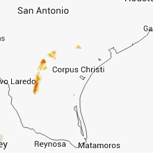
Hail Map for Friday, June 13, 2014

Number of Impacted Households on 6/13/2014
0
Impacted by 1" or Larger Hail
0
Impacted by 1.75" or Larger Hail
0
Impacted by 2.5" or Larger Hail
Square Miles of Populated Area Impacted on 6/13/2014
0
Impacted by 1" or Larger Hail
0
Impacted by 1.75" or Larger Hail
0
Impacted by 2.5" or Larger Hail


Cities Most Affected by Hail Storms of 6/13/2014
| Hail Size | Demographics of Zip Codes Affected | ||||||
|---|---|---|---|---|---|---|---|
| City | Count | Average | Largest | Pop Density | House Value | Income | Age |
| Martin, SD | 2 | 1.88 | 2.00 | 1 | $41k | $27.3k | 31.6 |
| Hulett, WY | 2 | 1.75 | 1.75 | 1 | $64k | $28.0k | 43.7 |
| Kim, CO | 1 | 2.75 | 2.75 | 0 | $39k | $31.8k | 52.4 |
| Three Rivers, TX | 1 | 1.75 | 1.75 | 3 | $53k | $33.0k | 37.3 |
| Pine Ridge, SD | 1 | 1.75 | 1.75 | 0 | $21k | $20.8k | 23.5 |
| Mobridge, SD | 1 | 1.75 | 1.75 | 18 | $48k | $26.1k | 43.3 |
Hail and Wind Damage Spotted on 6/13/2014
Filter by Report Type:Hail ReportsWind Reports
States Impacted
Florida, Alabama, Maryland, New Jersey, New York, Texas, North Carolina, Wyoming, New Mexico, Louisiana, South Carolina, South Dakota, Colorado, Montana, Nebraska, North DakotaFlorida
| Local Time | Report Details |
|---|---|
| 11:50 AM EDT | Tree down on a car on e broadway st near louise st in oviedo. initially reported by broadcast media with details from law enforcemen in seminole county FL, 14.6 miles NE of Orlando, FL |
| 2:36 PM EDT | One trailer with the siding torn off in broward county FL, 27.5 miles NNW of Miami, FL |
| 2:43 PM EDT | One trailer with the siding torn off in broward county FL, 27.5 miles NNW of Miami, FL |
| 2:55 PM EDT | Quarter sized hail reported near Fort Lauderdale, FL, 27.3 miles N of Miami, FL |
| 3:10 PM EDT | Quarter sized hail reported near Fort Lauderdale, FL, 25.2 miles N of Miami, FL |
| 3:25 PM EDT | Quarter sized hail reported near Fort Lauderdale, FL, 22.9 miles N of Miami, FL |
| 4:08 PM EDT | Storm damage reported in miami-dade county FL, 13.3 miles W of Miami, FL |
| 4:10 PM EDT | Multiple trees down at miccosukee golf and country club in miami-dade county FL, 12.1 miles W of Miami, FL |
| 6:45 PM EDT | Damage to back yard gazebo in palm beach gardens. wind estimated at 50 mph. report relayed by medi in palm beach county FL, 34.6 miles SSE of Port Saint Lucie, FL |
| 7:54 PM EDT | Kvrb measured wind gust of 53 kt/61 mp in indian river county FL, 26.7 miles N of Port Saint Lucie, FL |
| 7:56 PM EDT | Multiple 1-2 inch diameter branches down on 15th street in vero beach in indian river county FL, 24.7 miles N of Port Saint Lucie, FL |
| 8:14 PM EDT | Station dw1257 measured 57 kt/66 mph wind gust just north of jaycee beac in indian river county FL, 31.8 miles NNW of Port Saint Lucie, FL |
| 8:14 PM EDT | Station dw1257 measured 57 kt/66 mph wind gust just north of jaycee beac in indian river county FL, 27.3 miles N of Port Saint Lucie, FL |
Alabama
| Local Time | Report Details |
|---|---|
| 12:24 PM CDT | Mulitple trees and power lines down. one storage shed blown over into road. also dime size hail reporte in houston county AL, 72.4 miles NE of Miramar Beach, FL |
Maryland
| Local Time | Report Details |
|---|---|
| 2:12 PM EDT | Tree down blocking road at diamond point and oriole avenue in baltimore county MD, 5.9 miles E of Baltimore, MD |
| 2:14 PM EDT | Tree down blocking cove road near the beltway in baltimore county MD, 7.6 miles E of Baltimore, MD |
| 2:15 PM EDT | Large tree uprooted at coxs point in baltimore county MD, 8.7 miles E of Baltimore, MD |
| 2:18 PM EDT | Tree down blocking road at sandlewood and thomas blvd in baltimore county MD, 10.8 miles ESE of Baltimore, MD |
New Jersey
| Local Time | Report Details |
|---|---|
| 3:54 PM EDT | Large limbs down in hunterdon county NJ, 49.6 miles W of Brooklyn, NY |
| 4:30 PM EDT | Trees down in randolph townshi in morris county NJ, 32.3 miles WNW of Brooklyn, NY |
| 5:15 PM EDT | Storm damage reported in passaic county NJ, 26.4 miles NW of Brooklyn, NY |
| 5:35 PM EDT | Skywarn spotter coordinator reporting trees and wires down across ridgewood in bergen county NJ, 20.8 miles NNW of Brooklyn, NY |
| 5:40 PM EDT | Route 208 on the border of wycott and midland park is closed in both directions due to road flooding and trees down in bergen county NJ, 23.2 miles NNW of Brooklyn, NY |
| 5:40 PM EDT | Tree down on car at intersection of vreeland and payne aves in bergen county NJ, 22 miles NNW of Brooklyn, NY |
| 5:43 PM EDT | Tree down on wires on shuart lane in bergen county NJ, 26.7 miles NNW of Brooklyn, NY |
| 6:05 PM EDT | Route 208 on the border of wycott and midland park is closed in both directions due to road flooding and trees down in bergen county NJ, 23.2 miles NNW of Brooklyn, NY |
| 6:22 PM EDT | Skywarn spotter coordinator reporting trees and wires down across ridgewood in bergen county NJ, 20.8 miles NNW of Brooklyn, NY |
New York
| Local Time | Report Details |
|---|---|
| 4:20 PM EDT | Tree down on route 34 in cayuga county NY, 24.8 miles WNW of Syracuse, NY |
| 4:40 PM EDT | Large tree limb down in oswego county NY, 25.3 miles NW of Syracuse, NY |
Texas
| Local Time | Report Details |
|---|---|
| 3:30 PM CDT | Quarter sized hail reported near Spurger, TX, 48.9 miles NNW of Beaumont, TX, kbmt news relayed a public facebook report of quarter size hail in spurger. |
| 6:06 PM CDT | Law enforcement reported two power lines down around parklane st and stinson dr in free in duval county TX, 59.2 miles ENE of Laredo, TX |
| 5:10 PM MDT | Wind damage to a bill board near interstate 10 and redd road in el paso county TX, 1.5 miles NNE of El Paso, TX |
| 6:19 PM CDT | Golf Ball sized hail reported near Three Rivers, TX, 67.7 miles SSE of San Antonio, TX, police officer reported golf ball size hail near county road 403 off of highway 72 west of three rivers. |
| 7:26 PM CDT | Limbs blown down by thunderstorm outflow winds estimated at 55-60 mp in reeves county TX, 72.9 miles WSW of Odessa, TX |
| 7:28 PM CDT | Lots of dust on the gust front in deaf smith county TX, 38.8 miles E of Tucumcari, NM |
| 7:35 PM CDT | Measured 59 mph wind gust at kpe in reeves county TX, 69.3 miles N of Alpine, TX |
| 7:55 PM CDT | Reported by west texas mesonet site 2ne of friona in parmer county TX, 62 miles SW of Amarillo, TX |
| 8:01 PM CDT | Estimated by bailey county s o...in addition to blowing dust in bailey county TX, 66.7 miles NW of Lubbock, TX |
| 8:06 PM CDT | Kvii schoolnet site in deaf smith county TX, 41.3 miles SW of Amarillo, TX |
| 8:10 PM CDT | Storm damage reported in deaf smith county TX, 42.6 miles SW of Amarillo, TX |
| 11:15 PM CDT | Public report of 60 mph winds and dime size hail via social medi in pecos county TX, 48.5 miles NE of Alpine, TX |
| 11:54 PM CDT | Quarter sized hail reported near Fort Stockton, TX, 58 miles NE of Alpine, TX |
| 11:58 PM CDT | Quarter sized hail reported near Fort Stockton, TX, 58.9 miles NE of Alpine, TX |
| 12:30 AM CDT | Storm damage reported in stonewall county TX, 56.1 miles NNW of Abilene, TX |
North Carolina
| Local Time | Report Details |
|---|---|
| 4:45 PM EDT | Quarter sized hail reported near Etowah, NC, 33.7 miles N of Greenville, SC |
| 5:10 PM EDT | Multiple trees and power lines down in rosman area. time estimated from radar in transylvania county NC, 24.7 miles NNW of Greenville, SC |
| 6:50 PM EDT | Multiple trees and power lines down on hickory blvd and barcose street in lenoir are in caldwell county NC, 60 miles NW of Charlotte, NC |
| 7:55 PM EDT | Quarter sized hail reported near Gastonia, NC, 16 miles W of Charlotte, NC |
Wyoming
| Local Time | Report Details |
|---|---|
| 3:00 PM MDT | Quarter sized hail reported near Weston, WY, 41.9 miles N of Gillette, WY |
| 4:05 PM MDT | Golf Ball sized hail reported near Hulett, WY, 42.4 miles NE of Gillette, WY |
| 4:26 PM MDT | Storm damage reported in campbell county WY, 48.6 miles SSW of Gillette, WY |
| 4:28 PM MDT | Storm damage reported in campbell county WY, 4.9 miles NNW of Gillette, WY |
| 4:40 PM MDT | Golf Ball sized hail reported near Hulett, WY, 54.3 miles NE of Gillette, WY |
| 4:45 PM MDT | Storm damage reported in crook county WY, 52.1 miles ENE of Gillette, WY |
| 4:57 PM MDT | Quarter sized hail reported near Gillette, WY, 27.5 miles N of Gillette, WY |
| 5:07 PM MDT | Storm damage reported in crook county WY, 34.7 miles E of Gillette, WY |
New Mexico
| Local Time | Report Details |
|---|---|
| 4:15 PM MDT | Multiple gusts near 60 knots. zero visibility in blowing dust in dona ana county NM, 11 miles NW of El Paso, TX |
| 5:27 PM MDT | Schoolnet sit in quay county NM, 38.1 miles SSW of Tucumcari, NM |
| 5:50 PM MDT | Storm damage reported in quay county NM, 0.7 miles SSW of Tucumcari, NM |
| 5:55 PM MDT | Ktcc aso in quay county NM, 6.9 miles ENE of Tucumcari, NM |
| 5:56 PM MDT | Ktcc aso in quay county NM, 6.9 miles ENE of Tucumcari, NM |
| 6:00 PM MDT | Storm damage reported in dona ana county NM, 55.4 miles NNW of El Paso, TX |
| 6:07 PM MDT | Ranchvale elementary schoolnet in curry county NM, 52.8 miles SSE of Tucumcari, NM |
| 6:12 PM MDT | Kcvs aso in curry county NM, 59.3 miles SSE of Tucumcari, NM |
| 7:29 PM CDT | Storm damage reported in quay county NM, 38.8 miles E of Tucumcari, NM |
| 7:35 PM MDT | Storm damage reported in grant county NM, 11.8 miles SE of Silver City, NM |
Louisiana
| Local Time | Report Details |
|---|---|
| 5:20 PM CDT | Quarter sized hail reported near Leblanc, LA, 58.6 miles NE of Beaumont, TX, kplc relayed a facebook report of nickel to quarter size hail 6 miles north of leblanc. |
South Carolina
| Local Time | Report Details |
|---|---|
| 6:40 PM EDT | Multiple trees and power lines down on wood burn road near country club roa in spartanburg county SC, 41.6 miles E of Greenville, SC |
| 7:31 PM EDT | One tree down on powerline along north main stree in dorchester county SC, 15.2 miles SW of Charleston, SC |
| 8:05 PM EDT | Public reported several limbs down with a diameter of up to 2 inche in dorchester county SC, 16.1 miles SW of Charleston, SC |
| 8:33 PM EDT | County dispatch reports trees down along hwy 21. time estimated from rada in orangeburg county SC, 56.8 miles WNW of Charleston, SC |
South Dakota
| Local Time | Report Details |
|---|---|
| 5:15 PM MDT | Quarter sized hail reported near Belle Fourche, SD, 67.6 miles NW of Rapid City, SD |
| 7:03 PM MDT | Storm damage reported in pennington county SD, 9 miles ESE of Rapid City, SD |
| 7:03 PM MDT | At least one semi damaged from outflow wind gusts. i-90 mm7 in pennington county SD, 17 miles E of Rapid City, SD |
| 7:06 PM MDT | Storm damage reported in meade county SD, 41 miles ENE of Rapid City, SD |
| 7:08 PM MDT | Storm damage reported in meade county SD, 41.4 miles ENE of Rapid City, SD |
| 7:40 PM MDT | Storm damage reported in ziebach county SD, 73.9 miles ENE of Rapid City, SD |
| 7:50 PM MDT | Golf Ball sized hail reported near Pine Ridge, SD, 75.1 miles SSE of Rapid City, SD |
| 7:52 PM MDT | Storm damage reported in meade county SD, 87.9 miles NE of Rapid City, SD |
| 8:00 PM MDT | Storm damage reported in ziebach county SD, 85.5 miles NW of Pierre, SD |
| 8:00 PM MDT | Storm damage reported in shannon county SD, 76.7 miles SSE of Rapid City, SD |
| 8:15 PM MDT | Storm damage reported in ziebach county SD, 62.2 miles NW of Pierre, SD |
| 8:17 PM MDT | Storm damage reported in ziebach county SD, 59.4 miles NW of Pierre, SD |
| 8:25 PM MDT | Storm damage reported in dewey county SD, 69.3 miles NW of Pierre, SD |
| 8:55 PM MDT | Quarter sized hail reported near Batesland, SD, 80.4 miles SE of Rapid City, SD |
| 9:16 PM MDT | Half Dollar sized hail reported near Batesland, SD, 80.4 miles WNW of Valentine, NE |
| 9:18 PM MDT | Golf Ball sized hail reported near Mobridge, SD, 78.8 miles N of Pierre, SD |
| 9:32 PM MDT | Golf Ball sized hail reported near Martin, SD, 75.5 miles WNW of Valentine, NE |
| 9:55 PM MDT | Hen Egg sized hail reported near Martin, SD, 67.9 miles WNW of Valentine, NE |
| 11:09 PM CDT | Quarter sized hail reported near Roscoe, SD, 41.3 miles W of Aberdeen, SD |
| 11:41 PM CDT | Quarter sized hail reported near Ipswich, SD, 11.6 miles WSW of Aberdeen, SD, along the brown county and edmunds county line. |
| 11:41 PM CDT | Quarter sized hail reported near Ipswich, SD, 13.3 miles W of Aberdeen, SD, mainly nickle size with quarter size mixed in. road was covered with hail |
| 11:20 PM MDT | Quarter sized hail reported near Tuthill, SD, 42.8 miles WNW of Valentine, NE, 40 mph wind gusts |
Colorado
| Local Time | Report Details |
|---|---|
| 5:55 PM MDT | Baseball sized hail reported near Kim, CO, 86.4 miles SE of Pueblo, CO |
Montana
| Local Time | Report Details |
|---|---|
| 6:05 PM MDT | Windsock and metal pole bending in the win in garfield county MT, 42.5 miles S of Glasgow, MT |
| 6:08 PM MDT | Peak wind gust measured at the south sawmill creek sensor between 508pm and 608p in garfield county MT, 60.4 miles SW of Glasgow, MT |
| 7:45 PM MDT | Ping Pong Ball sized hail reported near Froid, MT, 36.4 miles WNW of Williston, ND, hail ranged from quarter sized to ping pongs. |
| 8:00 PM MDT | Half Dollar sized hail reported near Dagmar, MT, 33.9 miles WNW of Williston, ND, two storms went through and hail ranged from pea to half dollar. |
Nebraska
| Local Time | Report Details |
|---|---|
| 7:31 PM MDT | Storm damage reported in dawes county NE, 75 miles NNE of Scottsbluff, NE |
North Dakota
| Local Time | Report Details |
|---|---|
| 10:30 PM CDT | Quarter sized hail reported near Ray, ND, 24.8 miles ENE of Williston, ND |
| 10:33 PM CDT | Half Dollar sized hail reported near Ray, ND, 24.8 miles ENE of Williston, ND |
Connect with Interactive Hail Maps