

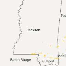
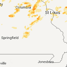
Hail Map for Friday, June 10, 2011

Number of Impacted Households on 6/10/2011
0
Impacted by 1" or Larger Hail
0
Impacted by 1.75" or Larger Hail
0
Impacted by 2.5" or Larger Hail
Square Miles of Populated Area Impacted on 6/10/2011
0
Impacted by 1" or Larger Hail
0
Impacted by 1.75" or Larger Hail
0
Impacted by 2.5" or Larger Hail


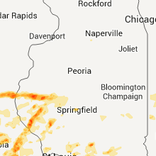


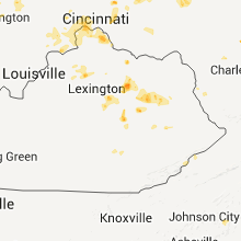


Cities Most Affected by Hail Storms of 6/10/2011
| Hail Size | Demographics of Zip Codes Affected | ||||||
|---|---|---|---|---|---|---|---|
| City | Count | Average | Largest | Pop Density | House Value | Income | Age |
| Middletown, MO | 2 | 2.75 | 2.75 | 10 | $49k | $35.8k | 45.5 |
| Sedalia, MO | 2 | 1.88 | 2.00 | 144 | $67k | $31.5k | 36.8 |
| Alexandria, KY | 2 | 1.88 | 2.00 | 338 | $119k | $53.1k | 38.2 |
| Liberty, IL | 2 | 1.88 | 2.00 | 16 | $69k | $40.5k | 39.9 |
| Vandalia, MO | 2 | 1.75 | 1.75 | 30 | $47k | $27.8k | 38.8 |
| Hermann, MO | 1 | 2.75 | 2.75 | 24 | $77k | $37.9k | 46.7 |
| Augusta, IL | 1 | 2.75 | 2.75 | 13 | $37k | $36.3k | 43.6 |
| Fort Scott, KS | 1 | 2.00 | 2.00 | 42 | $48k | $31.0k | 37.2 |
| Smithville, OH | 1 | 2.00 | 2.00 | 149 | $115k | $41.6k | 40.8 |
| Buckingham, VA | 1 | 1.75 | 1.75 | 23 | $82k | $28.6k | 45.4 |
| Kincaid, KS | 1 | 1.75 | 1.75 | 6 | $28k | $32.4k | 46.4 |
| Welda, KS | 1 | 1.75 | 1.75 | 4 | $32k | $26.4k | 43.8 |
| Westphalia, KS | 1 | 1.75 | 1.75 | 5 | $26k | $35.1k | 43.9 |
| Yates Center, KS | 1 | 1.75 | 1.75 | 7 | $39k | $25.9k | 47.0 |
| Barry, IL | 1 | 1.75 | 1.75 | 21 | $49k | $30.2k | 43.1 |
| Clayton, IL | 1 | 1.75 | 1.75 | 17 | $38k | $30.1k | 38.1 |
| Plymouth, IL | 1 | 1.75 | 1.75 | 10 | $25k | $33.6k | 39.9 |
| Chelsea, AL | 1 | 1.75 | 1.75 | 210 | $175k | $58.7k | 36.3 |
| Alexandria, MO | 1 | 1.75 | 1.75 | 11 | $56k | $31.1k | 38.2 |
| Williamsburg, MO | 1 | 1.75 | 1.75 | 13 | $58k | $38.3k | 45.3 |
| New Franklin, MO | 1 | 1.75 | 1.75 | 30 | $65k | $33.1k | 43.3 |
| Owensville, MO | 1 | 1.75 | 1.75 | 32 | $74k | $34.4k | 43.0 |
Hail and Wind Damage Spotted on 6/10/2011
Filter by Report Type:Hail ReportsWind Reports
States Impacted
Virginia, Ohio, Kentucky, Maryland, West Virginia, Indiana, Louisiana, North Carolina, Alabama, Pennsylvania, Georgia, Missouri, South Carolina, Delaware, Texas, Illinois, Mississippi, Oklahoma, KansasVirginia
| Local Time | Report Details |
|---|---|
| 1:54 PM UTC | Quarter sized hail reported near Cascade, VA, 50.6 miles SSE of Roanoke, VA |
| 7:00 PM UTC | Several 4 in diameter tree limbs down in alleghany county VA, 36.8 miles N of Roanoke, VA |
| 7:20 PM UTC | Several 4 in diameter tree limbs down in alleghany county VA, 36.8 miles N of Roanoke, VA |
| 7:26 PM UTC | Ping Pong Ball sized hail reported near Charlottesville, VA, 67.5 miles NW of Richmond, VA |
| 3:55 PM EDT | Trees down on power lines in prince george county VA, 33.7 miles SE of Richmond, VA |
| 4:10 PM EDT | Tree down in yar in chesterfield county VA, 15.7 miles SE of Richmond, VA |
| 9:00 PM UTC | Large limbs down vicinity of virginia beach friends schoo in city of virginia b county VA, 7.1 miles NNE of Virginia Beach, VA |
| 9:38 PM UTC | Golf Ball sized hail reported near Buckingham, VA, 55.4 miles W of Richmond, VA, occurred on union church road |
| 9:45 PM UTC | Tree down in roanoke county VA, 4.8 miles SE of Roanoke, VA |
| 10:26 PM UTC | Ping Pong Ball sized hail reported near Charlottesville, VA, 67.5 miles NW of Richmond, VA |
| 10:28 PM UTC | Quarter sized hail reported near Charlottesville, VA, 66.2 miles NW of Richmond, VA, dime to quarter size hail |
| 10:36 PM UTC | Trees down along a quarter mile path from crafts ford road and 3 quarter point roa in franklin county VA, 19.5 miles SE of Roanoke, VA |
| 11:09 PM UTC | Multiple 15-20 plus inch diameter trees blown dow in albemarle county VA, 60.8 miles WNW of Richmond, VA |
| 11:09 PM UTC | 8-12 inch diameter tree blown dow in albemarle county VA, 60.2 miles WNW of Richmond, VA |
| 11:18 PM UTC | Tree down in henry county VA, 35.2 miles S of Roanoke, VA |
| 11:31 PM UTC | Tree down in henry county VA, 35.3 miles S of Roanoke, VA |
| 11:50 PM UTC | Two trees down on route 685 in henry county VA, 43 miles S of Roanoke, VA |
| 12:05 AM UTC | Numerous trees reported down on us 301 in dinwiddie county VA, 35.3 miles SSE of Richmond, VA |
| 12:30 AM UTC | Trees down all over cit in city of martinsvil county VA, 41 miles S of Roanoke, VA |
Ohio
| Local Time | Report Details |
|---|---|
| 4:16 PM UTC | Quarter sized hail reported near Cleves, OH, 16.6 miles WNW of Cincinnati, OH, dime to quarter size hail |
| 4:25 PM UTC | Quarter sized hail reported near Cleves, OH, 12.7 miles NW of Cincinnati, OH |
| 4:37 PM UTC | Quarter sized hail reported near North Bend, OH, 12.5 miles WNW of Cincinnati, OH, along us-50 just southeast of north bend. |
| 6:12 PM UTC | Quarter sized hail reported near New Richmond, OH, 15.8 miles SE of Cincinnati, OH |
| 9:40 PM UTC | One tree dow in hamilton county OH, 13.7 miles WNW of Cincinnati, OH |
| 9:50 PM UTC | Power lines down. time estimated from rada in hamilton county OH, 8.2 miles WNW of Cincinnati, OH |
| 9:50 PM UTC | Quarter sized hail reported near Waynesville, OH, 36.7 miles NE of Cincinnati, OH |
| 10:15 PM UTC | Quarter sized hail reported near New London, OH, 47.5 miles SW of Cleveland, OH, spotter reported quarter size hail. |
| 10:21 PM UTC | Storm damage reported in hamilton county OH, 4.6 miles E of Cincinnati, OH |
| 10:24 PM UTC | Storm damage reported in hamilton county OH, 4.6 miles E of Cincinnati, OH |
| 10:24 PM UTC | Quarter sized hail reported near Trotwood, OH, 50.5 miles NNE of Cincinnati, OH |
| 10:28 PM UTC | Quarter sized hail reported near Trotwood, OH, 49.1 miles NNE of Cincinnati, OH |
| 10:46 PM UTC | Trees damage reported near fort jenning in putnam county OH, 43.3 miles ESE of Fort Wayne, IN |
| 11:15 PM UTC | Quarter sized hail reported near Plymouth, OH, 62.2 miles SW of Cleveland, OH |
| 11:27 PM UTC | Storm damage reported in montgomery county OH, 55.9 miles NNE of Cincinnati, OH |
| 11:50 PM UTC | Hen Egg sized hail reported near Smithville, OH, 45.3 miles SSW of Cleveland, OH, 1 1/4 to 2 inch hail. |
| 11:58 PM UTC | Quarter sized hail reported near Columbus, OH, 6.8 miles W of Columbus, OH, nickle to quarter size hail. |
| 12:00 AM UTC | Several large grain storage silos were damaged and destroyed. a garage roof was blown off and shingles were blown off of several structures. a large barn was blown off in marion county OH, 51.5 miles NNW of Columbus, OH |
| 12:10 AM UTC | Corrected tim in franklin county OH, 9.6 miles WSW of Columbus, OH |
| 12:17 AM UTC | Half Dollar sized hail reported near New Bremen, OH, 54.6 miles SE of Fort Wayne, IN |
| 12:23 AM UTC | Also dime size hail in auglaize county OH, 57.8 miles SE of Fort Wayne, IN |
| 12:25 AM UTC | Lg tree limbs down in franklin county OH, 1.1 miles SE of Columbus, OH |
| 12:25 AM UTC | 3.5 foot diameter tree fell on a hous in franklin county OH, 4.6 miles ENE of Columbus, OH |
| 12:29 AM UTC | Numerous power lines downed...blocking some roads. a tree fell through the roof of a hous in delaware county OH, 21.3 miles NNE of Columbus, OH |
| 12:31 AM UTC | Quarter sized hail reported near Massillon, OH, 50.1 miles S of Cleveland, OH |
| 12:37 AM UTC | Storm damage reported in franklin county OH, 9.6 miles WSW of Columbus, OH |
| 12:37 AM UTC | Storm damage reported in franklin county OH, 3.9 miles E of Columbus, OH |
| 12:45 AM UTC | Quarter sized hail reported near Mansfield, OH, 50.1 miles NNE of Columbus, OH, spotter reported pea to quarter size hail. |
| 12:45 AM UTC | Quarter sized hail reported near Galion, OH, 52.5 miles N of Columbus, OH |
| 12:45 AM UTC | Spotter reported several large tree branches and road signs dow in morrow county OH, 50.1 miles NNE of Columbus, OH |
| 12:49 AM UTC | Storm damage reported in morrow county OH, 45.3 miles NNE of Columbus, OH |
| 12:56 AM UTC | Trees damage reported near fort jenning in putnam county OH, 43.3 miles ESE of Fort Wayne, IN |
| 1:15 AM UTC | Large branches broken in perry county OH, 36.6 miles E of Columbus, OH |
| 1:40 AM UTC | Tree down on route 83 south of clark in coshocton county OH, 66.7 miles ENE of Columbus, OH |
| 1:45 AM UTC | Storm damage reported in muskingum county OH, 53.8 miles ENE of Columbus, OH |
| 2:20 AM UTC | Numerous trees down in guernsey county OH, 77.7 miles E of Columbus, OH |
| 2:30 AM UTC | Numerous trees down throughout guernsey county in guernsey county OH, 73.4 miles WSW of Pittsburgh, PA |
| 3:00 AM UTC | Powerlines down in belmont county OH, 53.7 miles WSW of Pittsburgh, PA |
Kentucky
| Local Time | Report Details |
|---|---|
| 4:48 PM UTC | Trees and powerlines down along highway 49 in laurel county KY, 37.7 miles S of Irvine, KY |
| 5:52 PM UTC | Golf Ball sized hail reported near Alexandria, KY, 12.1 miles SSE of Cincinnati, OH |
| 5:55 PM UTC | Hen Egg sized hail reported near Alexandria, KY, 12.1 miles SSE of Cincinnati, OH |
| 7:00 PM UTC | Trees and a cable line down in bethel. also...dime sized hail covered the ground and the temperature dropped from 90 degrees to 60 degrees in a short tim in bath county KY, 38.4 miles N of Irvine, KY |
| 7:10 PM UTC | Trees down on hwy 36 near nicholas county lin in bath county KY, 36.6 miles N of Irvine, KY |
| 7:10 PM UTC | Half Dollar sized hail reported near Owingsville, KY, 37.9 miles NNE of Irvine, KY, quarter to half dollar size hail along highway 119 near odessa. |
| 7:30 PM UTC | Several trees downe in bath county KY, 34.9 miles NNE of Irvine, KY |
| 7:36 PM UTC | Ping Pong Ball sized hail reported near Maysville, KY, 48.2 miles SE of Cincinnati, OH, on pleasant ridge road. |
| 7:38 PM UTC | Quarter sized hail reported near Maysville, KY, 50.3 miles SE of Cincinnati, OH, hail covered the ground. corrected location and time. |
| 8:00 PM UTC | Quarter sized hail reported near Mays Lick, KY, 53.6 miles SE of Cincinnati, OH, hail covered the ground |
| 8:10 PM UTC | Trees down. pea size hai in bath county KY, 35.1 miles NNE of Irvine, KY |
| 8:12 PM UTC | Trees down on hwy 303 in morgan county KY, 39.8 miles NE of Irvine, KY |
| 8:23 PM UTC | Quarter sized hail reported near Irvine, KY, 1.1 miles NE of Irvine, KY |
| 8:30 PM UTC | Trees down on hwy 77 near tar ridg in menifee county KY, 25.2 miles ENE of Irvine, KY |
| 8:31 PM UTC | Quarter sized hail reported near Irvine, KY, 0.3 miles E of Irvine, KY |
| 8:35 PM UTC | Multiple trees down in the cit in estill county KY, 0.3 miles E of Irvine, KY |
| 8:35 PM UTC | Multiple trees dow in estill county KY, 1.5 miles ESE of Irvine, KY |
| 9:12 PM UTC | Quarter sized hail reported near Irvine, KY, 6.9 miles SSE of Irvine, KY |
| 9:25 PM UTC | Tree down on along hwy 1 in breathitt county KY, 31.3 miles E of Irvine, KY |
| 9:25 PM UTC | Tree down from a 48 mph wind gust measured by asos at nws jackso in breathitt county KY, 36 miles E of Irvine, KY |
| 10:29 PM UTC | Storm damage reported in boone county KY, 9.7 miles WSW of Cincinnati, OH |
| 12:00 AM UTC | Trees down on sr 607 in owen county KY, 45.2 miles S of Cincinnati, OH |
Maryland
| Local Time | Report Details |
|---|---|
| 5:15 PM UTC | Two utility poles downed in worcester county MD, 16.5 miles SW of Ocean City, MD |
West Virginia
| Local Time | Report Details |
|---|---|
| 5:30 PM UTC | Trees down on power lines and across livesay rd. there was also hail with this storm...size unknow in greenbrier county WV, 51.1 miles NNW of Roanoke, VA |
Indiana
| Local Time | Report Details |
|---|---|
| 6:57 PM UTC | Quarter sized hail reported near Tipton, IN, 35.9 miles N of Indianapolis, IN, hail size of quarters fell on mound street for 5 to 7 minutes |
| 7:59 PM UTC | Quarter sized hail reported near Alexandria, IN, 42.2 miles NE of Indianapolis, IN, quarter size hail is covering the ground |
| 8:10 PM UTC | Quarter sized hail reported near Tippecanoe, IN, 54.2 miles W of Fort Wayne, IN |
| 8:30 PM UTC | Quarter sized hail reported near Muncie, IN, 50.2 miles NE of Indianapolis, IN, located on west weber drive |
| 8:40 PM UTC | Quarter sized hail reported near Muncie, IN, 50.2 miles NE of Indianapolis, IN, hail has been falling for 10 minutes now. |
| 4:45 PM EDT | Quarter sized hail reported near Muncie, IN, 50.7 miles NE of Indianapolis, IN |
| 8:46 PM UTC | Accompanied by 1 inch hail. 8 to 12 diameter tree limb dow in delaware county IN, 50.2 miles NE of Indianapolis, IN |
| 8:46 PM UTC | Eight to twelve inch diameter tree branch blown down in delaware county IN, 50.2 miles NE of Indianapolis, IN |
| 8:46 PM UTC | Quarter sized hail reported near Muncie, IN, 50.2 miles NE of Indianapolis, IN, accompanied by estimated 60 mph winds |
| 8:50 PM UTC | Utility poles and trees or tree limbs down...damage to a swimming pool. located in the vicinity of 700 east and 50s near state route 32 in delaware county IN, 55.5 miles ENE of Indianapolis, IN |
| 8:55 PM UTC | Utility poles down...time approximated in randolph county IN, 58.3 miles ENE of Indianapolis, IN |
| 9:20 PM UTC | Utility poles have been blown or knocked down...time is approximate in randolph county IN, 62.8 miles S of Fort Wayne, IN |
| 11:05 PM UTC | Trees and power lines down near 325 w and sr 2 in grant county IN, 48.3 miles NNE of Indianapolis, IN |
| 4:10 AM UTC | Estimating 55 to 60 mph in morgan county IN, 15.6 miles SSW of Indianapolis, IN |
| 4:13 AM UTC | Winds gusted to this estimated speed several times during a 10-minute period. trees and limbs dow in parke county IN, 53.5 miles ENE of Mattoon, IL |
| 4:53 AM UTC | Storm damage reported in putnam county IN, 30.1 miles WSW of Indianapolis, IN |
| 4:53 AM UTC | Tree on car on state road 231 3 miles south of 36. multiple power lines down in northern part of county. multiple trees dow in putnam county IN, 30.1 miles WSW of Indianapolis, IN |
| 5:04 AM UTC | Storm damage reported in montgomery county IN, 45.5 miles WNW of Indianapolis, IN |
| 5:37 AM UTC | A power pole has been snapped off in boone county IN, 24.2 miles NW of Indianapolis, IN |
| 5:42 AM UTC | Storm damage reported in hamilton county IN, 14.6 miles NNE of Indianapolis, IN |
| 6:28 AM UTC | Location...morningside. branches broken approx 2.5 inches in diameter. report from spotternetwork.org in delaware county IN, 50.2 miles NE of Indianapolis, IN |
| 6:29 AM UTC | Anderson university reported to emergency management that a large live tree with about a 3-foot diameter blew down at 6th and cottage on the campus in madison county IN, 33.1 miles NE of Indianapolis, IN |
| 6:40 AM UTC | A tree fell on a mobile home on ewing avenue...temporarily trapping the occupant. possible injury. time estimated based on rada in knox county IN, 48.6 miles N of Evansville, IN |
| 7:38 AM UTC | Very brief gust associated with outflow boundary. other sustained gusts of 40-45 mph. no damag in spencer county IN, 28.9 miles ESE of Evansville, IN |
Louisiana
| Local Time | Report Details |
|---|---|
| 7:15 PM UTC | Report of a roof blown off of a barn and powerlines down on felice cutoff rd. time estimated by rada in beauregard county LA, 40.4 miles NE of Beaumont, TX |
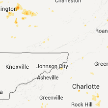
North Carolina
| Local Time | Report Details |
|---|---|
| 7:17 PM UTC | Quarter sized hail reported near Newland, NC, 38.6 miles SSE of Bristol, TN |
| 7:58 PM UTC | Large limbs down in town. dime size hai in ashe county NC, 43.9 miles ESE of Bristol, TN |
| 8:30 PM UTC | Quarter sized hail reported near , , 69.1 miles E of Bristol, TN |
| 9:00 PM UTC | Tree down... time estimated by radar in lee county NC, 42 miles SW of Raleigh, NC |
| 9:00 PM UTC | Tree down... time estimated by radar in lee county NC, 41.1 miles SW of Raleigh, NC |
| 9:08 PM UTC | One tree down on pattys chapel roa in henderson county NC, 40.4 miles N of Greenville, SC |
| 9:11 PM UTC | Tree down at drapers and ringwood roads... time estimated by radar in halifax county NC, 56.9 miles ENE of Raleigh, NC |
| 9:13 PM UTC | One tree in the roadway on hwy 25...asheville hw in henderson county NC, 41.7 miles N of Greenville, SC |
| 9:28 PM UTC | Tree on a home at 3204 belfast lane in carolina trace in lee county NC, 36.8 miles SW of Raleigh, NC |
| 9:28 PM UTC | Trees on 2 homes at 3208 and 3209 argyll drive in carolina trace in lee county NC, 36 miles SW of Raleigh, NC |
| 9:40 PM UTC | Quarter sized hail reported near Charlotte, NC, 5.4 miles SE of Charlotte, NC, a spotter was not at home when the hail fell but arrived about an hour after the hail ended. he found pieces of melting hail that were still as large as nickels. no nei |
| 9:55 PM UTC | One tree down on power lines along muse avenu in surry county NC, 65.5 miles SW of Roanoke, VA |
| 9:57 PM UTC | One tree down on airview driv in surry county NC, 66.9 miles SW of Roanoke, VA |
| 10:14 PM UTC | One tree down near linville and stanley road are in surry county NC, 63.3 miles SW of Roanoke, VA |
| 10:20 PM UTC | Tree down across the roa in northampton county NC, 77.8 miles WSW of Virginia Beach, VA |
| 10:25 PM UTC | Jupiter fire department knew of at least 2 trees down under where the storm crossed. there were rumors of more trees down back on property of nearby residents. also had in buncombe county NC, 61.4 miles SSW of Bristol, TN |
| 10:31 PM UTC | A tree down along newsome roa in forsyth county NC, 73.7 miles SSW of Roanoke, VA |
| 10:31 PM UTC | Tree down in the charleston court are in stokes county NC, 72.6 miles SSW of Roanoke, VA |
| 10:31 PM UTC | A tree down along newsome roa in stokes county NC, 73.1 miles SSW of Roanoke, VA |
| 10:36 PM UTC | Tree down along white roa in stokes county NC, 72.6 miles SSW of Roanoke, VA |
| 10:37 PM UTC | Tree down at drapers road and 561 in halifax county NC, 60.2 miles ENE of Raleigh, NC |
| 10:37 PM UTC | Carport roof blown off at hedgepeth and drapers road in halifax county NC, 62.8 miles ENE of Raleigh, NC |
| 10:40 PM UTC | One tree down near vass. time estimated by rada in moore county NC, 53.2 miles SW of Raleigh, NC |
| 10:42 PM UTC | Quarter sized hail reported near Corapeake, NC, 33.4 miles WSW of Virginia Beach, VA, time is radar estimated...nickel to quarter size hail |
| 10:47 PM UTC | Carport roof blown off at hedgepeth and drapers road in halifax county NC, 62.8 miles ENE of Raleigh, NC |
| 10:55 PM UTC | Tree down in taylortow in moore county NC, 61.7 miles SW of Raleigh, NC |
| 11:00 PM UTC | Numerous trees down across mocksville. power ou in davie county NC, 49.3 miles NNE of Charlotte, NC |
| 11:43 PM UTC | Tree down ne of bunn... time estimated by radar in franklin county NC, 28.1 miles ENE of Raleigh, NC |
| 11:53 PM UTC | Tree down 1 mile south of bunn... time estimated by radar in franklin county NC, 24 miles ENE of Raleigh, NC |
| 11:53 PM UTC | Roof blown off house in franklin county NC, 23.3 miles ENE of Raleigh, NC |
| 11:56 PM UTC | Tree down in franklin county NC, 21.6 miles ENE of Raleigh, NC |
| 12:36 AM UTC | Trees down near the intersection of highway 135 and leprechaun lan in rockingham county NC, 57.5 miles S of Roanoke, VA |
| 12:42 AM UTC | Several trees down in pasquotank county NC, 29.5 miles SW of Virginia Beach, VA |
| 12:51 AM UTC | Trees down along highway 31 in rockingham county NC, 61.5 miles S of Roanoke, VA |
| 12:51 AM UTC | One tree down along harrington highwa in rockingham county NC, 56.4 miles SSE of Roanoke, VA |
| 1:15 AM UTC | Many trees and power lines down. also several fires sparked by downed power line in gaston county NC, 18.9 miles W of Charlotte, NC |
| 1:15 AM UTC | News reports of an entrance way roof blown off at eastridge mall in gaston county NC, 18.9 miles W of Charlotte, NC |
| 2:20 AM UTC | Several trees down in the allens crossroads area...including a tree that fell on a fire fighting truck with people in the truc in union county NC, 33.4 miles SE of Charlotte, NC |
Alabama
| Local Time | Report Details |
|---|---|
| 7:35 PM UTC | Quarter sized hail reported near Plantersville, AL, 43.9 miles NNE of Camden, AL, quarter sized hail reported on county road 84 just off of county road 63 between valley grande and plantersville. |
| 3:01 PM CDT | Golf Ball sized hail reported near Chelsea, AL, 15.7 miles SE of Birmingham, AL, golfball sized hail reported covering the ground on cheser park drive off of highway 280. |
| 8:37 PM UTC | Quarter sized hail reported near Centreville, AL, 43 miles SSW of Birmingham, AL, quarter sized hail reported on highway 25 near highway 82 in centreville |
| 8:45 PM UTC | Two large trees down in brent. one in bibb county AL, 45.1 miles SSW of Birmingham, AL |
| 9:00 PM UTC | Small tree limbs and power lines down in monroevill in monroe county AL, 31.9 miles S of Camden, AL |
| 9:15 PM UTC | Roof damage to a shed near mexi in monroe county AL, 33.8 miles S of Camden, AL |
| 9:15 PM UTC | Limbs down near talladega national forest south of brent in bibb county AL, 49.2 miles SSW of Birmingham, AL |
| 9:21 PM UTC | Multiple trees down just north of u.s. hwy 82 on serty boyd r in tuscaloosa county AL, 45.1 miles SW of Birmingham, AL |
| 9:55 PM UTC | Multiple trees down in and around clanton in chilton county AL, 48 miles SSE of Birmingham, AL |
| 10:41 PM UTC | Quarter sized hail reported near Sweet Water, AL, 34.8 miles WNW of Camden, AL |
| 10:45 PM UTC | Tree or two down...along with lots of limbs down in howells community. dime to nickel sized hail. power out in the community. reported by publi in covington county AL, 47.4 miles N of Miramar Beach, FL |
| 11:41 PM UTC | Several trees were blown down blocking hwy 17 near hwy 80. winds estimated at 40 mp in sumter county AL, 64.9 miles WNW of Camden, AL |
| 11:54 PM UTC | Two trees were blown down blocking hwy 17 near hwy 80. winds estimated at 40 mp in sumter county AL, 64.9 miles WNW of Camden, AL |
| 1:50 AM UTC | A tree was reported down along hw in barbour county AL, 57.7 miles SSE of Auburn, AL |
Pennsylvania
| Local Time | Report Details |
|---|---|
| 7:45 PM UTC | Trees and wires down on blue goose rd and wolfe rd in barr twp in cambria county PA, 52.3 miles WSW of State College, PA |
| 7:55 PM UTC | Trees down in west carroll twp in cambria county PA, 46.6 miles WSW of State College, PA |
| 8:14 PM UTC | Large tree down across ruskin road - 5800 block in blair county PA, 34.4 miles SW of State College, PA |
Georgia
| Local Time | Report Details |
|---|---|
| 8:20 PM UTC | Quarter sized hail reported near Clayton, GA, 45.6 miles W of Greenville, SC, pea to quarter sized hail in clayton. some limbs down on road to black rock mtn. |
| 9:40 PM UTC | Several trees down mainly along rock creek road...but also on wolf pit road at turner road...williams circle...brookhaven...all in east central stephens count in stephens county GA, 41.9 miles WSW of Greenville, SC |
| 11:22 PM UTC | One tree down near lumpkin road in randolph county GA, 68.7 miles SE of Auburn, AL |
Missouri
| Local Time | Report Details |
|---|---|
| 8:50 PM UTC | Quarter sized hail reported near Mokane, MO, 31.3 miles SE of Columbia, MO |
| 9:35 PM UTC | Golf Ball sized hail reported near Williamsburg, MO, 32.1 miles E of Columbia, MO |
| 9:37 PM UTC | Half Dollar sized hail reported near Williamsburg, MO, 34.2 miles E of Columbia, MO |
| 10:00 PM UTC | Quarter sized hail reported near Wellsville, MO, 41.9 miles ENE of Columbia, MO |
| 10:01 PM UTC | Quarter sized hail reported near Wellsville, MO, 41.9 miles ENE of Columbia, MO, wind gust estimated at 50 to 60 mph. |
| 10:13 PM UTC | Baseball sized hail reported near Hermann, MO, 52.8 miles ESE of Columbia, MO, hail is ongoing. ranging from golfball to baseball sized. |
| 10:14 PM UTC | Quarter sized hail reported near Wyaconda, MO, 11.4 miles WSW of Kahoka, MO, time estimated from radar. |
| 10:15 PM UTC | Ping Pong Ball sized hail reported near Wellsville, MO, 42.4 miles ENE of Columbia, MO, strong winds of unknown speed. |
| 10:38 PM UTC | Quarter sized hail reported near Vandalia, MO, 50.4 miles ENE of Columbia, MO |
| 10:40 PM UTC | Quarter sized hail reported near Curryville, MO, 59.1 miles ENE of Columbia, MO |
| 10:41 PM UTC | Golf Ball sized hail reported near Vandalia, MO, 51.6 miles ENE of Columbia, MO |
| 10:42 PM UTC | Golf Ball sized hail reported near Vandalia, MO, 50.4 miles ENE of Columbia, MO |
| 10:45 PM UTC | Quarter sized hail reported near Curryville, MO, 60 miles ENE of Columbia, MO, hail ranged from dime to quarter size. estimated winds in excess of 60 mph. |
| 10:55 PM UTC | Golf Ball sized hail reported near Alexandria, MO, 12.2 miles SE of Kahoka, MO |
| 11:05 PM UTC | Quarter sized hail reported near New Haven, MO, 50.4 miles W of Saint Louis, MO |
| 11:11 PM UTC | Quarter sized hail reported near New Haven, MO, 55.9 miles W of Saint Louis, MO, hail ranges from pea sized to quarter sized |
| 11:49 PM UTC | Quarter sized hail reported near Sedalia, MO, 52.4 miles WSW of Columbia, MO |
| 11:57 PM UTC | Golf Ball sized hail reported near Sedalia, MO, 53.2 miles WSW of Columbia, MO |
| 11:59 PM UTC | Hen Egg sized hail reported near Sedalia, MO, 53.2 miles WSW of Columbia, MO |
| 12:08 AM UTC | Quarter sized hail reported near Sedalia, MO, 51.4 miles WSW of Columbia, MO |
| 12:28 AM UTC | Golf Ball sized hail reported near New Franklin, MO, 22.3 miles WNW of Columbia, MO |
| 12:30 AM UTC | 190 foot tall communications tower destroyed at slumberland furniture building...also large trees damaged at mexico country club approx 1 mile down the road. event time in audrain county MO, 29.7 miles ENE of Columbia, MO |
| 12:30 AM UTC | Quarter sized hail reported near Otterville, MO, 40.7 miles WSW of Columbia, MO |
| 12:43 AM UTC | Quarter sized hail reported near Boonville, MO, 22.4 miles W of Columbia, MO |
| 12:46 AM UTC | Quarter sized hail reported near Mexico, MO, 29.1 miles ENE of Columbia, MO |
| 12:54 AM UTC | Quarter sized hail reported near Hannibal, MO, 50.4 miles SSE of Kahoka, MO |
| 1:00 AM UTC | Five inch diameter tree limbs down...also...a truck camper shell blown ontu roof of a residenc in audrain county MO, 29.7 miles ENE of Columbia, MO |
| 1:02 AM UTC | Ping Pong Ball sized hail reported near Montgomery City, MO, 44.4 miles E of Columbia, MO, hail covering ground. |
| 1:06 AM UTC | Quarter sized hail reported near Dixon, MO, 38.9 miles NW of Salem, MO |
| 1:11 AM UTC | Quarter sized hail reported near Mexico, MO, 29.1 miles ENE of Columbia, MO, on highway 22 near county road 308. |
| 1:15 AM UTC | Baseball sized hail reported near Middletown, MO, 48.7 miles ENE of Columbia, MO, hail size varied from tennis ball to baseball size. |
| 1:40 AM UTC | Quarter sized hail reported near Craig, MO, 77.1 miles NNW of Kansas City, MO |
| 1:40 AM UTC | Baseball sized hail reported near Middletown, MO, 48.7 miles ENE of Columbia, MO, hail size varied from tennis ball to baseball size. |
| 1:52 AM UTC | Quarter sized hail reported near Doolittle, MO, 28.2 miles NW of Salem, MO |
| 2:28 AM UTC | Golf Ball sized hail reported near Owensville, MO, 49.2 miles N of Salem, MO |
| 2:35 AM UTC | Two large trees blown down in the city of warrenton in warren county MO, 52.5 miles WNW of Saint Louis, MO |
| 2:40 AM UTC | Large trees blown down near the intersection of highways j and in lincoln county MO, 49.9 miles WNW of Saint Louis, MO |
| 3:00 AM UTC | Large trees blown down near intersection of highways 50 and e in franklin county MO, 50.8 miles WSW of Saint Louis, MO |
| 3:25 AM UTC | Large trees blown down near gray summit along highway 10 in franklin county MO, 34.9 miles WSW of Saint Louis, MO |
| 4:06 AM UTC | Early evening friday a large tree unknown size downed by wind gust. wind speed unknown. tree down in the 6600 block of washington in university city missour in st. louis county MO, 7.6 miles WNW of Saint Louis, MO |
South Carolina
| Local Time | Report Details |
|---|---|
| 9:22 PM UTC | Trees down around walhall in oconee county SC, 26.5 miles W of Greenville, SC |
| 9:45 PM UTC | A few trees dow in pickens county SC, 11 miles W of Greenville, SC |
| 10:45 PM UTC | Quarter sized hail reported near Liberty, SC, 8.4 miles S of Greenville, SC, quarter sized hail fell on highway 88 between pendleton and piedmont. |
| 10:55 PM UTC | A tree limb fell and brought down 2 power lines near intersection of crescent street and spartanburg roa in spartanburg county SC, 28.5 miles ENE of Greenville, SC |
| 10:55 PM UTC | Several large limbs down on holly springs roa in spartanburg county SC, 27.6 miles ENE of Greenville, SC |
| 11:22 PM UTC | Trees down around walhall in oconee county SC, 26.5 miles W of Greenville, SC |
| 12:25 AM UTC | Many trees down near highway 560 near the newberry county lin in laurens county SC, 54.6 miles SE of Greenville, SC |
| 12:29 AM UTC | Tree down on bush river roa in laurens county SC, 53.8 miles SE of Greenville, SC |
| 12:40 AM UTC | Tree down on pickens street near a house. power lines down at that location possibly from the tree fal in laurens county SC, 53.2 miles ESE of Greenville, SC |
Delaware
| Local Time | Report Details |
|---|---|
| 9:22 PM UTC | Roof damage to homes. trees down. produce stand damage in sussex county DE, 33.3 miles NW of Ocean City, MD |
Texas
| Local Time | Report Details |
|---|---|
| 9:40 PM UTC | Storm damage reported in terry county TX, 38.8 miles SW of Lubbock, TX |
| 9:50 PM UTC | City hall est gusts in lubbock county TX, 11.2 miles ENE of Lubbock, TX |
| 10:40 PM UTC | Storm damage reported in crosby county TX, 28.1 miles ENE of Lubbock, TX |
| 11:47 PM UTC | Tree damage occurring and heavy outdoor objects being blown about. small hail increasing in size. est 70 plus mp in king county TX, 46.9 miles SSW of Childress, TX |
| 11:55 PM UTC | Measured by wtm. sustained speed of 53 mp in cottle county TX, 37.9 miles SSW of Childress, TX |
| 11:55 PM UTC | Roof damage reported on a home. wind gusts est over 70 mp in king county TX, 46.9 miles SSW of Childress, TX |
| 12:05 AM UTC | Utility poles and lines downed by thunderstorm wind in cottle county TX, 38.9 miles S of Childress, TX |
| 12:06 AM UTC | Kvii-tv schoolnet in cottle county TX, 29.4 miles S of Childress, TX |
| 12:10 AM UTC | Minor structural damage reported at paducah high school. press box at football field severely damaged. garage door blown in at hs ag building. tree damag in cottle county TX, 29.4 miles S of Childress, TX |
| 12:35 AM UTC | Storm damage reported in foard county TX, 33.5 miles SSE of Childress, TX |
| 1:01 AM UTC | Storm damage reported in childress county TX, 3.4 miles WNW of Childress, TX |
| 1:09 AM UTC | Storm damage reported in childress county TX, 3.4 miles WNW of Childress, TX |
Illinois
| Local Time | Report Details |
|---|---|
| 10:07 PM UTC | Quarter sized hail reported near Salem, IL, 66.4 miles SSW of Mattoon, IL |
| 11:23 PM UTC | Half Dollar sized hail reported near Winchester, IL, 70.5 miles NNW of Saint Louis, MO, hail happened with winds up to 55 miles per hour |
| 11:24 PM UTC | Ping Pong Ball sized hail reported near Griggsville, IL, 71.8 miles SE of Kahoka, MO, time estimated from radar. |
| 11:25 PM UTC | Trees and large tree limbs down and fifteen large power poles snapped...no power in winchester in scott county IL, 70.5 miles NNW of Saint Louis, MO |
| 11:25 PM UTC | Trees and large tree limbs down and nine large power poles snapped...no power in winchester in scott county IL, 70.5 miles NNW of Saint Louis, MO |
| 11:25 PM UTC | 12 inch diameter tree branch down along with several other smaller branches and tree limb in hancock county IL, 30.1 miles ESE of Kahoka, MO |
| 11:34 PM UTC | Golf Ball sized hail reported near Barry, IL, 61.4 miles SE of Kahoka, MO |
| 11:40 PM UTC | Half Dollar sized hail reported near Bowen, IL, 37.2 miles ESE of Kahoka, MO |
| 11:40 PM UTC | Estimated 55 to 60 mph. lots of small limbs dow in hancock county IL, 37.2 miles ESE of Kahoka, MO |
| 11:42 PM UTC | Quarter sized hail reported near Winchester, IL, 73.9 miles N of Saint Louis, MO |
| 11:44 PM UTC | Hen Egg sized hail reported near Liberty, IL, 58.2 miles SE of Kahoka, MO, 1.5 to 2 inch diameter hail |
| 6:45 PM CDT | Baseball sized hail reported near Augusta, IL, 42.7 miles ESE of Kahoka, MO, golf ball to baseball sized hail. report from augusta fire department relayed by hancock county sheriffs office. |
| 11:45 PM UTC | Large tree down. report from augusta fire department relayed by hancock county sheriffs offic in hancock county IL, 42.7 miles ESE of Kahoka, MO |
| 11:50 PM UTC | Power lines down east of bowen. power outage in bowe in hancock county IL, 37.2 miles ESE of Kahoka, MO |
| 11:55 PM UTC | One large tree uprooted and several pine trees snapped off in schuyler county IL, 48.3 miles ESE of Kahoka, MO |
| 11:59 PM UTC | Golf Ball sized hail reported near Liberty, IL, 58.2 miles SE of Kahoka, MO |
| 11:59 PM UTC | Golf Ball sized hail reported near Plymouth, IL, 48.3 miles ESE of Kahoka, MO |
| 12:00 AM UTC | Power lines down east of bowen. power outage in bowe in hancock county IL, 37.2 miles ESE of Kahoka, MO |
| 12:34 AM UTC | Quarter sized hail reported near Mt Sterling, IL, 61 miles ESE of Kahoka, MO |
| 1:13 AM UTC | 20-foot ornamental tree snapped 3 feet above ground...large maple tree lost a 4-inch diamater branch over route 97 in menard county IL, 49.1 miles SSW of Peoria, IL |
| 1:32 AM UTC | Golf Ball sized hail reported near Clayton, IL, 48.4 miles ESE of Kahoka, MO, hail covering ground. |
| 3:01 AM UTC | At champaign airport in champaign county IL, 40.5 miles N of Mattoon, IL |
| 4:21 AM UTC | Estimated 60 mph plus straight line winds caused a tree to block illinois 143 0.5 miles west of illinois 12 in bond county IL, 44.8 miles ENE of Saint Louis, MO |
| 4:30 AM UTC | Tree blocking highway 140 on north side of tow in bond county IL, 46.8 miles ENE of Saint Louis, MO |
| 5:48 AM UTC | Measured at olney-noble airport in richland county IL, 53.1 miles SSE of Mattoon, IL |
Mississippi
| Local Time | Report Details |
|---|---|
| 10:45 PM UTC | Tree or two down...along with lots of limbs down in howells community. dime to nickel sized hail. power out in the community. reported by publi in george county MS, 23.5 miles WNW of Mobile, AL |
| 11:19 PM UTC | A tree was down on highway 49 just north of maxi in forrest county MS, 71.7 miles WNW of Mobile, AL |
| 11:25 PM UTC | Power outages...many trees down. reported by smith county cd in smith county MS, 54.6 miles SE of Jackson, MS |
| 12:02 AM UTC | Tree down on ridge road near magnolia in stone county MS, 73.8 miles NE of New Orleans, LA |
| 12:19 AM UTC | Vehicle with a trailer overturned due to high winds on i-59 near the gumpond-beal road 3 miles north of hillsdale exit 3 in pearl river county MS, 78.8 miles NNE of New Orleans, LA |
| 12:40 AM UTC | A tree fell on a house in marion county MS, 80.5 miles SSE of Jackson, MS |
Oklahoma
| Local Time | Report Details |
|---|---|
| 11:30 PM UTC | An 18-wheeler was blown over at mile marker 95 on i-40. two other accidents occurred as a result of the very heavy rainfall and win in caddo county OK, 53.6 miles W of Oklahoma City, OK |
| 11:30 PM UTC | Storm damage reported in caddo county OK, 53.6 miles W of Oklahoma City, OK |
| 12:13 AM UTC | The wind gust was reported near northwest expressway and council roa in oklahoma county OK, 9.1 miles NW of Oklahoma City, OK |
| 12:14 AM UTC | Storm damage reported in kay county OK, 68.7 miles SSE of Wichita, KS |
| 1:25 AM UTC | Ping Pong Ball sized hail reported near Mangum, OK, 44.9 miles NE of Childress, TX |
| 1:27 AM UTC | Quarter sized hail reported near Mangum, OK, 48 miles NE of Childress, TX, 60 mph winds were also estimated at this location. |
| 1:47 AM UTC | Quarter sized hail reported near Willow, OK, 58.5 miles NE of Childress, TX |
| 1:50 AM UTC | Quarter sized hail reported near Mangum, OK, 51 miles NE of Childress, TX, the hail lasted about 12 minutes. relayed by the altus eoc. |
| 2:05 AM UTC | The wind report was measured at the retrop mesonet sit in washita county OK, 70.2 miles NE of Childress, TX |
| 2:10 AM UTC | Storm damage reported in greer county OK, 51.9 miles ENE of Childress, TX |
| 3:20 AM UTC | Storm damage reported in custer county OK, 70.5 miles W of Oklahoma City, OK |
Kansas
| Local Time | Report Details |
|---|---|
| 11:55 PM UTC | Quarter sized hail reported near Waverly, KS, 41.2 miles N of Chanute, KS |
| 12:12 AM UTC | Quarter sized hail reported near Yates Center, KS, 16.7 miles WNW of Chanute, KS |
| 12:14 AM UTC | Golf Ball sized hail reported near Yates Center, KS, 10.3 miles WNW of Chanute, KS |
| 12:15 AM UTC | Golf Ball sized hail reported near Westphalia, KS, 36.5 miles N of Chanute, KS, most stones quarter size with few golf ball sized stones mixed in. |
| 12:23 AM UTC | Golf Ball sized hail reported near Welda, KS, 35.1 miles N of Chanute, KS, quarter size to golfball size hail covering the ground. |
| 12:32 AM UTC | Quarter sized hail reported near Chanute, KS, 4.3 miles NNW of Chanute, KS |
| 12:50 AM UTC | Quarter sized hail reported near Kincaid, KS, 32 miles NNE of Chanute, KS |
| 12:51 AM UTC | Golf Ball sized hail reported near Kincaid, KS, 30.6 miles NNE of Chanute, KS, report relayed via allen county dispatch and wfo wichita. |
| 12:55 AM UTC | Quarter sized hail reported near Sedan, KS, 58.2 miles SW of Chanute, KS |
| 1:21 AM UTC | Quarter sized hail reported near Blue Mound, KS, 35.7 miles NE of Chanute, KS, estimated winds of 45-50 mph |
| 1:25 AM UTC | Estimated 50 to 60 mph winds in sedan at 825 p in chautauqua county KS, 55.3 miles SW of Chanute, KS |
| 1:40 AM UTC | Quarter sized hail reported near Blue Mound, KS, 39.9 miles NE of Chanute, KS |
| 1:45 AM UTC | Public reported sustained 50 mph winds with gusts up to 60 to 70 mp in wilson county KS, 15.1 miles SW of Chanute, KS |
| 1:58 AM UTC | Storm damage reported in montgomery county KS, 33.4 miles SW of Chanute, KS |
| 2:08 AM UTC | Quarter sized hail reported near Neodesha, KS, 22 miles SW of Chanute, KS |
| 2:20 AM UTC | Hen Egg sized hail reported near Fort Scott, KS, 44.3 miles ENE of Chanute, KS |
| 2:39 AM UTC | Emergency manager reports 70 to 80 mph winds on highway 4 in neosho county KS, 11.6 miles SSE of Chanute, KS |
| 2:39 AM UTC | Quarter sized hail reported near Galesburg, KS, 11.6 miles SSE of Chanute, KS |
| 2:40 AM UTC | Storm damage reported in labette county KS, 23.7 miles SSE of Chanute, KS |
| 3:35 AM UTC | 2 foot diameter tree dow in bourbon county KS, 43.1 miles ENE of Chanute, KS |
| 3:45 AM UTC | Quarter sized hail reported near Colony, KS, 26.8 miles N of Chanute, KS, between barton and colorado roads. |
Connect with Interactive Hail Maps