

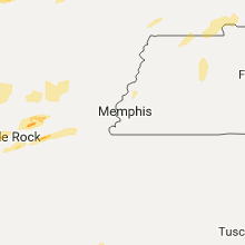
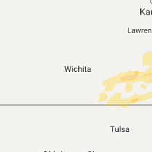
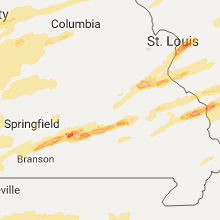
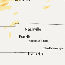
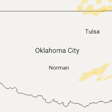
Hail Map for Tuesday, February 28, 2017

Number of Impacted Households on 2/28/2017
0
Impacted by 1" or Larger Hail
0
Impacted by 1.75" or Larger Hail
0
Impacted by 2.5" or Larger Hail
Square Miles of Populated Area Impacted on 2/28/2017
0
Impacted by 1" or Larger Hail
0
Impacted by 1.75" or Larger Hail
0
Impacted by 2.5" or Larger Hail


Cities Most Affected by Hail Storms of 2/28/2017
| Hail Size | Demographics of Zip Codes Affected | ||||||
|---|---|---|---|---|---|---|---|
| City | Count | Average | Largest | Pop Density | House Value | Income | Age |
| Galva, IL | 3 | 2.33 | 2.50 | 42 | $62k | $36.5k | 42.2 |
| Chanute, KS | 3 | 1.83 | 2.00 | 60 | $45k | $32.2k | 39.4 |
| Roland, AR | 1 | 4.50 | 4.50 | 36 | $100k | $45.3k | 46.0 |
| Harrisonville, MO | 2 | 2.25 | 2.50 | 122 | $91k | $44.7k | 38.7 |
| Sterling, IL | 2 | 1.88 | 2.00 | 179 | $78k | $40.8k | 40.4 |
| Collinsville, IL | 2 | 1.75 | 1.75 | 929 | $86k | $43.9k | 37.4 |
| Red Bud, IL | 2 | 1.75 | 1.75 | 65 | $95k | $46.0k | 41.7 |
| Edwardsville, IL | 2 | 1.75 | 1.75 | 293 | $106k | $51.7k | 34.3 |
| Columbus, KS | 2 | 1.75 | 1.75 | 24 | $46k | $29.6k | 41.2 |
| Benton, IL | 1 | 3.00 | 3.00 | 114 | $52k | $29.3k | 43.4 |
| Johnston City, IL | 1 | 3.00 | 3.00 | 222 | $42k | $30.4k | 40.9 |
| Ottawa, IL | 1 | 2.75 | 2.75 | 161 | $92k | $39.2k | 41.7 |
| Beebe, AR | 1 | 2.00 | 2.00 | 134 | $78k | $37.4k | 35.0 |
| Troy, IL | 1 | 2.00 | 2.00 | 474 | $111k | $58.9k | 37.2 |
| Imperial, MO | 1 | 1.75 | 1.75 | 844 | $110k | $52.4k | 35.3 |
| Oak Grove, MO | 1 | 1.75 | 1.75 | 225 | $90k | $47.6k | 36.5 |
| Cook Sta, MO | 1 | 1.75 | 1.75 | 9 | $68k | $29.3k | 44.4 |
| Mcalester, OK | 1 | 1.75 | 1.75 | 50 | $58k | $30.5k | 39.9 |
| Grand Tower, IL | 1 | 1.75 | 1.75 | 14 | $34k | $30.5k | 41.4 |
| Cabool, MO | 1 | 1.75 | 1.75 | 21 | $56k | $25.6k | 44.1 |
| Frankfort, IL | 1 | 1.75 | 1.75 | 870 | $191k | $74.8k | 39.8 |
| Maryville, IL | 1 | 1.75 | 1.75 | 1263 | $107k | $55.4k | 39.8 |
| Glen Carbon, IL | 1 | 1.75 | 1.75 | 982 | $127k | $57.1k | 37.4 |
| Jackson, MO | 1 | 1.75 | 1.75 | 147 | $100k | $42.1k | 38.5 |
| Caney, KS | 1 | 1.75 | 1.75 | 57 | $45k | $33.1k | 39.6 |
| Shelbyville, IL | 1 | 1.75 | 1.75 | 61 | $71k | $37.0k | 44.7 |
| Cadet, MO | 1 | 1.75 | 1.75 | 68 | $50k | $27.6k | 36.8 |
| La Moille, IL | 1 | 1.75 | 1.75 | 12 | $86k | $39.4k | 42.4 |
| Flossmoor, IL | 1 | 1.75 | 1.75 | 2355 | $216k | $94.7k | 45.1 |
| Sparta, MO | 1 | 1.75 | 1.75 | 62 | $80k | $31.6k | 36.9 |
| Princeville, IL | 1 | 1.75 | 1.75 | 31 | $89k | $47.6k | 39.6 |
| Winchester, IL | 1 | 1.75 | 1.75 | 20 | $64k | $36.1k | 43.5 |
| Saint Louis, MO | 1 | 1.75 | 1.75 | 6221 | $48k | $23.5k | 34.8 |
Hail and Wind Damage Spotted on 2/28/2017
Filter by Report Type:Hail ReportsWind Reports
States Impacted
Wisconsin, Missouri, Illinois, Iowa, Arkansas, Indiana, Ohio, Michigan, Kansas, Kentucky, Oklahoma, TennesseeWisconsin
| Local Time | Report Details |
|---|---|
| 9:42 AM CST | Quarter sized hail reported near Sun Prairie, WI, 10.8 miles NE of Madison, WI |
| 10:32 AM CST | Quarter sized hail reported near Hartford, WI, 53.4 miles ENE of Madison, WI, hail observed 3 mi south of hwy 33 on county p. |
| 11:02 AM CST | Quarter sized hail reported near Cedar Grove, WI, 65.8 miles S of Green Bay, WI, . |
| 11:05 AM CST | Quarter sized hail reported near Random Lake, WI, 66.5 miles S of Green Bay, WI, . |
Missouri
| Local Time | Report Details |
|---|---|
| 11:22 AM CST | Quarter sized hail reported near Warsaw, MO, 76.2 miles SW of Columbia, MO, . |
| 2:35 PM CST | Quarter sized hail reported near Salem, MO, 9.9 miles NNW of Salem, MO, 1.00 hail reported by the public in hobson heights. time estimated based on radar. |
| 2:44 PM CST | Golf Ball sized hail reported near Cook Sta, MO, 13 miles NNE of Salem, MO, video from viewer. |
| 2:50 PM CST | Quarter sized hail reported near Steelville, MO, 18.7 miles NNE of Salem, MO |
| 3:25 PM CST | Quarter sized hail reported near Potosi, MO, 41.7 miles NE of Salem, MO |
| 3:35 PM CST | Ping Pong Ball sized hail reported near Salem, MO, 12.7 miles SW of Salem, MO, . |
| 3:40 PM CST | Golf Ball sized hail reported near Cadet, MO, 51.1 miles SSW of Saint Louis, MO |
| 3:50 PM CST | Quarter sized hail reported near Aurora, MO, 36.9 miles SW of Springfield, MO, 1.00" hail reported in jenkins... mo via public on facebook. |
| 3:50 PM CST | Quarter sized hail reported near Salem, MO, 0.9 miles NNW of Salem, MO, 1.00" hail reported by the public and relayed by the media. |
| 3:50 PM CST | Half Dollar sized hail reported near Salem, MO, 0.9 miles NNW of Salem, MO, 1.25" size hail observed in salem. report via public. |
| 3:53 PM CST | Quarter sized hail reported near Galena, MO, 29.2 miles SSW of Springfield, MO, corrected time. picture from social media. |
| 3:55 PM CST | Quarter sized hail reported near De Soto, MO, 43.7 miles SSW of Saint Louis, MO, public report relayed via the media from valles mines |
| 3:57 PM CST | Quarter sized hail reported near Crane, MO, 27.1 miles SSW of Springfield, MO, corrected for time. deputies reporting 1.00" hail east of elsey on hwy a. . |
| 4:02 PM CST | Quarter sized hail reported near Crane, MO, 27.1 miles SSW of Springfield, MO, deputies reporting 1.00" hail east of elsey on hwy a. . |
| 4:05 PM CST | Ping Pong Ball sized hail reported near Highlandville, MO, 19.9 miles S of Springfield, MO, 1.50" hail reported between 4:05 and 4:10 pm by the public. . |
| 4:10 PM CST | Quarter sized hail reported near Elsberry, MO, 49.1 miles NW of Saint Louis, MO |
| 4:10 PM CST | 12" limb blown down... also had dime size hail. time estimated based on radar. received via skywar in christian county MO, 17.2 miles S of Springfield, MO |
| 4:10 PM CST | 4" tree limb blown down and 12 " tree blown over at bradley street and kentling streets in highlandville. relayed via skywar in christian county MO, 19.3 miles S of Springfield, MO |
| 4:15 PM CST | Quarter sized hail reported near Sparta, MO, 18.6 miles SE of Springfield, MO, delayed report. 1.00in hail reported at south lane sparta...mo. home had hail damage with holes in siding. |
| 4:20 PM CST | Golf Ball sized hail reported near Sparta, MO, 21.6 miles SE of Springfield, MO, public reported dime to golf ball size hail. via facebook pictures. |
| 4:35 PM CST | Quarter sized hail reported near Seymour, MO, 29.1 miles E of Springfield, MO, numerous reports of dime to quarter size hail covering highway 60 around seymour causing travel impacts |
| 4:43 PM CST | Half Dollar sized hail reported near Galena, MO, 29.2 miles SSW of Springfield, MO, picture from social media |
| 4:50 PM CST | Ping Pong Ball sized hail reported near Mansfield, MO, 39.9 miles E of Springfield, MO, live video of the hail from storm chaser cam |
| 4:51 PM CST | Quarter sized hail reported near Richwoods, MO, 46.6 miles SW of Saint Louis, MO |
| 4:58 PM CST | Ping Pong Ball sized hail reported near Hillsboro, MO, 32.4 miles SW of Saint Louis, MO |
| 5:02 PM CST | Quarter sized hail reported near Graff, MO, 46.8 miles WSW of Salem, MO, . |
| 5:08 PM CST | Golf Ball sized hail reported near Imperial, MO, 22.4 miles SW of Saint Louis, MO |
| 5:09 PM CST | Half Dollar sized hail reported near Barnhart, MO, 22.3 miles SW of Saint Louis, MO, based off of a picture from facebook |
| 5:10 PM CST | Quarter sized hail reported near Arnold, MO, 18.2 miles SSW of Saint Louis, MO |
| 5:15 PM CST | Golf Ball sized hail reported near Cabool, MO, 40.9 miles SW of Salem, MO, picture from social media of golf ball size hail near bado missouri. |
| 5:16 PM CST | Quarter sized hail reported near Steelville, MO, 19.7 miles NNE of Salem, MO |
| 5:16 PM CST | Half Dollar sized hail reported near Cabool, MO, 47.4 miles SW of Salem, MO, live video from storm chaser on highway 60 showing at least half dollar size |
| 5:17 PM CST | Quarter sized hail reported near Mountain Grove, MO, 53 miles SW of Salem, MO, 1.00" size hail reported in mountain grove. via skywarn spotter. |
| 5:18 PM CST | Golf Ball sized hail reported near Saint Louis, MO, 6.9 miles SSW of Saint Louis, MO |
| 5:19 PM CST | Ping Pong Ball sized hail reported near Saint Louis, MO, 14.5 miles SSW of Saint Louis, MO |
| 5:20 PM CST | Ping Pong Ball sized hail reported near Saint Louis, MO, 11 miles SW of Saint Louis, MO |
| 5:24 PM CST | Quarter sized hail reported near Cadet, MO, 49.5 miles ENE of Salem, MO |
| 5:25 PM CST | Quarter sized hail reported near Festus, MO, 33.2 miles SSW of Saint Louis, MO |
| 5:25 PM CST | Quarter sized hail reported near Saint Louis, MO, 6.9 miles SSW of Saint Louis, MO |
| 5:53 PM CST | Quarter sized hail reported near Blue Springs, MO, 17.3 miles ESE of Kansas City, MO |
| 5:54 PM CST | Quarter sized hail reported near Blue Springs, MO, 17.3 miles ESE of Kansas City, MO, reported at i-70 and woods chapel |
| 5:59 PM CST | Quarter sized hail reported near Lees Summit, MO, 17.2 miles SE of Kansas City, MO, reported via social media |
| 6:00 PM CST | Golf Ball sized hail reported near Oak Grove, MO, 25.2 miles ESE of Kansas City, MO |
| 6:05 PM CST | Quarter sized hail reported near Salem, MO, 19.3 miles SSE of Salem, MO, dime to quarter size hail covered the ground and lasted for about 15 minutes near shannondale community church on highway 19. |
| 6:21 PM CST | Quarter sized hail reported near Lexington, MO, 36.9 miles E of Kansas City, MO |
| 6:45 PM CST | Several trees down across highway 21 northwest of lestervill in reynolds county MO, 37.2 miles ESE of Salem, MO |
| 7:05 PM CST | Quarter sized hail reported near Miami, MO, 52.3 miles WNW of Columbia, MO, brief period of quarter size hail |
| 7:52 PM CST | Half Dollar sized hail reported near Moberly, MO, 33.4 miles N of Columbia, MO |
| 7:54 PM CST | Quarter sized hail reported near Lone Jack, MO, 29.7 miles ESE of Kansas City, MO |
| 7:54 PM CST | Quarter sized hail reported near Lone Jack, MO, 31.5 miles ESE of Kansas City, MO |
| 7:56 PM CST | Ping Pong Ball sized hail reported near Lone Jack, MO, 30.8 miles ESE of Kansas City, MO, reported by kshb meteorologist chasing. observed at highway 50 and state highway z. |
| 8:01 PM CST | Power flashed viewed just north of perryville along interstate 55 in perry county MO, 36.3 miles NNW of Cape Girardeau, MO |
| 8:11 PM CST | Half Dollar sized hail reported near Shelbina, MO, 48.7 miles NNE of Columbia, MO |
| 8:17 PM CST | Quarter sized hail reported near Higginsville, MO, 46.7 miles E of Kansas City, MO |
| 8:30 PM CST | Quarter sized hail reported near Monroe City, MO, 53.2 miles S of Kahoka, MO |
| 8:30 PM CST | Storm damage reported in monroe county MO, 53.2 miles S of Kahoka, MO |
| 8:46 PM CST | Quarter sized hail reported near Hannibal, MO, 52.2 miles SSE of Kahoka, MO |
| 8:50 PM CST | Quarter sized hail reported near Hannibal, MO, 52.2 miles SSE of Kahoka, MO |
| 8:53 PM CST | Quarter sized hail reported near Drexel, MO, 43 miles S of Kansas City, MO |
| 8:53 PM CST | Ping Pong Ball sized hail reported near Harrisonville, MO, 32.9 miles SSE of Kansas City, MO |
| 8:53 PM CST | Tennis Ball sized hail reported near Harrisonville, MO, 33.7 miles SSE of Kansas City, MO |
| 8:55 PM CST | Hen Egg sized hail reported near Harrisonville, MO, 33.7 miles SSE of Kansas City, MO |
| 9:00 PM CST | Quarter sized hail reported near Harrisonville, MO, 35 miles SSE of Kansas City, MO |
| 9:06 PM CST | Quarter sized hail reported near Pleasant Hill, MO, 34.6 miles SE of Kansas City, MO |
| 9:15 PM CST | Quarter sized hail reported near Harrisonville, MO, 42.8 miles SSE of Kansas City, MO, reported at 327th and i-49 |
| 9:20 PM CST | Quarter sized hail reported near Sweet Springs, MO, 58.5 miles W of Columbia, MO, quarter size hail reported via facebook. |
| 9:35 PM CST | Quarter sized hail reported near Garden City, MO, 45 miles SSE of Kansas City, MO |
| 9:35 PM CST | Ping Pong Ball sized hail reported near Warrensburg, MO, 52.2 miles ESE of Kansas City, MO |
| 9:49 PM CST | Half Dollar sized hail reported near Knob Noster, MO, 62.7 miles ESE of Kansas City, MO |
| 9:50 PM CST | Half Dollar sized hail reported near Adrian, MO, 50.1 miles SSE of Kansas City, MO, report via twitter of 1.25 inch hail in adrian. |
| 10:05 PM CST | Golf Ball sized hail reported near Jackson, MO, 14.6 miles NNW of Cape Girardeau, MO, reports of golf ball sized hail near pocahontas |
| 10:08 PM CST | Ping Pong Ball sized hail reported near Urich, MO, 54.4 miles SE of Kansas City, MO |
| 10:22 PM CST | Half Dollar sized hail reported near Green Ridge, MO, 60.8 miles WSW of Columbia, MO, report via twitter of hail slightly larger than quarter. |
| 10:26 PM CST | Quarter sized hail reported near Green Ridge, MO, 61 miles WSW of Columbia, MO, . |
| 10:30 PM CST | Quarter sized hail reported near Chilhowee, MO, 52.7 miles SE of Kansas City, MO, report of hail ranging in size from dimes to nickels to quarters. |
| 10:35 PM CST | Quarter sized hail reported near Sedalia, MO, 53.3 miles WSW of Columbia, MO, quarter size hail reported via facebook. |
| 11:00 PM CST | Quarter sized hail reported near Deerfield, MO, 52.7 miles ENE of Chanute, KS, 1 inch hail in deerfield. |
| 11:03 PM CST | Quarter sized hail reported near Clinton, MO, 67 miles SE of Kansas City, MO, . |
| 11:05 PM CST | Quarter sized hail reported near Sedalia, MO, 47.6 miles WSW of Columbia, MO, . |
| 11:06 PM CST | Quarter sized hail reported near Nevada, MO, 60.1 miles E of Chanute, KS, . |
| 11:06 PM CST | Half Dollar sized hail reported near Windsor, MO, 69.7 miles SE of Kansas City, MO, report via twitter of quarter to half dollar size hail. time estimated. |
| 11:15 PM CST | Quarter sized hail reported near Walker, MO, 68.5 miles ENE of Chanute, KS, . |
| 11:21 PM CST | Quarter sized hail reported near Columbia, MO, 0.3 miles SE of Columbia, MO, reported on the west side of columbia. |
| 11:22 PM CST | Quarter sized hail reported near Warsaw, MO, 76.2 miles SW of Columbia, MO, corrected time. |
| 11:42 PM CST | Quarter sized hail reported near Sheldon, MO, 63.1 miles WNW of Springfield, MO, . |
| 11:45 PM CST | Ping Pong Ball sized hail reported near Osceola, MO, 62.2 miles NNW of Springfield, MO, also had 40 to 50 mph wind gusts. |
| 11:53 PM CST | Quarter sized hail reported near Osceola, MO, 59.7 miles NNW of Springfield, MO, quarter size hail covering the highway south of osceola |
| 12:06 AM CST | Ping Pong Ball sized hail reported near Quincy, MO, 56.1 miles N of Springfield, MO, . |
| 12:10 AM CST | Quarter sized hail reported near Versailles, MO, 49.4 miles SSW of Columbia, MO, quarter size hail picture from twitter |
| 12:22 AM CST | Report of 55-60 mph winds and hail to the size of nickel in hickory county MO, 43 miles NNW of Springfield, MO |
| 12:25 AM CST | Trees down 3 miles north of greenfiel in dade county MO, 34.8 miles WNW of Springfield, MO |
| 12:25 AM CST | Quarter sized hail reported near Hermitage, MO, 46.3 miles N of Springfield, MO, winds 5o to 60 mph estimated |
| 12:30 AM CST | Quarter sized hail reported near Joplin, MO, 66.8 miles W of Springfield, MO, mping report. |
| 12:30 AM CST | Middle school roof was peeled off and blown away due to high wind gusts. in jasper county MO, 56.3 miles W of Springfield, MO |
| 12:31 AM CST | Quarter sized hail reported near Joplin, MO, 64.7 miles WSW of Springfield, MO, . |
| 12:38 AM CST | Tree limbs down on ww highwa in polk county MO, 27.2 miles NNW of Springfield, MO |
| 12:50 AM CST | Quarter sized hail reported near Osage Beach, MO, 57.5 miles SSW of Columbia, MO, quarter size hail reported and 50 to 55 mph winds measured |
| 1:00 AM CST | Reported wind damage at 01:00 during initial storm. tin from roof of barn was blown off contacted power lines breaking pole and debris impacted the mobile home. in laclede county MO, 32 miles NE of Springfield, MO |
| 1:05 AM CST | Quarter sized hail reported near Mount Vernon, MO, 30.1 miles WSW of Springfield, MO, . |
| 1:07 AM CST | Garage blown apart due to high winds on pritchett roa in camden county MO, 59.1 miles WNW of Salem, MO |
| 1:17 AM CST | Quarter sized hail reported near Fair Grove, MO, 14.5 miles NNE of Springfield, MO, . |
| 1:18 AM CST | Medium size trees blown down blocking farm road 209 near fair grove in greene county MO, 14.1 miles NNE of Springfield, MO |
| 1:19 AM CST | Quarter sized hail reported near Billings, MO, 17.2 miles SW of Springfield, MO, reported by billings pd via christian county dispatch. |
| 1:22 AM CST | Quarter sized hail reported near Brookline, MO, 7.5 miles SW of Springfield, MO, . |
| 1:22 AM CST | Quarter sized hail reported near Purdy, MO, 43.9 miles SW of Springfield, MO, . |
| 1:24 AM CST | 60 mph wind gust measured at ktbn awos in pulaski county MO, 34.6 miles W of Salem, MO |
| 1:28 AM CST | Tree down across highway 28. dime size hail also reporte in pulaski county MO, 34.2 miles WNW of Salem, MO |
| 1:34 AM CST | Storm damage reported in pulaski county MO, 34.6 miles W of Salem, MO |
| 1:35 AM CST | Quarter sized hail reported near Niangua, MO, 28.3 miles ENE of Springfield, MO, . |
| 2:08 AM CST | Quarter sized hail reported near Hartville, MO, 43.2 miles E of Springfield, MO, . |
| 2:24 AM CST | Small limbs down with estimated 65 mph wind gusts west of av in douglas county MO, 36.8 miles ESE of Springfield, MO |
| 2:32 AM CST | Severe thunderstorm wind gusts downed a large tree in downtown branso in taney county MO, 39.4 miles S of Springfield, MO |
| 2:38 AM CST | Severe thunderstorm wind gusts downed trees along highway 160 east of forsyth in taney county MO, 38 miles SSE of Springfield, MO |
| 2:48 AM CST | Small tree limbs down in drur in douglas county MO, 57 miles ESE of Springfield, MO |
| 2:58 AM CST | Severe thunderstorm wind gusts knocked down several power lines in summersvill in texas county MO, 32.2 miles SSW of Salem, MO |
| 2:59 AM CST | Severe thunderstorm wind gusts damaged a roof of a grocery store in willow spring in howell county MO, 50.6 miles SSW of Salem, MO |
| 3:03 AM CST | Small limbs down. power outage also reporte in oregon county MO, 77 miles S of Salem, MO |
| 4:09 AM CST | Storm damage reported in butler county MO, 60.7 miles SW of Cape Girardeau, MO |
| 4:10 AM CST | Storm damage reported in butler county MO, 60.7 miles SW of Cape Girardeau, MO |
| 4:10 AM CST | Observed by davis weather station near broseley in butler county MO, 59.4 miles SW of Cape Girardeau, MO |
| 4:17 AM CST | Observed by davis weather station in dexter in stoddard county MO, 42.2 miles SSW of Cape Girardeau, MO |
| 4:25 AM CST | Storm damage reported in dunklin county MO, 54.4 miles SSW of Cape Girardeau, MO |
| 4:37 AM CST | Measured at cape girardeau airport asos in cape girardeau county MO, 1.8 miles SSW of Cape Girardeau, MO |
Illinois
| Local Time | Report Details |
|---|---|
| 3:25 PM CST | Quarter sized hail reported near Dallas City, IL, 33.9 miles ENE of Kahoka, MO, started as pea sized and increased to quarter. hail fell for 2 mintues. |
| 3:40 PM CST | Quarter sized hail reported near La Harpe, IL, 41.4 miles ENE of Kahoka, MO, 3 to 4 mile long swath of 1 inch hail covering highway 94. |
| 3:40 PM CST | 1 inch branch down along highway 9 in hancock county IL, 41.4 miles ENE of Kahoka, MO |
| 4:10 PM CST | Half Dollar sized hail reported near Altona, IL, 42.1 miles NW of Peoria, IL, . |
| 4:15 PM CST | Hen Egg sized hail reported near Galva, IL, 40.6 miles NW of Peoria, IL, golfball to slightly bigger right now. duration 3 minutes so far. |
| 4:15 PM CST | Tennis Ball sized hail reported near Galva, IL, 40.6 miles NW of Peoria, IL, esda confirms 2 to 2.5 inch hail 415 to 419 pm. |
| 4:18 PM CST | Quarter sized hail reported near Grafton, IL, 29.2 miles NNW of Saint Louis, MO, report came from dow |
| 4:20 PM CST | Tennis Ball sized hail reported near Galva, IL, 40 miles NW of Peoria, IL, mostly quarter to half dollar sized. |
| 4:40 PM CST | Golf Ball sized hail reported near Winchester, IL, 65.5 miles N of Saint Louis, MO, . |
| 4:42 PM CST | Half Dollar sized hail reported near Granville, IL, 43.9 miles NNE of Peoria, IL |
| 4:44 PM CST | Quarter sized hail reported near Chadwick, IL, 83.3 miles SSW of Madison, WI, up to size of quarters. |
| 4:45 PM CST | Baseball sized hail reported near Ottawa, IL, 59.9 miles NE of Peoria, IL, reported on social media. |
| 4:54 PM CST | Hen Egg sized hail reported near Sterling, IL, 76.6 miles N of Peoria, IL, few stones up to hen egg. |
| 4:58 PM CST | Golf Ball sized hail reported near Princeville, IL, 18.7 miles NNW of Peoria, IL, . |
| 4:58 PM CST | Golf Ball sized hail reported near Sterling, IL, 76.5 miles N of Peoria, IL, largest slightly larger than golf balls. |
| 5:04 PM CST | Quarter sized hail reported near Yates City, IL, 24.7 miles WNW of Peoria, IL, . |
| 5:04 PM CST | Quarter sized hail reported near Edelstein, IL, 16.6 miles N of Peoria, IL, . |
| 5:08 PM CST | Quarter sized hail reported near Warren, IL, 50.6 miles SW of Madison, WI, hail occurred 508 to 509 pm. |
| 5:09 PM CST | Lighthouse road to lowden road. buildings destroyed... large trees uprooted... siding taken off houses. time estimated from rada in ogle county IL, 73.4 miles S of Madison, WI |
| 5:13 PM CST | Quarter sized hail reported near Dixon, IL, 80.1 miles N of Peoria, IL |
| 5:15 PM CST | Quarter sized hail reported near Chillicothe, IL, 16.4 miles NNE of Peoria, IL |
| 5:25 PM CST | Half Dollar sized hail reported near East Saint Louis, IL, 4.8 miles SSE of Saint Louis, MO |
| 5:35 PM CST | Half Dollar sized hail reported near Shorewood, IL, 38.6 miles SW of Chicago, IL |
| 5:35 PM CST | Trees and powerlines down blocking roads...siding damage on a house near il route 157 and horseshoe lake d in madison county IL, 11.4 miles ENE of Saint Louis, MO |
| 5:35 PM CST | Golf Ball sized hail reported near Collinsville, IL, 11.4 miles ENE of Saint Louis, MO |
| 5:37 PM CST | Half Dollar sized hail reported near Maryville, IL, 14.7 miles ENE of Saint Louis, MO |
| 5:37 PM CST | Quarter sized hail reported near Collinsville, IL, 11.4 miles ENE of Saint Louis, MO |
| 5:38 PM CST | Quarter sized hail reported near Fults, IL, 27.5 miles S of Saint Louis, MO |
| 5:39 PM CST | Golf Ball sized hail reported near Maryville, IL, 14.7 miles ENE of Saint Louis, MO |
| 5:39 PM CST | Quarter sized hail reported near Joliet, IL, 35.1 miles SW of Chicago, IL, larkin and black road |
| 5:40 PM CST | Quarter sized hail reported near Edwardsville, IL, 13.7 miles NE of Saint Louis, MO |
| 5:40 PM CST | Quarter sized hail reported near Maryville, IL, 14.7 miles ENE of Saint Louis, MO |
| 5:40 PM CST | Golf Ball sized hail reported near Glen Carbon, IL, 15.4 miles NE of Saint Louis, MO |
| 5:40 PM CST | Golf Ball sized hail reported near Edwardsville, IL, 18 miles NE of Saint Louis, MO, east side of town at i-55 and governors parkway....ping pong up to golfball sized for about two minutes. |
| 5:40 PM CST | Hen Egg sized hail reported near Troy, IL, 18.2 miles ENE of Saint Louis, MO, on north side of town |
| 5:40 PM CST | Ping Pong Ball sized hail reported near Glen Carbon, IL, 15.4 miles NE of Saint Louis, MO |
| 5:44 PM CST | Antenna mast of 1 5/8 inch diameter bent over in will county IL, 32.9 miles SW of Chicago, IL |
| 5:45 PM CST | Golf Ball sized hail reported near Edwardsville, IL, 19.6 miles NE of Saint Louis, MO |
| 5:47 PM CST | Half Dollar sized hail reported near Plainfield, IL, 35.7 miles SW of Chicago, IL, south lily cache road... plainfield |
| 5:49 PM CST | Golf Ball sized hail reported near Collinsville, IL, 11.4 miles ENE of Saint Louis, MO |
| 5:50 PM CST | Quarter sized hail reported near Marine, IL, 25.3 miles ENE of Saint Louis, MO |
| 5:50 PM CST | Power lines down in trailer par in madison county IL, 9.9 miles NE of Saint Louis, MO |
| 5:55 PM CST | Trees and powerlines down blocking roads in madison county IL, 11.4 miles ENE of Saint Louis, MO |
| 5:55 PM CST | Trees and powerlines down blocking roads in madison county IL, 11.4 miles ENE of Saint Louis, MO |
| 5:56 PM CST | Quarter sized hail reported near Fults, IL, 32.3 miles S of Saint Louis, MO |
| 5:56 PM CST | Quarter sized hail reported near Romeoville, IL, 28.6 miles SW of Chicago, IL, weber road and taylor road |
| 6:00 PM CST | Ping Pong Ball sized hail reported near Red Bud, IL, 25.3 miles SSE of Saint Louis, MO |
| 6:00 PM CST | Golf Ball sized hail reported near Red Bud, IL, 25.3 miles SSE of Saint Louis, MO |
| 6:01 PM CST | Ping Pong Ball sized hail reported near Glen Carbon, IL, 15.4 miles NE of Saint Louis, MO |
| 6:05 PM CST | Quarter sized hail reported near Shorewood, IL, 38.6 miles SW of Chicago, IL, silo road and sarver |
| 6:11 PM CST | Ping Pong Ball sized hail reported near New Athens, IL, 27.4 miles SE of Saint Louis, MO |
| 6:12 PM CST | Quarter sized hail reported near Alsip, IL, 15.8 miles SSW of Chicago, IL |
| 6:13 PM CST | Ping Pong Ball sized hail reported near Red Bud, IL, 30.8 miles SSE of Saint Louis, MO |
| 6:25 PM CST | Golf Ball sized hail reported near Red Bud, IL, 31.4 miles SSE of Saint Louis, MO |
| 6:30 PM CST | Tree down blocking road in monroe county IL, 25.3 miles SSE of Saint Louis, MO |
| 6:30 PM CST | Metal pole barn levele in will county IL, 35.1 miles SW of Chicago, IL |
| 6:41 PM CST | Window blown out of house. 175th and dixie in homewoo in cook county IL, 22.4 miles S of Chicago, IL |
| 6:45 PM CST | Golf Ball sized hail reported near Shelbyville, IL, 23.2 miles WSW of Mattoon, IL |
| 7:19 PM CST | Quarter sized hail reported near Centralia, IL, 58.4 miles E of Saint Louis, MO |
| 8:01 PM CST | Quarter sized hail reported near Xenia, IL, 59.8 miles SSW of Mattoon, IL |
| 8:07 PM CST | Half Dollar sized hail reported near Xenia, IL, 61.3 miles SSW of Mattoon, IL |
| 8:12 PM CST | Quarter sized hail reported near Galva, IL, 40.6 miles NW of Peoria, IL |
| 8:35 PM CST | Golf Ball sized hail reported near La Moille, IL, 60 miles NNE of Peoria, IL, quarter size hail that increased to golf ball size. report via social media and forwarded by wfo chicago |
| 8:48 PM CST | Quarter sized hail reported near Frankfort, IL, 28.6 miles SSW of Chicago, IL |
| 8:50 PM CST | Golf Ball sized hail reported near Frankfort, IL, 28.6 miles SSW of Chicago, IL |
| 8:53 PM CST | Golf Ball sized hail reported near Flossmoor, IL, 25.3 miles S of Chicago, IL |
| 8:55 PM CST | Quarter sized hail reported near Mendota, IL, 64 miles NNE of Peoria, IL |
| 8:55 PM CST | Quarter sized hail reported near Payson, IL, 48.6 miles SSE of Kahoka, MO |
| 8:55 PM CST | 60 mph wind and pea size hail in cook county IL, 22.4 miles S of Chicago, IL |
| 9:00 PM CST | Half Dollar sized hail reported near Frankfort, IL, 28.6 miles SSW of Chicago, IL, st. francis road and rt. 30 |
| 9:15 PM CST | Tea Cup sized hail reported near Benton, IL, 60.2 miles NE of Cape Girardeau, MO, 3 inch diameter hail reported. |
| 9:15 PM CST | Quarter sized hail reported near West Frankfort, IL, 53.2 miles NE of Cape Girardeau, MO, quarter size hail reported. |
| 9:30 PM CST | Several mobile homes overturned in brown county IL, 67.4 miles ESE of Kahoka, MO |
| 9:42 PM CST | Quarter sized hail reported near Orland Park, IL, 22 miles SSW of Chicago, IL |
| 9:45 PM CST | Quarter sized hail reported near Beardstown, IL, 64.7 miles SW of Peoria, IL |
| 9:47 PM CST | Quarter sized hail reported near Alsip, IL, 15.8 miles SSW of Chicago, IL |
| 9:53 PM CST | Semi blown over near i-80 and i-39. time estimated by rada in la salle county IL, 53.4 miles NNE of Peoria, IL |
| 10:00 PM CST | Quarter sized hail reported near Crossville, IL, 29.8 miles WNW of Evansville, IN, quarter sized hail in town |
| 10:09 PM CST | Tazewell county eoc measure in tazewell county IL, 11.9 miles SSE of Peoria, IL |
| 10:12 PM CST | Storm damage reported in la salle county IL, 65.8 miles NE of Peoria, IL |
| 10:12 PM CST | Large tree blocking roods rd. power lines also damage in kendall county IL, 53.6 miles WSW of Chicago, IL |
| 10:12 PM CST | Quarter sized hail reported near Oakford, IL, 45.6 miles SSW of Peoria, IL |
| 10:18 PM CST | Golf Ball sized hail reported near Grand Tower, IL, 23.4 miles N of Cape Girardeau, MO, golf ball size hail reported. |
| 10:25 PM CST | Semi blown over on i74 in woodford county IL, 15.4 miles ESE of Peoria, IL |
| 10:29 PM CST | Quarter sized hail reported near Carbondale, IL, 33.9 miles NNE of Cape Girardeau, MO, quarter size hail reported. |
| 10:56 PM CST | Tea Cup sized hail reported near Johnston City, IL, 49.1 miles NE of Cape Girardeau, MO |
| 12:45 AM CST | Em reports multiple power lines and large tree limbs downed throughout the cit in vermilion county IL, 60.7 miles NE of Mattoon, IL |
| 2:10 AM CST | Storm damage reported in st. clair county IL, 4.2 miles SE of Saint Louis, MO |
| 2:22 AM CST | Storm damage reported in st. clair county IL, 19.7 miles ESE of Saint Louis, MO |
| 2:44 AM CST | Multiple trees and power lines down across the are in st. clair county IL, 22.6 miles ESE of Saint Louis, MO |
| 4:20 AM CST | Quarter sized hail reported near Murphysboro, IL, 34.1 miles NNE of Cape Girardeau, MO |
Iowa
| Local Time | Report Details |
|---|---|
| 3:55 PM CST | Quarter sized hail reported near Camanche, IA, 73 miles E of Cedar Rapids, IA, dime to quarter |
| 3:55 PM CST | Half Dollar sized hail reported near Iowa City, IA, 22.9 miles SSE of Cedar Rapids, IA |
| 4:00 PM CST | Quarter sized hail reported near Iowa City, IA, 22.9 miles SSE of Cedar Rapids, IA, quarter size hail on southeast side of iowa city. |
| 4:01 PM CST | Quarter sized hail reported near Eldridge, IA, 60.8 miles ESE of Cedar Rapids, IA, one inch hail with some nickel sized hail. time estimated from radar. |
| 4:02 PM CST | Ping Pong Ball sized hail reported near West Branch, IA, 25.7 miles SE of Cedar Rapids, IA, 1.25 to 1.50 inch hail falling on i-80 |
| 4:14 PM CST | Quarter sized hail reported near West Liberty, IA, 35.3 miles SE of Cedar Rapids, IA, to size of quarters. |
| 4:18 PM CST | Quarter sized hail reported near Camanche, IA, 74 miles E of Cedar Rapids, IA, delayed report. a mixture of pea...nickel...and quarter sized hail. |
| 4:36 PM CST | Quarter sized hail reported near Oskaloosa, IA, 54.5 miles ESE of Des Moines, IA, trained spotter reported lots of small hail with a few measured 1 inch hail stones mixed in. |
| 4:38 PM CST | Quarter sized hail reported near Oskaloosa, IA, 53.2 miles ESE of Des Moines, IA, trained spotter reported 1 inch hail. |
| 5:18 PM CST | Quarter sized hail reported near Keswick, IA, 47.2 miles SW of Cedar Rapids, IA |
| 5:50 PM CST | Half Dollar sized hail reported near Iowa City, IA, 28.9 miles SSE of Cedar Rapids, IA, sized based on facebook photo. |
| 5:59 PM CST | Quarter sized hail reported near Riverside, IA, 30.3 miles SSE of Cedar Rapids, IA, continued through phone call. |
| 6:26 PM CST | Quarter sized hail reported near West Liberty, IA, 32.6 miles SE of Cedar Rapids, IA |
| 7:28 PM CST | Quarter sized hail reported near Donnellson, IA, 25.4 miles NNE of Kahoka, MO, one inch hail from 728 to 738 pm cst. |
| 7:49 PM CST | Quarter sized hail reported near New London, IA, 35.6 miles NNE of Kahoka, MO |
| 7:52 PM CST | Ping Pong Ball sized hail reported near New London, IA, 31.6 miles NNE of Kahoka, MO, delayed report. from social media. |
| 7:55 PM CST | Ping Pong Ball sized hail reported near Danville, IA, 37.2 miles NE of Kahoka, MO, from facebook picture. |
Arkansas
| Local Time | Report Details |
|---|---|
| 5:00 PM CST | Trees down on a hous in garland county AR, 41.7 miles W of Little Rock, AR |
| 5:40 PM CST | Quarter sized hail reported near Perryville, AR, 29.6 miles WNW of Little Rock, AR |
| 5:46 PM CST | Quarter sized hail reported near Bigelow, AR, 22.3 miles NW of Little Rock, AR |
| 5:49 PM CST | Ping Pong Ball sized hail reported near Roland, AR, 17 miles NW of Little Rock, AR |
| 5:55 PM CST | Softball sized hail reported near Roland, AR, 17 miles NW of Little Rock, AR |
| 6:15 PM CST | Quarter sized hail reported near Vilonia, AR, 23.1 miles N of Little Rock, AR |
| 7:00 PM CST | Hen Egg sized hail reported near Beebe, AR, 33.5 miles NE of Little Rock, AR |
| 7:00 PM CST | Several trees and powerlines down near highway 36 in white county AR, 42.9 miles NE of Little Rock, AR |
| 7:05 PM CST | Several trees and powerlines down as well damage to a couple of home in white county AR, 44.2 miles NE of Little Rock, AR |
| 12:53 AM CST | Storm damage reported in sebastian county AR, 1.3 miles ENE of Fort Smith, AR |
| 1:00 AM CST | Tree blown down on a hom in sebastian county AR, 1.3 miles ENE of Fort Smith, AR |
| 1:00 AM CST | Travel trailer blown ove in crawford county AR, 11.2 miles ENE of Fort Smith, AR |
| 1:15 AM CST | Trees and power lines down in tow in franklin county AR, 34.1 miles ENE of Fort Smith, AR |
| 1:40 AM CST | Tree blown down on a hom in crawford county AR, 18.4 miles N of Fort Smith, AR |
| 2:05 AM CST | 68 mph wind gust reporte in van buren county AR, 70.8 miles NNW of Little Rock, AR |
| 2:12 AM CST | Damage reported in and around marshall. roof...tree and building damage reported. the county barn was reported demolishe in searcy county AR, 82.7 miles NNW of Little Rock, AR |
| 2:15 AM CST | Tree downs and damage to homes reported in jerusalem and clevelan in conway county AR, 54.5 miles NW of Little Rock, AR |
| 2:30 AM CST | Trained storm spotter estimated winds in excess of 60 mph with trees down in the are in baxter county AR, 79.5 miles SE of Springfield, MO |
| 2:30 AM CST | Multiple trees down and outbuildings damaged. shingle damage to houses. sheet metal and other debris scattered aroun in van buren county AR, 49.7 miles N of Little Rock, AR |
| 2:45 AM CST | Roof damage reported to a hom in van buren county AR, 46.1 miles N of Little Rock, AR |
| 2:46 AM CST | Social media shows a large tree has fallen through a house in heber spring in cleburne county AR, 52.9 miles NNE of Little Rock, AR |
| 3:05 AM CST | Trees and powerlines down. a tree was reported on a hous in van buren county AR, 44.8 miles N of Little Rock, AR |
| 3:05 AM CST | Trees and powerlines down. a tree was reported on a hous in independence county AR, 75.3 miles NNE of Little Rock, AR |
| 3:05 AM CST | Oem director reported windows damaged... yawnings and tree limbs down throughout the area. personal weather instrument recorded 64 mph wind gus in fulton county AR, 92.9 miles S of Salem, MO |
| 3:10 AM CST | Social media report of trees and powerlines down in hard in sharp county AR, 90.9 miles S of Salem, MO |
| 3:20 AM CST | Roof blown off of a home in ravenden in lawrence county AR, 97.6 miles S of Salem, MO |
| 3:20 AM CST | A u-haul trailer was blown down in lawrence county AR, 96.4 miles NW of Memphis, TN |
| 3:23 AM CST | Social media report of trees and powerlines dow in independence county AR, 86.7 miles WNW of Memphis, TN |
| 3:23 AM CST | Estimated wind gust of 60 mph just north of bald kno in white county AR, 57.1 miles NE of Little Rock, AR |
| 3:25 AM CST | Reports of several houses damaged and powerlines down in the are in jackson county AR, 76.6 miles WNW of Memphis, TN |
| 3:25 AM CST | Law enforcement reported several trailers have been flipped ove in jackson county AR, 71.9 miles WNW of Memphis, TN |
| 3:25 AM CST | Personal instrument owned by public recorded 63 mph wind gus in stone county AR, 78.2 miles N of Little Rock, AR |
| 3:25 AM CST | Carport blown off and trees dow in randolph county AR, 93.1 miles S of Salem, MO |
| 3:35 AM CST | Hanger door blown in at walnut ridge regional airpor in lawrence county AR, 83.5 miles NW of Memphis, TN |
| 3:35 AM CST | Wind gust reported at walnut ridge airpor in lawrence county AR, 81.6 miles NW of Memphis, TN |
| 3:45 AM CST | Measured on a weather station in poinsett county AR, 59.1 miles NW of Memphis, TN |
| 3:50 AM CST | Wind gusts at jonesboro airport in craighead county AR, 58.7 miles NW of Memphis, TN |
| 3:55 AM CST | Wind gust measured at corning airport in clay county AR, 84.5 miles SW of Cape Girardeau, MO |
| 4:05 AM CST | A tin roof was blown off of a vacant building. a home lost shingles on their roo in craighead county AR, 53.6 miles NNW of Memphis, TN |
| 4:15 AM CST | A large tree fell on a mobile home trapping a perso in poinsett county AR, 29.3 miles NW of Memphis, TN |
| 4:29 AM CST | Wind gust measured at blytheville airport in mississippi county AR, 54.3 miles N of Memphis, TN |
| 4:49 AM CST | Quarter sized hail reported near Little Rock, AR, 0.3 miles WNW of Little Rock, AR |
| 4:50 AM CST | Quarter sized hail reported near North Little Rock, AR, 2.9 miles NE of Little Rock, AR |
| 5:01 AM CST | Quarter sized hail reported near Lonoke, AR, 22.3 miles E of Little Rock, AR |
Indiana
| Local Time | Report Details |
|---|---|
| 6:20 PM EST | Quarter sized hail reported near Huntington, IN, 21 miles WSW of Fort Wayne, IN, . |
| 6:29 PM EST | Quarter sized hail reported near Roanoke, IN, 16.8 miles WSW of Fort Wayne, IN, . |
| 6:34 PM EST | Quarter sized hail reported near Roanoke, IN, 10.8 miles WSW of Fort Wayne, IN, . |
| 6:35 PM EST | Quarter sized hail reported near Kendallville, IN, 25.2 miles NNW of Fort Wayne, IN, . |
| 6:37 PM EST | Half Dollar sized hail reported near Hudson, IN, 30 miles N of Fort Wayne, IN, . |
| 6:40 PM EST | Half Dollar sized hail reported near Hudson, IN, 31.4 miles N of Fort Wayne, IN, . |
| 6:48 PM EST | Quarter sized hail reported near Pleasant Lake, IN, 34.4 miles N of Fort Wayne, IN, . |
| 6:50 PM EST | Quarter sized hail reported near New Haven, IN, 5.7 miles ESE of Fort Wayne, IN, . |
| 6:36 PM CST | Storm damage reported in lake county IN, 17.8 miles SSE of Chicago, IL |
| 7:14 PM CST | Measured at michigan city c-man statio in lmz046 county IN, 38.6 miles ESE of Chicago, IL |
| 10:00 PM EST | Half Dollar sized hail reported near Mishawaka, IN, 68.7 miles NW of Fort Wayne, IN, . |
| 10:30 PM EST | Quarter sized hail reported near Shipshewana, IN, 49.8 miles NNW of Fort Wayne, IN, . |
| 10:30 PM EST | Ping Pong Ball sized hail reported near Shipshewana, IN, 48.6 miles NNW of Fort Wayne, IN, . |
| 10:33 PM EST | Storm damage reported in marion county IN, 8.1 miles WSW of Indianapolis, IN |
| 10:35 PM EST | Storm damage reported in boone county IN, 14.2 miles NNW of Indianapolis, IN |
| 11:00 PM EST | Half Dollar sized hail reported near Angola, IN, 42 miles N of Fort Wayne, IN, . |
| 11:05 PM EST | Storm damage reported in hamilton county IN, 14.4 miles NNE of Indianapolis, IN |
| 11:30 PM EST | Several trees downed across roads in southeast part of count in jay county IN, 51.6 miles SSE of Fort Wayne, IN |
| 12:10 AM EST | Numerous downed trees blocking roads and a large downed tree on a hom in dubois county IN, 43.3 miles NE of Evansville, IN |
| 12:23 AM EST | Quarter sized hail reported near Franklin, IN, 19.7 miles SSE of Indianapolis, IN |
| 12:24 AM EST | Quarter sized hail reported near Franklin, IN, 19.7 miles SSE of Indianapolis, IN |
| 11:42 PM CST | Storm damage reported in lmz046 county IN, 38.6 miles ESE of Chicago, IL |
| 11:55 PM CST | Storm damage reported in la porte county IN, 50.4 miles ESE of Chicago, IL |
| 11:59 PM CST | County road 900 north and state road 49... near the wheatfield fire station 3. 1 foot diameter tree snappe in jasper county IN, 59.6 miles SSE of Chicago, IL |
| 1:15 AM EST | Storm damage reported in st. joseph county IN, 70.1 miles E of Chicago, IL |
| 12:21 AM CST | Half Dollar sized hail reported near Haubstadt, IN, 15.4 miles N of Evansville, IN |
| 1:24 AM EST | Storm damage reported in st. joseph county IN, 68.8 miles NW of Fort Wayne, IN |
| 1:30 AM EST | Tree down across entire roa in marshall county IN, 65 miles WNW of Fort Wayne, IN |
| 1:35 AM EST | Storm damage reported in elkhart county IN, 62.4 miles NW of Fort Wayne, IN |
| 1:40 AM EST | Storm damage reported in elkhart county IN, 52.8 miles WNW of Fort Wayne, IN |
| 1:53 AM EST | Privacy fence blown ove in kosciusko county IN, 41.8 miles NW of Fort Wayne, IN |
| 1:54 AM EST | Storm damage reported in kosciusko county IN, 39.9 miles WNW of Fort Wayne, IN |
| 1:54 AM EST | Quarter sized hail reported near Huntingburg, IN, 38.6 miles ENE of Evansville, IN, with 60 mph wind speeds measured with anemometer. . |
| 1:54 AM EST | Power lines downe in kosciusko county IN, 40.9 miles WNW of Fort Wayne, IN |
| 1:55 AM EST | Storm damage reported in kosciusko county IN, 40.8 miles WNW of Fort Wayne, IN |
| 1:56 AM EST | Storm damage reported in kosciusko county IN, 41.6 miles WNW of Fort Wayne, IN |
| 2:00 AM EST | At nws iwx offic in kosciusko county IN, 37 miles WNW of Fort Wayne, IN |
| 2:00 AM EST | Tree downed on hous in kosciusko county IN, 35.9 miles WNW of Fort Wayne, IN |
| 2:05 AM EST | Utility lines down and power station on fire at 9th and north obrien... report and photo received from viewer by tv station then relayed to nws. time estimate in jackson county IN, 57.4 miles SSE of Indianapolis, IN |
| 2:18 AM EST | Storm damage reported in noble county IN, 28.5 miles NNW of Fort Wayne, IN |
| 2:19 AM EST | One large tree down and several smaller two inch limbs down in miami village are in whitley county IN, 17 miles WNW of Fort Wayne, IN |
| 2:20 AM EST | Reports of power outages in the are in whitley county IN, 20.5 miles W of Fort Wayne, IN |
| 2:22 AM EST | Storm damage reported in noble county IN, 20.3 miles NNW of Fort Wayne, IN |
| 2:27 AM EST | Several power lines downed in the are in de kalb county IN, 20.4 miles N of Fort Wayne, IN |
| 2:29 AM EST | Large tree down on roa in allen county IN, 11.5 miles N of Fort Wayne, IN |
| 2:30 AM EST | Roof of a business damaged as well as damage to the interior of the building. time estimated by radar. in allen county IN, 6.9 miles NNW of Fort Wayne, IN |
| 2:32 AM EST | Portion of roof blown of in allen county IN, 6.9 miles NNW of Fort Wayne, IN |
| 2:34 AM EST | Power lines dow in allen county IN, 13.4 miles NNE of Fort Wayne, IN |
| 2:34 AM EST | Tree on hous in allen county IN, 13.1 miles NNE of Fort Wayne, IN |
| 2:34 AM EST | Tree dow in allen county IN, 11.8 miles NNE of Fort Wayne, IN |
| 2:35 AM EST | Storm damage reported in allen county IN, 5.2 miles NNW of Fort Wayne, IN |
| 2:37 AM EST | Pine tree downe in allen county IN, 3.5 miles NNW of Fort Wayne, IN |
| 2:40 AM EST | Storm damage reported in allen county IN, 5.2 miles NNW of Fort Wayne, IN |
| 2:40 AM EST | Several trees downe in allen county IN, 14.1 miles NNE of Fort Wayne, IN |
| 3:34 AM EST | Tree dow in allen county IN, 11.8 miles NNE of Fort Wayne, IN |
| 4:17 AM EST | Tree damage along state road 47 report via twitte in boone county IN, 28.1 miles NNW of Indianapolis, IN |
| 5:32 AM EST | Storm damage reported in dubois county IN, 37.9 miles ENE of Evansville, IN |
| 6:11 AM EST | Tree on a house. time estimated from rada in clark county IN, 30.8 miles N of Louisville, KY |
| 6:39 AM EST | Quarter sized hail reported near Lawrenceburg, IN, 20.6 miles WNW of Cincinnati, OH |
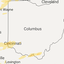
Ohio
| Local Time | Report Details |
|---|---|
| 7:15 PM EST | Quarter sized hail reported near Paulding, OH, 27.5 miles E of Fort Wayne, IN, . |
| 12:00 AM EST | Structural damage to modular home. roof damage and porch collapsed. time estimate in allen county OH, 56.7 miles ESE of Fort Wayne, IN |
| 12:00 AM EST | Downed tree and power lines. time estimate in allen county OH, 46.6 miles ESE of Fort Wayne, IN |
| 1:05 AM EST | Several trees dow in seneca county OH, 75.1 miles N of Columbus, OH |
| 1:51 AM EST | Storm damage reported in cuyahoga county OH, 10.5 miles SW of Cleveland, OH |
| 2:25 AM EST | Several trees dow in geauga county OH, 18.2 miles E of Cleveland, OH |
| 2:34 AM EST | Tree dow in ashtabula county OH, 39 miles E of Cleveland, OH |
| 2:35 AM EST | House destroyed. possible tornado. time estimate in highland county OH, 53 miles SSW of Columbus, OH |
| 3:04 AM EST | Storm damage reported in ross county OH, 36 miles S of Columbus, OH |
| 3:39 AM EST | Storm damage reported in lucas county OH, 82.4 miles ENE of Fort Wayne, IN |
| 3:43 AM EST | Tree fell on roof of residence on locust lake rd. roof missing on another structure on locust lake rd. time estimated by rada in clermont county OH, 15.2 miles ESE of Cincinnati, OH |
| 4:01 AM EST | Storm damage reported in hancock county OH, 76.6 miles NNW of Columbus, OH |
| 4:15 AM EST | Tree dow in medina county OH, 26.8 miles SSW of Cleveland, OH |
| 4:35 AM EST | Multiple trees down southern portion of the count in sandusky county OH, 75.2 miles W of Cleveland, OH |
| 4:53 AM EST | A shed was destroyed. time estimated by rada in pickaway county OH, 36.7 miles SSE of Columbus, OH |
| 6:01 AM EST | Multiple trees dow in medina county OH, 26.8 miles SSW of Cleveland, OH |
| 6:35 AM EST | Quarter sized hail reported near Harrison, OH, 18.2 miles WNW of Cincinnati, OH |
| 6:49 AM EST | Quarter sized hail reported near Cincinnati, OH, 10.1 miles NW of Cincinnati, OH |
Michigan
| Local Time | Report Details |
|---|---|
| 8:25 PM EST | Quarter sized hail reported near Three Oaks, MI, 53.1 miles E of Chicago, IL, . |
| 8:33 PM EST | Quarter sized hail reported near Galien, MI, 58.7 miles E of Chicago, IL, . |
| 8:50 PM EST | Multiple trees and power lines downed in area. largest was 1 foot in diamete in berrien county MI, 71.4 miles E of Chicago, IL |
| 9:00 PM EST | A few power poles downed on m5 in cass county MI, 71.7 miles SSW of Grand Rapids, MI |
| 9:05 PM EST | Several large trees downed along calvin center rd and brownsville s in cass county MI, 71.4 miles NW of Fort Wayne, IN |
| 9:18 PM EST | Large tree downed across roa in cass county MI, 64.7 miles NW of Fort Wayne, IN |
| 9:25 PM EST | Tree downed on power lin in st. joseph county MI, 61.7 miles NNW of Fort Wayne, IN |
| 9:40 PM EST | Report of tree downed on power lin in st. joseph county MI, 60.2 miles NNW of Fort Wayne, IN |
| 11:15 PM EST | Ping Pong Ball sized hail reported near Camden, MI, 49.8 miles NNE of Fort Wayne, IN, . |
| 11:42 PM EST | Downed tree in lenawee county MI, 66.2 miles NE of Fort Wayne, IN |
| 12:00 AM EST | Quarter sized hail reported near Ypsilanti, MI, 60.3 miles S of Flint, MI, measured 1 inch hail reported |
| 12:45 AM EST | Quarter sized hail reported near New Buffalo, MI, 46.4 miles E of Chicago, IL, . |
| 12:50 AM EST | Quarter sized hail reported near Union Pier, MI, 48.8 miles E of Chicago, IL, . |
Kansas
| Local Time | Report Details |
|---|---|
| 8:32 PM CST | Quarter sized hail reported near Louisburg, KS, 34.9 miles S of Kansas City, MO |
| 9:54 PM CST | Ping Pong Ball sized hail reported near Lacygne, KS, 52.8 miles S of Kansas City, MO |
| 10:00 PM CST | Golf Ball sized hail reported near Chanute, KS, 1 miles SSW of Chanute, KS |
| 10:12 PM CST | Golf Ball sized hail reported near Chanute, KS, 1 miles SSW of Chanute, KS, via twitter. hail partially covered the ground. time adjusted for radar. |
| 10:17 PM CST | Ping Pong Ball sized hail reported near Chanute, KS, 1 miles SSW of Chanute, KS, from chanute tribune |
| 10:31 PM CST | Trees blown down and blocking roads...poles blown down. a garage down was blown in and damag in crawford county KS, 20.8 miles ESE of Chanute, KS |
| 10:34 PM CST | Quarter sized hail reported near Buffalo, KS, 13.7 miles W of Chanute, KS |
| 10:44 PM CST | Hen Egg sized hail reported near Chanute, KS, 1 miles SSW of Chanute, KS, via twitter. |
| 10:50 PM CST | Half Dollar sized hail reported near Fort Scott, KS, 42 miles ENE of Chanute, KS, . |
| 10:50 PM CST | Golf Ball sized hail reported near Caney, KS, 53.3 miles SSW of Chanute, KS, delayed report relayed via coffeyville police department. |
| 10:52 PM CST | Quarter sized hail reported near Caney, KS, 52.1 miles SSW of Chanute, KS, via twitter. |
| 10:54 PM CST | Quarter sized hail reported near Fort Scott, KS, 42 miles ENE of Chanute, KS, 1.00inch hail in fort scott kansas. |
| 11:19 PM CST | Quarter sized hail reported near Girard, KS, 35.6 miles ESE of Chanute, KS, . |
| 11:22 PM CST | Quarter sized hail reported near Arma, KS, 42.4 miles ESE of Chanute, KS, . |
| 11:27 PM CST | Quarter sized hail reported near Arcadia, KS, 45.7 miles E of Chanute, KS, . |
| 11:30 PM CST | Quarter sized hail reported near Oswego, KS, 40 miles SSE of Chanute, KS |
| 11:44 PM CST | Golf Ball sized hail reported near Columbus, KS, 48.8 miles SE of Chanute, KS, . |
| 11:45 PM CST | Trees and powerlines down in town of cheroke in crawford county KS, 42 miles ESE of Chanute, KS |
| 11:48 PM CST | Ping Pong Ball sized hail reported near Oswego, KS, 40 miles SSE of Chanute, KS, labette county emergency management reported 1 to 1.5 inch diameter hail relayed by photo on social media. |
| 11:48 PM CST | Quarter sized hail reported near Weir, KS, 47.7 miles ESE of Chanute, KS, . |
| 11:56 PM CST | Golf Ball sized hail reported near Columbus, KS, 43.4 miles SE of Chanute, KS, . |
Kentucky
| Local Time | Report Details |
|---|---|
| 10:45 PM CST | Large tree limbs down in the communit in graves county KY, 42.5 miles N of Mc Kenzie, TN |
| 10:45 PM CST | Power pole on building. blew part of metal roof off and shingles along with the back wall out of an outbuilding and buckled another wal in graves county KY, 30.2 miles N of Mc Kenzie, TN |
| 10:55 PM CST | Power pole on building on west side of murray. roof damage als in calloway county KY, 34.7 miles NNE of Mc Kenzie, TN |
| 11:07 PM CST | Storm damage reported in trigg county KY, 70.6 miles S of Evansville, IN |
| 11:30 PM CST | Swath of tree damage roughly 1/2 mile path along donaldson creek road. some damage to houses as wel in trigg county KY, 57 miles NE of Mc Kenzie, TN |
| 11:35 PM CST | Power lines down on south road and hwy 139 south of cadiz in trigg county KY, 59.2 miles NE of Mc Kenzie, TN |
| 11:40 PM CST | Some damage on old rocky point rd including roof damage... trees down... and fencing down. trees down on hwy 1253 and 158 in trigg county KY, 63.6 miles NE of Mc Kenzie, TN |
| 12:41 AM CST | Measured at owensboro airport aso in daviess county KY, 28.5 miles ESE of Evansville, IN |
| 12:45 AM CST | Several trees and power poles down across town. street signs down as well. over 5000 customers without power in owensboro/daviess county in daviess county KY, 28.5 miles ESE of Evansville, IN |
| 2:56 AM EST | Tree limbs approximately 12 inches in diameter fell on a vehicl in jefferson county KY, 17.4 miles N of Louisville, KY |
| 3:28 AM EST | 2 trees down on mellwood ave east of downtow in jefferson county KY, 19.5 miles N of Louisville, KY |
| 3:37 AM EST | Quarter sized hail reported near Frankfort, KY, 47.7 miles ENE of Louisville, KY, quarter size hail. |
| 4:00 AM EST | Damage to roof... trees... and transformers on yarnallton pike. damage to siding on winding oak trail. in fayette county KY, 41.9 miles NW of Irvine, KY |
| 4:43 AM EST | Storm damage reported in mason county KY, 56.8 miles SE of Cincinnati, OH |
| 5:05 AM CST | Measured at ky mesonet in fulton county KY, 45.9 miles NW of Mc Kenzie, TN |
| 5:07 AM CST | Observed at davis weather station south of clinton in hickman county KY, 43.7 miles NW of Mc Kenzie, TN |
| 5:13 AM CST | Storm damage reported in mccracken county KY, 47.7 miles ESE of Cape Girardeau, MO |
| 5:15 AM CST | Power pole on a car...powerline on car and trees down in mccracken county KY, 51.5 miles ESE of Cape Girardeau, MO |
| 5:21 AM CST | Storm damage reported in mccracken county KY, 40.3 miles ESE of Cape Girardeau, MO |
| 5:25 AM CST | Measured at ky mesonet site in graves county KY, 38.7 miles NNW of Mc Kenzie, TN |
| 5:32 AM CST | Storm damage reported in webster county KY, 37 miles SSW of Evansville, IN |
| 5:34 AM CST | Storm damage reported in marshall county KY, 60.5 miles N of Mc Kenzie, TN |
| 6:35 AM EST | Storm damage reported in carroll county KY, 44.7 miles SW of Cincinnati, OH |
| 6:38 AM EST | Storm damage reported in jefferson county KY, 12.6 miles N of Louisville, KY |
| 5:43 AM CST | Quarter sized hail reported near Almo, KY, 40.7 miles NNE of Mc Kenzie, TN |
Oklahoma
| Local Time | Report Details |
|---|---|
| 11:10 PM CST | Quarter sized hail reported near Copan, OK, 54.6 miles N of Tulsa, OK, nickel to quarter sized hail at highway 75 and w 500 rd. |
| 12:12 AM CST | Quarter sized hail reported near Mcalester, OK, 42.7 miles NNE of Atoka, OK, reported in northern parts of the city. also 50 mph winds reported. |
| 12:15 AM CST | Golf Ball sized hail reported near Mcalester, OK, 42.7 miles NNE of Atoka, OK, relayed via broadcast media. time estimated. |
| 12:21 AM CST | Quarter sized hail reported near Mcalester, OK, 42.7 miles NNE of Atoka, OK, reported at intersection of strong and electric street in town. |
| 12:25 AM CST | Power lines down. damage to one of the county barn in sequoyah county OK, 21.4 miles WNW of Fort Smith, AR |
| 12:45 AM CST | Storm damage reported in latimer county OK, 57.6 miles NE of Atoka, OK |
| 1:00 AM CST | Power pole snapped and power lines down in town. power out to entire tow in le flore county OK, 20.4 miles SW of Fort Smith, AR |
| 1:25 AM CST | Quarter sized hail reported near Talihina, OK, 57.5 miles SW of Fort Smith, AR |
| 1:35 AM CST | Multiple trees dow in sequoyah county OK, 10.2 miles W of Fort Smith, AR |
Tennessee
| Local Time | Report Details |
|---|---|
| 4:45 AM CST | Several large tree limbs down. nickel size hai in lake county TN, 54.4 miles W of Mc Kenzie, TN |
| 4:50 AM CST | Some power lines were blown down and electric poles were snappe in dyer county TN, 54.2 miles W of Mc Kenzie, TN |
Connect with Interactive Hail Maps