

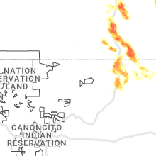
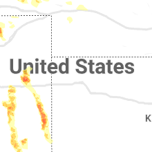
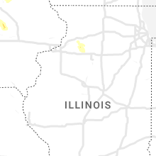
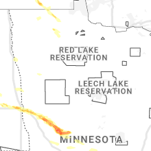
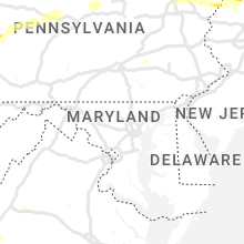
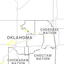
Hail Map for Thursday, July 13, 2023

Number of Impacted Households on 7/13/2023
0
Impacted by 1" or Larger Hail
0
Impacted by 1.75" or Larger Hail
0
Impacted by 2.5" or Larger Hail
Square Miles of Populated Area Impacted on 7/13/2023
0
Impacted by 1" or Larger Hail
0
Impacted by 1.75" or Larger Hail
0
Impacted by 2.5" or Larger Hail


Cities Most Affected by Hail Storms of 7/13/2023
| Hail Size | Demographics of Zip Codes Affected | ||||||
|---|---|---|---|---|---|---|---|
| City | Count | Average | Largest | Pop Density | House Value | Income | Age |
| Pueblo, CO | 3 | 2.50 | 3.00 | 563 | $99k | $33.3k | 37.6 |
| Adrian, MN | 3 | 2.33 | 2.75 | 12 | $60k | $35.9k | 41.9 |
| Avondale, CO | 2 | 2.75 | 2.75 | 2 | $67k | $33.8k | 39.8 |
| Seibert, CO | 2 | 2.25 | 2.75 | 0 | $43k | $25.8k | 49.4 |
| Lake Benton, MN | 2 | 2.25 | 2.50 | 10 | $42k | $31.4k | 44.9 |
| Belgrade, MN | 2 | 2.25 | 2.75 | 9 | $55k | $34.8k | 41.7 |
| Hugo, CO | 2 | 2.00 | 2.00 | 0 | $71k | $31.3k | 46.8 |
| Mapleton, ND | 2 | 2.00 | 2.00 | 6 | $77k | $41.9k | 34.2 |
| Jasper, MN | 2 | 1.75 | 1.75 | 11 | $35k | $30.0k | 43.4 |
| New Raymer, CO | 1 | 3.25 | 3.25 | 0 | $73k | $32.3k | 52.1 |
| Sabin, MN | 1 | 2.75 | 2.75 | 15 | $78k | $47.9k | 36.8 |
| Texline, TX | 1 | 2.75 | 2.75 | 1 | $44k | $33.6k | 33.2 |
| Magnolia, MN | 1 | 2.50 | 2.50 | 5 | $52k | $35.0k | 38.3 |
| Karval, CO | 1 | 2.20 | 2.20 | 0 | $40k | $29.5k | 46.4 |
| Stoneham, CO | 1 | 2.00 | 2.00 | 0 | $90k | $30.8k | 47.3 |
| Glyndon, MN | 1 | 2.00 | 2.00 | 15 | $89k | $48.4k | 35.1 |
| Sheridan Lake, CO | 1 | 1.75 | 1.75 | 1 | $25k | $30.7k | 38.8 |
| Clear Lake, MN | 1 | 1.75 | 1.75 | 83 | $140k | $59.9k | 40.7 |
| Eden, SD | 1 | 1.75 | 1.75 | 3 | $33k | $23.8k | 47.6 |
| Arlington, SD | 1 | 1.75 | 1.75 | 7 | $61k | $37.0k | 45.2 |
| Freeport, MN | 1 | 1.75 | 1.75 | 24 | $82k | $40.2k | 36.3 |
| Henning, MN | 1 | 1.75 | 1.75 | 19 | $68k | $28.9k | 48.5 |
| Albany, MN | 1 | 1.75 | 1.75 | 41 | $93k | $37.3k | 35.0 |
| Harrison, NE | 1 | 1.75 | 1.75 | 0 | $37k | $28.2k | 49.9 |
Hail and Wind Damage Spotted on 7/13/2023
Filter by Report Type:Hail ReportsWind Reports
States Impacted
Mississippi, Minnesota, New York, Ohio, Colorado, Indiana, West Virginia, North Carolina, Virginia, South Dakota, North Dakota, Iowa, Nebraska, Kentucky, Texas, Vermont, Pennsylvania, Oklahoma, Montana, Missouri, Massachusetts, New Mexico, Florida, New Hampshire, New Jersey, Connecticut, ArkansasMississippi
| Local Time | Report Details |
|---|---|
| 11:29 AM CDT | An canopy was blown off a gas station at ms 19 and rd 56 in neshoba county MS, 49 miles SSW of Starkville, MS |
Minnesota
| Local Time | Report Details |
|---|---|
| 11:30 AM CDT | Quarter sized hail reported near Plainview, MN, 52.4 miles WNW of La Crosse, WI, relayed by social media. |
| 3:16 PM CDT | Quarter sized hail reported near East Grand Forks, MN, 74.3 miles N of Fargo, ND |
| 8:20 PM UTC | Quarter sized hail reported near East Grand Forks, MN, 73.6 miles N of Fargo, ND |
| 4:52 PM CDT | Baseball sized hail reported near Sabin, MN, 14.4 miles SE of Fargo, ND, property damage with multiple hail pictures suggesting 3 inches or larger possible based on visual estimates. |
| 4:55 PM CDT | Hen Egg sized hail reported near Glyndon, MN, 14.2 miles ESE of Fargo, ND |
| 5:35 PM CDT | Half Dollar sized hail reported near Pelican Rapids, MN, 36.1 miles ESE of Fargo, ND, hailed for 15-20 minutes. |
| 5:45 PM CDT | 8-10 inch tree branch broke in otter tail county MN, 41.1 miles ESE of Fargo, ND |
| 6:05 PM CDT | Quarter sized hail reported near Janesville, MN, 62.7 miles NNW of Mason City, IA, dime to quarter size hail. |
| 6:10 PM CDT | Baseball sized hail reported near Belgrade, MN, 48.8 miles NE of Montevideo, MN |
| 6:10 PM CDT | Golf Ball sized hail reported near Belgrade, MN, 49.2 miles NE of Montevideo, MN |
| 6:11 PM CDT | Tennis Ball sized hail reported near Lake Benton, MN, 53.6 miles NNE of Sioux Falls, SD, delayed report. picture report via social media. |
| 6:12 PM CDT | Half Dollar sized hail reported near Lake Benton, MN, 53.8 miles NNE of Sioux Falls, SD |
| 6:12 PM CDT | Hen Egg sized hail reported near Lake Benton, MN, 54 miles NNE of Sioux Falls, SD, report via social media. |
| 6:15 PM CDT | Personal weather statio in otter tail county MN, 69.4 miles SE of Fargo, ND |
| 11:24 PM UTC | Quarter sized hail reported near Ruthton, MN, 50.6 miles NNE of Sioux Falls, SD |
| 6:24 PM CDT | Quarter sized hail reported near Ruthton, MN, 50.6 miles NE of Sioux Falls, SD, report from mping: quarter (1.00 in.). time corrected by radar. |
| 6:25 PM CDT | Golf Ball sized hail reported near Henning, MN, 68.1 miles ESE of Fargo, ND, 1.5-1.75 inch hail. |
| 6:26 PM CDT | Quarter sized hail reported near Ruthton, MN, 51.2 miles NE of Sioux Falls, SD, also 45 to 50 mph winds. |
| 11:27 PM UTC | Quarter sized hail reported near Roseau, MN, 0.5 miles NE of Roseau, MN, 1 inch hail reported in roseau via twitter. time estimated via radar. |
| 6:29 PM CDT | Half Dollar sized hail reported near Roseau, MN, 0.5 miles SE of Roseau, MN, corrects previous hail report from roseau. |
| 6:29 PM CDT | Trees uprooted or snapped; roof blown of in otter tail county MN, 63.3 miles ESE of Fargo, ND |
| 6:33 PM CDT | Half Dollar sized hail reported near Roseau, MN, 0.5 miles SE of Roseau, MN |
| 6:34 PM CDT | Quarter sized hail reported near Melrose, MN, 67.5 miles NE of Montevideo, MN, pea to quarter sized hail. |
| 6:35 PM CDT | Half Dollar sized hail reported near Nicollet, MN, 62.9 miles SW of Minneapolis, MN, report from mping: half dollar (1.25 in.). |
| 6:41 PM CDT | Quarter sized hail reported near Henning, MN, 69.7 miles SE of Fargo, ND, report from mping: quarter (1.00 in.). |
| 6:45 PM CDT | Golf Ball sized hail reported near Freeport, MN, 70.5 miles NE of Montevideo, MN |
| 6:46 PM CDT | Ping Pong Ball sized hail reported near Henning, MN, 69.7 miles SE of Fargo, ND, report from mping: ping pong ball (1.50 in.). |
| 6:51 PM CDT | Golf Ball sized hail reported near Albany, MN, 73 miles NE of Montevideo, MN |
| 6:57 PM CDT | Golf Ball sized hail reported near Jasper, MN, 26.8 miles NE of Sioux Falls, SD, report via social media. time estimated by radar. |
| 6:57 PM CDT | Golf Ball sized hail reported near Jasper, MN, 26.5 miles NE of Sioux Falls, SD |
| 7:05 PM CDT | Quarter sized hail reported near Avon, MN, 72.4 miles NW of Minneapolis, MN, report from mping: quarter (1.00 in.). |
| 7:10 PM CDT | Quarter sized hail reported near Lowry, MN, 53.2 miles N of Montevideo, MN |
| 7:22 PM CDT | Quarter sized hail reported near Saint Joseph, MN, 64.5 miles NW of Minneapolis, MN |
| 7:24 PM CDT | Half Dollar sized hail reported near Darwin, MN, 55.4 miles W of Minneapolis, MN, report from mping: half dollar (1.25 in.). |
| 12:34 AM UTC | Measured by personal weather statio in rock county MN, 28 miles ENE of Sioux Falls, SD |
| 7:35 PM CDT | Quarter sized hail reported near South Haven, MN, 54.9 miles NW of Minneapolis, MN, email report. |
| 12:35 AM UTC | Reported by minnesota dot weather station. time corrected by rada in rock county MN, 32.8 miles ENE of Sioux Falls, SD |
| 7:35 PM CDT | Quarter sized hail reported near Janesville, MN, 66 miles SSW of Minneapolis, MN |
| 7:39 PM CDT | Reports of trees dow in wright county MN, 45.8 miles W of Minneapolis, MN |
| 7:40 PM CDT | Ping Pong Ball sized hail reported near Cokato, MN, 46.2 miles W of Minneapolis, MN, report from mping: ping pong ball (1.50 in.). |
| 7:40 PM CDT | Tennis Ball sized hail reported near Magnolia, MN, 33.5 miles ENE of Sioux Falls, SD |
| 7:50 PM CDT | Tennis Ball sized hail reported near Adrian, MN, 37.2 miles E of Sioux Falls, SD, report from mping: tennis ball (2.50 in.). report time corrected by radar. |
| 7:52 PM CDT | Golf Ball sized hail reported near Clear Lake, MN, 46.9 miles NW of Minneapolis, MN |
| 7:54 PM CDT | Baseball sized hail reported near Adrian, MN, 40.2 miles E of Sioux Falls, SD |
| 8:15 PM CDT | Golf Ball sized hail reported near Adrian, MN, 37.4 miles E of Sioux Falls, SD, delayed report from social media. |
| 8:27 PM CDT | Ping Pong Ball sized hail reported near Big Lake, MN, 32.8 miles NW of Minneapolis, MN, report from mping: ping pong ball (1.50 in.). |
| 8:44 PM CDT | Quarter sized hail reported near Elk River, MN, 26.7 miles NW of Minneapolis, MN, nickel to quarter sized. |
| 9:53 PM CDT | Asos station kmsp minneapolis-st. paul a in hennepin county MN, 7 miles SSE of Minneapolis, MN |
| 11:27 PM CDT | Ping Pong Ball sized hail reported near Plainview, MN, 52.5 miles WNW of La Crosse, WI |
| 11:30 PM CDT | Ping Pong Ball sized hail reported near Kellogg, MN, 54.1 miles WNW of La Crosse, WI |
| 12:19 AM CDT | Ping Pong Ball sized hail reported near Winona, MN, 29.9 miles WNW of La Crosse, WI, relayed by emergency management. |
| 12:20 AM CDT | Quarter sized hail reported near Houston, MN, 18.9 miles WNW of La Crosse, WI |
| 12:29 AM CDT | Quarter sized hail reported near Winona, MN, 23.7 miles WNW of La Crosse, WI, relayed by emergency management. |
New York
| Local Time | Report Details |
|---|---|
| 1:38 PM EDT | Tree down over roadwa in wayne county NY, 32.1 miles WNW of Syracuse, NY |
| 1:42 PM EDT | Tree down over roadwa in cayuga county NY, 27.4 miles WNW of Syracuse, NY |
| 2:06 PM EDT | Trees and wires dow in oswego county NY, 25.3 miles NW of Syracuse, NY |
| 2:11 PM EDT | Trees and wires dow in oswego county NY, 23.2 miles NW of Syracuse, NY |
| 2:16 PM EDT | Trees and wires dow in oswego county NY, 28.7 miles NNE of Syracuse, NY |
| 2:20 PM EDT | Local police reported multiple trees down on the roadwa in st. lawrence county NY, 31.4 miles ENE of Ogdensburg, NY |
| 2:20 PM EDT | Large tree fell across davis road just south of 326. a vehicle hit the tree... but no injuries reporte in cayuga county NY, 29.1 miles WSW of Syracuse, NY |
| 2:33 PM EDT | Sumac trees blown dow in st. lawrence county NY, 31.9 miles ENE of Ogdensburg, NY |
| 2:36 PM EDT | Trees and wires dow in oswego county NY, 22.1 miles N of Syracuse, NY |
| 6:41 PM UTC | Corrects previous tstm wnd dmg report from 3 n camden. tree down on electrical pol in oneida county NY, 29.8 miles NE of Syracuse, NY |
| 2:50 PM EDT | Trees down over bradbury roa in oswego county NY, 13.1 miles N of Syracuse, NY |
| 3:01 PM EDT | Half Dollar sized hail reported near North Hudson, NY, 44.5 miles SW of Burlington, VT, north hudson campground estimated half dollar size hail. |
| 7:03 PM UTC | Trees and wires down on park av in lewis county NY, 60.9 miles NNE of Syracuse, NY |
| 7:03 PM UTC | Trees and wires down at west rd and gardner r in lewis county NY, 59.2 miles NNE of Syracuse, NY |
| 7:03 PM UTC | Trees and wires down on rt 17 in lewis county NY, 59 miles NNE of Syracuse, NY |
| 7:04 PM UTC | Trees and wires down in the town of watso in lewis county NY, 61.7 miles NE of Syracuse, NY |
| 3:06 PM EDT | Corrects previous tstm wnd dmg report from 1 w lyncourt. reported tent blew into power lines on court street... syracuse... n in onondaga county NY, 2.1 miles N of Syracuse, NY |
| 3:06 PM EDT | Corrects previous tstm wnd dmg report from 1 w lyncourt. reported tent blew into power lines on court street... syracuse... n in onondaga county NY, 2.1 miles N of Syracuse, NY |
| 3:13 PM EDT | Trees down on electrical pole on strong road... tully... n in onondaga county NY, 17.3 miles S of Syracuse, NY |
| 3:15 PM EDT | Trees down on power poles. relayed by oneida count in lewis county NY, 44.8 miles NE of Syracuse, NY |
| 7:16 PM UTC | Corrects previous tstm wnd dmg report from 1 w delta lake. wires down on sleepy hollow road in rome... n in oneida county NY, 37.3 miles ENE of Syracuse, NY |
| 7:17 PM UTC | Trees and wires down on river r in lewis county NY, 57.8 miles NE of Syracuse, NY |
| 3:23 PM EDT | Tree down on electrical pol in oneida county NY, 29.8 miles NE of Syracuse, NY |
| 3:40 PM EDT | Quarter sized hail reported near Brant Lake, NY, 60.3 miles SSW of Burlington, VT |
| 3:40 PM EDT | Half Dollar sized hail reported near Brant Lake, NY, 60.5 miles SSW of Burlington, VT |
| 7:52 PM UTC | Corrects previous tstm wnd dmg report from 4 s virgil. tree on the wires on bleck road near babcock hollow roa in cortland county NY, 40.1 miles S of Syracuse, NY |
| 3:54 PM EDT | Wires down on sleepy hollow road in rome... n in oneida county NY, 37.3 miles ENE of Syracuse, NY |
| 3:58 PM EDT | Trees down on wires on 118 ridge road... utica n in oneida county NY, 43.9 miles E of Syracuse, NY |
| 4:00 PM EDT | Numerous trees and wires down in both the towns of russia and ohi in herkimer county NY, 59.8 miles ENE of Syracuse, NY |
| 4:15 PM EDT | Tree on the wires on bleck road near babcock hollow roa in cortland county NY, 40.1 miles S of Syracuse, NY |
| 8:23 PM UTC | Corrects previous tstm wnd dmg report from 1 sw exeter center. tree down on wires at 360 brady road... exeter n in otsego county NY, 57.5 miles ESE of Syracuse, NY |
| 4:33 PM EDT | Quarter sized hail reported near West Winfield, NY, 49.9 miles ESE of Syracuse, NY, small branches also falling at time of call |
| 8:35 PM UTC | Corrects previous tstm wnd dmg report from exeter center. large tree down blocking road at 544 angel hill road... exeter n in otsego county NY, 57.4 miles W of Schenectady, NY |
| 8:40 PM UTC | Quarter sized hail reported near West Winfield, NY, 49.9 miles ESE of Syracuse, NY, small branches down |
| 8:47 PM UTC | Corrects previous tstm wnd dmg report from schenevus. tree down on hous in otsego county NY, 48.8 miles WSW of Schenectady, NY |
| 9:07 PM UTC | Quarter sized hail reported near North Hudson, NY, 44.5 miles SW of Burlington, VT, frontier campground reported quarter size hail. time estimated from radar. |
| 9:10 PM UTC | Corrects previous tstm wnd dmg report from 3 se hartwick. trees down on arnold lake road off of county rt 4 in otsego county NY, 56.2 miles WSW of Schenectady, NY |
| 9:12 PM UTC | Local utility company reported a tree down in cannon corners in clinton county NY, 42.3 miles NW of Burlington, VT |
| 9:15 PM UTC | Corrects previous tstm wnd dmg report from 1 sse mt vision. tree down over upper dutch hill roa in otsego county NY, 59.1 miles WSW of Schenectady, NY |
| 9:23 PM UTC | Tree down on wires at 360 brady road... exeter n in otsego county NY, 57.5 miles ESE of Syracuse, NY |
| 9:23 PM UTC | Multiple trees and wires down across southern and eastern fulton county per 911 dispatch in fulton county NY, 33 miles WNW of Schenectady, NY |
| 9:27 PM UTC | Quarter sized hail reported near Paradox, NY, 47.2 miles SSW of Burlington, VT, paradox lake campground reported hail ranging from dime to quarter size. |
| 9:30 PM UTC | Several trees and powerlines down in warren county NY, 56.9 miles NNE of Schenectady, NY |
| 9:39 PM UTC | Tree down near intersection of clinton rd and rte 16 in montgomery county NY, 38.2 miles W of Schenectady, NY |
| 9:42 PM UTC | Quarter sized hail reported near North Hudson, NY, 44.5 miles SW of Burlington, VT, frontier campground reported quarter size hail. time estimated from radar. |
| 9:42 PM UTC | Corrects previous tstm wnd dmg report from schenevus. corrects previous tstm wnd dmg report from schenevus. tree down on hous in otsego county NY, 48.8 miles WSW of Schenectady, NY |
| 9:45 PM UTC | Trees down on arnold lake road off of county rt 4 in otsego county NY, 56.2 miles WSW of Schenectady, NY |
| 9:53 PM UTC | Tree down over upper dutch hill roa in otsego county NY, 59.1 miles WSW of Schenectady, NY |
| 10:00 PM UTC | Tree downed across county route 2 in washington county NY, 51 miles S of Burlington, VT |
| 10:02 PM UTC | Tree and wires down in saratoga county NY, 19.4 miles N of Schenectady, NY |
| 10:04 PM UTC | Many trees and powerlines across the city. streets are impassable in place in warren county NY, 39.4 miles NNE of Schenectady, NY |
| 10:05 PM UTC | Trees and wires down on route 20 and 30 in schoharie county NY, 20.1 miles W of Schenectady, NY |
| 10:10 PM UTC | Tree and wires across route 9 at hudson s in columbia county NY, 31 miles SSE of Schenectady, NY |
| 10:13 PM UTC | Tree downed across pike brook road in washington county NY, 60.2 miles NNE of Schenectady, NY |
| 10:13 PM UTC | Multiple trees and wires down across greenfield in saratoga county NY, 20.3 miles NNE of Schenectady, NY |
| 10:13 PM UTC | Tree and wires down in saratoga county NY, 10.9 miles N of Schenectady, NY |
| 10:15 PM UTC | Trees down on creek side roa in schoharie county NY, 16.1 miles WSW of Schenectady, NY |
| 10:15 PM UTC | Wires down on charleston s in schoharie county NY, 16.6 miles WSW of Schenectady, NY |
| 10:17 PM UTC | Tree and wires down in saratoga county NY, 33 miles N of Schenectady, NY |
| 10:18 PM UTC | Tree and wires down at route 32 and callahan rd in saratoga county NY, 27 miles NE of Schenectady, NY |
| 10:18 PM UTC | Tree downed on route 20 in schoharie county NY, 20.1 miles W of Schenectady, NY |
| 10:22 PM UTC | Multiple trees downed across pattens mills road in washington county NY, 42.8 miles NNE of Schenectady, NY |
| 6:32 PM EDT | Tree down on wires... partially blocking the roa in tioga county NY, 58.1 miles NW of Scranton, PA |
| 6:35 PM EDT | Quarter sized hail reported near Waverly, NY, 61.5 miles NW of Scranton, PA |
| 10:36 PM UTC | Multiple trees and wires down across the county. 911 dispatch too busy to talk in washington county NY, 57.9 miles NNE of Schenectady, NY |
| 10:38 PM UTC | Porch damage on a house on franklin st in warren county NY, 36.7 miles NNE of Schenectady, NY |
| 10:44 PM UTC | Tree downed across hunt ave in washington county NY, 36.5 miles NNE of Schenectady, NY |
| 10:50 PM UTC | 60 mph wind gust measured at columbia county airport. multiple 2 inch tree limbs down in columbia county NY, 37.9 miles SSE of Schenectady, NY |
| 10:55 PM UTC | Multiple trees and wires down on route in columbia county NY, 37.3 miles SSE of Schenectady, NY |
| 10:55 PM UTC | Tree downed across state route 4 in washington county NY, 57.9 miles NNE of Schenectady, NY |
| 11:15 PM UTC | Trees and wires downed across county route 49 in washington county NY, 29.5 miles NE of Schenectady, NY |
| 11:22 PM UTC | Tree... pole and wires downed across county route 61 in washington county NY, 33.9 miles NE of Schenectady, NY |
| 11:24 PM UTC | Route 9w closed at division stdue to downed trees in greene county NY, 41 miles S of Schenectady, NY |
| 7:27 PM EDT | Trees down across route 9g in columbia county NY, 47.2 miles S of Schenectady, NY |
| 11:32 PM UTC | Tree down on house in columbia county NY, 48.7 miles S of Schenectady, NY |
| 7:43 PM EDT | *** 1 inj *** tree down on occupied vehicle. 1 minor injury in columbia county NY, 42.4 miles SSE of Schenectady, NY |
| 7:45 PM EDT | Quarter sized hail reported near Germantown, NY, 47.2 miles S of Schenectady, NY |
| 11:53 PM UTC | Numerous trees down in town of ghent per law enforemen in columbia county NY, 37.1 miles SSE of Schenectady, NY |
| 11:57 PM UTC | Trees down at multiple locations in chatham per 911 dispatch in columbia county NY, 35.7 miles SSE of Schenectady, NY |
| 11:57 PM UTC | Trees down in columbia county NY, 48.7 miles SSE of Schenectady, NY |
| 11:59 PM UTC | Trees down in columbia county NY, 46.9 miles SSE of Schenectady, NY |
| 11:59 PM UTC | Trees downed across forest prserve road in ulster county NY, 53.5 miles SSW of Schenectady, NY |
| 12:00 AM UTC | Road closure due to downed tree on north and south ny-9g at old road in the town of clermont in columbia county in columbia county NY, 50.6 miles S of Schenectady, NY |
| 8:27 PM EDT | Tree down in columbia county NY, 49.3 miles S of Schenectady, NY |
| 12:55 AM UTC | Trees downed at the intersection of state route 199 and orlich road. ny route 199 was closed to traffi in dutchess county NY, 56.9 miles S of Schenectady, NY |
| 8:57 PM EDT | Tree down on wires on mcmullen roa in orange county NY, 51.7 miles NW of Brooklyn, NY |
| 12:57 AM UTC | Tree down on wires near jacobs road and route in orange county NY, 52.3 miles NNW of Brooklyn, NY |
| 4:16 AM UTC | Tree down and road closure on us 202 both directions at lovell st. (somers) all lanes of 2 lanes close in westchester county NY, 46 miles NNE of Brooklyn, NY |
Ohio
| Local Time | Report Details |
|---|---|
| 2:21 PM EDT | Tree down on 125 near hamersville. time estimated from rada in brown county OH, 30.5 miles ESE of Cincinnati, OH |
| 3:20 PM EDT | Downed tree blocking both lanes of state route 141 near ford stree in lawrence county OH, 51.1 miles WNW of Charleston, WV |
| 3:40 PM EDT | Tree down blocking one lane of state route 141 approximately a quarter mile south of zalmon lan in lawrence county OH, 49.1 miles WNW of Charleston, WV |
| 7:40 PM UTC | Tree down on rocky fork road in guyan townshi in gallia county OH, 40.6 miles WNW of Charleston, WV |
| 7:45 PM UTC | Tree down on hazel ridge road in clay townshi in gallia county OH, 37.6 miles NW of Charleston, WV |
| 11:11 PM UTC | Tree down on west main stree in belmont county OH, 61.9 miles WSW of Pittsburgh, PA |
| 11:16 PM UTC | Tree down on mt. hope roa in belmont county OH, 58.4 miles WSW of Pittsburgh, PA |
| 7:31 PM EDT | Large tree down... blocking cameron bridge roa in noble county OH, 83.5 miles ESE of Columbus, OH |
Colorado
| Local Time | Report Details |
|---|---|
| 12:23 PM MDT | Quarter sized hail reported near Cope, CO, 31.7 miles SSW of Yuma, CO |
| 1:39 PM MDT | Baseball sized hail reported near Seibert, CO, 45.4 miles S of Yuma, CO, public report of 1/4 to 3/4 inch average sized hail that began about 30-45 minutes ago. at the time of the report... a few baseball sized stones were falling. |
| 1:45 PM MDT | Estimated wind gust. wind came approximately 5 minutes before hail at this locatio in lincoln county CO, 80.6 miles SSW of Yuma, CO |
| 1:50 PM MDT | Ping Pong Ball sized hail reported near Hugo, CO, 80.6 miles SSW of Yuma, CO, mostly quarter sized hail... with a few estimated up to the size of ping pong. also estimated up to 70 mph wind gusts. time estimated by radar. |
| 1:50 PM MDT | Golf Ball sized hail reported near Seibert, CO, 50.2 miles S of Yuma, CO, public reported a lot of golf ball sized hail and not has heavy rain. |
| 2:01 PM MDT | Hen Egg sized hail reported near Hugo, CO, 82.9 miles SSW of Yuma, CO, time estimated. |
| 2:13 PM MDT | Half Dollar sized hail reported near Hugo, CO, 84.4 miles ENE of Pueblo, CO |
| 2:31 PM MDT | Hen Egg sized hail reported near Hugo, CO, 78.5 miles ENE of Pueblo, CO |
| 3:00 PM MDT | Hen Egg sized hail reported near Karval, CO, 72.2 miles ENE of Pueblo, CO |
| 10:30 PM UTC | Golf Ball sized hail reported near Sheridan Lake, CO, 86.5 miles WNW of Garden City, KS |
| 4:52 PM MDT | Half Dollar sized hail reported near Stoneham, CO, 63 miles WNW of Yuma, CO |
| 10:54 PM UTC | Quarter sized hail reported near Stoneham, CO, 61.2 miles NW of Yuma, CO, report from mping: quarter (1.00 in.). |
| 4:56 PM MDT | Tea Cup sized hail reported near New Raymer, CO, 65.1 miles WNW of Yuma, CO, delayed report. photo provided by a trained spotter showed hail as large as 3 to 3.5 inches in diameter... and this photo was taken roughly 2 hours after the hail fell. |
| 10:58 PM UTC | Damage to windows and several 6 to 8 inch diameter tree branches down west of stoneham. time and location estimate in weld county CO, 61.7 miles NW of Yuma, CO |
| 5:04 PM MDT | Hen Egg sized hail reported near Stoneham, CO, 62.1 miles NW of Yuma, CO |
| 5:12 PM MDT | Ping Pong Ball sized hail reported near Stoneham, CO, 62.1 miles NW of Yuma, CO, report from mping: ping pong ball (1.50 in.). |
| 5:24 PM MDT | Baseball sized hail reported near Pueblo, CO, 6.4 miles ENE of Pueblo, CO, pueblo memorial airport. several cars have wind shields blown out. window blown out in the building. |
| 5:24 PM MDT | Tea Cup sized hail reported near Pueblo, CO, 5.1 miles ENE of Pueblo, CO, wfo pueblo office. |
| 5:33 PM MDT | Golf Ball sized hail reported near Pueblo, CO, 4 miles ESE of Pueblo, CO |
| 5:38 PM MDT | Ping Pong Ball sized hail reported near Pueblo, CO, 5.1 miles E of Pueblo, CO |
| 5:46 PM MDT | Baseball sized hail reported near Avondale, CO, 11.9 miles SE of Pueblo, CO, car windshield was shattered. |
| 5:49 PM MDT | Baseball sized hail reported near Avondale, CO, 11.9 miles SE of Pueblo, CO |
| 12:47 AM UTC | Corrects previous tstm wnd dmg report from 2 ne pritchett. pole snappe in baca county CO, 114.5 miles WSW of Garden City, KS |
| 12:57 AM UTC | Power pole blown down. time estimated by rada in baca county CO, 114.1 miles ESE of Pueblo, CO |
| 6:58 PM MDT | Quarter sized hail reported near Pueblo, CO, 8.1 miles WNW of Pueblo, CO |
| 12:59 AM UTC | Barn roofs torn off... with most damage centered around county road 13... and aa and z. time is estimate in baca county CO, 116 miles ESE of Pueblo, CO |
| 1:07 AM UTC | Power pole blown down cr w and 17. time estimated by rada in baca county CO, 114.9 miles WSW of Garden City, KS |
| 1:14 AM UTC | Quarter sized hail reported near Pueblo, CO, 9.4 miles WNW of Pueblo, CO |
| 1:47 AM UTC | Pole snappe in baca county CO, 114.5 miles WSW of Garden City, KS |
Indiana
| Local Time | Report Details |
|---|---|
| 6:28 PM UTC | Quarter sized hail reported near North Vernon, IN, 59.2 miles SSE of Indianapolis, IN, report from mping: quarter (1.00 in.). |
West Virginia
| Local Time | Report Details |
|---|---|
| 2:43 PM EDT | Corrects previous non-tstm wnd dmg report from birch river. fallen tree and downed lines reported in birch river. time estimated from rada in nicholas county WV, 48.8 miles ENE of Charleston, WV |
| 7:55 PM UTC | Several small trees and one large tree down along jerico roa in pocahontas county WV, 49.2 miles SSW of Elkins, WV |
| 4:00 PM EDT | Tree down on ashton upland roa in mason county WV, 31.2 miles NW of Charleston, WV |
| 4:10 PM EDT | Tree down on power lines near hunt lan in putnam county WV, 24.3 miles NW of Charleston, WV |
| 4:15 PM EDT | Tree down on winfield road at tuckers branch roa in putnam county WV, 20.1 miles NW of Charleston, WV |
| 4:20 PM EDT | Tree down along winfield road near winfield mobile home village driv in putnam county WV, 18.5 miles NW of Charleston, WV |
| 4:25 PM EDT | Tree down on mclane pike at lime kiln roa in putnam county WV, 19.4 miles NW of Charleston, WV |
| 8:25 PM UTC | Tree down blocking half winfield road at the winfield church of chris in putnam county WV, 17.6 miles NW of Charleston, WV |
| 8:25 PM UTC | Tree down along mclane pike at lone oak roa in putnam county WV, 19.1 miles NW of Charleston, WV |
| 9:30 PM UTC | Large tree fell and is blocking all lanes of washington street e near abundant life churc in kanawha county WV, 1.2 miles SE of Charleston, WV |
| 7:30 PM EDT | Numerous calls reporting downed trees in the county. time estimate in ohio county WV, 44.6 miles WSW of Pittsburgh, PA |
| 11:31 PM UTC | Corrected report. large tree down... blocking cameron bridge roa in marshall county WV, 53.1 miles SW of Pittsburgh, PA |
| 11:45 PM UTC | Power lines blown down on 2nd street in marshall county WV, 53.1 miles SW of Pittsburgh, PA |
| 3:43 AM UTC | Trees down just before safe hous in mcdowell county WV, 62.1 miles S of Charleston, WV |
| 4:29 AM UTC | In algoma at the church there is a tree blocking the roa in mcdowell county WV, 65.3 miles S of Charleston, WV |
North Carolina
| Local Time | Report Details |
|---|---|
| 3:30 PM EDT | The mt. airy fire chief reported that up to 25 large trees were down along the 1300 block of main street in mt. airy. considerable damage to trees and property as a res in surry county NC, 64.3 miles SW of Roanoke, VA |
| 12:10 AM UTC | Powerlines down in drivewa in rowan county NC, 31.3 miles NNE of Charlotte, NC |
| 8:24 PM EDT | Trees down on powerlines near jones rd and centenary r in rowan county NC, 29.5 miles NNE of Charlotte, NC |
| 12:25 AM UTC | Large tree down in driveway on sherrills ford r in rowan county NC, 34.8 miles NNE of Charlotte, NC |
| 12:40 AM UTC | Trees down near foster rd and cool springs r in rowan county NC, 40.4 miles NNE of Charlotte, NC |
| 8:50 PM EDT | Multiple trees down near glenn faust r in rowan county NC, 37 miles N of Charlotte, NC |
| 8:50 PM EDT | Multiple trees down near glenn faust r in rowan county NC, 37 miles N of Charlotte, NC |
| 2:30 AM UTC | Multiple trees down across cleveland count in cleveland county NC, 49 miles WNW of Charlotte, NC |
Virginia
| Local Time | Report Details |
|---|---|
| 3:30 PM EDT | A large tree down on the highway in boones mill. the tree was two feet in diameter and 45 feet tall. other tree debris was noted in the are in franklin county VA, 10.5 miles S of Roanoke, VA |
| 7:40 PM UTC | Trees dow in alleghany county VA, 38.5 miles N of Roanoke, VA |
| 3:48 PM EDT | Trees and power lines dow in carroll county VA, 62.2 miles SW of Roanoke, VA |
| 3:51 PM EDT | Quarter sized hail reported near Lynchburg, VA, 37.1 miles ENE of Roanoke, VA, reported by amateur radio. |
| 3:53 PM EDT | Tree down. time estimated from rada in carroll county VA, 65.9 miles SW of Roanoke, VA |
| 7:56 PM UTC | Trees dow in city of covington county VA, 35.8 miles N of Roanoke, VA |
| 3:57 PM EDT | The carroll county emergency manager reports numerous trees down along flower gap road and apple ridge road. damage spread across a stretch of 2-3 miles. considerable d in carroll county VA, 63.3 miles SW of Roanoke, VA |
| 4:13 PM EDT | Tree down across road. time estimated from rada in bedford county VA, 38.8 miles ENE of Roanoke, VA |
| 4:20 PM EDT | Tree dow in city of lynchburg county VA, 41.7 miles ENE of Roanoke, VA |
| 4:44 PM EDT | Quarter sized hail reported near Lynchburg, VA, 44.4 miles ENE of Roanoke, VA, quarter size hail along us 460. |
| 4:45 PM EDT | Tree on house- hawkins mill road... bedford count in bedford county VA, 38.1 miles ENE of Roanoke, VA |
| 4:45 PM EDT | Tree across road - forest road... near harris tir in bedford county VA, 36.3 miles E of Roanoke, VA |
| 8:51 PM UTC | Quarter sized hail reported near Warm Springs, VA, 54.3 miles N of Roanoke, VA, largest hailstone was quarter size... but most were dime to nickel size. |
| 9:14 PM UTC | Tree down on roa in appomattox county VA, 63.8 miles ENE of Roanoke, VA |
| 9:25 PM UTC | Tree down. time estimated from rada in campbell county VA, 46.3 miles E of Roanoke, VA |
| 9:28 PM UTC | Quarter sized hail reported near Blacksburg, VA, 26 miles W of Roanoke, VA, time estimated from radar. |
| 9:31 PM UTC | Tree down. time estimated from rada in campbell county VA, 53.2 miles E of Roanoke, VA |
| 10:04 PM UTC | Tree down across both lanes of u.s. 460w between odd fellows and candlers mountain road exits. there was also a car with a broken windshield on the shoulder just past t in city of lynchburg county VA, 42.8 miles E of Roanoke, VA |
| 10:12 PM UTC | Thunderstorm winds blew a tree down at the intersection of county line road and wilson highwa in grayson county VA, 50.7 miles E of Bristol, TN |
| 10:16 PM UTC | Thunderstorm winds blew a tree down on fox creek road near wilson highway. the tree fell on a vehicl in grayson county VA, 51.2 miles E of Bristol, TN |
| 10:17 PM UTC | Tree down on a power line and the adjacent power pole was on fir in appomattox county VA, 56.8 miles E of Roanoke, VA |
| 10:18 PM UTC | Report from mping: 3-inch tree limbs broken; power poles broke in campbell county VA, 49.7 miles E of Roanoke, VA |
| 10:19 PM UTC | Thunderstorm winds blew a tree down at the intersection of maple road and gold hill roa in grayson county VA, 52.9 miles E of Bristol, TN |
| 10:28 PM UTC | Tree down. time estimated from rada in campbell county VA, 48 miles E of Roanoke, VA |
| 10:33 PM UTC | Tree down. time estimated from rada in appomattox county VA, 57 miles E of Roanoke, VA |
| 10:33 PM UTC | Trees and power lines down. time estimated from rada in campbell county VA, 46.3 miles E of Roanoke, VA |
| 10:33 PM UTC | Tree down across pumping station road near breezy hill road. time estimated from rada in appomattox county VA, 58.1 miles E of Roanoke, VA |
| 10:39 PM UTC | Trees and power lines down. time estimated from rada in campbell county VA, 53.2 miles E of Roanoke, VA |
| 10:53 PM UTC | Power pole down on a private residence near the intersection of bear creek road and chetham road near glady in campbell county VA, 52.1 miles E of Roanoke, VA |
| 10:58 PM UTC | Tree and power lines down in the 8000 block of red house road near glady in campbell county VA, 52 miles E of Roanoke, VA |
| 11:08 PM UTC | Numerous large trees down on lawyers road in red house. trees were blocking some roads in the area. pea-sized hail was also observed during the stor in charlotte county VA, 62 miles E of Roanoke, VA |
| 11:29 PM UTC | Power lines down across the road in the 40 blokc of cheatham road near glady in campbell county VA, 52.1 miles E of Roanoke, VA |
| 11:29 PM UTC | Tree down on roadway at the intersection of reedy springs road and double springs roa in appomattox county VA, 59.6 miles E of Roanoke, VA |
| 11:45 PM UTC | Trees down near lynchbur in amherst county VA, 45.8 miles ENE of Roanoke, VA |
| 7:45 PM EDT | Tree down in the 90 block of settlers row road in the city of lynchbur in campbell county VA, 48.9 miles E of Roanoke, VA |
| 12:42 AM UTC | Tree down on craig creek road and vise road near eagle roc in botetourt county VA, 27.9 miles N of Roanoke, VA |
| 1:32 AM UTC | Tree down in the 320 block of plum branch roa in campbell county VA, 52 miles E of Roanoke, VA |
| 2:01 AM UTC | Tree down on power line and across driveway at a private residenc in campbell county VA, 50.9 miles E of Roanoke, VA |
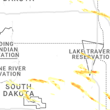
South Dakota
| Local Time | Report Details |
|---|---|
| 7:48 PM UTC | Quarter sized hail reported near Grenville, SD, 58.8 miles E of Aberdeen, SD, radar estimated time. |
| 3:22 PM CDT | Half Dollar sized hail reported near Langford, SD, 46.4 miles ENE of Aberdeen, SD, hail nearly covering the ground... some larger than quarters. radar estimated time. |
| 3:32 PM CDT | Golf Ball sized hail reported near Eden, SD, 48.3 miles ENE of Aberdeen, SD |
| 8:48 PM UTC | Quarter sized hail reported near Grenville, SD, 58.8 miles E of Aberdeen, SD, corrects time of the previous hail report from 2 n pickerel lake station. radar estimated time. |
| 3:58 PM CDT | Half Dollar sized hail reported near Florence, SD, 62.8 miles ESE of Aberdeen, SD, quarter to half dollar size hail in florence. |
| 9:02 PM UTC | Quarter sized hail reported near Redfield, SD, 42.8 miles S of Aberdeen, SD |
| 4:08 PM CDT | Quarter sized hail reported near Henry, SD, 69.2 miles SE of Aberdeen, SD, hail up to quarter size. |
| 9:08 PM UTC | Mesonet station 215 jct sd47/sd26 (sddot in hyde county SD, 52.7 miles ENE of Pierre, SD |
| 9:08 PM UTC | Half Dollar sized hail reported near Willow Lake, SD, 67 miles SSE of Aberdeen, SD, hail covering the ground with no gravel visible on roads... up to 3 inches deep in some spots. mostly quarter sized hailstones... with a few larger. |
| 4:13 PM CDT | Half Dollar sized hail reported near Florence, SD, 57.8 miles ESE of Aberdeen, SD, radar estimated time. |
| 9:15 PM UTC | Quarter sized hail reported near Pierre, SD, 22 miles ESE of Pierre, SD, corrects previous hail report from 8 ese rosseau. observer corrected report to 0.72 inches of rain and 55 mph winds. tree limbs 4 inches in diameter broken. |
| 9:18 PM UTC | Quarter sized hail reported near Willow Lake, SD, 70.5 miles SSE of Aberdeen, SD, radar estimated time. |
| 9:24 PM UTC | Quarter sized hail reported near South Shore, SD, 59.4 miles W of Montevideo, MN, dime to up as large as quarter sized hail... along with strong winds. radar estimated time. |
| 9:25 PM UTC | Quarter sized hail reported near Bryant, SD, 75.5 miles SE of Aberdeen, SD, mostly dime... up to quarter sized hail. radar estimated time. |
| 9:30 PM UTC | Quarter sized hail reported near Orient, SD, 55.9 miles SSW of Aberdeen, SD |
| 9:34 PM UTC | Quarter sized hail reported near Blunt, SD, 20.3 miles ENE of Pierre, SD, report from mping: quarter (1.00 in.). |
| 9:35 PM UTC | Mesonet station onms2 onida 13wsw (sd mesonet in sully county SD, 19.5 miles N of Pierre, SD |
| 4:48 PM CDT | Ping Pong Ball sized hail reported near Erwin, SD, 74.2 miles NNW of Sioux Falls, SD |
| 10:15 PM UTC | Quarter sized hail reported near Porcupine, SD, 77.2 miles SE of Rapid City, SD |
| 10:15 PM UTC | Storm damage reported in oglala lakota county SD, 77.2 miles SE of Rapid City, SD |
| 5:22 PM CDT | Ping Pong Ball sized hail reported near Arlington, SD, 49 miles NNW of Sioux Falls, SD, report from social media. time estimated by radar. |
| 10:34 PM UTC | Storm damage reported in oglala lakota county SD, 85.5 miles W of Valentine, NE |
| 5:35 PM CDT | Golf Ball sized hail reported near Arlington, SD, 48.6 miles NNW of Sioux Falls, SD |
| 10:36 PM UTC | Two power poles snapped along county road 1 in oglala lakota county SD, 84 miles W of Valentine, NE |
| 4:36 PM MDT | Quarter sized hail reported near Batesland, SD, 84.2 miles W of Valentine, NE |
| 4:36 PM MDT | Wind driven hail broke out windows on buildings and homes... crops and vegetation stripped bare. hail accumulation of several inches blown into large pile in oglala lakota county SD, 84.2 miles W of Valentine, NE |
| 10:49 PM UTC | Quarter sized hail reported near Nunda, SD, 42.5 miles NNW of Sioux Falls, SD, report from mping: quarter (1.00 in.). |
| 11:03 PM UTC | Quarter sized hail reported near Colman, SD, 37 miles N of Sioux Falls, SD, report from mping: quarter (1.00 in.). time corrected by radar. |
| 11:54 PM UTC | Half Dollar sized hail reported near Flandreau, SD, 32 miles NNE of Sioux Falls, SD, report via social media. |
North Dakota
| Local Time | Report Details |
|---|---|
| 7:50 PM UTC | Quarter sized hail reported near Sharon, ND, 54 miles SE of Devils Lake, ND, time estimated from radar. |
| 3:46 PM CDT | Corrects previous tstm wnd gst report from 2 e mayville. ndawn measuremen in traill county ND, 49.3 miles NNW of Fargo, ND |
| 3:56 PM CDT | Quarter sized hail reported near Casselton, ND, 20.3 miles W of Fargo, ND |
| 4:17 PM CDT | Hen Egg sized hail reported near Mapleton, ND, 11.8 miles W of Fargo, ND, lots of quarter to half dollar size hail with a few stones as large as 2 inches in diameter. |
| 4:23 PM CDT | Hen Egg sized hail reported near Mapleton, ND, 12.9 miles W of Fargo, ND |
| 4:25 PM CDT | Report from mping: 1-inch tree limbs broken; shingles blown of in cass county ND, 4.5 miles SW of Fargo, ND |
| 4:30 PM CDT | Ping Pong Ball sized hail reported near West Fargo, ND, 7 miles W of Fargo, ND, about 60 cars with hail damage in parking lot. |
| 4:30 PM CDT | Half Dollar sized hail reported near Fargo, ND, 2.6 miles SSW of Fargo, ND |
| 4:33 PM CDT | Quarter sized hail reported near Fargo, ND, 3.7 miles SW of Fargo, ND |
| 4:50 PM CDT | Quarter sized hail reported near Fargo, ND, 3.7 miles SSW of Fargo, ND |
Iowa
| Local Time | Report Details |
|---|---|
| 2:52 PM CDT | Quarter sized hail reported near Britt, IA, 35.9 miles W of Mason City, IA, nickel to quarter sized hail. relayed by law enforcement. |
| 3:02 PM CDT | Quarter sized hail reported near Britt, IA, 32.8 miles W of Mason City, IA, report from mping: quarter (1.00 in.). |
| 6:20 PM CDT | Quarter sized hail reported near Van Horne, IA, 21.6 miles W of Cedar Rapids, IA, 1 inch branches down from wind. |
| 8:15 PM CDT | Quarter sized hail reported near Albion, IA, 49 miles NE of Des Moines, IA |
| 8:18 PM CDT | Quarter sized hail reported near Marshalltown, IA, 47.6 miles NE of Des Moines, IA, delayed report. |
| 1:20 AM UTC | Corrects previous tstm wnd gst report from 1 w sible in osceola county IA, 49.4 miles ESE of Sioux Falls, SD |
| 1:23 AM UTC | Storm damage reported in marshall county IA, 47.4 miles NE of Des Moines, IA |
| 1:24 AM UTC | Storm damage reported in osceola county IA, 49.4 miles ESE of Sioux Falls, SD |
| 8:26 PM CDT | Quarter sized hail reported near Marshalltown, IA, 46.7 miles NE of Des Moines, IA |
| 8:27 PM CDT | Quarter sized hail reported near Sibley, IA, 53.9 miles E of Sioux Falls, SD, report from mping: quarter (1.00 in.). time corrected by radar. |
| 8:31 PM CDT | Quarter sized hail reported near Marshalltown, IA, 45.8 miles NE of Des Moines, IA, low hanging wall cloud also observed. |
| 8:52 PM CDT | Ping Pong Ball sized hail reported near Hartley, IA, 40.7 miles NNW of Storm Lake, IA |
| 8:54 PM CDT | Quarter sized hail reported near Gilman, IA, 44.8 miles ENE of Des Moines, IA |
| 10:53 PM CDT | Quarter sized hail reported near Oelwein, IA, 50.1 miles NNW of Cedar Rapids, IA |
Nebraska
| Local Time | Report Details |
|---|---|
| 3:30 PM CDT | Quarter sized hail reported near Valentine, NE, 10.1 miles SW of Valentine, NE |
| 9:25 PM UTC | Quarter sized hail reported near Johnstown, NE, 30.9 miles SE of Valentine, NE |
| 3:50 PM MDT | Golf Ball sized hail reported near Harrison, NE, 65.7 miles N of Scottsbluff, NE |
| 10:02 PM UTC | Quarter sized hail reported near Ainsworth, NE, 45.8 miles SE of Valentine, NE |
| 10:02 PM UTC | Storm damage reported in brown county NE, 45.8 miles SE of Valentine, NE |
| 10:04 PM UTC | Half Dollar sized hail reported near Whitney, NE, 67.1 miles N of Scottsbluff, NE, received report of hail damage to cars north of crawford. time estimated based on radar. |
| 4:16 PM MDT | Quarter sized hail reported near Gering, NE, 9.3 miles SE of Scottsbluff, NE |
| 10:18 PM UTC | Half Dollar sized hail reported near Gering, NE, 9.3 miles SE of Scottsbluff, NE, corrects previous hail report from melbeta. |
| 10:19 PM UTC | Half Dollar sized hail reported near Gering, NE, 9.3 miles SE of Scottsbluff, NE |
| 10:39 PM UTC | Ping Pong Ball sized hail reported near Chadron, NE, 75.6 miles NNE of Scottsbluff, NE, received photo on facebook of quarter to ping pong ball size hail on the north side of chadron. |
| 10:44 PM UTC | Quarter sized hail reported near Chadron, NE, 74.7 miles NNE of Scottsbluff, NE |
| 10:58 PM UTC | Large trees downed...greater than 4 inches in diamete in cherry county NE, 71 miles W of Valentine, NE |
| 11:11 PM UTC | Quarter sized hail reported near Merriman, NE, 67.2 miles W of Valentine, NE |
| 11:15 PM UTC | Quarter sized hail reported near Merriman, NE, 67.2 miles W of Valentine, NE |
| 11:30 PM UTC | Coop observer reports 11 power poles down 8 miles north northeast of oshkosh along road 189 between roads 64 and 70. winds estimated at 70 - 80 mp in garden county NE, 74.8 miles ESE of Scottsbluff, NE |
| 11:34 PM UTC | Storm damage reported in garden county NE, 79.5 miles ESE of Scottsbluff, NE |
| 12:01 AM UTC | Storm damage reported in keith county NE, 55.1 miles WNW of North Platte, NE |
| 1:30 AM UTC | Tree damage with power lines down on the southeast side of north platt in lincoln county NE, 1.8 miles S of North Platte, NE |
| 1:35 AM UTC | Storm damage reported in lincoln county NE, 4.7 miles ESE of North Platte, NE |
| 1:45 AM UTC | Tree damage with power lines down on the southeast side of north platt in lincoln county NE, 1.8 miles S of North Platte, NE |
| 5:48 AM UTC | Quarter sized hail reported near Minatare, NE, 13 miles ESE of Scottsbluff, NE, emergency manager reports quarter size hail. |
| 6:01 AM UTC | Half Dollar sized hail reported near Bayard, NE, 13.5 miles ESE of Scottsbluff, NE, video from social media showing quarter to half dollar size hail. |
| 6:35 AM UTC | Quarter sized hail reported near Bayard, NE, 19.1 miles ESE of Scottsbluff, NE, social media reports of pea to quarter size hail. |
Kentucky
| Local Time | Report Details |
|---|---|
| 8:35 PM UTC | Tree fell onto house and powerlines along state route 207 near baker cemetery roa in greenup county KY, 62.2 miles W of Charleston, WV |
Texas
| Local Time | Report Details |
|---|---|
| 9:15 PM UTC | Storm damage reported in foard county TX, 41.8 miles SE of Childress, TX |
| 9:40 PM UTC | Half Dollar sized hail reported near Vega, TX, 32.3 miles W of Amarillo, TX |
| 11:31 PM UTC | Storm damage reported in wichita county TX, 4.3 miles N of Wichita Falls, TX |
| 11:40 PM UTC | Storm damage reported in knox county TX, 53.3 miles SSE of Childress, TX |
| 1:32 AM UTC | West texas mesonet report in castro county TX, 51 miles SSW of Amarillo, TX |
| 1:52 AM UTC | Observed by west texas mesone in dallam county TX, 93.7 miles NNE of Tucumcari, NM |
| 8:57 PM CDT | Baseball sized hail reported near Texline, TX, 91.8 miles NNE of Tucumcari, NM, report from texline fire department chief of golf ball size hail with a few baseballs mixed in. time estimated by radar. |
| 9:32 PM CDT | West texas mesonet report in lubbock county TX, 12.1 miles NNW of Lubbock, TX |
| 4:31 AM UTC | West texas mesonet. other severe gusts ranging from 65 to 70 mph recorded until 1135 p in floyd county TX, 56.3 miles NE of Lubbock, TX |
| 5:22 AM UTC | West texas mesone in hall county TX, 12.9 miles WNW of Childress, TX |
| 5:30 AM UTC | Asos station kcds childress municipal airpor in childress county TX, 3.9 miles W of Childress, TX |
| 5:40 AM UTC | West texas mesonet. also recorded a gust to 64 mph at 1239 a in childress county TX, 2.2 miles NNE of Childress, TX |
| 5:41 AM UTC | Asos station kcds childress municipal airport. also recorded a 64 mph gust at 1242 a in childress county TX, 3.9 miles W of Childress, TX |
| 6:03 AM UTC | Observed by west texas mesone in dallam county TX, 93.7 miles NNE of Tucumcari, NM |
| 6:52 AM UTC | Observed by dalhart aso in hartley county TX, 69 miles NW of Amarillo, TX |
| 8:25 AM UTC | Observed by borger aso in hutchinson county TX, 42.2 miles NE of Amarillo, TX |
| 8:34 AM UTC | Observed by west texas mesone in hutchinson county TX, 44.2 miles NE of Amarillo, TX |
Vermont
| Local Time | Report Details |
|---|---|
| 9:34 PM UTC | Several trees down... and some snapped at the to in addison county VT, 40.1 miles S of Burlington, VT |
| 9:45 PM UTC | Spotter reported a large tree limb down in addison county VT, 34.6 miles S of Burlington, VT |
| 9:56 PM UTC | Trees reported down in five tree hill country par in chittenden county VT, 6.8 miles SE of Burlington, VT |
| 10:00 PM UTC | Measured by a cwo in addison county VT, 32.3 miles S of Burlington, VT |
| 10:02 PM UTC | Trees and powerlines dow in rutland county VT, 53.8 miles SSE of Burlington, VT |
| 10:02 PM UTC | Numerous power lines down. time estimated from radar in addison county VT, 32.3 miles S of Burlington, VT |
| 10:30 PM UTC | The rutland county sheriff office reported numerous trees and powerlines down across northwest rutland county. some of the damage is blocking roadway in rutland county VT, 59.1 miles S of Burlington, VT |
| 6:43 PM EDT | Trees down in wires closing portion of vt-73. time is radar estimated in rutland county VT, 47.1 miles S of Burlington, VT |
| 10:55 PM UTC | Power lines were reported down by the lamoille county sheriff's office in lamoille county VT, 36.2 miles ENE of Burlington, VT |
| 11:00 PM UTC | Numerous trees and powerlines down. time estimated in addison county VT, 35.4 miles SSE of Burlington, VT |
| 11:02 PM UTC | Trees and powerlines dow in rutland county VT, 53.8 miles SSE of Burlington, VT |
| 11:08 PM UTC | Several trees were reported down in the waitsfield area in washington county VT, 28.2 miles SE of Burlington, VT |
| 11:13 PM UTC | Trees and powerlines down in washington county VT, 39.4 miles E of Burlington, VT |
| 11:13 PM UTC | Several trees were reported down by the lamoille county sheriff's office in lamoille county VT, 30.8 miles E of Burlington, VT |
| 11:16 PM UTC | Trees and powerlines dow in orange county VT, 43.5 miles SE of Burlington, VT |
| 11:35 PM UTC | Trees and powerlines down. time estimated from radar in orange county VT, 56.5 miles SE of Burlington, VT |
| 11:50 PM UTC | Trees and powerlines dow in rutland county VT, 71.8 miles NE of Schenectady, NY |
| 11:58 PM UTC | Trees and powerlines down in orleans county VT, 54.4 miles ENE of Burlington, VT |
| 11:58 PM UTC | Trees and powerlines down in orleans county VT, 54.4 miles ENE of Burlington, VT |
| 12:00 AM UTC | Damage to house siding in windsor county VT, 81.5 miles SSE of Burlington, VT |
| 12:05 AM UTC | Powerlines and trees down in washington county VT, 39.4 miles E of Burlington, VT |
| 12:14 AM UTC | Damage to house siding in windsor county VT, 81.5 miles SSE of Burlington, VT |
Pennsylvania
| Local Time | Report Details |
|---|---|
| 10:34 PM UTC | Quarter sized hail reported near Lake Ariel, PA, 15 miles ENE of Scranton, PA, sent in via social media with picture. radar-estimated time. |
| 10:57 PM UTC | Tree down on wires on kimbles r in pike county PA, 27.1 miles E of Scranton, PA |
| 7:08 PM EDT | Quarter sized hail reported near Hawley, PA, 27.8 miles E of Scranton, PA, along route 402. radar-estimated time. reported to nws via social media. |
| 11:42 PM UTC | Trees down across roadway on state route 92n near oaklan in susquehanna county PA, 37.4 miles N of Scranton, PA |
| 7:53 PM EDT | Quarter sized hail reported near West Alexander, PA, 35.8 miles SW of Pittsburgh, PA |
| 7:55 PM EDT | Tree down on south forge roa in lebanon county PA, 67 miles N of Baltimore, MD |
| 8:00 PM EDT | Trees down on belgium hill road. time estimate in washington county PA, 12.6 miles SW of Pittsburgh, PA |
| 8:05 PM EDT | Quarter sized hail reported near Washington, PA, 23.8 miles SW of Pittsburgh, PA, located off of mcclay road. |
| 12:07 AM UTC | A tree was reported down on powerlines on dickerson run roa in fayette county PA, 31.9 miles SSE of Pittsburgh, PA |
| 8:08 PM EDT | Trees down over twin rocks road near creamery roa in wayne county PA, 17.6 miles ESE of Scranton, PA |
| 8:12 PM EDT | Trees down on morgan hill road. time estimate in allegheny county PA, 10.1 miles SW of Pittsburgh, PA |
| 8:14 PM EDT | Quarter sized hail reported near Lebanon, PA, 72.2 miles N of Baltimore, MD |
| 8:18 PM EDT | Measured on home weather station in north fayette township. time estimate in allegheny county PA, 11.3 miles W of Pittsburgh, PA |
| 8:20 PM EDT | Tree down on car at the intersection of abbey lane and ridgebury drive. no injuries. time estimate in allegheny county PA, 9.6 miles S of Pittsburgh, PA |
| 8:20 PM EDT | Large branches torn off of a tree. picture provided. time estimate in allegheny county PA, 10.4 miles S of Pittsburgh, PA |
| 8:21 PM EDT | Report from mping: 3-inch tree limbs broken; power poles broke in allegheny county PA, 10.4 miles S of Pittsburgh, PA |
| 8:35 PM EDT | Large tree down on road near intersection of gross street and friendship avenue. time estimate in allegheny county PA, 3.4 miles ENE of Pittsburgh, PA |
| 8:40 PM EDT | Tree down at intersection of gross street and mond way. time estimate in allegheny county PA, 3.4 miles ENE of Pittsburgh, PA |
| 8:45 PM EDT | Tree down on railroad. time estimate in allegheny county PA, 12.5 miles NE of Pittsburgh, PA |
| 8:50 PM EDT | Numerous trees down in the area. time estimate in westmoreland county PA, 15.9 miles NE of Pittsburgh, PA |
| 8:53 PM EDT | Numerous trees down in upper burrell township. time estimate in westmoreland county PA, 18.9 miles ENE of Pittsburgh, PA |
| 9:05 PM EDT | Half Dollar sized hail reported near Apollo, PA, 20.6 miles ENE of Pittsburgh, PA, report from mping: half dollar (1.25 in.). |
| 1:30 AM UTC | Trees down along route 286. time estimate in indiana county PA, 42.1 miles ENE of Pittsburgh, PA |
| 1:30 AM UTC | Tree down on old route 56. time estimate in indiana county PA, 41.8 miles ENE of Pittsburgh, PA |
| 1:38 AM UTC | A tree limb greater than 3 inch diameter was reported down on old route 11 in indiana county PA, 45.3 miles ENE of Pittsburgh, PA |
| 1:50 AM UTC | A tree was reported down along route 403 in kenwood pa in indiana count in indiana county PA, 57 miles ENE of Pittsburgh, PA |
| 2:24 AM UTC | A tree was reported down over the intersection of ridge road and cloe rossier roa in jefferson county PA, 57.2 miles W of State College, PA |
| 2:26 AM UTC | Tree down across twin lakes road at don drive intersection. reported to nws via social media. radar-estimated time from main core of stor in pike county PA, 39 miles E of Scranton, PA |
| 10:35 PM EDT | Tree down blocking whiskey run road at colonel drake highwa in clearfield county PA, 48.6 miles W of State College, PA |
| 2:41 AM UTC | Multiple trees dow in clearfield county PA, 41.9 miles WNW of State College, PA |
| 2:44 AM UTC | Multiple trees and wires dow in clearfield county PA, 41.1 miles WNW of State College, PA |
| 2:45 AM UTC | Tree down on curwensville grampian highwa in clearfield county PA, 41.1 miles WNW of State College, PA |
| 2:58 AM UTC | Tree down on coal hill road near riverview roa in clearfield county PA, 34.6 miles WNW of State College, PA |
| 11:57 PM EDT | Trees on power lines. time estimated by rada in centre county PA, 18.3 miles NE of State College, PA |
| 12:00 AM EDT | Tree on power lines on farrandsville rd. time estimated by rada in clinton county PA, 32.6 miles NE of State College, PA |
| 12:07 AM EDT | Trees down on renovo rd in grugan twp. time estimated by rada in clinton county PA, 34.1 miles NNE of State College, PA |
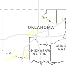
Oklahoma
| Local Time | Report Details |
|---|---|
| 11:00 PM UTC | Storm damage reported in tillman county OK, 38.2 miles NNW of Wichita Falls, TX |
| 6:15 PM CDT | Quarter sized hail reported near Frederick, OK, 34.8 miles NW of Wichita Falls, TX, relayed via twitter. |
| 12:26 AM UTC | Half Dollar sized hail reported near Boise City, OK, 120 miles NNE of Tucumcari, NM, report from mping. |
| 7:30 PM CDT | Corrects previous report from 3 ese lawton. 6 power poles down on se 45th and lee in lawto in comanche county OK, 48 miles NNE of Wichita Falls, TX |
| 7:30 PM CDT | Quarter sized hail reported near Lawton, OK, 48 miles NNE of Wichita Falls, TX, 6 power poles down on se 45th and lee in lawton. |
| 2:47 AM UTC | 2 power poles/lines down. time estimated from rada in comanche county OK, 36.3 miles NNW of Wichita Falls, TX |
| 3:30 AM CDT | Windows blown out of a dollar general store with at least some structural damage to the front of the buildin in sequoyah county OK, 5.6 miles WNW of Fort Smith, AR |
Montana
| Local Time | Report Details |
|---|---|
| 11:12 PM UTC | Recorded at the jordan airport aso in garfield county MT, 61.5 miles SSW of Glasgow, MT |
| 12:50 AM UTC | An old building wall structure fell during the passage of an outflow boundary and the associated thunderstor in dawson county MT, 72.2 miles NE of Miles City, MT |
Missouri
| Local Time | Report Details |
|---|---|
| 11:15 PM UTC | Quarter sized hail reported near Doniphan, MO, 74.3 miles SSE of Salem, MO, nickel to quarter sized hail reported at a school three miles east of gatewood along 142 highway. relayed by nws springfield. |
| 11:15 PM UTC | Quarter sized hail reported near Gatewood, MO, 77.8 miles SSE of Salem, MO, corrects previous hail report from 3 n gatewood. nickel to quarter sized hail reported at a school three miles east of gatewood along 142 highway. relayed by nws spring |
Massachusetts
| Local Time | Report Details |
|---|---|
| 11:25 PM UTC | Tree down on west st. near tanglewoo in berkshire county MA, 45.2 miles SE of Schenectady, NY |
| 11:25 PM UTC | Tree and wires dow in berkshire county MA, 45.3 miles SE of Schenectady, NY |
| 11:38 PM UTC | Tree and wires down on hawthorne rd in berkshire county MA, 48 miles SE of Schenectady, NY |
| 11:42 PM UTC | Tree down on baker st blocking roadway in berkshire county MA, 42.2 miles SE of Schenectady, NY |
| 11:53 PM UTC | Trees down in and around pittsfield... ma in berkshire county MA, 42.8 miles SE of Schenectady, NY |
| 12:36 AM UTC | Multiple trees down on route 2 in charlemon in franklin county MA, 59.1 miles ESE of Schenectady, NY |
| 12:51 AM UTC | Numerous trees down near cummington roa in franklin county MA, 59.4 miles ESE of Schenectady, NY |
| 1:15 AM UTC | Two trees down on hog hollow roa in franklin county MA, 61.4 miles ESE of Schenectady, NY |
| 1:16 AM UTC | Trees downed on webster road in berkshire county MA, 53.8 miles SE of Schenectady, NY |
| 2:00 AM UTC | Large tree down on power lines on barre road near dudley roa in worcester county MA, 60.4 miles NNW of Providence, RI |
| 2:07 AM UTC | Tree down on pine stree in hampden county MA, 67 miles WNW of Providence, RI |
New Mexico
| Local Time | Report Details |
|---|---|
| 11:50 PM UTC | Corrects previous non-tstm wnd gst report from 17 wnw oscuro. mesonet station wsm39 shist (wsmr in lincoln county NM, 105.4 miles W of Roswell, NM |
Florida
| Local Time | Report Details |
|---|---|
| 7:53 PM EDT | Asos station kpbi west palm beach reports a wind gust of 67 mph during a strong thunderstor in palm beach county FL, 44 miles SSE of Port Saint Lucie, FL |
New Hampshire
| Local Time | Report Details |
|---|---|
| 12:20 AM UTC | Tree down across river r in grafton county NH, 70.1 miles SE of Burlington, VT |
| 12:20 AM UTC | Delayed report. trees down north of haverhil in grafton county NH, 64.5 miles ESE of Burlington, VT |
| 12:29 AM UTC | Trees down on jarvis hill r in sullivan county NH, 86.1 miles SSE of Burlington, VT |
| 12:30 AM UTC | Delayed report. trees down in plainfield. one tree partially blocking stage r in sullivan county NH, 77.6 miles SE of Burlington, VT |
| 12:30 AM UTC | Tree down across main st. in the area of parker r in grafton county NH, 75.7 miles E of Burlington, VT |
| 12:40 AM UTC | Tree and power lines down across dalton r in coos county NH, 75.9 miles E of Burlington, VT |
| 1:00 AM UTC | Delayed report. tree down at local hote in coos county NH, 77.4 miles NW of Portland, ME |
| 1:00 AM UTC | Delayed report. downed trees on river r in grafton county NH, 68.9 miles SE of Burlington, VT |
| 1:05 AM UTC | Quarter sized hail reported near West Chesterfield, NH, 71.4 miles E of Schenectady, NY, hail fell for 5 mins in the area of spaulding hill rd and highway 9. |
| 1:10 AM UTC | Trees down across river r in cheshire county NH, 73.8 miles E of Schenectady, NY |
| 1:15 AM UTC | Quarter sized hail reported near Keene, NH, 83.4 miles E of Schenectady, NY, photos sent via social media of hail stones with some quarter size. |
| 9:20 PM EDT | Several large branches and 2 12-inch diameter trees down on nh rt. 7 in cheshire county NH, 80 miles E of Schenectady, NY |
| 1:25 AM UTC | Tree down partially blocking nh rt. 1 in cheshire county NH, 89.1 miles ENE of Schenectady, NY |
| 9:30 PM EDT | Trees down on nh-12 in cheshire county NH, 90 miles ENE of Schenectady, NY |
| 1:45 AM UTC | Half Dollar sized hail reported near Troy, NH, 79.7 miles NNW of Providence, RI, delayed report. downed trees also reported in the area. |
New Jersey
| Local Time | Report Details |
|---|---|
| 10:30 PM EDT | Quarter sized hail reported near Vernon, NJ, 43.4 miles NW of Brooklyn, NY, public report via social media; quarter-sized hail occurred between 10:18 and 10:30 pm. |
| 6:20 AM EDT | Trees and wires down on hopewell wertsville road. time estimated via rada in mercer county NJ, 45.9 miles WSW of Brooklyn, NY |
| 6:20 AM EDT | Trees down in east amwell township. time estimated via rada in hunterdon county NJ, 50 miles WSW of Brooklyn, NY |
| 6:42 AM EDT | Trees down in hillsborough township. time estimated via rada in somerset county NJ, 38.4 miles WSW of Brooklyn, NY |
| 6:57 AM EDT | Trees down in bernards township. time estimated via rada in somerset county NJ, 28.9 miles W of Brooklyn, NY |
Connecticut
| Local Time | Report Details |
|---|---|
| 12:49 AM EDT | Tree down on west redding road blocking one lane of traffi in fairfield county CT, 52.9 miles NNE of Brooklyn, NY |
Arkansas
| Local Time | Report Details |
|---|---|
| 8:36 AM UTC | Storm damage reported in sebastian county AR, 4.2 miles SE of Fort Smith, AR |
| 3:40 AM CDT | Several trees down between bonanza and hackett. time estimated by rada in sebastian county AR, 12.1 miles S of Fort Smith, AR |
| 8:49 AM UTC | Measured at kfsm asos observation sit in sebastian county AR, 4.7 miles SE of Fort Smith, AR |
Connect with Interactive Hail Maps