

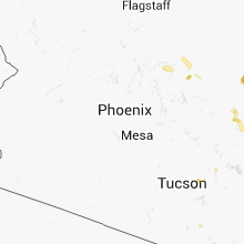
Hail Map for Sunday, July 27, 2014

Number of Impacted Households on 7/27/2014
0
Impacted by 1" or Larger Hail
0
Impacted by 1.75" or Larger Hail
0
Impacted by 2.5" or Larger Hail
Square Miles of Populated Area Impacted on 7/27/2014
0
Impacted by 1" or Larger Hail
0
Impacted by 1.75" or Larger Hail
0
Impacted by 2.5" or Larger Hail


Cities Most Affected by Hail Storms of 7/27/2014
| Hail Size | Demographics of Zip Codes Affected | ||||||
|---|---|---|---|---|---|---|---|
| City | Count | Average | Largest | Pop Density | House Value | Income | Age |
| Strunk, KY | 3 | 2.50 | 3.00 | 18 | $38k | $17.9k | 38.7 |
| Kawkawlin, MI | 4 | 1.88 | 2.00 | 138 | $98k | $44.7k | 44.4 |
| Midland, MI | 3 | 2.42 | 3.00 | 301 | $109k | $48.5k | 39.3 |
| Bear Branch, KY | 2 | 3.50 | 4.25 | 4 | $29k | $23.8k | 42.5 |
| Pennington Gap, VA | 3 | 2.00 | 2.50 | 91 | $57k | $22.7k | 43.0 |
| Highland, MI | 3 | 1.75 | 1.75 | 642 | $175k | $62.8k | 41.9 |
| Kingsport, TN | 2 | 2.25 | 2.75 | 640 | $83k | $30.4k | 43.5 |
| Bay City, MI | 2 | 2.25 | 2.50 | 618 | $89k | $40.2k | 42.9 |
| Winfield, TN | 2 | 2.25 | 2.75 | 23 | $64k | $25.2k | 37.7 |
| Manchester, KY | 2 | 2.25 | 2.75 | 46 | $46k | $16.3k | 37.5 |
| Dryden, VA | 2 | 1.88 | 2.00 | 68 | $62k | $23.6k | 40.7 |
| Auburn, MI | 2 | 1.88 | 2.00 | 167 | $97k | $52.6k | 41.3 |
| White Lake, MI | 2 | 1.75 | 1.75 | 983 | $195k | $67.7k | 41.1 |
| Duffield, VA | 1 | 2.75 | 2.75 | 29 | $66k | $25.3k | 43.1 |
| Versailles, KY | 1 | 2.00 | 2.00 | 153 | $119k | $49.0k | 40.9 |
| Mount Eden, KY | 1 | 2.00 | 2.00 | 41 | $92k | $40.6k | 39.8 |
| Whitley City, KY | 1 | 2.00 | 2.00 | 35 | $50k | $20.2k | 36.9 |
| Kalamazoo, MI | 1 | 2.00 | 2.00 | 437 | $160k | $46.6k | 35.4 |
| Pinconning, MI | 1 | 2.00 | 2.00 | 73 | $79k | $40.3k | 43.7 |
| Essie, KY | 1 | 1.75 | 1.75 | 23 | $39k | $20.2k | 40.5 |
| Stevensville, MI | 1 | 1.75 | 1.75 | 708 | $133k | $52.0k | 42.4 |
| Larwill, IN | 1 | 1.75 | 1.75 | 37 | $86k | $45.1k | 39.8 |
| Plainwell, MI | 1 | 1.75 | 1.75 | 204 | $117k | $47.6k | 40.5 |
| Waynesville, NC | 1 | 1.75 | 1.75 | 284 | $104k | $32.8k | 46.9 |
| Commerce Township, MI | 1 | 1.75 | 1.75 | 1390 | $210k | $79.0k | 40.2 |
| Johnson City, TN | 1 | 1.75 | 1.75 | 578 | $110k | $41.6k | 40.1 |
| Newcomb, TN | 1 | 1.75 | 1.75 | 35 | $43k | $23.4k | 42.5 |
| New Martinsville, WV | 1 | 1.75 | 1.75 | 77 | $81k | $33.2k | 45.3 |
| Burnside, KY | 1 | 1.75 | 1.75 | 57 | $53k | $22.9k | 44.5 |
| Jamestown, KY | 1 | 1.75 | 1.75 | 47 | $65k | $21.8k | 44.8 |
| Lexington, KY | 1 | 1.75 | 1.75 | 3375 | $80k | $33.5k | 39.0 |
| Monticello, KY | 1 | 1.75 | 1.75 | 44 | $55k | $20.9k | 40.8 |
Hail and Wind Damage Spotted on 7/27/2014
Filter by Report Type:Hail ReportsWind Reports
States Impacted
Kentucky, Indiana, Maryland, North Carolina, Ohio, Michigan, Wisconsin, New York, Tennessee, Pennsylvania, Massachusetts, West Virginia, Virginia, Vermont, Nevada, Connecticut, New Hampshire, MaineKentucky
| Local Time | Report Details |
|---|---|
| 10:31 AM EDT | Quarter sized hail reported near Mc Kee, KY, 11.3 miles SSW of Irvine, KY |
| 11:12 AM EDT | Ping Pong Ball sized hail reported near Taylorsville, KY, 20.8 miles E of Louisville, KY |
| 11:25 AM EDT | Hen Egg sized hail reported near Mount Eden, KY, 31.2 miles E of Louisville, KY |
| 11:35 AM EDT | Straight line winds damaged around six homes and downed many trees between masterson station park and highlands park. winds were generally around 70 mph... with peak wi in fayette county KY, 35.4 miles NW of Irvine, KY |
| 11:40 AM EDT | Golf Ball sized hail reported near Lexington, KY, 35.4 miles NW of Irvine, KY |
| 11:44 AM EDT | Hen Egg sized hail reported near Versailles, KY, 47.8 miles WNW of Irvine, KY |
| 11:50 AM EDT | A brick building destroyed along with several downed trees in the mark avenue area in fayette county KY, 35.4 miles NW of Irvine, KY |
| 11:52 AM EDT | Several trees down in the newtown pike-interstate 75 area along with one inch hail in fayette county KY, 35.4 miles NW of Irvine, KY |
| 11:55 AM EDT | Downed trees and 1.75 inch hail near the junction of interstate 75 and interstate 64 in fayette county KY, 35.4 miles NW of Irvine, KY |
| 12:40 PM EDT | One tree down little hardwicks creek and furnace jc in powell county KY, 8.9 miles ENE of Irvine, KY |
| 12:49 PM EDT | Quarter sized hail reported near Cynthiana, KY, 50.7 miles SSE of Cincinnati, OH |
| 1:30 PM EDT | Half Dollar sized hail reported near Danville, KY, 43.8 miles W of Irvine, KY |
| 1:35 PM EDT | Half Dollar sized hail reported near Owingsville, KY, 30 miles NNE of Irvine, KY, quarter to half dollar size hail |
| 1:38 PM EDT | Ping Pong Ball sized hail reported near Brodhead, KY, 29.5 miles SW of Irvine, KY |
| 1:40 PM EDT | Tree down near tenny av in montgomery county KY, 24.9 miles N of Irvine, KY |
| 2:10 PM EDT | Half Dollar sized hail reported near Orlando, KY, 27.9 miles SW of Irvine, KY, in the community of maple grove road |
| 2:54 PM EDT | Golf Ball sized hail reported near Monticello, KY, 76 miles SW of Irvine, KY, in the community of eadsville. |
| 3:25 PM EDT | Baseball sized hail reported near Manchester, KY, 31.8 miles SSE of Irvine, KY |
| 3:28 PM EDT | Ping Pong Ball sized hail reported near Marshes Siding, KY, 62.1 miles NNW of Knoxville, TN, damage to cars from large hail. |
| 3:29 PM EDT | Quarter sized hail reported near Revelo, KY, 58.6 miles NNW of Knoxville, TN, in the community of revelo |
| 3:35 PM EDT | Hen Egg sized hail reported near Whitley City, KY, 61 miles NNW of Knoxville, TN |
| 3:35 PM EDT | Baseball sized hail reported near Strunk, KY, 53.9 miles NNW of Knoxville, TN, in the community of murphy ridge. |
| 3:35 PM EDT | Tea Cup sized hail reported near Strunk, KY, 53.9 miles NNW of Knoxville, TN, in the community of marsh creek. |
| 3:40 PM EDT | Quarter sized hail reported near Strunk, KY, 53.3 miles NNW of Knoxville, TN |
| 3:40 PM EDT | One tree down. power lines down on residenc in leslie county KY, 46.2 miles SE of Irvine, KY |
| 3:41 PM EDT | Golf Ball sized hail reported near Strunk, KY, 53.3 miles NNW of Knoxville, TN |
| 3:50 PM EDT | Quarter sized hail reported near Hyden, KY, 49.7 miles SE of Irvine, KY |
| 3:54 PM EDT | Trees down due to high wind in clay county KY, 42.8 miles SSE of Irvine, KY |
| 3:55 PM EDT | Grapefruit sized hail reported near Bear Branch, KY, 44 miles SSE of Irvine, KY |
| 4:00 PM EDT | Golf Ball sized hail reported near Manchester, KY, 42.8 miles SSE of Irvine, KY |
| 4:05 PM EDT | Baseball sized hail reported near Bear Branch, KY, 44 miles SSE of Irvine, KY |
| 4:10 PM EDT | Quarter sized hail reported near Nancy, KY, 68.5 miles SW of Irvine, KY, in the community of conley bottom resort |
| 4:10 PM EDT | Quarter sized hail reported near Essie, KY, 52.7 miles SSE of Irvine, KY |
| 4:11 PM EDT | Quarter sized hail reported near Holmes Mill, KY, 45.2 miles WNW of Bristol, TN |
| 4:15 PM EDT | Golf Ball sized hail reported near Essie, KY, 52.7 miles SSE of Irvine, KY |
| 4:18 PM EDT | Trees dow in leslie county KY, 57.7 miles SSE of Irvine, KY |
| 3:28 PM CDT | Quarter sized hail reported near Edmonton, KY, 73.7 miles S of Louisville, KY, spotter reported quarter size or bigger hail... also some strong winds. |
| 4:30 PM EDT | Quarter sized hail reported near Bronston, KY, 60.5 miles SW of Irvine, KY |
| 4:35 PM EDT | Quarter sized hail reported near Totz, KY, 56.6 miles WNW of Bristol, TN |
| 3:38 PM CDT | Quarter sized hail reported near Burkesville, KY, 77.3 miles SSE of Louisville, KY, hail an inch in diameter... falling for the past seven minutes. |
| 4:40 PM EDT | Quarter sized hail reported near Lejunior, KY, 55 miles WNW of Bristol, TN |
| 4:45 PM EDT | Half Dollar sized hail reported near Burnside, KY, 61.6 miles SSW of Irvine, KY |
| 3:50 PM CDT | Golf Ball sized hail reported near Jamestown, KY, 77.7 miles SW of Irvine, KY |
| 4:50 PM EDT | Golf Ball sized hail reported near Burnside, KY, 61.9 miles SSW of Irvine, KY, quarter to golf-ball sized hail at alpine recreational area. |
| 5:00 PM EDT | Ping Pong Ball sized hail reported near Whitley City, KY, 61 miles NNW of Knoxville, TN |
| 8:15 PM EDT | One tree down. also pea size hai in kenton county KY, 11.1 miles SSW of Cincinnati, OH |
| 7:55 PM CDT | Hwy 3140 closed due to several downed tree in cumberland county KY, 80.5 miles SSE of Louisville, KY |
| 8:16 PM CDT | Trees down in the northern part of the count in clinton county KY, 88.5 miles SSE of Louisville, KY |
| 10:00 PM EDT | Several trees down near goldbug and canada tow in whitley county KY, 58.9 miles NNW of Knoxville, TN |
Indiana
| Local Time | Report Details |
|---|---|
| 11:20 AM EDT | Quarter sized hail reported near Albany, IN, 54 miles S of Fort Wayne, IN, hail up to quarter size. |
| 3:00 PM EDT | Half Dollar sized hail reported near Nappanee, IN, 53.2 miles WNW of Fort Wayne, IN, picture of larger than quarter size hail on nws facebook page |
| 3:19 PM EDT | Fountain county dispatch reported a tree down on a power line near sr-63 just north of the warren county lin in fountain county IN, 69.2 miles NE of Mattoon, IL |
| 3:20 PM EDT | Half Dollar sized hail reported near South Bend, IN, 70.8 miles WNW of Fort Wayne, IN |
| 3:37 PM EDT | Quarter sized hail reported near Syracuse, IN, 37 miles WNW of Fort Wayne, IN |
| 3:50 PM EDT | Half Dollar sized hail reported near South Bend, IN, 72.8 miles E of Chicago, IL |
| 3:50 PM EDT | Reports of tree limbs and power down along us 33 in southern parts of the count in noble county IN, 27.7 miles NW of Fort Wayne, IN |
| 3:55 PM EDT | Quarter sized hail reported near New Paris, IN, 46.4 miles NW of Fort Wayne, IN, on us 6 just east of state route 15 |
| 4:06 PM EDT | Power line down us 33 near churbusco in whitley county IN, 15.7 miles NW of Fort Wayne, IN |
| 4:06 PM EDT | Tree down covering epworth forest road. size unknown but front end loader being requested in kosciusko county IN, 34.9 miles WNW of Fort Wayne, IN |
| 4:10 PM EDT | Quarter sized hail reported near North Webster, IN, 36.6 miles WNW of Fort Wayne, IN |
| 4:18 PM EDT | Golf Ball sized hail reported near Larwill, IN, 30.1 miles WNW of Fort Wayne, IN, picture of at least golf ball size hail |
| 4:23 PM EDT | Fountain county dispatch reported a tree down on a power line near sr-63 just north of the warren county lin in fountain county IN, 69.2 miles NE of Mattoon, IL |
| 4:31 PM EDT | Intersection of coldwater and till roads in allen county IN, 6.7 miles NNW of Fort Wayne, IN |
| 4:43 PM EDT | Quarter sized hail reported near Grabill, IN, 11.5 miles NE of Fort Wayne, IN, posted on nws facebook page |
| 5:02 PM EDT | Downed tree on state road 1 and tonkel rd. other debris on the roa in allen county IN, 7.3 miles N of Fort Wayne, IN |
| 5:05 PM EDT | Numerous tree limbs and power lines down in mooresvill in morgan county IN, 15.5 miles SW of Indianapolis, IN |
| 5:26 PM EDT | Small to medium branches down in town in adams county IN, 19.1 miles SSE of Fort Wayne, IN |
| 6:17 PM EDT | One tree downed blocking foundry road. time estimate in wayne county IN, 50.1 miles E of Indianapolis, IN |
| 6:22 PM EDT | One tree downed on caldwell road in wayne county IN, 51.7 miles E of Indianapolis, IN |
Maryland
| Local Time | Report Details |
|---|---|
| 11:33 AM EDT | Tree down on falls rd near the intersection of mt carmel rd in baltimore county MD, 23 miles NNW of Baltimore, MD |
| 11:30 PM EDT | Trees down near the intersection of grave run road and roller roa in carroll county MD, 29.6 miles NNW of Baltimore, MD |
| 11:33 PM EDT | Tree down on falls rd near the intersection of mt carmel rd in baltimore county MD, 23 miles NNW of Baltimore, MD |
North Carolina
| Local Time | Report Details |
|---|---|
| 11:37 AM EDT | Trees and powerlines reported down in goldsboro... time estimated by radar in wayne county NC, 47 miles SE of Raleigh, NC |
| 11:38 AM EDT | Trees and powerlines reported down in pikeville... time estimated by radar in wayne county NC, 42.2 miles ESE of Raleigh, NC |
| 11:38 AM EDT | Wind gust of 64 mph reported at gsb in wayne county NC, 48.8 miles SE of Raleigh, NC |
| 12:00 PM EDT | All siding blown off of building next to courthouse on 3rd street. time estimate in greene county NC, 59.4 miles ESE of Raleigh, NC |
| 12:04 PM EDT | A roof blown off from a house on nahunta rd. time estimated from rada in greene county NC, 59.4 miles ESE of Raleigh, NC |
| 8:07 PM EDT | Tree down on guntertown road. both lanes blocke in madison county NC, 54.1 miles SSW of Bristol, TN |
| 8:35 PM EDT | A couple of trees down blocking chambers farm road and fines creek road. time determined from radar dat in haywood county NC, 46.6 miles NNW of Greenville, SC |
| 8:36 PM EDT | Tree down on power line on haywood roa in buncombe county NC, 51 miles N of Greenville, SC |
| 8:36 PM EDT | Tree down on baileys branch road blocking both lanes in marshal in madison county NC, 60.3 miles SSW of Bristol, TN |
| 8:45 PM EDT | Multiple trees down in asheville vicinity... including cedar lane and old buncombe highwa in buncombe county NC, 51 miles N of Greenville, SC |
| 8:55 PM EDT | Several wind damage reports from haywood county. 849 pm tree down on ratcliff cove road. 850 pm tree down at cruso road and harvest lane. 905 pm trees on power lines on in haywood county NC, 50.1 miles NNW of Greenville, SC |
| 9:00 PM EDT | County reports several trees and power lines down in mountain home are in henderson county NC, 37.6 miles N of Greenville, SC |
| 9:00 PM EDT | Tree and powerline down near apple blossom park drive. power reported out in the fletcher and arden area in henderson county NC, 42.6 miles N of Greenville, SC |
| 9:35 PM EDT | Golf Ball sized hail reported near Waynesville, NC, 50.1 miles NNW of Greenville, SC, time determined from radar data. report from social media. |
| 9:40 PM EDT | Multiple trees down on soco mountain. report from wrgc in sylv in jackson county NC, 48.3 miles SE of Knoxville, TN |
| 9:45 PM EDT | Trees and power lines down on poors ford road. trees down on thunder road. time of occurrence estimated from radar location of stor in rutherford county NC, 48.2 miles NE of Greenville, SC |
| 9:49 PM EDT | Large tree on house in green hill communit in rutherford county NC, 49.9 miles NE of Greenville, SC |
| 9:49 PM EDT | Quarter sized hail reported near Waynesville, NC, 50.7 miles NNW of Greenville, SC, report received on social media. |
| 12:10 AM EDT | Several trees reported down across the county.the spring creek area had the greatest number of power outages. time determined from radar dat in madison county NC, 61.1 miles E of Knoxville, TN |
| 1:25 AM EDT | Several additional trees down over east asheville from latest round of thunderstorm wind in buncombe county NC, 51.2 miles N of Greenville, SC |
Ohio
| Local Time | Report Details |
|---|---|
| 11:39 AM EDT | Tree and power lines down. semi trailer flipped ove in van wert county OH, 29 miles SE of Fort Wayne, IN |
| 12:23 PM EDT | Quarter sized hail reported near Belle Center, OH, 52.1 miles NW of Columbus, OH |
| 12:55 PM EDT | Quarter sized hail reported near Richwood, OH, 38.7 miles NNW of Columbus, OH, large hail and tree limbs down near 739 northwest of richwood. |
| 1:18 PM EDT | A few trees down in price cemetery. time estimated from rada in union county OH, 41 miles NNW of Columbus, OH |
| 1:25 PM EDT | Large tree down at state route 4 and hoskins rd. time estimated from rada in union county OH, 34.2 miles NNW of Columbus, OH |
| 1:30 PM EDT | Car shelter blown away...broken windows in rv...several 6-9 inch limbs down in delaware county OH, 29.9 miles NNW of Columbus, OH |
| 1:33 PM EDT | Ping Pong Ball sized hail reported near Bellefontaine, OH, 44.3 miles NW of Columbus, OH, time estimated from radar. |
| 1:45 PM EDT | Several trees down across the northern part of the county. time and specific location estimate in delaware county OH, 31 miles N of Columbus, OH |
| 3:26 PM EDT | Part of roof including trusses lifted off home on us 36 and several apple trees uprooted. time estimated from rada in champaign county OH, 34 miles WNW of Columbus, OH |
| 3:40 PM EDT | A barn roof was partially removed...leading to partial collapse in union county OH, 22.8 miles WNW of Columbus, OH |
| 4:47 PM EDT | One tree down across palmer road in licking county OH, 12.9 miles E of Columbus, OH |
| 4:50 PM EDT | Half Dollar sized hail reported near Hannibal, OH, 70.4 miles SW of Pittsburgh, PA |
| 6:05 PM EDT | 4 inch diameter tree limb broken off...sr 117 and sr 66 near spencervill in allen county OH, 46.6 miles ESE of Fort Wayne, IN |
| 6:15 PM EDT | Power lines were blown down on the west side of cridersvill in auglaize county OH, 57.7 miles ESE of Fort Wayne, IN |
| 7:54 PM EDT | Power pole down in the county road 15 and county road h are in williams county OH, 42.1 miles NE of Fort Wayne, IN |
| 8:20 PM EDT | A large tree was knocked down. scattered power outages were reported in lakewoo in cuyahoga county OH, 5.9 miles WSW of Cleveland, OH |
| 8:27 PM EDT | A large tree was blown ove in cuyahoga county OH, 10.5 miles E of Cleveland, OH |
| 8:43 PM EDT | Numerous trees and power lines were blown down along route 62 south of hillsboro. green...ervin...and ivy hill roads are closed due to debris. a mobile home was partial in highland county OH, 47.2 miles E of Cincinnati, OH |
| 8:52 PM EDT | Spotter estimates 50 to 60 mph wind gust and heard trees snap and break with the win in summit county OH, 19.3 miles SE of Cleveland, OH |
| 9:00 PM EDT | 80 mph wind estimated with gust front. a few small trees and branches down on 4 in portage county OH, 22.6 miles SE of Cleveland, OH |
| 9:05 PM EDT | Small to medium branches down. wind estimated at 65 to 75 mp in portage county OH, 22.6 miles SE of Cleveland, OH |
| 9:20 PM EDT | At least 4 trees were blown down in kinsman townshi in trumbull county OH, 56.7 miles E of Cleveland, OH |
| 9:30 PM EDT | Several trees were reported down in rome township along dodgeville roa in ashtabula county OH, 45.6 miles ENE of Cleveland, OH |
| 9:35 PM EDT | 8 inch diameter tree across road near 303 and stanley roa in portage county OH, 38.4 miles ESE of Cleveland, OH |
| 9:46 PM EDT | Section of large tree down on home along meadowbrook drive causing some damag in trumbull county OH, 47.8 miles ESE of Cleveland, OH |
Michigan
| Local Time | Report Details |
|---|---|
| 12:20 PM EDT | Quarter sized hail reported near Frederic, MI, 43.6 miles E of Traverse City, MI |
| 12:40 PM EDT | Quarter sized hail reported near Grayling, MI, 45.1 miles E of Traverse City, MI |
| 12:40 PM EDT | A 4 to 6 inch healthy tree fell on a car. a 16 to 18 inch dead and rotting tree fell on hous in otsego county MI, 50 miles ENE of Traverse City, MI |
| 12:49 PM EDT | Quarter sized hail reported near Mio, MI, 44 miles SW of Alpena, MI, hail ranging in size from dime sized to quarter sized |
| 1:55 PM EDT | Couple trees blown over. also reported 1/2 inch hai in kalkaska county MI, 28.3 miles E of Traverse City, MI |
| 1:55 PM EDT | 8 inch diameter pine tree snapped in half in waters in otsego county MI, 46 miles ENE of Traverse City, MI |
| 1:58 PM EDT | Quarter sized hail reported near Frederic, MI, 46.2 miles E of Traverse City, MI |
| 2:15 PM EDT | Trees down in glennie in alcona county MI, 36.5 miles SSW of Alpena, MI |
| 2:21 PM EDT | Tennis Ball sized hail reported near Midland, MI, 49.9 miles NNW of Flint, MI, relayed via shave report. |
| 2:30 PM EDT | Tea Cup sized hail reported near Midland, MI, 49.8 miles NNW of Flint, MI, relayed via shave project |
| 2:30 PM EDT | Golf Ball sized hail reported near Midland, MI, 50.2 miles NNW of Flint, MI, lots of 1.5 inch hail...a few to 1.75 inches. relayed via facebook with pictures. |
| 2:41 PM EDT | Hen Egg sized hail reported near Auburn, MI, 49.5 miles NNW of Flint, MI, relayed via shave project. |
| 2:43 PM EDT | Golf Ball sized hail reported near Auburn, MI, 49.9 miles NNW of Flint, MI, relayed by shave project |
| 2:49 PM EDT | Hen Egg sized hail reported near Kawkawlin, MI, 48.2 miles NNW of Flint, MI, relayed via shave project |
| 2:50 PM EDT | Quarter sized hail reported near Kawkawlin, MI, 49.6 miles NNW of Flint, MI, relayed via shave project |
| 2:50 PM EDT | Hen Egg sized hail reported near Kawkawlin, MI, 46.7 miles NNW of Flint, MI, relayed via shave project |
| 2:52 PM EDT | Golf Ball sized hail reported near Stevensville, MI, 58 miles E of Chicago, IL, relayed by ema with video footage of hail to golfball size falling |
| 2:56 PM EDT | Tennis Ball sized hail reported near Bay City, MI, 46.5 miles NNW of Flint, MI, relayed via shave project |
| 3:00 PM EDT | Ping Pong Ball sized hail reported near Kawkawlin, MI, 49.8 miles NNW of Flint, MI, relayed via shave project |
| 3:00 PM EDT | Golf Ball sized hail reported near Kawkawlin, MI, 48.2 miles NNW of Flint, MI, relayed via shave project. |
| 3:00 PM EDT | Golf Ball sized hail reported near Kawkawlin, MI, 46.1 miles NNW of Flint, MI |
| 3:05 PM EDT | Hen Egg sized hail reported near Bay City, MI, 45.8 miles NNW of Flint, MI, relayed via shave project |
| 3:06 PM EDT | Quarter sized hail reported near Stevensville, MI, 58.6 miles E of Chicago, IL |
| 3:10 PM EDT | Quarter sized hail reported near Bay City, MI, 45.1 miles NNW of Flint, MI |
| 3:10 PM EDT | Ping Pong Ball sized hail reported near Bay City, MI, 45.1 miles NNW of Flint, MI, in bangor twp right on saginaw bay |
| 3:10 PM EDT | Hen Egg sized hail reported near Pinconning, MI, 56.9 miles NNW of Flint, MI, relayed with pictures |
| 3:12 PM EDT | Powerlines down in houghton lake in roscommon county MI, 52.9 miles SE of Traverse City, MI |
| 3:15 PM EDT | Quarter sized hail reported near Traverse City, MI, 4.1 miles S of Traverse City, MI |
| 3:25 PM EDT | Trees down in prudenville in roscommon county MI, 56.5 miles SE of Traverse City, MI |
| 3:30 PM EDT | Quarter sized hail reported near Dewitt, MI, 44.4 miles WSW of Flint, MI |
| 4:03 PM EDT | Quarter sized hail reported near Zeeland, MI, 21.2 miles WSW of Grand Rapids, MI, report relayed by ham radio operator of quarter size hail that fell in zeeland area |
| 4:04 PM EDT | Quarter sized hail reported near Big Rapids, MI, 49.3 miles NNE of Grand Rapids, MI, report relayed by media of quarter size hail that fell for approximately 6 minutes near big rapids. |
| 4:05 PM EDT | Numerous trees down in rives and parma township in jackson county MI, 58.2 miles SW of Flint, MI |
| 4:15 PM EDT | Quarter sized hail reported near Hartland, MI, 23.5 miles S of Flint, MI |
| 4:20 PM EDT | Measured at gravelly shoals light in lhz421 county MI, 70.1 miles N of Flint, MI |
| 4:25 PM EDT | Ping Pong Ball sized hail reported near Midland, MI, 57.2 miles NW of Flint, MI, at m-20 and 11 mile |
| 4:30 PM EDT | Golf Ball sized hail reported near Highland, MI, 23.2 miles S of Flint, MI, harvey lake rd and milford rd |
| 4:30 PM EDT | Quarter sized hail reported near Edmore, MI, 44.6 miles NE of Grand Rapids, MI |
| 4:31 PM EDT | Golf Ball sized hail reported near Highland, MI, 25.8 miles S of Flint, MI |
| 4:35 PM EDT | Trained spotter estimated 60 mph gust near ravine and 6th st. dime size hail was also fallin in kalamazoo county MI, 38.4 miles S of Grand Rapids, MI |
| 4:35 PM EDT | Trees and large limbs down blocking the road. sheriff on the scen in washtenaw county MI, 51.5 miles SSW of Flint, MI |
| 4:35 PM EDT | Half Dollar sized hail reported near Highland, MI, 22.8 miles SSE of Flint, MI, at duck lake rd and m-59 |
| 4:35 PM EDT | At mobile home park at milford and middle roads. 80 percent of mobile homes damaged with broken window in oakland county MI, 23.8 miles S of Flint, MI |
| 4:35 PM EDT | Power lines dow in bay county MI, 60.4 miles NNW of Flint, MI |
| 4:38 PM EDT | Quarter sized hail reported near White Lake, MI, 25 miles SSE of Flint, MI, measured in white lake twp |
| 4:38 PM EDT | Golf Ball sized hail reported near Plainwell, MI, 36.6 miles S of Grand Rapids, MI, spotter measured golfball size hail near allegan st. in cooper township area |
| 4:40 PM EDT | Golf Ball sized hail reported near White Lake, MI, 27.6 miles SSE of Flint, MI, measured in white lake twp |
| 4:40 PM EDT | Hen Egg sized hail reported near Kalamazoo, MI, 41.4 miles S of Grand Rapids, MI, public sent pictures of 2 inch hail to local media which was relayed to nws courtesy of wood-tv. |
| 4:40 PM EDT | Golf Ball sized hail reported near Highland, MI, 22.9 miles SSE of Flint, MI |
| 4:40 PM EDT | Quarter sized hail reported near Plainwell, MI, 35.7 miles S of Grand Rapids, MI |
| 4:42 PM EDT | Golf Ball sized hail reported near White Lake, MI, 26.6 miles SSE of Flint, MI |
| 4:43 PM EDT | Golf Ball sized hail reported near Commerce Township, MI, 29.1 miles SSE of Flint, MI, measured at bogie lk and cooley lk roads |
| 4:45 PM EDT | Ping Pong Ball sized hail reported near Kalamazoo, MI, 48.8 miles S of Grand Rapids, MI, delayed report received |
| 4:45 PM EDT | Large limbs down in st. clair county MI, 60.2 miles ESE of Flint, MI |
| 4:49 PM EDT | Measured at pontiac oakland county international airport /kptk/ in oakland county MI, 28.5 miles SSE of Flint, MI |
| 4:50 PM EDT | Quarter sized hail reported near Waterford, MI, 28.5 miles SSE of Flint, MI, measured at airport road and m-59 |
| 4:55 PM EDT | Quarter sized hail reported near Kalamazoo, MI, 44.2 miles S of Grand Rapids, MI |
| 4:55 PM EDT | Few trees down with size unknow in mecosta county MI, 48.1 miles NE of Grand Rapids, MI |
| 4:58 PM EDT | Tree branches down in the area in kalamazoo county MI, 49.1 miles S of Grand Rapids, MI |
| 5:00 PM EDT | 6 inch limb down at west bloomfield and cass lake road in oakland county MI, 31.7 miles SSE of Flint, MI |
| 5:00 PM EDT | 10 inch diameter branch took down powerline across frost road in saginaw county MI, 43.5 miles NW of Flint, MI |
| 5:00 PM EDT | Quarter sized hail reported near Alma, MI, 55 miles WNW of Flint, MI |
| 5:00 PM EDT | Tree uprooted in saginaw county MI, 32.9 miles NNW of Flint, MI |
| 5:00 PM EDT | Multiple limbs down at telegraph and voorhies. relayed via twitte in oakland county MI, 32.2 miles SE of Flint, MI |
| 5:00 PM EDT | Tree fell onto hous in oakland county MI, 46.4 miles SE of Flint, MI |
| 5:00 PM EDT | A couple of trees down with size unknow in isabella county MI, 49.3 miles NE of Grand Rapids, MI |
| 5:02 PM EDT | 4 inch diameter branches down at cass lake and orchard lake roads in oakland county MI, 32.6 miles SSE of Flint, MI |
| 5:05 PM EDT | Storm damage reported in saginaw county MI, 24.9 miles WNW of Flint, MI |
| 5:05 PM EDT | Large limbs down on i-75 south of square lake road in oakland county MI, 36 miles SE of Flint, MI |
| 5:05 PM EDT | Quarter sized hail reported near Bloomfield Hills, MI, 36 miles SE of Flint, MI, at square lake and opdyke |
| 5:05 PM EDT | Received a call from the public regard a power pole and tree that was down nearest to raymond and westbrook. power lines were down in the yard. time est by rada in calhoun county MI, 52.2 miles SSE of Grand Rapids, MI |
| 5:07 PM EDT | Barn roof torn off... trees uprooted. fergus rd in st charles in saginaw county MI, 26.7 miles NW of Flint, MI |
| 5:07 PM EDT | Power lines down for one half mile and damage to porch at birch run and stewart in saginaw county MI, 26.3 miles NW of Flint, MI |
| 5:07 PM EDT | Quarter sized hail reported near Galesburg, MI, 48.4 miles SSE of Grand Rapids, MI, spotter estimated quarter size hail falling at the time of report |
| 5:10 PM EDT | At square lake and woodward in oakland county MI, 37.1 miles SE of Flint, MI |
| 5:14 PM EDT | Large tree limbs down at 12 mile and dequindre in oakland county MI, 46.2 miles SE of Flint, MI |
| 5:15 PM EDT | One large limb down at stanford and cambridge in berkley in oakland county MI, 44.2 miles SE of Flint, MI |
| 5:15 PM EDT | 15 inch diameter limb down in saginaw county MI, 33.1 miles NNW of Flint, MI |
| 5:20 PM EDT | Half Dollar sized hail reported near North Branch, MI, 29.3 miles ENE of Flint, MI, fell for 7 minutes at half dollar size. also 45 mph gust. |
| 5:24 PM EDT | Few trees reported down by em in eaton county MI, 49.2 miles SE of Grand Rapids, MI |
| 5:28 PM EDT | Small branches down in tuscola county MI, 25.2 miles NNE of Flint, MI |
| 5:30 PM EDT | Storm damage reported in genesee county MI, 14.8 miles NNW of Flint, MI |
| 5:30 PM EDT | Half Dollar sized hail reported near Edmore, MI, 44.6 miles NE of Grand Rapids, MI |
| 5:30 PM EDT | Quarter sized hail reported near Warren, MI, 49.3 miles SE of Flint, MI, at martin and hoover |
| 5:30 PM EDT | Large branch down on powerlines in wayne county MI, 60.2 miles SSE of Flint, MI |
| 5:37 PM EDT | Quarter sized hail reported near Utica, MI, 40.8 miles SE of Flint, MI, 25 mile and jewell |
| 5:46 PM EDT | Trees snapped and uprooted at metro villa dr and north pointe pkwy in harrison twp in macomb county MI, 52.7 miles SE of Flint, MI |
| 5:46 PM EDT | Large tree fell onto house. multiple large tree limbs also dow in macomb county MI, 52.3 miles SE of Flint, MI |
| 5:47 PM EDT | Tree limbs greater than one foot diameter down near metro beach in harrison twp in macomb county MI, 53.2 miles ESE of Flint, MI |
| 5:53 PM EDT | Trees down up to 3 feet in diameter on m-57 between irish rd and m-15 in genesee county MI, 13.8 miles NNE of Flint, MI |
| 5:53 PM EDT | Tree down at m50 and billmyer rd in lenawee county MI, 70.7 miles S of Flint, MI |
| 6:00 PM EDT | Limbs down and power outages in sanilac county MI, 37.8 miles ENE of Flint, MI |
| 6:13 PM EDT | Trees and wires reported down in leslie and onondaga are in ingham county MI, 54.1 miles SW of Flint, MI |
| 6:21 PM EDT | Quarter sized hail reported near Manchester, MI, 62.1 miles SSW of Flint, MI |
| 6:21 PM EDT | Quarter sized hail reported near Ann Arbor, MI, 51.8 miles S of Flint, MI, at austin rd and manchester rd |
| 6:25 PM EDT | Trees down near telegraph and armstrong in monroe county MI, 67.5 miles SSE of Flint, MI |
| 6:29 PM EDT | Eaton 911 center reporting trees down in the area to include wilcox rd near boody hwy and houston rd in eaton county MI, 61.7 miles SW of Flint, MI |
| 6:30 PM EDT | 10 inch diameter limb down in washtenaw county MI, 52.6 miles SSW of Flint, MI |
| 6:46 PM EDT | 3 foot diameter tree down on a house at jefferson and east in washtenaw county MI, 51.3 miles SSW of Flint, MI |
| 6:51 PM EDT | 14 inch tree limb reported dow in washtenaw county MI, 49.1 miles S of Flint, MI |
| 6:51 PM EDT | At green and plymouth in washtenaw county MI, 48.4 miles S of Flint, MI |
| 7:04 PM EDT | 10 trees down blocking road in washtenaw county MI, 43.6 miles S of Flint, MI |
| 7:17 PM EDT | A couple of downed trees in wayne county MI, 40.6 miles SSE of Flint, MI |
Wisconsin
| Local Time | Report Details |
|---|---|
| 12:00 PM CDT | Quarter sized hail reported near Plymouth, WI, 52.7 miles S of Green Bay, WI |
| 12:24 PM CDT | Quarter sized hail reported near Sheboygan, WI, 54.6 miles SSE of Green Bay, WI, public report relayed by media. |
| 1:15 PM CDT | One large branch down. source is twitter photo. time estimated from rada in washington county WI, 65.4 miles ENE of Madison, WI |
New York
| Local Time | Report Details |
|---|---|
| 3:20 PM EDT | Trees...large tree limbs and wires down on 1157 7th avenue...313 7th st...and 559 4th avenu in albany county NY, 13.4 miles ESE of Schenectady, NY |
| 3:51 PM EDT | Quarter sized hail reported near Averill Park, NY, 23.5 miles ESE of Schenectady, NY, nickel and quarter size hail |
| 3:55 PM EDT | Half Dollar sized hail reported near Averill Park, NY, 23.5 miles ESE of Schenectady, NY |
| 3:55 PM EDT | A tree down on route 66 and also route 43 in rensselaer county NY, 23.5 miles ESE of Schenectady, NY |
| 4:10 PM EDT | Tree and broken pole down. route 66 blocke in rensselaer county NY, 30.3 miles SE of Schenectady, NY |
| 4:00 AM EDT | Trees limbs reported down in saratoga county NY, 10.4 miles NNE of Schenectady, NY |
| 4:17 AM EDT | Pine tree limb down through mobile home roof in saratoga county NY, 22.8 miles NNE of Schenectady, NY |
Tennessee
| Local Time | Report Details |
|---|---|
| 3:41 PM EDT | Baseball sized hail reported near Winfield, TN, 50.8 miles NW of Knoxville, TN |
| 3:41 PM EDT | Golf Ball sized hail reported near Winfield, TN, 50.8 miles NW of Knoxville, TN |
| 4:00 PM EDT | Golf Ball sized hail reported near Newcomb, TN, 42.5 miles NNW of Knoxville, TN |
| 5:35 PM EDT | Several tress and powerlines down in hawkins county TN, 27.5 miles W of Bristol, TN |
| 5:38 PM EDT | Golf Ball sized hail reported near Kingsport, TN, 22 miles W of Bristol, TN |
| 5:40 PM EDT | Several trees down in sullivan county TN, 19.3 miles WSW of Bristol, TN |
| 5:42 PM EDT | Baseball sized hail reported near Kingsport, TN, 19.3 miles WSW of Bristol, TN |
| 5:53 PM EDT | Golf Ball sized hail reported near Johnson City, TN, 19.1 miles SW of Bristol, TN |
| 5:33 PM CDT | Trees and power lines down sw and south of jamestown in fentress county TN, 69.5 miles WNW of Knoxville, TN |
| 5:39 PM CDT | Quarter sized hail reported near Jamestown, TN, 65.5 miles WNW of Knoxville, TN, quarter size hail reported by 911 center and trained spotter in jamestown |
| 5:40 PM CDT | Tree fell onto a house and car in jamestown in fentress county TN, 65.5 miles WNW of Knoxville, TN |
| 5:40 PM CDT | Tree fell onto a house and car on old allardt road just southeast of jamestown in fentress county TN, 64.2 miles WNW of Knoxville, TN |
| 5:42 PM CDT | Tree down and power outage on briar av in fentress county TN, 65.5 miles WNW of Knoxville, TN |
| 7:15 PM EDT | Two trees down - 1 in maynardville and 1 in corryto in union county TN, 20.9 miles NNE of Knoxville, TN |
| 7:20 PM EDT | Quarter sized hail reported near Norris, TN, 18.9 miles NNW of Knoxville, TN |
| 7:40 PM EDT | Numerous trees down as the storms passed through knoxvill in knox county TN, 1.8 miles WNW of Knoxville, TN |
| 7:45 PM EDT | 2 trees down on indian gap rd in andersonvill in anderson county TN, 19.7 miles NNW of Knoxville, TN |
| 8:00 PM EDT | Trees down in the topside rd area just nw of the airpor in blount county TN, 12.2 miles SSW of Knoxville, TN |
| 8:00 PM EDT | Trees down across southern end of jefferson count in jefferson county TN, 24.9 miles ENE of Knoxville, TN |
| 8:34 PM EDT | Quarter sized hail reported near Alcoa, TN, 12.2 miles SSW of Knoxville, TN, quarter size hail on cusick rd. |
| 8:42 PM EDT | Quarter sized hail reported near Knoxville, TN, 11.2 miles W of Knoxville, TN, quarter sized hail 1 mile east of shaad rd. |
| 8:44 PM EDT | Trees down on hwy 321 between walland and townsen in blount county TN, 21.6 miles SSE of Knoxville, TN |
| 8:50 PM EDT | Large tree fell on a bus stop shelter near the university heights apartments...1319 knotty pine way. the bus stop shelter was completely destroye in knox county TN, 1.8 miles WNW of Knoxville, TN |
| 8:53 PM EDT | Trees down on boyds creek rd and east park lan in sevier county TN, 19.7 miles ESE of Knoxville, TN |
| 9:12 PM EDT | Quarter sized hail reported near Knoxville, TN, 1.8 miles WNW of Knoxville, TN, quarter sized hail on alcoa hwy about 1/2 mile from ut medical center. |
| 9:15 PM EDT | Trees down and a carport damaged on ford pike near the tennessee river and university height apartment in knox county TN, 1.8 miles WNW of Knoxville, TN |
| 8:25 PM CDT | Tree down at highway 31 and gifford lane in bethpage in sumner county TN, 33.4 miles NE of Nashville, TN |
| 9:33 PM EDT | Quarter sized hail reported near Seymour, TN, 10.5 miles SE of Knoxville, TN, quarter sized hail reported by spotter and amateur radio. |
| 8:40 PM CDT | Tree down on johnny spears road in sumner county TN, 39.1 miles NE of Nashville, TN |
| 8:45 PM CDT | Three trees down in yard of home in adams in robertson county TN, 32.7 miles NNW of Nashville, TN |
| 8:45 PM CDT | A tree was reported down as well as a small flag pole in white hous in robertson county TN, 21 miles NNE of Nashville, TN |
| 8:50 PM CDT | Tree down in coopertown in robertson county TN, 21.6 miles NNW of Nashville, TN |
| 9:15 PM CDT | Tree down on lickton pike in davidson county TN, 11.2 miles N of Nashville, TN |
| 9:25 PM CDT | Tree down on greenhill road at windtree trace blocking the roadway in wilson county TN, 14.2 miles ENE of Nashville, TN |
| 9:25 PM CDT | Tree down blocking hunters crossing drive in wilson county TN, 11.9 miles ENE of Nashville, TN |
| 9:27 PM CDT | Tree down at the intersection of estes road and luchan road. the tree was blocking the roadwa in wilson county TN, 22 miles ENE of Nashville, TN |
| 9:27 PM CDT | A tree was blocking the roadway at bradshaw road and nw williams roa in wilson county TN, 21.5 miles ENE of Nashville, TN |
| 9:28 PM CDT | Tree down along saundersville rd next to old hickory lake in wilson county TN, 12.7 miles ENE of Nashville, TN |
| 9:30 PM CDT | Tree down across old hunters point pike blocking the roadway in wilson county TN, 27.9 miles ENE of Nashville, TN |
| 9:35 PM CDT | Power lines down on hill street in lebanon in wilson county TN, 25.8 miles E of Nashville, TN |
| 9:40 PM CDT | A tree was snapped and fell onto a carport badly damaging the carport and the two cars under i in davidson county TN, 4.8 miles NNE of Nashville, TN |
| 9:45 PM CDT | Tree fell on power lines in north cookeville in putnam county TN, 70.9 miles E of Nashville, TN |
| 9:50 PM CDT | Tree down at tulip grove rd and chandler rd in davidson county TN, 10.8 miles ENE of Nashville, TN |
| 9:50 PM CDT | Tree down at chandler road and old lebanon dirt road in hermitage in davidson county TN, 9.5 miles E of Nashville, TN |
| 10:00 PM CDT | Most of fentress county without power and numerous trees down blocking roadways in fentress county TN, 65.5 miles WNW of Knoxville, TN |
| 10:00 PM CDT | Tree fell onto a house and car on cornwell avenue in watertown causing significant damage in wilson county TN, 36 miles E of Nashville, TN |
| 10:10 PM CDT | Numerous trees down across roadways in area of cookeville highway and pine grove road with several homes damaged. ema currently assessing damage in are in de kalb county TN, 57.4 miles ESE of Nashville, TN |
| 10:15 PM CDT | Tree down in jackson valley subdivision in davidson county TN, 12.6 miles SSE of Nashville, TN |
| 10:20 PM CDT | Trees down across the 2600 block of oak grove road in white county TN, 63.9 miles NNW of Chattanooga, TN |
| 10:20 PM CDT | Tree down on house in lyles in hickman county TN, 36.3 miles WSW of Nashville, TN |
| 10:30 PM CDT | A few trees blown down across white county in white county TN, 61.6 miles N of Chattanooga, TN |
| 10:45 PM CDT | Trees down across crossville highway in white county TN, 61.6 miles N of Chattanooga, TN |
| 12:15 AM EDT | Couple of trees down in newpor in cocke county TN, 41 miles E of Knoxville, TN |
| 11:20 PM CDT | Powerlines down along jacksboro rd in warren county TN, 57.2 miles ESE of Nashville, TN |
| 11:28 PM CDT | Tree down across old shelbyville rd in warren county TN, 52.3 miles NNW of Chattanooga, TN |
Pennsylvania
| Local Time | Report Details |
|---|---|
| 4:35 PM EDT | Trees down on powerlines at 627 n. cherry st. in worthington in armstrong county PA, 33.8 miles NE of Pittsburgh, PA |
| 5:15 PM EDT | Multiple trees down in farmington twp....wasington twp....and highland tw in clarion county PA, 73.9 miles NNE of Pittsburgh, PA |
| 5:26 PM EDT | Quarter sized hail reported near Huntingdon, PA, 26.4 miles SSW of State College, PA |
| 5:30 PM EDT | Trees down on wire in cumberland county PA, 47.6 miles SE of State College, PA |
| 6:05 PM EDT | Multiple trees down in mercer county PA, 68 miles E of Cleveland, OH |
| 6:35 PM EDT | Storm damage reported in cumberland county PA, 60.2 miles SE of State College, PA |
| 6:37 PM EDT | Trees and wires dow in blair county PA, 42.8 miles SW of State College, PA |
| 6:45 PM EDT | Trees down acros much of southern blair count in blair county PA, 37.5 miles SW of State College, PA |
| 6:45 PM EDT | Numerous trees and wires down east of shiremanstown in cumberland county PA, 62.6 miles SE of State College, PA |
| 6:48 PM EDT | Trees down across central blair count in blair county PA, 34.4 miles SW of State College, PA |
| 7:29 PM EDT | Trees and wires dow in lebanon county PA, 70.4 miles N of Baltimore, MD |
| 7:31 PM EDT | Tree down across road at locust lane and east hamilton av in centre county PA, 0.3 miles S of State College, PA |
| 7:31 PM EDT | Tree down across road at locust lane and east hamilton av in centre county PA, 0.3 miles S of State College, PA |
| 9:34 PM EDT | Route 10 closed at wawassan drive due to downed poles and wire in chester county PA, 66.6 miles NNE of Baltimore, MD |
| 10:40 PM EDT | Several large limbs dow in montgomery county PA, 82.2 miles S of Scranton, PA |
Massachusetts
| Local Time | Report Details |
|---|---|
| 4:40 PM EDT | Tree down on wires on powder mtn r in berkshire county MA, 41.5 miles ESE of Schenectady, NY |
| 4:50 PM EDT | Trees down on holmes road in berkshire county MA, 42.8 miles SE of Schenectady, NY |
| 4:55 PM EDT | Possible microburst. several trees down and damage to houses. time estimated by rada in berkshire county MA, 46.3 miles ESE of Schenectady, NY |
| 5:01 PM EDT | Tree down in berkshire county MA, 48.7 miles ESE of Schenectady, NY |
| 5:21 PM EDT | Large tree and wires down on becket road in berkshire county MA, 55.1 miles SE of Schenectady, NY |
| 5:45 PM EDT | Tree down on car on nagler cross road in hampden county MA, 67.5 miles SE of Schenectady, NY |
| 5:45 PM EDT | Tree down on car on nagler cross road in hampden county MA, 67.5 miles SE of Schenectady, NY |
| 6:05 PM EDT | Power lines down on south meadow road in hampden county MA, 72.8 miles WNW of Providence, RI |
| 6:05 PM EDT | Power lines down on south meadow road in hampden county MA, 72.8 miles WNW of Providence, RI |
| 6:16 PM EDT | Quarter sized hail reported near Otis, MA, 61.4 miles SE of Schenectady, NY |
| 6:20 PM EDT | Tree down on tolland road in berkshire county MA, 64.3 miles SE of Schenectady, NY |
| 6:30 PM EDT | Tree down on high street blocking the road in hampden county MA, 67 miles WNW of Providence, RI |
| 6:30 PM EDT | Tree down on a trailer home on springfield street in hampden county MA, 64.5 miles WNW of Providence, RI |
| 6:30 PM EDT | Tree down on a trailer home on springfield street in hampden county MA, 64.5 miles WNW of Providence, RI |
| 6:32 PM EDT | Several trees are down on route 57 in hampden county MA, 64.5 miles WNW of Providence, RI |
| 6:40 PM EDT | A large tree and power lines are down on elmwood road in hampden county MA, 61.7 miles WNW of Providence, RI |
| 6:50 PM EDT | Large branches down on route 202 in hampden county MA, 71.7 miles WNW of Providence, RI |
| 6:57 PM EDT | Tree down on a house on prynnwood road in hampden county MA, 61.7 miles WNW of Providence, RI |
| 6:57 PM EDT | Tree down on a house on prynnwood road in hampden county MA, 61.7 miles WNW of Providence, RI |
West Virginia
| Local Time | Report Details |
|---|---|
| 4:50 PM EDT | Multiple mobile homes damaged from fallen trees in new martinsville in wetzel county WV, 70.5 miles SW of Pittsburgh, PA |
| 4:50 PM EDT | Golf Ball sized hail reported near New Martinsville, WV, 69 miles SW of Pittsburgh, PA |
| 7:18 PM EDT | Time estimated from radar. multiple trees blocking turkey run off rt 16. crews are still attempting to clear the road in pleasants county WV, 74 miles NNE of Charleston, WV |
| 7:18 PM EDT | Structural damage to building in ellenboro. 1 home destroyed. trees topped in ritchie county WV, 69.6 miles WNW of Elkins, WV |
| 7:18 PM EDT | Structural damage to building in ellenboro. 1 home destroyed. trees topped in ritchie county WV, 69.6 miles WNW of Elkins, WV |
| 8:55 PM EDT | Numerous trees down along rt 20 near century. time estimated from rada in barbour county WV, 23 miles NW of Elkins, WV |
| 9:02 PM EDT | Trees down through audra state par in barbour county WV, 14.5 miles WNW of Elkins, WV |
| 9:07 PM EDT | Wv511 reports trees down across us250nb at belington industrial park r in barbour county WV, 6.4 miles NW of Elkins, WV |
| 9:11 PM EDT | Trees down on audra park state rd. 911 center said trees down all over barbour count in barbour county WV, 7.8 miles NNW of Elkins, WV |
| 9:20 PM EDT | Several trees and powerlines down in the gilman and leading creek communities. time estimated from rada in randolph county WV, 3.9 miles N of Elkins, WV |
| 9:25 PM EDT | Several trees reported down. time estimated from rada in randolph county WV, 10.2 miles N of Elkins, WV |
| 9:34 PM EDT | Multiple trees and powerlines down in leading creek...gilman...and kerens areas of randolph county. report via faceboo in randolph county WV, 6.8 miles N of Elkins, WV |
| 9:39 PM EDT | Wv511 reports trees down across road at glady fork and us33 wb in randolph county WV, 11.4 miles SE of Elkins, WV |
| 10:15 PM EDT | Tree down across jefferson roa in kanawha county WV, 3.9 miles W of Charleston, WV |
| 10:20 PM EDT | Large tree down along smith creek rd in pendleton county WV, 32.7 miles SE of Elkins, WV |
Virginia
| Local Time | Report Details |
|---|---|
| 4:54 PM EDT | Golf Ball sized hail reported near Pennington Gap, VA, 46.4 miles WNW of Bristol, TN |
| 5:00 PM EDT | Golf Ball sized hail reported near Dryden, VA, 42 miles WNW of Bristol, TN |
| 5:00 PM EDT | Tennis Ball sized hail reported near Pennington Gap, VA, 46.4 miles WNW of Bristol, TN |
| 5:03 PM EDT | Hen Egg sized hail reported near Dryden, VA, 42 miles WNW of Bristol, TN |
| 5:10 PM EDT | Golf Ball sized hail reported near Pennington Gap, VA, 46.4 miles WNW of Bristol, TN, 2 police cars destroyed by damage from golf ball size or larger hail. lots of debris on roadways. |
| 5:12 PM EDT | Several trees down in scott county VA, 33.3 miles WNW of Bristol, TN |
| 5:12 PM EDT | Baseball sized hail reported near Duffield, VA, 33.3 miles WNW of Bristol, TN |
Vermont
| Local Time | Report Details |
|---|---|
| 5:10 PM EDT | Tree wires down on converse bay roa in chittenden county VT, 14.3 miles S of Burlington, VT |
| 5:18 PM EDT | Quarter sized hail reported near North Ferrisburgh, VT, 14.9 miles S of Burlington, VT |
| 5:20 PM EDT | Ping Pong Ball sized hail reported near Charlotte, VT, 14.2 miles S of Burlington, VT, 1.5 inch diameter hail |
| 6:40 PM EDT | Quarter sized hail reported near Rutland, VT, 59.2 miles SSE of Burlington, VT, 1 inch hail covered ground. |
| 7:20 PM EDT | Quarter sized hail reported near Williston, VT, 6.3 miles ESE of Burlington, VT |
Nevada
| Local Time | Report Details |
|---|---|
| 2:40 PM PDT | Warm springs summit community environmental monitoring program mesonet site...7550 feet above sea leve in nye county NV, 110 miles SW of Ely, NV |
Connecticut
| Local Time | Report Details |
|---|---|
| 6:55 PM EDT | Storm damage reported in hartford county CT, 60.6 miles W of Providence, RI |
| 6:55 PM EDT | Storm damage reported in hartford county CT, 60.6 miles W of Providence, RI |
| 7:05 PM EDT | Trees and wires down on george wood road in tolland county CT, 54.6 miles WNW of Providence, RI |
| 7:18 PM EDT | Trees and wires down on north maple street in hartford county CT, 60.6 miles W of Providence, RI |
| 7:18 PM EDT | Quarter sized hail reported near Enfield, CT, 60.6 miles W of Providence, RI |
| 7:32 PM EDT | Tree down on wires at frog hill road in tolland county CT, 54.8 miles W of Providence, RI |
| 7:40 PM EDT | Multiple trees and wires down on route 195 in tolland county CT, 49.5 miles W of Providence, RI |
| 7:43 PM EDT | Trees and wires down on reed road at mile hill in tolland county CT, 49.5 miles W of Providence, RI |
| 7:52 PM EDT | Tree down on wires on route 320 by the mansfield line in tolland county CT, 44.4 miles W of Providence, RI |
| 7:55 PM EDT | Trees and wires down on johnathan lane in tolland county CT, 43.3 miles W of Providence, RI |
| 8:05 PM EDT | A tree and wires down on codfish falls road in tolland county CT, 43.8 miles W of Providence, RI |
| 8:05 PM EDT | A tree and wires down on codfish falls road in tolland county CT, 43.8 miles W of Providence, RI |
New Hampshire
| Local Time | Report Details |
|---|---|
| 7:15 PM EDT | Tree down on mack av in grafton county NH, 75 miles SE of Burlington, VT |
| 7:15 PM EDT | Trees down at storrs hill ski area in grafton county NH, 76.6 miles SE of Burlington, VT |
Maine
| Local Time | Report Details |
|---|---|
| 7:15 PM EDT | Trees down at storrs hill ski area in york county ME, 35.9 miles WSW of Portland, ME |
Connect with Interactive Hail Maps